Withnoe Cliff

Cliff, Slope in Cornwall

England

Withnoe Cliff

SW Coast Path between Tregantle Down & Freathy
SW Coast Path between Tregantle Down & Freathy Credit: Colin Park

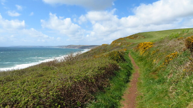
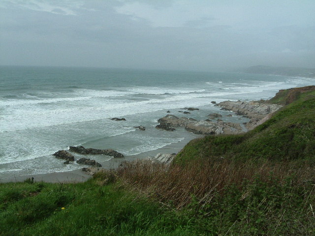
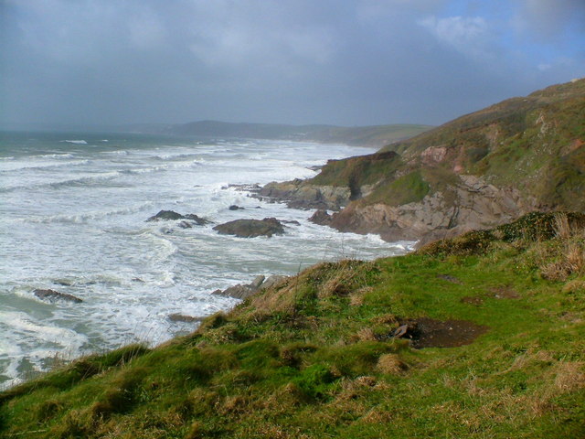
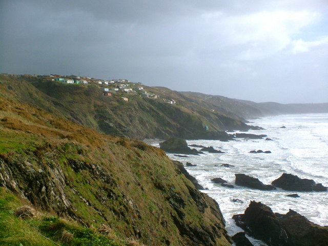
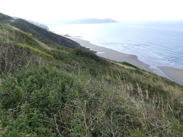
Withnoe Cliff is a stunning coastal landmark located in Cornwall, England. Situated along the southwestern edge of the county, this cliff is renowned for its magnificent views and rugged beauty. Rising to a height of approximately 100 meters, Withnoe Cliff offers panoramic vistas of the Atlantic Ocean, making it a popular destination for nature lovers, hikers, and photographers.

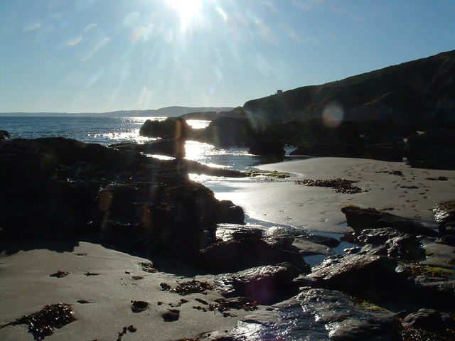
The cliff is characterized by its steep slope and dramatic geological formations. It is composed mainly of rugged rocks, including granite and slate, which have been shaped by centuries of erosion caused by the crashing waves. This erosion has resulted in the formation of caves, arches, and stacks, adding to the cliff's unique charm.

Withnoe Cliff is also home to a diverse range of flora and fauna. The cliff face supports various plant species, including sea campion, thrift, and sea beet, which thrive in the harsh coastal environment. The surrounding grasslands attract numerous bird species, such as peregrine falcons, kestrels, and fulmars, making it a haven for birdwatchers.

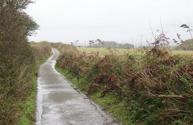
Visitors can access Withnoe Cliff via well-marked footpaths that wind through the picturesque countryside. These paths offer breathtaking views of the cliff and its surroundings, providing ample opportunities for outdoor enthusiasts to explore the area. However, it is vital to exercise caution when near the cliff edge, as it can be hazardous due to its steepness and occasional landslides.

Overall, Withnoe Cliff is a remarkable natural landmark that showcases the wild beauty of Cornwall's coastline. Its awe-inspiring views, unique geology, and diverse ecosystem make it a must-visit destination for those seeking an immersive experience in the region's natural wonders.

If you have any feedback on the listing, please let us know in the comments section below.

Withnoe Cliff Images

Images are sourced within 2km of 50.344136/-4.2483294 or Grid Reference SX4051. Thanks to Geograph Open Source API. All images are credited.

SW Coast Path between Tregantle Down & Freathy
Clampet Lane A narrow lane through mixed agricultural land to the north of Whitsand Bay.
Clampet Lane
A narrow lane through mixed agricultural land to the north of Whitsand Bay.
Higher Tregantle Farm
Looking out to sea near Sharrow Point Sharrow Point juts out to sea on Whitsand Bay near Freathy.
For a similar view, but on a much sunnier day taken 7 years later - see <a href="https://www.geograph.org.uk/photo/2145314">SX3952 : Whitsand Bay looking west from Sharrow Point</a>
Looking out to sea near Sharrow Point
Sharrow Point juts out to sea on Whitsand Bay near Freathy. For a similar view, but on a much sunnier day taken 7 years later - see SX3952 : Whitsand Bay looking west from Sharrow Point
National Trust Coastline The turbulent sea at Sharrow Point
National Trust Coastline
The turbulent sea at Sharrow Point
Coastline near Freathy The dramatic coastline with Freathy perched on the cliffs.
Coastline near Freathy
The dramatic coastline with Freathy perched on the cliffs.
Freathy Beach Evening scene looking towards Looe
Freathy Beach
Evening scene looking towards Looe
Arable Land around Higher Tregantle Farm
The Grotto Beach at low tide, Freathy Looking down onto the Grotto Beach at low tide.
The Grotto Beach at low tide, Freathy
Looking down onto the Grotto Beach at low tide.
Sharrow Point at low tide, Freathy Sharrow Point at low tide along side The Grotto Beach.
Sharrow Point at low tide, Freathy
Sharrow Point at low tide along side The Grotto Beach.
Rocks at the base of Freathy Cliff A nice morning for walking the dogs along the beach.
Rocks at the base of Freathy Cliff
A nice morning for walking the dogs along the beach.
Top of Freathy Cliff - view eastwards Along Whitsand Bay towards Rame Head in the distance.
Top of Freathy Cliff - view eastwards
Along Whitsand Bay towards Rame Head in the distance.
Freathy Cliff - view westwards The roof of a holiday home halfway down the slope can just be seen, with the rocks of Sharrow point beyond.
Freathy Cliff - view westwards
The roof of a holiday home halfway down the slope can just be seen, with the rocks of Sharrow point beyond.
Whitsand Bay Cornwall  in the Winter Looking from the Military Road near Freathy towards Rame Head on a very cold and wet Friday afternoon just after 12 o'clock. There were surfers in the water to the right of me.
Whitsand Bay Cornwall in the Winter
Looking from the Military Road near Freathy towards Rame Head on a very cold and wet Friday afternoon just after 12 o'clock. There were surfers in the water to the right of me.
Whitsand Bay Surfers It was very cold wet and windy when I took this, however I think they were enjoying themselves. You don't have to always go to Newquay to surf.
Whitsand Bay Surfers
It was very cold wet and windy when I took this, however I think they were enjoying themselves. You don't have to always go to Newquay to surf.
Rocks nr Freathy
Rocks nr Freathy
Freathy in the distance On the coast road to Rame Head it will be much more crowded in the summer!
Freathy in the distance
On the coast road to Rame Head it will be much more crowded in the summer!
Looking west from the Coast road nr Freathy
Show me another place!

Withnoe Cliff is located at Grid Ref: SX4051 (Lat: 50.344136, Lng: -4.2483294)

Unitary Authority: Cornwall

Police Authority: Devon and Cornwall

What 3 Words

///perused.tangling.angle. Near Millbrook, Cornwall

Related Wikis

Freathy

Freathy (Cornish: Frydhi) is a beach and coastal settlement on the Rame Peninsula in east Cornwall, England, United Kingdom.Freathy is accessible by the...

Tregantle Down Battery

Tregantle Down Battery was a high angle gun battery in south east Cornwall. It was built between 1888 and 1894 to defend HMNB Devonport from Whitsand Bay...

List of shipwrecks in 2004

The list of shipwrecks in 2004 includes ships sunk, foundered, grounded, or otherwise lost during 2004. == January == === 15 January === === 19 January... ===

HMS Scylla (F71)

HMS Scylla (F71) was a Leander-class frigate of the Royal Navy (RN). She was built at Devonport Royal Dockyard, the last RN frigate to be built there as...

SS James Eagan Layne

SS James Eagan Layne was a liberty ship. She was beached and sunk during the Second World War off Whitsand Bay, Cornwall, United Kingdom. == History... ==

St John, Cornwall

St John (parish: Cornish: Pluwjowan, village: Cornish: S. Jowan) is a coastal civil parish and a village in south-east Cornwall, England, United Kingdom...

Lower Tregantle

Lower Tregantle is a hamlet in Cornwall, England, UK. It is about half a mile south of Antony; Higher Tregantle is about a quarter of a mile further south...

Tregantle Fort

Tregantle Fort in south east Cornwall is one of several forts surrounding Plymouth that were built as a result of a decision in Lord Palmerston's premiership...

Nearby Amenities

Located within 500m of 50.344136,-4.2483294
Source: PGS
Lat/Long: 50.3453911/-4.254977
Source: PGS
Lat/Long: 50.3440055/-4.2521941
Source: PGS
Lat/Long: 50.3425332/-4.2490197
Freathy
Name Kw: Frydhi
Place: village
Wikidata: Q5494304
Lat/Long: 50.3474539/-4.2515965
Bus Stop
Shelter
Bench: yes
Bin: no
Naptan AtcoCode: 0800COB20091
Naptan Bearing: SW
Naptan CommonName: Shelter
Naptan NaptanCode: cordwjpm
Naptan Street: Unclassified
Naptan Verified: no
Shelter: yes
Source: naptan_import
Tactile Paving: no
Lat/Long: 50.3461651/-4.2518181
Generator Method: photovoltaic
Generator Output Electricity: yes
Generator Source: solar
Generator Type: solar_photovoltaic_panel
Location: roof
Power: generator
Lat/Long: 50.3465186/-4.2535198
Generator Method: photovoltaic
Generator Output Electricity: yes
Generator Source: solar
Generator Type: solar_photovoltaic_panel
Location: roof
Power: generator
Lat/Long: 50.3460407/-4.253424
Generator Method: photovoltaic
Generator Output Electricity: yes
Generator Source: solar
Generator Type: solar_photovoltaic_panel
Location: roof
Power: generator
Lat/Long: 50.3463205/-4.2534797
Power: pole
Lat/Long: 50.3447056/-4.2420504
Power: pole
Lat/Long: 50.3452156/-4.2428255
Power: pole
Lat/Long: 50.3461725/-4.2442954
Power: pole
Lat/Long: 50.347107/-4.2457277
Power: pole
Lat/Long: 50.3478892/-4.2469132
Post Box
Brand: Royal Mail
Brand Wikidata: Q638098
Brand Wikipedia: en:Royal Mail
Collection Times: Mo-Sa 10:00; Su off
Operator: Royal Mail
Operator Wikidata: Q638098
Post Box Mounting: pier
Post Box Type: lamp
Ref: PL10 722
Source: streetlevel imagery;aerial imagery
Lat/Long: 50.3465974/-4.2518114
Bench
Backrest: yes
Lat/Long: 50.3463454/-4.2530184
Bench
Backrest: yes
Lat/Long: 50.3462298/-4.2539586
Bench
Backrest: no
Lat/Long: 50.3458766/-4.2537791
Bench
Backrest: no
Lat/Long: 50.3458803/-4.2545256
The data included in this document is from www.openstreetmap.org. The data is made available under ODbL.

Have you been to Withnoe Cliff?

Leave your review of Withnoe Cliff below (or comments, questions and feedback).