Chamber Rock

Island in Cornwall

England

Chamber Rock

View over Reefs towards Looe at Captain Blake's Point View over reefs in foreground - as detailed on the map - looking out across Whitsand Bay towards Looe.
View over Reefs towards Looe at Captain Blake's Point Credit: BB

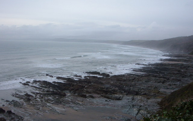
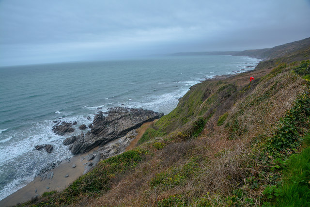
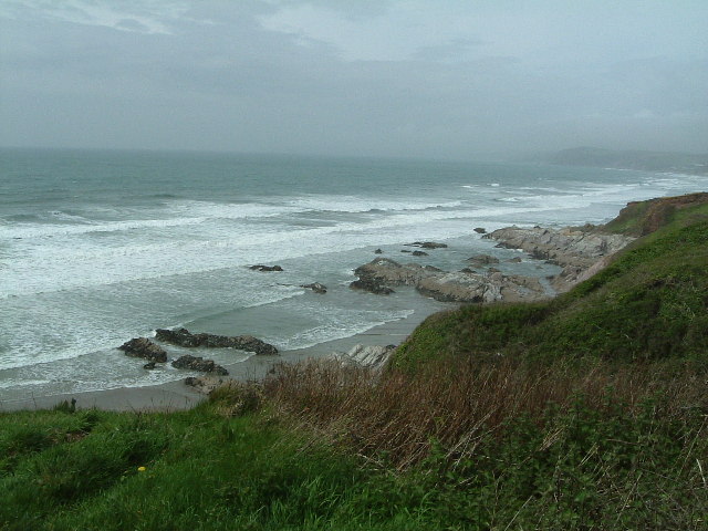
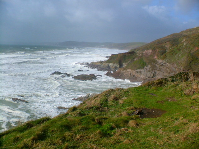
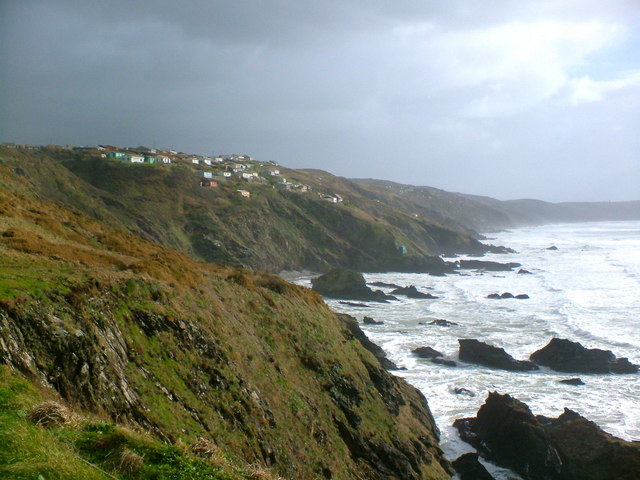
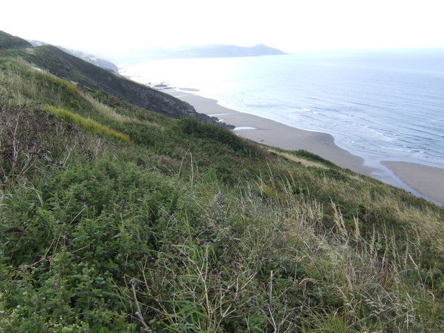
Chamber Rock is a small island located off the coast of Cornwall, England. It is known for its stunning natural beauty and unique rock formations that have been shaped by centuries of coastal erosion. The island is accessible only by boat and offers a secluded and peaceful retreat for nature enthusiasts and adventure seekers.

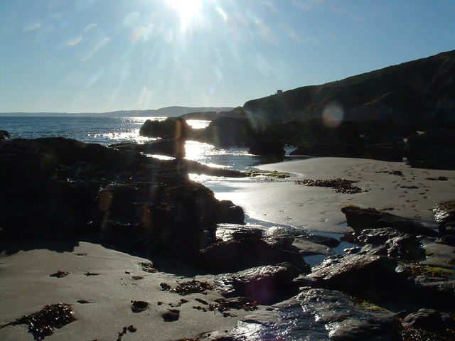
The main attraction of Chamber Rock is its distinct rock arch, which is a result of the relentless pounding of the waves against the cliffs over time. This arch provides a picturesque backdrop for photographers and has become an iconic symbol of the island. The surrounding rugged coastline is also home to a variety of seabirds, making it a popular spot for birdwatching.

Visitors to Chamber Rock can enjoy a range of activities, including hiking along the coastal trails, exploring the tidal pools, or simply relaxing on the sandy beaches. The island's diverse flora and fauna offer ample opportunities for nature lovers to observe and appreciate the local ecosystem. Additionally, the clear waters surrounding Chamber Rock make it an excellent spot for snorkeling and diving, allowing visitors to explore the underwater world teeming with marine life.

For those interested in history, Chamber Rock is also home to a small lighthouse that has been guiding ships safely along the coast since the 19th century. The lighthouse offers guided tours, providing visitors with insight into the maritime history and the challenges faced by sailors navigating these treacherous waters.

Chamber Rock, Cornwall, is a hidden gem that offers a unique blend of natural beauty, adventure, and history. Whether you are seeking tranquility, outdoor activities, or a glimpse into the past, this island has something to offer to every visitor.

If you have any feedback on the listing, please let us know in the comments section below.

Chamber Rock Images

Images are sourced within 2km of 50.340743/-4.2433203 or Grid Reference SX4051. Thanks to Geograph Open Source API. All images are credited.

View over Reefs towards Looe at Captain Blake's Point View over reefs in foreground - as detailed on the map - looking out across Whitsand Bay towards Looe.
View over Reefs towards Looe at Captain Blake's Point
View over reefs in foreground - as detailed on the map - looking out across Whitsand Bay towards Looe.
Maker-With-Rame : Coastal Scenery Looking out across the coastline of Cornwall.
Maker-With-Rame : Coastal Scenery
Looking out across the coastline of Cornwall.
Higher Tregantle Farm
Looking out to sea near Sharrow Point Sharrow Point juts out to sea on Whitsand Bay near Freathy.
For a similar view, but on a much sunnier day taken 7 years later - see <a href="https://www.geograph.org.uk/photo/2145314">SX3952 : Whitsand Bay looking west from Sharrow Point</a>
Looking out to sea near Sharrow Point
Sharrow Point juts out to sea on Whitsand Bay near Freathy. For a similar view, but on a much sunnier day taken 7 years later - see SX3952 : Whitsand Bay looking west from Sharrow Point
National Trust Coastline The turbulent sea at Sharrow Point
National Trust Coastline
The turbulent sea at Sharrow Point
Coastline near Freathy The dramatic coastline with Freathy perched on the cliffs.
Coastline near Freathy
The dramatic coastline with Freathy perched on the cliffs.
Freathy Beach Evening scene looking towards Looe
Freathy Beach
Evening scene looking towards Looe
Arable Land around Higher Tregantle Farm
The Grotto Beach at low tide, Freathy Looking down onto the Grotto Beach at low tide.
The Grotto Beach at low tide, Freathy
Looking down onto the Grotto Beach at low tide.
Sharrow Point at low tide, Freathy Sharrow Point at low tide along side The Grotto Beach.
Sharrow Point at low tide, Freathy
Sharrow Point at low tide along side The Grotto Beach.
Rocks at the base of Freathy Cliff A nice morning for walking the dogs along the beach.
Rocks at the base of Freathy Cliff
A nice morning for walking the dogs along the beach.
Top of Freathy Cliff - view eastwards Along Whitsand Bay towards Rame Head in the distance.
Top of Freathy Cliff - view eastwards
Along Whitsand Bay towards Rame Head in the distance.
Freathy Cliff - view westwards The roof of a holiday home halfway down the slope can just be seen, with the rocks of Sharrow point beyond.
Freathy Cliff - view westwards
The roof of a holiday home halfway down the slope can just be seen, with the rocks of Sharrow point beyond.
Whitsand Bay Cornwall  in the Winter Looking from the Military Road near Freathy towards Rame Head on a very cold and wet Friday afternoon just after 12 o'clock. There were surfers in the water to the right of me.
Whitsand Bay Cornwall in the Winter
Looking from the Military Road near Freathy towards Rame Head on a very cold and wet Friday afternoon just after 12 o'clock. There were surfers in the water to the right of me.
Whitsand Bay Surfers It was very cold wet and windy when I took this, however I think they were enjoying themselves. You don't have to always go to Newquay to surf.
Whitsand Bay Surfers
It was very cold wet and windy when I took this, however I think they were enjoying themselves. You don't have to always go to Newquay to surf.
Rocks nr Freathy
Rocks nr Freathy
Freathy in the distance On the coast road to Rame Head it will be much more crowded in the summer!
Freathy in the distance
On the coast road to Rame Head it will be much more crowded in the summer!
Looking west from the Coast road nr Freathy
Show me another place!

Chamber Rock is located at Grid Ref: SX4051 (Lat: 50.340743, Lng: -4.2433203)

Unitary Authority: Cornwall

Police Authority: Devon and Cornwall

What 3 Words

///snore.unguarded.intensely. Near Millbrook, Cornwall

Related Wikis

Freathy

Freathy (Cornish: Frydhi) is a beach and coastal settlement on the Rame Peninsula in east Cornwall, England, United Kingdom.Freathy is accessible by the...

SS James Eagan Layne

SS James Eagan Layne was a liberty ship. She was beached and sunk during the Second World War off Whitsand Bay, Cornwall, United Kingdom. == History... ==

List of shipwrecks in 2004

The list of shipwrecks in 2004 includes ships sunk, foundered, grounded, or otherwise lost during 2004. == January == === 15 January === === 19 January... ===

HMS Scylla (F71)

HMS Scylla (F71) was a Leander-class frigate of the Royal Navy (RN). She was built at Devonport Royal Dockyard, the last RN frigate to be built there as...

Nearby Amenities

Located within 500m of 50.340743,-4.2433203
Source: PGS
Lat/Long: 50.3425332/-4.2490197
Source: PGS
Lat/Long: 50.3403342/-4.2443171
Entrance: main
Lat/Long: 50.3400161/-4.2369582
Bench
Lat/Long: 50.3399253/-4.2371242
Power: pole
Lat/Long: 50.3442947/-4.2395559
Power: pole
Lat/Long: 50.3447056/-4.2420504
Power: pole
Lat/Long: 50.3452156/-4.2428255
Information: board
Tourism: information
Lat/Long: 50.3399228/-4.2367936
Bench
Lat/Long: 50.3399276/-4.2370545
Bench
Lat/Long: 50.3399463/-4.2371677
Bicycle Parking
Lat/Long: 50.3399177/-4.2370837
Tregonhawk Beach RNLI
Lifeguard
Emergency: lifeguard
Layer: 1
Website: https://rnli.org/find-my-nearest/lifeguarded-beaches/tregonhawke-beach
Lat/Long: 50.3406277/-4.2419893
The data included in this document is from www.openstreetmap.org. The data is made available under ODbL.

Have you been to Chamber Rock?

Leave your review of Chamber Rock below (or comments, questions and feedback).