Tregonhawke Cliff

Cliff, Slope in Cornwall

England

Tregonhawke Cliff

View over Reefs towards Looe at Captain Blake's Point View over reefs in foreground - as detailed on the map - looking out across Whitsand Bay towards Looe.
View over Reefs towards Looe at Captain Blake's Point Credit: BB

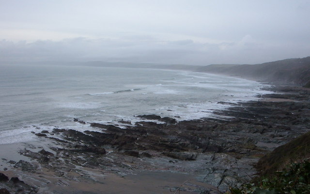
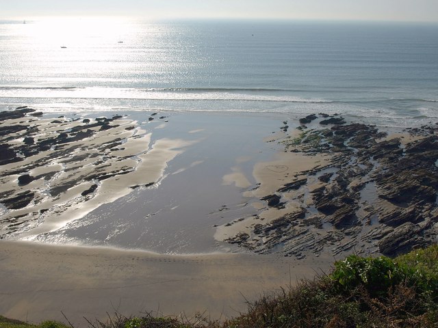
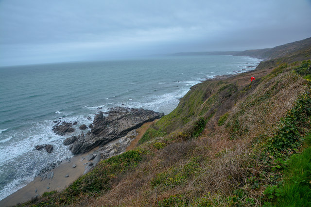
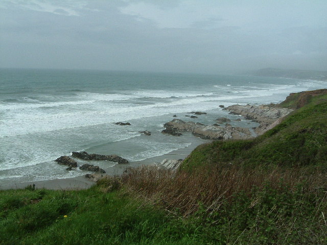
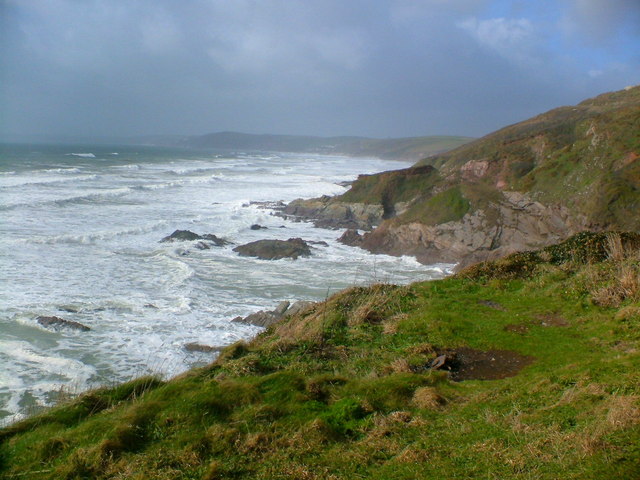
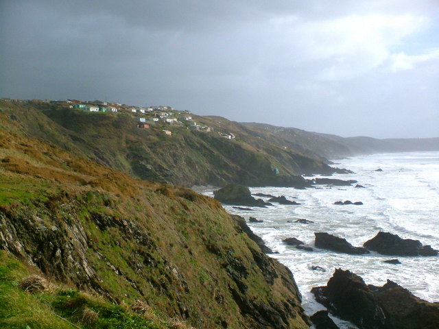
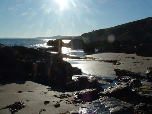
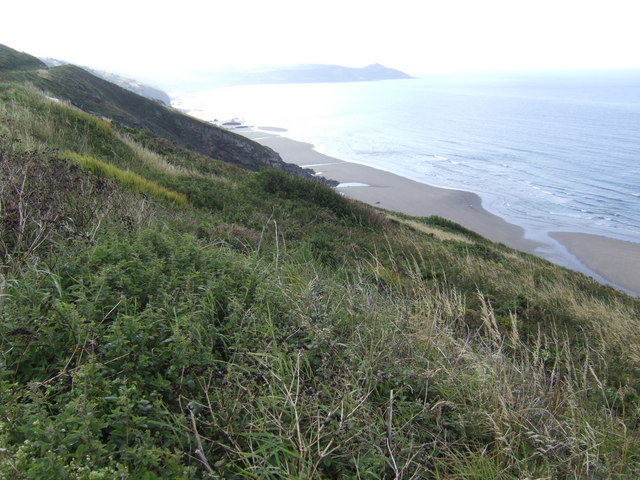
Tregonhawke Cliff, located in Cornwall, England, is a prominent feature of the picturesque coastline. This impressive cliff, with its rugged beauty, offers visitors a stunning panoramic view of the surrounding landscape. Standing tall at an elevation of approximately 100 meters, Tregonhawke Cliff is a popular destination for nature lovers and adventure enthusiasts alike.

The cliff is characterized by its sheer vertical drop and jagged edges, which have been formed over millions of years through natural erosion processes. The rocks that make up the cliff are predominantly composed of sandstone and shale, creating a striking contrast of colors against the blue waters of the English Channel.

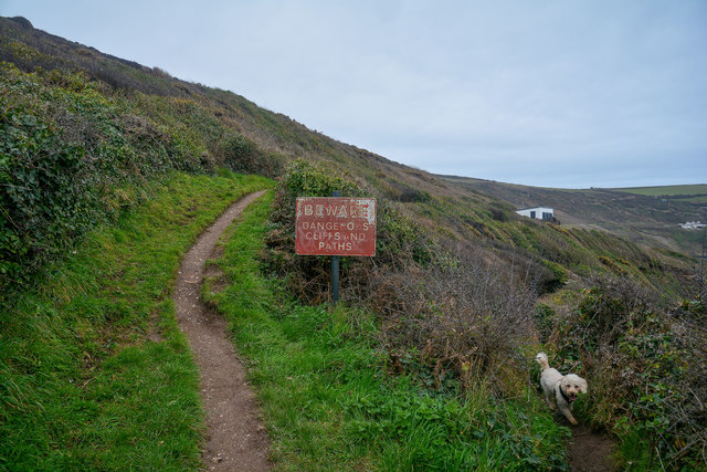
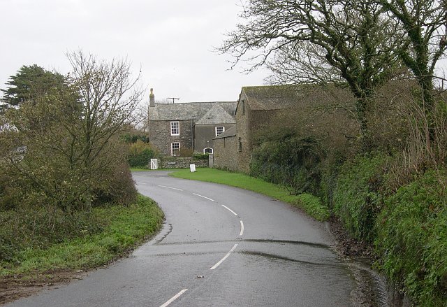
Access to Tregonhawke Cliff is facilitated by a network of footpaths and trails, making it an ideal location for hikers and walkers. These paths wind their way through the neighboring coastal vegetation, providing visitors with opportunities to spot various species of local flora and fauna.

Furthermore, Tregonhawke Cliff is renowned for its excellent rock climbing opportunities. The challenging routes and varying difficulty levels attract climbers from near and far, seeking to conquer the cliff's vertical face. However, it is important to exercise caution and adhere to safety guidelines while attempting any climbing activities.

Overall, Tregonhawke Cliff is a remarkable natural wonder, offering breathtaking views and recreational opportunities for all who venture to this rugged stretch of coastline in Cornwall.

If you have any feedback on the listing, please let us know in the comments section below.

Tregonhawke Cliff Images

Images are sourced within 2km of 50.340829/-4.24168 or Grid Reference SX4051. Thanks to Geograph Open Source API. All images are credited.

View over Reefs towards Looe at Captain Blake's Point View over reefs in foreground - as detailed on the map - looking out across Whitsand Bay towards Looe.
View over Reefs towards Looe at Captain Blake's Point
View over reefs in foreground - as detailed on the map - looking out across Whitsand Bay towards Looe.
Beach at Wiggle Sandway The next cove of sand east of <a href="https://www.geograph.org.uk/photo/2635104">SX4150 : Beach at Wiggle Sandway</a>. On the left are rocks below  Captain Blake's Point.
Beach at Wiggle Sandway
The next cove of sand east of SX4150 : Beach at Wiggle Sandway. On the left are rocks below Captain Blake's Point.
Maker-With-Rame : South West Coast Path Looking along the coast path.
Maker-With-Rame : South West Coast Path
Looking along the coast path.
Maker-With-Rame : Coastal Scenery Looking out across the coastline of Cornwall.
Maker-With-Rame : Coastal Scenery
Looking out across the coastline of Cornwall.
Higher Tregantle Farm
Looking out to sea near Sharrow Point Sharrow Point juts out to sea on Whitsand Bay near Freathy.
For a similar view, but on a much sunnier day taken 7 years later - see <a href="https://www.geograph.org.uk/photo/2145314">SX3952 : Whitsand Bay looking west from Sharrow Point</a>
Looking out to sea near Sharrow Point
Sharrow Point juts out to sea on Whitsand Bay near Freathy. For a similar view, but on a much sunnier day taken 7 years later - see SX3952 : Whitsand Bay looking west from Sharrow Point
National Trust Coastline The turbulent sea at Sharrow Point
National Trust Coastline
The turbulent sea at Sharrow Point
Coastline near Freathy The dramatic coastline with Freathy perched on the cliffs.
Coastline near Freathy
The dramatic coastline with Freathy perched on the cliffs.
Freathy Beach Evening scene looking towards Looe
Freathy Beach
Evening scene looking towards Looe
Arable Land around Higher Tregantle Farm
The Grotto Beach at low tide, Freathy Looking down onto the Grotto Beach at low tide.
The Grotto Beach at low tide, Freathy
Looking down onto the Grotto Beach at low tide.
Sharrow Point at low tide, Freathy Sharrow Point at low tide along side The Grotto Beach.
Sharrow Point at low tide, Freathy
Sharrow Point at low tide along side The Grotto Beach.
Rocks at the base of Freathy Cliff A nice morning for walking the dogs along the beach.
Rocks at the base of Freathy Cliff
A nice morning for walking the dogs along the beach.
Top of Freathy Cliff - view eastwards Along Whitsand Bay towards Rame Head in the distance.
Top of Freathy Cliff - view eastwards
Along Whitsand Bay towards Rame Head in the distance.
Freathy Cliff - view westwards The roof of a holiday home halfway down the slope can just be seen, with the rocks of Sharrow point beyond.
Freathy Cliff - view westwards
The roof of a holiday home halfway down the slope can just be seen, with the rocks of Sharrow point beyond.
Whitsand Bay Cornwall  in the Winter Looking from the Military Road near Freathy towards Rame Head on a very cold and wet Friday afternoon just after 12 o'clock. There were surfers in the water to the right of me.
Whitsand Bay Cornwall in the Winter
Looking from the Military Road near Freathy towards Rame Head on a very cold and wet Friday afternoon just after 12 o'clock. There were surfers in the water to the right of me.
Whitsand Bay Surfers It was very cold wet and windy when I took this, however I think they were enjoying themselves. You don't have to always go to Newquay to surf.
Whitsand Bay Surfers
It was very cold wet and windy when I took this, however I think they were enjoying themselves. You don't have to always go to Newquay to surf.
Rocks nr Freathy
Rocks nr Freathy
Show me another place!

Tregonhawke Cliff is located at Grid Ref: SX4051 (Lat: 50.340829, Lng: -4.24168)

Unitary Authority: Cornwall

Police Authority: Devon and Cornwall

What 3 Words

///spillage.paint.today. Near Millbrook, Cornwall

Related Wikis

Freathy

Freathy (Cornish: Frydhi) is a beach and coastal settlement on the Rame Peninsula in east Cornwall, England, United Kingdom.Freathy is accessible by the...

SS James Eagan Layne

SS James Eagan Layne was a liberty ship. She was beached and sunk during the Second World War off Whitsand Bay, Cornwall, United Kingdom. == History... ==

List of shipwrecks in 2004

The list of shipwrecks in 2004 includes ships sunk, foundered, grounded, or otherwise lost during 2004. == January == === 15 January === === 19 January... ===

HMS Scylla (F71)

HMS Scylla (F71) was a Leander-class frigate of the Royal Navy (RN). She was built at Devonport Royal Dockyard, the last RN frigate to be built there as...

Millbrook, Cornwall

Millbrook (Cornish: Govermelin) is a civil parish and village in southeast Cornwall, England, United Kingdom. The village is situated on the Rame Peninsula...

All Saints Church, Millbrook

All Saints Church is a Church of England parish church in Millbrook, Cornwall, England, UK. It was built in 1893–95 and has been Grade II listed since...

St John, Cornwall

St John (parish: Cornish: Pluwjowan, village: Cornish: S. Jowan) is a coastal civil parish and a village in south-east Cornwall, England, United Kingdom...

Tregantle Down Battery

Tregantle Down Battery was a high angle gun battery in south east Cornwall. It was built between 1888 and 1894 to defend HMNB Devonport from Whitsand Bay...

Nearby Amenities

Located within 500m of 50.340829,-4.24168
Source: PGS
Lat/Long: 50.3403342/-4.2443171
Entrance: main
Lat/Long: 50.3400161/-4.2369582
Bus Stop
Whitsand Bay Holiday Park
Bus: yes
Naptan AtcoCode: 0800COA15562
Naptan Bearing: SE
Naptan BusStopType: CUS
Naptan CommonName: Whitsand Bay Holiday Park
Naptan Indicator: SE-bound
Naptan NaptanCode: corgjdja
Naptan Verified: no
Operator: Plymouth Citybus
Public Transport: platform
Shelter: no
Source: naptan;bing;naptan_compare_tool
Lat/Long: 50.3399252/-4.2359548
Bench
Lat/Long: 50.3399253/-4.2371242
Power: pole
Lat/Long: 50.3426617/-4.2364553
Power: pole
Lat/Long: 50.3433071/-4.2367691
Power: pole
Lat/Long: 50.3450667/-4.2396954
Power: pole
Lat/Long: 50.3440585/-4.2374343
Power: pole
Lat/Long: 50.3442947/-4.2395559
Power: pole
Lat/Long: 50.3447056/-4.2420504
Power: pole
Lat/Long: 50.3452156/-4.2428255
Information: board
Tourism: information
Lat/Long: 50.3399228/-4.2367936
Bench
Lat/Long: 50.3399276/-4.2370545
Bench
Lat/Long: 50.3399463/-4.2371677
Bicycle Parking
Lat/Long: 50.3399177/-4.2370837
Tregonhawk Beach RNLI
Lifeguard
Emergency: lifeguard
Layer: 1
Website: https://rnli.org/find-my-nearest/lifeguarded-beaches/tregonhawke-beach
Lat/Long: 50.3406277/-4.2419893
The data included in this document is from www.openstreetmap.org. The data is made available under ODbL.

Have you been to Tregonhawke Cliff?

Leave your review of Tregonhawke Cliff below (or comments, questions and feedback).