Mount Pleasant

Settlement in Dorset

England

Mount Pleasant

Haycraft's Lane Minor road near Harman's Cross.
Haycraft's Lane Credit: Wayland Smith

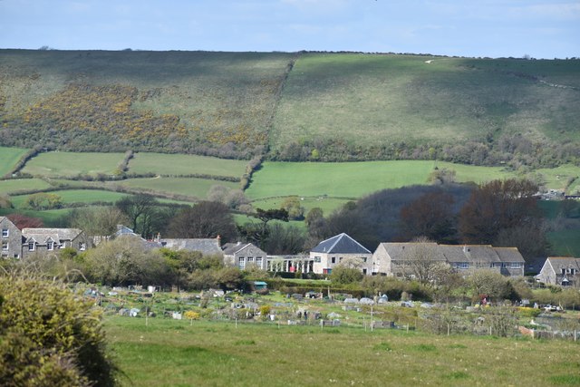
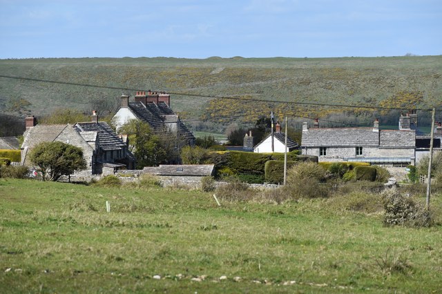
Mount Pleasant is a small village located in the county of Dorset, in the southern part of England. Situated within the picturesque countryside, the village is surrounded by rolling hills, lush green fields, and breathtaking landscapes. It is part of the West Dorset district and lies approximately 4 miles west of the market town of Dorchester.

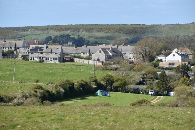
The village itself is characterized by its charming and idyllic atmosphere, with traditional stone cottages and well-maintained gardens adding to its quaint appeal. The community is tight-knit, with a population of around 500 residents who take pride in the village's history and heritage.

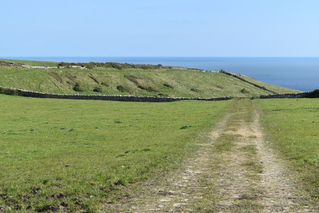
One of the notable features of Mount Pleasant is its proximity to several natural attractions. The village is situated near the iconic Jurassic Coast, a UNESCO World Heritage Site renowned for its stunning cliffs and fossil-rich beaches. This allows residents and visitors to enjoy scenic coastal walks and explore the rich geological history of the area.

Despite its small size, Mount Pleasant offers a range of amenities to cater to the needs of its residents. These include a local pub, a village hall, and a primary school. The village also benefits from excellent transportation links, with regular bus services connecting it to nearby towns and villages.

Overall, Mount Pleasant provides a tranquil and picturesque setting for those seeking a peaceful countryside lifestyle. Its natural beauty, community spirit, and convenient location make it an attractive place to live or visit in Dorset.

If you have any feedback on the listing, please let us know in the comments section below.

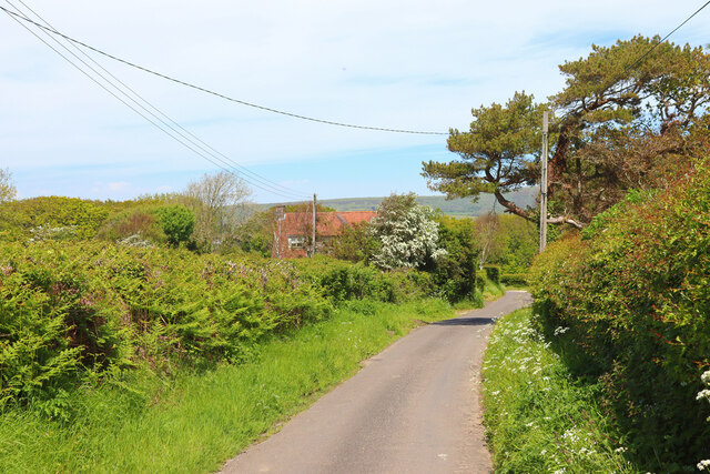
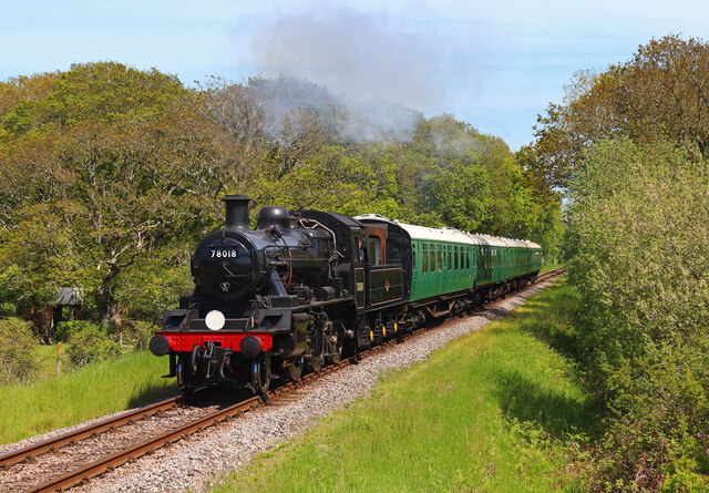
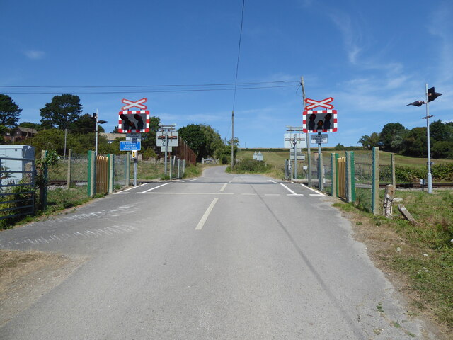
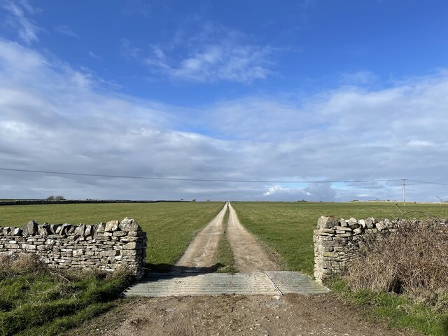
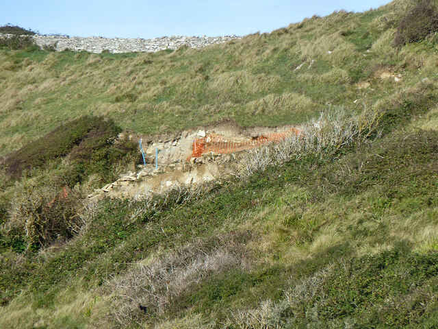
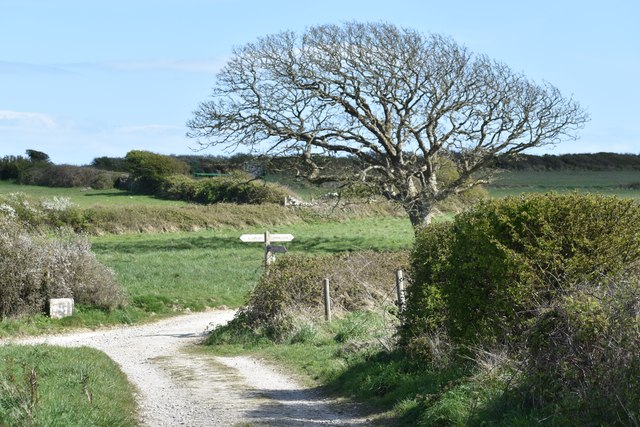
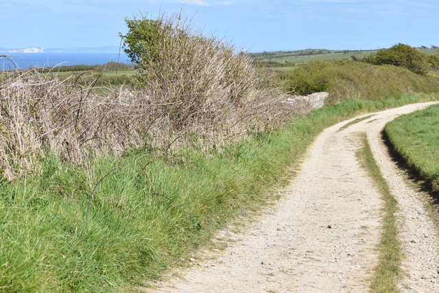
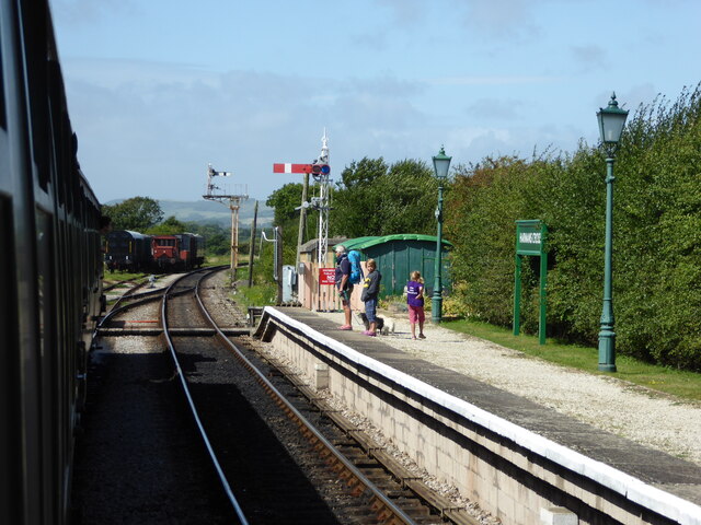
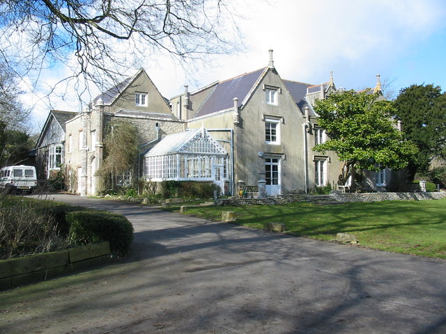
Mount Pleasant Images

Images are sourced within 2km of 50.611406/-2.0055299 or Grid Reference SY9979. Thanks to Geograph Open Source API. All images are credited.

Haycraft's Lane Minor road near Harman's Cross.
Haycraft's Lane
Minor road near Harman's Cross.
Level Crossing Steam train near Harman's Cross.
Level Crossing
Steam train near Harman's Cross.
Level crossing, Quarr Farm
Track off the Priest's Way
Land slip on or near footpath SE16/25, 2012 Either that or a recutting of the steep path.  A long view, from where I was it was difficult to get closer, the scrub was fierce.
Land slip on or near footpath SE16/25, 2012
Either that or a recutting of the steep path. A long view, from where I was it was difficult to get closer, the scrub was fierce.
Path junction north of Spyway Barn Footpath crosses the Priest's Way bridleway.
Path junction north of Spyway Barn
Footpath crosses the Priest's Way bridleway.
Priest's Way south of Langton Matravers
Campsite at Langton Matravers With Nine Barrow Down in the background.
Campsite at Langton Matravers
With Nine Barrow Down in the background.
Langton Matravers beneath Nine Barrow Down The building in the centre of the image is St George's Primary School.
Langton Matravers beneath Nine Barrow Down
The building in the centre of the image is St George's Primary School.
Dinosaur footprints, Keates Quarry Dinosaur footprints preserved in Purbeck Stone in former quarry.
Dinosaur footprints, Keates Quarry
Dinosaur footprints preserved in Purbeck Stone in former quarry.
Information board at former Keates Quarry Former quarry where <a href="https://www.geograph.org.uk/photo/7759824">SY9878 : Dinosaur footprints, Keates Quarry</a> can be seen.
Information board at former Keates Quarry
Former quarry where SY9878 : Dinosaur footprints, Keates Quarry can be seen.
Quarry track at Blacklands
Houses at Acton
Houses at Acton
Footpath to Seacombe Bottom
Cow and calf near Eastington Farm
Burnham's Lane
Burnham's Lane
Restricted byway SE16/53 The byway extends little further than can be seen, then splits into two footpaths.
Restricted byway SE16/53
The byway extends little further than can be seen, then splits into two footpaths.
Swanage Railway - Harman's Cross Station
Show me another place!

Mount Pleasant is located at Grid Ref: SY9979 (Lat: 50.611406, Lng: -2.0055299)

Unitary Authority: Dorset

Police Authority: Dorset

What 3 Words

///noon.stretcher.item. Near Swanage, Dorset

Related Wikis

The Old Malthouse School

The Old Malthouse School (The OMH) was a preparatory school in the village of Langton Matravers near Swanage in the Isle of Purbeck, Dorset, United Kingdom...

Durnford School

Durnford School was an English preparatory school for boys which opened in 1894 on the Isle of Purbeck in Dorset. The school occupied Durnford House, in...

Langton Matravers

Langton Matravers () is a village and civil parish on the Isle of Purbeck, in the county of Dorset in the south of England. It is situated about 2 miles...

Leeson House

Leeson House is a field studies centre in the village of Langton Matravers in the heart of the Isle of Purbeck, Dorset, England. The Isle of Purbeck forms...

Nearby Amenities

Located within 500m of 50.611406,-2.0055299
Langton Matravers
Is In: Dorset, England, UK
Place: village
Source: npe
Lat/Long: 50.6099559/-2.0004999
Turning Circle
Lat/Long: 50.6074782/-2.0048427
Turning Circle
Source: bing
Lat/Long: 50.6100406/-2.0034477
Langton Matravers Museum of the Stone Industry
Addr City: Swanage
Addr Postcode: BH19 3HZ
Addr Street: Saint George's Close
Fee: yes
Fee Conditional: no @ (age < 10)
Opening Hours: Apr 01-Sep 30 Mo-Sa 10:00-12:00,14:00-16:00
Tourism: museum
Website: https://www.dorsetmuseums.co.uk/langton-matravers-museum
Wikidata: Q113369844
Lat/Long: 50.610026/-2.0033197
Material: wood
Power: pole
Source: bing
Lat/Long: 50.6094666/-2.0001065
Material: wood
Power: pole
Source: bing
Lat/Long: 50.6118766/-1.9986378
Material: wood
Power: pole
Source: bing
Lat/Long: 50.6144521/-2.0105566
Fire Hydrant
Emergency: fire_hydrant
Fire Hydrant Diameter: 100
Fire Hydrant Type: underground
Ref: 649
Source: GPS
Lat/Long: 50.6087201/-2.0074687
Fire Hydrant
Emergency: fire_hydrant
Fire Hydrant Diameter: 3 inch
Fire Hydrant Type: underground
Ref: 8401
Source: GPS
Lat/Long: 50.608828/-2.0046196
Fire Hydrant
Emergency: fire_hydrant
Fire Hydrant Diameter: 3 inch
Fire Hydrant Type: underground
Ref: 5233
Source: GPS
Lat/Long: 50.6091223/-2.0037461
Fire Hydrant
Emergency: fire_hydrant
Fire Hydrant Type: underground
Source: GPS
Lat/Long: 50.6091966/-2.00235
Telephone
Booth: K6
Covered: booth
Operator: BT
Payment Coins: yes
Phone: +44 1929 422225
Source: GPS
Lat/Long: 50.6096016/-2.0019783
Fire Hydrant
Emergency: fire_hydrant
Fire Hydrant Diameter: 100
Fire Hydrant Type: underground
Ref: 2785
Source: GPS
Lat/Long: 50.6097622/-2.0013467
Material: wood
Power: pole
Ref: 245;816028
Source: GPS+GLONASS
Lat/Long: 50.6104566/-2.0076401
Material: wood
Power: pole
Ref: 816031
Source: GPS+GLONASS
Source Ref: survey
Lat/Long: 50.6105062/-2.0070144
Barrier: stile
Source: GPS
Lat/Long: 50.6114705/-2.0080968
Barrier: gate;stile
Source: GPS
Lat/Long: 50.612996/-2.0082637
Barrier: stile
Source: GPS
Lat/Long: 50.6140249/-2.0088819
Man Made: surveillance
Surveillance: public
Surveillance Type: camera
Lat/Long: 50.6089339/-2.0073671
Barrier: stile
Source: survey
Lat/Long: 50.6128894/-2.0098746
Barrier: stile
Source: survey
Lat/Long: 50.6142569/-2.0017904
Fire Hydrant
Emergency: fire_hydrant
Fire Hydrant Diameter: 3 inch
Fire Hydrant Type: underground
Ref: 396
Source: GPS+GLONASS
Lat/Long: 50.609388/-2.003994
Bench
Source: survey
Lat/Long: 50.6095561/-2.0033388
Fire Hydrant
Emergency: fire_hydrant
Fixme: Is this a real fire hydrant?
Source: GPS+GLONASS
Lat/Long: 50.6102917/-2.0085083
Barrier: stile
Source: GPS+GLONASS
Lat/Long: 50.6103201/-2.0086008
Location: underground
Source: survey
Water: wash_out
Lat/Long: 50.6103755/-2.0085139
Barrier: stile
Source: GPS+GLONASS
Lat/Long: 50.6103888/-2.0079266
Barrier: stile
Source: survey
Lat/Long: 50.6106087/-2.0068795
Barrier: stile
Source: survey
Lat/Long: 50.6123862/-2.00678
Historic Highway: street_lamp
Note: Concrete street lapm column, still partially exists, cut short to fit in wall.
Source: GPS+GLONASS
Lat/Long: 50.6091515/-2.0046066
Fixme: Small water tap on a short pillar above a blocked drain. Looks abandoned.
Lat/Long: 50.609256/-2.0044207
Post Box
Brand: Royal Mail
Brand Wikidata: Q638098
Brand Wikipedia: en:Royal Mail
Collection Times: Mo-Fr 16:30; Sa 09:45
Operator: Royal Mail
Operator Wikidata: Q638098
Post Box Type: pillar
Ref: BH19 76
Ref GB Uprn: 10015477930
Royal Cypher: EIIR
Royal Cypher Wikidata: Q33102113
Source: GPS+GLONASS
Lat/Long: 50.6095203/-2.0023487
Historic: memorial
Source: survey
Lat/Long: 50.6095564/-2.0033954
Waste Basket
Source: survey
Waste: dog_excrement
Lat/Long: 50.6096579/-2.0024024
Man Made: surveillance
Surveillance: outdoor;public
Surveillance Type: camera
Lat/Long: 50.6097561/-2.0052665
Location: underground
Source: GPS+GLONASS
Water: wash_out
Lat/Long: 50.6103762/-2.0085236
Fixme: School playing fields
Lat/Long: 50.6103783/-2.0070248
Location: underground
Source: GPS+GLONASS
Water: wash_out
Lat/Long: 50.610573/-2.0053422
Bench
Source: survey
Lat/Long: 50.6128946/-2.0012445
Bench
Source: survey
Lat/Long: 50.6128972/-2.0022834
Bench
Source: survey
Lat/Long: 50.6129377/-2.0012514
Barrier: stile
Source: GPS+GLONASS
Lat/Long: 50.6144268/-2.0014619
Material: wood
Power: pole
Source: bing
Lat/Long: 50.6108973/-1.9996271
Material: wood
Power: pole
Source: bing
Lat/Long: 50.6111895/-1.9987122
Durnford Drove
Material: wood
Power: pole
Ref: 56904045;16
Source: survey
Source Ref: survey
Transformer: distribution
Voltage Primary: 11000
Voltage Secondary: 400
Voltage Tertiary: 230
Lat/Long: 50.607311/-2.0050397
Langton Matravers
Location Transition: yes
Material: wood
Note: 11kV goes underground as well as LV
Power: pole
Ref: 56904036
Source: GPS+GLONASS
Transformer: distribution
Voltage Primary: 11000
Voltage Secondary: 400
Voltage Tertiary: 230
Lat/Long: 50.6098048/-1.9999995
Material: wood
Power: pole
Ref: 56904044;15
Source: survey
Source Ref: survey
Lat/Long: 50.6073326/-2.0030014
Fire Hydrant
Emergency: fire_hydrant
Fire Hydrant Diameter: 100
Fire Hydrant Type: underground
Ref: 11999
Source: GPS+GLONASS
Lat/Long: 50.60817/-2.003944
Fire Hydrant
Emergency: fire_hydrant
Fire Hydrant Type: underground
Source: GPS+GLONASS
Lat/Long: 50.608171/-2.01015
Grit Bin
Lat/Long: 50.6082102/-2.0046818
Grit Bin
Source: survey
Lat/Long: 50.60822/-2.0101482
Material: wood
Power: pole
Source: bing
Lat/Long: 50.6085303/-2.0105693
Material: wood
Power: pole
Source: bing
Lat/Long: 50.6085659/-2.0099466
Material: wood
Power: pole
Source: bing
Lat/Long: 50.6085804/-2.0093966
Post Box
Brand: Royal Mail
Brand Wikidata: Q638098
Brand Wikipedia: en:Royal Mail
Collection Times: Mo-Fr 16:30; Sa 09:30
Operator: Royal Mail
Operator Wikidata: Q638098
Post Box Type: wall
Ref: BH19 109
Ref GB Uprn: 10015427849
Royal Cypher: GVIR
Royal Cypher Wikidata: Q33102169
Source: survey
Lat/Long: 50.6086213/-2.0103411
Bench
Backrest: no
Lat/Long: 50.6090803/-2.0046839
Bench
Source: survey
Lat/Long: 50.6092173/-2.0048537
Fire Hydrant
Emergency: fire_hydrant
Fire Hydrant Type: underground
Source: GPS+GLONASS
Lat/Long: 50.609228/-2.004856
Recycling
Source: survey
Lat/Long: 50.6095816/-1.999093
School
St George's Pre-School
Denomination: anglican
Religion: christian
Website: http://www.stgeorgespreschool.dorset.sch.uk/
Lat/Long: 50.609538/-2.0062609
Waste Basket
Check Date: 2023-04-07
Source: survey
Waste: dog_excrement
Lat/Long: 50.607295/-2.0047816
Bus Stop
Langton Matravers, Capston Field
Bench: no
Bin: no
Bus: yes
Layby: no
Naptan AtcoCode: 1200POA10087
Naptan Bearing: W
Naptan BusStopType: CUS
Naptan CommonName: Capston Field
Naptan Indicator: W-bound
Naptan NaptanCode: dordamtj
Naptan Street: High Street
Naptan Verified: no
Public Transport: platform
Shelter: no
Lat/Long: 50.6085259/-2.0104577
Bus Stop
Langton Matravers, Capston Field
Bench: no
Bus: yes
Layby: no
Naptan AtcoCode: 1200POA10086
Naptan Bearing: E
Naptan CommonName: Capstan Field
Naptan Indicator: E-bound
Naptan NaptanCode: dordamtg
Naptan Street: High Street
Naptan Verified: no
Public Transport: platform
Shelter: no
Lat/Long: 50.608617/-2.0103956
Bus Stop
Kings Arms
Bench: yes
Bus: yes
Layby: no
Naptan AtcoCode: 1200POA10090
Naptan Bearing: E
Naptan CommonName: The Kings Arms
Naptan Indicator: E-bound
Naptan NaptanCode: dordapgd
Naptan Street: High Street
Naptan Verified: no
Public Transport: platform
Shelter: yes
Lat/Long: 50.6095725/-2.0026538
Defibrillator
Defibrillator Location: High Street, Langton Matravers - almost opposite Kings Arms
Emergency: defibrillator
Indoor: no
Lat/Long: 50.6096858/-2.0018712
Direction: 190
Generator Method: photovoltaic
Generator Output Electricity: yes
Generator Solar Modules: 3
Generator Source: solar
Generator Type: solar_photovoltaic_panel
Location: roof
Power: generator
Lat/Long: 50.6089599/-2.0035112
Direction: S
Generator Method: photovoltaic
Generator Output Electricity: yes
Generator Solar Modules: 8
Generator Source: solar
Generator Type: solar_photovoltaic_panel
Location: roof
Power: generator
Lat/Long: 50.6088113/-2.000955
Direction: S
Generator Method: photovoltaic
Generator Output Electricity: yes
Generator Solar Modules: 8
Generator Source: solar
Generator Type: solar_photovoltaic_panel
Location: roof
Power: generator
Lat/Long: 50.6083118/-2.0105229
Direction: 190
Generator Method: photovoltaic
Generator Output Electricity: yes
Generator Solar Modules: 12
Generator Source: solar
Generator Type: solar_photovoltaic_panel
Location: roof
Power: generator
Lat/Long: 50.6089333/-2.0038571
Direction: SSW
Generator Method: photovoltaic
Generator Output Electricity: yes
Generator Solar Modules: 14
Generator Source: solar
Generator Type: solar_photovoltaic_panel
Location: roof
Power: generator
Lat/Long: 50.609208/-2.0061021
Direction: 190
Generator Method: photovoltaic
Generator Output Electricity: yes
Generator Solar Modules: 3
Generator Source: solar
Generator Type: solar_photovoltaic_panel
Location: roof
Power: generator
Lat/Long: 50.6089548/-2.0034197
Direction: 190
Generator Method: photovoltaic
Generator Output Electricity: yes
Generator Solar Modules: 2
Generator Source: solar
Generator Type: solar_photovoltaic_panel
Location: roof
Power: generator
Lat/Long: 50.6089363/-2.0034702
Direction: 190
Generator Method: photovoltaic
Generator Output Electricity: yes
Generator Solar Modules: 17
Generator Source: solar
Generator Type: solar_photovoltaic_panel
Location: roof
Power: generator
Lat/Long: 50.6099275/-2.0004952
Power: transformer
Source: bing
Transformer: distribution
Lat/Long: 50.6100971/-2.0024109
Power: switch
Source: bing
Lat/Long: 50.610093/-2.0024377
Power: transformer
Source: bing
Transformer: distribution
Lat/Long: 50.6083938/-2.0076556
Power: switch
Source: bing
Lat/Long: 50.6083711/-2.0076257
Bus Stop
Kings Arms
Bus: yes
Naptan AtcoCode: 1200POA10091
Naptan Bearing: W
Naptan BusStopType: CUS
Naptan CommonName: The Kings Arms
Naptan Indicator: W-bound
Naptan NaptanCode: dordapgj
Naptan Street: High Street
Naptan Verified: no
Public Transport: platform
Lat/Long: 50.60955/-2.0024749
Bus Stop
Durnford Drove
Bus: yes
Naptan AtcoCode: 1200POA10089
Naptan Bearing: W
Naptan CommonName: Durnford Drove
Naptan Indicator: W-bound
Naptan NaptanCode: dordapam
Naptan Street: High Street
Naptan Verified: no
Public Transport: platform
Shelter: no
Lat/Long: 50.6092245/-2.0048567
Bus Stop
Durnford Drove
Bus: yes
Naptan AtcoCode: 1200POA10088
Naptan Bearing: E
Naptan BusStopType: CUS
Naptan CommonName: Durnford Drove
Naptan Indicator: E-bound
Naptan NaptanCode: dordapaj
Naptan Street: High Street
Naptan Verified: no
Public Transport: platform
Shelter: no
Lat/Long: 50.609313/-2.0048379
The data included in this document is from www.openstreetmap.org. The data is made available under ODbL.

Have you been to Mount Pleasant?

Leave your review of Mount Pleasant below (or comments, questions and feedback).