Mount Pleasant

Settlement in Dorset

England

Mount Pleasant

Footpath across golf course fairway A public right-of-way across one of the fairways at Broadstone Golf Course, at Corfe Hills.
Footpath across golf course fairway Credit: Peter Kazmierczak

Mount Pleasant is a small village located in the county of Dorset, England. Situated on the southwest coast of the country, it is part of the Purbeck district and lies within the Isle of Purbeck Area of Outstanding Natural Beauty. The village is positioned between the towns of Swanage and Wareham, offering residents and visitors easy access to these larger settlements.

This picturesque village is known for its stunning natural surroundings, with rolling hills, lush meadows, and breathtaking views of the English Channel. The area is a popular destination for outdoor enthusiasts, as it offers a multitude of opportunities for hiking, cycling, and exploring the nearby countryside.

Mount Pleasant itself is a small, tight-knit community with a population of approximately 500 residents. The village features a handful of charming cottages and houses, some of which date back centuries, adding to its quaint and traditional atmosphere.

Despite its small size, Mount Pleasant is well-served by local amenities. There is a primary school, a village hall, and a community center, providing residents with opportunities for education, social activities, and events.

For those seeking a peaceful and idyllic place to reside or visit, Mount Pleasant offers a tranquil escape from the hustle and bustle of city life. Its natural beauty and sense of community make it a truly special place within the Dorset countryside.

If you have any feedback on the listing, please let us know in the comments section below.

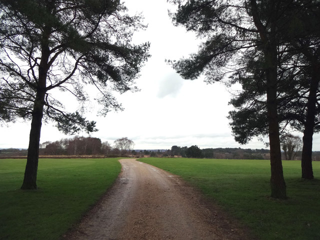
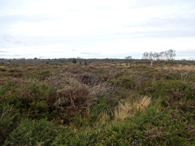
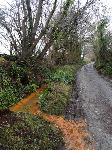
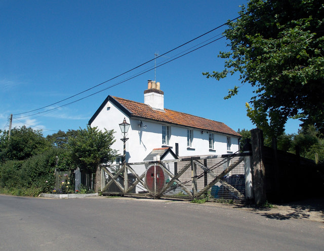
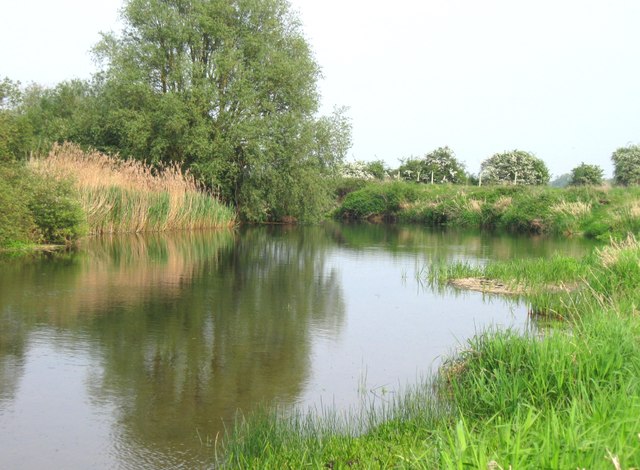
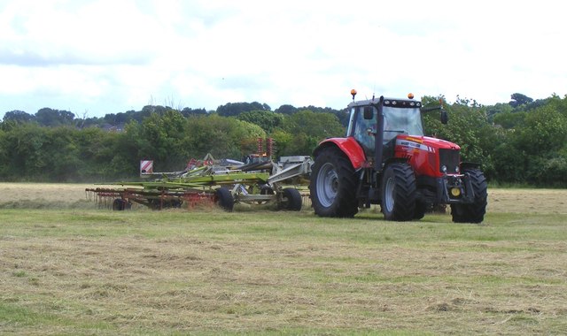
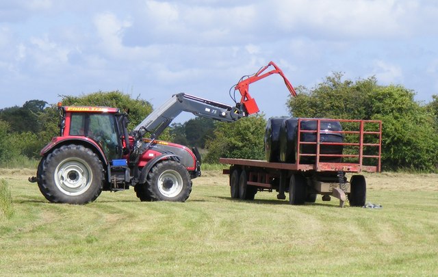
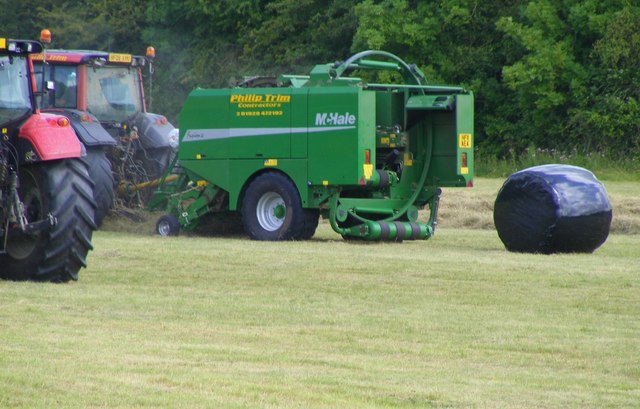
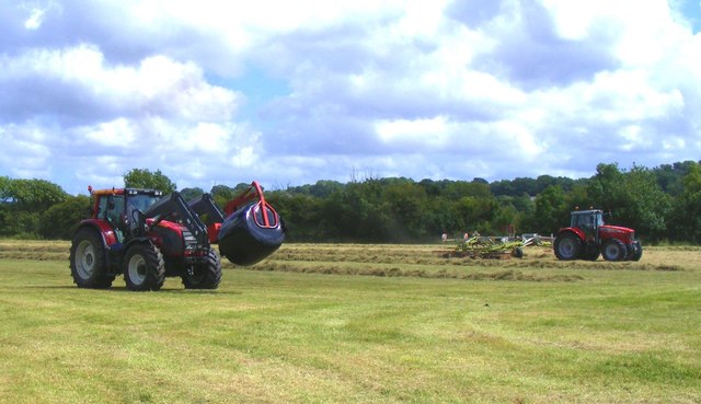
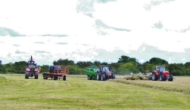
Mount Pleasant Images

Images are sourced within 2km of 50.776683/-2.0145564 or Grid Reference SY9997. Thanks to Geograph Open Source API. All images are credited.

Footpath across golf course fairway A public right-of-way across one of the fairways at Broadstone Golf Course, at Corfe Hills.
Footpath across golf course fairway
A public right-of-way across one of the fairways at Broadstone Golf Course, at Corfe Hills.
Corfe and Barrow Hills Nature Reserve Looking towards Rushcombe Bottom, from the footpath across the Corfe and Barrow Hills Nature Reserve.
Corfe and Barrow Hills Nature Reserve
Looking towards Rushcombe Bottom, from the footpath across the Corfe and Barrow Hills Nature Reserve.
Lambs Green Lane Not sure what's turning the water orange, with this field run-off.
Lambs Green Lane
Not sure what's turning the water orange, with this field run-off.
Remains of the Somerset & Dorset Joint Railway The site of Corfe Mullen Junction, with some old crossing gates and an (extended) crossing keeper / signalman's house.
Remains of the Somerset & Dorset Joint Railway
The site of Corfe Mullen Junction, with some old crossing gates and an (extended) crossing keeper / signalman's house.
Beautiful stretch of the Dorset Stour Taken on the South side of the river, on the Bear Mead nature reserve, near Cowgrove.
Beautiful stretch of the Dorset Stour
Taken on the South side of the river, on the Bear Mead nature reserve, near Cowgrove.
Cutting the hay at Bear Mead nature reserve, near Cowgrove
Hay cutting at Bear Mead nature reserve One of the amazing machines that cut the hay and gather it into long piles to be subsequently picked up and baled.
Hay cutting at Bear Mead nature reserve
One of the amazing machines that cut the hay and gather it into long piles to be subsequently picked up and baled.
Loading the baled and wrapped hay, ready for removal Mid-summer hay cutting at Bear Mead nature reserve
Loading the baled and wrapped hay, ready for removal
Mid-summer hay cutting at Bear Mead nature reserve
The incredible baling machine at Bear Mead nature reserve The machine scoops up the pre-cut silage and forms it into bales, then wraps it in plastic before disgorging it onto the field to await collection.
The incredible baling machine at Bear Mead nature reserve
The machine scoops up the pre-cut silage and forms it into bales, then wraps it in plastic before disgorging it onto the field to await collection.
Hay cutting at Bear Mead nature reserve One machine still cutting the grass whilst another carries away the wrapped bales to be loaded and transported.
Hay cutting at Bear Mead nature reserve
One machine still cutting the grass whilst another carries away the wrapped bales to be loaded and transported.
Hay cutting at Bear Mead nature reserve Continuous operation. Cutting of the grass and forming long lines ready for the next machine to scoop it up, form it into round bales and wrap it in plastic. It then dumps it out of the back end ready for the third machine to collect and lift it onto the flat bed trailer for subsequent transportation.
Hay cutting at Bear Mead nature reserve
Continuous operation. Cutting of the grass and forming long lines ready for the next machine to scoop it up, form it into round bales and wrap it in plastic. It then dumps it out of the back end ready for the third machine to collect and lift it onto the flat bed trailer for subsequent transportation.
Roundabout on the A31, Lambs Green This was my first digital photo in SY
Roundabout on the A31, Lambs Green
This was my first digital photo in SY
Layby on the A31, Sleight
Bale carrier on the A31, Sleight
Mill Street, Corfe Mullen
Old Milestone by the A31, north west of Sleight Stone post (plate lost) by the A31, in parish of CORFE MULLEN (EAST DORSET District), grass area opposite St Huberts church, just inside safety barrier, on South side of road. Dorset 2 (limestone), erected by the Puddletown & Wimborne turnpike trust in the 19th century. 

Inscription reads:-
DORCHESTER
20
WIMBORNE
2  

Milestone Society National ID: DO_DOWB20
Old Milestone by the A31, north west of Sleight
Stone post (plate lost) by the A31, in parish of CORFE MULLEN (EAST DORSET District), grass area opposite St Huberts church, just inside safety barrier, on South side of road. Dorset 2 (limestone), erected by the Puddletown & Wimborne turnpike trust in the 19th century. Inscription reads:- DORCHESTER 20 WIMBORNE 2 Milestone Society National ID: DO_DOWB20
Show me another place!

Mount Pleasant is located at Grid Ref: SY9997 (Lat: 50.776683, Lng: -2.0145564)

Unitary Authority: Dorset

Police Authority: Dorset

What 3 Words

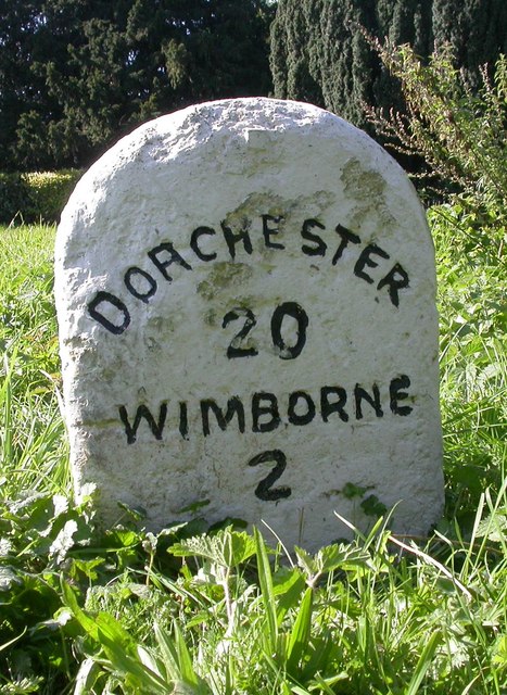
///notices.honestly.decoded. Near Wimborne Minster, Dorset

Related Wikis

Corfe Mullen

Corfe Mullen is a village in Dorset, England, on the north-western urban fringe of the South East Dorset conurbation. The community had a population of...

Corfe Hills School

Corfe Hills School is a co-educational upper school in Broadstone, Poole, Dorset, England, in the urban fringe between Poole and Wimborne. The school became...

Corfe Barrows Nature Park

Corfe Barrows Nature Park comprises around nine natural areas, covering an area of 90 hectares, within the Borough of Poole that are being managed for...

Corfe Mullen Halt railway station

Corfe Mullen Halt was a station in the English county of Dorset. It was located between Bailey Gate and Broadstone stations on the Somerset and Dorset...

Nearby Amenities

Located within 500m of 50.776683,-2.0145564
Fuel
Esso Windgreen
Addr Housenumber: 2
Addr Postcode: BH21 3LE
Addr Street: Wareham Road
Car Wash: yes
Fhrs Id: 340427
Operator: Esso
Shop: kiosk
Surveillance: outdoor;public
Lat/Long: 50.7770231/-2.0158381
Turning Circle
Lat/Long: 50.7752478/-2.0144157
Turning Circle
Lat/Long: 50.7745702/-2.0121934
Turning Circle
Lat/Long: 50.7727059/-2.0113614
Turning Circle
Lat/Long: 50.7731707/-2.0156959
BHLive Corfe Mullen
Access: customers
Addr Housenumber: 14
Addr Postcode: BH21 3LE
Addr Street: Wareham Road
Building: yes
Fhrs Id: 950896
Leisure: fitness_centre
Operator: BHLive
Source Addr: FHRS Open Data
Sport: swimming
Lat/Long: 50.7762266/-2.0164407
Turning Circle
Lat/Long: 50.7738403/-2.0114261
Turning Circle
Lat/Long: 50.7735941/-2.0107776
Turning Circle
Lat/Long: 50.7752549/-2.0133117
Turning Circle
Lat/Long: 50.7739099/-2.0124695
Fire Hydrant
Emergency: fire_hydrant
Fire Hydrant Diameter: 150
Fire Hydrant Type: underground
Ref: 9673
Source: GPS
Lat/Long: 50.7770047/-2.0145643
Fire Hydrant
Emergency: fire_hydrant
Fire Hydrant Diameter: 150
Fire Hydrant Type: underground
Source: GPS
Lat/Long: 50.7783685/-2.0135565
Waste Basket
Source: GPS
Waste: dog_excrement
Lat/Long: 50.7783721/-2.0135179
Fire Hydrant
Emergency: fire_hydrant
Fire Hydrant Diameter: 4 inch
Fire Hydrant Type: underground
Ref: 6410
Source: GPS+GLONASS
Lat/Long: 50.773427/-2.018844
Fire Hydrant
Emergency: fire_hydrant
Fire Hydrant Diameter: 150
Fire Hydrant Type: underground
Ref: 2027
Source: GPS+GLONASS
Lat/Long: 50.7740489/-2.0165583
Crossing
Crossing: traffic_signals
Crossing Island: no
Lat/Long: 50.7742447/-2.0165811
Crossing
Crossing: uncontrolled
Crossing Island: no
Crossing Ref: zebra
Source: bing
Tactile Paving: yes
Lat/Long: 50.7771058/-2.0145171
Man Made: surveillance
Surveillance: outdoor;public
Surveillance Type: camera
Lat/Long: 50.7771912/-2.0156796
Crossing
Crossing: unmarked
Crossing Island: no
Kerb: lowered
Tactile Paving: no
Lat/Long: 50.778275/-2.0136152
Car Wash
Wind Green
Lat/Long: 50.7772283/-2.0157389
Crossing
Crossing: unmarked
Crossing Island: yes
Crossing Markings: no
Kerb: lowered
Tactile Paving: yes
Lat/Long: 50.7767621/-2.0146815
Post Box
Post Box Type: lamp
Ref: BH21 215
Ref GB Uprn: 10015295263
Lat/Long: 50.7806889/-2.01372
Post Box
Ref: BH21 49
Lat/Long: 50.7768988/-2.0160106
Bus Stop
Corfe Mullen Co-op
Bench: no
Bin: no
Bus: yes
Naptan AtcoCode: 1200POA11340
Naptan Bearing: S
Naptan CommonName: Co-op Store
Naptan Indicator: opp
Naptan NaptanCode: dordamdj
Naptan PlusbusZoneRef: BOMO
Naptan Street: Wareham Road
Naptan Verified: no
Public Transport: platform
Shelter: no
Tactile Paving: no
Lat/Long: 50.7745919/-2.0164161
Street Lamp
Lat/Long: 50.7795814/-2.0137226
Street Lamp
Lat/Long: 50.7801386/-2.013898
Street Lamp
Lat/Long: 50.780467/-2.0140767
Street Lamp
Lat/Long: 50.7806687/-2.0138792
Crossing
Crossing: unmarked
Crossing Island: no
Crossing Markings: no
Kerb: lowered
Tactile Paving: no
Lat/Long: 50.777494/-2.0138578
Crossing
Crossing: unmarked
Crossing Island: yes
Kerb: lowered
Lat/Long: 50.7807647/-2.014312
Street Lamp
Lat/Long: 50.7793182/-2.0129648
Street Lamp
Lat/Long: 50.7794988/-2.012625
Street Lamp
Lat/Long: 50.7796619/-2.0124662
Street Lamp
Ref: 3C281
Lat/Long: 50.7797641/-2.0108859
Street Lamp
Lat/Long: 50.7798352/-2.0112943
Street Lamp
Lat/Long: 50.7798634/-2.010465
Street Lamp
Lat/Long: 50.7799843/-2.0125186
Street Lamp
Lat/Long: 50.7800401/-2.0128244
Street Lamp
Lat/Long: 50.7800401/-2.0133111
Street Lamp
Lat/Long: 50.7800968/-2.0113817
Street Lamp
Lat/Long: 50.7802267/-2.0124713
Street Lamp
Lat/Long: 50.780371/-2.0113212
Street Lamp
Lat/Long: 50.7804239/-2.0124243
Street Lamp
Lat/Long: 50.7804296/-2.011825
Street Lamp
Lat/Long: 50.7805033/-2.012982
Street Lamp
Lat/Long: 50.780538/-2.0109896
Street Lamp
Lat/Long: 50.7806341/-2.0134196
Street Lamp
Lat/Long: 50.7806732/-2.0142285
Street Lamp
Lat/Long: 50.7808892/-2.0142405
Street Lamp
Lat/Long: 50.7808924/-2.0138754
Man Made: street_cabinet
Note: FTTC cab ... possibly ECI given http://www.kitz.co.uk/adsl/fttc-cabinets.htm
Street Cabinet: telecom
Lat/Long: 50.7770689/-2.0148541
Man Made: street_cabinet
Ref: 11
Street Cabinet: telecom
Lat/Long: 50.7771391/-2.0151595
Man Made: street_cabinet
Note: FTTC cab ... possibly Huawei given http://www.kitz.co.uk/adsl/fttc-cabinets.htm
Street Cabinet: telecom
Lat/Long: 50.7773525/-2.0140899
Man Made: street_cabinet
Ref: 51
Street Cabinet: telecom
Lat/Long: 50.7773749/-2.0140545
Crossing
Crossing: unmarked
Crossing Island: no
Crossing Markings: no
Kerb: lowered
Tactile Paving: no
Lat/Long: 50.7761808/-2.0157669
Street Lamp
Ref: 4L37
Lat/Long: 50.7785736/-2.0130224
Street Lamp
Ref: 5L37
Lat/Long: 50.7786287/-2.0124933
Street Lamp
Ref: 6L37
Lat/Long: 50.7787525/-2.0121044
Street Lamp
Ref: 7L37
Lat/Long: 50.7788369/-2.011922
Street Lamp
Ref: 11L37
Lat/Long: 50.7789632/-2.0110784
Street Lamp
Ref: 8L37
Lat/Long: 50.7790696/-2.0112742
Street Lamp
Ref: 10L37
Lat/Long: 50.7791841/-2.0108947
Street Lamp
Lat/Long: 50.7792816/-2.0103824
Street Lamp
Ref: 9L37
Lat/Long: 50.7794788/-2.0108672
Information: board
Tourism: information
Lat/Long: 50.7782533/-2.0134496
Fire Hydrant
Emergency: fire_hydrant
Fire Hydrant Type: underground
Lat/Long: 50.7798138/-2.0171324
Waste Basket
Waste: dog_excrement
Lat/Long: 50.7798879/-2.0176605
Milestone
Lat/Long: 50.7798742/-2.0191321
Bus Stop
Windgreen
Bin: no
Bus: yes
Naptan AtcoCode: 1200POA11341
Naptan Bearing: SW
Naptan CommonName: Windgreen
Naptan Indicator: SW-bound
Naptan NaptanCode: dordamga
Naptan PlusbusZoneRef: BOMO
Naptan Verified: no
Public Transport: platform
Shelter: yes
Lat/Long: 50.7765481/-2.0153606
Bus Stop
Windgreen
Bench: no
Bin: no
Bus: yes
Naptan AtcoCode: 1200POA11342
Naptan Bearing: NE
Naptan CommonName: Windgreen
Naptan Indicator: NE-bound
Naptan NaptanCode: dordamdw
Naptan PlusbusZoneRef: BOMO
Naptan Verified: no
Public Transport: platform
Shelter: no
Tactile Paving: no
Lat/Long: 50.7766248/-2.0154525
Bus Stop
Corfe Mullen, Lockyers School
Bus: yes
Naptan AtcoCode: 1200POA10416
Naptan Bearing: W
Naptan CommonName: Lockyers School
Naptan Indicator: W-bound
Naptan NaptanCode: dordajwd
Naptan PlusbusZoneRef: BOMO
Naptan Street: Wimborne Road
Naptan Verified: no
Public Transport: platform
Lat/Long: 50.7798308/-2.0184073
Bus Stop
Corfe Mullen, Lockyers School
Bus: yes
Naptan AtcoCode: 1200POA10417
Naptan Bearing: E
Naptan CommonName: Lockyers School
Naptan Indicator: E-bound
Naptan NaptanCode: dordajtw
Naptan PlusbusZoneRef: BOMO
Naptan Verified: no
Public Transport: platform
Lat/Long: 50.7800479/-2.0191568
Power: pole
Lat/Long: 50.7779114/-2.0089758
Power: pole
Lat/Long: 50.778261/-2.0087692
Power: pole
Lat/Long: 50.7773731/-2.009959
Power: pole
Lat/Long: 50.777401/-2.0097043
Fire Hydrant
Emergency: fire_hydrant
Fire Hydrant Type: underground
Lat/Long: 50.7806416/-2.0134416
Power: pole
Lat/Long: 50.7784969/-2.0082624
Street Lamp
Lat/Long: 50.7797549/-2.0129222
Street Lamp
Lat/Long: 50.7802957/-2.0129552
Street Lamp
Lat/Long: 50.7790262/-2.0129549
Street Lamp
Lat/Long: 50.7787853/-2.0130354
Fast Food
Subway
Addr Housenumber: 2
Addr Postcode: BH21 3LE
Addr Street: Wareham Road
Brand: Subway
Brand Wikidata: Q244457
Brand Wikipedia: en:Subway (restaurant)
Contact Website: https://restaurants.subway.com/united-kingdom/en/dorset/3-wareham-road-wimborne
Cuisine: sandwich
Delivery: no
Drive Through: no
Fhrs Id: 1105338
Operator: Subway
Outdoor Seating: no
Smoking: no
Source Addr: FHRS Open Data
Takeaway: yes
Lat/Long: 50.776984/-2.0157855
Telephone
Booth: KX100
Covered: booth
Ref GB Uprn: 10024749145
Lat/Long: 50.7799357/-2.0192268
Newtown
Place: locality
Source: OS OpenData StreetView
Lat/Long: 50.7772598/-2.0176347
Generator Method: photovoltaic
Generator Output Electricity: yes
Generator Source: solar
Generator Type: solar_photovoltaic_panel
Location: roof
Power: generator
Lat/Long: 50.7725523/-2.016251
Generator Method: photovoltaic
Generator Output Electricity: yes
Generator Source: solar
Generator Type: solar_photovoltaic_panel
Location: roof
Power: generator
Lat/Long: 50.7735441/-2.0145671
Generator Method: photovoltaic
Generator Output Electricity: yes
Generator Source: solar
Generator Type: solar_photovoltaic_panel
Location: roof
Power: generator
Lat/Long: 50.773902/-2.0137705
Generator Method: photovoltaic
Generator Output Electricity: yes
Generator Source: solar
Generator Type: solar_photovoltaic_panel
Location: roof
Power: generator
Lat/Long: 50.7738206/-2.0135022
Generator Method: photovoltaic
Generator Output Electricity: yes
Generator Source: solar
Generator Type: solar_photovoltaic_panel
Location: roof
Power: generator
Lat/Long: 50.7740835/-2.0143015
Generator Method: photovoltaic
Generator Output Electricity: yes
Generator Source: solar
Generator Type: solar_photovoltaic_panel
Location: roof
Power: generator
Lat/Long: 50.7740632/-2.0141889
Generator Method: photovoltaic
Generator Output Electricity: yes
Generator Source: solar
Generator Type: solar_photovoltaic_panel
Location: roof
Power: generator
Lat/Long: 50.7749757/-2.0152215
Generator Method: photovoltaic
Generator Output Electricity: yes
Generator Source: solar
Generator Type: solar_photovoltaic_panel
Location: roof
Power: generator
Lat/Long: 50.7746195/-2.0134406
Generator Method: photovoltaic
Generator Output Electricity: yes
Generator Source: solar
Generator Type: solar_photovoltaic_panel
Location: roof
Power: generator
Lat/Long: 50.7760493/-2.014095
Generator Method: photovoltaic
Generator Output Electricity: yes
Generator Source: solar
Generator Type: solar_photovoltaic_panel
Location: roof
Power: generator
Lat/Long: 50.7754387/-2.0132716
Generator Method: photovoltaic
Generator Output Electricity: yes
Generator Source: solar
Generator Type: solar_photovoltaic_panel
Location: roof
Power: generator
Lat/Long: 50.7749231/-2.012534
Generator Method: photovoltaic
Generator Output Electricity: yes
Generator Source: solar
Generator Type: solar_photovoltaic_panel
Location: roof
Power: generator
Lat/Long: 50.7748739/-2.0124776
Generator Method: photovoltaic
Generator Output Electricity: yes
Generator Source: solar
Generator Type: solar_photovoltaic_panel
Location: roof
Power: generator
Lat/Long: 50.7744923/-2.0114423
Generator Method: photovoltaic
Generator Output Electricity: yes
Generator Source: solar
Generator Type: solar_photovoltaic_panel
Location: roof
Power: generator
Lat/Long: 50.7734305/-2.0132072
Generator Method: photovoltaic
Generator Output Electricity: yes
Generator Source: solar
Generator Type: solar_photovoltaic_panel
Location: roof
Power: generator
Lat/Long: 50.772774/-2.0134593
Generator Method: photovoltaic
Generator Output Electricity: yes
Generator Source: solar
Generator Type: solar_photovoltaic_panel
Location: roof
Power: generator
Lat/Long: 50.7735342/-2.0115372
Generator Method: photovoltaic
Generator Output Electricity: yes
Generator Source: solar
Generator Type: solar_photovoltaic_panel
Location: roof
Power: generator
Lat/Long: 50.7735359/-2.0114461
Generator Method: photovoltaic
Generator Output Electricity: yes
Generator Source: solar
Generator Type: solar_photovoltaic_panel
Location: roof
Power: generator
Lat/Long: 50.7739617/-2.0110142
Barrier: kissing_gate
Bicycle: no
Foot: yes
Lat/Long: 50.7791591/-2.0094714
Bus Stop
Corfe Mullen Co-op
Bench: no
Bin: no
Bus: yes
Lit: yes
Naptan AtcoCode: 1200POA11339
Naptan Bearing: N
Naptan CommonName: Co-op Store
Naptan Indicator: N-bound
Naptan NaptanCode: dordamaw
Naptan PlusbusZoneRef: BOMO
Naptan Street: Wareham Road
Naptan Verified: no
Public Transport: platform
Shelter: no
Tactile Paving: no
Lat/Long: 50.7736351/-2.0168602
Asda Express
Addr City: Wimborne
Addr Country: GB
Addr Housenumber: 2
Addr Postcode: BH21 3LE
Addr Street: Wareham Road
Branch: Windgreen
Brand: Asda Express
Brand Wikidata: Q114826023
Fhrs Id: 1606418
Shop: convenience
Website: https://storelocator.asda.com/south-west/wimborne/2-wareham-road
Lat/Long: 50.7770397/-2.0160154
The data included in this document is from www.openstreetmap.org. The data is made available under ODbL.

Have you been to Mount Pleasant?

Leave your review of Mount Pleasant below (or comments, questions and feedback).