Barrow Hill

Hill, Mountain in Dorset

England

Barrow Hill

Footpath across golf course fairway A public right-of-way across one of the fairways at Broadstone Golf Course, at Corfe Hills.
Footpath across golf course fairway Credit: Peter Kazmierczak

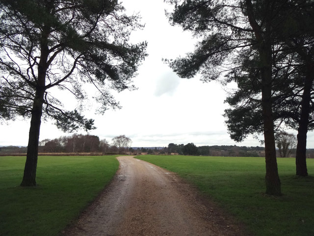
Barrow Hill, located in Dorset, England, is a prominent hill that offers breathtaking views and holds historical significance. Rising to a height of 219 meters, it stands as an impressive landmark in the region. The hill is situated near the village of Abbotsbury, approximately 14 kilometers west of Weymouth.

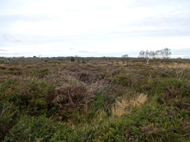
Covered in lush greenery, Barrow Hill is a popular destination for hikers and nature enthusiasts. Its slopes are home to a variety of flora and fauna, providing a serene and picturesque setting for outdoor activities. The hill is also part of the Jurassic Coast, a UNESCO World Heritage site known for its geological and fossil-rich landscapes.

Barrow Hill is steeped in history, with evidence of human activity dating back thousands of years. Archaeological excavations have revealed the presence of Iron Age settlements on the hill, indicating its significance as a strategic location in ancient times. Additionally, remnants of burial mounds and barrows have been found, further adding to its historical significance.

The hill offers panoramic views of the surrounding countryside, including the scenic Chesil Beach and the English Channel. On a clear day, visitors can see as far as the Isle of Portland and even the distant hills of Devon. These spectacular vistas make Barrow Hill a popular spot for photography and relaxation.

In conclusion, Barrow Hill in Dorset is a majestic natural landmark with a rich history and stunning views. Its combination of natural beauty and historical significance make it a must-visit destination for both locals and tourists alike.

If you have any feedback on the listing, please let us know in the comments section below.
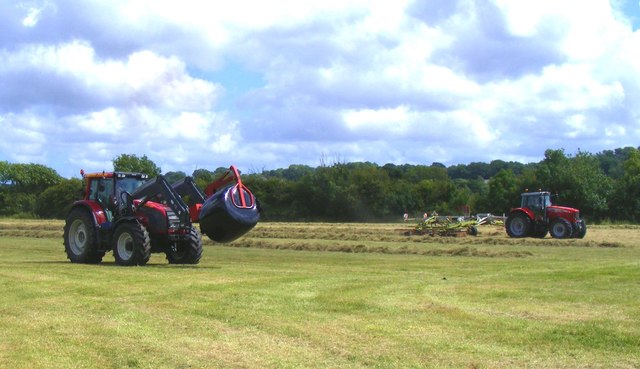
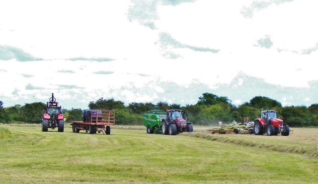
Barrow Hill Images

Images are sourced within 2km of 50.777214/-2.0062879 or Grid Reference SY9997. Thanks to Geograph Open Source API. All images are credited.

Footpath across golf course fairway A public right-of-way across one of the fairways at Broadstone Golf Course, at Corfe Hills.
Footpath across golf course fairway
A public right-of-way across one of the fairways at Broadstone Golf Course, at Corfe Hills.
Corfe and Barrow Hills Nature Reserve Looking towards Rushcombe Bottom, from the footpath across the Corfe and Barrow Hills Nature Reserve.
Corfe and Barrow Hills Nature Reserve
Looking towards Rushcombe Bottom, from the footpath across the Corfe and Barrow Hills Nature Reserve.
Tributary of the River Stour A stream passes under Mill Street, the B3078, leading to Netherwood Mead.
Tributary of the River Stour
A stream passes under Mill Street, the B3078, leading to Netherwood Mead.
Lambs Green Lane Not sure what's turning the water orange, with this field run-off.
Lambs Green Lane
Not sure what's turning the water orange, with this field run-off.
Cutting the hay at Bear Mead nature reserve, near Cowgrove
Hay cutting at Bear Mead nature reserve One of the amazing machines that cut the hay and gather it into long piles to be subsequently picked up and baled.
Hay cutting at Bear Mead nature reserve
One of the amazing machines that cut the hay and gather it into long piles to be subsequently picked up and baled.
Loading the baled and wrapped hay, ready for removal Mid-summer hay cutting at Bear Mead nature reserve
Loading the baled and wrapped hay, ready for removal
Mid-summer hay cutting at Bear Mead nature reserve
The incredible baling machine at Bear Mead nature reserve The machine scoops up the pre-cut silage and forms it into bales, then wraps it in plastic before disgorging it onto the field to await collection.
The incredible baling machine at Bear Mead nature reserve
The machine scoops up the pre-cut silage and forms it into bales, then wraps it in plastic before disgorging it onto the field to await collection.
Hay cutting at Bear Mead nature reserve One machine still cutting the grass whilst another carries away the wrapped bales to be loaded and transported.
Hay cutting at Bear Mead nature reserve
One machine still cutting the grass whilst another carries away the wrapped bales to be loaded and transported.
Hay cutting at Bear Mead nature reserve Continuous operation. Cutting of the grass and forming long lines ready for the next machine to scoop it up, form it into round bales and wrap it in plastic. It then dumps it out of the back end ready for the third machine to collect and lift it onto the flat bed trailer for subsequent transportation.
Hay cutting at Bear Mead nature reserve
Continuous operation. Cutting of the grass and forming long lines ready for the next machine to scoop it up, form it into round bales and wrap it in plastic. It then dumps it out of the back end ready for the third machine to collect and lift it onto the flat bed trailer for subsequent transportation.
Roundabout on the A31, Lambs Green This was my first digital photo in SY
Roundabout on the A31, Lambs Green
This was my first digital photo in SY
Layby on the A31, Sleight
Bale carrier on the A31, Sleight
Old Milestone by the A31, west of Lambs Green Stone post (plate lost) by the A31, in parish of CORFE MULLEN (EAST DORSET District), opposite Eastern end of Little Chef car park, on wide verge 2.5m back from road, on North side of road. Dorset 2 (limestone), erected by the Puddletown & Wimborne turnpike trust in the 19th century. 

Inscription reads:-
DORCHESTER
21
WIMBORNE
1
Carved benchmark on front face beneath lettering.

Milestone Society National ID: DO_DOWB21
Old Milestone by the A31, west of Lambs Green
Stone post (plate lost) by the A31, in parish of CORFE MULLEN (EAST DORSET District), opposite Eastern end of Little Chef car park, on wide verge 2.5m back from road, on North side of road. Dorset 2 (limestone), erected by the Puddletown & Wimborne turnpike trust in the 19th century. Inscription reads:- DORCHESTER 21 WIMBORNE 1 Carved benchmark on front face beneath lettering. Milestone Society National ID: DO_DOWB21
Old Milestone by the B3074, Corfe Mullen Carved stone post by the B3074, in parish of CORFE MULLEN (EAST DORSET District), Blandford Road, Corfe Mullen, at junction of Wimborne Rd and B3074 by Lockyers Middle School, on East side of road. Dorset 2 (limestone), erected by the Blandford & Poole turnpike trust in the 19th century. 

Inscription reads:-
POOLE
5   
Carved benchmark front lower centre.  

Milestone Society National ID: DO_POBFA05
Old Milestone by the B3074, Corfe Mullen
Carved stone post by the B3074, in parish of CORFE MULLEN (EAST DORSET District), Blandford Road, Corfe Mullen, at junction of Wimborne Rd and B3074 by Lockyers Middle School, on East side of road. Dorset 2 (limestone), erected by the Blandford & Poole turnpike trust in the 19th century. Inscription reads:- POOLE 5 Carved benchmark front lower centre. Milestone Society National ID: DO_POBFA05
Old Direction Sign - Signpost by Wimborne Elms, Corfe Mullen parish Annulus and bar finial - 3 arms; Dorset halo with NGR by the UC road, in parish of Corfe Mullen (East Dorset District), Cogdean Elms, junction of Wimborne Road with Higher Merley Lane.

Surveyed

Milestone Society National ID: DO_SY9997
Old Direction Sign - Signpost by Wimborne Elms, Corfe Mullen parish
Annulus and bar finial - 3 arms; Dorset halo with NGR by the UC road, in parish of Corfe Mullen (East Dorset District), Cogdean Elms, junction of Wimborne Road with Higher Merley Lane. Surveyed Milestone Society National ID: DO_SY9997
Lay-by on B3078 north of Lamb's Green
Show me another place!

Barrow Hill is located at Grid Ref: SY9997 (Lat: 50.777214, Lng: -2.0062879)

Unitary Authority: Bournemouth, Christchurch and Poole

Police Authority: Dorset

What 3 Words

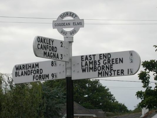
///triathlon.purses.definite. Near Wimborne Minster, Dorset

Related Wikis

Corfe Barrows Nature Park

Corfe Barrows Nature Park comprises around nine natural areas, covering an area of 90 hectares, within the Borough of Poole that are being managed for...

Corfe Hills School

Corfe Hills School is a co-educational upper school in Broadstone, Poole, Dorset, England, in the urban fringe between Poole and Wimborne. The school became...

Corfe & Barrow Hills

Corfe & Barrow Hills is a 102.8 hectare biological Site of Special Scientific Interest in Dorset, notified in 1986. One part of it is a Local Nature Reserve...

Ashington, Dorset

Ashington is a hamlet in Dorset, England. It lies within the unitary authority of Bournemouth, Christchurch and Poole, between the villages of Corfe Mullen...

Nearby Amenities

Located within 500m of 50.777214,-2.0062879
Street Lamp
Ref: 3C281
Lat/Long: 50.7797641/-2.0108859
Street Lamp
Lat/Long: 50.7798352/-2.0112943
Street Lamp
Lat/Long: 50.7798634/-2.010465
Street Lamp
Lat/Long: 50.7800968/-2.0113817
Street Lamp
Lat/Long: 50.780371/-2.0113212
Street Lamp
Lat/Long: 50.780477/-2.0107033
Street Lamp
Lat/Long: 50.780538/-2.0109896
Street Lamp
Ref: 4L37
Lat/Long: 50.7785736/-2.0130224
Street Lamp
Ref: 5L37
Lat/Long: 50.7786287/-2.0124933
Street Lamp
Ref: 6L37
Lat/Long: 50.7787525/-2.0121044
Street Lamp
Ref: 7L37
Lat/Long: 50.7788369/-2.011922
Street Lamp
Ref: 11L37
Lat/Long: 50.7789632/-2.0110784
Street Lamp
Ref: 8L37
Lat/Long: 50.7790696/-2.0112742
Street Lamp
Ref: 10L37
Lat/Long: 50.7791841/-2.0108947
Street Lamp
Lat/Long: 50.7792816/-2.0103824
Street Lamp
Ref: 9L37
Lat/Long: 50.7794788/-2.0108672
Information: board
Tourism: information
Lat/Long: 50.7812996/-2.0092595
Barrier: kissing_gate
Bicycle: no
Foot: yes
Lat/Long: 50.7793965/-2.0002792
Access: no
Barrier: kissing_gate
Bicycle: no
Foot: permissive
Lat/Long: 50.7811036/-2.0079607
Access: no
Barrier: kissing_gate
Bicycle: no
Foot: permissive
Lat/Long: 50.7811578/-2.0079215
Power: pole
Lat/Long: 50.7779114/-2.0089758
Power: pole
Lat/Long: 50.778261/-2.0087692
Power: pole
Lat/Long: 50.7786446/-2.0071189
Power: pole
Lat/Long: 50.7788517/-2.0043828
Power: pole
Lat/Long: 50.7792419/-2.0037138
Power: pole
Lat/Long: 50.7795934/-2.0030233
Power: pole
Lat/Long: 50.78014/-2.0029374
Pole: transition
Power: pole
Lat/Long: 50.7808091/-2.0028071
Power: pole
Lat/Long: 50.7773731/-2.009959
Power: pole
Lat/Long: 50.777401/-2.0097043
Power: pole
Lat/Long: 50.7795634/-2.0073105
Power: pole
Lat/Long: 50.7799892/-2.0084231
Power: pole
Lat/Long: 50.7806673/-2.0094452
Power: pole
Lat/Long: 50.7784969/-2.0082624
Power: pole
Lat/Long: 50.7786688/-2.0058185
Barrier: stile
Foot: yes
Lat/Long: 50.7762732/-2.0040076
Barrier: stile
Foot: yes
Lat/Long: 50.7759407/-2.0070908
Brookvale Farm
Place: farm
Source: OS OpenData StreetView
Lat/Long: 50.7784402/-2.0044202
Barrow Hill
Place: locality
Source: OS OpenData StreetView
Lat/Long: 50.7782265/-2.0074927
Man Made: water_well
Lat/Long: 50.7751174/-2.0015175
Generator Method: photovoltaic
Generator Output Electricity: yes
Generator Source: solar
Generator Type: solar_photovoltaic_panel
Location: roof
Power: generator
Lat/Long: 50.7744923/-2.0114423
Generator Method: photovoltaic
Generator Output Electricity: yes
Generator Source: solar
Generator Type: solar_photovoltaic_panel
Location: roof
Power: generator
Lat/Long: 50.7739617/-2.0110142
Barrier: kissing_gate
Foot: yes
Lat/Long: 50.7785799/-2.0059044
Barrier: kissing_gate
Foot: yes
Lat/Long: 50.7795183/-2.0070705
Barrier: kissing_gate
Foot: yes
Lat/Long: 50.780249/-2.0075316
Barrier: kissing_gate
Lat/Long: 50.780146/-2.008078
Barrier: kissing_gate
Foot: yes
Lat/Long: 50.7806496/-2.0093749
Barrier: kissing_gate
Lat/Long: 50.7797012/-2.0072036
Barrier: kissing_gate
Bicycle: no
Foot: yes
Lat/Long: 50.7791591/-2.0094714
Archaeological Site: tumulus
Historic: archaeological_site
Lat/Long: 50.77862/-2.007203
Archaeological Site: tumulus
Historic: archaeological_site
Lat/Long: 50.778754/-2.0075449
Barrier: kissing_gate
Foot: yes
Lat/Long: 50.7801893/-2.0073166
The data included in this document is from www.openstreetmap.org. The data is made available under ODbL.

Have you been to Barrow Hill?

Leave your review of Barrow Hill below (or comments, questions and feedback).