Milltown of Rothiemay

Settlement in Banffshire

Scotland

Milltown of Rothiemay

View to Retanach From a minor road near Moss-side.
View to Retanach Credit: Alan Hodgson

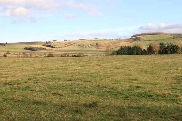
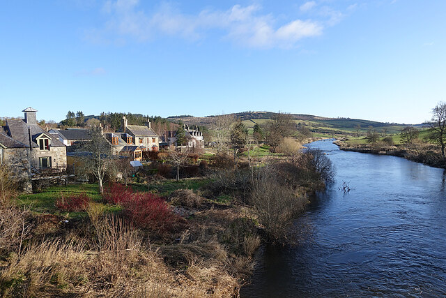
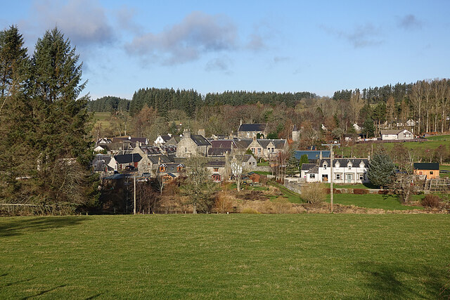
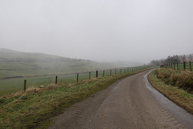
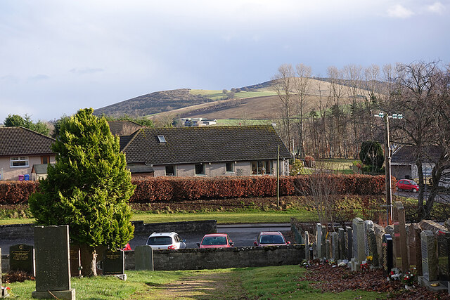
Milltown of Rothiemay is a small village located in the county of Banffshire, Scotland. Situated near the River Deveron, it is nestled amidst picturesque countryside and is surrounded by rolling hills and farmland. The village is approximately 6 miles southeast of Huntly and 40 miles northwest of Aberdeen.

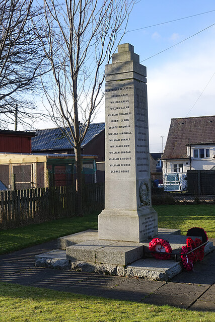
With a population of around 250 residents, Milltown of Rothiemay is a close-knit community where neighbors often know each other well. The village offers a peaceful and tranquil atmosphere, making it an ideal place for those seeking a laid-back lifestyle away from the hustle and bustle of larger towns and cities.

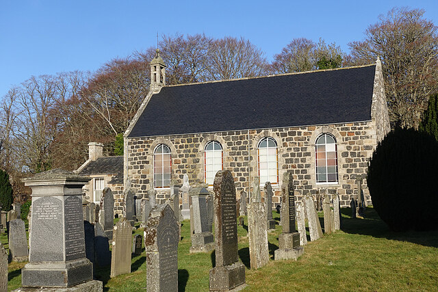
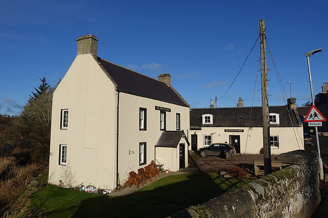
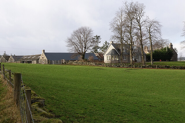
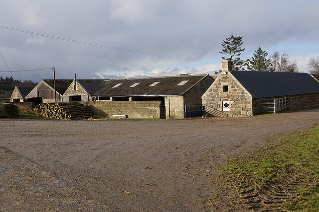
Milltown of Rothiemay has a rich history, with its origins dating back to the 18th century. The village was primarily an agricultural center, and evidence of its past can still be seen in the well-preserved stone buildings and traditional farmhouses that dot the landscape.

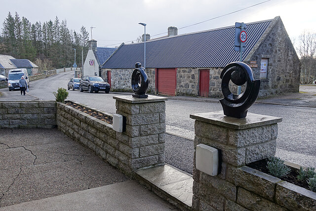
Today, the village boasts a few amenities to cater to the needs of its residents. These include a local pub, a primary school, and a village hall, which serves as a hub for community gatherings and events. The surrounding area offers opportunities for outdoor activities such as hiking, fishing, and cycling.

Although small in size, Milltown of Rothiemay is a charming and welcoming village that provides a peaceful retreat for its residents, preserving the timeless beauty of rural Scotland.

If you have any feedback on the listing, please let us know in the comments section below.

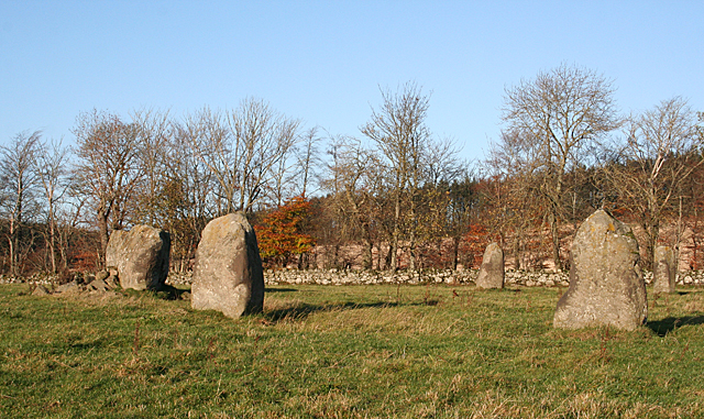
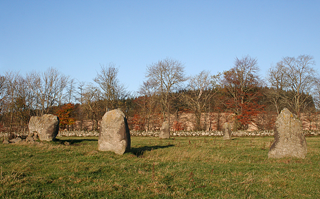
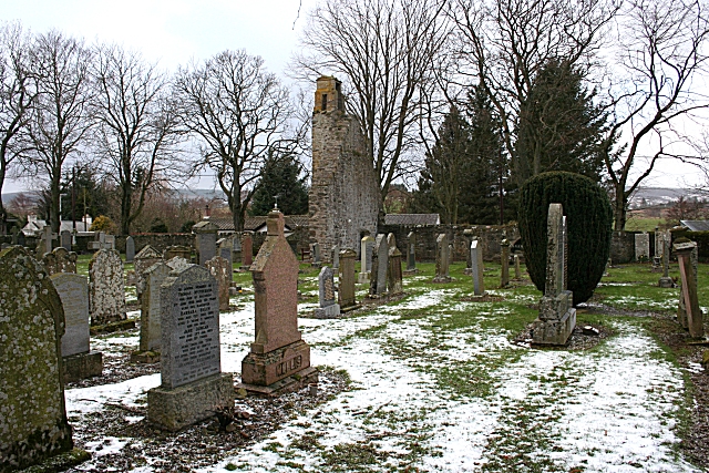
Milltown of Rothiemay Images

Images are sourced within 2km of 57.525628/-2.756674 or Grid Reference NJ5448. Thanks to Geograph Open Source API. All images are credited.

View to Retanach From a minor road near Moss-side.
View to Retanach
From a minor road near Moss-side.
Rothiemay Parish Kirk The kirk dates from 1807 and is a Category B Listed building. It incorporates some features from earlier buildings. See <span class="nowrap"><a title="http://portal.historicenvironment.scot/designation/LB15616" rel="nofollow ugc noopener" href="http://portal.historicenvironment.scot/designation/LB15616">Link</a><img style="margin-left:2px;" alt="External link" title="External link - shift click to open in new window" src="https://s1.geograph.org.uk/img/external.png" width="10" height="10"/></span> for more details.
Rothiemay Parish Kirk
The kirk dates from 1807 and is a Category B Listed building. It incorporates some features from earlier buildings. See LinkExternal link for more details.
Rothiemay War Memorial A plain granite monument, standing beside the main street.
Rothiemay War Memorial
A plain granite monument, standing beside the main street.
Forbes Arms Hotel The two-storey house is 18th century and the one-and-s-half storey extension is later. It is a Category B Listed building. See <span class="nowrap"><a title="http://portal.historicenvironment.scot/designation/LB15614" rel="nofollow ugc noopener" href="http://portal.historicenvironment.scot/designation/LB15614">Link</a><img style="margin-left:2px;" alt="External link" title="External link - shift click to open in new window" src="https://s1.geograph.org.uk/img/external.png" width="10" height="10"/></span> for details.
Forbes Arms Hotel
The two-storey house is 18th century and the one-and-s-half storey extension is later. It is a Category B Listed building. See LinkExternal link for details.
River Deveron Looking downstream from the bridge at Milltown.
River Deveron
Looking downstream from the bridge at Milltown.
Milltown of Rothiemay Although officially called Milltown of Rothiemay, most local people refer to it simply as Rothiemay. The River Deveron is in the dip between the foreground field and the village.
Milltown of Rothiemay
Although officially called Milltown of Rothiemay, most local people refer to it simply as Rothiemay. The River Deveron is in the dip between the foreground field and the village.
Drystane Dyke A rather haphazard-looking dyke on the side of the road to Redhill.
Drystane Dyke
A rather haphazard-looking dyke on the side of the road to Redhill.
Gate with a View From the gate the land drops steeply to the River Deveren, rising again to the grounds of Rothiemay House, with its clumps of conifers. Knock Hill, on the skyline, dominates the view.
Gate with a View
From the gate the land drops steeply to the River Deveren, rising again to the grounds of Rothiemay House, with its clumps of conifers. Knock Hill, on the skyline, dominates the view.
Snow Shower So much for getting some sunlit shots from the road on the right bank of the River Deveron. The weather had been getting steadily worse, and we found ourselves walking into the teeth of an icy shower. This is the view back, with the camera facing away from the windblown snow.
Snow Shower
So much for getting some sunlit shots from the road on the right bank of the River Deveron. The weather had been getting steadily worse, and we found ourselves walking into the teeth of an icy shower. This is the view back, with the camera facing away from the windblown snow.
Corsekellie Farm Corskellie lies astride the minor road, with outbuildings on both sides. These are the buildings on the north side, closer to the River Deveron.
Corsekellie Farm
Corskellie lies astride the minor road, with outbuildings on both sides. These are the buildings on the north side, closer to the River Deveron.
Corskellie Farm Some of the extensive range of traditional stone buildings on the north side of the minor road.
Corskellie Farm
Some of the extensive range of traditional stone buildings on the north side of the minor road.
Interesting Gateposts We were lured through the gateway by a window display of fascinating old objects, like a little heritage museum. The white van is a travelling butcher's shop, and the lady walking up the street has just been buying from it. Now that there is no shop at all in the village, the van must be very welcome.
Interesting Gateposts
We were lured through the gateway by a window display of fascinating old objects, like a little heritage museum. The white van is a travelling butcher's shop, and the lady walking up the street has just been buying from it. Now that there is no shop at all in the village, the van must be very welcome.
Milltown of Rothiemay Having left our car beside a sign saying that the parking area (the only one in the village) is for visitors to the cemetery, we felt obliged to visit the cemetery when we returned from our walk. This was far from being a hardship, because as well as some interesting gravestones there is a bench which offered us this view while we relaxed in the sunshine with the second instalment of our picnic. (The three cars in view were all there when we first arrived, and still there when we left to go home, but we saw no-one else visiting the cemetery.) On the skyline is Fourman Hill, and our seven-mile walk had taken us over the shoulder of the hill past the scattered trees.
Milltown of Rothiemay
Having left our car beside a sign saying that the parking area (the only one in the village) is for visitors to the cemetery, we felt obliged to visit the cemetery when we returned from our walk. This was far from being a hardship, because as well as some interesting gravestones there is a bench which offered us this view while we relaxed in the sunshine with the second instalment of our picnic. (The three cars in view were all there when we first arrived, and still there when we left to go home, but we saw no-one else visiting the cemetery.) On the skyline is Fourman Hill, and our seven-mile walk had taken us over the shoulder of the hill past the scattered trees.
OS Cut Mark - Rothiemay, Bridge over the Deveron Bridge Parapet Buttress NW SIDE RD
OS Cut Mark - Rothiemay, Bridge over the Deveron
Bridge Parapet Buttress NW SIDE RD
Rothiemay Recumbent Stone Circle (1) It's easy to miss this modest sign at the gate to the field containing the standing stones. <a href="https://www.geograph.org.uk/photo/4742957">NJ5548 : Rothiemay Recumbent Stone Circle (2)</a>
Rothiemay Recumbent Stone Circle (1)
It's easy to miss this modest sign at the gate to the field containing the standing stones. NJ5548 : Rothiemay Recumbent Stone Circle (2)
Rothiemay Recumbent Stone Circle (2) Until some time in the 1840s this circle was complete, but a farm bailiff had some removed in the 1840s, and only the intervention of the landowner prevented further destruction. Now, only five stones survive. See <span class="nowrap"><a title="https://canmore.org.uk/site/17820/rothiemay" rel="nofollow ugc noopener" href="https://canmore.org.uk/site/17820/rothiemay">Link</a><img style="margin-left:2px;" alt="External link" title="External link - shift click to open in new window" src="https://s1.geograph.org.uk/img/external.png" width="10" height="10"/></span> for more information. <a href="https://www.geograph.org.uk/photo/4742964">NJ5548 : Rothiemay Recumbent Stone Circle (3)</a>
Rothiemay Recumbent Stone Circle (2)
Until some time in the 1840s this circle was complete, but a farm bailiff had some removed in the 1840s, and only the intervention of the landowner prevented further destruction. Now, only five stones survive. See LinkExternal link for more information. NJ5548 : Rothiemay Recumbent Stone Circle (3)
Rothiemay Recumbent Stone Circle (3) This is the view from the south-east. Nearest the camera are the two stones on the south-eastern arc of the circle. To the left is the recumbent, and in the background are the two stones on the north-western arc.  See <span class="nowrap"><a title="https://canmore.org.uk/site/17820/rothiemay" rel="nofollow ugc noopener" href="https://canmore.org.uk/site/17820/rothiemay">Link</a><img style="margin-left:2px;" alt="External link" title="External link - shift click to open in new window" src="https://s1.geograph.org.uk/img/external.png" width="10" height="10"/></span> for more information. <a href="https://www.geograph.org.uk/photo/4742971">NJ5548 : Rothiemay Recumbent Stone Circle (4)</a>
Rothiemay Recumbent Stone Circle (3)
This is the view from the south-east. Nearest the camera are the two stones on the south-eastern arc of the circle. To the left is the recumbent, and in the background are the two stones on the north-western arc. See LinkExternal link for more information. NJ5548 : Rothiemay Recumbent Stone Circle (4)
Rothiemay Recumbent Stone Circle (4) From the south-east, the two stones in the north-west are framed in the space between the two on the south-east. The recumbent is to the left. See <span class="nowrap"><a title="https://canmore.org.uk/site/17820/rothiemay" rel="nofollow ugc noopener" href="https://canmore.org.uk/site/17820/rothiemay">Link</a><img style="margin-left:2px;" alt="External link" title="External link - shift click to open in new window" src="https://s1.geograph.org.uk/img/external.png" width="10" height="10"/></span> for more information. <a href="https://www.geograph.org.uk/photo/4742978">NJ5548 : Rothiemay Recumbent Stone Circle (5)</a>
Rothiemay Recumbent Stone Circle (4)
From the south-east, the two stones in the north-west are framed in the space between the two on the south-east. The recumbent is to the left. See LinkExternal link for more information. NJ5548 : Rothiemay Recumbent Stone Circle (5)
Show me another place!

Milltown of Rothiemay is located at Grid Ref: NJ5448 (Lat: 57.525628, Lng: -2.756674)

Unitary Authority: Moray

Police Authority: North East

What 3 Words

///tadpole.donation.money. Near Aberchirder, Aberdeenshire

Related Wikis

Milltown of Rothiemay

Milltown of Rothiemay (Scottish Gaelic: Ràth a' Mhuigh) is a small inland village, built mostly of granite, in the north-east of Scotland and is within...

River Isla, Moray

The River Isla (Scottish Gaelic: Uisge Ìle) is a tributary of the River Deveron in North-East Scotland. The area surrounding it is known as Strathisla...

Avochie Castle

Avochie Castle is a ruined tower house, dating from the 16th century, or early 17th century, around 4.5 miles (7.2 km) north of Huntly, east of the river...

Mountains Burn

Mountains Burn is a burn which marks the boundary of the parish of Huntly, Aberdeenshire, Scotland. == References ==

Rothiemay railway station

Rothiemay railway station served the village of Milltown of Rothiemay, Aberdeenshire, Scotland from 1856 to 1968 on the Great North of Scotland Railway...

Fourman Hill

Fourman Hill is a hill located west of Bogniebrae, Aberdeenshire, Scotland. It has an elevation of 1,127 feet (344 m). A cairn near the summit marked the...

Millegin railway station

Millegin railway station, Millagan railway station or later Millegin Siding was briefly an intermediate stop situated on what became the Great North of...

Ruthven, Aberdeenshire

Ruthven (, Gaelic: Ruadhainn), Aberdeenshire is a village in Scotland near Huntly (to the south east), and Keith (to the north west). It is traditionally...

Nearby Amenities

Located within 500m of 57.525628,-2.756674
Milltown of Rothiemay
Name Ga: Ráth a' Mhuigh
Name Gd: Ràth a' Mhuigh
Place: village
Wikidata: Q15059258
Wikipedia: en:Milltown of Rothiemay
Lat/Long: 57.5225539/-2.7566902
Forbes Arms Hotel
Tourism: hotel
Lat/Long: 57.5211929/-2.7563964
Recycling
Lat/Long: 57.524678/-2.7565816
Bus Stop
Lat/Long: 57.5215688/-2.7561684
Post Box
Operator: Royal Mail
Post Box Mounting: building
Post Box Type: wall
Ref: AB54 76
Royal Cypher: GVIR
Lat/Long: 57.521448/-2.7563062
Power: pole
Lat/Long: 57.5244642/-2.7571138
Power: pole
Lat/Long: 57.52447/-2.7579494
Power: pole
Lat/Long: 57.5244642/-2.7589906
Power: pole
Lat/Long: 57.5248129/-2.7601856
Power: pole
Lat/Long: 57.5249581/-2.760716
Power: pole
Lat/Long: 57.5254091/-2.7611944
Power: pole
Lat/Long: 57.5260066/-2.7618958
Power: pole
Lat/Long: 57.5266121/-2.762937
Power: pole
Lat/Long: 57.5270852/-2.7636449
Power: pole
Lat/Long: 57.5257619/-2.7483064
Power: pole
Lat/Long: 57.5259594/-2.7494004
Power: pole
Lat/Long: 57.5256931/-2.7503711
Power: pole
Lat/Long: 57.5253937/-2.7514509
Power: pole
Lat/Long: 57.5251019/-2.7524975
Power: pole
Lat/Long: 57.5249018/-2.7534634
Power: pole
Lat/Long: 57.5247158/-2.7543865
Power: pole
Lat/Long: 57.5245106/-2.7552883
Power: pole
Lat/Long: 57.5218181/-2.7607206
Power: pole
Lat/Long: 57.5225369/-2.7610083
Power: pole
Lat/Long: 57.5230507/-2.7612154
Power: pole
Lat/Long: 57.5237045/-2.7609488
Power: pole
Lat/Long: 57.5241905/-2.7607436
Bench
Backrest: yes
Lat/Long: 57.5227367/-2.7568676
Rothiemay War Memorial
Historic: memorial
Memorial: war_memorial
Wikidata: Q114168966
Lat/Long: 57.5226806/-2.7567791
The data included in this document is from www.openstreetmap.org. The data is made available under ODbL.

Have you been to Milltown of Rothiemay?

Leave your review of Milltown of Rothiemay below (or comments, questions and feedback).