Horselees

Settlement in Kent Swale

England

Horselees

Boughton Golf Course, Boughton-under-Blean Viewed from the footpath that leads from the village to the church of St. Peter and St. Paul on South Street.
Boughton Golf Course, Boughton-under-Blean Credit: pam fray

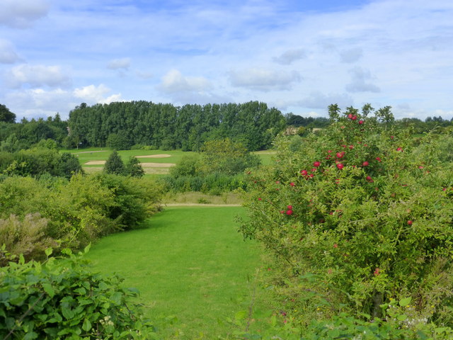
Horselees is a picturesque rural village located in the county of Kent, England. Nestled amidst rolling green hills and surrounded by beautiful countryside, the village offers a tranquil and idyllic setting for its residents and visitors alike.

The village of Horselees is home to a small, close-knit community that prides itself on its friendly and welcoming atmosphere. The residents often organize community events and activities, fostering a strong sense of camaraderie among the villagers.

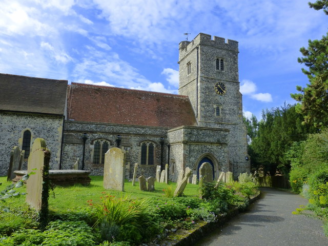
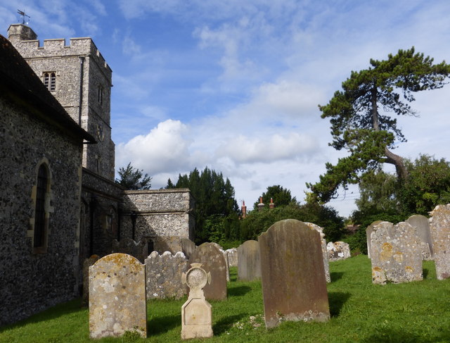
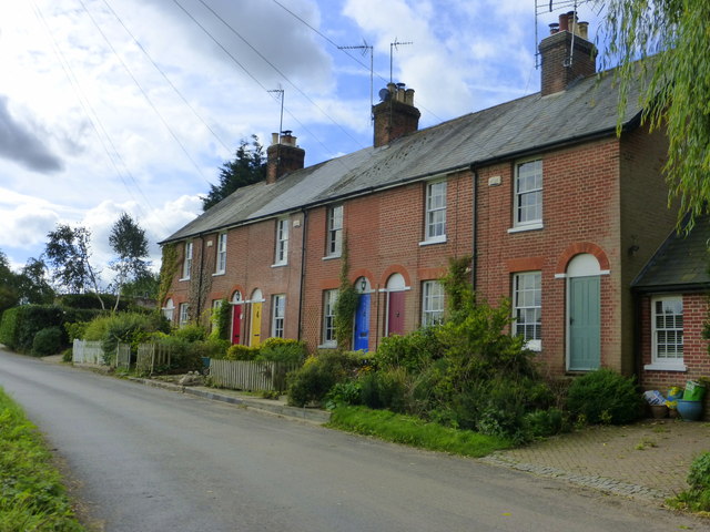
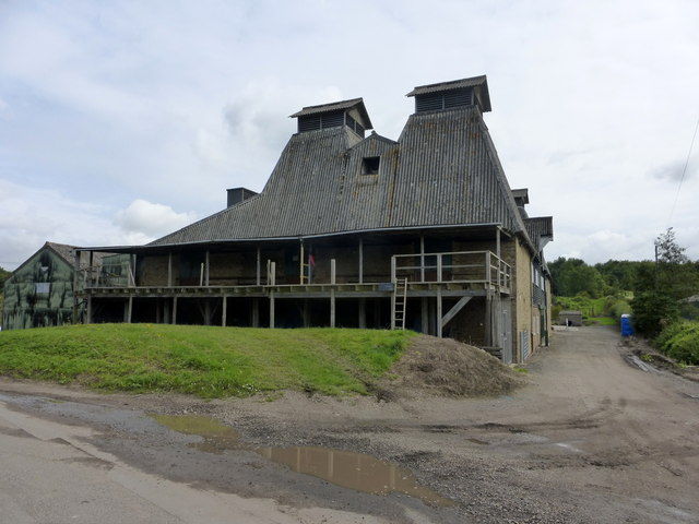
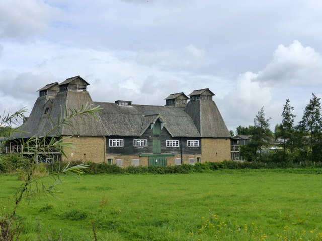
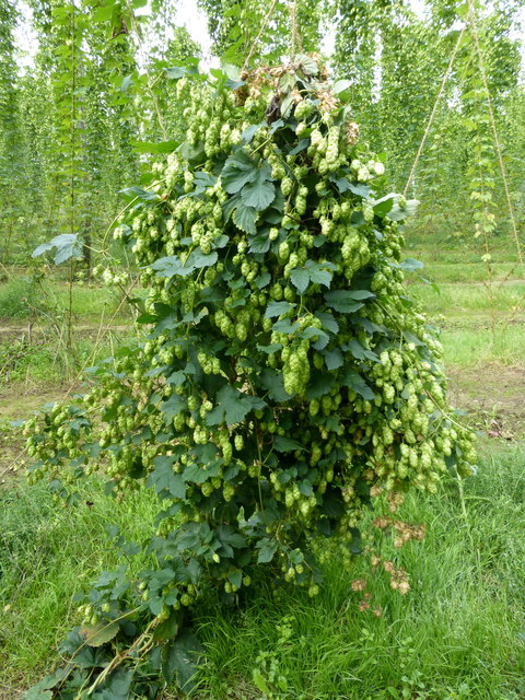
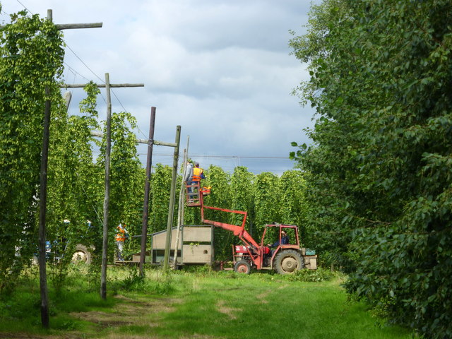
The village is characterized by its charming architecture, with many traditional cottages and houses dotting the landscape. These buildings often feature the iconic Kentish oast houses, which were historically used for drying hops.

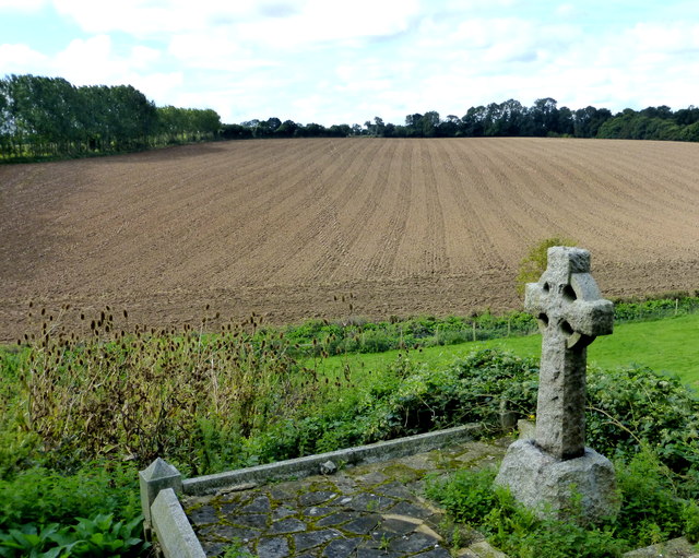
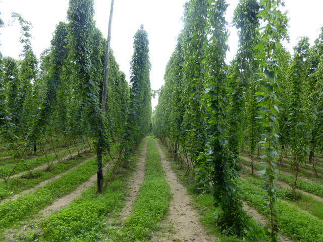
Horselees is also known for its thriving agricultural industry, with several farms and fields in the surrounding area. The fertile soil and favorable climate make it an ideal location for growing a variety of crops, including fruits, vegetables, and grains.

In terms of amenities, Horselees boasts a small but well-equipped village hall, which serves as a hub for social gatherings and community events. There are also a few local businesses, including a post office and a village shop, providing essential services to the residents.

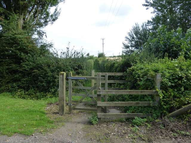
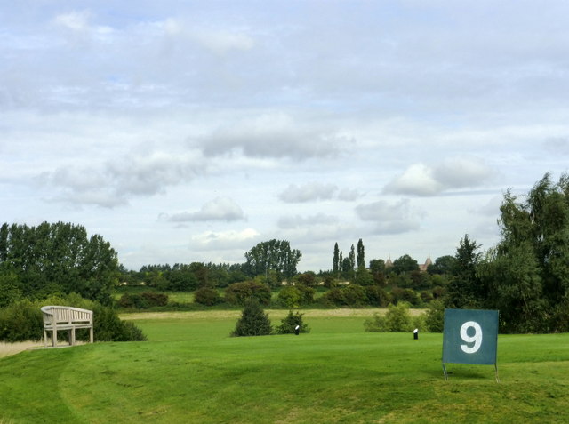
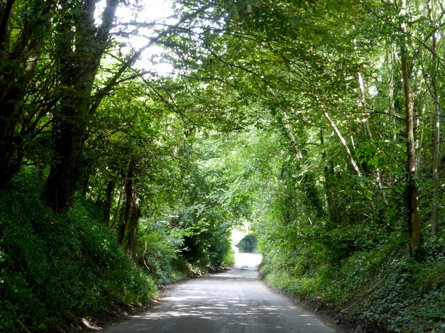
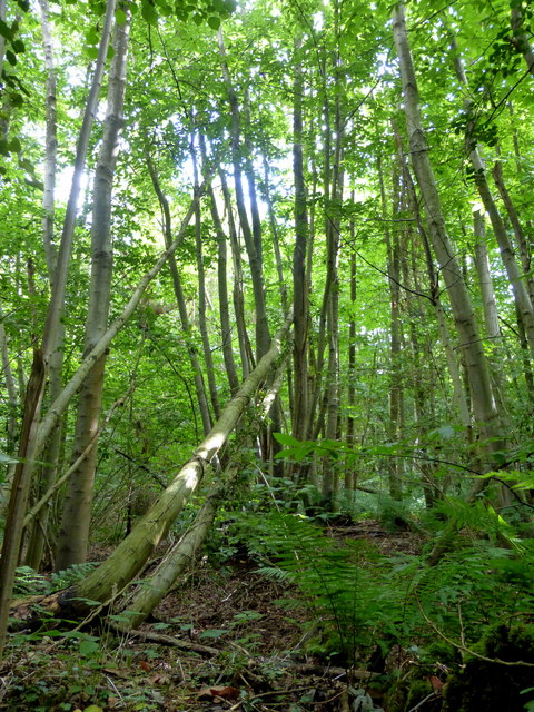
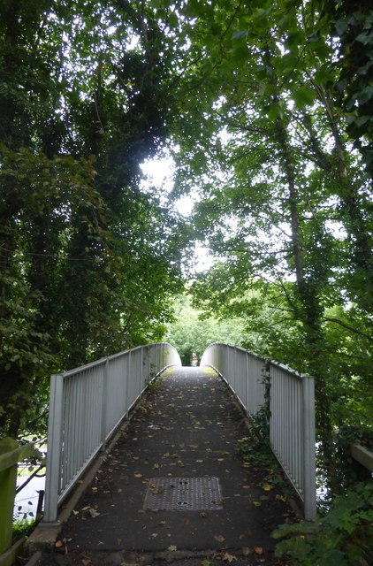
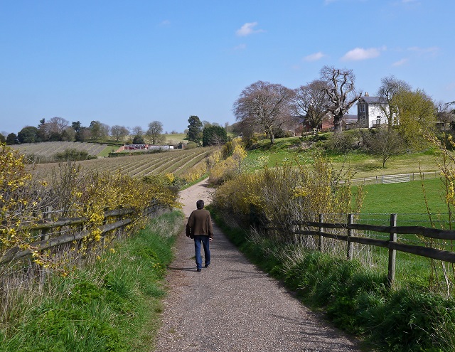
For those seeking outdoor activities, Horselees offers plenty of opportunities for exploration. The surrounding countryside is crisscrossed with walking and cycling paths, allowing visitors to immerse themselves in the stunning natural scenery.

Overall, Horselees is a charming and peaceful village that captures the essence of rural life in the heart of Kent. With its beautiful surroundings, strong community spirit, and agricultural heritage, it is a place that truly embodies the charm of the English countryside.

If you have any feedback on the listing, please let us know in the comments section below.
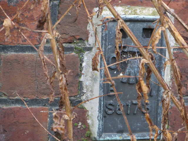
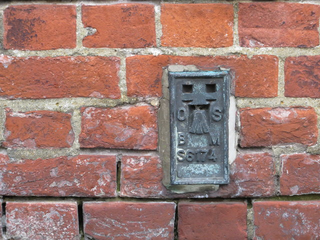
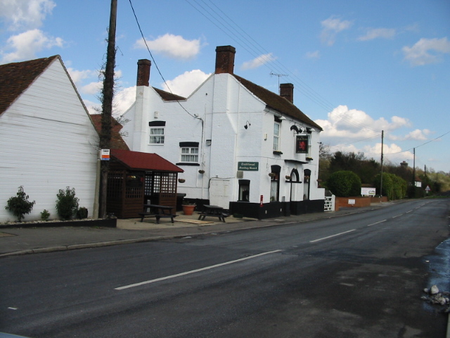
Horselees Images

Images are sourced within 2km of 51.292526/0.96229657 or Grid Reference TR0658. Thanks to Geograph Open Source API. All images are credited.

Boughton Golf Course, Boughton-under-Blean Viewed from the footpath that leads from the village to the church of St. Peter and St. Paul on South Street.
Boughton Golf Course, Boughton-under-Blean
Viewed from the footpath that leads from the village to the church of St. Peter and St. Paul on South Street.
Footpath from Boughton-under-Blean to South Street The path crosses Boughton Golf Course and leads from the village to the parish church of St. Peter and St. Paul which is about a mile from the village centre.
Footpath from Boughton-under-Blean to South Street
The path crosses Boughton Golf Course and leads from the village to the parish church of St. Peter and St. Paul which is about a mile from the village centre.
The 9th hole, Boughton Golf Course Viewed from the footpath that leads from the village to the church of St. Peter and St. Paul on South Street.
The 9th hole, Boughton Golf Course
Viewed from the footpath that leads from the village to the church of St. Peter and St. Paul on South Street.
Boughton Church, South Street The church of St. Peter and St. Paul, Boughton-under-Blean, is a Grade I listed medieval building, situated nearly a mile from the village centre. The footpath leading to it is known as the coffin track as the funeral procession used to travel along it with the coffin on a cart.
Boughton Church, South Street
The church of St. Peter and St. Paul, Boughton-under-Blean, is a Grade I listed medieval building, situated nearly a mile from the village centre. The footpath leading to it is known as the coffin track as the funeral procession used to travel along it with the coffin on a cart.
View from Boughton churchyard Looking towards Selling.The church of St. Peter and St. Paul, Boughton-under-Blean, is a Grade I listed medieval building, situated nearly a mile from the village centre.
View from Boughton churchyard
Looking towards Selling.The church of St. Peter and St. Paul, Boughton-under-Blean, is a Grade I listed medieval building, situated nearly a mile from the village centre.
Boughton church and churchyard, South Street The church of St. Peter and St. Paul, Boughton-under-Blean, is a Grade I listed medieval building, situated nearly a mile from the village centre. The footpath leading to it is known as the coffin track as the funeral procession used to travel along it with the coffin on a cart.
Boughton church and churchyard, South Street
The church of St. Peter and St. Paul, Boughton-under-Blean, is a Grade I listed medieval building, situated nearly a mile from the village centre. The footpath leading to it is known as the coffin track as the funeral procession used to travel along it with the coffin on a cart.
Cottages in South Street, Boughton-under-Blean Being so close to Boughton Church Farm, I assume that these dwellings were originally built for farm workers.
Cottages in South Street, Boughton-under-Blean
Being so close to Boughton Church Farm, I assume that these dwellings were originally built for farm workers.
Oast house, South Street, Boughton-under-Blean One of the few working oasts in the area.
Oast house, South Street, Boughton-under-Blean
One of the few working oasts in the area.
Oast house, South Street, Boughton-under-Blean One of the few working oasts in the area.
Oast house, South Street, Boughton-under-Blean
One of the few working oasts in the area.
Horselees Road, by Meadow Wood Looking towards Boughton-under-Blean
Horselees Road, by Meadow Wood
Looking towards Boughton-under-Blean
Meadow Wood, near Boughton-under-Blean Viewed from Horselees Road.
Meadow Wood, near Boughton-under-Blean
Viewed from Horselees Road.
Hop fields, Boughton-under-Blean Situated on the south side of the A2 road from Faversham to Canterbury. It is now hop picking time and Faversham Hop Festival is about to begin.
Hop fields, Boughton-under-Blean
Situated on the south side of the A2 road from Faversham to Canterbury. It is now hop picking time and Faversham Hop Festival is about to begin.
Hops in a field in Boughton-under-Blean Situated on the south side of the A2 road from Faversham to Canterbury. It is now hop picking time and Faversham Hop Festival is about to begin.
Hops in a field in Boughton-under-Blean
Situated on the south side of the A2 road from Faversham to Canterbury. It is now hop picking time and Faversham Hop Festival is about to begin.
Hop picking, modern style. Boughton-under-Blean Situated on the south side of the A2 road from Faversham to Canterbury. Hop picking is now under way and Faversham Hop Festival is about to begin.
Hop picking, modern style. Boughton-under-Blean
Situated on the south side of the A2 road from Faversham to Canterbury. Hop picking is now under way and Faversham Hop Festival is about to begin.
Footbridge over the A2 Boughton bypass Looking north towards Boughton Street.
Footbridge over the A2 Boughton bypass
Looking north towards Boughton Street.
'The Bounds' From Bounds Lane
'The Bounds'
From Bounds Lane
Ordnance Survey Flush Bracket S6173 This can be found on the roadside wall of the former primary school in Dunkirk.
For more detail see : <span class="nowrap"><a title="http://www.bench-marks.org.uk/bm19720" rel="nofollow ugc noopener" href="http://www.bench-marks.org.uk/bm19720">Link</a><img style="margin-left:2px;" alt="External link" title="External link - shift click to open in new window" src="https://s1.geograph.org.uk/img/external.png" width="10" height="10"/></span>
Ordnance Survey Flush Bracket S6173
This can be found on the roadside wall of the former primary school in Dunkirk. For more detail see : LinkExternal link
Ordnance Survey Flush Bracket S6174 This can be found on the wall of the Primary School in Boughton Street.
For more detail see : <span class="nowrap"><a title="http://www.bench-marks.org.uk/bm19721" rel="nofollow ugc noopener" href="http://www.bench-marks.org.uk/bm19721">Link</a><img style="margin-left:2px;" alt="External link" title="External link - shift click to open in new window" src="https://s1.geograph.org.uk/img/external.png" width="10" height="10"/></span>
Ordnance Survey Flush Bracket S6174
This can be found on the wall of the Primary School in Boughton Street. For more detail see : LinkExternal link
Show me another place!

Horselees is located at Grid Ref: TR0658 (Lat: 51.292526, Lng: 0.96229657)

Administrative County: Kent

District: Swale

Police Authority: Kent

What 3 Words

///outbursts.briefer.fabric. Near Chartham, Kent

Related Wikis

Boughton under Blean

Boughton under Blean is a village and civil parish between Faversham and Canterbury in south-east England. "Boughton under Blean" technically refers only...

Mount Ephraim Gardens

Mount Ephraim Gardens is an Edwardian terraced gardens located at Hernhill, near Faversham, in the English county of Kent. == History == The gardens are...

Dunkirk, Kent

Dunkirk is a village and civil parish between Faversham and Canterbury in southeast England. It lies on the Canterbury Road between Boughton under Blean...

Staplestreet

Staplestreet is a village near the village of Boughton Street, in the Swale District of the English county of Kent. It is east of the town of Faversham...

Hernhill

Hernhill is a village and civil parish between Faversham and Canterbury in southeast England. The parish includes the hamlets of Crockham, Dargate, The...

Oversland

Oversland is a settlement in the Swale district of Kent, England. It is located about 1 mile (1.6 km) to the west of Selling and is situated near Selling...

Battle of Bossenden Wood

The Battle of Bossenden Wood took place on 31 May 1838 near Hernhill in Kent; it has been called the last battle on English soil. The battle was fought...

Selling railway station

Selling railway station is on the Dover branch of the Chatham Main Line in England, serving the village of Selling, Kent. It is 55 miles 18 chains (88...

Nearby Amenities

Located within 500m of 51.292526,0.96229657
Post Box
Postal Code: ME13
Ref: ME13 66
Lat/Long: 51.2923563/0.9572866
Bus Stop
Wood's Garage
Naptan AtcoCode: 2400A038880A
Naptan Bearing: E
Naptan CommonName: Wood's Garage
Naptan Indicator: opp
Naptan Landmark: Wood's Garage
Naptan NaptanCode: kntdpjdp
Naptan Street: The Street
Naptan Verified: no
Public Transport: platform
Ref: kntdpjdp
Source: naptan_import
Source Date: 2018-03-26T15:45:00
Lat/Long: 51.2951391/0.9571998
Bus Stop
Staplestreet Road
Naptan AtcoCode: 2400A038890A
Naptan Bearing: E
Naptan CommonName: Staplestreet Road
Naptan Indicator: adj
Naptan Landmark: Staplestreet Road
Naptan NaptanCode: kntdpjdt
Naptan Street: Canterbury Road
Naptan Verified: no
Public Transport: platform
Ref: kntdpjdt
Source: naptan_import
Source Date: 2018-03-26T15:54:00
Lat/Long: 51.2940705/0.963888
Bus Stop
Staplestreet Road
Naptan AtcoCode: 2400A038970A
Naptan Bearing: W
Naptan CommonName: Staplestreet Road
Naptan Indicator: opp
Naptan Landmark: Staplestreet Road
Naptan NaptanCode: kntdpjgw
Naptan Street: The Street
Naptan Verified: no
Public Transport: platform
Ref: kntdpjgw
Source: naptan_import
Source Date: 2018-03-26T15:53:00
Lat/Long: 51.2940793/0.9631856
Post Box
Postal Code: ME13
Ref: ME13 20
Source: survey
Lat/Long: 51.2950383/0.9665185
Power: pole
Lat/Long: 51.2924184/0.9566042
Woods Garage & Convenience Store
Addr City: Boughton-under-Blean
Addr Housename: Woods Garage & Convenience Store
Addr Housenumber: 49
Addr Postcode: ME13 9BA
Addr Street: The Street
Fhrs Authority: Swale
Fhrs Id: 714326
Fhrs Inspectiondate: 2015-09-28
Fhrs Rating: 5
Level: 0
Shop: convenience
Lat/Long: 51.294855/0.9582494
Fuel
Gulf
Addr City: Boughton-under-Blean
Addr Housenumber: 49
Addr Postcode: ME13 9BA
Addr Street: The Street
Brand: Gulf
Brand Wikidata: Q5617505
Compressed Air: no
Self Service: yes
Source: receipt from visit
Lat/Long: 51.2948581/0.9582148
Post Office
Boughton Post Office
Addr City: Boughton-under-Blean
Addr Housenumber: 49
Addr Postcode: ME13 9BA
Addr Street: The Street
Brand: Post Office
Brand Wikidata: Q1783168
Opening Hours: Mo-Fr 07:30-18:00; Sa 08:00-13:00
Operator: Post Office Ltd
Ref Pol Id: 131832
Source: receipt from visit
Website: https://www.postoffice.co.uk/branch-finder/2369419/boughton
Lat/Long: 51.2948511/0.9582824
Restaurant
The Dairy
Addr Housenumber: 40
Addr Postcode: ME13 9AS
Addr Street: The Street
Fhrs Authority: Swale
Fhrs Id: 714475
Fhrs Inspectiondate: 2016-11-01
Fhrs Rating: 5
Level: 0
Lat/Long: 51.2947857/0.9597826
Turning Circle
Diameter: 12m
Lat/Long: 51.2908907/0.9637068
Generator Method: photovoltaic
Generator Output Electricity: yes
Generator Source: solar
Generator Type: solar_photovoltaic_panel
Location: roof
Power: generator
Lat/Long: 51.2933594/0.9602093
Generator Method: photovoltaic
Generator Output Electricity: yes
Generator Source: solar
Generator Type: solar_photovoltaic_panel
Location: roof
Power: generator
Lat/Long: 51.2943255/0.9585625
Generator Method: photovoltaic
Generator Output Electricity: yes
Generator Source: solar
Generator Type: solar_photovoltaic_panel
Location: roof
Power: generator
Lat/Long: 51.2938391/0.9597266
Generator Method: photovoltaic
Generator Output Electricity: yes
Generator Source: solar
Generator Type: solar_photovoltaic_panel
Location: roof
Power: generator
Lat/Long: 51.2927212/0.9603784
Generator Method: photovoltaic
Generator Output Electricity: yes
Generator Source: solar
Generator Type: solar_photovoltaic_panel
Location: roof
Power: generator
Lat/Long: 51.2943943/0.9650025
Generator Method: photovoltaic
Generator Output Electricity: yes
Generator Solar Modules: 16
Generator Source: solar
Generator Type: solar_photovoltaic_panel
Location: roof
Power: generator
Lat/Long: 51.2936026/0.9629285
Generator Method: photovoltaic
Generator Output Electricity: yes
Generator Solar Modules: 14
Generator Source: solar
Generator Type: solar_photovoltaic_panel
Location: roof
Power: generator
Lat/Long: 51.2930302/0.9634488
Generator Method: photovoltaic
Generator Output Electricity: yes
Generator Solar Modules: 14
Generator Source: solar
Generator Type: solar_photovoltaic_panel
Location: roof
Power: generator
Lat/Long: 51.2928734/0.9649046
Generator Method: photovoltaic
Generator Output Electricity: yes
Generator Solar Modules: 12
Generator Source: solar
Generator Type: solar_photovoltaic_panel
Location: roof
Power: generator
Lat/Long: 51.2923883/0.9647182
Generator Method: photovoltaic
Generator Output Electricity: yes
Generator Solar Modules: 11
Generator Source: solar
Generator Type: solar_photovoltaic_panel
Location: roof
Power: generator
Lat/Long: 51.292184/0.9646914
Generator Method: photovoltaic
Generator Output Electricity: yes
Generator Solar Modules: 12
Generator Source: solar
Generator Type: solar_photovoltaic_panel
Location: roof
Power: generator
Lat/Long: 51.2919803/0.9646464
Generator Method: photovoltaic
Generator Output Electricity: yes
Generator Source: solar
Generator Type: solar_photovoltaic_panel
Location: roof
Power: generator
Lat/Long: 51.2918633/0.9606037
Generator Method: photovoltaic
Generator Output Electricity: yes
Generator Source: solar
Generator Type: solar_photovoltaic_panel
Location: roof
Power: generator
Lat/Long: 51.2930416/0.957672
Generator Method: photovoltaic
Generator Output Electricity: yes
Generator Source: solar
Generator Type: solar_photovoltaic_panel
Location: roof
Power: generator
Lat/Long: 51.2930315/0.9575996
Post Box
Operator: Royal Mail
Ref: ME13 10
Lat/Long: 51.2948729/0.9585762
Turning Loop
Lat/Long: 51.2944749/0.9585826
Generator Method: photovoltaic
Generator Output Electricity: yes
Generator Source: solar
Generator Type: solar_photovoltaic_panel
Location: roof
Power: generator
Lat/Long: 51.2953964/0.965433
Generator Method: photovoltaic
Generator Output Electricity: yes
Generator Source: solar
Generator Type: solar_photovoltaic_panel
Location: roof
Power: generator
Lat/Long: 51.2954492/0.9655604
Generator Method: photovoltaic
Generator Output Electricity: yes
Generator Source: solar
Generator Type: solar_photovoltaic_panel
Location: roof
Power: generator
Lat/Long: 51.2953738/0.9655094
Generator Method: photovoltaic
Generator Output Electricity: yes
Generator Source: solar
Generator Type: solar_photovoltaic_panel
Location: roof
Power: generator
Lat/Long: 51.295248/0.9661022
Generator Method: photovoltaic
Generator Output Electricity: yes
Generator Source: solar
Generator Type: solar_photovoltaic_panel
Location: roof
Power: generator
Lat/Long: 51.2952279/0.9660566
Generator Method: photovoltaic
Generator Output Electricity: yes
Generator Source: solar
Generator Type: solar_photovoltaic_panel
Location: roof
Power: generator
Lat/Long: 51.2944228/0.9661397
Generator Method: photovoltaic
Generator Output Electricity: yes
Generator Solar Modules: 5
Generator Source: solar
Generator Type: solar_photovoltaic_panel
Location: roof
Power: generator
Lat/Long: 51.293341/0.9628057
Generator Method: photovoltaic
Generator Output Electricity: yes
Generator Solar Modules: 7
Generator Source: solar
Generator Type: solar_photovoltaic_panel
Location: roof
Power: generator
Lat/Long: 51.2933623/0.9628775
Generator Method: photovoltaic
Generator Output Electricity: yes
Generator Solar Modules: 12
Generator Source: solar
Generator Type: solar_photovoltaic_panel
Location: roof
Power: generator
Lat/Long: 51.2931279/0.9602576
Generator Method: photovoltaic
Generator Output Electricity: yes
Generator Source: solar
Generator Type: solar_photovoltaic_panel
Location: roof
Power: generator
Lat/Long: 51.2934546/0.9629526
Generator Method: photovoltaic
Generator Output Electricity: yes
Generator Source: solar
Generator Type: solar_photovoltaic_panel
Location: roof
Power: generator
Lat/Long: 51.293237/0.9554887
Generator Method: photovoltaic
Generator Output Electricity: yes
Generator Source: solar
Generator Type: solar_photovoltaic_panel
Location: roof
Power: generator
Lat/Long: 51.293762/0.9617087
Generator Method: photovoltaic
Generator Output Electricity: yes
Generator Source: solar
Generator Type: solar_photovoltaic_panel
Location: roof
Power: generator
Lat/Long: 51.2937301/0.9613359
Generator Method: photovoltaic
Generator Output Electricity: yes
Generator Source: solar
Generator Type: solar_photovoltaic_panel
Location: roof
Power: generator
Lat/Long: 51.2935926/0.9614244
Generator Method: photovoltaic
Generator Output Electricity: yes
Generator Source: solar
Generator Type: solar_photovoltaic_panel
Location: roof
Power: generator
Lat/Long: 51.2935892/0.9613627
The data included in this document is from www.openstreetmap.org. The data is made available under ODbL.

Have you been to Horselees?

Leave your review of Horselees below (or comments, questions and feedback).