Bark Hill

Settlement in Worcestershire Wyre Forest

England

Bark Hill

Severn Valley Railway - Stanier mogul at Bewdley No. 2968 is the only survivor of 40 2-6-0 moguls designed by William Stanier at the LMS railway. It was built in 1934 and arrived at the Severn Valley Railway in 1973. If first entered service on the line in 1990 and following major overhauls re-entered service again in 2002 and 2023. It is seen approaching Bewdley and the driver is about to hand the token to the signalman. This was definitely dusk and the light was very poor.
Severn Valley Railway - Stanier mogul at Bewdley Credit: Chris Allen

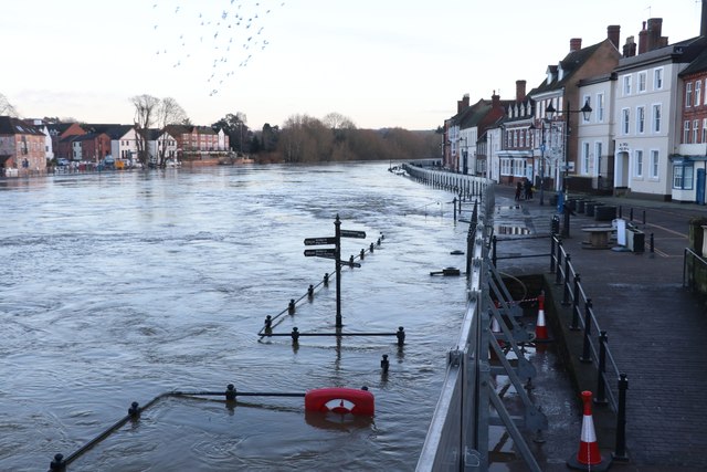
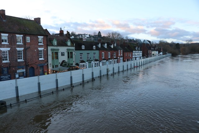
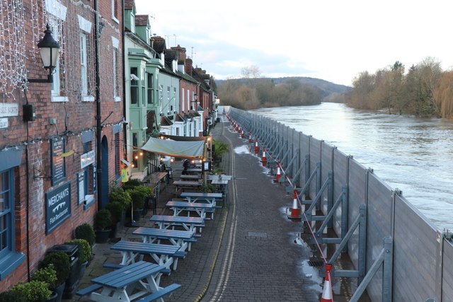
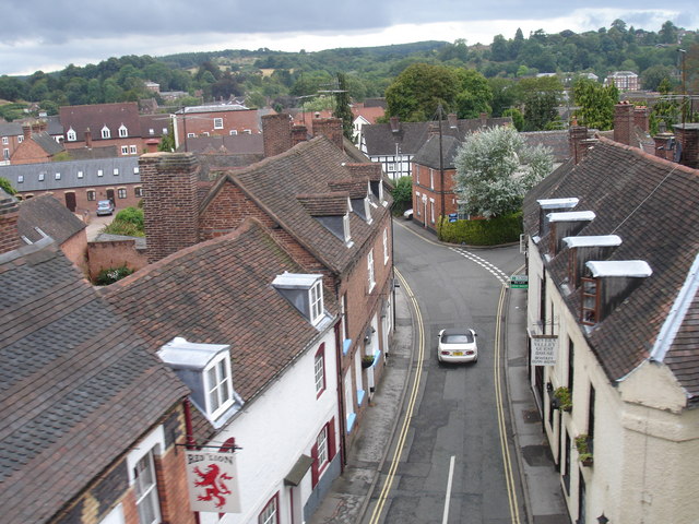
Bark Hill is a small village located in the county of Worcestershire, England. Situated in the heart of the picturesque countryside, it is known for its stunning natural beauty and peaceful atmosphere. The village is nestled among rolling hills, with lush green fields and picturesque meadows surrounding it.

Bark Hill is home to a close-knit community of friendly and welcoming residents. The village has a rich history, dating back several centuries, with some buildings still standing from the medieval era. The architecture in Bark Hill is a mix of traditional English cottages and more modern houses, blending the old and the new seamlessly.

Despite its small size, Bark Hill offers a range of amenities to its residents. There is a village hall that hosts various community events and gatherings throughout the year, providing opportunities for locals to come together and socialize. Additionally, there is a small primary school that serves the village and its surrounding areas.

For those who enjoy outdoor activities, Bark Hill offers ample opportunities for walking, hiking, and exploring the surrounding countryside. The village is also located near several nature reserves and parks, providing residents with plenty of options for leisure and relaxation.

Overall, Bark Hill is a charming village that exudes a sense of tranquility and natural beauty. Its close-knit community, historical charm, and stunning surroundings make it an idyllic place to call home.

If you have any feedback on the listing, please let us know in the comments section below.

Bark Hill Images

Images are sourced within 2km of 52.376139/-2.3248151 or Grid Reference SO7775. Thanks to Geograph Open Source API. All images are credited.
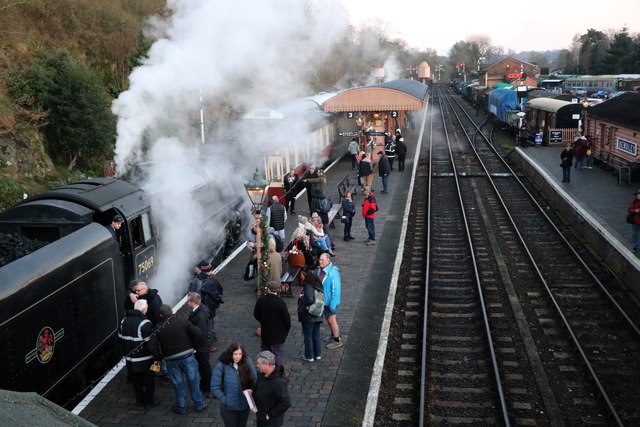
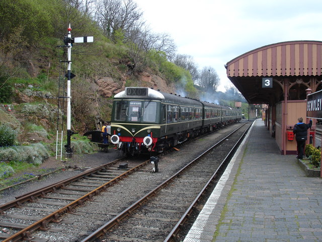
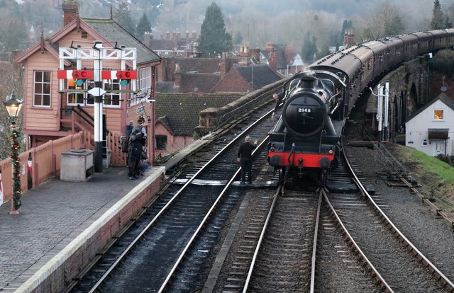
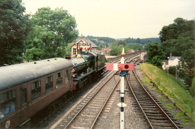
Severn Valley Railway - Stanier mogul at Bewdley No. 2968 is the only survivor of 40 2-6-0 moguls designed by William Stanier at the LMS railway. It was built in 1934 and arrived at the Severn Valley Railway in 1973. If first entered service on the line in 1990 and following major overhauls re-entered service again in 2002 and 2023. It is seen approaching Bewdley and the driver is about to hand the token to the signalman. This was definitely dusk and the light was very poor.
Severn Valley Railway - Stanier mogul at Bewdley
No. 2968 is the only survivor of 40 2-6-0 moguls designed by William Stanier at the LMS railway. It was built in 1934 and arrived at the Severn Valley Railway in 1973. If first entered service on the line in 1990 and following major overhauls re-entered service again in 2002 and 2023. It is seen approaching Bewdley and the driver is about to hand the token to the signalman. This was definitely dusk and the light was very poor.
Erlestoke Manor heading for Bridgnorth On the viaduct north of Bewdley Station. A lovely clean exhaust. There was very little black smoke all day and that's as it should be.
Erlestoke Manor heading for Bridgnorth
On the viaduct north of Bewdley Station. A lovely clean exhaust. There was very little black smoke all day and that's as it should be.
Flooding at Bewdley A very swollen River Severn is flooding the road near the photographer. On the far side the flood defences were holding it back.
Flooding at Bewdley
A very swollen River Severn is flooding the road near the photographer. On the far side the flood defences were holding it back.
A very swollen River Severn at Bewdley There was flooding to the left but the temporary flood barriers on the right were holding it at bay.
A very swollen River Severn at Bewdley
There was flooding to the left but the temporary flood barriers on the right were holding it at bay.
Flood defences at Bewdley The temporary barriers were holding back the River Severn but there was flooding on the left where the works were still in progress. Flooding is a perennial problem in Bewdley and other communities along the River Severn in Worcestershire.
Flood defences at Bewdley
The temporary barriers were holding back the River Severn but there was flooding on the left where the works were still in progress. Flooding is a perennial problem in Bewdley and other communities along the River Severn in Worcestershire.
Flood defences at Bewdley The temporary barriers were holding the River Severn back.
Flood defences at Bewdley
The temporary barriers were holding the River Severn back.
Flood defences at Bewdley The temporary barrier was holding the very swollen River Severn at bay.
Flood defences at Bewdley
The temporary barrier was holding the very swollen River Severn at bay.
Severn Valley Railway - Bewdley Station No. 75069 on the left is awaiting for the arrival of the train from Bridgnorth so that it can have the single track to the north. This was during the winter steam gala. This was the first time this had been held and it was proving popular.
Severn Valley Railway - Bewdley Station
No. 75069 on the left is awaiting for the arrival of the train from Bridgnorth so that it can have the single track to the north. This was during the winter steam gala. This was the first time this had been held and it was proving popular.
Superfine shag - complete satisfaction for only a shilling Seen at Bewdley Station on the Severn Valley Railway. This refers to a type of tobacco. It was very gloomy with the ISO pushed up resulting in a less than pin sharp image.
Superfine shag - complete satisfaction for only a shilling
Seen at Bewdley Station on the Severn Valley Railway. This refers to a type of tobacco. It was very gloomy with the ISO pushed up resulting in a less than pin sharp image.
Severn Valley Railway - bunker first to Highley No. 7714 is departing Bewdley on a local service to Highley. No. 7714 is a GWR 0-6-0PT built in 1930 by Kerr Stuart of Stoke-on-Trent. It was withdrawn from BR in 1959 and went on to work for the National Coal Board at Penallta Colliery. It was bought by the Severn Valley Railway in 1973.
Severn Valley Railway - bunker first to Highley
No. 7714 is departing Bewdley on a local service to Highley. No. 7714 is a GWR 0-6-0PT built in 1930 by Kerr Stuart of Stoke-on-Trent. It was withdrawn from BR in 1959 and went on to work for the National Coal Board at Penallta Colliery. It was bought by the Severn Valley Railway in 1973.
Bewdley, including Severn Valley Guest House Part of the town of Bewdley taken from 'Bewdley North' railway viaduct looking towards the river. In view is the Severn Valley Guest House and part of the 'Red Lion'
Bewdley, including Severn Valley Guest House
Part of the town of Bewdley taken from 'Bewdley North' railway viaduct looking towards the river. In view is the Severn Valley Guest House and part of the 'Red Lion'
48773 entering Bewdley Station, SVR Stanier 8F 2-8-0 No 48773, owned by the Stanier 8F Locomotive Society who bought the locomotive from British Railways in 1968, enters Bewdley Station with a Severn Valley Railway train from Bridgnorth to Kidderminster Town. The train is crossing Bewdley North Viaduct on its way into the station.
48773 entering Bewdley Station, SVR
Stanier 8F 2-8-0 No 48773, owned by the Stanier 8F Locomotive Society who bought the locomotive from British Railways in 1968, enters Bewdley Station with a Severn Valley Railway train from Bridgnorth to Kidderminster Town. The train is crossing Bewdley North Viaduct on its way into the station.
Rock Siding, Bewdley Station A diesel multiple unit occupies the track known as 'Rock Siding' at Bewdley Station, Severn Valley Railway
Rock Siding, Bewdley Station
A diesel multiple unit occupies the track known as 'Rock Siding' at Bewdley Station, Severn Valley Railway
Elephant Enclosure, West Midlands Safari Park Viewed from the railway line beside the Safari Park, this is the elephant enclosure.
Elephant Enclosure, West Midlands Safari Park
Viewed from the railway line beside the Safari Park, this is the elephant enclosure.
Bewdley Bridge in 1987 The bridge carries the B4195 road over the River Severn. The large red brick house over the bridge on the left hand side stands in Severn Street South. The church tower is that of St Anne's.
Bewdley Bridge in 1987
The bridge carries the B4195 road over the River Severn. The large red brick house over the bridge on the left hand side stands in Severn Street South. The church tower is that of St Anne's.
Rock Outcrop, Bewdley This outcrop of sandstone rock forms the northern boundary of Bewdley station
Rock Outcrop, Bewdley
This outcrop of sandstone rock forms the northern boundary of Bewdley station
Trains Pass at Bewdley BR Standard Pacific No 71000 "Duke of Gloucester" [left] and 'Manor' class 4-6-0 No 7812 "Erlestoke Manor" pass at Bewdley station.
Trains Pass at Bewdley
BR Standard Pacific No 71000 "Duke of Gloucester" [left] and 'Manor' class 4-6-0 No 7812 "Erlestoke Manor" pass at Bewdley station.
Bewdley station on the Severn Valley Railway
Show me another place!

Bark Hill is located at Grid Ref: SO7775 (Lat: 52.376139, Lng: -2.3248151)

Administrative County: Worcestershire

District: Wyre Forest

Police Authority: West Merica

What 3 Words

///weeded.pickles.essays. Near Bewdley, Worcestershire

Related Wikis

Tickenhill Palace

Tickenhill Palace (also known as Tickenhill House or Tickenhall Manor) is a historic building in Bewdley, Worcestershire, England. It is a grade II* listed...

Bewdley Museum

Bewdley Museum is a museum in the town of Bewdley in Worcestershire, England. It is managed by the Wyre Forest District Council. == History == The Bewdley...

Bewdley Guildhall

Bewdley Guildhall is a municipal building in Load Street in Bewdley, Worcestershire, England. The structure, which is the meeting place of Bewdley Town...

Bewdley

Bewdley ( pronunciation) is a town and civil parish in the Wyre Forest District in Worcestershire, England on the banks of the River Severn. It is in the...

Bewdley Rowing Club

Bewdley Rowing Club is a rowing club on the River Severn, based at Riverside North, Wribbenhall, Bewdley, Wyre Forest District, West Midlands. == Club... ==
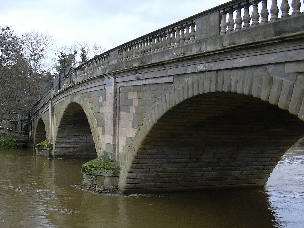
Bewdley Bridge

Bewdley Bridge is a three-span masonry arch bridge over the River Severn at Bewdley, Worcestershire, designed by civil engineer Thomas Telford. The two...

A456 road

Known as the Hagley Road in Birmingham, the A456 is a main road in England running between Central Birmingham and Woofferton, Shropshire, south of Ludlow...

Dowles Brook

Dowles Brook flows through the heart of the Wyre Forest, into the former civil parish of Dowles and into the River Severn. == History == In 1902, ornithologist...

Nearby Amenities

Located within 500m of 52.376139,-2.3248151
Pub
The Woodcolliers
Lat/Long: 52.3752785/-2.3185986
Riar News
Brand: Premier
Brand Wikidata: Q7240340
Brand Wikipedia: en:Premier Stores
Operator: Premier
Shop: convenience
Website: https://www.premier-stores.co.uk/our-stores/riar-news
Lat/Long: 52.3774825/-2.3279192
Bus Stop
Lyttleton Road
Bus: yes
Naptan AtcoCode: 2000G100900
Naptan Bearing: SE
Naptan CommonName: Lyttleton Road
Naptan Crossing: Richmond Road
Naptan Indicator: near
Naptan NaptanCode: wocgjwmd
Naptan PlusbusZoneRef: KDRMNST
Naptan Street: Lyttleton Road
Naptan Verified: no
Public Transport: platform
Source: naptan_import
Lat/Long: 52.3769126/-2.3210989
Bus Stop
Ingram Crescent
Bus: yes
Naptan AtcoCode: 2000G100996
Naptan Bearing: SE
Naptan CommonName: Ingram Crescent
Naptan Indicator: Adj
Naptan Landmark: Ingram Crescent
Naptan NaptanCode: wocgpmaj
Naptan Street: Lyttleton Road
Naptan Verified: no
Public Transport: platform
Source: naptan_import
Lat/Long: 52.3777571/-2.3246308
Bus Stop
Hop Pole Inn
Bus: yes
Naptan AtcoCode: 2000G100997
Naptan Bearing: N
Naptan CommonName: Hop Pole Inn
Naptan Indicator: Adj
Naptan Landmark: Hop Pole Inn
Naptan NaptanCode: wocgjwmg
Naptan PlusbusZoneRef: KDRMNST
Naptan Street: Cleobury Road
Naptan Verified: no
Public Transport: platform
Source: naptan_import
Lat/Long: 52.3746629/-2.3316297
Bus Stop
Cobham Crescent
Bus: yes
Naptan AtcoCode: 2000G100998
Naptan Bearing: E
Naptan CommonName: Cobham Crescent
Naptan Crossing: Cobham Crescent
Naptan Indicator: adj
Naptan NaptanCode: wocgjwmj
Naptan PlusbusZoneRef: KDRMNST
Naptan Street: Lyttleton Road
Naptan Verified: no
Public Transport: platform
Source: naptan_import
Lat/Long: 52.3771509/-2.3227606
Bus Stop
Lyttleton Road
Bus: yes
Naptan AtcoCode: 2000G100999
Naptan Bearing: SE
Naptan CommonName: Lyttleton Road
Naptan Crossing: Lancaster Road
Naptan Indicator: opp
Naptan NaptanCode: wocgjwmp
Naptan PlusbusZoneRef: KDRMNST
Naptan Street: Lyttleton Road
Naptan Verified: no
Public Transport: platform
Source: naptan_import
Lat/Long: 52.3775072/-2.3239532
Bus Stop
Cleobury Road
Bus: yes
Naptan AtcoCode: 2000G500648
Naptan Bearing: E
Naptan CommonName: Cleobury Road
Naptan Crossing: The Lakes Road
Naptan Indicator: Adj
Naptan NaptanCode: wocdadpw
Naptan PlusbusZoneRef: KDRMNST
Naptan Street: Cleobury Road
Naptan Verified: no
Public Transport: platform
Source: naptan_import
Lat/Long: 52.3753635/-2.3286382
Bus Stop
Shops
Bus: yes
Naptan AtcoCode: 2000G500650
Naptan Bearing: SW
Naptan CommonName: Shops
Naptan Indicator: Opp
Naptan Landmark: Shops
Naptan NaptanCode: wocdpgpg
Naptan PlusbusZoneRef: KDRMNST
Naptan Street: The Lakes Road
Naptan Verified: no
Public Transport: platform
Source: naptan_import
Lat/Long: 52.376758/-2.328296
Bus Stop
Richmond Road
Bus: yes
Naptan AtcoCode: 2000G500651
Naptan Bearing: W
Naptan CommonName: Richmond Road
Naptan Indicator: adj
Naptan NaptanCode: wocdpgpj
Naptan PlusbusZoneRef: KDRMNST
Naptan Street: Richmond Road
Naptan Verified: no
Public Transport: platform
Source: naptan_import
Lat/Long: 52.3758305/-2.3223103
Bus Stop
The Lakes Road
Bus: yes
Naptan AtcoCode: 2000G500652
Naptan Bearing: NW
Naptan CommonName: The Lakes Road
Naptan Indicator: Opp
Naptan Landmark: Garden Lodge
Naptan NaptanCode: wocgpmgd
Naptan Street: The Lakes Road
Naptan Verified: no
Public Transport: platform
Source: naptan_import
Lat/Long: 52.3755527/-2.3285074
Bus Stop
The Lakes Road
Bus: yes
Naptan AtcoCode: 2000G500653
Naptan Bearing: SE
Naptan CommonName: The Lakes Road
Naptan Indicator: Adj
Naptan Landmark: Garden Lodge
Naptan NaptanCode: wocgpmpj
Naptan Street: The Lakes Road
Naptan Verified: no
Public Transport: platform
Source: naptan_import
Lat/Long: 52.3756342/-2.3282876
Bus Stop
Richmond Road- opp Lancaster Road
Bus: yes
Naptan AtcoCode: 2000G500654
Naptan Bearing: NW
Naptan CommonName: Richmond Road- opp Lancaster Road
Naptan Indicator: Opp
Naptan Landmark: Lancaster Road
Naptan NaptanCode: wocgpgwm
Naptan Street: Richmond Road
Naptan Verified: no
Public Transport: platform
Source: naptan_import
Lat/Long: 52.3763517/-2.3256634
Bus Stop
Tudor Road
Bus: yes
Naptan AtcoCode: 2000G500655
Naptan Bearing: NE
Naptan CommonName: Tudor Road
Naptan Indicator: adj
Naptan NaptanCode: wocdpgpm
Naptan PlusbusZoneRef: KDRMNST
Naptan Street: Tudor Road
Naptan Verified: no
Public Transport: platform
Source: naptan_import
Lat/Long: 52.3770794/-2.3258598
Bus Stop
Hales Park
Bus: yes
Naptan AtcoCode: 2000G500657
Naptan Bearing: S
Naptan CommonName: Hales Park
Naptan Indicator: Adj
Naptan Landmark: Elton Road
Naptan NaptanCode: wocgpjtm
Naptan Street: Hales Park
Naptan Verified: no
Public Transport: platform
Source: naptan_import
Lat/Long: 52.374607/-2.3291173
Bus Stop
Cleobury Road
Bus: yes
Naptan AtcoCode: 2000G581518
Naptan Bearing: W
Naptan CommonName: Cleobury Road
Naptan Crossing: The Lakes Road
Naptan Indicator: opp
Naptan NaptanCode: wocgagmw
Naptan PlusbusZoneRef: KDRMNST
Naptan Street: Cleobury Road
Naptan Verified: no
Public Transport: platform
Source: naptan_import
Lat/Long: 52.3750189/-2.3264909
Turning Circle
Source: bing
Lat/Long: 52.3748588/-2.3192703
Noexit: yes
Lat/Long: 52.373664/-2.3254596
Bus Stop
Bus: yes
Public Transport: platform
Lat/Long: 52.377061/-2.3281619
Fixme: continue
Lat/Long: 52.3753949/-2.3189159
Post Box
Fixme: location approximate
Post Box Type: pillar
Source: survey
Lat/Long: 52.3746957/-2.331581
Post Box
Lat/Long: 52.3746764/-2.3317192
Turning Circle
Lat/Long: 52.3796926/-2.3247066
Generator Method: photovoltaic
Generator Output Electricity: yes
Generator Source: solar
Generator Type: solar_photovoltaic_panel
Location: roof
Power: generator
Lat/Long: 52.3787863/-2.3213151
Generator Method: photovoltaic
Generator Output Electricity: yes
Generator Source: solar
Generator Type: solar_photovoltaic_panel
Location: roof
Power: generator
Lat/Long: 52.3786308/-2.3242548
Generator Method: photovoltaic
Generator Output Electricity: yes
Generator Source: solar
Generator Type: solar_photovoltaic_panel
Location: roof
Power: generator
Lat/Long: 52.3786832/-2.330499
Generator Method: photovoltaic
Generator Output Electricity: yes
Generator Source: solar
Generator Type: solar_photovoltaic_panel
Location: roof
Power: generator
Lat/Long: 52.3780364/-2.3186155
Generator Method: photovoltaic
Generator Output Electricity: yes
Generator Source: solar
Generator Type: solar_photovoltaic_panel
Location: roof
Power: generator
Lat/Long: 52.3779587/-2.3246746
Generator Method: photovoltaic
Generator Output Electricity: yes
Generator Source: solar
Generator Type: solar_photovoltaic_panel
Location: roof
Power: generator
Lat/Long: 52.3777262/-2.3277712
Generator Method: photovoltaic
Generator Output Electricity: yes
Generator Source: solar
Generator Type: solar_photovoltaic_panel
Location: roof
Power: generator
Lat/Long: 52.3777712/-2.3295347
Generator Method: photovoltaic
Generator Output Electricity: yes
Generator Source: solar
Generator Type: solar_photovoltaic_panel
Location: roof
Power: generator
Lat/Long: 52.3777843/-2.3297198
Generator Method: photovoltaic
Generator Output Electricity: yes
Generator Source: solar
Generator Type: solar_photovoltaic_panel
Location: roof
Power: generator
Lat/Long: 52.3775796/-2.3284337
Generator Method: photovoltaic
Generator Output Electricity: yes
Generator Source: solar
Generator Type: solar_photovoltaic_panel
Location: roof
Power: generator
Lat/Long: 52.3770843/-2.3235749
Generator Method: photovoltaic
Generator Output Electricity: yes
Generator Source: solar
Generator Type: solar_photovoltaic_panel
Location: roof
Power: generator
Lat/Long: 52.3770606/-2.3234636
Generator Method: photovoltaic
Generator Output Electricity: yes
Generator Source: solar
Generator Type: solar_photovoltaic_panel
Location: roof
Power: generator
Lat/Long: 52.3767912/-2.3217604
Generator Method: photovoltaic
Generator Output Electricity: yes
Generator Source: solar
Generator Type: solar_photovoltaic_panel
Location: roof
Power: generator
Lat/Long: 52.3767814/-2.3216718
Generator Method: photovoltaic
Generator Output Electricity: yes
Generator Source: solar
Generator Type: solar_photovoltaic_panel
Location: roof
Power: generator
Lat/Long: 52.3767298/-2.3213875
Generator Method: photovoltaic
Generator Output Electricity: yes
Generator Source: solar
Generator Type: solar_photovoltaic_panel
Location: roof
Power: generator
Lat/Long: 52.3765382/-2.3230143
Generator Method: photovoltaic
Generator Output Electricity: yes
Generator Source: solar
Generator Type: solar_photovoltaic_panel
Location: roof
Power: generator
Lat/Long: 52.3761829/-2.3244922
Generator Method: photovoltaic
Generator Output Electricity: yes
Generator Source: solar
Generator Type: solar_photovoltaic_panel
Location: roof
Power: generator
Lat/Long: 52.3767462/-2.3259754
Generator Method: photovoltaic
Generator Output Electricity: yes
Generator Source: solar
Generator Type: solar_photovoltaic_panel
Location: roof
Power: generator
Lat/Long: 52.3762967/-2.3265213
Generator Method: photovoltaic
Generator Output Electricity: yes
Generator Source: solar
Generator Type: solar_photovoltaic_panel
Location: roof
Power: generator
Lat/Long: 52.3763516/-2.3263724
Generator Method: photovoltaic
Generator Output Electricity: yes
Generator Source: solar
Generator Type: solar_photovoltaic_panel
Location: roof
Power: generator
Lat/Long: 52.3757932/-2.3317556
Generator Method: photovoltaic
Generator Output Electricity: yes
Generator Source: solar
Generator Type: solar_photovoltaic_panel
Location: roof
Power: generator
Lat/Long: 52.3736784/-2.3209852
Generator Method: photovoltaic
Generator Output Electricity: yes
Generator Source: solar
Generator Type: solar_photovoltaic_panel
Location: roof
Power: generator
Lat/Long: 52.373147/-2.3287904
Generator Method: photovoltaic
Generator Output Electricity: yes
Generator Source: solar
Generator Type: solar_photovoltaic_panel
Location: roof
Power: generator
Lat/Long: 52.3731577/-2.3287207
Generator Method: photovoltaic
Generator Output Electricity: yes
Generator Source: solar
Generator Type: solar_photovoltaic_panel
Location: roof
Power: generator
Lat/Long: 52.3737906/-2.3302965
Generator Method: photovoltaic
Generator Output Electricity: yes
Generator Source: solar
Generator Type: solar_photovoltaic_panel
Location: roof
Power: generator
Lat/Long: 52.3738192/-2.3303206
Generator Method: photovoltaic
Generator Output Electricity: yes
Generator Source: solar
Generator Type: solar_photovoltaic_panel
Location: roof
Power: generator
Lat/Long: 52.3731953/-2.330322
Generator Method: photovoltaic
Generator Output Electricity: yes
Generator Source: solar
Generator Type: solar_photovoltaic_panel
Location: roof
Power: generator
Lat/Long: 52.3735376/-2.3302254
Generator Method: photovoltaic
Generator Output Electricity: yes
Generator Source: solar
Generator Type: solar_photovoltaic_panel
Location: roof
Power: generator
Lat/Long: 52.374728/-2.3263241
Generator Method: photovoltaic
Generator Output Electricity: yes
Generator Source: solar
Generator Type: solar_photovoltaic_panel
Location: roof
Power: generator
Lat/Long: 52.374715/-2.326241
Generator Method: photovoltaic
Generator Output Electricity: yes
Generator Source: solar
Generator Type: solar_photovoltaic_panel
Location: roof
Power: generator
Lat/Long: 52.3745013/-2.3240523
Pub
The Black Boy
Addr City: Bewdley
Addr Housenumber: 50
Addr Postcode: DY12 2UE
Addr Street: Wyre Hill
Brewery: yes
Opening Hours: We-Th 12:00-23:00; Fr-Sa 12:00-24:00; Su 12:00-22:30
Outdoor Seating: yes
Phone: +44 1299 400088
Smoking: outside
Website: https://www.theblackboybewdley.co.uk/
Lat/Long: 52.3735403/-2.3228738
Generator Method: photovoltaic
Generator Output Electricity: yes
Generator Source: solar
Generator Type: solar_photovoltaic_panel
Location: roof
Power: generator
Lat/Long: 52.3758481/-2.318244
Generator Method: photovoltaic
Generator Output Electricity: yes
Generator Source: solar
Generator Type: solar_photovoltaic_panel
Location: roof
Power: generator
Lat/Long: 52.3741156/-2.3203602
Generator Method: photovoltaic
Generator Output Electricity: yes
Generator Source: solar
Generator Type: solar_photovoltaic_panel
Location: roof
Power: generator
Lat/Long: 52.3740714/-2.3203254
Generator Method: photovoltaic
Generator Output Electricity: yes
Generator Source: solar
Generator Type: solar_photovoltaic_panel
Location: roof
Power: generator
Lat/Long: 52.3739322/-2.3249468
Generator Method: photovoltaic
Generator Output Electricity: yes
Generator Source: solar
Generator Type: solar_photovoltaic_panel
Location: roof
Power: generator
Lat/Long: 52.3728253/-2.3244506
Generator Method: photovoltaic
Generator Output Electricity: yes
Generator Source: solar
Generator Type: solar_photovoltaic_panel
Location: roof
Power: generator
Lat/Long: 52.3728138/-2.324625
Generator Method: photovoltaic
Generator Output Electricity: yes
Generator Source: solar
Generator Type: solar_photovoltaic_panel
Location: roof
Power: generator
Lat/Long: 52.372524/-2.323418
Generator Method: photovoltaic
Generator Output Electricity: yes
Generator Source: solar
Generator Type: solar_photovoltaic_panel
Location: roof
Power: generator
Lat/Long: 52.372935/-2.3221412
Generator Method: photovoltaic
Generator Output Electricity: yes
Generator Source: solar
Generator Type: solar_photovoltaic_panel
Location: roof
Power: generator
Lat/Long: 52.3728973/-2.3223129
Generator Method: photovoltaic
Generator Output Electricity: yes
Generator Source: solar
Generator Type: solar_photovoltaic_panel
Location: roof
Power: generator
Lat/Long: 52.3719737/-2.3234555
Generator Method: photovoltaic
Generator Output Electricity: yes
Generator Source: solar
Generator Type: solar_photovoltaic_panel
Location: roof
Power: generator
Lat/Long: 52.3719197/-2.3233858
Generator Method: photovoltaic
Generator Output Electricity: yes
Generator Source: solar
Generator Type: solar_photovoltaic_panel
Location: roof
Power: generator
Lat/Long: 52.3717346/-2.3263094
Generator Method: photovoltaic
Generator Output Electricity: yes
Generator Source: solar
Generator Type: solar_photovoltaic_panel
Location: roof
Power: generator
Lat/Long: 52.3731102/-2.32665
Generator Method: photovoltaic
Generator Output Electricity: yes
Generator Source: solar
Generator Type: solar_photovoltaic_panel
Location: roof
Power: generator
Lat/Long: 52.3761117/-2.3221117
Generator Method: photovoltaic
Generator Output Electricity: yes
Generator Source: solar
Generator Type: solar_photovoltaic_panel
Location: roof
Power: generator
Lat/Long: 52.3760871/-2.3222968
Crossing
Crossing: uncontrolled
Crossing Island: no
Crossing Markings: zebra
Crossing Ref: zebra
Tactile Paving: yes
Lat/Long: 52.3723642/-2.3279159
The data included in this document is from www.openstreetmap.org. The data is made available under ODbL.

Have you been to Bark Hill?

Leave your review of Bark Hill below (or comments, questions and feedback).