Hales Park

Settlement in Worcestershire Wyre Forest

England

Hales Park

Bewdley Bridge in 1987 The bridge carries the B4195 road over the River Severn. The large red brick house over the bridge on the left hand side stands in Severn Street South. The church tower is that of St Anne's.
Bewdley Bridge in 1987 Credit: John Baker

Hales Park is a picturesque village located in the county of Worcestershire, England. Situated in the West Midlands region, it is nestled amidst rolling green hills and charming countryside, offering residents and visitors a peaceful and idyllic setting.

The village of Hales Park dates back to medieval times, and its rich history is evident in its architecture and layout. The village center is dominated by a beautiful 12th-century church, St. Mary's, which is a prominent landmark and a testament to the village's heritage.

The community in Hales Park is close-knit and friendly, with a population of approximately 500 residents. The village boasts a range of amenities, including a local pub, a village hall, and a primary school, providing a convenient and self-sufficient environment for its inhabitants.

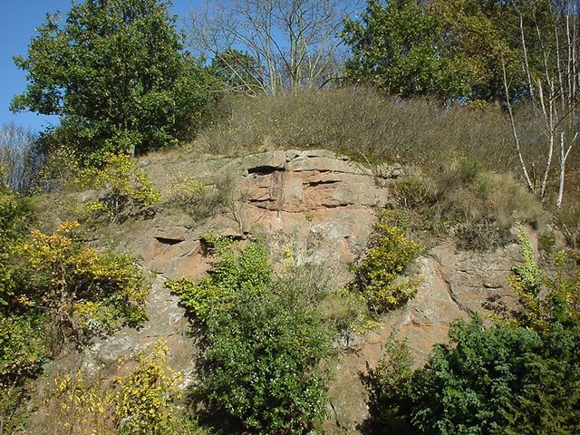
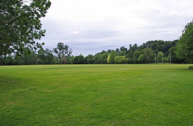
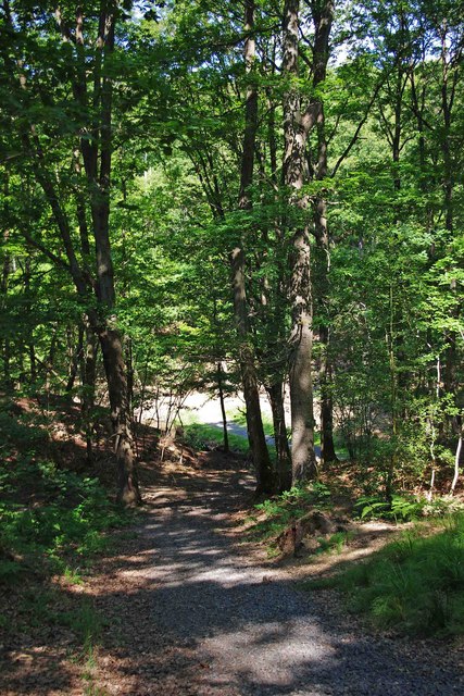
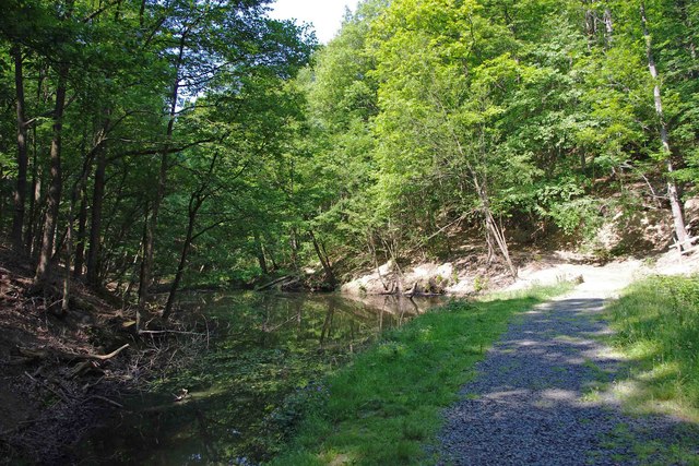
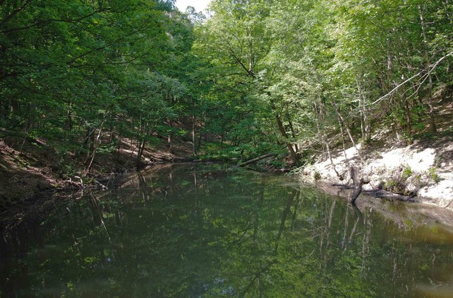
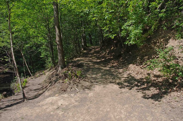
Nature lovers are drawn to Hales Park for its stunning natural surroundings. The village is surrounded by lush green fields, woodland areas, and meandering streams, making it an ideal destination for outdoor activities such as walking, cycling, and picnicking.

Hales Park is also conveniently located near the larger towns of Redditch and Worcester, where residents can access a wider range of amenities, shopping centers, and leisure facilities.

Overall, Hales Park offers a tranquil and picturesque setting, steeped in history and surrounded by natural beauty. Its strong sense of community and proximity to larger towns make it an attractive place to live or visit in Worcestershire.

If you have any feedback on the listing, please let us know in the comments section below.

Hales Park Images

Images are sourced within 2km of 52.37402/-2.332134 or Grid Reference SO7775. Thanks to Geograph Open Source API. All images are credited.
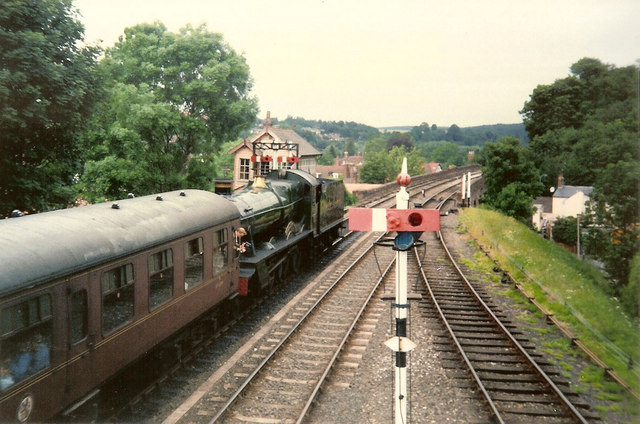
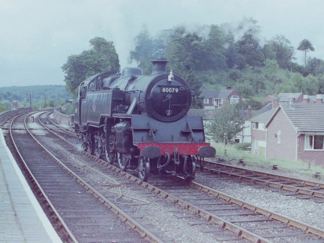
Bewdley Bridge in 1987 The bridge carries the B4195 road over the River Severn. The large red brick house over the bridge on the left hand side stands in Severn Street South. The church tower is that of St Anne's.
Bewdley Bridge in 1987
The bridge carries the B4195 road over the River Severn. The large red brick house over the bridge on the left hand side stands in Severn Street South. The church tower is that of St Anne's.
Rock Outcrop, Bewdley This outcrop of sandstone rock forms the northern boundary of Bewdley station
Rock Outcrop, Bewdley
This outcrop of sandstone rock forms the northern boundary of Bewdley station
Trains Pass at Bewdley BR Standard Pacific No 71000 "Duke of Gloucester" [left] and 'Manor' class 4-6-0 No 7812 "Erlestoke Manor" pass at Bewdley station.
Trains Pass at Bewdley
BR Standard Pacific No 71000 "Duke of Gloucester" [left] and 'Manor' class 4-6-0 No 7812 "Erlestoke Manor" pass at Bewdley station.
Bewdley station on the Severn Valley Railway
Sports field behind Bewdley Leisure Centre, Bewdley It's not clear if the field is part of the centre, or belongs to the adjoining school. Possibly it is used by both.
Sports field behind Bewdley Leisure Centre, Bewdley
It's not clear if the field is part of the centre, or belongs to the adjoining school. Possibly it is used by both.
2 new houses, Bewdley
Riverside Caravan Park, Bewdley
Car park off Dry Mill Lane This is a new car park for people walking in the Wyre Forest and is the recommended car park for visitors to Knowles Mill. A fellow collaborator has kindly confirmed my position and view direction.
Car park off Dry Mill Lane
This is a new car park for people walking in the Wyre Forest and is the recommended car park for visitors to Knowles Mill. A fellow collaborator has kindly confirmed my position and view direction.
Knowles Mill Preserved derelict flour mill on the Dowles Brook in the Wyre Forest. The remains of the overshot waterwheel are behind the curved wall in the foreground and the tail race is in a tunnel.
Knowles Mill
Preserved derelict flour mill on the Dowles Brook in the Wyre Forest. The remains of the overshot waterwheel are behind the curved wall in the foreground and the tail race is in a tunnel.
Knowles Mill - the remains of the waterwheel This was an overshot waterwheel with the leat coming in at high level on the left and the portal of the tail race tunnel visible to the right.
Knowles Mill - the remains of the waterwheel
This was an overshot waterwheel with the leat coming in at high level on the left and the portal of the tail race tunnel visible to the right.
Knowles Mill - machinery A nineteenth century watermill that went out of use in 1891 when it was damaged by a flood following a big freeze. It is the only recognisable mill in the Wyre Forest.

This somewhat sharpened (really!) shot shows the pit wheel, wallower, great spur wheel and crown wheel. There is a surviving stone nut and quant on the right with a bed stone on the floor above. The other stone nut and the other stones have gone. There is a fragmented French burr stone on the ground inside.
Knowles Mill - machinery
A nineteenth century watermill that went out of use in 1891 when it was damaged by a flood following a big freeze. It is the only recognisable mill in the Wyre Forest. This somewhat sharpened (really!) shot shows the pit wheel, wallower, great spur wheel and crown wheel. There is a surviving stone nut and quant on the right with a bed stone on the floor above. The other stone nut and the other stones have gone. There is a fragmented French burr stone on the ground inside.
Knowles Mill Nineteenth century watermill that has been out of use since 1891 and is now preserved by the National Trust. The bridge in the foreground crosses the Dowles Brook.
Knowles Mill
Nineteenth century watermill that has been out of use since 1891 and is now preserved by the National Trust. The bridge in the foreground crosses the Dowles Brook.
Standard Tank at Bewdley, 1981 Standard 2-6-4T locomotive No 80079 at Bewdley Station, Severn Valley Railway
Standard Tank at Bewdley, 1981
Standard 2-6-4T locomotive No 80079 at Bewdley Station, Severn Valley Railway
Gated entrance to track in Wyre Forest near Bewdley There is both a kissing gate here, and a gate wide enough to let a vehicle pass through. On the other side is a track, with a rough stone surface, which makes a steep descent down to a pond and a steam.

<a href="https://www.geograph.org.uk/photo/2487006">SO7676 : Track to pond in Wyre Forest, near Bewdley</a>.
<a href="https://www.geograph.org.uk/photo/2487032">SO7676 : Pond and track in the Wyre Forest near Bewdley</a>.
Gated entrance to track in Wyre Forest near Bewdley
There is both a kissing gate here, and a gate wide enough to let a vehicle pass through. On the other side is a track, with a rough stone surface, which makes a steep descent down to a pond and a steam. SO7676 : Track to pond in Wyre Forest, near Bewdley. SO7676 : Pond and track in the Wyre Forest near Bewdley.
Track to pond in Wyre Forest, near Bewdley The pond is at the bottom of the track, but not visible in this photograph.

<a href="https://www.geograph.org.uk/photo/2486986">SO7676 : Gated entrance to track in Wyre Forest near Bewdley</a>.
<a href="https://www.geograph.org.uk/photo/2487032">SO7676 : Pond and track in the Wyre Forest near Bewdley</a>.
Track to pond in Wyre Forest, near Bewdley
The pond is at the bottom of the track, but not visible in this photograph. SO7676 : Gated entrance to track in Wyre Forest near Bewdley. SO7676 : Pond and track in the Wyre Forest near Bewdley.
Pond and track in the Wyre Forest near Bewdley The pond is on the left but difficult to see, as its surface is reflecting the trees which hang overhead. It is one of several which are linked by a small stream, and appears to be either artificial or enlarged from the original.

<a href="https://www.geograph.org.uk/photo/2486986">SO7676 : Gated entrance to track in Wyre Forest near Bewdley</a>.
<a href="https://www.geograph.org.uk/photo/2487006">SO7676 : Track to pond in Wyre Forest, near Bewdley</a>.
<a href="https://www.geograph.org.uk/photo/2487054">SO7676 : Pond in Wyre Forest near Bewdley</a>.
Pond and track in the Wyre Forest near Bewdley
The pond is on the left but difficult to see, as its surface is reflecting the trees which hang overhead. It is one of several which are linked by a small stream, and appears to be either artificial or enlarged from the original. SO7676 : Gated entrance to track in Wyre Forest near Bewdley. SO7676 : Track to pond in Wyre Forest, near Bewdley. SO7676 : Pond in Wyre Forest near Bewdley.
Pond in Wyre Forest near Bewdley The pond may be artificial or artificially enlarged. It lies on a stream which runs through the forest.

<a href="https://www.geograph.org.uk/photo/2487032">SO7676 : Pond and track in the Wyre Forest near Bewdley</a>.
Pond in Wyre Forest near Bewdley
The pond may be artificial or artificially enlarged. It lies on a stream which runs through the forest. SO7676 : Pond and track in the Wyre Forest near Bewdley.
Junction of two paths in the Wyre Forest near Bewdley The lower path runs alongside a pond. The other path climbs steeply.

<a href="https://www.geograph.org.uk/photo/2487054">SO7676 : Pond in Wyre Forest near Bewdley</a>.
Junction of two paths in the Wyre Forest near Bewdley
The lower path runs alongside a pond. The other path climbs steeply. SO7676 : Pond in Wyre Forest near Bewdley.
Show me another place!

Hales Park is located at Grid Ref: SO7775 (Lat: 52.37402, Lng: -2.332134)

Administrative County: Worcestershire

District: Wyre Forest

Police Authority: West Mercia

What 3 Words

///tarred.printout.dumps. Near Bewdley, Worcestershire

Related Wikis

A456 road

Known as the Hagley Road in Birmingham, the A456 is a main road in England running between Central Birmingham and Woofferton, Shropshire, south of Ludlow...

Tickenhill Palace

Tickenhill Palace (also known as Tickenhill House or Tickenhall Manor) is a historic building in Bewdley, Worcestershire, England. It is a grade II* listed...

Bewdley Museum

Bewdley Museum is a museum in the town of Bewdley in Worcestershire, England. It is managed by the Wyre Forest District Council. == History == The Bewdley...

Bewdley Guildhall

Bewdley Guildhall is a municipal building in Load Street in Bewdley, Worcestershire, England. The structure, which is the meeting place of Bewdley Town...

Nearby Amenities

Located within 500m of 52.37402,-2.332134
Riar News
Brand: Premier
Brand Wikidata: Q7240340
Brand Wikipedia: en:Premier Stores
Operator: Premier
Shop: convenience
Website: https://www.premier-stores.co.uk/our-stores/riar-news
Lat/Long: 52.3774825/-2.3279192
Hop Pole Inn
Naptan AtcoCode: 2000G045800
Naptan Bearing: NE
Naptan BusStopType: CUS
Naptan CommonName: Hop Pole Inn
Naptan Indicator: opp
Naptan Landmark: Hop Pole Inn
Naptan NaptanCode: wocgmjgj
Naptan PlusbusZoneRef: KDRMNST
Naptan Street: Cleobury Road
Naptan Verified: no
Source: naptan_import
Lat/Long: 52.3739875/-2.3320506
Bus Stop
Severn Way
Bus: yes
Naptan AtcoCode: 2000G045801
Naptan Bearing: NE
Naptan CommonName: Severn Way
Naptan Indicator: Adj
Naptan NaptanCode: wocgpgwj
Naptan Street: Severn Way
Naptan Verified: no
Public Transport: platform
Source: naptan_import
Lat/Long: 52.3734598/-2.3310771
Bus Stop
Hop Pole Inn
Bus: yes
Naptan AtcoCode: 2000G100997
Naptan Bearing: N
Naptan CommonName: Hop Pole Inn
Naptan Indicator: Adj
Naptan Landmark: Hop Pole Inn
Naptan NaptanCode: wocgjwmg
Naptan PlusbusZoneRef: KDRMNST
Naptan Street: Cleobury Road
Naptan Verified: no
Public Transport: platform
Source: naptan_import
Lat/Long: 52.3746629/-2.3316297
Bus Stop
Wyre Hill
Bus: yes
Naptan AtcoCode: 2000G101000
Naptan Bearing: SW
Naptan CommonName: Wyre Hill
Naptan Indicator: Adj
Naptan NaptanCode: wocgjwmt
Naptan PlusbusZoneRef: KDRMNST
Naptan Street: Wyre Hill
Naptan Verified: no
Public Transport: platform
Source: naptan_import
Lat/Long: 52.371944/-2.3297879
Bus Stop
Cleobury Road
Bus: yes
Naptan AtcoCode: 2000G500648
Naptan Bearing: E
Naptan CommonName: Cleobury Road
Naptan Crossing: The Lakes Road
Naptan Indicator: Adj
Naptan NaptanCode: wocdadpw
Naptan PlusbusZoneRef: KDRMNST
Naptan Street: Cleobury Road
Naptan Verified: no
Public Transport: platform
Source: naptan_import
Lat/Long: 52.3753635/-2.3286382
Bus Stop
Shops
Bus: yes
Naptan AtcoCode: 2000G500650
Naptan Bearing: SW
Naptan CommonName: Shops
Naptan Indicator: Opp
Naptan Landmark: Shops
Naptan NaptanCode: wocdpgpg
Naptan PlusbusZoneRef: KDRMNST
Naptan Street: The Lakes Road
Naptan Verified: no
Public Transport: platform
Source: naptan_import
Lat/Long: 52.376758/-2.328296
Bus Stop
The Lakes Road
Bus: yes
Naptan AtcoCode: 2000G500652
Naptan Bearing: NW
Naptan CommonName: The Lakes Road
Naptan Indicator: Opp
Naptan Landmark: Garden Lodge
Naptan NaptanCode: wocgpmgd
Naptan Street: The Lakes Road
Naptan Verified: no
Public Transport: platform
Source: naptan_import
Lat/Long: 52.3755527/-2.3285074
Bus Stop
The Lakes Road
Bus: yes
Naptan AtcoCode: 2000G500653
Naptan Bearing: SE
Naptan CommonName: The Lakes Road
Naptan Indicator: Adj
Naptan Landmark: Garden Lodge
Naptan NaptanCode: wocgpmpj
Naptan Street: The Lakes Road
Naptan Verified: no
Public Transport: platform
Source: naptan_import
Lat/Long: 52.3756342/-2.3282876
Bus Stop
Hales Park
Bus: yes
Naptan AtcoCode: 2000G500657
Naptan Bearing: S
Naptan CommonName: Hales Park
Naptan Indicator: Adj
Naptan Landmark: Elton Road
Naptan NaptanCode: wocgpjtm
Naptan Street: Hales Park
Naptan Verified: no
Public Transport: platform
Source: naptan_import
Lat/Long: 52.374607/-2.3291173
Bus Stop
Cleobury Road
Bus: yes
Naptan AtcoCode: 2000G581518
Naptan Bearing: W
Naptan CommonName: Cleobury Road
Naptan Crossing: The Lakes Road
Naptan Indicator: opp
Naptan NaptanCode: wocgagmw
Naptan PlusbusZoneRef: KDRMNST
Naptan Street: Cleobury Road
Naptan Verified: no
Public Transport: platform
Source: naptan_import
Lat/Long: 52.3750189/-2.3264909
Noexit: yes
Lat/Long: 52.3763377/-2.3329259
Noexit: yes
Lat/Long: 52.373664/-2.3254596
Bus Stop
Bus: yes
Public Transport: platform
Lat/Long: 52.377061/-2.3281619
Post Box
Fixme: location approximate
Post Box Type: pillar
Source: survey
Lat/Long: 52.3746957/-2.331581
Pub
The Hop Pole Inn
Addr City: Bewdley
Addr Postcode: DY12 2QH
Addr Street: Cleobury Road
Brewery: yes
Fhrs Id: 686424
Opening Hours: Mo-Sa 12:00-23:00; Su 12:00-22:00
Outdoor Seating: yes
Phone: +44 1299 401295
Smoking: outside
Source: survey;local knowledge
Source Postcode: FHRS Open Data
Website: https://www.thehoppolebewdley.co.uk/
Lat/Long: 52.3740636/-2.3325467
Fixme: continue
Lat/Long: 52.3719528/-2.3342604
Post Box
Lat/Long: 52.3746764/-2.3317192
Generator Method: photovoltaic
Generator Output Electricity: yes
Generator Source: solar
Generator Type: solar_photovoltaic_panel
Location: roof
Power: generator
Lat/Long: 52.3777712/-2.3295347
Generator Method: photovoltaic
Generator Output Electricity: yes
Generator Source: solar
Generator Type: solar_photovoltaic_panel
Location: roof
Power: generator
Lat/Long: 52.3777843/-2.3297198
Generator Method: photovoltaic
Generator Output Electricity: yes
Generator Source: solar
Generator Type: solar_photovoltaic_panel
Location: roof
Power: generator
Lat/Long: 52.3775796/-2.3284337
Generator Method: photovoltaic
Generator Output Electricity: yes
Generator Source: solar
Generator Type: solar_photovoltaic_panel
Location: roof
Power: generator
Lat/Long: 52.3762967/-2.3265213
Generator Method: photovoltaic
Generator Output Electricity: yes
Generator Source: solar
Generator Type: solar_photovoltaic_panel
Location: roof
Power: generator
Lat/Long: 52.3763516/-2.3263724
Generator Method: photovoltaic
Generator Output Electricity: yes
Generator Source: solar
Generator Type: solar_photovoltaic_panel
Location: roof
Power: generator
Lat/Long: 52.3755541/-2.3328875
Generator Method: photovoltaic
Generator Output Electricity: yes
Generator Source: solar
Generator Type: solar_photovoltaic_panel
Location: roof
Power: generator
Lat/Long: 52.3757932/-2.3317556
Generator Method: photovoltaic
Generator Output Electricity: yes
Generator Source: solar
Generator Type: solar_photovoltaic_panel
Location: roof
Power: generator
Lat/Long: 52.373147/-2.3287904
Generator Method: photovoltaic
Generator Output Electricity: yes
Generator Source: solar
Generator Type: solar_photovoltaic_panel
Location: roof
Power: generator
Lat/Long: 52.3731577/-2.3287207
Generator Method: photovoltaic
Generator Output Electricity: yes
Generator Source: solar
Generator Type: solar_photovoltaic_panel
Location: roof
Power: generator
Lat/Long: 52.3737906/-2.3302965
Generator Method: photovoltaic
Generator Output Electricity: yes
Generator Source: solar
Generator Type: solar_photovoltaic_panel
Location: roof
Power: generator
Lat/Long: 52.3738192/-2.3303206
Generator Method: photovoltaic
Generator Output Electricity: yes
Generator Source: solar
Generator Type: solar_photovoltaic_panel
Location: roof
Power: generator
Lat/Long: 52.3731953/-2.330322
Generator Method: photovoltaic
Generator Output Electricity: yes
Generator Source: solar
Generator Type: solar_photovoltaic_panel
Location: roof
Power: generator
Lat/Long: 52.3735376/-2.3302254
Generator Method: photovoltaic
Generator Output Electricity: yes
Generator Source: solar
Generator Type: solar_photovoltaic_panel
Location: roof
Power: generator
Lat/Long: 52.3735269/-2.3318039
Generator Method: photovoltaic
Generator Output Electricity: yes
Generator Source: solar
Generator Type: solar_photovoltaic_panel
Location: roof
Power: generator
Lat/Long: 52.3735843/-2.3316336
Generator Method: photovoltaic
Generator Output Electricity: yes
Generator Source: solar
Generator Type: solar_photovoltaic_panel
Location: roof
Power: generator
Lat/Long: 52.3736833/-2.3315518
Generator Method: photovoltaic
Generator Output Electricity: yes
Generator Source: solar
Generator Type: solar_photovoltaic_panel
Location: roof
Power: generator
Lat/Long: 52.374728/-2.3263241
Generator Method: photovoltaic
Generator Output Electricity: yes
Generator Source: solar
Generator Type: solar_photovoltaic_panel
Location: roof
Power: generator
Lat/Long: 52.374715/-2.326241
Generator Method: photovoltaic
Generator Output Electricity: yes
Generator Source: solar
Generator Type: solar_photovoltaic_panel
Location: roof
Power: generator
Lat/Long: 52.3739322/-2.3249468
Generator Method: photovoltaic
Generator Output Electricity: yes
Generator Source: solar
Generator Type: solar_photovoltaic_panel
Location: roof
Power: generator
Lat/Long: 52.3717346/-2.3263094
Generator Method: photovoltaic
Generator Output Electricity: yes
Generator Source: solar
Generator Type: solar_photovoltaic_panel
Location: roof
Power: generator
Lat/Long: 52.3731102/-2.32665
Generator Method: photovoltaic
Generator Output Electricity: yes
Generator Source: solar
Generator Type: solar_photovoltaic_panel
Location: roof
Power: generator
Lat/Long: 52.3722095/-2.3293832
Generator Method: photovoltaic
Generator Output Electricity: yes
Generator Source: solar
Generator Type: solar_photovoltaic_panel
Location: roof
Power: generator
Lat/Long: 52.371019/-2.336086
Generator Method: photovoltaic
Generator Output Electricity: yes
Generator Source: solar
Generator Type: solar_photovoltaic_panel
Location: roof
Power: generator
Lat/Long: 52.3704164/-2.3325589
Generator Method: photovoltaic
Generator Output Electricity: yes
Generator Source: solar
Generator Type: solar_photovoltaic_panel
Location: roof
Power: generator
Lat/Long: 52.370626/-2.3313493
Generator Method: photovoltaic
Generator Output Electricity: yes
Generator Source: solar
Generator Type: solar_photovoltaic_panel
Location: roof
Power: generator
Lat/Long: 52.3714481/-2.3313573
Barrier: bollard
Lat/Long: 52.3771118/-2.3326047
Crossing
Crossing: uncontrolled
Crossing Island: no
Crossing Markings: zebra
Crossing Ref: zebra
Tactile Paving: yes
Lat/Long: 52.3723642/-2.3279159
The data included in this document is from www.openstreetmap.org. The data is made available under ODbL.

Have you been to Hales Park?

Leave your review of Hales Park below (or comments, questions and feedback).