Lakes, The

Settlement in Worcestershire Wyre Forest

England

Lakes, The

Bewdley, including Severn Valley Guest House Part of the town of Bewdley taken from 'Bewdley North' railway viaduct looking towards the river. In view is the Severn Valley Guest House and part of the 'Red Lion'
Bewdley, including Severn Valley Guest House Credit: Rob Newman

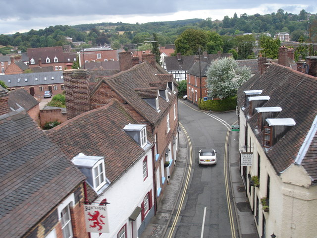
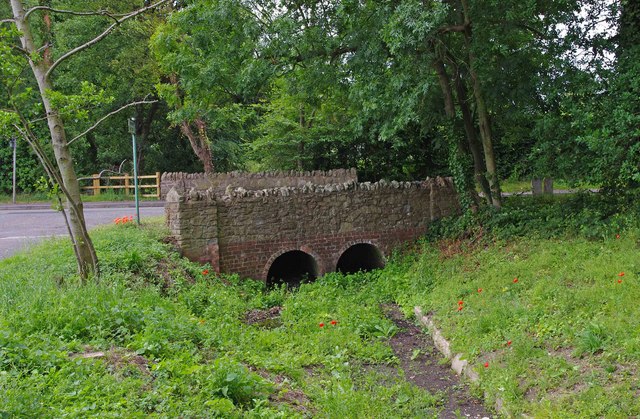
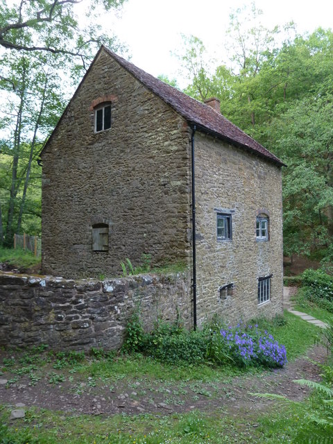
The Lakes is a picturesque village located in Worcestershire, England. Nestled in the heart of the county, it is renowned for its stunning natural beauty and tranquil surroundings. The village is surrounded by lush greenery, rolling hills, and several serene lakes, which give it its name.

The Lakes is a popular destination for nature lovers and outdoor enthusiasts. It offers a plethora of recreational activities, including fishing, boating, and hiking. The lakes themselves are teeming with various species of fish, making it a haven for anglers. The calm waters also provide an ideal spot for boating and sailing, attracting visitors from all over the region.

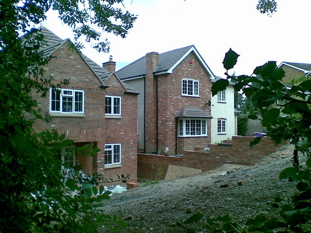
The village itself exudes a peaceful charm, with its quaint cottages, well-manicured gardens, and friendly community. The main street offers a range of amenities, including a local pub, a small grocery store, and a few independent shops. Additionally, there are some delightful cafes and restaurants that serve delicious local cuisine, allowing visitors to indulge in a memorable dining experience.

The Lakes is also home to some notable landmarks and attractions. One such landmark is the historic St. Mary's Church, which dates back several centuries and showcases stunning architectural features. The village is also within close proximity to several other attractions, including country estates and historic sites, making it an ideal base for exploring the wider Worcestershire area.

Overall, The Lakes is a charming village that offers a perfect blend of natural beauty, outdoor activities, and a welcoming community. It is an idyllic destination for those seeking a peaceful retreat in the heart of Worcestershire.

If you have any feedback on the listing, please let us know in the comments section below.

Lakes, The Images

Images are sourced within 2km of 52.378492/-2.327716 or Grid Reference SO7775. Thanks to Geograph Open Source API. All images are credited.
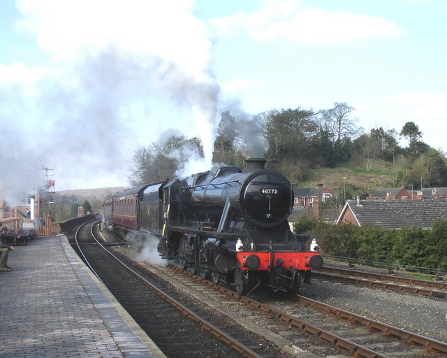
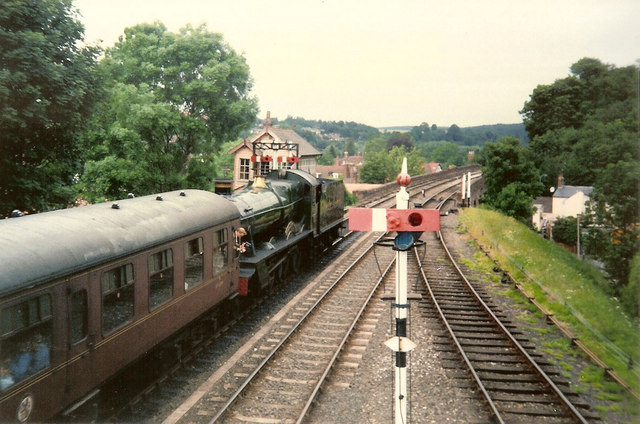
Bewdley, including Severn Valley Guest House Part of the town of Bewdley taken from 'Bewdley North' railway viaduct looking towards the river. In view is the Severn Valley Guest House and part of the 'Red Lion'
Bewdley, including Severn Valley Guest House
Part of the town of Bewdley taken from 'Bewdley North' railway viaduct looking towards the river. In view is the Severn Valley Guest House and part of the 'Red Lion'
48773 entering Bewdley Station, SVR Stanier 8F 2-8-0 No 48773, owned by the Stanier 8F Locomotive Society who bought the locomotive from British Railways in 1968, enters Bewdley Station with a Severn Valley Railway train from Bridgnorth to Kidderminster Town. The train is crossing Bewdley North Viaduct on its way into the station.
48773 entering Bewdley Station, SVR
Stanier 8F 2-8-0 No 48773, owned by the Stanier 8F Locomotive Society who bought the locomotive from British Railways in 1968, enters Bewdley Station with a Severn Valley Railway train from Bridgnorth to Kidderminster Town. The train is crossing Bewdley North Viaduct on its way into the station.
Rock Siding, Bewdley Station A diesel multiple unit occupies the track known as 'Rock Siding' at Bewdley Station, Severn Valley Railway
Rock Siding, Bewdley Station
A diesel multiple unit occupies the track known as 'Rock Siding' at Bewdley Station, Severn Valley Railway
Bewdley Bridge in 1987 The bridge carries the B4195 road over the River Severn. The large red brick house over the bridge on the left hand side stands in Severn Street South. The church tower is that of St Anne's.
Bewdley Bridge in 1987
The bridge carries the B4195 road over the River Severn. The large red brick house over the bridge on the left hand side stands in Severn Street South. The church tower is that of St Anne's.
Rock Outcrop, Bewdley This outcrop of sandstone rock forms the northern boundary of Bewdley station
Rock Outcrop, Bewdley
This outcrop of sandstone rock forms the northern boundary of Bewdley station
Trains Pass at Bewdley BR Standard Pacific No 71000 "Duke of Gloucester" [left] and 'Manor' class 4-6-0 No 7812 "Erlestoke Manor" pass at Bewdley station.
Trains Pass at Bewdley
BR Standard Pacific No 71000 "Duke of Gloucester" [left] and 'Manor' class 4-6-0 No 7812 "Erlestoke Manor" pass at Bewdley station.
Bewdley station on the Severn Valley Railway
Bewdley Leisure Centre, Stourport Road, Bewdley Bewdley Leisure Centre is on the edge of Bewdley. It is owned by Wyre Forest District Council, but the facilities are managed for them by a firm called D C Leisure. At this centre facilities include badminton, five-a-side football, group exercise classes, basketball, volleyball, martial arts, and much else. There are also two football pitches, a rugby pitch and an artificial cricket wicket.

D C Leisure's contract to manage this centre, and other centres in Kidderminster and Stourport-on-Severn expires in 2013. Because of rising management and maintenance costs, the District Council are looking at other arrangements. They seem minded to hand over the Bewdley Leisure Centre to community groups or organisations. This presumably is what the current Government's "Big Society" is all about. It will be interesting to see if any groups come forward to run what is in effect a business, and running a facility this size would surely require some paid staff, or maybe volunteers will do everything. Although how a community group can cope with increasing management and maintenance costs, when the council can't, isn't immediately obvious.

<a href="https://www.geograph.org.uk/photo/2465462">SO7974 : Bewdley Leisure Centre sign, Stourport Road, Bewdley</a>.
Bewdley Leisure Centre, Stourport Road, Bewdley
Bewdley Leisure Centre is on the edge of Bewdley. It is owned by Wyre Forest District Council, but the facilities are managed for them by a firm called D C Leisure. At this centre facilities include badminton, five-a-side football, group exercise classes, basketball, volleyball, martial arts, and much else. There are also two football pitches, a rugby pitch and an artificial cricket wicket. D C Leisure's contract to manage this centre, and other centres in Kidderminster and Stourport-on-Severn expires in 2013. Because of rising management and maintenance costs, the District Council are looking at other arrangements. They seem minded to hand over the Bewdley Leisure Centre to community groups or organisations. This presumably is what the current Government's "Big Society" is all about. It will be interesting to see if any groups come forward to run what is in effect a business, and running a facility this size would surely require some paid staff, or maybe volunteers will do everything. Although how a community group can cope with increasing management and maintenance costs, when the council can't, isn't immediately obvious. SO7974 : Bewdley Leisure Centre sign, Stourport Road, Bewdley.
Bewdley Leisure Centre sign, Stourport Road, Bewdley The sign is by the entrance to the centre.

<a href="https://www.geograph.org.uk/photo/2465449">SO7974 : Bewdley Leisure Centre, Stourport Road, Bewdley</a>.
Bewdley Leisure Centre sign, Stourport Road, Bewdley
The sign is by the entrance to the centre. SO7974 : Bewdley Leisure Centre, Stourport Road, Bewdley.
Sports field behind Bewdley Leisure Centre, Bewdley It's not clear if the field is part of the centre, or belongs to the adjoining school. Possibly it is used by both.
Sports field behind Bewdley Leisure Centre, Bewdley
It's not clear if the field is part of the centre, or belongs to the adjoining school. Possibly it is used by both.
Bridge carrying Stourport Road over a stream, Bewdley This bridge carries Stourport Road over a very small stream, which was virtually dry when photographed. The stream is culverted in places, and discharges into the nearby River Severn.
Bridge carrying Stourport Road over a stream, Bewdley
This bridge carries Stourport Road over a very small stream, which was virtually dry when photographed. The stream is culverted in places, and discharges into the nearby River Severn.
Lane off Stourport Road, Bewdley On the outskirts of Bewdley, this appears to be a private road, terminating by a viaduct carrying the Severn Valley Railway. The sign on the corner indicates there is a public footpath running along the lane, which doesn't seem to have any name.
Lane off Stourport Road, Bewdley
On the outskirts of Bewdley, this appears to be a private road, terminating by a viaduct carrying the Severn Valley Railway. The sign on the corner indicates there is a public footpath running along the lane, which doesn't seem to have any name.
Stourport Road (B4195), Bewdley The road shortly terminates at a traffic light controlled junction, with the A456 road. The building seen on the right is Bewdley Leisure Centre.
Stourport Road (B4195), Bewdley
The road shortly terminates at a traffic light controlled junction, with the A456 road. The building seen on the right is Bewdley Leisure Centre.
2 new houses, Bewdley
Riverside Caravan Park, Bewdley
Car park off Dry Mill Lane This is a new car park for people walking in the Wyre Forest and is the recommended car park for visitors to Knowles Mill. A fellow collaborator has kindly confirmed my position and view direction.
Car park off Dry Mill Lane
This is a new car park for people walking in the Wyre Forest and is the recommended car park for visitors to Knowles Mill. A fellow collaborator has kindly confirmed my position and view direction.
Knowles Mill Preserved derelict flour mill on the Dowles Brook in the Wyre Forest. The remains of the overshot waterwheel are behind the curved wall in the foreground and the tail race is in a tunnel.
Knowles Mill
Preserved derelict flour mill on the Dowles Brook in the Wyre Forest. The remains of the overshot waterwheel are behind the curved wall in the foreground and the tail race is in a tunnel.
Knowles Mill - the remains of the waterwheel This was an overshot waterwheel with the leat coming in at high level on the left and the portal of the tail race tunnel visible to the right.
Knowles Mill - the remains of the waterwheel
This was an overshot waterwheel with the leat coming in at high level on the left and the portal of the tail race tunnel visible to the right.
Show me another place!

Lakes, The is located at Grid Ref: SO7775 (Lat: 52.378492, Lng: -2.327716)

Administrative County: Worcestershire

District: Wyre Forest

Police Authority: West Mercia

What 3 Words

///treaty.oblige.dips. Near Bewdley, Worcestershire

Related Wikis

Dowles Brook

Dowles Brook flows through the heart of the Wyre Forest, into the former civil parish of Dowles and into the River Severn. == History == In 1902, ornithologist...

Dowles

Dowles is a hamlet in the civil parish of Upper Arley, in the Wyre Forest district, in the county of Worcestershire, England. It is about 3 miles from...

Bewdley Rowing Club

Bewdley Rowing Club is a rowing club on the River Severn, based at Riverside North, Wribbenhall, Bewdley, Wyre Forest District, West Midlands. == Club... ==

Tickenhill Palace

Tickenhill Palace (also known as Tickenhill House or Tickenhall Manor) is a historic building in Bewdley, Worcestershire, England. It is a grade II* listed...

Nearby Amenities

Located within 500m of 52.378492,-2.327716
Riar News
Brand: Premier
Brand Wikidata: Q7240340
Brand Wikipedia: en:Premier Stores
Operator: Premier
Shop: convenience
Website: https://www.premier-stores.co.uk/our-stores/riar-news
Lat/Long: 52.3774825/-2.3279192
Bus Stop
Lyttleton Road
Bus: yes
Naptan AtcoCode: 2000G100900
Naptan Bearing: SE
Naptan CommonName: Lyttleton Road
Naptan Crossing: Richmond Road
Naptan Indicator: near
Naptan NaptanCode: wocgjwmd
Naptan PlusbusZoneRef: KDRMNST
Naptan Street: Lyttleton Road
Naptan Verified: no
Public Transport: platform
Source: naptan_import
Lat/Long: 52.3769126/-2.3210989
Bus Stop
Ingram Crescent
Bus: yes
Naptan AtcoCode: 2000G100996
Naptan Bearing: SE
Naptan CommonName: Ingram Crescent
Naptan Indicator: Adj
Naptan Landmark: Ingram Crescent
Naptan NaptanCode: wocgpmaj
Naptan Street: Lyttleton Road
Naptan Verified: no
Public Transport: platform
Source: naptan_import
Lat/Long: 52.3777571/-2.3246308
Bus Stop
Cobham Crescent
Bus: yes
Naptan AtcoCode: 2000G100998
Naptan Bearing: E
Naptan CommonName: Cobham Crescent
Naptan Crossing: Cobham Crescent
Naptan Indicator: adj
Naptan NaptanCode: wocgjwmj
Naptan PlusbusZoneRef: KDRMNST
Naptan Street: Lyttleton Road
Naptan Verified: no
Public Transport: platform
Source: naptan_import
Lat/Long: 52.3771509/-2.3227606
Bus Stop
Lyttleton Road
Bus: yes
Naptan AtcoCode: 2000G100999
Naptan Bearing: SE
Naptan CommonName: Lyttleton Road
Naptan Crossing: Lancaster Road
Naptan Indicator: opp
Naptan NaptanCode: wocgjwmp
Naptan PlusbusZoneRef: KDRMNST
Naptan Street: Lyttleton Road
Naptan Verified: no
Public Transport: platform
Source: naptan_import
Lat/Long: 52.3775072/-2.3239532
Bus Stop
Cleobury Road
Bus: yes
Naptan AtcoCode: 2000G500648
Naptan Bearing: E
Naptan CommonName: Cleobury Road
Naptan Crossing: The Lakes Road
Naptan Indicator: Adj
Naptan NaptanCode: wocdadpw
Naptan PlusbusZoneRef: KDRMNST
Naptan Street: Cleobury Road
Naptan Verified: no
Public Transport: platform
Source: naptan_import
Lat/Long: 52.3753635/-2.3286382
Bus Stop
Shops
Bus: yes
Naptan AtcoCode: 2000G500650
Naptan Bearing: SW
Naptan CommonName: Shops
Naptan Indicator: Opp
Naptan Landmark: Shops
Naptan NaptanCode: wocdpgpg
Naptan PlusbusZoneRef: KDRMNST
Naptan Street: The Lakes Road
Naptan Verified: no
Public Transport: platform
Source: naptan_import
Lat/Long: 52.376758/-2.328296
Bus Stop
Richmond Road
Bus: yes
Naptan AtcoCode: 2000G500651
Naptan Bearing: W
Naptan CommonName: Richmond Road
Naptan Indicator: adj
Naptan NaptanCode: wocdpgpj
Naptan PlusbusZoneRef: KDRMNST
Naptan Street: Richmond Road
Naptan Verified: no
Public Transport: platform
Source: naptan_import
Lat/Long: 52.3758305/-2.3223103
Bus Stop
The Lakes Road
Bus: yes
Naptan AtcoCode: 2000G500652
Naptan Bearing: NW
Naptan CommonName: The Lakes Road
Naptan Indicator: Opp
Naptan Landmark: Garden Lodge
Naptan NaptanCode: wocgpmgd
Naptan Street: The Lakes Road
Naptan Verified: no
Public Transport: platform
Source: naptan_import
Lat/Long: 52.3755527/-2.3285074
Bus Stop
The Lakes Road
Bus: yes
Naptan AtcoCode: 2000G500653
Naptan Bearing: SE
Naptan CommonName: The Lakes Road
Naptan Indicator: Adj
Naptan Landmark: Garden Lodge
Naptan NaptanCode: wocgpmpj
Naptan Street: The Lakes Road
Naptan Verified: no
Public Transport: platform
Source: naptan_import
Lat/Long: 52.3756342/-2.3282876
Bus Stop
Richmond Road- opp Lancaster Road
Bus: yes
Naptan AtcoCode: 2000G500654
Naptan Bearing: NW
Naptan CommonName: Richmond Road- opp Lancaster Road
Naptan Indicator: Opp
Naptan Landmark: Lancaster Road
Naptan NaptanCode: wocgpgwm
Naptan Street: Richmond Road
Naptan Verified: no
Public Transport: platform
Source: naptan_import
Lat/Long: 52.3763517/-2.3256634
Bus Stop
Tudor Road
Bus: yes
Naptan AtcoCode: 2000G500655
Naptan Bearing: NE
Naptan CommonName: Tudor Road
Naptan Indicator: adj
Naptan NaptanCode: wocdpgpm
Naptan PlusbusZoneRef: KDRMNST
Naptan Street: Tudor Road
Naptan Verified: no
Public Transport: platform
Source: naptan_import
Lat/Long: 52.3770794/-2.3258598
Bus Stop
Hales Park
Bus: yes
Naptan AtcoCode: 2000G500657
Naptan Bearing: S
Naptan CommonName: Hales Park
Naptan Indicator: Adj
Naptan Landmark: Elton Road
Naptan NaptanCode: wocgpjtm
Naptan Street: Hales Park
Naptan Verified: no
Public Transport: platform
Source: naptan_import
Lat/Long: 52.374607/-2.3291173
Bus Stop
Cleobury Road
Bus: yes
Naptan AtcoCode: 2000G581518
Naptan Bearing: W
Naptan CommonName: Cleobury Road
Naptan Crossing: The Lakes Road
Naptan Indicator: opp
Naptan NaptanCode: wocgagmw
Naptan PlusbusZoneRef: KDRMNST
Naptan Street: Cleobury Road
Naptan Verified: no
Public Transport: platform
Source: naptan_import
Lat/Long: 52.3750189/-2.3264909
Noexit: yes
Lat/Long: 52.3763377/-2.3329259
Power: pole
Lat/Long: 52.3794812/-2.3319722
Power: pole
Lat/Long: 52.3805559/-2.3313896
Power: pole
Lat/Long: 52.3815686/-2.3308452
Power: pole
Lat/Long: 52.3822291/-2.329539
Power: pole
Lat/Long: 52.3829142/-2.3281834
Bus Stop
Bus: yes
Public Transport: platform
Lat/Long: 52.377061/-2.3281619
Post Box
Fixme: location approximate
Post Box Type: pillar
Source: survey
Lat/Long: 52.3746957/-2.331581
Turning Circle
Lat/Long: 52.3796926/-2.3247066
Generator Method: photovoltaic
Generator Output Electricity: yes
Generator Source: solar
Generator Type: solar_photovoltaic_panel
Location: roof
Power: generator
Lat/Long: 52.3787863/-2.3213151
Generator Method: photovoltaic
Generator Output Electricity: yes
Generator Source: solar
Generator Type: solar_photovoltaic_panel
Location: roof
Power: generator
Lat/Long: 52.3786308/-2.3242548
Generator Method: photovoltaic
Generator Output Electricity: yes
Generator Source: solar
Generator Type: solar_photovoltaic_panel
Location: roof
Power: generator
Lat/Long: 52.3786832/-2.330499
Generator Method: photovoltaic
Generator Output Electricity: yes
Generator Source: solar
Generator Type: solar_photovoltaic_panel
Location: roof
Power: generator
Lat/Long: 52.3792824/-2.3312661
Generator Method: photovoltaic
Generator Output Electricity: yes
Generator Source: solar
Generator Type: solar_photovoltaic_panel
Location: roof
Power: generator
Lat/Long: 52.3785309/-2.331313
Generator Method: photovoltaic
Generator Output Electricity: yes
Generator Source: solar
Generator Type: solar_photovoltaic_panel
Location: roof
Power: generator
Lat/Long: 52.3779587/-2.3246746
Generator Method: photovoltaic
Generator Output Electricity: yes
Generator Source: solar
Generator Type: solar_photovoltaic_panel
Location: roof
Power: generator
Lat/Long: 52.3777262/-2.3277712
Generator Method: photovoltaic
Generator Output Electricity: yes
Generator Source: solar
Generator Type: solar_photovoltaic_panel
Location: roof
Power: generator
Lat/Long: 52.3777712/-2.3295347
Generator Method: photovoltaic
Generator Output Electricity: yes
Generator Source: solar
Generator Type: solar_photovoltaic_panel
Location: roof
Power: generator
Lat/Long: 52.3777843/-2.3297198
Generator Method: photovoltaic
Generator Output Electricity: yes
Generator Source: solar
Generator Type: solar_photovoltaic_panel
Location: roof
Power: generator
Lat/Long: 52.3775796/-2.3284337
Generator Method: photovoltaic
Generator Output Electricity: yes
Generator Source: solar
Generator Type: solar_photovoltaic_panel
Location: roof
Power: generator
Lat/Long: 52.3770843/-2.3235749
Generator Method: photovoltaic
Generator Output Electricity: yes
Generator Source: solar
Generator Type: solar_photovoltaic_panel
Location: roof
Power: generator
Lat/Long: 52.3770606/-2.3234636
Generator Method: photovoltaic
Generator Output Electricity: yes
Generator Source: solar
Generator Type: solar_photovoltaic_panel
Location: roof
Power: generator
Lat/Long: 52.3767912/-2.3217604
Generator Method: photovoltaic
Generator Output Electricity: yes
Generator Source: solar
Generator Type: solar_photovoltaic_panel
Location: roof
Power: generator
Lat/Long: 52.3767814/-2.3216718
Generator Method: photovoltaic
Generator Output Electricity: yes
Generator Source: solar
Generator Type: solar_photovoltaic_panel
Location: roof
Power: generator
Lat/Long: 52.3767298/-2.3213875
Generator Method: photovoltaic
Generator Output Electricity: yes
Generator Source: solar
Generator Type: solar_photovoltaic_panel
Location: roof
Power: generator
Lat/Long: 52.3765382/-2.3230143
Generator Method: photovoltaic
Generator Output Electricity: yes
Generator Source: solar
Generator Type: solar_photovoltaic_panel
Location: roof
Power: generator
Lat/Long: 52.3761829/-2.3244922
Generator Method: photovoltaic
Generator Output Electricity: yes
Generator Source: solar
Generator Type: solar_photovoltaic_panel
Location: roof
Power: generator
Lat/Long: 52.3767462/-2.3259754
Generator Method: photovoltaic
Generator Output Electricity: yes
Generator Source: solar
Generator Type: solar_photovoltaic_panel
Location: roof
Power: generator
Lat/Long: 52.3762967/-2.3265213
Generator Method: photovoltaic
Generator Output Electricity: yes
Generator Source: solar
Generator Type: solar_photovoltaic_panel
Location: roof
Power: generator
Lat/Long: 52.3763516/-2.3263724
Generator Method: photovoltaic
Generator Output Electricity: yes
Generator Source: solar
Generator Type: solar_photovoltaic_panel
Location: roof
Power: generator
Lat/Long: 52.3755541/-2.3328875
Generator Method: photovoltaic
Generator Output Electricity: yes
Generator Source: solar
Generator Type: solar_photovoltaic_panel
Location: roof
Power: generator
Lat/Long: 52.3757932/-2.3317556
Generator Method: photovoltaic
Generator Output Electricity: yes
Generator Source: solar
Generator Type: solar_photovoltaic_panel
Location: roof
Power: generator
Lat/Long: 52.374728/-2.3263241
Generator Method: photovoltaic
Generator Output Electricity: yes
Generator Source: solar
Generator Type: solar_photovoltaic_panel
Location: roof
Power: generator
Lat/Long: 52.374715/-2.326241
Generator Method: photovoltaic
Generator Output Electricity: yes
Generator Source: solar
Generator Type: solar_photovoltaic_panel
Location: roof
Power: generator
Lat/Long: 52.3761117/-2.3221117
Generator Method: photovoltaic
Generator Output Electricity: yes
Generator Source: solar
Generator Type: solar_photovoltaic_panel
Location: roof
Power: generator
Lat/Long: 52.3760871/-2.3222968
Barrier: bollard
Lat/Long: 52.3771118/-2.3326047
The data included in this document is from www.openstreetmap.org. The data is made available under ODbL.

Have you been to Lakes, The?

Leave your review of Lakes, The below (or comments, questions and feedback).