Sgeirean Rubha Thaoig

Island in Ross-shire

Scotland

Sgeirean Rubha Thaoig

Blackhouse Village at Garenin
Blackhouse Village at Garenin Credit: Colin Park

Sgeirean Rubha Thaoig is a small uninhabited island located off the coast of Ross-shire, Scotland. Situated in the North Atlantic Ocean, it is part of the Inner Hebrides archipelago. The island is characterized by its rugged and rocky terrain, with steep cliffs and jagged outcrops dominating its landscape.

Covering an area of approximately 0.25 square kilometers, Sgeirean Rubha Thaoig is a haven for various species of seabirds, including gannets, guillemots, and puffins. The island's remote location and lack of human activity make it an ideal breeding ground for these birds, which flock here during the nesting season.

Access to the island is challenging due to its treacherous waters and rocky shores, making it an unspoiled and pristine natural habitat. However, for experienced sailors and adventurers, it offers an opportunity to witness the raw beauty of Scotland's coastal wilderness.

The name "Sgeirean Rubha Thaoig" translates to "stacks of Rubha Thaoig," referring to the numerous rocky stacks that surround the island. These formations were created by erosion over thousands of years, sculpting the island's distinctive features.

Sgeirean Rubha Thaoig is part of a larger marine ecosystem and is protected for its ecological value. It serves as a valuable nesting site for seabirds and provides a habitat for other marine life, including seals and dolphins. Its remote location and untouched natural beauty make it a place of interest for nature enthusiasts and wildlife photographers seeking a glimpse of Scotland's untamed coastal scenery.

If you have any feedback on the listing, please let us know in the comments section below.

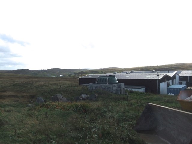
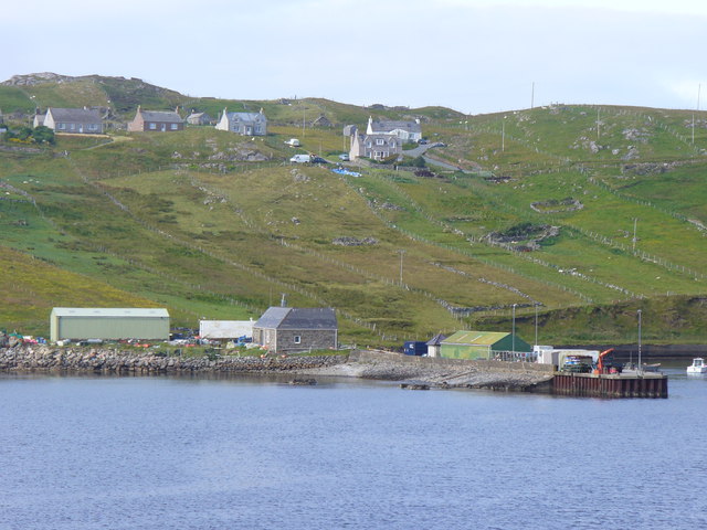
Sgeirean Rubha Thaoig Images

Images are sourced within 2km of 58.290959/-6.8117099 or Grid Reference NB1843. Thanks to Geograph Open Source API. All images are credited.

Blackhouse Village at Garenin
Ruin by Loch Garenin
Bus shelter near the Tweed Mill
Na Gearrannan The main road through the restored part of the old village of blackhouses. People lived in some of these houses up until 1974.
Na Gearrannan
The main road through the restored part of the old village of blackhouses. People lived in some of these houses up until 1974.
Buildings in Gearrannan Blackhouse Village
The road to Gearrannan Blackhouse Village
Loch Garenin Sea loch below the Black House Village.
Loch Garenin
Sea loch below the Black House Village.
Blackhouse Village at Garenin The village was occupied until 1974. Restored in the later years of the Century. The plaque commemorates the opening of the village as a visitor attraction by Princess Anne. Most of the black houses are let as self-catering holiday accommodation.
Blackhouse Village at Garenin
The village was occupied until 1974. Restored in the later years of the Century. The plaque commemorates the opening of the village as a visitor attraction by Princess Anne. Most of the black houses are let as self-catering holiday accommodation.
Cottage interior, Garenin Blackhouse Village
Garenin Blackhouses Museum Group of reconstructed blackhouses which give an excellent impression of what Hebridean hamlets would have looked like 200 years ago.
Garenin Blackhouses Museum
Group of reconstructed blackhouses which give an excellent impression of what Hebridean hamlets would have looked like 200 years ago.
Garenin Blackhouses Museum A reconstructed blackhouse settlement.
Garenin Blackhouses Museum
A reconstructed blackhouse settlement.
Rubha Mor Neidallt illicit still Illicit still hidden below a large rock outcrop. <span class="nowrap"><a title="https://canmore.org.uk/site/137120/lewis-rubha-mor-neidallt" rel="nofollow ugc noopener" href="https://canmore.org.uk/site/137120/lewis-rubha-mor-neidallt">Link</a><img style="margin-left:2px;" alt="External link" title="External link - shift click to open in new window" src="https://s1.geograph.org.uk/img/external.png" width="10" height="10"/></span>
Rubha Mor Neidallt illicit still
Illicit still hidden below a large rock outcrop. LinkExternal link
Rubha Mor Neidallt illicit still View into the building from the rock outcrop above the building. <span class="nowrap"><a title="https://canmore.org.uk/site/137120/lewis-rubha-mor-neidallt" rel="nofollow ugc noopener" href="https://canmore.org.uk/site/137120/lewis-rubha-mor-neidallt">Link</a><img style="margin-left:2px;" alt="External link" title="External link - shift click to open in new window" src="https://s1.geograph.org.uk/img/external.png" width="10" height="10"/></span>
Rubha Mor Neidallt illicit still
View into the building from the rock outcrop above the building. LinkExternal link
Marker Cairn
Marker Cairn
Historic shelter or shieling
Carloway Mill
Carloway Mill
Crofts, Borghastan Traditional field strips descending to the Loch Charlabhaig shoreline, with pier, from the crofts above.
Crofts, Borghastan
Traditional field strips descending to the Loch Charlabhaig shoreline, with pier, from the crofts above.
Show me another place!

Sgeirean Rubha Thaoig is located at Grid Ref: NB1843 (Lat: 58.290959, Lng: -6.8117099)

Unitary Authority: Na h-Eileanan an Iar

Police Authority: Highlands and Islands

What 3 Words

///beeline.curls.gain. Near Carloway, Na h-Eileanan Siar

Related Wikis

Garenin

Garenin (Scottish Gaelic: Na Gearrannan) is a crofting township on the west coast of the Isle of Lewis in the Outer Hebrides of Scotland. Garenin is in...

Borrowston, Lewis

Borrowston (Scottish Gaelic: Borghastan), with a population of about 50, is a crofting township situated on the Isle of Lewis, on the Outer Hebrides of...

Dun Carloway

Dun Carloway (Scottish Gaelic: Dùn Chàrlabhaigh) is a broch situated in the district of Carloway, on the west coast of the Isle of Lewis, Scotland (grid...

Carloway

Carloway (Scottish Gaelic: Càrlabhagh [ˈkʰaːɾɫ̪ə.ɤː]) is a crofting township and a district on the west coast of the Isle of Lewis, in the Outer Hebrides...

Have you been to Sgeirean Rubha Thaoig?

Leave your review of Sgeirean Rubha Thaoig below (or comments, questions and feedback).