Druidigeo
Coastal Feature, Headland, Point in Ross-shire
Scotland
Druidigeo

Druidigeo is a prominent coastal feature located in Ross-shire, Scotland. It is a rugged headland that stretches out into the North Sea, forming a distinct point along the coastline. The name Druidigeo is derived from the Gaelic language, with "druid" meaning "an oak tree" and "geo" referring to a narrow inlet or cove.
This headland is characterized by its dramatic cliffs, which rise up to considerable heights, offering stunning views of the surrounding area. The cliffs are composed of sedimentary rocks, displaying layers of different geological formations, providing valuable insights into the region's geological history.
The headland of Druidigeo is a haven for various bird species, making it a popular spot for birdwatching enthusiasts. Puffins, razorbills, guillemots, and gannets are among the many species that can be observed nesting and diving along the cliffs. The surrounding waters are also home to seals and dolphins, further enhancing the area's natural beauty and attracting wildlife enthusiasts.
As a coastal feature, Druidigeo is vulnerable to erosion caused by the relentless crashing waves, which have shaped the cliffs over centuries. The constant battering of the sea has resulted in the formation of sea caves and natural arches along the headland, adding to its allure.
Druidigeo is a popular destination for outdoor enthusiasts and nature lovers, who can enjoy coastal walks along the headland, explore the rugged terrain, and admire the breathtaking coastal views. Its remote location and untouched beauty make it a hidden gem for those seeking tranquility and a connection with nature.
If you have any feedback on the listing, please let us know in the comments section below.
Druidigeo Images
Images are sourced within 2km of 58.292499/-6.8042659 or Grid Reference NB1843. Thanks to Geograph Open Source API. All images are credited.


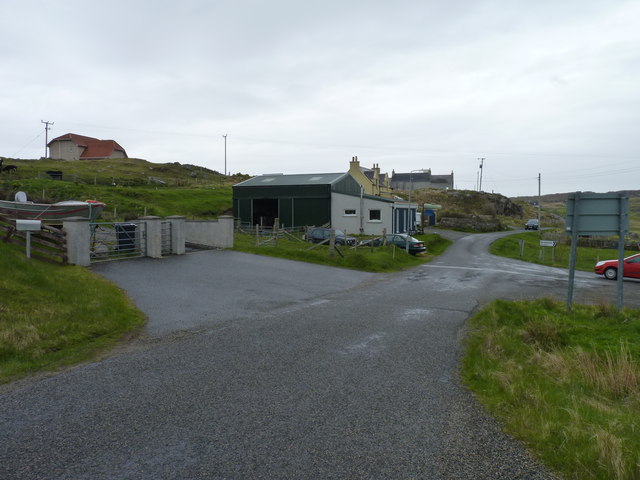
Druidigeo is located at Grid Ref: NB1843 (Lat: 58.292499, Lng: -6.8042659)
Unitary Authority: Na h-Eileanan an Iar
Police Authority: Highlands and Islands
What 3 Words
///restore.chains.commoners. Near Carloway, Na h-Eileanan Siar
Nearby Locations
Related Wikis

Garenin
Garenin (Scottish Gaelic: Na Gearrannan) is a crofting township on the west coast of the Isle of Lewis in the Outer Hebrides of Scotland. Garenin is in...

Borrowston, Lewis
Borrowston (Scottish Gaelic: Borghastan), with a population of about 50, is a crofting township situated on the Isle of Lewis, on the Outer Hebrides of...

Carloway
Carloway (Scottish Gaelic: Càrlabhagh [ˈkʰaːɾɫ̪ə.ɤː]) is a crofting township and a district on the west coast of the Isle of Lewis, in the Outer Hebrides...

Dun Carloway
Dun Carloway (Scottish Gaelic: Dùn Chàrlabhaigh) is a broch situated in the district of Carloway, on the west coast of the Isle of Lewis, Scotland (grid...
Related Videos
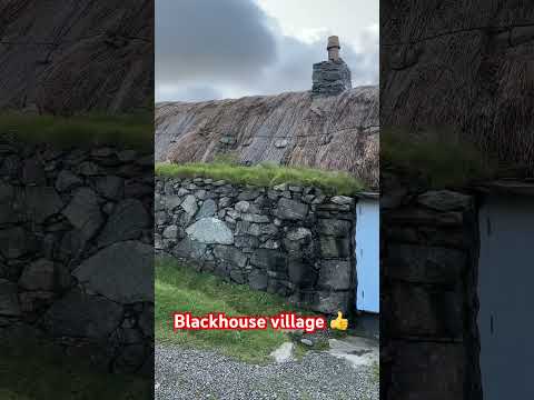

Gearrannan village of traditional houses
Gearrannan Black House village on the Isle of Lewis.
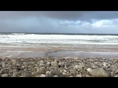
Dalmore - Isle of Lewis - Outer Hebrides
January 2023 - Dalmore - Isle of Lewis - Outer Hebrides Hit Subscribe for more content from here in the wonderful Western Isles of ...
Nearby Amenities
Located within 500m of 58.292499,-6.8042659Have you been to Druidigeo?
Leave your review of Druidigeo below (or comments, questions and feedback).