Eilean na Mùile
Island in Inverness-shire
Scotland
Eilean na Mùile

Eilean na Mùile is a small island located in Inverness-shire, on the west coast of Scotland. Also known as the Isle of Mull, it is situated in the Inner Hebrides and covers an area of approximately 875 square kilometers. The island is known for its picturesque landscapes, rugged cliffs, and stunning beaches, making it a popular destination for nature lovers and outdoor enthusiasts.
Eilean na Mùile is home to a diverse range of wildlife, including seals, otters, and various species of birds. The island's rich biodiversity can be explored through its numerous nature reserves and hiking trails, such as the popular Mull Eagle Watch, which provides visitors with the opportunity to observe majestic golden eagles in their natural habitat.
In terms of human habitation, the island has a population of around 3,000 residents. The main town on the island is Tobermory, famous for its brightly colored buildings lining the harbor. Tobermory offers various amenities to visitors, including accommodation options, restaurants, and shops selling local crafts and produce.
Eilean na Mùile is also known for its historical and cultural significance. Visitors can explore ancient castles and ruins, such as the iconic Duart Castle, which has been standing since the 13th century. The island also hosts several annual events and festivals, celebrating its Gaelic heritage and traditional music.
Overall, Eilean na Mùile offers a unique blend of natural beauty, wildlife, history, and culture, making it a must-visit destination for anyone seeking an authentic Scottish experience.
If you have any feedback on the listing, please let us know in the comments section below.
Eilean na Mùile Images
Images are sourced within 2km of 57.532108/-7.3269719 or Grid Reference NF8161. Thanks to Geograph Open Source API. All images are credited.


Eilean na Mùile is located at Grid Ref: NF8161 (Lat: 57.532108, Lng: -7.3269719)
Unitary Authority: Na h-Eileanan an Iar
Police Authority: Highlands and Islands
What 3 Words
///searcher.voters.brief. Near Balivanich, Na h-Eileanan Siar
Related Wikis

Battle of Carinish
The Battle of Carinish was a Scottish clan battle fought in North Uist in 1601. It was part of a year of feuding between Clan MacLeod of Dunvegan and the...

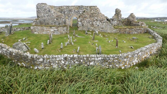
Teampull na Trionaid
Teampull na Trionaid ("trinity church") is a ruined 13th-century Augustinian nunnery at Carinish, on North Uist, in the Outer Hebrides of Scotland. �...

Carinish
Carinish (Scottish Gaelic: Càirinis), is a hamlet on North Uist, in the Outer Hebrides, Scotland. It is in the south of the island, about two miles (three...

Bail' Iochdrach
Bail' Iochdrach or Baliochrach (Scottish Gaelic: Am Baile Ìochdrach) is a village on Benbecula in the Outer Hebrides, Scotland. Baliochrach is within the...
Nearby Amenities
Located within 500m of 57.532108,-7.3269719Have you been to Eilean na Mùile?
Leave your review of Eilean na Mùile below (or comments, questions and feedback).