Eilean an Eòrna

Island in Inverness-shire

Scotland

Eilean an Eòrna

Houses at Samhla
Houses at Samhla Credit: Sandy Gerrard

Eilean an Eòrna, also known as Island of Barley, is a small uninhabited island located in the Scottish Highlands, in Inverness-shire, Scotland. Situated in Loch Eil, the island is approximately 200 meters long and 100 meters wide, with a total area of about 1.5 hectares.

The island is characterized by its rugged and rocky terrain, with a few small patches of vegetation, mostly heather and grass. It is surrounded by the picturesque waters of Loch Eil, providing stunning views of the surrounding mountains and the nearby Eilean Donan Castle.

Access to Eilean an Eòrna is challenging as there are no regular transportation services to the island. However, it is possible to reach the island by private boat or canoe. The island is popular among nature enthusiasts, hikers, and photographers, who visit to appreciate its unspoiled beauty and tranquility.

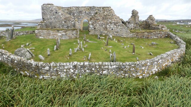
Historically, Eilean an Eòrna was used for grazing livestock, particularly sheep. Evidence of old stone walls and ruins can still be seen, serving as a reminder of its past use. Today, the island is a haven for wildlife, with various bird species, including the common gull and oystercatcher, frequently spotted in the area.

Eilean an Eòrna offers an opportunity for visitors to experience the natural beauty of the Scottish Highlands, away from the hustle and bustle of city life. Its untouched landscape and serene atmosphere make it an idyllic spot for those seeking a peaceful retreat or a chance to connect with nature.

If you have any feedback on the listing, please let us know in the comments section below.

Eilean an Eòrna Images

Images are sourced within 2km of 57.531818/-7.3295895 or Grid Reference NF8161. Thanks to Geograph Open Source API. All images are credited.

Houses at Samhla
Houses at Samhla
House at Carinish
House at Carinish
Marshy area at Carinish Seemingly a naturally infilled loch.
Marshy area at Carinish
Seemingly a naturally infilled loch.
Outside Talla Chairinis, North Uist Outside a community hall
Outside Talla Chairinis, North Uist
Outside a community hall
Blar Chairinis Site of battle in 1601.
Blar Chairinis
Site of battle in 1601.
Stone barn at Carinish
The ruins of Trinity Temple (Teampull na Trianaid) According to the plaque "Medieval monastery and college of European significance, founded by Beathag, daughter of Somhairle (Somerled).  Enlarged about 1350 to 1390 by Amie Mic Ruarie, first wife of John, Lord of the Isles.  Reconstructed in the 16th century.  Destroyed after the reformation.  Later restored in the 19th century by Dotair Ban."
The ruins of Trinity Temple (Teampull na Trianaid)
According to the plaque "Medieval monastery and college of European significance, founded by Beathag, daughter of Somhairle (Somerled). Enlarged about 1350 to 1390 by Amie Mic Ruarie, first wife of John, Lord of the Isles. Reconstructed in the 16th century. Destroyed after the reformation. Later restored in the 19th century by Dotair Ban."
Field and houses at Carinish And also the site of Feith na Fala (The ditch of blood) - a battle waged in 1601 between the MacLeods and the MacDonalds.
Field and houses at Carinish
And also the site of Feith na Fala (The ditch of blood) - a battle waged in 1601 between the MacLeods and the MacDonalds.
Bagh a’ Ghriasaiche
Bagh a’ Ghriasaiche
Fèithe na Fala - The ditch of blood
View from Temple View Hotel Teampull na Trionaid is a ruined 13th-century church and seminary at Carinish, North Uist, Scotland. Amie mac Ruari is said to have rebuilt the church in the 14th century after her divorce from John of Islay, Lord of the Isles. The ruins are protected as a scheduled monument.
View from Temple View Hotel
Teampull na Trionaid is a ruined 13th-century church and seminary at Carinish, North Uist, Scotland. Amie mac Ruari is said to have rebuilt the church in the 14th century after her divorce from John of Islay, Lord of the Isles. The ruins are protected as a scheduled monument.
Closer to the temple The ruins of Trinity Temple (Teampull na Trianaid)
Closer to the temple
The ruins of Trinity Temple (Teampull na Trianaid)
Free Church, Cairinis Current OS maps show this as a church, but older versions show it as a pub, which was its original purpose. Enough said.
Free Church, Cairinis
Current OS maps show this as a church, but older versions show it as a pub, which was its original purpose. Enough said.
A not very useful gate A rusty old metal gate at the point where a fence once crossed the track.
A not very useful gate
A rusty old metal gate at the point where a fence once crossed the track.
Track above Loch Creag nan Speireag This track, which is indistinct in places, forms part of the Hebridean Way, a relatively new walking route through the Western Isles.
Track above Loch Creag nan Speireag
This track, which is indistinct in places, forms part of the Hebridean Way, a relatively new walking route through the Western Isles.
Cotton grass, Creag nan Speireag Looking over cotton grass towards Loch nan Speireag and the houses at Gearraidh Cladach.
Cotton grass, Creag nan Speireag
Looking over cotton grass towards Loch nan Speireag and the houses at Gearraidh Cladach.
Teampull Na Trionaid A 14th century church with earlier origins. <span class="nowrap"><a title="https://canmore.org.uk/site/10265/north-uist-carinish-teampull-na-trionaid" rel="nofollow ugc noopener" href="https://canmore.org.uk/site/10265/north-uist-carinish-teampull-na-trionaid">Link</a><img style="margin-left:2px;" alt="External link" title="External link - shift click to open in new window" src="https://s1.geograph.org.uk/img/external.png" width="10" height="10"/></span>
Teampull Na Trionaid
A 14th century church with earlier origins. LinkExternal link
Teampull Na Trionaid View from the south. <span class="nowrap"><a title="https://canmore.org.uk/site/10265/north-uist-carinish-teampull-na-trionaid" rel="nofollow ugc noopener" href="https://canmore.org.uk/site/10265/north-uist-carinish-teampull-na-trionaid">Link</a><img style="margin-left:2px;" alt="External link" title="External link - shift click to open in new window" src="https://s1.geograph.org.uk/img/external.png" width="10" height="10"/></span>
Teampull Na Trionaid
View from the south. LinkExternal link
Show me another place!

Eilean an Eòrna is located at Grid Ref: NF8161 (Lat: 57.531818, Lng: -7.3295895)

Unitary Authority: Na h-Eileanan an Iar

Police Authority: Highlands and Islands

What 3 Words

///struck.tabs.cuddling. Near Balivanich, Na h-Eileanan Siar

Related Wikis

Battle of Carinish

The Battle of Carinish was a Scottish clan battle fought in North Uist in 1601. It was part of a year of feuding between Clan MacLeod of Dunvegan and the...

Teampull na Trionaid

Teampull na Trionaid ("trinity church") is a ruined 13th-century Augustinian nunnery at Carinish, on North Uist, in the Outer Hebrides of Scotland. �...

Carinish

Carinish (Scottish Gaelic: Càirinis), is a hamlet on North Uist, in the Outer Hebrides, Scotland. It is in the south of the island, about two miles (three...

Bail' Iochdrach

Bail' Iochdrach or Baliochrach (Scottish Gaelic: Am Baile Ìochdrach) is a village on Benbecula in the Outer Hebrides, Scotland. Baliochrach is within the...

Nearby Amenities

Located within 500m of 57.531818,-7.3295895
Power: pole
Lat/Long: 57.531656/-7.3218377
Power: pole
Lat/Long: 57.5315898/-7.3224358
Power: pole
Lat/Long: 57.5322867/-7.3226665
Power: pole
Lat/Long: 57.5330124/-7.3229025
Power: pole
Lat/Long: 57.5336747/-7.3231252
Power: pole
Lat/Long: 57.5343543/-7.3233397
The data included in this document is from www.openstreetmap.org. The data is made available under ODbL.

Have you been to Eilean an Eòrna?

Leave your review of Eilean an Eòrna below (or comments, questions and feedback).