Loch an Fhaing Bhuidhe
Lake, Pool, Pond, Freshwater Marsh in Inverness-shire
Scotland
Loch an Fhaing Bhuidhe

Loch an Fhaing Bhuidhe, located in Inverness-shire, Scotland, is a picturesque freshwater loch nestled amidst the breathtaking Scottish Highlands. With its captivating beauty and serene atmosphere, it attracts both locals and tourists seeking tranquility and natural wonder.
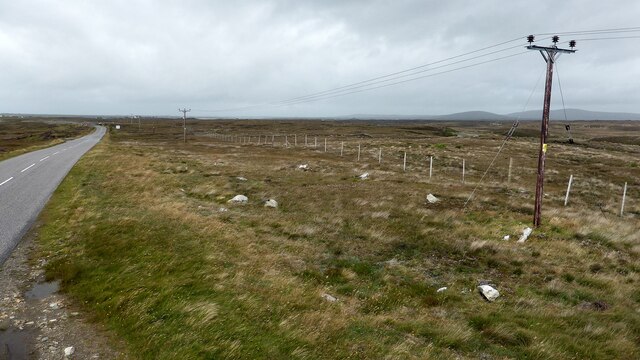
Covering an area of approximately 2 square kilometers, Loch an Fhaing Bhuidhe is surrounded by rolling hills and lush greenery, providing a stunning backdrop for any visitor. Its crystal-clear waters reflect the surrounding landscape, creating a mesmerizing sight that captivates the senses.
The loch is home to a variety of aquatic life, including several species of fish like brown trout and salmon, making it a popular spot for fishing enthusiasts. The tranquil waters also attract a diverse range of bird species, making it a haven for birdwatchers and nature enthusiasts alike.
Surrounding the loch, there is a freshwater marsh that adds to the biodiversity of the area. This marshland is a haven for various plant species, including reeds and water lilies, which provide a vibrant and colorful display during the warmer months.
The calm and peaceful ambiance of Loch an Fhaing Bhuidhe invites visitors to explore its shores and immerse themselves in the surrounding natural beauty. Whether it's a leisurely stroll along the banks, a picnic with loved ones, or simply sitting by the water and enjoying the tranquility, this loch offers a serene escape from the hustle and bustle of everyday life.
In conclusion, Loch an Fhaing Bhuidhe is a captivating freshwater loch that showcases the stunning Scottish Highlands landscape. With its diverse wildlife, peaceful surroundings, and beautiful marshland, it offers a haven of tranquility for all who venture to its shores.
If you have any feedback on the listing, please let us know in the comments section below.
Loch an Fhaing Bhuidhe Images
Images are sourced within 2km of 57.529486/-7.3198129 or Grid Reference NF8161. Thanks to Geograph Open Source API. All images are credited.


Loch an Fhaing Bhuidhe is located at Grid Ref: NF8161 (Lat: 57.529486, Lng: -7.3198129)
Unitary Authority: Na h-Eileanan an Iar
Police Authority: Highlands and Islands
What 3 Words
///fools.shorts.pinks. Near Balivanich, Na h-Eileanan Siar
Related Wikis

Battle of Carinish
The Battle of Carinish was a Scottish clan battle fought in North Uist in 1601. It was part of a year of feuding between Clan MacLeod of Dunvegan and the...

Carinish
Carinish (Scottish Gaelic: Càirinis), is a hamlet on North Uist, in the Outer Hebrides, Scotland. It is in the south of the island, about two miles (three...

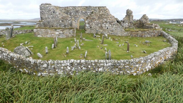
Teampull na Trionaid
Teampull na Trionaid ("trinity church") is a ruined 13th-century Augustinian nunnery at Carinish, on North Uist, in the Outer Hebrides of Scotland. �...

Bail' Iochdrach
Bail' Iochdrach or Baliochrach (Scottish Gaelic: Am Baile Ìochdrach) is a village on Benbecula in the Outer Hebrides, Scotland. Baliochrach is within the...
Nearby Amenities
Located within 500m of 57.529486,-7.3198129Have you been to Loch an Fhaing Bhuidhe?
Leave your review of Loch an Fhaing Bhuidhe below (or comments, questions and feedback).