Teistie Taing
Coastal Marsh, Saltings in Orkney
Scotland
Teistie Taing

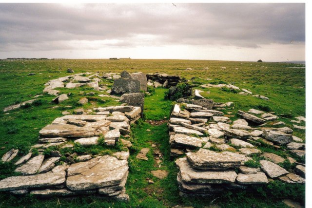
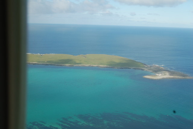
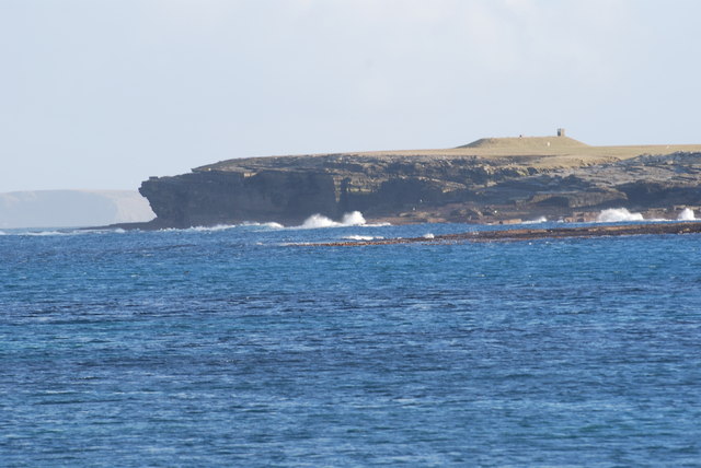
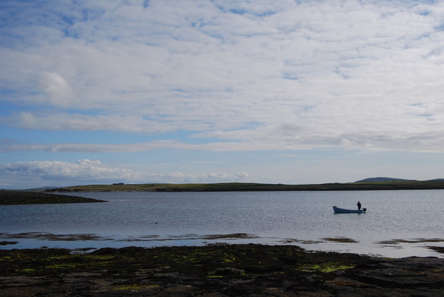
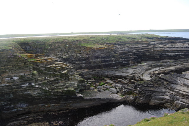
Teistie Taing, located in Orkney, is a picturesque coastal marsh and saltings area that offers breathtaking views and a unique ecosystem. This natural wonder is situated on the edge of the North Atlantic Ocean, making it an ideal spot for wildlife enthusiasts and nature lovers.
The name "Teistie Taing" is derived from the Scottish word "teistie," which refers to the local bird species known as the Arctic tern, and "taing," meaning a strip of land. This name perfectly encapsulates the essence of this region, as it is home to a diverse range of bird species, including the iconic Arctic terns.
The coastal marsh and saltings of Teistie Taing provide a vital habitat for both resident and migratory birds. The area is characterized by a mix of saltmarsh, sand dunes, and mud flats, creating an ideal environment for bird nesting, feeding, and roosting. It is a designated Special Protection Area (SPA) and a Site of Special Scientific Interest (SSSI) due to its importance for bird conservation.
Visitors to Teistie Taing can witness a spectacular array of bird species, including waders like redshanks, dunlins, and oystercatchers, as well as numerous terns, gulls, and waterfowl. The marsh and saltings also attract other wildlife, such as seals, otters, and various plant species adapted to the coastal environment.
To preserve and protect this unique ecosystem, access to Teistie Taing is carefully managed, ensuring visitors can enjoy its natural beauty while minimizing disturbance to the wildlife. Interpretive signage and walking paths provide information and guidance to visitors, offering an educational and immersive experience in this stunning coastal marsh and saltings area.
If you have any feedback on the listing, please let us know in the comments section below.
Teistie Taing Images
Images are sourced within 2km of 59.345542/-2.8655789 or Grid Reference HY5051. Thanks to Geograph Open Source API. All images are credited.


Teistie Taing is located at Grid Ref: HY5051 (Lat: 59.345542, Lng: -2.8655789)
Unitary Authority: Orkney Islands
Police Authority: Highlands and Islands
What 3 Words
///booklets.nodded.giant. Near Pierowall, Orkney Islands
Nearby Locations
Related Wikis

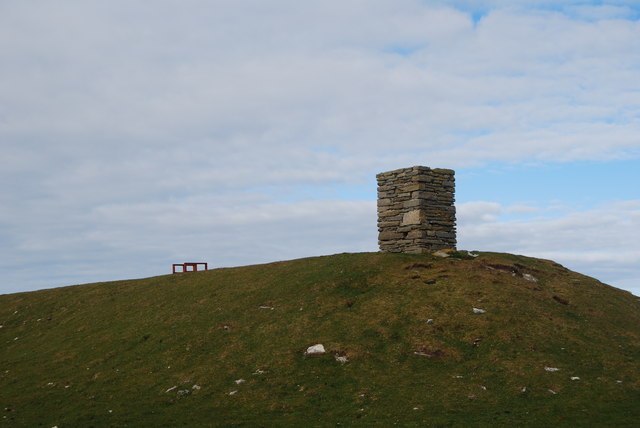
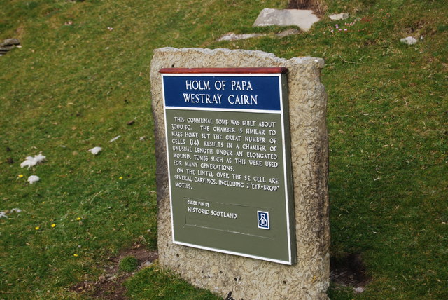
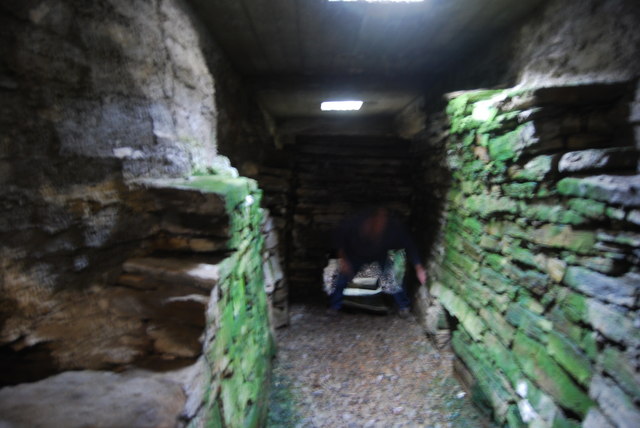
Holm of Papa
The Holm of Papa (or Holm of Papay, Holm of Papa Westray and known locally as the Papay Holm,) is a very small uninhabited island in the Orkney Islands...

Holland House, Papa Westray
Holland Farm is a historic farm complex located on the island of Papa Westray in Orkney, Scotland. The two-storey harled flagstone house with crow-stepped...

Papa Westray
Papa Westray () (Scots: Papa Westree), also known as Papay, is one of the Orkney Islands in Scotland, United Kingdom. The fertile soil has long been a...

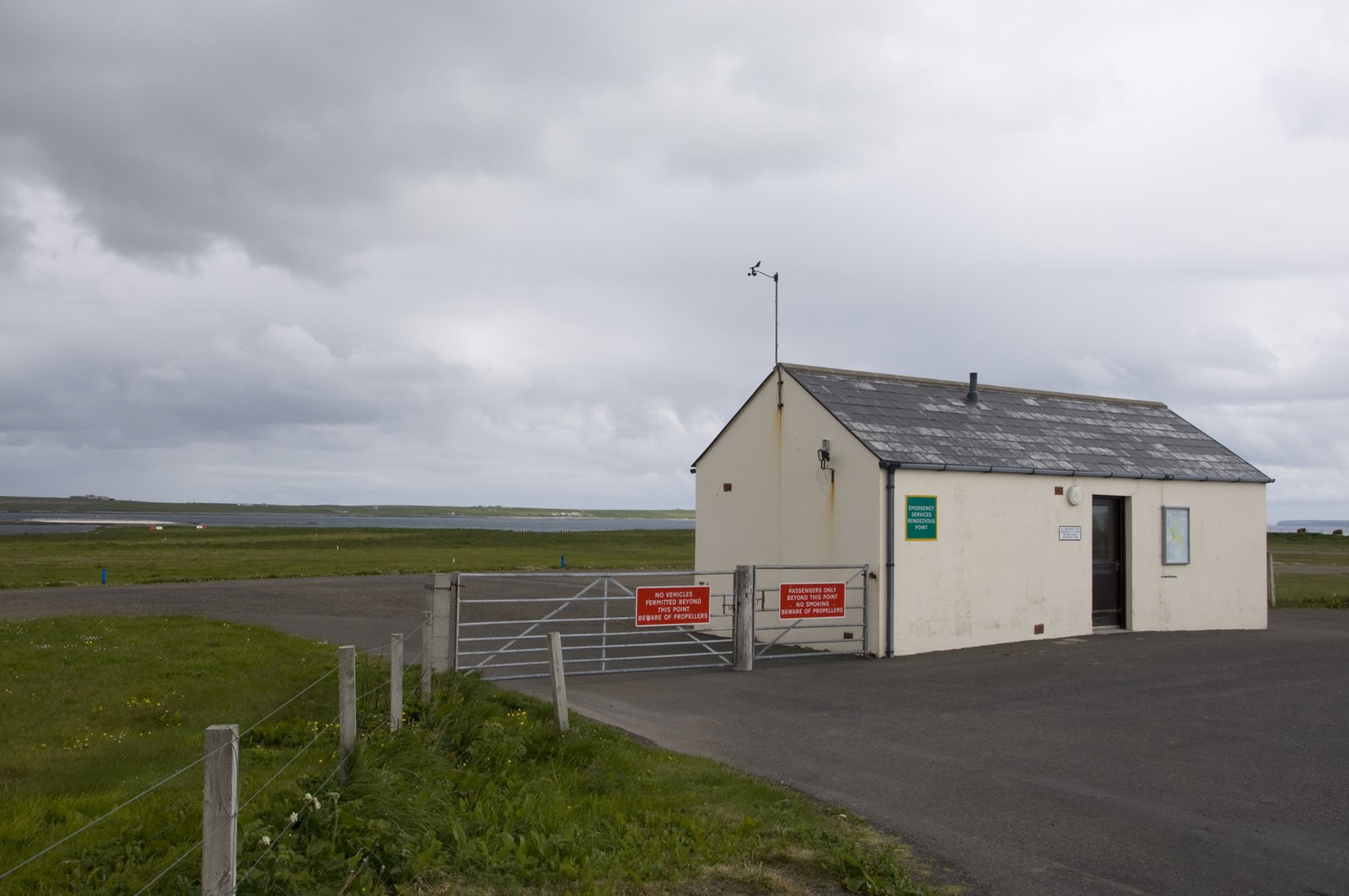
Papa Westray Airport
Papa Westray Airport (IATA: PPW, ICAO: EGEP) is located 22 NM (41 km; 25 mi) north of Kirkwall Airport on Papa Westray, Orkney Islands, Scotland. The facility...

St Boniface's Church, Papa Westray
St Boniface's Church, Papa Westray is a historic church and graveyard located on the island of Papa Westray in Orkney, Scotland. The site of the church...

Knap of Howar
The Knap of Howar () on the island of Papa Westray in Orkney, Scotland is a Neolithic farmstead which may be the oldest preserved stone house in northern...
Westray Airport
Westray Airport (IATA: WRY, ICAO: EGEW) is an airport at Aikerness, on Westray in the Orkney Islands, Scotland. It is best known for being one of the two...

Quoygrew settlement, Westray
Quoygrew, Westray is the site of a medieval Norse settlement on the island of Westray in Orkney, Scotland. Established as a small farmstead most likely...
Have you been to Teistie Taing?
Leave your review of Teistie Taing below (or comments, questions and feedback).