Scarf Geo
Coastal Feature, Headland, Point in Orkney
Scotland
Scarf Geo

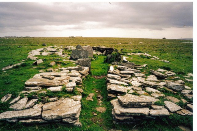
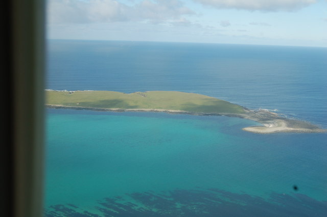
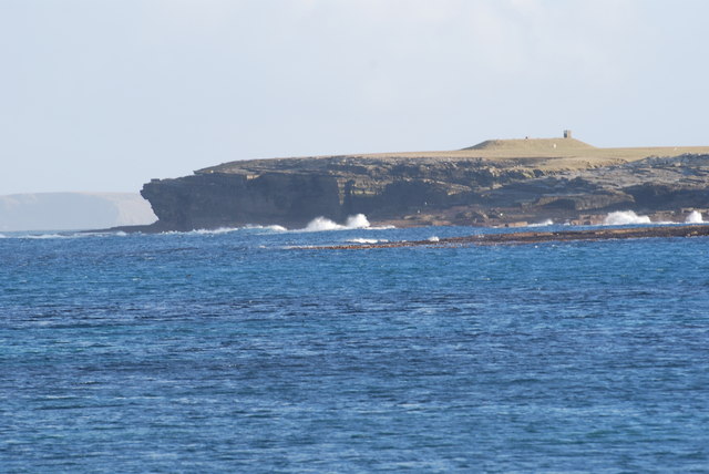
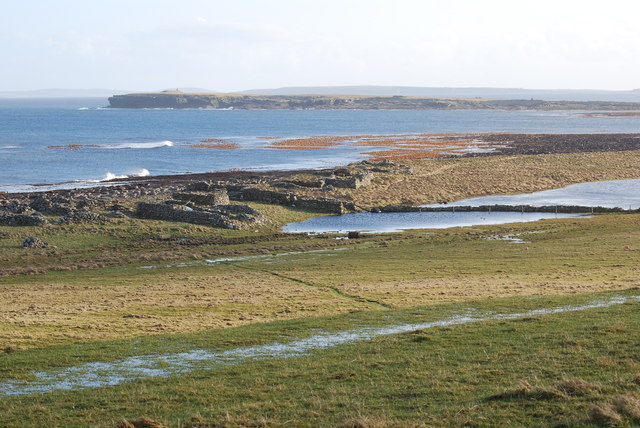
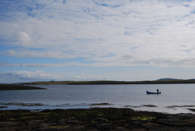
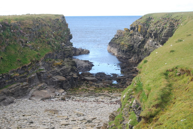
Scarf Geo is a prominent coastal feature located on the northern coast of Orkney, Scotland. It is a headland that juts out into the North Sea, forming a distinct point along the rugged coastline. The name "Scarf Geo" is derived from the Old Norse word "skerf," meaning a piece cut off, which accurately describes the shape of this geological formation.
The headland is characterized by steep cliffs that rise dramatically from the sea, reaching heights of up to 30 meters (98 feet). These cliffs are composed of sedimentary rock layers, which have been shaped by the relentless power of the ocean over thousands of years. The exposed rock formations provide a glimpse into the geological history of the area, revealing evidence of ancient marine sediments and fossilized remains.
Scarf Geo is known for its stunning natural beauty and is a popular destination for nature enthusiasts and hikers. The headland offers breathtaking panoramic views of the surrounding coastline and the vast expanse of the North Sea. The crashing waves against the cliffs create a mesmerizing spectacle, especially during stormy weather.
The area surrounding Scarf Geo is rich in biodiversity, supporting a diverse range of plant and animal species. Seabirds, such as fulmars and kittiwakes, nest on the cliffs, while seals can often be seen basking on nearby rocky outcrops. The coastal waters are also home to a variety of marine life, including dolphins and porpoises.
Overall, Scarf Geo is an impressive coastal feature that showcases the natural beauty and geological heritage of Orkney. It offers visitors a unique opportunity to appreciate the raw power of the sea and the diverse ecosystems that thrive in this rugged environment.
If you have any feedback on the listing, please let us know in the comments section below.
Scarf Geo Images
Images are sourced within 2km of 59.350351/-2.8635559 or Grid Reference HY5051. Thanks to Geograph Open Source API. All images are credited.


Scarf Geo is located at Grid Ref: HY5051 (Lat: 59.350351, Lng: -2.8635559)
Unitary Authority: Orkney Islands
Police Authority: Highlands and Islands
What 3 Words
///fully.shocked.continues. Near Pierowall, Orkney Islands
Nearby Locations
Related Wikis

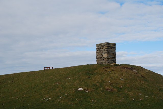
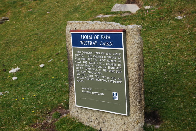
Holm of Papa
The Holm of Papa (or Holm of Papay, Holm of Papa Westray and known locally as the Papay Holm,) is a very small uninhabited island in the Orkney Islands...

Papa Westray
Papa Westray () (Scots: Papa Westree), also known as Papay, is one of the Orkney Islands in Scotland, United Kingdom. The fertile soil has long been a...

Papa Westray Airport
Papa Westray Airport (IATA: PPW, ICAO: EGEP) is located 22 NM (41 km; 25 mi) north of Kirkwall Airport on Papa Westray, Orkney Islands, Scotland. The facility...

Holland House, Papa Westray
Holland Farm is a historic farm complex located on the island of Papa Westray in Orkney, Scotland. The two-storey harled flagstone house with crow-stepped...

St Boniface's Church, Papa Westray
St Boniface's Church, Papa Westray is a historic church and graveyard located on the island of Papa Westray in Orkney, Scotland. The site of the church...

Knap of Howar
The Knap of Howar () on the island of Papa Westray in Orkney, Scotland is a Neolithic farmstead which may be the oldest preserved stone house in northern...
Westray Airport
Westray Airport (IATA: WRY, ICAO: EGEW) is an airport at Aikerness, on Westray in the Orkney Islands, Scotland. It is best known for being one of the two...

Quoygrew settlement, Westray
Quoygrew, Westray is the site of a medieval Norse settlement on the island of Westray in Orkney, Scotland. Established as a small farmstead most likely...
Have you been to Scarf Geo?
Leave your review of Scarf Geo below (or comments, questions and feedback).