South Cruive
Coastal Feature, Headland, Point in Orkney
Scotland
South Cruive

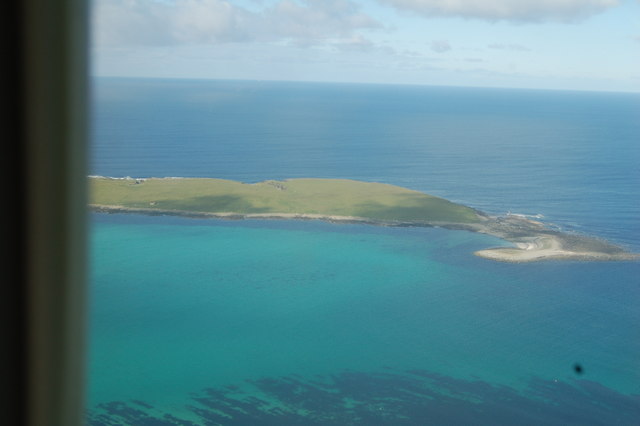
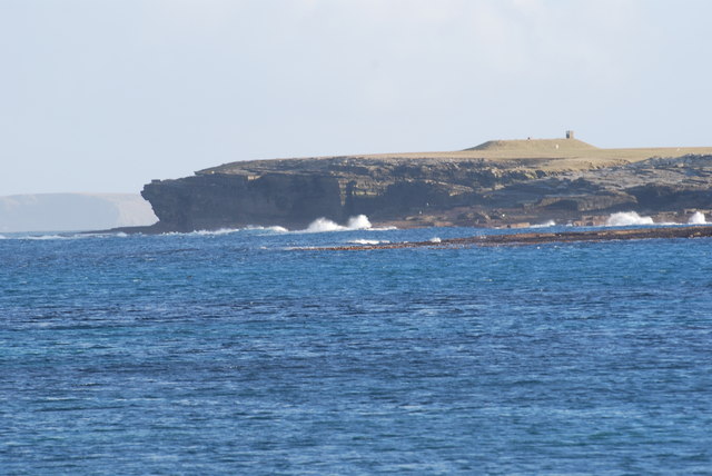
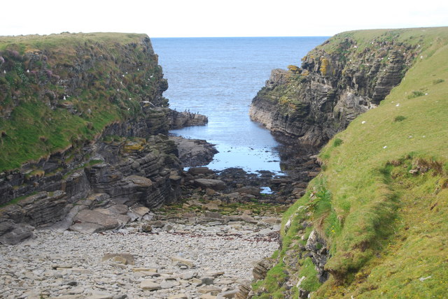
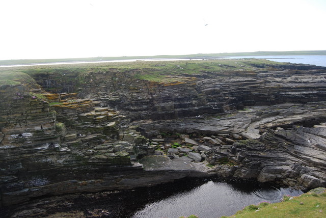
South Cruive is a prominent headland located on the southern coast of Orkney, an archipelago in Scotland. Situated near the village of St. Margaret's Hope, this coastal feature offers breathtaking panoramic views of the surrounding area. With its rugged cliffs and dramatic rocky outcrops, South Cruive is a popular destination for nature enthusiasts and outdoor adventurers.
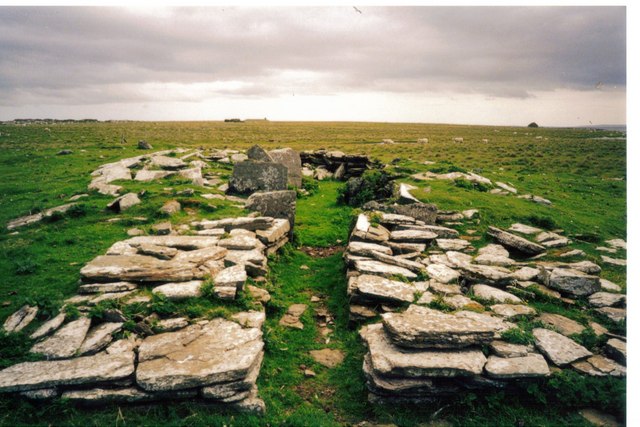
The headland is characterized by its distinctive geology, comprised mainly of sandstone and shale formations. These sedimentary rocks have been shaped over centuries by the relentless forces of wind and water, resulting in impressive sea stacks and caves that add to the area's scenic allure.
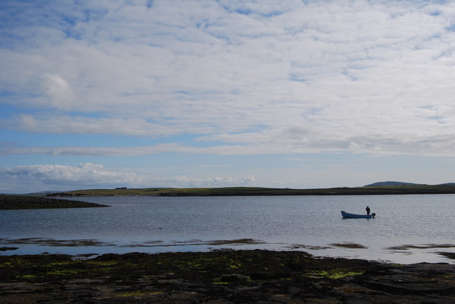
South Cruive is also home to a diverse range of wildlife. The surrounding waters are teeming with marine life, including seals, dolphins, and various seabird species, such as guillemots and puffins. Birdwatchers flock to the headland to observe these fascinating creatures in their natural habitat.
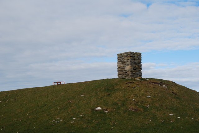
In addition to its natural beauty, South Cruive holds historical significance. It is believed that the headland served as a lookout point during ancient times, with archaeological evidence suggesting human activity in the area dating back thousands of years. Ruins of ancient settlements and burial mounds can still be found in the vicinity, offering glimpses into Orkney's rich cultural heritage.
Visitors to South Cruive can enjoy leisurely walks along the headland, taking in the stunning coastal scenery and immersing themselves in the tranquility of the surroundings. The area is easily accessible by foot, with well-maintained paths and designated viewpoints for optimal sightseeing. Whether exploring the geological wonders, observing wildlife, or delving into history, South Cruive is a captivating coastal feature that showcases the natural and cultural treasures of Orkney.
If you have any feedback on the listing, please let us know in the comments section below.
South Cruive Images
Images are sourced within 2km of 59.346285/-2.8672506 or Grid Reference HY5051. Thanks to Geograph Open Source API. All images are credited.


South Cruive is located at Grid Ref: HY5051 (Lat: 59.346285, Lng: -2.8672506)
Unitary Authority: Orkney Islands
Police Authority: Highlands and Islands
What 3 Words
///gosh.deform.rekindle. Near Pierowall, Orkney Islands
Nearby Locations
Related Wikis

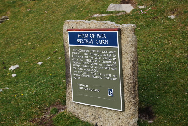
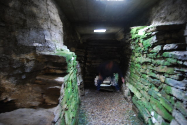
Holm of Papa
The Holm of Papa (or Holm of Papay, Holm of Papa Westray and known locally as the Papay Holm,) is a very small uninhabited island in the Orkney Islands...

Holland House, Papa Westray
Holland Farm is a historic farm complex located on the island of Papa Westray in Orkney, Scotland. The two-storey harled flagstone house with crow-stepped...

Papa Westray
Papa Westray () (Scots: Papa Westree), also known as Papay, is one of the Orkney Islands in Scotland, United Kingdom. The fertile soil has long been a...

Papa Westray Airport
Papa Westray Airport (IATA: PPW, ICAO: EGEP) is located 22 NM (41 km; 25 mi) north of Kirkwall Airport on Papa Westray, Orkney Islands, Scotland. The facility...

St Boniface's Church, Papa Westray
St Boniface's Church, Papa Westray is a historic church and graveyard located on the island of Papa Westray in Orkney, Scotland. The site of the church...

Knap of Howar
The Knap of Howar () on the island of Papa Westray in Orkney, Scotland is a Neolithic farmstead which may be the oldest preserved stone house in northern...
Westray Airport
Westray Airport (IATA: WRY, ICAO: EGEW) is an airport at Aikerness, on Westray in the Orkney Islands, Scotland. It is best known for being one of the two...

Quoygrew settlement, Westray
Quoygrew, Westray is the site of a medieval Norse settlement on the island of Westray in Orkney, Scotland. Established as a small farmstead most likely...
Have you been to South Cruive?
Leave your review of South Cruive below (or comments, questions and feedback).