Geo of Vatsvie
Coastal Feature, Headland, Point in Shetland
Scotland
Geo of Vatsvie

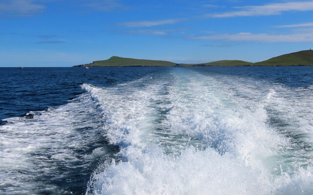
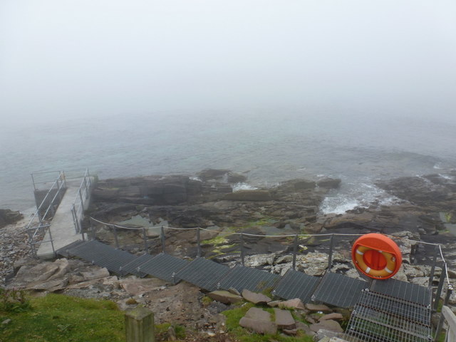
Geo of Vatsvie is a prominent coastal feature located on the island of Shetland, which belongs to Scotland. It is specifically situated on the west side of the island, near the village of Aithsetter. This coastal feature is classified as a headland or point, as it extends out into the sea, forming a distinctive and visually appealing land formation.
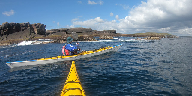
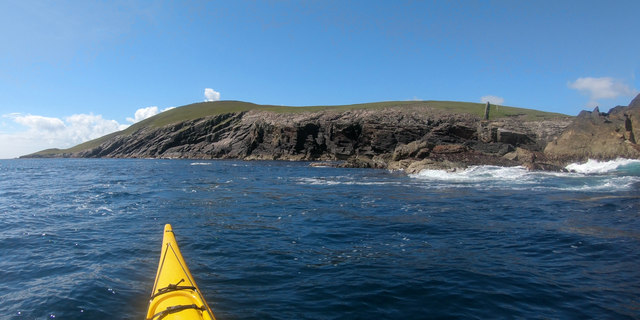
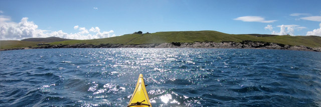
Geo of Vatsvie is characterized by its rugged and rocky cliffs that jut out from the mainland. These cliffs rise to impressive heights, providing breathtaking views of the surrounding landscape and the vast Atlantic Ocean. The headland is composed of various types of rock, including sandstone and granite, which have been shaped by the relentless forces of wind and water over thousands of years.
The area surrounding Geo of Vatsvie is renowned for its rich wildlife. The cliffs provide nesting sites for a variety of seabirds, including puffins, fulmars, and guillemots. Additionally, seals can often be spotted lounging on the rocks or swimming in the waters below.
For visitors, Geo of Vatsvie offers excellent opportunities for coastal walks and exploration. The headland is easily accessible from nearby paths and offers stunning panoramic views of the surrounding coastline. Its dramatic cliffs and crashing waves make it a popular spot for photographers, nature enthusiasts, and those seeking tranquility in nature.
Overall, Geo of Vatsvie is a captivating coastal feature that showcases the natural beauty and geological diversity of the Shetland Islands. Its rugged cliffs, diverse wildlife, and scenic vistas make it a must-see destination for anyone visiting the area.
If you have any feedback on the listing, please let us know in the comments section below.
Geo of Vatsvie Images
Images are sourced within 2km of 60.162048/-1.04937 or Grid Reference HU5242. Thanks to Geograph Open Source API. All images are credited.


Geo of Vatsvie is located at Grid Ref: HU5242 (Lat: 60.162048, Lng: -1.04937)
Unitary Authority: Shetland Islands
Police Authority: Highlands and Islands
What 3 Words
///laughs.gladiators.playfully. Near Lerwick, Shetland Islands
Nearby Locations
Related Wikis

Broch of Cullingsburgh
The Broch of Cullingsburgh is an Iron Age broch located in the Shetland islands. == Location == Located on Bressay, off the east coast of mainland Shetland...

Voe of Cullingsburgh
Voe of Cullingsburgh is a large sea loch off the Shetland island of Bressay, voe meaning "sea inlet" in Shetland dialect. The local spelling of the name...

Bressay
Bressay (Scots: Bressa) is a populated island in the Shetland archipelago of Scotland. == Geography and geology == Bressay lies due south of Whalsay, west...
Isle of Noss
The Isle of Noss or Noss (Scots: Noss) is a small, previously inhabited island in Shetland, Scotland. Noss is separated from the island of Bressay by the...

Holm of Noss
The Holm of Noss or Cradle Holm is an uninhabited islet of the Shetland Islands. It is about 48m at its highest point. == Geography and geology == It is...

Gardie House
Gardie House is an 18th-century estate house on Bressay in Shetland, Scotland. Located opposite Lerwick, across the Bressay Sound, Gardie is described...
Bressay transmitting station
Bressay transmitting station is a broadcasting transmission facility for the Shetland Islands, located on the isle of Bressay, owned and operated by Arqiva...
Lerwick and Bressay Parish Church
Lerwick and Bressay Parish Church is the largest Church of Scotland congregation in Shetland, serving the islands' capital Lerwick and the surrounding...
Nearby Amenities
Located within 500m of 60.162048,-1.04937Have you been to Geo of Vatsvie?
Leave your review of Geo of Vatsvie below (or comments, questions and feedback).