Corbie Geo

Coastal Feature, Headland, Point in Shetland

Scotland

Corbie Geo

Gungstie, Noss I am looking back as we leave Noss Sound, Shetland, on our way back to Lerwick.  The rocky outcrop of Gungstie is to the right of shot and the distinctive Hill of Setter (to the south of Noss) can be seen in the distance.
Gungstie, Noss Credit: Carroll Pierce

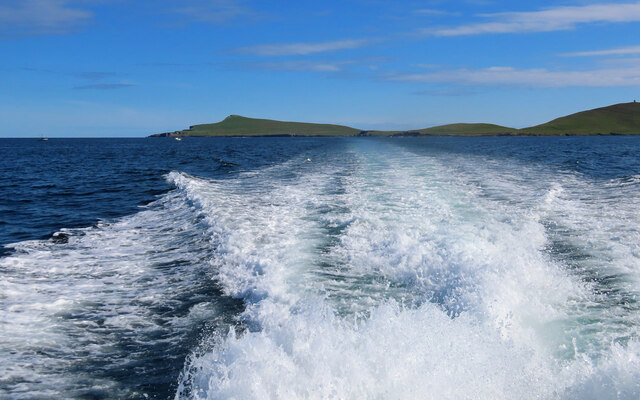
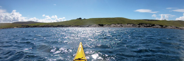
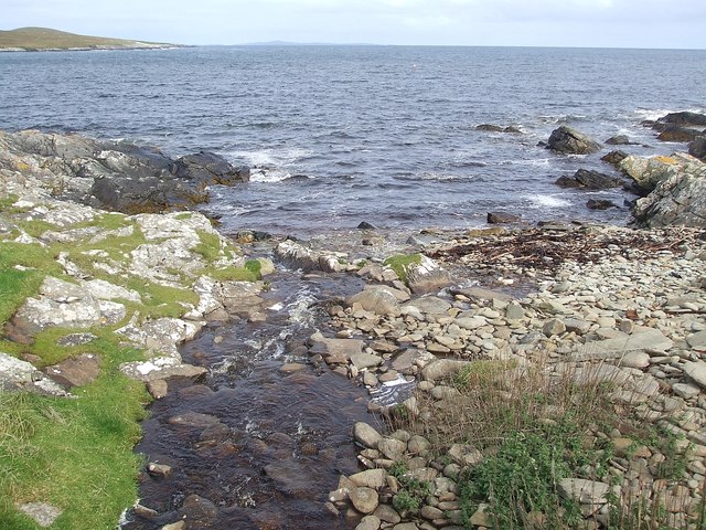
Corbie Geo is a prominent coastal feature located on the Shetland Islands, an archipelago in Scotland, United Kingdom. It is classified as a headland or point due to its protruding nature into the sea. Situated on the eastern coast of the mainland, Corbie Geo offers breathtaking views of the North Sea and its rugged cliffs make it a popular destination for tourists and nature enthusiasts.

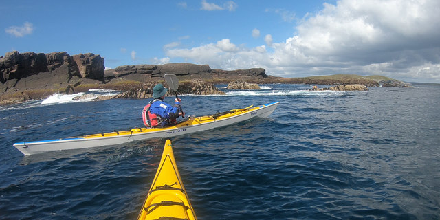
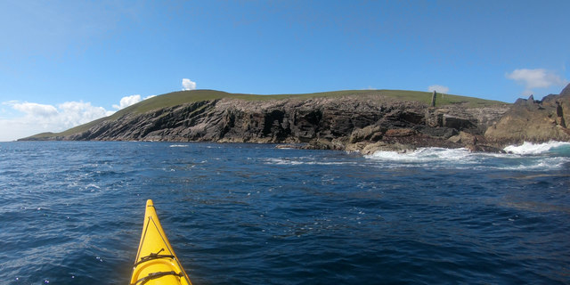
The headland is characterized by its towering cliffs, which reach heights of up to 100 meters (328 feet) above sea level. These cliffs are composed of layers of sedimentary rocks, showcasing the region's geological history. The rocks are predominantly sandstone and shale, displaying a variety of colors and textures that add to the area's aesthetic appeal.

Corbie Geo is known for its diverse wildlife, attracting birdwatchers from far and wide. The cliffs provide nesting sites for a range of seabirds, including puffins, guillemots, and fulmars. Visitors can often spot these majestic birds soaring through the air or perched on the ledges.

Access to Corbie Geo is relatively easy, with a well-maintained footpath leading from the nearby village of Sandwick. The path meanders along the coastline, offering glimpses of the dramatic cliffs and the opportunity to explore the surrounding area. However, caution is advised, as the terrain can be steep and slippery in places.

Corbie Geo is not only a scenic spot but also an important geological and ecological site. Its towering cliffs, rich wildlife, and easy accessibility make it an attractive destination for those seeking to immerse themselves in the natural beauty of the Shetland Islands.

If you have any feedback on the listing, please let us know in the comments section below.
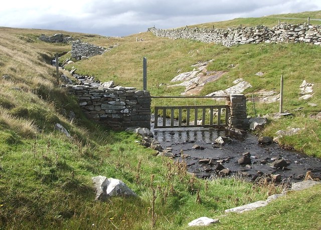
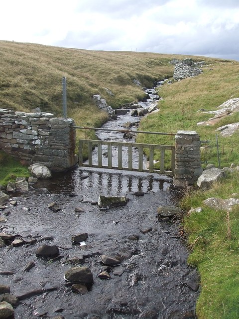
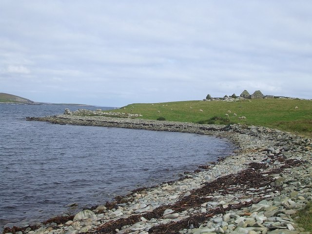
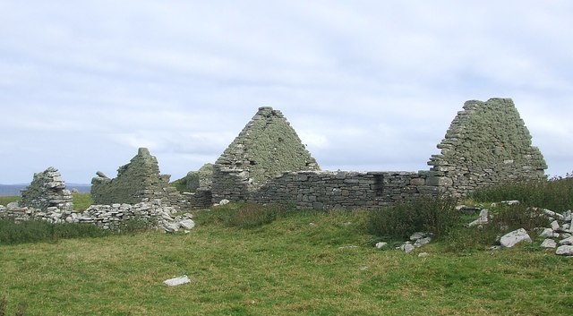
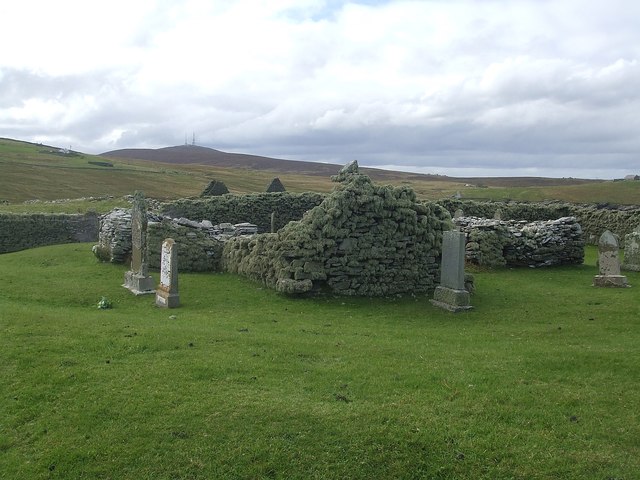
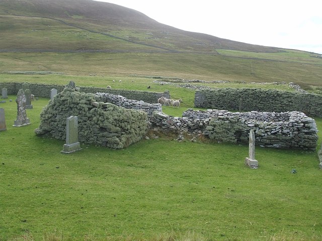
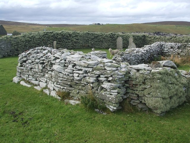
Corbie Geo Images

Images are sourced within 2km of 60.170072/-1.0488679 or Grid Reference HU5243. Thanks to Geograph Open Source API. All images are credited.

Gungstie, Noss I am looking back as we leave Noss Sound, Shetland, on our way back to Lerwick.  The rocky outcrop of Gungstie is to the right of shot and the distinctive Hill of Setter (to the south of Noss) can be seen in the distance.
Gungstie, Noss
I am looking back as we leave Noss Sound, Shetland, on our way back to Lerwick. The rocky outcrop of Gungstie is to the right of shot and the distinctive Hill of Setter (to the south of Noss) can be seen in the distance.
Hill of Setter, Noss Taken as we pass north east along the coast of Bressay, en route back to Lerwick, Shetland, I am looking back towards the distinctive Hill of Setter on Noss.
Hill of Setter, Noss
Taken as we pass north east along the coast of Bressay, en route back to Lerwick, Shetland, I am looking back towards the distinctive Hill of Setter on Noss.
Skerry-hopping at Loder Head Last time I'd been to Bressay nine years ago, we didn't even get round the corner to see Noss, as the wind was too much. On this trip, despite a spell of bad weather as we came to Shetland on the ferry, the wind had dropped dramatically by our second day, and the east side of Shetland was relatively protected from the big swells. Coming round the top of Bressay, there was still enough for rock-hopping (paddling over reefs and rocks that would be too shallow without the help of a wave and good timing) but it was unpredictable enough (the result of two separate swell directions interfering producing occasional big waves) that sport was certainly to be had. The first through this gap had been caught by a bigger set as he came over, then three of us had popped through before the next set arrived. The last paddler has dropped back a little to wait for the next calmer spell and is just about to make her way through.
Skerry-hopping at Loder Head
Last time I'd been to Bressay nine years ago, we didn't even get round the corner to see Noss, as the wind was too much. On this trip, despite a spell of bad weather as we came to Shetland on the ferry, the wind had dropped dramatically by our second day, and the east side of Shetland was relatively protected from the big swells. Coming round the top of Bressay, there was still enough for rock-hopping (paddling over reefs and rocks that would be too shallow without the help of a wave and good timing) but it was unpredictable enough (the result of two separate swell directions interfering producing occasional big waves) that sport was certainly to be had. The first through this gap had been caught by a bigger set as he came over, then three of us had popped through before the next set arrived. The last paddler has dropped back a little to wait for the next calmer spell and is just about to make her way through.
Geo of Vatsvie More of an embayment than a deep cleft, the Geo of Vatsvie cuts into Old Red Sandstone on the east coast of Bressay's Loder Head peninsula. There's swell coming in from the east, reflecting off the foot of the rocks and rushing back towards the kayak which always makes getting in close fun. Not far ahead the Island of Noss starts to provide more shelter and the sea becomes pretty much flat - great for nervous tourists on the tiny RIB passenger ferry, but  a bit dull for sea kayaks. The opposite side of Noss was to provide a lot more excitement...
Geo of Vatsvie
More of an embayment than a deep cleft, the Geo of Vatsvie cuts into Old Red Sandstone on the east coast of Bressay's Loder Head peninsula. There's swell coming in from the east, reflecting off the foot of the rocks and rushing back towards the kayak which always makes getting in close fun. Not far ahead the Island of Noss starts to provide more shelter and the sea becomes pretty much flat - great for nervous tourists on the tiny RIB passenger ferry, but a bit dull for sea kayaks. The opposite side of Noss was to provide a lot more excitement...
Southwest shore, Voe of Cullingsborough Although the Voe of Cullingsborough looks sheltered, there is a low pass through the island of Bressay just to its south and today's southerly wind was being canalised through the gap, giving us the strongest headwind of our day's paddle round Noss. A somewhat unexpected end to a day where we'd anticipated the most challenging conditions to be out on the open coast. However, it's not far to go now - the landing is on the little shingle beach on the left of the photo, which lies just below the end of the public road, and the parked cars of both our group of sea kayakers and another, bigger group, who'd gone round the other way and were not far behind us.
Southwest shore, Voe of Cullingsborough
Although the Voe of Cullingsborough looks sheltered, there is a low pass through the island of Bressay just to its south and today's southerly wind was being canalised through the gap, giving us the strongest headwind of our day's paddle round Noss. A somewhat unexpected end to a day where we'd anticipated the most challenging conditions to be out on the open coast. However, it's not far to go now - the landing is on the little shingle beach on the left of the photo, which lies just below the end of the public road, and the parked cars of both our group of sea kayakers and another, bigger group, who'd gone round the other way and were not far behind us.
Coastguard Lookout, Ander Hill from Setter, Bressay Historic Environment Scotland Scheduled Monument the Admiralty lookout station was built between 1912 and 1917. In addition to the tower, an underground shelter, accessed by a ground-level trapdoor, a cast-iron water-pump and a concrete footing with the remains of a wooden signalling pole survive in close proximity. The now floorless concrete tower commands fantastic views reaching as far as Foula and Sumburgh Head on a fine day. The building was in use as a coastguard lookout until it was abandoned in 1969.
Coastguard Lookout, Ander Hill from Setter, Bressay
Historic Environment Scotland Scheduled Monument the Admiralty lookout station was built between 1912 and 1917. In addition to the tower, an underground shelter, accessed by a ground-level trapdoor, a cast-iron water-pump and a concrete footing with the remains of a wooden signalling pole survive in close proximity. The now floorless concrete tower commands fantastic views reaching as far as Foula and Sumburgh Head on a fine day. The building was in use as a coastguard lookout until it was abandoned in 1969.
Ander Hill, Bressay, from Noss Sound
Mansie's Berg, Noss, from the sea
Bressay - Burn of Setter The Burn of Setter trickles down to meet the sea at the Voe of Cullingsburgh (see <a href="https://www.geograph.org.uk/photo/2706813">HU5141 : Bressay - Burn of Setter meets the sea</a>). A slightly different view can be seen here <a href="https://www.geograph.org.uk/photo/2706808">HU5141 : Bressay - Burn of Setter - Looking upstream</a>
Bressay - Burn of Setter
The Burn of Setter trickles down to meet the sea at the Voe of Cullingsburgh (see HU5141 : Bressay - Burn of Setter meets the sea). A slightly different view can be seen here HU5141 : Bressay - Burn of Setter - Looking upstream
Bressay - Burn of Setter - Looking upstream Looking upstream along the Burn of Setter as it nears its meeting with the sea in the Voe of Cullingsburgh (see <a href="https://www.geograph.org.uk/photo/2706813">HU5141 : Bressay - Burn of Setter meets the sea</a>). Taken from the track which passes over the stream as a flat bridge. See also <a href="https://www.geograph.org.uk/photo/2706753">HU5141 : Bressay - Burn of Setter</a>
Bressay - Burn of Setter - Looking upstream
Looking upstream along the Burn of Setter as it nears its meeting with the sea in the Voe of Cullingsburgh (see HU5141 : Bressay - Burn of Setter meets the sea). Taken from the track which passes over the stream as a flat bridge. See also HU5141 : Bressay - Burn of Setter
Bressay - Burn of Setter meets the sea The Burn of Setter seen in <a href="https://www.geograph.org.uk/photo/2706753">HU5141 : Bressay - Burn of Setter</a> and <a href="https://www.geograph.org.uk/photo/2706808">HU5141 : Bressay - Burn of Setter - Looking upstream</a> is seen here emptying into the sea in the Voe of Cullingsburgh.
Bressay - Burn of Setter meets the sea
The Burn of Setter seen in HU5141 : Bressay - Burn of Setter and HU5141 : Bressay - Burn of Setter - Looking upstream is seen here emptying into the sea in the Voe of Cullingsburgh.
Pow of Cullingsburgh This small bay curves around on the western side of the little promontory containing the remains of the village of Cullingsburgh and its ruined church of St Mary which can be seen a little way ahead on the right. (See adjacent square to east for images)
Pow of Cullingsburgh
This small bay curves around on the western side of the little promontory containing the remains of the village of Cullingsburgh and its ruined church of St Mary which can be seen a little way ahead on the right. (See adjacent square to east for images)
The remains of Cullingsburgh A general view of the former village of Cullingsburgh as seen when approaching from south along the path from Setter.
The remains of Cullingsburgh
A general view of the former village of Cullingsburgh as seen when approaching from south along the path from Setter.
Ruined cottages at Cullingsburgh Some of the ruined former dwellings at Cullingsburgh on Bressay.
Ruined cottages at Cullingsburgh
Some of the ruined former dwellings at Cullingsburgh on Bressay.
Ruins of St Mary's church, Cullingsburgh The ruined village of Cullingsburgh on Bressay has a ruined church. It is set in a walled churchyard which contained several sheep when I visited. Whether the sheep had been intentionally let in to graze the grass of the burial ground, been let in accidentally by earlier visitors, or had worked out a method of getting in here under their own trotter power I have no idea - but they seemed to be trapped within.
Ruins of St Mary's church, Cullingsburgh
The ruined village of Cullingsburgh on Bressay has a ruined church. It is set in a walled churchyard which contained several sheep when I visited. Whether the sheep had been intentionally let in to graze the grass of the burial ground, been let in accidentally by earlier visitors, or had worked out a method of getting in here under their own trotter power I have no idea - but they seemed to be trapped within.
Cullingsburgh - St Mary's and churchyard Part of the former church of St Mary in the abandoned and ruined village of Cullingsburgh on Bressay. Surrounded by gravestones, many of which I'm sure postdate the ruination of the church.
Cullingsburgh - St Mary's and churchyard
Part of the former church of St Mary in the abandoned and ruined village of Cullingsburgh on Bressay. Surrounded by gravestones, many of which I'm sure postdate the ruination of the church.
St Mary's church and churchyard wall, Cullingsburgh Part of the remaining structure of the former church of St Mary in the ruined village of Cullingsburgh with a section of the enclosing churchyard wall seen behind.
St Mary's church and churchyard wall, Cullingsburgh
Part of the remaining structure of the former church of St Mary in the ruined village of Cullingsburgh with a section of the enclosing churchyard wall seen behind.
Gravestones of St Mary's, Cullingsburgh Gravestones not only surround but are also within the walls of the ruined church of St Mary at Cullingsburgh. I'm sure this church has been a ruin far longer than the dates on many of the gravestones, suggesting that it continued as a graveyard for many decades after the ruination of the church and probably the abandonment of the village.
Gravestones of St Mary's, Cullingsburgh
Gravestones not only surround but are also within the walls of the ruined church of St Mary at Cullingsburgh. I'm sure this church has been a ruin far longer than the dates on many of the gravestones, suggesting that it continued as a graveyard for many decades after the ruination of the church and probably the abandonment of the village.
Show me another place!

Corbie Geo is located at Grid Ref: HU5243 (Lat: 60.170072, Lng: -1.0488679)

Unitary Authority: Shetland Islands

Police Authority: Highlands and Islands

What 3 Words

///exploring.jiffy.colonies. Near Lerwick, Shetland Islands

Related Wikis

Voe of Cullingsburgh

Voe of Cullingsburgh is a large sea loch off the Shetland island of Bressay, voe meaning "sea inlet" in Shetland dialect. The local spelling of the name...

Broch of Cullingsburgh

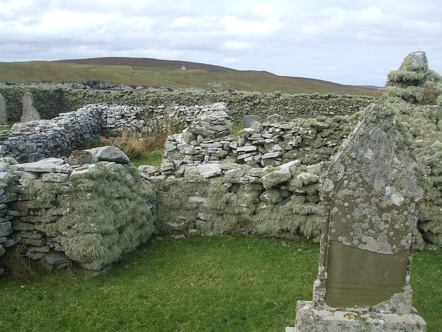
The Broch of Cullingsburgh is an Iron Age broch located in the Shetland islands. == Location == Located on Bressay, off the east coast of mainland Shetland...

Bressay

Bressay (Scots: Bressa) is a populated island in the Shetland archipelago of Scotland. == Geography and geology == Bressay lies due south of Whalsay, west...

Isle of Noss

The Isle of Noss or Noss (Scots: Noss) is a small, previously inhabited island in Shetland, Scotland. Noss is separated from the island of Bressay by the...

Gardie House

Gardie House is an 18th-century estate house on Bressay in Shetland, Scotland. Located opposite Lerwick, across the Bressay Sound, Gardie is described...

Holm of Noss

The Holm of Noss or Cradle Holm is an uninhabited islet of the Shetland Islands. It is about 48m at its highest point. == Geography and geology == It is...

Bressay transmitting station

Bressay transmitting station is a broadcasting transmission facility for the Shetland Islands, located on the isle of Bressay, owned and operated by Arqiva...

Lerwick and Bressay Parish Church

Lerwick and Bressay Parish Church is the largest Church of Scotland congregation in Shetland, serving the islands' capital Lerwick and the surrounding...

Have you been to Corbie Geo?

Leave your review of Corbie Geo below (or comments, questions and feedback).