St Mary's Church

Heritage Site in Shetland

Scotland

St Mary's Church

Noss ferry approaching the Bressay shore
Noss ferry approaching the Bressay shore Credit: Mike Pennington

St Mary's Church, located in the Shetland Islands, is a historical and architectural treasure that has stood for centuries. Situated in the village of Cunningsburgh, this church is a significant heritage site that holds great cultural and religious importance.

Built in the late 18th century, St Mary's Church exhibits a classic Georgian architectural style. The exterior features a simple yet elegant design, with white-washed walls and a slate roof. The church's symmetrical façade is adorned with large windows, allowing natural light to fill the interior space.

Inside, visitors are greeted by a spacious nave with high ceilings supported by wooden beams. The church can accommodate a large congregation and is known for its stunning acoustics, making it a popular venue for musical performances and events. The pews and pulpit are made of polished wood, adding to the church's warm and inviting atmosphere.

St Mary's Church has retained many of its original features throughout the years, including its beautiful stained glass windows. These windows depict biblical scenes and add a touch of color and splendor to the otherwise simple interior.

The churchyard surrounding St Mary's Church is a peaceful and well-maintained space, with gravestones dating back several centuries. It serves as a final resting place for generations of local residents and offers visitors an opportunity to explore the island's history.

St Mary's Church is not only a place of worship but also a symbol of Shetland's rich heritage and architectural prowess. Its timeless beauty and historical significance make it a must-visit site for those interested in the cultural and religious heritage of the region.

If you have any feedback on the listing, please let us know in the comments section below.

St Mary's Church Images

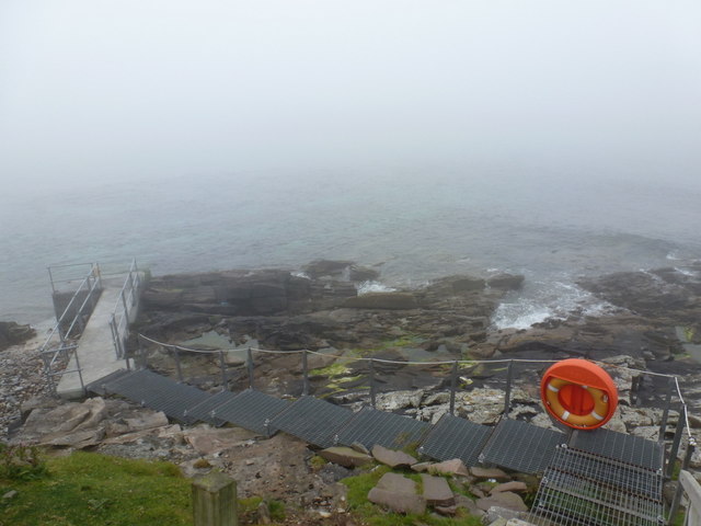
Images are sourced within 2km of 60.163/-1.053 or Grid Reference HU5242. Thanks to Geograph Open Source API. All images are credited.

Noss ferry approaching the Bressay shore
Gungstie, Noss, from Noss Sound
Noss-sound, Bressay, from Noss Sound
Noss National Nature Reserve Taken from a tour boat moored in Nesti Voe, Noss, Shetland, I am looking west to Big Ness where the wardens of Noss National Nature Reserve are located. NatureScot operates an inflatable ferry boat across Noss Sound (beyond the buildings pictured) during the summer months to allow walkers to get from Bressay to Noss.
Noss National Nature Reserve
Taken from a tour boat moored in Nesti Voe, Noss, Shetland, I am looking west to Big Ness where the wardens of Noss National Nature Reserve are located. NatureScot operates an inflatable ferry boat across Noss Sound (beyond the buildings pictured) during the summer months to allow walkers to get from Bressay to Noss.
Gungstie, Noss I am looking back as we leave Noss Sound, Shetland, on our way back to Lerwick.  The rocky outcrop of Gungstie is to the right of shot and the distinctive Hill of Setter (to the south of Noss) can be seen in the distance.
Gungstie, Noss
I am looking back as we leave Noss Sound, Shetland, on our way back to Lerwick. The rocky outcrop of Gungstie is to the right of shot and the distinctive Hill of Setter (to the south of Noss) can be seen in the distance.
Hill of Setter, Noss Taken as we pass north east along the coast of Bressay, en route back to Lerwick, Shetland, I am looking back towards the distinctive Hill of Setter on Noss.
Hill of Setter, Noss
Taken as we pass north east along the coast of Bressay, en route back to Lerwick, Shetland, I am looking back towards the distinctive Hill of Setter on Noss.
Skerry-hopping at Loder Head Last time I'd been to Bressay nine years ago, we didn't even get round the corner to see Noss, as the wind was too much. On this trip, despite a spell of bad weather as we came to Shetland on the ferry, the wind had dropped dramatically by our second day, and the east side of Shetland was relatively protected from the big swells. Coming round the top of Bressay, there was still enough for rock-hopping (paddling over reefs and rocks that would be too shallow without the help of a wave and good timing) but it was unpredictable enough (the result of two separate swell directions interfering producing occasional big waves) that sport was certainly to be had. The first through this gap had been caught by a bigger set as he came over, then three of us had popped through before the next set arrived. The last paddler has dropped back a little to wait for the next calmer spell and is just about to make her way through.
Skerry-hopping at Loder Head
Last time I'd been to Bressay nine years ago, we didn't even get round the corner to see Noss, as the wind was too much. On this trip, despite a spell of bad weather as we came to Shetland on the ferry, the wind had dropped dramatically by our second day, and the east side of Shetland was relatively protected from the big swells. Coming round the top of Bressay, there was still enough for rock-hopping (paddling over reefs and rocks that would be too shallow without the help of a wave and good timing) but it was unpredictable enough (the result of two separate swell directions interfering producing occasional big waves) that sport was certainly to be had. The first through this gap had been caught by a bigger set as he came over, then three of us had popped through before the next set arrived. The last paddler has dropped back a little to wait for the next calmer spell and is just about to make her way through.
Geo of Vatsvie More of an embayment than a deep cleft, the Geo of Vatsvie cuts into Old Red Sandstone on the east coast of Bressay's Loder Head peninsula. There's swell coming in from the east, reflecting off the foot of the rocks and rushing back towards the kayak which always makes getting in close fun. Not far ahead the Island of Noss starts to provide more shelter and the sea becomes pretty much flat - great for nervous tourists on the tiny RIB passenger ferry, but  a bit dull for sea kayaks. The opposite side of Noss was to provide a lot more excitement...
Geo of Vatsvie
More of an embayment than a deep cleft, the Geo of Vatsvie cuts into Old Red Sandstone on the east coast of Bressay's Loder Head peninsula. There's swell coming in from the east, reflecting off the foot of the rocks and rushing back towards the kayak which always makes getting in close fun. Not far ahead the Island of Noss starts to provide more shelter and the sea becomes pretty much flat - great for nervous tourists on the tiny RIB passenger ferry, but a bit dull for sea kayaks. The opposite side of Noss was to provide a lot more excitement...
Getting onto the Noss ferry Whilst the Bressay ferry used to get here takes vehicles and has a "proper" dock, the Noss ferry is only for very small numbers of pedestrians, so needs no more than a set of steps down to sea level. There's no timetable - when the ferryman notices that there are people waiting, he will come across to get them. Whether this works on foggy days is another question entirely, and not one we needed answered, as we were visiting in our own boats, just popping over to look at the ferry terminal out of curiosity.
Getting onto the Noss ferry
Whilst the Bressay ferry used to get here takes vehicles and has a "proper" dock, the Noss ferry is only for very small numbers of pedestrians, so needs no more than a set of steps down to sea level. There's no timetable - when the ferryman notices that there are people waiting, he will come across to get them. Whether this works on foggy days is another question entirely, and not one we needed answered, as we were visiting in our own boats, just popping over to look at the ferry terminal out of curiosity.
Paddling down Noss Sound Somehow, using a map, one always thinks of heading south as "down" though, of course, on average, the sea is level, and as we were going against the very start of the flood tide we might actually be going a tiny bit uphill ! Tidal flows at Noss are generally insignificant except in this shallow channel, and we were going anticlockwise round the island more to have the sun behind us on the scenic side than to take any advantage of the flow. The boat powering away from us had been stationary as we arrived, but seemed to form a sudden desire to leave as (or perhaps before) their clients realised just how much closer to the wildlife sea kayakers can get than anyone in a big boat. The Sound had already given us close encounters with Seals, Eider, Cormorants and Terns diving in just metres away. The outer side promised huge numbers of Gannets and Razorbills...
Paddling down Noss Sound
Somehow, using a map, one always thinks of heading south as "down" though, of course, on average, the sea is level, and as we were going against the very start of the flood tide we might actually be going a tiny bit uphill ! Tidal flows at Noss are generally insignificant except in this shallow channel, and we were going anticlockwise round the island more to have the sun behind us on the scenic side than to take any advantage of the flow. The boat powering away from us had been stationary as we arrived, but seemed to form a sudden desire to leave as (or perhaps before) their clients realised just how much closer to the wildlife sea kayakers can get than anyone in a big boat. The Sound had already given us close encounters with Seals, Eider, Cormorants and Terns diving in just metres away. The outer side promised huge numbers of Gannets and Razorbills...
Landing on Noss Although, coming from Voe of Cullingsborough round Loder Head, we hadn't paddled very far to reach Noss, the island offers few other landing places apart from the west side, facing Bressay across Noss Sound. Thus our group stopped for an early lunch in anticipation that we would be on the water for rather longer to complete our trip all the way round. This beach is just north of the tourist ferry landing, out of their way, and even seemed quite sheltered (we'd had a very windy 24 hours the previous day and the open sea was still quite lumpy, whilst here in the Sound it was essentially flat).
Landing on Noss
Although, coming from Voe of Cullingsborough round Loder Head, we hadn't paddled very far to reach Noss, the island offers few other landing places apart from the west side, facing Bressay across Noss Sound. Thus our group stopped for an early lunch in anticipation that we would be on the water for rather longer to complete our trip all the way round. This beach is just north of the tourist ferry landing, out of their way, and even seemed quite sheltered (we'd had a very windy 24 hours the previous day and the open sea was still quite lumpy, whilst here in the Sound it was essentially flat).
Southwest shore, Voe of Cullingsborough Although the Voe of Cullingsborough looks sheltered, there is a low pass through the island of Bressay just to its south and today's southerly wind was being canalised through the gap, giving us the strongest headwind of our day's paddle round Noss. A somewhat unexpected end to a day where we'd anticipated the most challenging conditions to be out on the open coast. However, it's not far to go now - the landing is on the little shingle beach on the left of the photo, which lies just below the end of the public road, and the parked cars of both our group of sea kayakers and another, bigger group, who'd gone round the other way and were not far behind us.
Southwest shore, Voe of Cullingsborough
Although the Voe of Cullingsborough looks sheltered, there is a low pass through the island of Bressay just to its south and today's southerly wind was being canalised through the gap, giving us the strongest headwind of our day's paddle round Noss. A somewhat unexpected end to a day where we'd anticipated the most challenging conditions to be out on the open coast. However, it's not far to go now - the landing is on the little shingle beach on the left of the photo, which lies just below the end of the public road, and the parked cars of both our group of sea kayakers and another, bigger group, who'd gone round the other way and were not far behind us.
Rounding Big Ness into Nesti Voe Big Ness is really quite a small peninsula, ending in these low shoreline rocks. Beyond to the left is Nesti Voe, with a big beach, but an onshore wind, so not what we wanted for a lunch stop. Across the Voe is Turr Ness, a somewhat rockier and longer peninsula with enough height to conceal our onward route to reach the east coast of Noss. The hill in partial shadow is Hill of Setter, rising to 181m directly above the cliffs and gannetry of Noss Head, though you'd scarcely guess that seeing it from the west. The whole island is a nature reserve, gentle slopes being mainly inhabited by chaps in camouflage jackets carrying large cameras and even bigger tripods. Must be something worthwhile to see then, so let's keep paddling !
Rounding Big Ness into Nesti Voe
Big Ness is really quite a small peninsula, ending in these low shoreline rocks. Beyond to the left is Nesti Voe, with a big beach, but an onshore wind, so not what we wanted for a lunch stop. Across the Voe is Turr Ness, a somewhat rockier and longer peninsula with enough height to conceal our onward route to reach the east coast of Noss. The hill in partial shadow is Hill of Setter, rising to 181m directly above the cliffs and gannetry of Noss Head, though you'd scarcely guess that seeing it from the west. The whole island is a nature reserve, gentle slopes being mainly inhabited by chaps in camouflage jackets carrying large cameras and even bigger tripods. Must be something worthwhile to see then, so let's keep paddling !
Coastguard Lookout, Ander Hill from Setter, Bressay Historic Environment Scotland Scheduled Monument the Admiralty lookout station was built between 1912 and 1917. In addition to the tower, an underground shelter, accessed by a ground-level trapdoor, a cast-iron water-pump and a concrete footing with the remains of a wooden signalling pole survive in close proximity. The now floorless concrete tower commands fantastic views reaching as far as Foula and Sumburgh Head on a fine day. The building was in use as a coastguard lookout until it was abandoned in 1969.
Coastguard Lookout, Ander Hill from Setter, Bressay
Historic Environment Scotland Scheduled Monument the Admiralty lookout station was built between 1912 and 1917. In addition to the tower, an underground shelter, accessed by a ground-level trapdoor, a cast-iron water-pump and a concrete footing with the remains of a wooden signalling pole survive in close proximity. The now floorless concrete tower commands fantastic views reaching as far as Foula and Sumburgh Head on a fine day. The building was in use as a coastguard lookout until it was abandoned in 1969.
Ander Hill, Bressay, from Noss Sound
Mansie's Berg, Noss, from the sea
The Noss ferry on the Bressay side of Noss Sound
Bressay: theoretical view of Noss The island of Noss is only 100 yards or so directly ahead of us but the fog is so thick today that it is completely invisible. The passenger ferry would run from here but is cancelled when the weather is bad - denoted by a red flag on the island which I suppose we must assume is flying now!
Bressay: theoretical view of Noss
The island of Noss is only 100 yards or so directly ahead of us but the fog is so thick today that it is completely invisible. The passenger ferry would run from here but is cancelled when the weather is bad - denoted by a red flag on the island which I suppose we must assume is flying now!
Show me another place!

St Mary's Church is located at Grid Ref: HU5242 (Lat: 60.163, Lng: -1.053)

Unitary Authority: Shetland Islands

Police Authority: Highlands and Islands

What 3 Words

///loads.thread.budgeted. Near Lerwick, Shetland Islands

Related Wikis

Broch of Cullingsburgh

The Broch of Cullingsburgh is an Iron Age broch located in the Shetland islands. == Location == Located on Bressay, off the east coast of mainland Shetland...

Voe of Cullingsburgh

Voe of Cullingsburgh is a large sea loch off the Shetland island of Bressay, voe meaning "sea inlet" in Shetland dialect. The local spelling of the name...

Bressay

Bressay (Scots: Bressa) is a populated island in the Shetland archipelago of Scotland. == Geography and geology == Bressay lies due south of Whalsay, west...

Isle of Noss

The Isle of Noss or Noss (Scots: Noss) is a small, previously inhabited island in Shetland, Scotland. Noss is separated from the island of Bressay by the...

Gardie House

Gardie House is an 18th-century estate house on Bressay in Shetland, Scotland. Located opposite Lerwick, across the Bressay Sound, Gardie is described...

Holm of Noss

The Holm of Noss or Cradle Holm is an uninhabited islet of the Shetland Islands. It is about 48m at its highest point. == Geography and geology == It is...

Bressay transmitting station

Bressay transmitting station is a broadcasting transmission facility for the Shetland Islands, located on the isle of Bressay, owned and operated by Arqiva...

Lerwick and Bressay Parish Church

Lerwick and Bressay Parish Church is the largest Church of Scotland congregation in Shetland, serving the islands' capital Lerwick and the surrounding...

Related Videos

Windy Shetland between Bressay and Noss

Windy Shetland between Bressay and Noss Things to do in Shetland Life Through My Lens.

Shetland Islands | Episode 3 - Noss Island

Noss Island is a very small island in Shetland. It is a nature reserve and hosts a number of migratory birds during the summer ...

Gannets feeding off the Isle of Noss in Shetland 9 July 2021

After visiting the Gannet Colony on the Isle of Noss our Seabirds-and-Seals boat trip provided us with the great aerobatic ...

Nearby Amenities

Located within 500m of 60.163,-1.053
Bay of Cuppa
Natural: bay
Lat/Long: 60.1624259/-1.0580778
The data included in this document is from www.openstreetmap.org. The data is made available under ODbL.

Have you been to St Mary's Church?

Leave your review of St Mary's Church below (or comments, questions and feedback).