Dierecleit

Coastal Feature, Headland, Point in Inverness-shire

Scotland

Dierecleit

North Harris Free Church (Free Church of Scotland) An active church.
North Harris Free Church (Free Church of Scotland) Credit: David Bremner

Dierecleit is a prominent coastal feature located in Inverness-shire, Scotland. It is a headland that extends into the North Atlantic Ocean, forming a point that overlooks the surrounding waters. The name "Dierecleit" is derived from the Gaelic language, with "Diùra" meaning "deer" and "cleit" meaning "rocky outcrop," reflecting the local wildlife and topography.

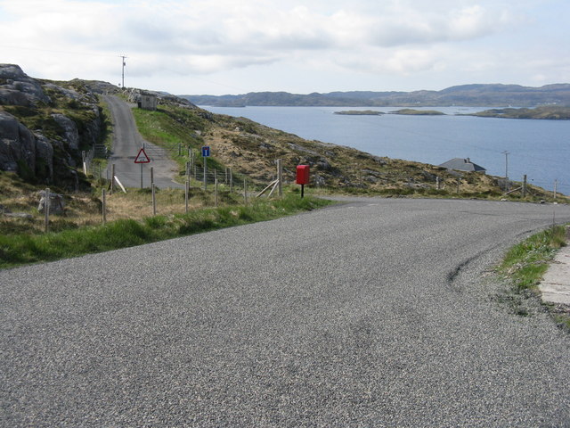
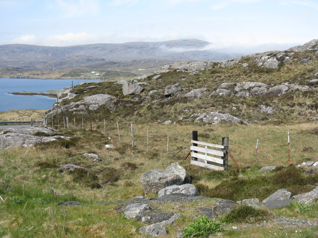
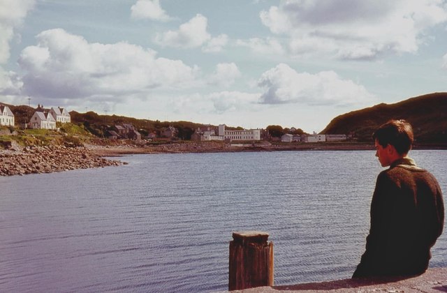
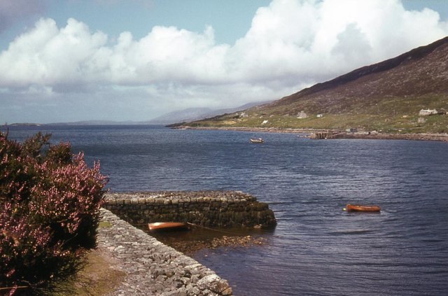
Situated on the western coast of Inverness-shire, Dierecleit offers breathtaking views of the rugged coastline and the open sea. The headland is characterized by steep cliffs that plunge into the water below, creating a dramatic and picturesque landscape. The rocky nature of the area makes it an ideal habitat for a variety of seabirds, including gulls, fulmars, and puffins, which can often be spotted nesting along the cliffs.

Dierecleit is renowned for its historical significance as well. Archaeological evidence suggests that the headland was inhabited during the Iron Age, with the remains of an ancient settlement discovered in the vicinity. This adds to the allure of the location, providing visitors with an opportunity to explore Scotland's rich cultural heritage.

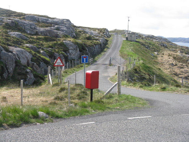
The coastal feature is easily accessible to the public, with walking trails and viewpoints established to allow visitors to fully appreciate the natural beauty of Dierecleit. The headland is a popular destination for nature enthusiasts, photographers, and hikers, who come to experience the captivating scenery and immerse themselves in the tranquility of the coastal setting.

In summary, Dierecleit is a remarkable coastal feature in Inverness-shire, Scotland. With its stunning cliffs, diverse wildlife, and historical significance, it offers a captivating experience for anyone who ventures to its shores.

If you have any feedback on the listing, please let us know in the comments section below.

Dierecleit Images

Images are sourced within 2km of 57.892075/-6.7938416 or Grid Reference NG1699. Thanks to Geograph Open Source API. All images are credited.

North Harris Free Church (Free Church of Scotland) An active church.
North Harris Free Church (Free Church of Scotland)
An active church.
Study of a Gasoline Station Harris Fuels, Tarbert.

 The title of the photograph is a tribute to the 1963 Ed Ruscha publication 'Twentysix Gasoline Stations'.
Study of a Gasoline Station
Harris Fuels, Tarbert. The title of the photograph is a tribute to the 1963 Ed Ruscha publication 'Twentysix Gasoline Stations'.
Post box at Urgha Beag At the turn off from the Scalpay road to Urgha Beag. Looking out to Bàgh Urgha Beag.
Post box at Urgha Beag
At the turn off from the Scalpay road to Urgha Beag. Looking out to Bàgh Urgha Beag.
Rocky hillside at Urgha Beag Looking out over Bàgh Urgha Beag.
Rocky hillside at Urgha Beag
Looking out over Bàgh Urgha Beag.
Urgha road end With post box, road signs and cattle grid.
Urgha road end
With post box, road signs and cattle grid.
West Loch Tarbert from the pier
West Loch Tarbert piers
Spinning wool for tweed in Harris
Tarbert Fire Station
Pier Road, Tarbert The Citizens Advice people may even be found in tiny villages in the Outer Hebrides.
Pier Road, Tarbert
The Citizens Advice people may even be found in tiny villages in the Outer Hebrides.
Tarbert in 1981
Tarbert in 1981
Tarbert Ferry Terminal View from an approaching ferry, MV Hebrides. The linkspan is on the left. Upgrade works are in progress, associated with the planned introduction of a new ferry on the Uig - Lochmaddy (Uist) - Tarbert (Harris) routes.
Tarbert Ferry Terminal
View from an approaching ferry, MV Hebrides. The linkspan is on the left. Upgrade works are in progress, associated with the planned introduction of a new ferry on the Uig - Lochmaddy (Uist) - Tarbert (Harris) routes.
Ferry leaving Tarbert On board MV Hebrides, looking astern. The vehicles have loaded through the bows, and the ferry is reversing away from the berth. Note the campervans.
Ferry leaving Tarbert
On board MV Hebrides, looking astern. The vehicles have loaded through the bows, and the ferry is reversing away from the berth. Note the campervans.
The 'Hebridean Isles' docked at Tarbert, Harris, 1989
Harris Tweed shop in Tarbert To be called "Harris Tweed" the cloth, by law, must be made from pure virgin wool which has been dyed and spun on the islands and handwoven at the home of the weaver in the Outer Hebrides. The cloth is then "finished" at one of three mills in the Outer Hebrides. Genuine Harris Tweed bears the "Orb" hallmark. (See <a href="https://www.geograph.org.uk/photo/2646702">NG1599 : Bolts of Harris Tweed</a>)
There are several places on the islands where the finished articles (suits, jackets, waistcoats, caps, bags, slippers and dozens more items) can be bought, and a few more where the cloth can be purchased.
Harris Tweed shop in Tarbert
To be called "Harris Tweed" the cloth, by law, must be made from pure virgin wool which has been dyed and spun on the islands and handwoven at the home of the weaver in the Outer Hebrides. The cloth is then "finished" at one of three mills in the Outer Hebrides. Genuine Harris Tweed bears the "Orb" hallmark. (See NG1599 : Bolts of Harris Tweed) There are several places on the islands where the finished articles (suits, jackets, waistcoats, caps, bags, slippers and dozens more items) can be bought, and a few more where the cloth can be purchased.
Very direct signage
Very direct signage
Tarbert There's a convenient lay-by and viewpoint from which to admire the view of the marina and the ferry terminal, where I was fortunate enough to see the MV 'Hebrides' just in from Uig in Skye.
Tarbert
There's a convenient lay-by and viewpoint from which to admire the view of the marina and the ferry terminal, where I was fortunate enough to see the MV 'Hebrides' just in from Uig in Skye.
Tarbert Church (Free Presbyterian Church of Scotland) An active church.
Tarbert Church (Free Presbyterian Church of Scotland)
An active church.
Show me another place!

Dierecleit is located at Grid Ref: NG1699 (Lat: 57.892075, Lng: -6.7938416)

Unitary Authority: Na h-Eileanan an Iar

Police Authority: Highlands and Islands

What 3 Words

///watching.sculpting.comedy. Near Tarbert, Na h-Eileanan Siar

Related Wikis

Harris distillery

Harris distillery is a Scotch whisky and Gin distillery in Tarbert on the Isle of Harris, Scotland. The distillery was the first legal distillery ever...

Tarbert, Harris

Tarbert (Scottish Gaelic: An Tairbeart [ən̪ˠ ˈt̪ɛrʲɛbərˠʃt̪]) is the main community on Harris in the Western Isles of Scotland. The name means "isthmus...

Harris, Outer Hebrides

Harris (Scottish Gaelic: Na Hearadh, pronounced [nə ˈhɛɾəɣ] ) is the southern and more mountainous part of Lewis and Harris, the largest island in the...

Sgeotasaigh

Scotasay (Scottish Gaelic: Sgeotasaigh) is small island in the Outer Hebrides of Scotland. It lies 1 kilometre (0.6 miles) off the east coast of Harris...

Nearby Amenities

Located within 500m of 57.892075,-6.7938416
An Loch an Ear
Name En: East Loch Tarbert
Name Gd: An Loch an Ear
Natural: bay
Wikidata: Q3777213
Wikipedia: en:East Loch Tarbert
Lat/Long: 57.8959285/-6.7973405
Barrier: cattle_grid
Lat/Long: 57.8929946/-6.7995656
Passing Place
Lat/Long: 57.8930781/-6.797753
Turning Circle
Lat/Long: 57.89331/-6.7959965
Seamark Rock Water Level: covers
Seamark Type: rock
Lat/Long: 57.8924022/-6.7918953
Seamark Rock Water Level: covers
Seamark Type: rock
Lat/Long: 57.8925494/-6.7920229
Seamark Rock Water Level: covers
Seamark Type: rock
Lat/Long: 57.8928886/-6.7927344
Bench
Lat/Long: 57.8945453/-6.8004191
Material: wood
Power: pole
Lat/Long: 57.8929521/-6.8006922
Material: wood
Power: pole
Lat/Long: 57.8927978/-6.8002606
Material: wood
Power: pole
Lat/Long: 57.8932152/-6.8013562
Material: wood
Power: pole
Lat/Long: 57.8929398/-6.7985994
Material: wood
Power: pole
Lat/Long: 57.8931612/-6.7968436
Power: pole
Lat/Long: 57.8909211/-6.7949035
Power: pole
Lat/Long: 57.891138/-6.7950027
Power: pole
Lat/Long: 57.8914295/-6.7951486
Power: pole
Lat/Long: 57.8919269/-6.7953826
Power: pole
Lat/Long: 57.8922263/-6.7955304
The data included in this document is from www.openstreetmap.org. The data is made available under ODbL.

Have you been to Dierecleit?

Leave your review of Dierecleit below (or comments, questions and feedback).