Rubh' a' Ghobhair

Coastal Feature, Headland, Point in Inverness-shire

Scotland

Rubh' a' Ghobhair

North Harris Free Church (Free Church of Scotland) An active church.
North Harris Free Church (Free Church of Scotland) Credit: David Bremner

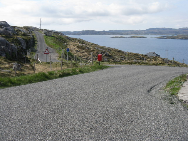
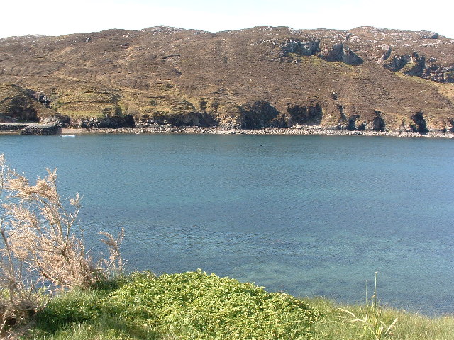
Rubh' a' Ghobhair, located in Inverness-shire, Scotland, is a prominent coastal feature that stands out as a majestic headland jutting into the North Atlantic Ocean. Also known as Rubha na Caillich, this point offers breathtaking views of the surrounding landscape, making it a popular destination for locals and tourists alike.

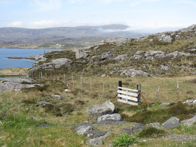
Situated on the west coast of the Scottish Highlands, Rubh' a' Ghobhair is characterized by its rugged cliffs, which rise dramatically from the sea. These towering cliffs are predominantly composed of ancient rock formations, showcasing layers of sedimentary and igneous rocks that tell the geological history of the region.

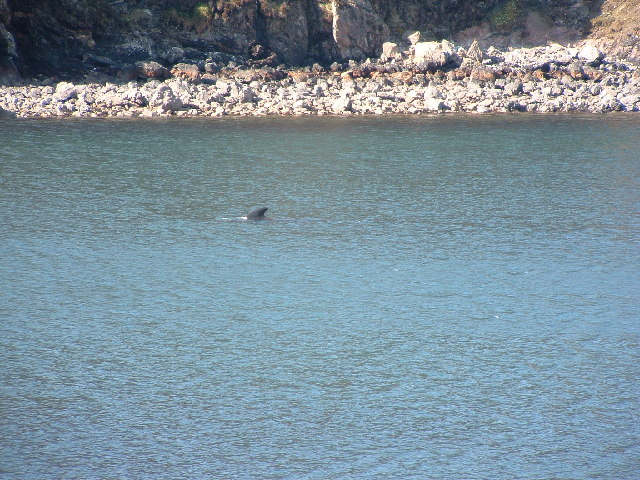
The headland is home to a diverse range of flora and fauna, with its coastal heathland providing a habitat for various plant species, including heather and gorse. Seabirds can often be spotted nesting on the cliffs, while the surrounding waters are known for their abundance of marine life, such as seals and dolphins.

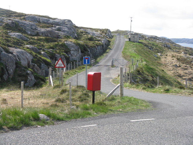
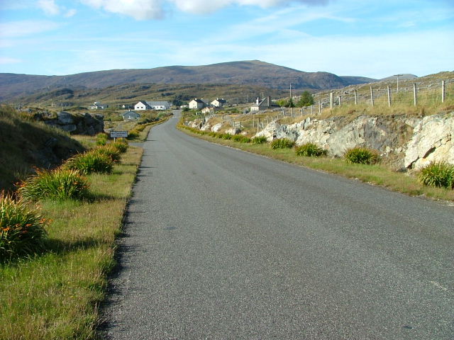
Access to Rubh' a' Ghobhair is relatively easy, with a well-maintained footpath leading visitors to the point. The path winds through picturesque coastal scenery, offering stunning panoramic views of the ocean and the nearby hills. On a clear day, it is even possible to catch a glimpse of the Isle of Skye in the distance.

Whether one is seeking a peaceful retreat, a chance to observe wildlife, or simply a place to admire the raw beauty of the Scottish coastline, Rubh' a' Ghobhair offers an unforgettable experience that showcases the magnificence of the natural world.

If you have any feedback on the listing, please let us know in the comments section below.

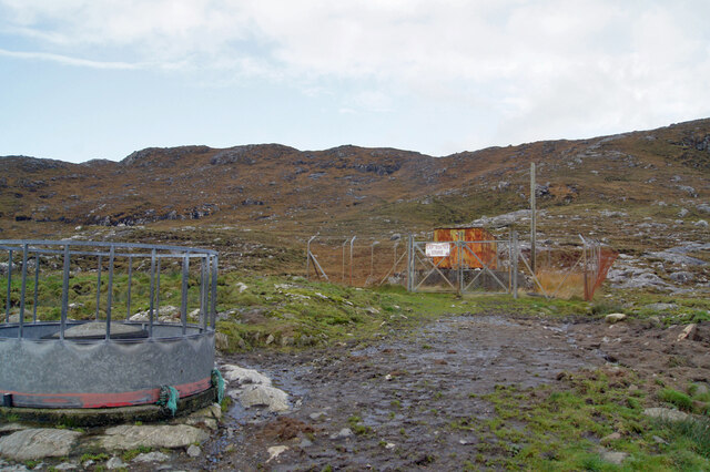
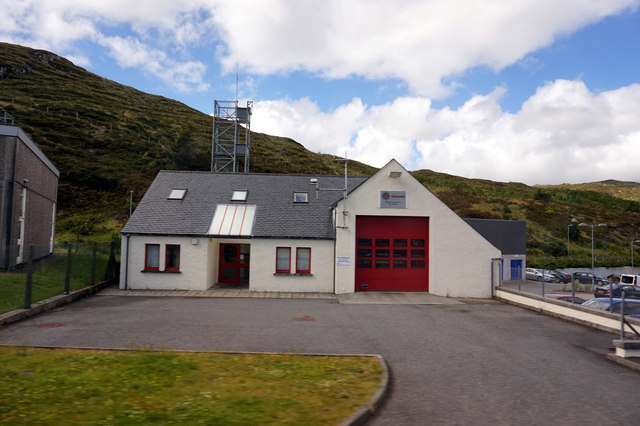
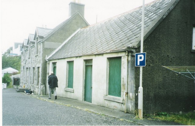
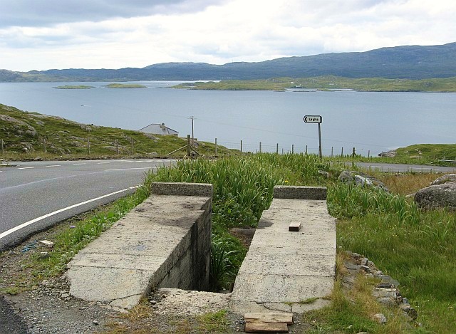
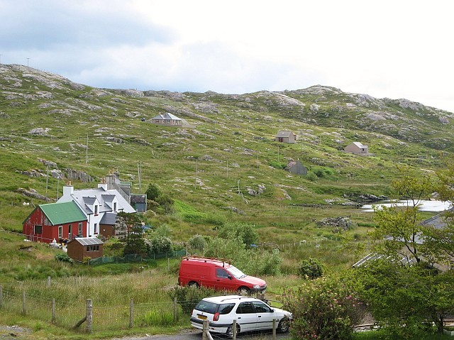
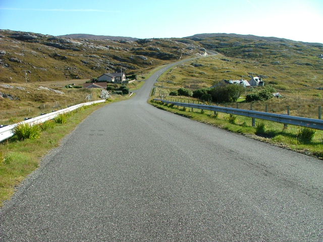
Rubh' a' Ghobhair Images

Images are sourced within 2km of 57.896825/-6.7940531 or Grid Reference NG1699. Thanks to Geograph Open Source API. All images are credited.

North Harris Free Church (Free Church of Scotland) An active church.
North Harris Free Church (Free Church of Scotland)
An active church.
Tarbert Church (Free Presbyterian Church of Scotland) An active church.
Tarbert Church (Free Presbyterian Church of Scotland)
An active church.
Explosives store The sign on the fence reads 'Explosives Store', though the rickety looking building within looks like it has seen better days, so I doubt any explosives are stored there now, and I have to wonder why they were ever there is the first place.
Explosives store
The sign on the fence reads 'Explosives Store', though the rickety looking building within looks like it has seen better days, so I doubt any explosives are stored there now, and I have to wonder why they were ever there is the first place.
Post box at Urgha Beag At the turn off from the Scalpay road to Urgha Beag. Looking out to Bàgh Urgha Beag.
Post box at Urgha Beag
At the turn off from the Scalpay road to Urgha Beag. Looking out to Bàgh Urgha Beag.
Rocky hillside at Urgha Beag Looking out over Bàgh Urgha Beag.
Rocky hillside at Urgha Beag
Looking out over Bàgh Urgha Beag.
Urgha road end With post box, road signs and cattle grid.
Urgha road end
With post box, road signs and cattle grid.
West Loch Tarbert from the pier
West Loch Tarbert piers
Spinning wool for tweed in Harris
Tarbert Fire Station
The Lovely Janice They don't make them like that any more! Bus parked in the car park of the Harris Hotel
The Lovely Janice
They don't make them like that any more! Bus parked in the car park of the Harris Hotel
View of West Bay at Tarbert View from the pier on the north side of the bay towards the pier on the south side, the interesting bit of the photo is the dorsal fin a bit right and up from the centre.
View of West Bay at Tarbert
View from the pier on the north side of the bay towards the pier on the south side, the interesting bit of the photo is the dorsal fin a bit right and up from the centre.
Tarbert bay Whale presumably a Minke whale, not huge but the biggest I've seen
Tarbert bay Whale
presumably a Minke whale, not huge but the biggest I've seen
MacAskill's former store Tarbert For many years these premises were run by a Mr MacAskill as a general store. He continued to work in the store until his nineties.
MacAskill's former store Tarbert
For many years these premises were run by a Mr MacAskill as a general store. He continued to work in the store until his nineties.
Car ramp near Urgha Beag Several of these outdoor concrete car ramps are to be found in seemingly unlikely roadside locations in Harris.  They were apparently built as part of a Job Creation scheme in the late 20th century, and are available for public use.  The example in the photo is situated on the minor road from Tarbert to Scalpay, near its junction with the road to Urgha.
Car ramp near Urgha Beag
Several of these outdoor concrete car ramps are to be found in seemingly unlikely roadside locations in Harris. They were apparently built as part of a Job Creation scheme in the late 20th century, and are available for public use. The example in the photo is situated on the minor road from Tarbert to Scalpay, near its junction with the road to Urgha.
Urgha Beag Urgha Beag consists of a handful of crofts on the minor road running between Tarbert and the island of Scalpay.
Urgha Beag
Urgha Beag consists of a handful of crofts on the minor road running between Tarbert and the island of Scalpay.
Houses at Oban A small settlement on the Tarbert to Scalpay road.
Houses at Oban
A small settlement on the Tarbert to Scalpay road.
Looking Towards Tarbert On the Scalpay to Tarbert road.
Looking Towards Tarbert
On the Scalpay to Tarbert road.
Show me another place!

Rubh' a' Ghobhair is located at Grid Ref: NG1699 (Lat: 57.896825, Lng: -6.7940531)

Unitary Authority: Na h-Eileanan an Iar

Police Authority: Highlands and Islands

What 3 Words

///celebrate.perplexed.blacken. Near Tarbert, Na h-Eileanan Siar

Related Wikis

Harris distillery

Harris distillery is a Scotch whisky and Gin distillery in Tarbert on the Isle of Harris, Scotland. The distillery was the first legal distillery ever...

Tarbert, Harris

Tarbert (Scottish Gaelic: An Tairbeart [ən̪ˠ ˈt̪ɛrʲɛbərˠʃt̪]) is the main community on Harris in the Western Isles of Scotland. The name means "isthmus...

Harris, Outer Hebrides

Harris (Scottish Gaelic: Na Hearadh, pronounced [nə ˈhɛɾəɣ] ) is the southern and more mountainous part of Lewis and Harris, the largest island in the...

Sgeotasaigh

Scotasay (Scottish Gaelic: Sgeotasaigh) is small island in the Outer Hebrides of Scotland. It lies 1 kilometre (0.6 miles) off the east coast of Harris...

Nearby Amenities

Located within 500m of 57.896825,-6.7940531
Created By: dmgroom_coastlines
Lat/Long: 57.8966676/-6.7862224
Ferry Terminal
Tarbert Ferry Terminal
Ferry: yes
Public Transport: station
Lat/Long: 57.8970094/-6.7993133
An Tairbeart
Alt Name: Tairbeart na Hearadh
Is In: Na Hearadh, Na h-Eileanan Siar, Scotland, UK
Name En: Tarbert
Name Gd: An Tairbeart
Name Sco: Tarabert
Place: village
Population: 500
Wikidata: Q2121588
Wikipedia: en:Tarbert, Harris
Lat/Long: 57.898022/-6.7991555
Atm
Cash In: no
Currency GBP: yes
Drive Through: no
Operator: Cardtronics
Source: survey
Lat/Long: 57.8977887/-6.798238
Source: survey
Tourism: picnic_site
Lat/Long: 57.8981951/-6.7977078
Bicycle Parking
Covered: no
Fee: no
Source: survey
Lat/Long: 57.8980068/-6.7981928
Hotel Hebrides
Addr City: Na Hearadh
Addr City En: Isle of Harris
Addr Country: GB
Addr Postcode: HS3 3DG
Addr Street: Pier Road
Addr Suburb: An Tairbeart
Facebook: https://www.facebook.com/HotelHebrides/
Fhrs Id: 806746
Phone: +44 1859 502 364
Tourism: hotel
Website: https://www.hotel-hebrides.com/
Lat/Long: 57.8974176/-6.7986439
A. D. Munro
Addr City: Na Hearadh
Addr City En: Isle of Harris
Addr Country: GB
Addr Postcode: HS3 3DB
Addr Street: An t-Sràid Mhòr
Addr Suburb: An Tairbeart
Facebook: https://www.facebook.com/www.admunro.co.uk/
Fhrs Id: 806550
Shop: convenience
Lat/Long: 57.8981607/-6.7990595
Post Box
Collection Times: Mo-Fr 09:45; Sa 09:45
Operator: Royal Mail
Operator Wikidata: Q638098
Post Box Design: type_k
Post Box Type: pillar
Ref: HS3 78
Royal Cypher: scottish_crown
Source: survey
Lat/Long: 57.8981984/-6.7985333
An Loch an Ear
Name En: East Loch Tarbert
Name Gd: An Loch an Ear
Natural: bay
Wikidata: Q3777213
Wikipedia: en:East Loch Tarbert
Lat/Long: 57.8959285/-6.7973405
Cafe
Waterside Cafe
Addr City: Na Hearadh
Addr City En: Isle of Harris
Addr Country: GB
Addr Housename: Pier Road cottage
Addr Postcode: HS3 3DG
Addr Street: Pier Road
Addr Suburb: An Tairbeart
Opening Hours: Mo-Sa 10:00-16:00; Su off
Outdoor Seating: yes
Phone: +44 7810 723303
Lat/Long: 57.8978064/-6.7989175
Blamire at Harris
Shop: gift
Website: http://www.hopeblamire.com/hopeblamire/Welcome.html
Lat/Long: 57.8978705/-6.8007621
Isle Style
Shop: hairdresser
Lat/Long: 57.8979493/-6.7986257
John Morrison
Addr City: Na Hearadh
Addr City En: Isle of Harris
Addr Country: GB
Addr Postcode: HS3 3DJ
Addr Street: An t-Sràid Mhòr
Addr Suburb: An Tairbeart
Facebook: https://www.facebook.com/pg/John-Morrison-Brownies-1402506953368791/
Fhrs Id: 806551
Phone: +44 1859 502319
Shop: convenience
Lat/Long: 57.8978518/-6.8005547
Kilda Cruises
Facebook: kildacruises
Tourism: attraction
Twitter: KildaCruises
Website: https://www.kildacruises.co.uk/
Wheelchair: yes
Lat/Long: 57.8980143/-6.7987434
Pub
Mote
Operator: Hotel Hebrides
Website: https://www.hotel-hebrides.com/bar/
Lat/Long: 57.8974931/-6.7985358
Restaurant
Pierhouse
Operator: Hotel Hebrides
Website: https://www.hotel-hebrides.com/food/
Lat/Long: 57.8973048/-6.7986198
Tarbert Stores
Addr City: An Tairbeart
Addr Street: Pier Road
Disused Shop: hardware
Lat/Long: 57.8976029/-6.798553
Noexit: yes
Lat/Long: 57.8976266/-6.7935272
Toilets
Fee: no
Toilets Disposal: flush
Lat/Long: 57.8977421/-6.7982304
Turning Circle
Lat/Long: 57.8984483/-6.7996959
Passing Place
Lat/Long: 57.8930781/-6.797753
Turning Circle
Lat/Long: 57.89331/-6.7959965
Telephone
Booth: KX100
Covered: booth
Source: survey
Lat/Long: 57.8977044/-6.8003778
Seamark Rock Water Level: covers
Seamark Type: rock
Lat/Long: 57.8925494/-6.7920229
Seamark Rock Water Level: covers
Seamark Type: rock
Lat/Long: 57.8928886/-6.7927344
Shelter
Shelter Type: public_transport
Lat/Long: 57.8980685/-6.7981221
Entrance: yes
Lat/Long: 57.8976149/-6.7988702
Waste Basket
Lat/Long: 57.8979432/-6.7992657
Bench
Backrest: yes
Lat/Long: 57.8979454/-6.7992879
Bench
Backrest: yes
Lat/Long: 57.8976318/-6.799478
Bench
Backrest: yes
Lat/Long: 57.8977123/-6.7996235
Essence of Harris
Addr City: Isle of Harris
Addr Street: Pier Road
Contact Twitter: essenceofharris
Facebook: https://www.facebook.com/essenceofharris/
Shop: soap
Website: https://essenceofharris.co.uk/
Lat/Long: 57.8976874/-6.7982713
Bench
Backrest: yes
Colour: brown
Material: wood
Lat/Long: 57.8978488/-6.8019909
Bench
Backrest: yes
Colour: brown
Material: wood
Lat/Long: 57.8978688/-6.8021142
Akram General Store
Opening Hours: Mo-Sa 09:00-17:00
Shop: convenience
Wheelchair: no
Lat/Long: 57.8978873/-6.8009059
Bench
Lat/Long: 57.8945453/-6.8004191
Access: customers
Entrance: yes
Lat/Long: 57.8976586/-6.798255
Entrance: yes
Lat/Long: 57.8977233/-6.7981768
Entrance: yes
Lat/Long: 57.8978418/-6.801277
Access: customers
Entrance: yes
Lat/Long: 57.8981454/-6.7991254
Access: customers
Entrance: yes
Lat/Long: 57.8981787/-6.7989555
Access: customers
Entrance: yes
Lat/Long: 57.8979785/-6.7987989
Access: customers
Entrance: yes
Lat/Long: 57.8978291/-6.7988872
Access: customers
Entrance: yes
Lat/Long: 57.8976097/-6.7984919
Access: customers
Entrance: yes
Lat/Long: 57.8978224/-6.8005149
Access: customers
Entrance: yes
Lat/Long: 57.8980188/-6.7983893
Entrance: yes
Lat/Long: 57.8981534/-6.7985558
Entrance: yes
Lat/Long: 57.8981496/-6.7986983
Street Lamp
Lamp Type: electric
Lat/Long: 57.8978971/-6.7986181
Street Lamp
Lamp Type: electric
Lat/Long: 57.8979664/-6.8019295
Street Lamp
Lamp Type: electric
Lat/Long: 57.8978787/-6.8014507
Street Lamp
Lamp Type: electric
Lat/Long: 57.8978089/-6.8009143
Street Lamp
Lamp Type: electric
Lat/Long: 57.8977604/-6.8003443
Street Lamp
Lamp Type: electric
Lat/Long: 57.8977846/-6.7998173
Street Lamp
Lamp Type: electric
Lat/Long: 57.897955/-6.7993425
Street Lamp
Lamp Type: electric
Lat/Long: 57.8974577/-6.798349
Street Lamp
Lamp Type: electric
Lat/Long: 57.8976994/-6.8004464
Street Lamp
Lamp Type: electric
Support: pole
Lat/Long: 57.8977229/-6.8008367
Bench
Backrest: yes
Colour: black
Direction: 180
Material: steel
Seats: 3
Lat/Long: 57.8977321/-6.800885
Street Lamp
Lamp Type: electric
Support: pole
Lat/Long: 57.8977097/-6.8011105
Street Lamp
Lamp Type: electric
Support: pole
Lat/Long: 57.8978194/-6.8019458
Street Lamp
Lamp Type: electric
Support: pole
Lat/Long: 57.8977625/-6.8015155
Height: 6
Lit: no
Man Made: flagpole
Lat/Long: 57.8978408/-6.8020558
Covered: no
Leisure: picnic_table
Material: wood
Seats: 3
Lat/Long: 57.8974109/-6.7988901
Bench
Backrest: no
Material: wood
Seats: 3
Lat/Long: 57.8974223/-6.7989317
Covered: no
Leisure: picnic_table
Material: wood
Seats: 3
Lat/Long: 57.8974316/-6.798972
Entrance: yes
Lat/Long: 57.8980021/-6.7969848
Entrance: yes
Lat/Long: 57.8983015/-6.7970895
Entrance: yes
Lat/Long: 57.8980463/-6.7972278
Street Lamp
Lamp Type: electric
Lat/Long: 57.8983984/-6.7972705
Street Lamp
Lamp Type: electric
Lat/Long: 57.898299/-6.796765
Street Lamp
Lamp Type: electric
Lat/Long: 57.898252/-6.7961712
Street Lamp
Lamp Type: electric
Lat/Long: 57.8984975/-6.7966805
Access: private
Entrance: yes
Lat/Long: 57.8984053/-6.7982292
Access: private
Entrance: yes
Lat/Long: 57.8984736/-6.7981517
Barrier: cattle_grid
Lat/Long: 57.8957471/-6.8018523
Access: customers
Entrance: yes
Lat/Long: 57.8978496/-6.8007852
Access: customers
Entrance: yes
Lat/Long: 57.8978616/-6.8009035
Access: no
Entrance: yes
Lat/Long: 57.8978929/-6.8011254
Access: private
Entrance: yes
Lat/Long: 57.8979475/-6.8015396
Access: private
Entrance: yes
Lat/Long: 57.8979275/-6.8013973
Access: private
Entrance: yes
Lat/Long: 57.8979179/-6.8013297
Access: private
Entrance: yes
Lat/Long: 57.8979701/-6.8016601
Access: private
Entrance: yes
Lat/Long: 57.8979632/-6.8016199
Access: private
Entrance: yes
Lat/Long: 57.8979982/-6.8018132
Access: private
Entrance: yes
Lat/Long: 57.8980239/-6.8019334
Access: private
Addr Housename: Bayview
Addr Street: An t-Sràid Mhòr
Entrance: yes
Lat/Long: 57.8980517/-6.8020447
Access: private
Entrance: yes
Lat/Long: 57.8993545/-6.7980854
Access: private
Entrance: yes
Lat/Long: 57.8994148/-6.797975
Access: private
Entrance: yes
Lat/Long: 57.8994766/-6.7978618
Access: private
Entrance: yes
Lat/Long: 57.8983816/-6.7987773
Access: private
Entrance: yes
Lat/Long: 57.8996248/-6.7978702
Access: private
Entrance: yes
Lat/Long: 57.8996723/-6.7976802
Access: private
Entrance: yes
Lat/Long: 57.8997061/-6.7976369
Access: private
Entrance: yes
Lat/Long: 57.8997506/-6.7974531
Access: private
Entrance: yes
Lat/Long: 57.8998262/-6.7974488
Access: private
Entrance: yes
Lat/Long: 57.8998555/-6.7972465
Barrier: cattle_grid
Lat/Long: 57.8976734/-6.7923937
Material: wood
Power: pole
Lat/Long: 57.8931612/-6.7968436
Material: wood
Power: pole
Lat/Long: 57.8950737/-6.8009827
Material: wood
Power: pole
Lat/Long: 57.8947883/-6.8013814
Street Lamp
Lamp Type: electric
Lat/Long: 57.8983557/-6.7955961
Street Lamp
Lamp Type: electric
Lat/Long: 57.898462/-6.7951265
Street Lamp
Lamp Type: electric
Lat/Long: 57.8985285/-6.7946621
Street Lamp
Lamp Type: electric
Lat/Long: 57.8984942/-6.7934998
Street Lamp
Lamp Type: electric
Lat/Long: 57.8985429/-6.7940945
Street Lamp
Lamp Type: electric
Lat/Long: 57.8983962/-6.7927864
Street Lamp
Lamp Type: electric
Lat/Long: 57.8983989/-6.7921981
Street Lamp
Lamp Type: electric
Lat/Long: 57.898488/-6.7916485
Street Lamp
Lamp Type: electric
Lat/Long: 57.8986018/-6.7911003
Street Lamp
Lamp Type: electric
Lat/Long: 57.898632/-6.7904875
Barrier: cattle_grid
Lat/Long: 57.8987105/-6.790091
Barrier: cattle_grid
Lat/Long: 57.8986083/-6.790555
Street Lamp
Lamp Type: electric
Lat/Long: 57.8982511/-6.7903255
Street Lamp
Lamp Type: electric
Lat/Long: 57.8992949/-6.7960791
Street Lamp
Lamp Type: electric
Lat/Long: 57.8993862/-6.7959316
Street Lamp
Lamp Type: electric
Lat/Long: 57.8994539/-6.7956057
Street Lamp
Lamp Type: electric
Lat/Long: 57.8993106/-6.7956956
Street Lamp
Lamp Type: electric
Lat/Long: 57.8989735/-6.7963031
Street Lamp
Lamp Type: electric
Lat/Long: 57.8996292/-6.7961287
Material: wood
Power: pole
Lat/Long: 57.8996278/-6.7951699
Street Lamp
Lamp Type: electric
Lat/Long: 57.8993906/-6.7950599
Street Lamp
Lamp Type: electric
Lat/Long: 57.8987539/-6.7960307
Street Lamp
Lamp Type: electric
Lat/Long: 57.8992221/-6.7963817
Street Lamp
Lamp Type: electric
Lat/Long: 57.8992752/-6.7961986
Street Lamp
Lamp Type: electric
Lat/Long: 57.8994789/-6.7964062
Material: wood
Power: pole
Lat/Long: 57.8996984/-6.795348
Street Lamp
Lamp Type: electric
Lat/Long: 57.899272/-6.797935
Street Lamp
Lamp Type: electric
Lat/Long: 57.8994778/-6.7975265
Street Lamp
Lamp Type: electric
Lat/Long: 57.8990806/-6.7982685
Street Lamp
Lamp Type: electric
Lat/Long: 57.8987689/-6.7986461
Street Lamp
Lamp Type: electric
Lat/Long: 57.8996386/-6.7971944
Barrier: cattle_grid
Lat/Long: 57.8990389/-6.7894833
Power: pole
Lat/Long: 57.8989325/-6.7905052
Power: pole
Lat/Long: 57.8993923/-6.7892495
Power: pole
Lat/Long: 57.8998156/-6.787914
Power: pole
Lat/Long: 57.8983924/-6.7882894
Power: pole
Lat/Long: 57.8985057/-6.7876293
Power: pole
Lat/Long: 57.8986382/-6.7867596
Power: pole
Lat/Long: 57.9004023/-6.7984588
Power: pole
Lat/Long: 57.9002038/-6.7970263
Power: pole
Lat/Long: 57.8996952/-6.7960404
Power: pole
Lat/Long: 57.895492/-6.801705
Access: private
Entrance: yes
Lat/Long: 57.8987545/-6.7937012
Man Made: mast
Tower Construction: freestanding
Lat/Long: 57.8992712/-6.7947486
Drinking Water
Top Up Tap
Access: yes
Bottle: yes
Fee: no
Fountain: bottle_refill
Operator: Scottish Water
Operator Wikidata: Q7438022
Lat/Long: 57.897441/-6.7983062
Power: pole
Lat/Long: 57.8993477/-6.787449
Power: pole
Lat/Long: 57.8989885/-6.787099
Leisure: outdoor_seating
Operator: Waterside Cafe
Lat/Long: 57.8978567/-6.7988333
Street Lamp
Lamp Type: electric
Support: pole
Lat/Long: 57.8976766/-6.7998203
Street Lamp
Lamp Type: electric
Support: pole
Lat/Long: 57.8974894/-6.7994641
Street Lamp
Lamp Type: electric
Support: pole
Lat/Long: 57.8973464/-6.7991494
Street Lamp
Lamp Type: electric
Support: pole
Lat/Long: 57.8976772/-6.8014591
Street Lamp
Lamp Type: electric
Support: pole
Lat/Long: 57.8976437/-6.8011507
Street Lamp
Lamp Type: electric
Support: pole
Lat/Long: 57.8976277/-6.8007859
Street Lamp
Lamp Type: electric
Support: pole
Lat/Long: 57.8976323/-6.8004835
Street Lamp
Lamp Type: electric
Support: pole
Lat/Long: 57.8976355/-6.8000664
Street Lamp
Lamp Type: electric
Support: pole
Lat/Long: 57.897324/-6.8003584
Street Lamp
Lamp Type: electric
Support: pole
Lat/Long: 57.8974239/-6.8009671
Street Lamp
Lamp Type: electric
Support: pole
Lat/Long: 57.8975344/-6.8016304
Noexit: yes
Lat/Long: 57.8975792/-6.8013893
Street Lamp
Lamp Type: electric
Support: pole
Lat/Long: 57.8976323/-6.8016898
Street Lamp
Lamp Type: electric
Support: pole
Lat/Long: 57.8975665/-6.8021167
Street Lamp
Lamp Type: electric
Support: pole
Lat/Long: 57.8976941/-6.8023017
Street Lamp
Lamp Type: electric
Support: pole
Lat/Long: 57.8972143/-6.7999712
Charging Station
Access: yes
Capacity: 2
Operator: ChargePlace Scotland
Operator Wikidata: Q105359316
Ref: 50598
Socket Chademo Output: 43 kW
Socket Type2 Cable: 1
Socket Type2 Combo: 1
Website: https://chargeplacescotland.org/cpmap/chargepoint/652491/
Lat/Long: 57.8974912/-6.7981215
Parking
Capacity: 8
Fee: no
Lat/Long: 57.8978146/-6.7980135
Street Lamp
Lamp Type: electric
Support: pole
Lat/Long: 57.8972495/-6.7997722
Street Lamp
Lamp Type: electric
Support: pole
Lat/Long: 57.897278/-6.7993779
Height: 10
Man Made: mast
Tower Construction: lattice
Lat/Long: 57.8973072/-6.7997554
The data included in this document is from www.openstreetmap.org. The data is made available under ODbL.

Have you been to Rubh' a' Ghobhair?

Leave your review of Rubh' a' Ghobhair below (or comments, questions and feedback).