The Deeps

Sea, Estuary, Creek in Hampshire Havant

England

The Deeps

Milestone, Langstone, Havant District Adjacent to the boundary of Langstone on the approach road to Langstone Bridge. On the SW grass verge.

Inscription: 1 mile☛  / Havant / ☚5 miles / Hayling / Beach /
Langstone Village Association / 1998 

Milestone Society National ID: HA_LNG01
Milestone, Langstone, Havant District Credit: Zak La Gumina

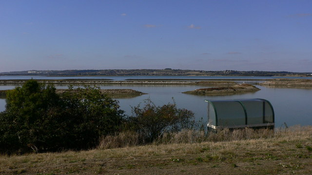
The Deeps is a stunning coastal area located in Hampshire, England. It encompasses a combination of sea, estuary, and creek, making it a diverse and ecologically rich landscape. The area is known for its breathtaking natural beauty and is a popular destination for outdoor enthusiasts and nature lovers.

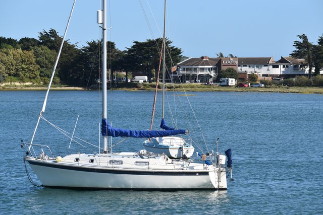
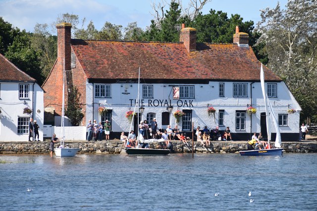
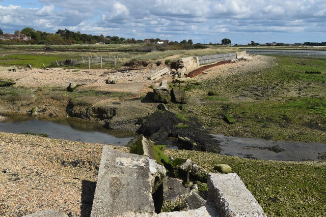
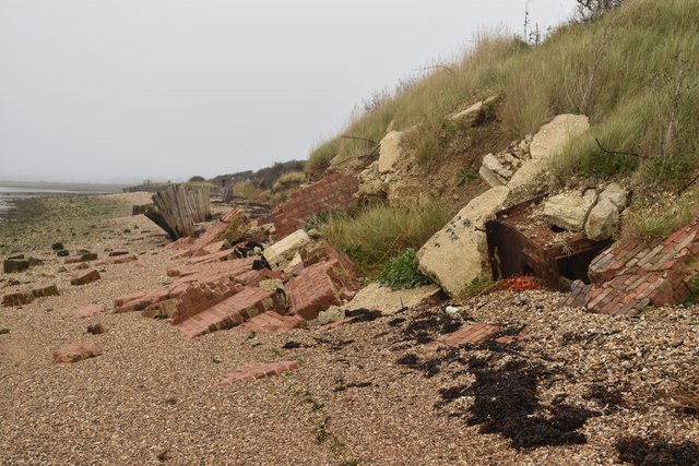
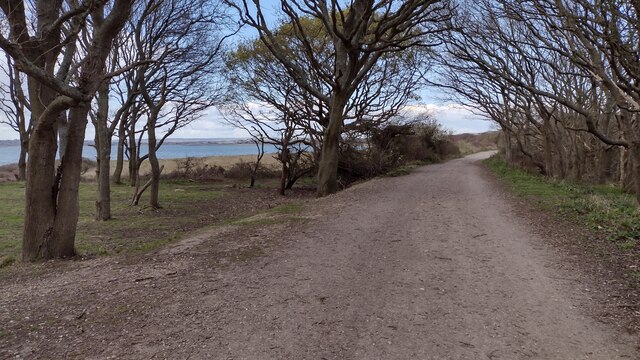
The coastline of The Deeps stretches for several miles and offers visitors a variety of experiences. The sandy beaches are perfect for sunbathing and picnicking, while the rocky cliffs provide a dramatic backdrop for hiking and photography. The crystal-clear waters of the sea are ideal for swimming, sailing, and other water sports, attracting visitors of all ages.

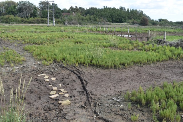
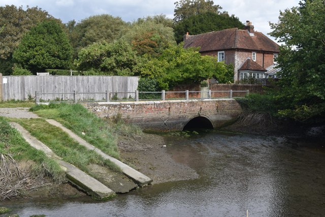
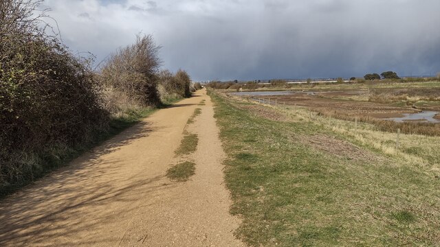
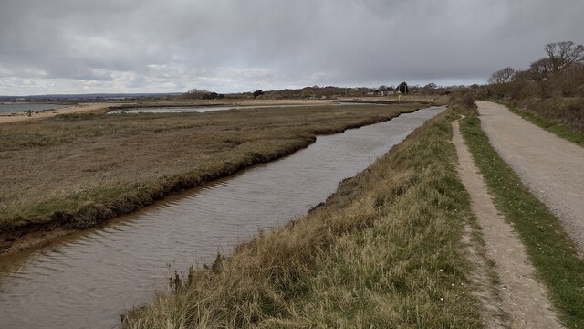
The estuary and creek of The Deeps are equally enchanting. The estuary is characterized by its calm and tranquil waters, providing a peaceful environment for boating and fishing. The creek, on the other hand, is a haven for wildlife, with its marshes and reed beds serving as habitats for various bird species and other wildlife.

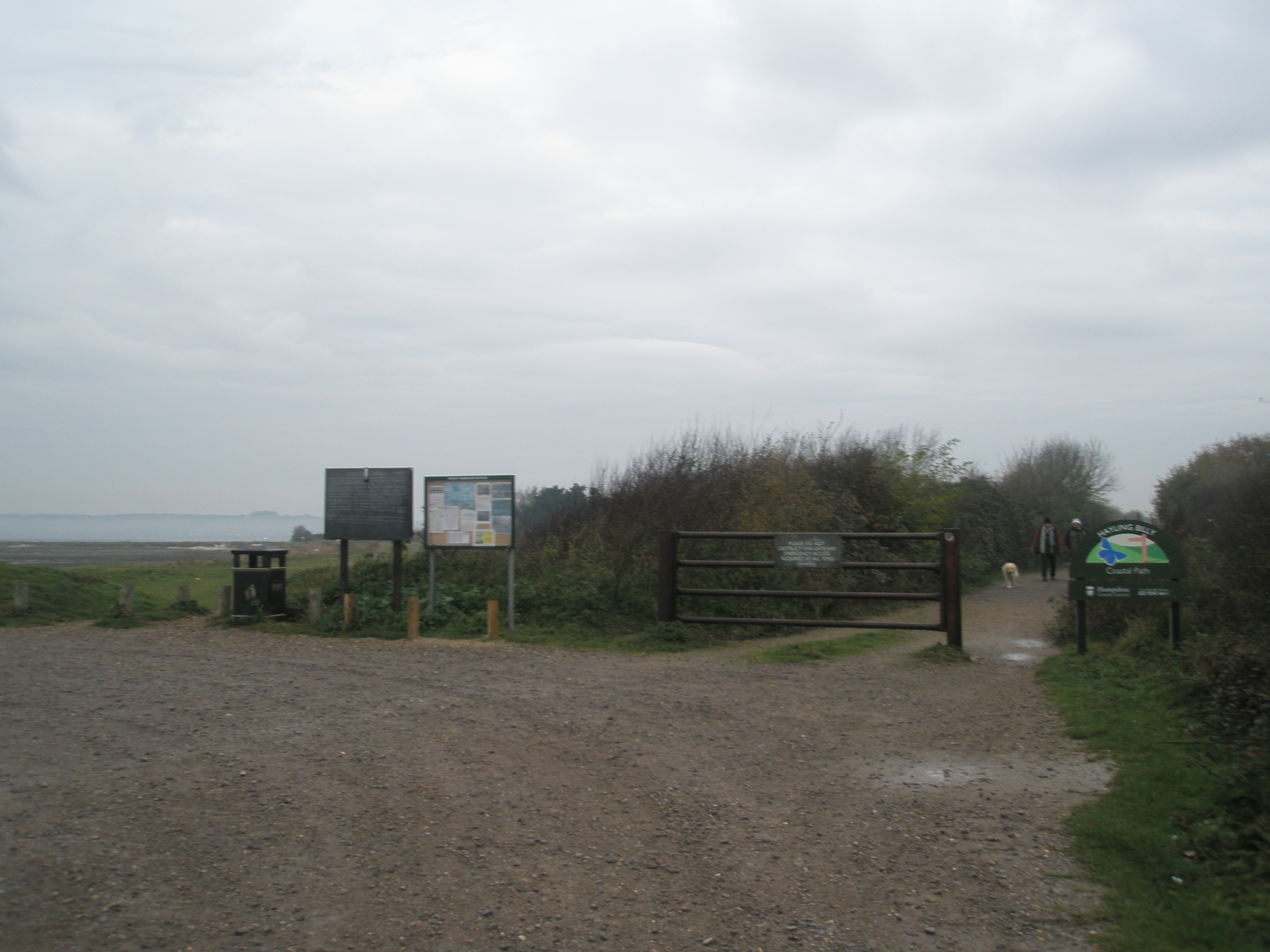
The Deeps is also home to a diverse range of flora and fauna. The surrounding areas feature lush vegetation, including grasslands, heathlands, and woodlands, which provide habitats for numerous plant and animal species.

Overall, The Deeps in Hampshire offers a unique and captivating experience for those seeking to immerse themselves in nature. Its combination of sea, estuary, and creek provides a dynamic and picturesque landscape, perfect for exploring and appreciating the beauty of the natural world.

If you have any feedback on the listing, please let us know in the comments section below.

The Deeps Images

Images are sourced within 2km of 50.826607/-0.9977781 or Grid Reference SU7003. Thanks to Geograph Open Source API. All images are credited.

Milestone, Langstone, Havant District Adjacent to the boundary of Langstone on the approach road to Langstone Bridge. On the SW grass verge.

Inscription: 1 mile☛  / Havant / ☚5 miles / Hayling / Beach /
Langstone Village Association / 1998 

Milestone Society National ID: HA_LNG01
Milestone, Langstone, Havant District
Adjacent to the boundary of Langstone on the approach road to Langstone Bridge. On the SW grass verge. Inscription: 1 mile☛ / Havant / ☚5 miles / Hayling / Beach / Langstone Village Association / 1998 Milestone Society National ID: HA_LNG01
Hayling Billy line The remains of the Hayling Billy Railway line crossing from Havant to Hayling island. The final train ran on Saturday 2 November 1963
Hayling Billy line
The remains of the Hayling Billy Railway line crossing from Havant to Hayling island. The final train ran on Saturday 2 November 1963
The Shipwrights Way joins the A3023 road The A3023 road crosses into Hayling Island via the Langstone Bridge. This is now the only land link onto the Island and is also used by the Shipwrights Way, which is joined by the Hayling Billy Coastal Path on the island. A 2nd bridge onto the island was the Hayling rail branch line, but that closed in 1963.
The Shipwrights Way joins the A3023 road
The A3023 road crosses into Hayling Island via the Langstone Bridge. This is now the only land link onto the Island and is also used by the Shipwrights Way, which is joined by the Hayling Billy Coastal Path on the island. A 2nd bridge onto the island was the Hayling rail branch line, but that closed in 1963.
Mud flats at Bridge Lake The remains of the Langston Harbour rail bridge are visible across the centre of the view. The poor state of the bridge led to the closure of the Hayling branch line in 1963 (but I'm sure, if not for the bridge, another reason to close the line would have been found!). Although much of the bridge infrastructure remains, it cannot be used to cross to the island. There have been recent calls to rebuild it, at a minimum as a walkway, but that seems unlikely in the near future, given the financial constraints which currently prevail. The road bridge to the island is visible on the left.
Mud flats at Bridge Lake
The remains of the Langston Harbour rail bridge are visible across the centre of the view. The poor state of the bridge led to the closure of the Hayling branch line in 1963 (but I'm sure, if not for the bridge, another reason to close the line would have been found!). Although much of the bridge infrastructure remains, it cannot be used to cross to the island. There have been recent calls to rebuild it, at a minimum as a walkway, but that seems unlikely in the near future, given the financial constraints which currently prevail. The road bridge to the island is visible on the left.
View from Langstone Bridge to Langstone Quays Resort
The Royal Oak pub, Langstone A classic view of this pretty waterside pub from the quayside in front of its neighbour, The Ship Inn.
The Royal Oak pub, Langstone
A classic view of this pretty waterside pub from the quayside in front of its neighbour, The Ship Inn.
A3023 Langstone Road This busy road is the only vehicle route onto Hayling Island (also reachable on foot by ferry from Portsmouth).
A3023 Langstone Road
This busy road is the only vehicle route onto Hayling Island (also reachable on foot by ferry from Portsmouth).
Path across marshland, Southmoor Nature Reserve
Bridge and former West Mill, Langstone
Channel in marshland, Southmoor Nature Reserve This area is now inundated by high tides, following <a href="https://www.geograph.org.uk/photo/7592560">SU7104 : Breach in sea wall, Southmoor Nature Reserve</a>. Compare <a href="https://www.geograph.org.uk/photo/5887297">SU7104 : South Moor Langstone</a> which shows the same fence in the foreground.
Channel in marshland, Southmoor Nature Reserve
This area is now inundated by high tides, following SU7104 : Breach in sea wall, Southmoor Nature Reserve. Compare SU7104 : South Moor Langstone which shows the same fence in the foreground.
Breach in sea wall, Southmoor Nature Reserve The breach occurred in 2020 and the marshland habitat has changed dramatically, with some areas now under water at each high tide: see <a href="https://www.geograph.org.uk/photo/7592550">SU7104 : Channel in marshland, Southmoor Nature Reserve</a>. The coastal footpath is officially closed.
Breach in sea wall, Southmoor Nature Reserve
The breach occurred in 2020 and the marshland habitat has changed dramatically, with some areas now under water at each high tide: see SU7104 : Channel in marshland, Southmoor Nature Reserve. The coastal footpath is officially closed.
On the shore at Southmoor Nature Reserve The projecting sea wall is at the end of Southmoor Lane.
On the shore at Southmoor Nature Reserve
The projecting sea wall is at the end of Southmoor Lane.
On the shore at Budd's Wall
Path on Budd's Wall Looking back towards Southmoor Lane.
Path on Budd's Wall
Looking back towards Southmoor Lane.
Dropped defences Second World War coastal defences collapsed onto the beach beside the Hayling Billy route.
Dropped defences
Second World War coastal defences collapsed onto the beach beside the Hayling Billy route.
Hayling Billy Line Hayling Billy Line (old railway between Hayling and Havant) path heading to the Bridge car park
Hayling Billy Line
Hayling Billy Line (old railway between Hayling and Havant) path heading to the Bridge car park
Hayling Billy Line The Hayling Billy Line path heading to the Victoria Road car park
Hayling Billy Line
The Hayling Billy Line path heading to the Victoria Road car park
Hayling Billy Line Hayling Billy Line path heading to Victoria Road car park
Hayling Billy Line
Hayling Billy Line path heading to Victoria Road car park
Show me another place!

The Deeps is located at Grid Ref: SU7003 (Lat: 50.826607, Lng: -0.9977781)

Administrative County: Hampshire

District: Havant

Police Authority: Hampshire

What 3 Words

///openly.vessel.single. Near Havant, Hampshire

Related Wikis

West Hayling

West Hayling is a 76.2-hectare (188-acre) Local Nature Reserve on Hayling Island in Hampshire. It is owned by Havant Borough Council and managed by the...

Long Island (Hampshire)

Long Island is an island in Langstone Harbour in Hampshire, England. It is 750 metres (820 yd) long and up to 250 metres (270 yd) wide. Three Bronze Age...

South Binness Island

South Binness Island is an island in Langstone Harbour. It is 600 metres (660 yd) long and up to 240 metres (260 yd) wide but only rises to 2 metres (7...

North Hayling railway station

North Hayling station was a halt on the single track Hayling Island branch, most often used to load oysters caught by local fishermen, but also ornithologists...

Baker's Island

Baker's Island is an island in Langstone Harbour, Hampshire, England. It is 400 m (1,300 ft) long and up to 300 m (980 ft) wide but only rises to a little...

Langstone Harbour

Langstone Harbour is a 2,085.4-hectare (5,153-acre) biological Site of Special Scientific Interest in Hampshire. It is an inlet of the English Channel...

Stoke, Hayling Island

Stoke is a village on Hayling Island in the Havant district, in the county of Hampshire, England. The village lies on the Havant A3023 road between North...

Fleet, Hayling Island

Fleet is a hamlet near Stoke on Hayling Island in Hampshire, England. The hamlet lies approximately 5.1 miles (8.2 km) east from Portsmouth and 1.6 miles...

Nearby Amenities

Located within 500m of 50.826607,-0.9977781
Broad Point
Addr City: Hayling
Addr Housename: Broad Point
Lat/Long: 50.8297604/-1.0004421
Southmoor Point
Addr City: Emsworth
Addr Housename: Southmoor Point
Lat/Long: 50.8305841/-0.9971888
Penner South Point
Addr City: Emsworth
Addr Housename: Penner South Point
Lat/Long: 50.8281824/-0.9954729
Seamark Beacon Lateral Category: port
Seamark Beacon Lateral Colour: black
Seamark Beacon Lateral Shape: stake
Seamark Type: beacon_lateral
Lat/Long: 50.8293066/-0.9998846
Seamark Beacon Lateral Category: port
Seamark Beacon Lateral Colour: red
Seamark Beacon Lateral Shape: pile
Seamark Beacon Lateral System: iala-a
Seamark Light Character: Fl
Seamark Light Colour: red
Seamark Light Period: 3
Seamark Type: beacon_lateral
Lat/Long: 50.8272735/-0.9989727
Seamark Beacon Lateral Category: starboard
Seamark Beacon Lateral Colour: green
Seamark Beacon Lateral Shape: stake
Seamark Beacon Lateral System: iala-a
Seamark Light Character: Fl
Seamark Light Colour: green
Seamark Light Period: 3
Seamark Type: beacon_lateral
Lat/Long: 50.8248609/-0.9979534
The data included in this document is from www.openstreetmap.org. The data is made available under ODbL.

Have you been to The Deeps?

Leave your review of The Deeps below (or comments, questions and feedback).