Wadeway

Coastal Marsh, Saltings in Hampshire Havant

England

Wadeway

Hayling Billy line The remains of the Hayling Billy Railway line crossing from Havant to Hayling island. The final train ran on Saturday 2 November 1963
Hayling Billy line Credit: Jackie OHalloran

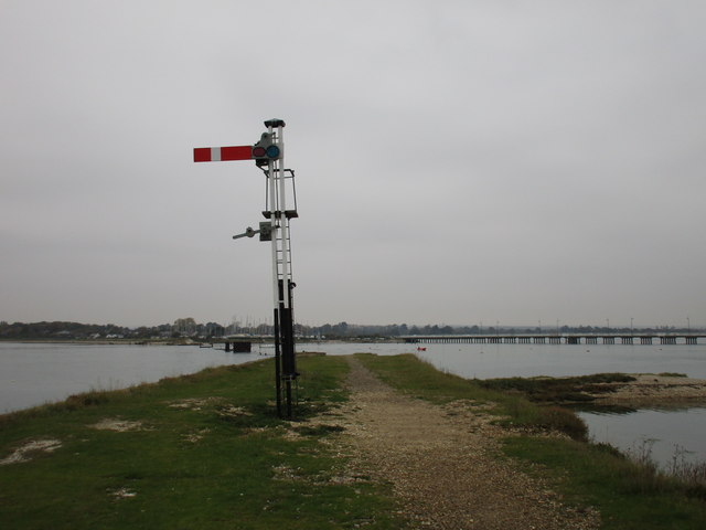
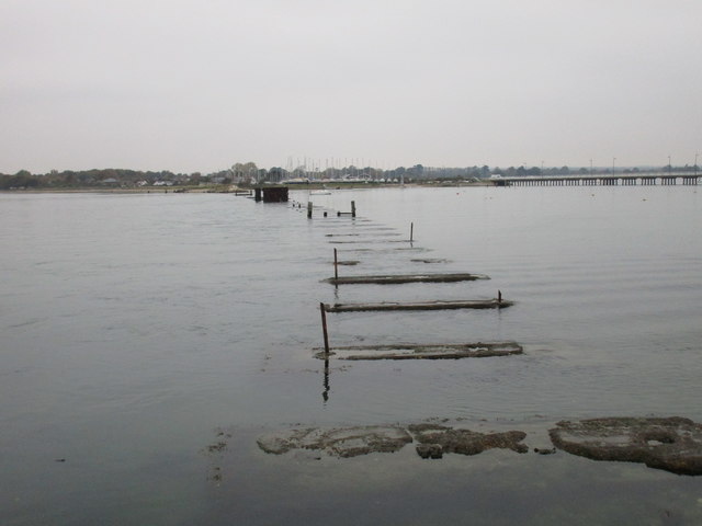
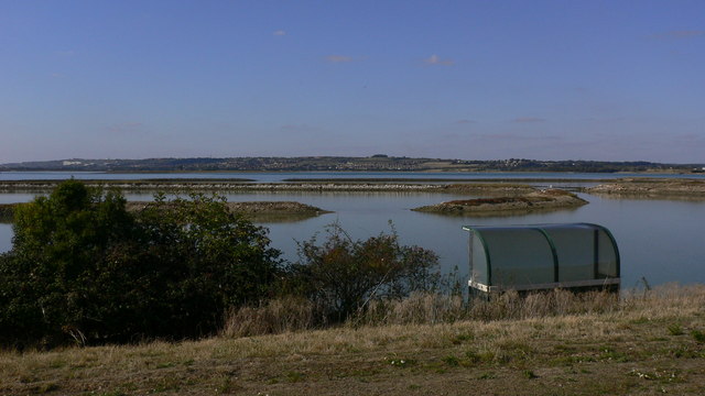
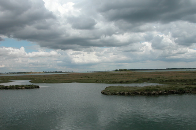
Wadeway is a coastal marsh located in Hampshire, England. It is situated in the southern part of the county, near the town of Lymington. This area is known for its unique geographical features, as it is a combination of marshes and saltings.

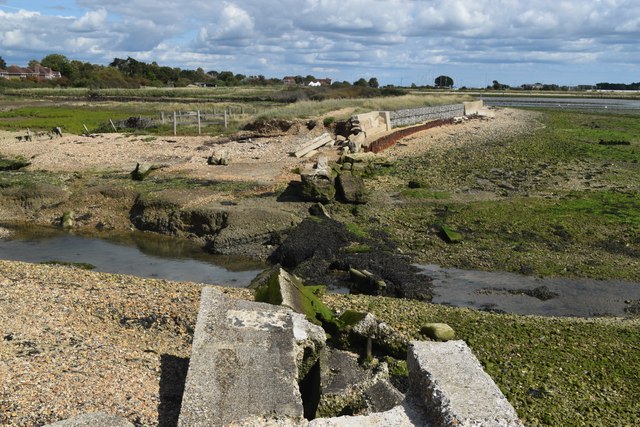
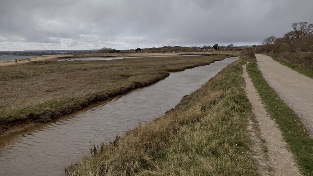
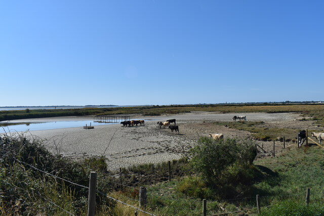
The marshes in Wadeway are characterized by their flat, low-lying terrain, with a mixture of grasses, reeds, and other wetland vegetation. They are often flooded with seawater during high tides, creating a dynamic and ever-changing landscape. This marshland is an important habitat for various bird species, including waders like curlews and redshanks, as well as waterfowl such as ducks and geese.

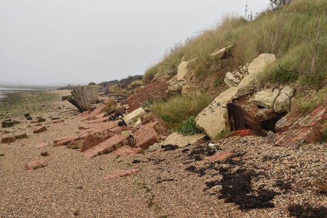
Adjacent to the marshes are the saltings, which are areas of salt marshes formed by the deposition of salt from tidal waters. These areas have a unique ecosystem adapted to the saline conditions, with plants like samphire and sea lavender thriving in the salty soil. The saltings in Wadeway are particularly renowned for their rich biodiversity and are home to numerous species of invertebrates, including crabs and snails.

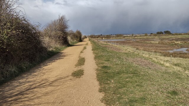
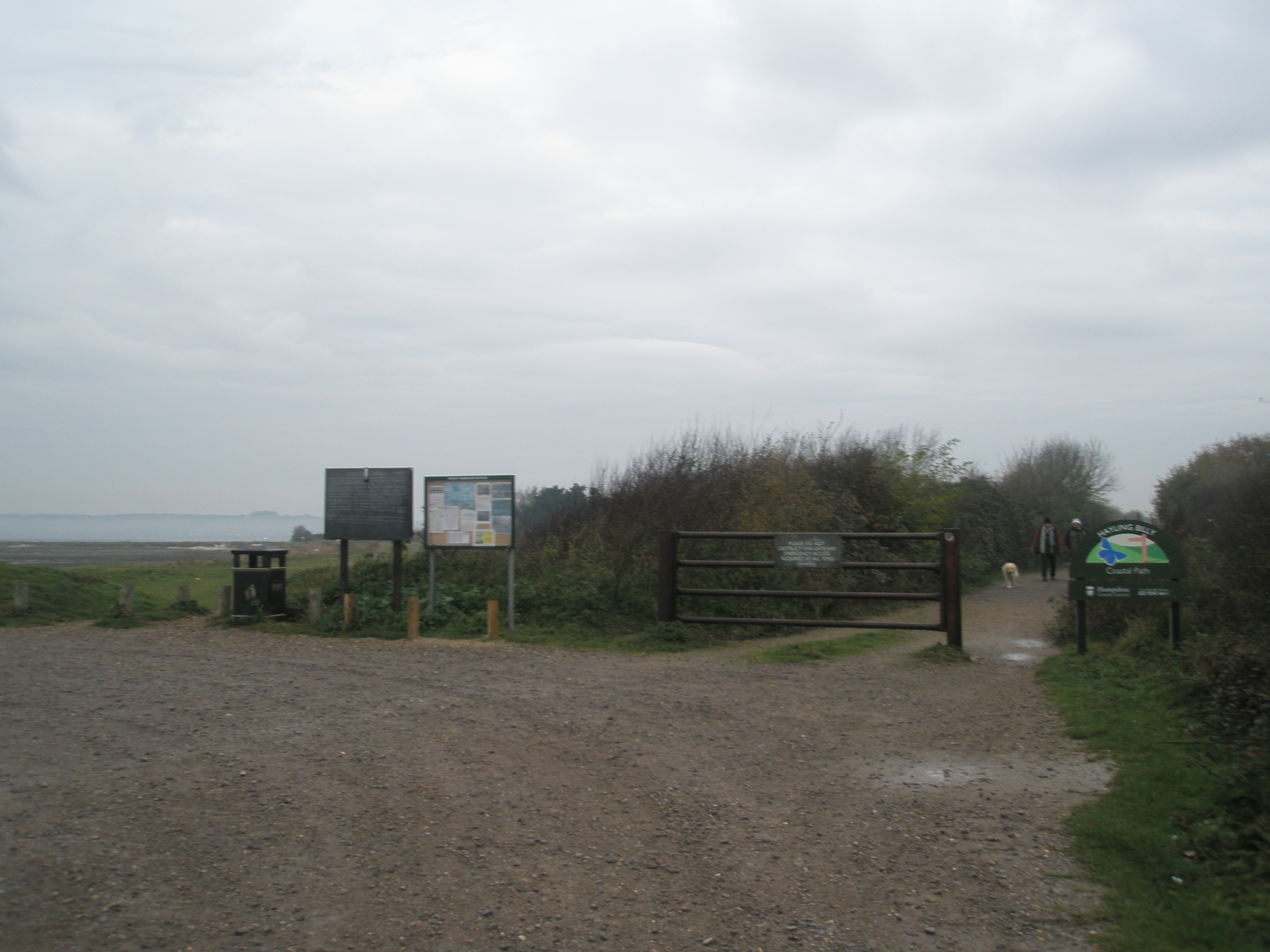
Wadeway is a popular spot for nature enthusiasts and birdwatchers, who come to observe the diverse range of birdlife and unique plant species. It is also a designated Site of Special Scientific Interest (SSSI), highlighting its ecological significance and the need for its conservation.

Overall, Wadeway in Hampshire offers a captivating blend of marshes and saltings, providing a haven for wildlife and a serene setting for visitors to appreciate the beauty of nature.

If you have any feedback on the listing, please let us know in the comments section below.
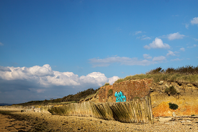
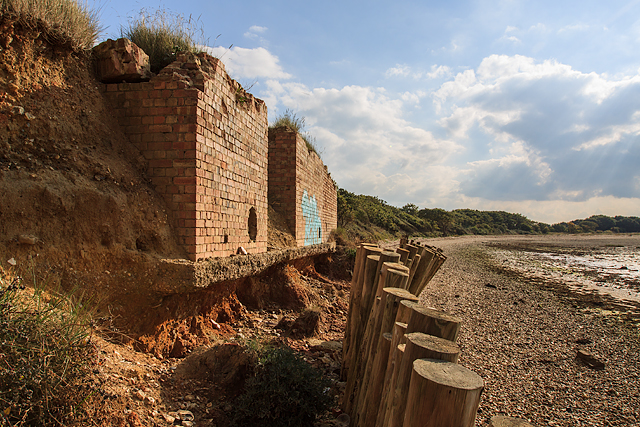
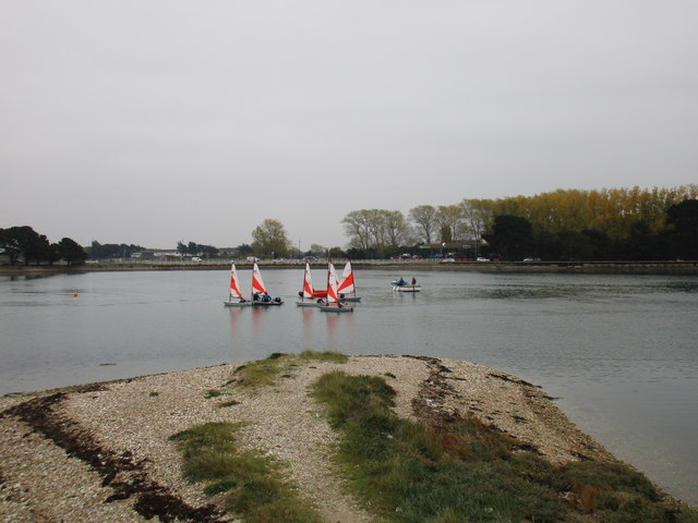
Wadeway Images

Images are sourced within 2km of 50.825589/-1.0059496 or Grid Reference SU7003. Thanks to Geograph Open Source API. All images are credited.

Hayling Billy line The remains of the Hayling Billy Railway line crossing from Havant to Hayling island. The final train ran on Saturday 2 November 1963
Hayling Billy line
The remains of the Hayling Billy Railway line crossing from Havant to Hayling island. The final train ran on Saturday 2 November 1963
Mud flats at Bridge Lake The remains of the Langston Harbour rail bridge are visible across the centre of the view. The poor state of the bridge led to the closure of the Hayling branch line in 1963 (but I'm sure, if not for the bridge, another reason to close the line would have been found!). Although much of the bridge infrastructure remains, it cannot be used to cross to the island. There have been recent calls to rebuild it, at a minimum as a walkway, but that seems unlikely in the near future, given the financial constraints which currently prevail. The road bridge to the island is visible on the left.
Mud flats at Bridge Lake
The remains of the Langston Harbour rail bridge are visible across the centre of the view. The poor state of the bridge led to the closure of the Hayling branch line in 1963 (but I'm sure, if not for the bridge, another reason to close the line would have been found!). Although much of the bridge infrastructure remains, it cannot be used to cross to the island. There have been recent calls to rebuild it, at a minimum as a walkway, but that seems unlikely in the near future, given the financial constraints which currently prevail. The road bridge to the island is visible on the left.
Channel in marshland, Southmoor Nature Reserve This area is now inundated by high tides, following <a href="https://www.geograph.org.uk/photo/7592560">SU7104 : Breach in sea wall, Southmoor Nature Reserve</a>. Compare <a href="https://www.geograph.org.uk/photo/5887297">SU7104 : South Moor Langstone</a> which shows the same fence in the foreground.
Channel in marshland, Southmoor Nature Reserve
This area is now inundated by high tides, following SU7104 : Breach in sea wall, Southmoor Nature Reserve. Compare SU7104 : South Moor Langstone which shows the same fence in the foreground.
Breach in sea wall, Southmoor Nature Reserve The breach occurred in 2020 and the marshland habitat has changed dramatically, with some areas now under water at each high tide: see <a href="https://www.geograph.org.uk/photo/7592550">SU7104 : Channel in marshland, Southmoor Nature Reserve</a>. The coastal footpath is officially closed.
Breach in sea wall, Southmoor Nature Reserve
The breach occurred in 2020 and the marshland habitat has changed dramatically, with some areas now under water at each high tide: see SU7104 : Channel in marshland, Southmoor Nature Reserve. The coastal footpath is officially closed.
On the shore at Southmoor Nature Reserve The projecting sea wall is at the end of Southmoor Lane.
On the shore at Southmoor Nature Reserve
The projecting sea wall is at the end of Southmoor Lane.
On the shore at Budd's Wall
Path on Budd's Wall Looking back towards Southmoor Lane.
Path on Budd's Wall
Looking back towards Southmoor Lane.
Dropped defences Second World War coastal defences collapsed onto the beach beside the Hayling Billy route.
Dropped defences
Second World War coastal defences collapsed onto the beach beside the Hayling Billy route.
Hayling Billy Line Hayling Billy Line (old railway between Hayling and Havant) path heading to the Bridge car park
Hayling Billy Line
Hayling Billy Line (old railway between Hayling and Havant) path heading to the Bridge car park
Hayling Billy Line The Hayling Billy Line path heading to the Victoria Road car park
Hayling Billy Line
The Hayling Billy Line path heading to the Victoria Road car park
The Deeps, Farlington Marsh This lake is called The Deeps, it's formed by a combination of overwash from the sea and retention of rainfall draining from the marsh. Following a recent extended hot and dry spell it's drying up and currently looks more like something from an African documentary than an English coastal lake.
The Deeps, Farlington Marsh
This lake is called The Deeps, it's formed by a combination of overwash from the sea and retention of rainfall draining from the marsh. Following a recent extended hot and dry spell it's drying up and currently looks more like something from an African documentary than an English coastal lake.
WWII Hampshire - Naval bombing decoy control bunker - Hayling Island (1) -
Naval Bombing Decoy (N Series): DoB ID: e18972

This was the Hayling Island Naval 'QF' (special fires) bombing decoy control building, now partially demolished and backfilled, and in danger of disappearing forever due to coastal erosion.

<a href="https://www.geograph.org.uk/photo/5154404">SU7102 : WWII Hampshire - Naval bombing decoy control bunker - Hayling Island (2)</a>
WWII Hampshire - Naval bombing decoy control bunker - Hayling Island (1)
- Naval Bombing Decoy (N Series): DoB ID: e18972 This was the Hayling Island Naval 'QF' (special fires) bombing decoy control building, now partially demolished and backfilled, and in danger of disappearing forever due to coastal erosion. SU7102 : WWII Hampshire - Naval bombing decoy control bunker - Hayling Island (2)
WWII Hampshire - Naval bombing decoy control bunker - Hayling Island (2) -
Naval Bombing Decoy (N Series): DoB ID: e18972
WWII Hampshire - Naval bombing decoy control bunker - Hayling Island (2)
- Naval Bombing Decoy (N Series): DoB ID: e18972
Messing about in boats And enjoying themselves. Bridge Lake.
Messing about in boats
And enjoying themselves. Bridge Lake.
Hayling Island foreshore Close to high tide.
Hayling Island foreshore
Close to high tide.
Signal but no railway The Hayling Island to Havant branch ran along the top of the bank on the right until closure in 1963. The expense of replacing the bridge over Langstone Harbour (the remains of which can be seen in the distance) brought about its demise. The signal remains as a reminder of its existence. The trackbed is now a combined footpath/cycleway.
Signal but no railway
The Hayling Island to Havant branch ran along the top of the bank on the right until closure in 1963. The expense of replacing the bridge over Langstone Harbour (the remains of which can be seen in the distance) brought about its demise. The signal remains as a reminder of its existence. The trackbed is now a combined footpath/cycleway.
Signal and the remains of the railway bridge The Hayling Island to Havant branch ran along the top of the bank until closure in 1963. The expense of replacing the bridge over Langstone Harbour (the remains of which can be seen in the distance) brought about its demise. The signal (recently restored) remains as a reminder of its existence. A full history of the line can be found at <span class="nowrap"><a title="http://www.semgonline.com/location/hayling_01.html" rel="nofollow ugc noopener" href="http://www.semgonline.com/location/hayling_01.html">Link</a><img style="margin-left:2px;" alt="External link" title="External link - shift click to open in new window" src="https://s1.geograph.org.uk/img/external.png" width="10" height="10"/></span> 17th October 2015
Signal and the remains of the railway bridge
The Hayling Island to Havant branch ran along the top of the bank until closure in 1963. The expense of replacing the bridge over Langstone Harbour (the remains of which can be seen in the distance) brought about its demise. The signal (recently restored) remains as a reminder of its existence. A full history of the line can be found at LinkExternal link 17th October 2015
The remains of the Hayling Island railway bridge The expense of repairing this bridge was given as the reason for the closure of the railway in 1963.
The remains of the Hayling Island railway bridge
The expense of repairing this bridge was given as the reason for the closure of the railway in 1963.
Show me another place!

Wadeway is located at Grid Ref: SU7003 (Lat: 50.825589, Lng: -1.0059496)

Administrative County: Hampshire

District: Havant

Police Authority: Hampshire

What 3 Words

///remit.device.burns. Near Havant, Hampshire

Related Wikis

South Binness Island

South Binness Island is an island in Langstone Harbour. It is 600 metres (660 yd) long and up to 240 metres (260 yd) wide but only rises to 2 metres (7...

Baker's Island

Baker's Island is an island in Langstone Harbour, Hampshire, England. It is 400 m (1,300 ft) long and up to 300 m (980 ft) wide but only rises to a little...

Long Island (Hampshire)

Long Island is an island in Langstone Harbour in Hampshire, England. It is 750 metres (820 yd) long and up to 250 metres (270 yd) wide. Three Bronze Age...

Langstone Harbour

Langstone Harbour is a 2,085.4-hectare (5,153-acre) biological Site of Special Scientific Interest in Hampshire. It is an inlet of the English Channel...

West Hayling

West Hayling is a 76.2-hectare (188-acre) Local Nature Reserve on Hayling Island in Hampshire. It is owned by Havant Borough Council and managed by the...

North Binness Island

North Binness Island is an island in Langstone Harbour It is 900 metres (980 yd) long and up to 250 metres (270 yd) wide but only rises to 2.5 metres...

North Hayling railway station

North Hayling station was a halt on the single track Hayling Island branch, most often used to load oysters caught by local fishermen, but also ornithologists...

Staunton Way

The Staunton Way is a 20.5 mile recreational circular walk in Hampshire, southern England, that connects Queen Elizabeth Country Park to Staunton Country...

Related Videos

Havant to Southsea via Hayling Island | South Coast Walks | Cool Dudes Walking Club

swcwalk179 This walk is from Havant Station, down to Hayling Island, then a short hop on the Hayling Island Ferry to Southsea.

Park dean Hayling island vlog

Join us on our family holiday weekend break to Parkdean resorts Hayling Island Hampshire in March 2018. This includes an ...

South Coast Hike 🇬🇧 Portsmouth - Hayling Island | Cold and Wet Hiking during Storm Ciaran

Filmed November 2023 Starting at Portsmouth Harbour, opposite the Historic Dockyard and beside the Isle of Wight and Gosport ...

Nearby Amenities

Located within 500m of 50.825589,-1.0059496
Source: PGS
Lat/Long: 50.8240232/-1.0081624
Deadman's Head
Place: locality
Lat/Long: 50.8237524/-1.0062532
The data included in this document is from www.openstreetmap.org. The data is made available under ODbL.

Have you been to Wadeway?

Leave your review of Wadeway below (or comments, questions and feedback).