Port a' Mhuilinn

Sea, Estuary, Creek in Argyllshire

Scotland

Port a' Mhuilinn

Sea wall, at Ellenabeich, Seil Island The lower part protected by a strong plastic net, which is providing good support for the seaweed.
Sea wall, at Ellenabeich, Seil Island Credit: M J Richardson

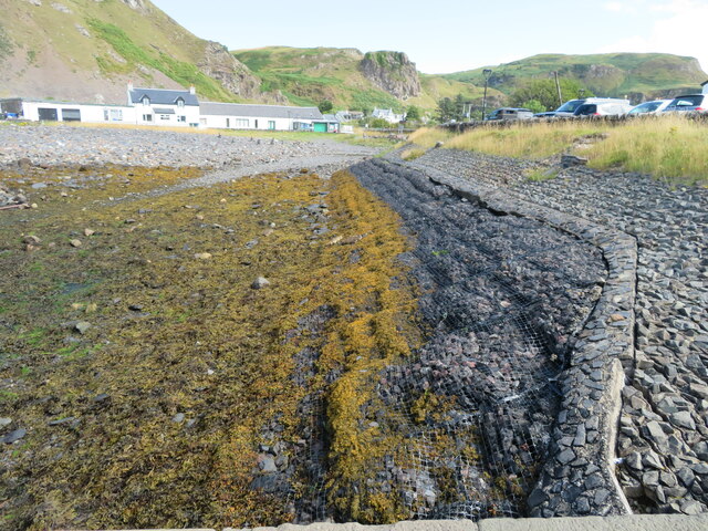
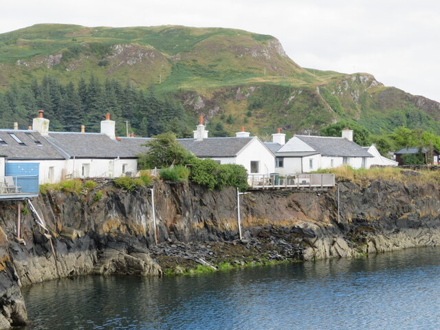
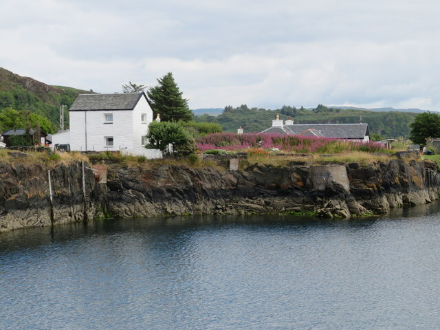
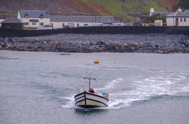
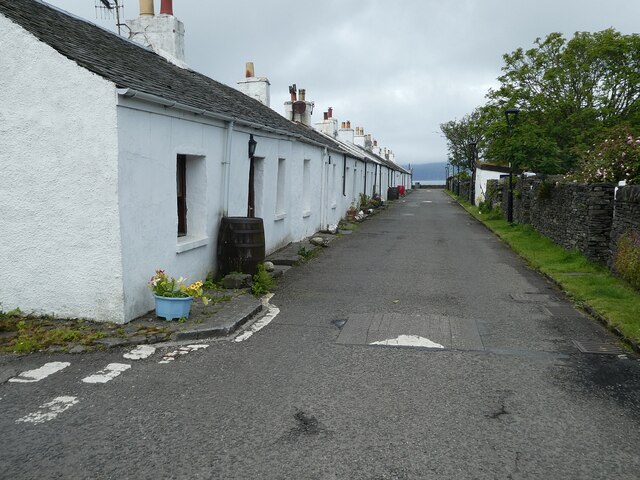
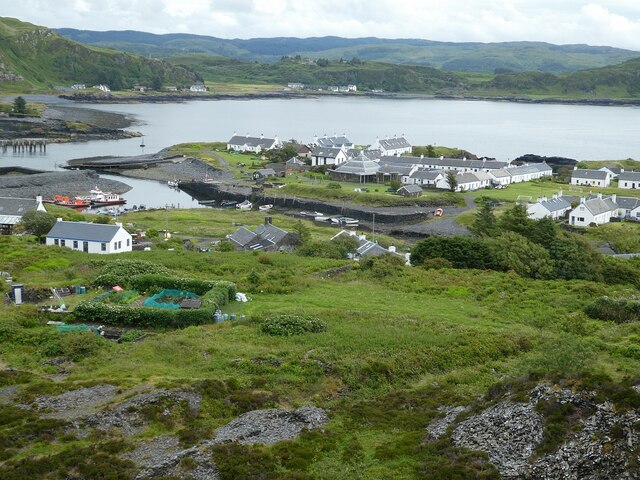
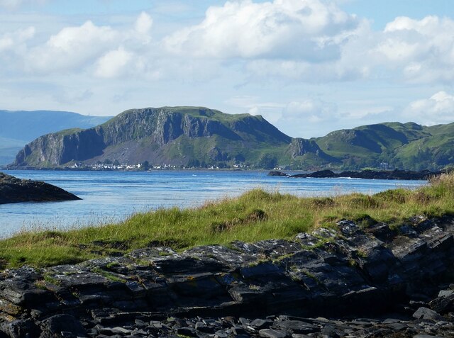
Port a' Mhuilinn is a small coastal village located in Argyllshire, Scotland. Situated on the western coast, it is known for its picturesque sea views, estuary, and creek. The village is surrounded by stunning natural landscapes, with rolling hills and lush greenery adding to its charm.

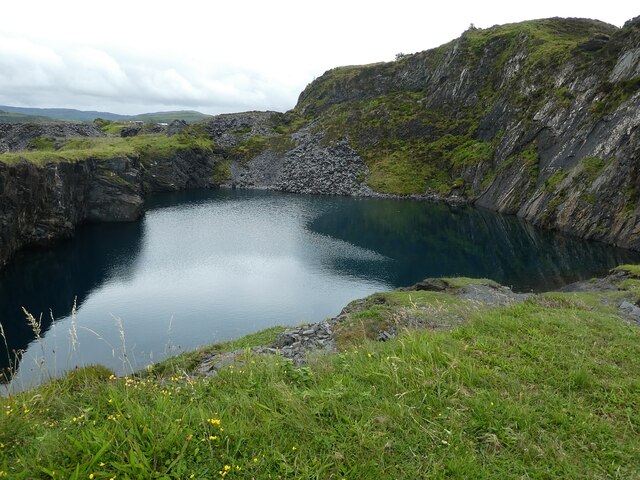
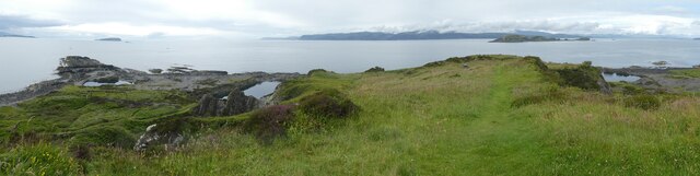
The sea that surrounds Port a' Mhuilinn is part of the Atlantic Ocean, offering visitors and residents alike breathtaking vistas of endless blue waters. The coastline is rugged and rocky, dotted with small sandy coves and pebble beaches. The sea in this area is known for its strong tides and currents, attracting adventurous water sports enthusiasts and fishermen.

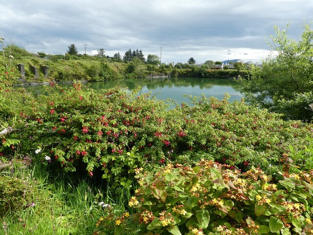
The village is also home to an estuary, where a river meets the sea. This estuary is a haven for wildlife, with a variety of bird species, including herons and oystercatchers, making it their habitat. The estuary also provides a rich feeding ground for seals, which can often be spotted basking on the rocks or swimming in the calm waters.

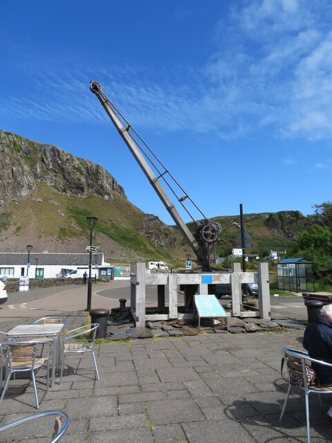
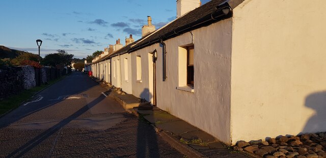
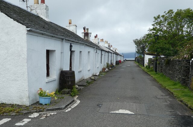
A creek runs through the heart of Port a' Mhuilinn, adding to the village's character. This creek is a small, narrow waterway that winds its way through the village, providing a tranquil setting for residents and visitors to enjoy. The creek is lined with quaint cottages and fishing boats, further enhancing the area's charm.

Overall, Port a' Mhuilinn's sea, estuary, and creek offer a rich and diverse natural environment for those seeking to experience the beauty of Scotland's coastal landscapes.

If you have any feedback on the listing, please let us know in the comments section below.

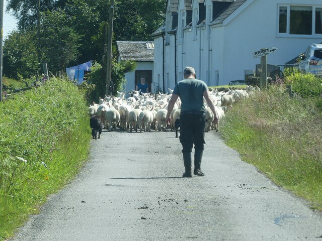
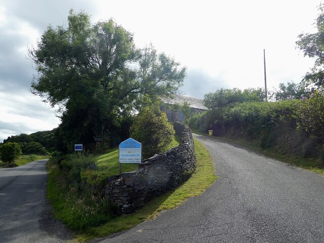
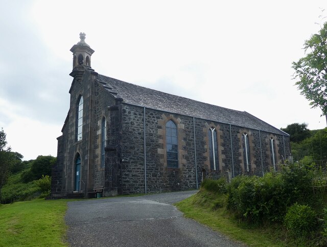
Port a' Mhuilinn Images

Images are sourced within 2km of 56.286835/-5.6361931 or Grid Reference NM7516. Thanks to Geograph Open Source API. All images are credited.

Sea wall, at Ellenabeich, Seil Island The lower part protected by a strong plastic net, which is providing good support for the seaweed.
Sea wall, at Ellenabeich, Seil Island
The lower part protected by a strong plastic net, which is providing good support for the seaweed.
Crane No. 295 at Ellenabeich It originally stood on the timber pier and served the 19thC paddle steamer traffic from Glasgow to Fort William. By 2000 the pier was deteriorating and the crane was in danger of falling into the sea. It was repaired and reinstalled by Alan Walker of Samuel Walker & Sons, Glasgow, in memory of his father- see <a href="https://www.geograph.org.uk/photo/6931922">NM7417 : Crane No. 295 at Ellenabeich</a>
Crane No. 295 at Ellenabeich
It originally stood on the timber pier and served the 19thC paddle steamer traffic from Glasgow to Fort William. By 2000 the pier was deteriorating and the crane was in danger of falling into the sea. It was repaired and reinstalled by Alan Walker of Samuel Walker & Sons, Glasgow, in memory of his father- see NM7417 : Crane No. 295 at Ellenabeich
Crane No. 295 at Ellenabeich Details of the crane <a href="https://www.geograph.org.uk/photo/6931911">NM7417 : Crane No. 295 at Ellenabeich</a> and its restoration.
Crane No. 295 at Ellenabeich
Details of the crane NM7417 : Crane No. 295 at Ellenabeich and its restoration.
Sgeir nam Ban Flooded slate quarry at Ellenabeich, and the back of cottages on one of the two streets.
Sgeir nam Ban
Flooded slate quarry at Ellenabeich, and the back of cottages on one of the two streets.
Sgeir nam Ban Flooded slate quarry at Ellenabeich, houses to the east, and a good growth of Rosebay Willowherb on some open ground.
Sgeir nam Ban
Flooded slate quarry at Ellenabeich, houses to the east, and a good growth of Rosebay Willowherb on some open ground.
The Easdale Ferry The ferry crossing to Easdale from Ellenbeich.
The Easdale Ferry
The ferry crossing to Easdale from Ellenbeich.
Toadlets Two out of hundreds of toadlets that were crawling about in the grounds of Garagh Mhor to the north of the flooded quarry in Ellenabeich, Seil.
These are almost certainly young Common Toads (Bufo bufo) as I believe young Natterjacks sport the yellow stripe that is distinctive of the adults.
Toadlets
Two out of hundreds of toadlets that were crawling about in the grounds of Garagh Mhor to the north of the flooded quarry in Ellenabeich, Seil. These are almost certainly young Common Toads (Bufo bufo) as I believe young Natterjacks sport the yellow stripe that is distinctive of the adults.
Seil - Ellenabeich - Village street Looking down the northernmost of the parallel streets that make up the village of Ellenabeich  on the Isle of Seil. This village is at the southwestern end of the island, overlooking the tiny island of Easdale.
Seil - Ellenabeich - Village street
Looking down the northernmost of the parallel streets that make up the village of Ellenabeich on the Isle of Seil. This village is at the southwestern end of the island, overlooking the tiny island of Easdale.
Seil - Ellenabeich - Flooded quarry One of the former quarries in Ellenabeich, Seil which is now entirely flooded but remains inland. Another quarry which was beside the coast has now been inundated by the sea, but this one is flooded with fresh water. This view is from the grounds of Garagh Mhor.
Seil - Ellenabeich - Flooded quarry
One of the former quarries in Ellenabeich, Seil which is now entirely flooded but remains inland. Another quarry which was beside the coast has now been inundated by the sea, but this one is flooded with fresh water. This view is from the grounds of Garagh Mhor.
Easdale - Former quarry, northernmost quarry This is a view, from the north, of the northernmost of all Easdale's numerous quarries. The number of quarries on this tiny island have resulted in it having a moth-eaten appearance from the air (see <a href="https://www.geograph.org.uk/photo/6898856">NM7317 : Island of Easdale off Seil</a>)
Easdale - Former quarry, northernmost quarry
This is a view, from the north, of the northernmost of all Easdale's numerous quarries. The number of quarries on this tiny island have resulted in it having a moth-eaten appearance from the air (see NM7317 : Island of Easdale off Seil)
Easdale - Village from the hill Taken from the top of the hill in Easdale (125', 38m elevation) looking down on the village which faces Ellenabeich on Seil.
Easdale - Village from the hill
Taken from the top of the hill in Easdale (125', 38m elevation) looking down on the village which faces Ellenabeich on Seil.
Easdale - View southwestwards from the hill Taken from by the toposcope atop the 125' (38m) hill in the centre of Easdale island, looking southwestwards with the finger of land of Rubha nam Faoileann pointing out on the left of the picture.
The island to the right of the 'pointing finger' is Garbh Eileach the largest of the Garvellach islands. The larger dark land to the right of the image is part of the Isle of Mull with Insh Island in front of it, much nearer the camera.
Easdale - View southwestwards from the hill
Taken from by the toposcope atop the 125' (38m) hill in the centre of Easdale island, looking southwestwards with the finger of land of Rubha nam Faoileann pointing out on the left of the picture. The island to the right of the 'pointing finger' is Garbh Eileach the largest of the Garvellach islands. The larger dark land to the right of the image is part of the Isle of Mull with Insh Island in front of it, much nearer the camera.
Seil - Sheep hold-up A short hiatus on our way down the B8003 through Seil to catch the ferry at Cuan to travel over to Luing. It was only a brief hold-up though as the sheep were soon steered off to the right.
Seil - Sheep hold-up
A short hiatus on our way down the B8003 through Seil to catch the ferry at Cuan to travel over to Luing. It was only a brief hold-up though as the sheep were soon steered off to the right.
Seil - Ellenabeich beneath Dùn Mòr from Luing Taken from close to <a href="https://www.geograph.org.uk/photo/7258288">NM7514 : Luing - Cnoc na h-Earde - small inlets</a> looking across <a href="https://www.geograph.org.uk/photo/7258280">NM7514 : Cuan Sound</a> to the village of Ellenabeich on the Isle of Seil as it nestles beneath to towering cliffs of Dùn Mòr which rises to 106m (348')
Seil - Ellenabeich beneath Dùn Mòr from Luing
Taken from close to NM7514 : Luing - Cnoc na h-Earde - small inlets looking across NM7514 : Cuan Sound to the village of Ellenabeich on the Isle of Seil as it nestles beneath to towering cliffs of Dùn Mòr which rises to 106m (348')
Seil - drive to Kilbrandon church car park The driveway on the right leads up to the carpark for <a href="https://www.geograph.org.uk/photo/7261589">NM7515 : Seil - Kilbrandon church</a> from the B8003 which continues on the left on its way to Cuan.
Seil - drive to Kilbrandon church car park
The driveway on the right leads up to the carpark for NM7515 : Seil - Kilbrandon church from the B8003 which continues on the left on its way to Cuan.
Seil - Kilbrandon church Kilbrandon church is famed for its stained glass. The five windows are the work of  Douglas Strachan and were presented to the church in 1938 in memory of the Marchioness of Breadalbane. Unfortunately on our visit the church wasn't open; however other Geograph contributors have been luckier - see the shared description below.
Seil - Kilbrandon church
Kilbrandon church is famed for its stained glass. The five windows are the work of Douglas Strachan and were presented to the church in 1938 in memory of the Marchioness of Breadalbane. Unfortunately on our visit the church wasn't open; however other Geograph contributors have been luckier - see the shared description below.
Seil - Ellenabeich - Quarrymen's cottages - view eastwards The northernmost row of the former quarrymen's cottages that make up the majority of the houses in the village of Ellenabeich on the Isle of Seil. Photograph taken as the sun was setting.
See shared descriptions below.
Seil - Ellenabeich - Quarrymen's cottages - view eastwards
The northernmost row of the former quarrymen's cottages that make up the majority of the houses in the village of Ellenabeich on the Isle of Seil. Photograph taken as the sun was setting. See shared descriptions below.
Seil - Ellenabeich - Quarrymen's cottages - view westwards The northernmost row of the former quarrymen's cottages that make up the majority of the houses in the village of Ellenabeich on the Isle of Seil. For the view in the opposite direction, see <a href="https://www.geograph.org.uk/photo/7261660">NM7417 : Seil - Ellenabeich - Quarrymen's cottages - view eastwards</a>
See shared descriptions below.
Seil - Ellenabeich - Quarrymen's cottages - view westwards
The northernmost row of the former quarrymen's cottages that make up the majority of the houses in the village of Ellenabeich on the Isle of Seil. For the view in the opposite direction, see NM7417 : Seil - Ellenabeich - Quarrymen's cottages - view eastwards See shared descriptions below.
Show me another place!

Port a' Mhuilinn is located at Grid Ref: NM7516 (Lat: 56.286835, Lng: -5.6361931)

Unitary Authority: Argyll and Bute

Police Authority: Argyll and West Dunbartonshire

What 3 Words

///bricks.curl.surfacing. Near Lochbuie, Argyll & Bute

Related Wikis

Ellenabeich

Ellenabeich (Scottish Gaelic: Eilean nam Beitheach, meaning "island of the birchwoods.") is a small village on the isle of Seil (Scottish Gaelic: Saoil...

Easdale

Easdale (Scottish Gaelic: Eilean Èisdeal) is one of the Slate Islands, in the Firth of Lorn, Scotland. Once the centre of the Scottish slate industry,...

Balvicar

Balvicar (Scottish Gaelic: Baile a' Bhiocair) is a village on the island of Seil, a small island seven miles (eleven kilometres) southwest of Oban, Scotland...

Seil

Seil (; Scottish Gaelic: Saoil, Scottish Gaelic pronunciation: [ˈs̪ɯːl]) is one of the Slate Islands, located on the east side of the Firth of Lorn, 7...

Nearby Amenities

Located within 500m of 56.286835,-5.6361931
Power: pole
Lat/Long: 56.290846/-5.6327406
Power: pole
Lat/Long: 56.2905027/-5.6326752
The data included in this document is from www.openstreetmap.org. The data is made available under ODbL.

Have you been to Port a' Mhuilinn?

Leave your review of Port a' Mhuilinn below (or comments, questions and feedback).