Port an Sgùmain

Sea, Estuary, Creek in Ross-shire

Scotland

Port an Sgùmain

Trigpoint, Meall na h-Airde Looking north-east towards Gairloch
Trigpoint, Meall na h-Airde Credit: Becky Williamson

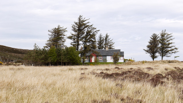
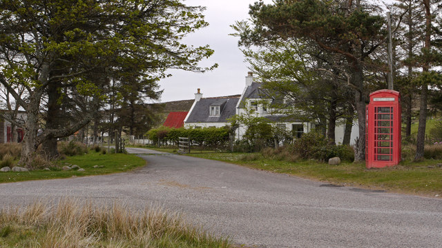
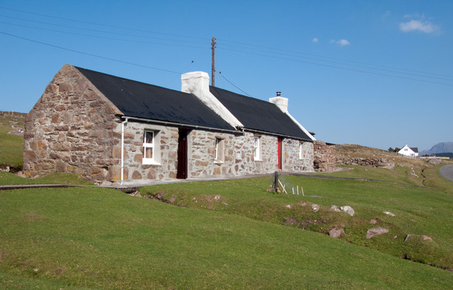
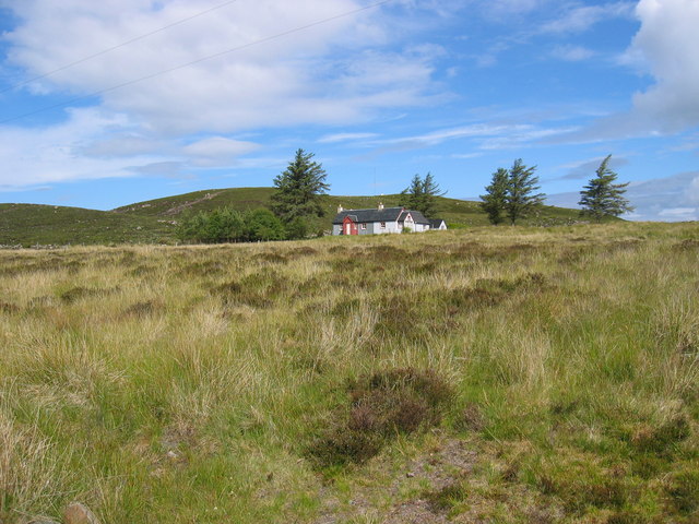
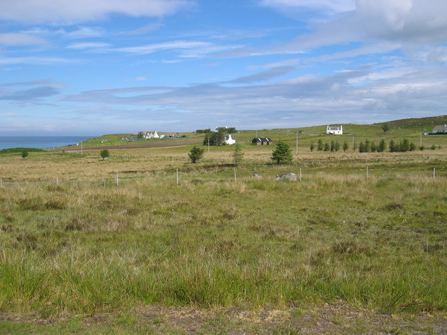
Port an Sgùmain is a scenic coastal settlement located in the county of Ross-shire, in the Scottish Highlands. Situated on the eastern coast of Scotland, it is nestled between the towns of Tain and Dornoch. This picturesque area is known for its beautiful sea, estuary, and creek.

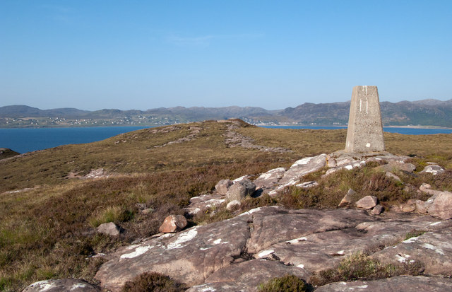
The main attraction of Port an Sgùmain is its stunning sea views. The azure waters of the North Sea stretch out before visitors, offering a serene and tranquil atmosphere. The sea is a prominent feature of the area and provides ample opportunities for water-based activities such as sailing, fishing, and boating.

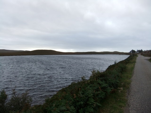
The settlement is also positioned along the estuary of the River Sgùmain, a tributary of the Dornoch Firth. This estuary is a haven for birdwatchers and nature enthusiasts, as it attracts a wide variety of bird species, including waders, ducks, and geese. The estuary serves as an important habitat for these birds, providing them with a rich feeding ground.

A small creek flows through Port an Sgùmain, adding to the natural beauty of the area. The creek is surrounded by lush vegetation and is a popular spot for locals and visitors to take leisurely walks or simply enjoy the peaceful surroundings.

Port an Sgùmain is a hidden gem along the Scottish coastline, offering a tranquil retreat for those seeking natural beauty and a slower pace of life. Whether it's exploring the sea, observing the estuary's wildlife, or strolling along the creek, this charming settlement has something to offer for everyone.

If you have any feedback on the listing, please let us know in the comments section below.

Port an Sgùmain Images

Images are sourced within 2km of 57.697476/-5.7770207 or Grid Reference NG7573. Thanks to Geograph Open Source API. All images are credited.

Trigpoint, Meall na h-Airde Looking north-east towards Gairloch
Trigpoint, Meall na h-Airde
Looking north-east towards Gairloch
Park Cottage Park Cottage is part of the crofting community of Port Henderson, near to Gairloch.
Park Cottage
Park Cottage is part of the crofting community of Port Henderson, near to Gairloch.
Road junction in Port Henderson Port Henderson is a crofting community on the south side of Loch Gairloch. The road crossing the image from left to right is the B8056.
Road junction in Port Henderson
Port Henderson is a crofting community on the south side of Loch Gairloch. The road crossing the image from left to right is the B8056.
Opinan Opinan is a crofting community astride the B8056 which is the road at the right side of the image.
Opinan
Opinan is a crofting community astride the B8056 which is the road at the right side of the image.
Moorland at Port Henderson Port Henderson is a crofting settlement at the south side of Loch Gairloch astride the B8056; from that road the minor road in the image heads out towards Sròn na Carra; the view is from the road end.
Moorland at Port Henderson
Port Henderson is a crofting settlement at the south side of Loch Gairloch astride the B8056; from that road the minor road in the image heads out towards Sròn na Carra; the view is from the road end.
Cottage at Port Henderson Port Henderson is a crofting community to the south of Loch Gairloch. The cottage is beside a minor road north of the B8056 and appears to have been renovated in recent times; it's doubtful if its present owner(s) follow a crofting life, it being more likely a holiday home now.
Cottage at Port Henderson
Port Henderson is a crofting community to the south of Loch Gairloch. The cottage is beside a minor road north of the B8056 and appears to have been renovated in recent times; it's doubtful if its present owner(s) follow a crofting life, it being more likely a holiday home now.
Trig point of Meall na h-Airde Meall na h-Airde is a low hill on the south side of Loch Gairloch. Sandstone ribs run away from the pillar towards the loch.
Trig point of Meall na h-Airde
Meall na h-Airde is a low hill on the south side of Loch Gairloch. Sandstone ribs run away from the pillar towards the loch.
Park Cottage near Port Henderson
Port Henderson crofting community
Coastal moorland near Opinan
Old croft at Opinan
Old croft at Opinan
Opinan
Opinan
Looking north over Port Henderson to Gairloch
Double rainbow , Meall na h-Airde
Loch bad na h-Aclaise
Uamh an Fhreiceadain The literal English translation of the name of this hillock (40m above sea level) is 'the Cave of the Guard.' Clearly this is not a cave but is named after the cave which is nearby. It is reported to be the last defensive position held by the MacLeods of Gairloch before they were expelled by the Mackenzies in the 16th century.
Uamh an Fhreiceadain
The literal English translation of the name of this hillock (40m above sea level) is 'the Cave of the Guard.' Clearly this is not a cave but is named after the cave which is nearby. It is reported to be the last defensive position held by the MacLeods of Gairloch before they were expelled by the Mackenzies in the 16th century.
Loch Bad na h-Achlaise Looking directly across the western part of the loch.
Loch Bad na h-Achlaise
Looking directly across the western part of the loch.
Port Henderson Looking over some of the houses of this scattered community to the bay beyond. The houses of Big Sand can be seen in the distance.
Port Henderson
Looking over some of the houses of this scattered community to the bay beyond. The houses of Big Sand can be seen in the distance.
Show me another place!

Port an Sgùmain is located at Grid Ref: NG7573 (Lat: 57.697476, Lng: -5.7770207)

Unitary Authority: Highland

Police Authority: Highlands and Islands

What 3 Words

///dizzy.smallest.maddening. Near Gairloch, Highland

Related Wikis

Port Henderson

Port Henderson (Scottish Gaelic: Portaigil) is a fishing village on the south west shore of the Gair Loch near the village of Gairloch, Ross-shire, Scottish...

Opinan, Gairloch

Opinan (Scottish Gaelic: Na h-Òbaidhnean) is a fishing village on the west coast of Scotland in Gairloch, Ross-shire, Scottish Highlands and is in the...

South Erradale

South Erradale is a small hamlet, situated on the coastline and to the southwest of Gairloch in Ross and Cromarty, Scottish Highlands and is in the Scottish...

Badachro

Badachro (Scottish Gaelic: Bad a' Chrò) is a former fishing village, in the northwest Highlands of Scotland. == Geography == Badachro sits about 3 km south...

Nearby Amenities

Located within 500m of 57.697476,-5.7770207
Source: PGS
Lat/Long: 57.6983453/-5.7688737
Source: PGS
Lat/Long: 57.6980695/-5.7693913
Source: PGS
Lat/Long: 57.698086/-5.7696506
Created By: almien_coastlines
Source: PGS
Lat/Long: 57.697864/-5.770964
Source: PGS
Lat/Long: 57.6974895/-5.7719
Created By: almien_coastlines
Source: PGS
Lat/Long: 57.697321/-5.772358
Source: PGS
Lat/Long: 57.6970278/-5.7739804
Source: PGS
Lat/Long: 57.6975495/-5.7755195
Source: PGS
Lat/Long: 57.697683/-5.7759747
Created By: almien_coastlines
Source: PGS
Lat/Long: 57.697727/-5.777173
Source: PGS
Lat/Long: 57.6974314/-5.7778633
Source: PGS
Lat/Long: 57.6973091/-5.7779863
Source: PGS
Lat/Long: 57.6976733/-5.779344
Source: PGS
Lat/Long: 57.6983575/-5.7798897
Source: PGS
Lat/Long: 57.6984468/-5.7801291
Source: PGS
Lat/Long: 57.6981/-5.7811457
Source: PGS
Lat/Long: 57.6975916/-5.7817254
Source: PGS
Lat/Long: 57.6975916/-5.7844226
Source: PGS
Lat/Long: 57.6975615/-5.7847432
Port Henderson
Name En: Port Henderson
Name Gd: Portaigil
Place: village
Wikidata: Q2390728
Wikipedia: en:Port Henderson
Lat/Long: 57.6967205/-5.7696728
Post Box
Post Box Type: lamp
Ref: IV21 221
Royal Cypher: scottish_crown
Source: survey
Lat/Long: 57.6959074/-5.7723256
Barrier: cattle_grid
Source: survey
Lat/Long: 57.6948471/-5.7753543
An Sgùman
Natural: cape
Lat/Long: 57.6983283/-5.7802786
Creag Mhaol
Natural: cape
Lat/Long: 57.6977913/-5.7762227
Port an Sgùmain
Natural: bay
Lat/Long: 57.6980072/-5.7782402
Camas nan Raineach
Natural: bay
Lat/Long: 57.6979728/-5.7829179
Power: pole
Lat/Long: 57.6973162/-5.7687083
Power: pole
Lat/Long: 57.6969857/-5.7693802
Power: pole
Lat/Long: 57.6967828/-5.7698383
Power: pole
Lat/Long: 57.6965583/-5.7707965
Power: pole
Lat/Long: 57.6963533/-5.7717757
Power: pole
Lat/Long: 57.6961738/-5.7725048
Power: pole
Lat/Long: 57.6959698/-5.77336
Power: pole
Lat/Long: 57.6956872/-5.774656
Power: pole
Lat/Long: 57.6954455/-5.7757211
Power: pole
Lat/Long: 57.6947477/-5.7766908
Power: pole
Lat/Long: 57.6941285/-5.7773588
Power: pole
Lat/Long: 57.6935756/-5.7779257
Power: pole
Lat/Long: 57.6931084/-5.7784106
Power: pole
Lat/Long: 57.6945753/-5.7761544
Power: pole
Lat/Long: 57.694866/-5.7771393
Power: pole
Lat/Long: 57.6951088/-5.7780536
Power: pole
Lat/Long: 57.6953343/-5.7788859
Power: pole
Lat/Long: 57.6956474/-5.7800483
Power: pole
Lat/Long: 57.6960514/-5.7808614
Power: pole
Lat/Long: 57.6964992/-5.7817223
Power: pole
Lat/Long: 57.6964961/-5.7825507
Power: pole
Lat/Long: 57.6964961/-5.7835108
Power: pole
Lat/Long: 57.6962345/-5.7840353
Power: pole
Lat/Long: 57.6957324/-5.7800608
Power: pole
Lat/Long: 57.6959261/-5.7797363
Power: pole
Lat/Long: 57.6961646/-5.7793214
Power: pole
Lat/Long: 57.6964744/-5.7792848
Power: pole
Lat/Long: 57.6964856/-5.7798554
Power: pole
Lat/Long: 57.696494/-5.7808146
The data included in this document is from www.openstreetmap.org. The data is made available under ODbL.

Have you been to Port an Sgùmain?

Leave your review of Port an Sgùmain below (or comments, questions and feedback).