Summers Beach

Beach in Cornwall

England

Summers Beach

Arriving by ferry at St Mawes
Arriving by ferry at St Mawes Credit: Roy Hughes

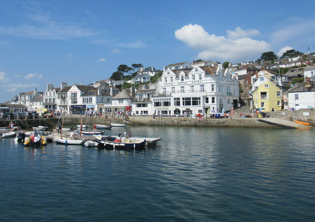
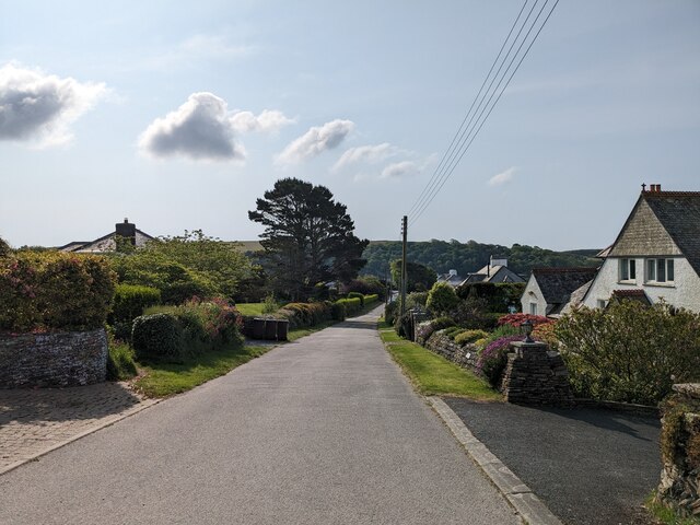
Summers Beach, located on the southern coast of Cornwall, England, is a picturesque and popular destination for both locals and tourists alike. With its stunning natural beauty and tranquil atmosphere, it offers a unique and memorable beach experience.

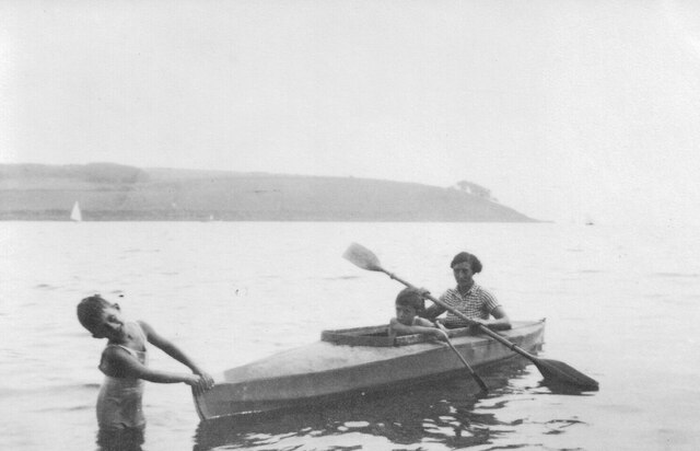
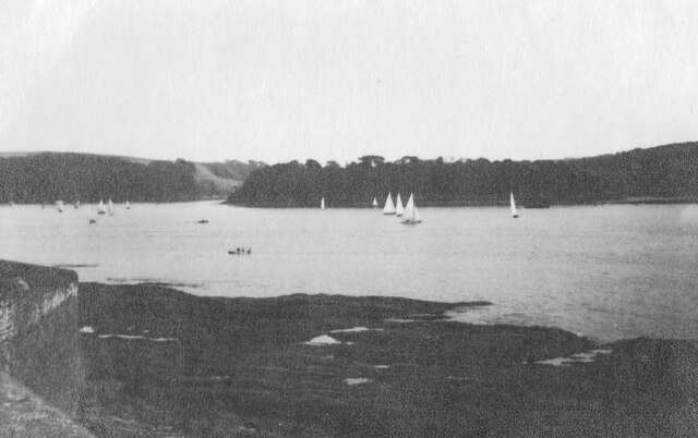
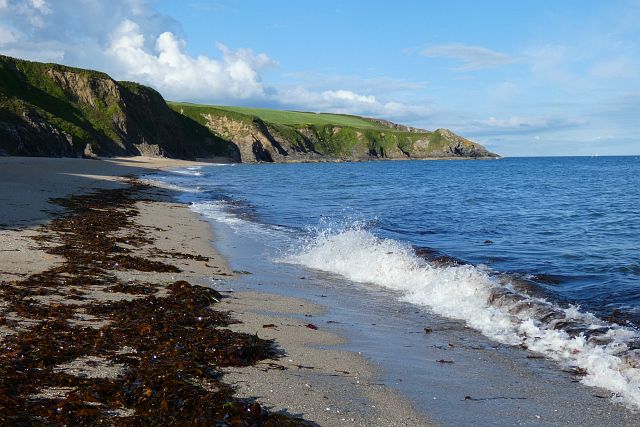
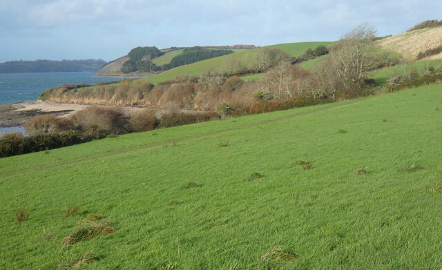
Stretching for approximately half a mile, Summers Beach boasts soft golden sand that gently slopes into the pristine turquoise waters of the Atlantic Ocean. The beach is surrounded by rugged cliffs and rock formations, providing a dramatic backdrop and adding to its charm. It is also known for its crystal-clear waters, making it ideal for swimming and snorkeling.

Summers Beach offers a range of amenities and facilities to cater to visitors' needs. There are lifeguards on duty during peak seasons, ensuring the safety of swimmers. Additionally, the beach provides ample parking spaces, making it easily accessible for those arriving by car. There are also nearby cafes and restaurants that offer a variety of food and refreshments.

Nature enthusiasts will appreciate the abundance of wildlife that can be found in the area. Summers Beach is home to a diverse range of marine life, including seals, dolphins, and various species of seabirds. The beach is also a popular spot for birdwatching, with many rare species making their home in the surrounding cliffs and dunes.

Overall, Summers Beach in Cornwall offers a serene and picturesque coastal experience, perfect for relaxation, water activities, and enjoying the natural beauty of the area. Whether you are seeking a peaceful day at the beach or an opportunity to explore the diverse wildlife, Summers Beach is sure to leave a lasting impression on visitors.

If you have any feedback on the listing, please let us know in the comments section below.

Summers Beach Images

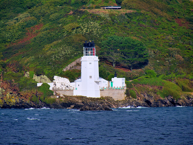
Images are sourced within 2km of 50.157932/-5.009833 or Grid Reference SW8532. Thanks to Geograph Open Source API. All images are credited.

Arriving by ferry at St Mawes
Folbot folding canoe, St Mawes 1938 Folding canoes of fabric over a frame originated with Inuit kayaks. Commercial ones started in Germany with Klepper's Faltboot in 1908. In the UK Jack Kissner started making the Folbot in 1933, and the company continued to 2016. In World War 2 Special Forces used folding canoes, known as cockles, the first ones were based on the Folbot design.
The Folbot in the photo is on Tavern Beach; the photographer was on holiday in "Our Cottage" in Lower Castle Road, just above the beach.
View towards Carricknath Point, as shown in <a href="https://www.geograph.org.uk/photo/29338">SW8432 : Carricknath Point</a>, also a view from St Mawes.
Folbot folding canoe, St Mawes 1938
Folding canoes of fabric over a frame originated with Inuit kayaks. Commercial ones started in Germany with Klepper's Faltboot in 1908. In the UK Jack Kissner started making the Folbot in 1933, and the company continued to 2016. In World War 2 Special Forces used folding canoes, known as cockles, the first ones were based on the Folbot design. The Folbot in the photo is on Tavern Beach; the photographer was on holiday in "Our Cottage" in Lower Castle Road, just above the beach. View towards Carricknath Point, as shown in SW8432 : Carricknath Point, also a view from St Mawes.
Tavern Beach St Mawes with yachts on harbour, 1938 Photo from Lower Castle Road where the photographer was on holiday in "Our Cottage". The sea wall beside the road is seen on the left. Across the estuary is the coast from Carricknath Point to St. Anthony.  A similar recent view is <a href="https://www.geograph.org.uk/photo/774705">SW8432 : St Mawes Harbour, Roseland, Cornwall taken 1964</a>.
Tavern Beach St Mawes with yachts on harbour, 1938
Photo from Lower Castle Road where the photographer was on holiday in "Our Cottage". The sea wall beside the road is seen on the left. Across the estuary is the coast from Carricknath Point to St. Anthony. A similar recent view is SW8432 : St Mawes Harbour, Roseland, Cornwall taken 1964.
Porthbeor Beach, Gerrans The tide was quite well in with relatively little of the beach exposed.  Access down a steep path is discouraged by the National Trust due to the risk of rockfalls.
Porthbeor Beach, Gerrans
The tide was quite well in with relatively little of the beach exposed. Access down a steep path is discouraged by the National Trust due to the risk of rockfalls.
The Percuil River, Gerrans A view from the riverside footpath above Precuil to steep pastures on the St Just side.
The Percuil River, Gerrans
A view from the riverside footpath above Precuil to steep pastures on the St Just side.
Farmland, Gerrans Fields of barley beside the road above Percuil.
Farmland, Gerrans
Fields of barley beside the road above Percuil.
St Anthony's Lighthouse St Anthony's Lighthouse is situated on St Anthony Head, on the eastern side of the entrance to Falmouth harbour. It was built in 1835 by the Chief Engineer of Trinity House to guide shipping away from the Manacles Rocks south of Falmouth Harbour (<span class="nowrap"><a title="https://www.trinityhouse.co.uk/lighthouses-and-lightvessels/st-anthonys-lighthouse" rel="nofollow ugc noopener" href="https://www.trinityhouse.co.uk/lighthouses-and-lightvessels/st-anthonys-lighthouse">Link</a><img style="margin-left:2px;" alt="External link" title="External link - shift click to open in new window" src="https://s1.geograph.org.uk/img/external.png" width="10" height="10"/></span>  Trinity House). It is a Grade II listed building (Historic England List Entry Number: 1136282 <span class="nowrap"><a title="https://historicengland.org.uk/listing/the-list/list-entry/1136282" rel="nofollow ugc noopener" href="https://historicengland.org.uk/listing/the-list/list-entry/1136282">Link</a><img style="margin-left:2px;" alt="External link" title="External link - shift click to open in new window" src="https://s1.geograph.org.uk/img/external.png" width="10" height="10"/></span> )

St Anthony's lighthouse was featured in the UK version of Jim Henson's Fraggle Rock, as "Fraggle Rock Lighthouse" in external scenes.

Today the light is automated, flashing white every 15 seconds
St Anthony's Lighthouse
St Anthony's Lighthouse is situated on St Anthony Head, on the eastern side of the entrance to Falmouth harbour. It was built in 1835 by the Chief Engineer of Trinity House to guide shipping away from the Manacles Rocks south of Falmouth Harbour (LinkExternal link Trinity House). It is a Grade II listed building (Historic England List Entry Number: 1136282 LinkExternal link ) St Anthony's lighthouse was featured in the UK version of Jim Henson's Fraggle Rock, as "Fraggle Rock Lighthouse" in external scenes. Today the light is automated, flashing white every 15 seconds
Pastures, St Just-in-Roseland Messack Point is seen in the middle distance from a little above the coast path between St Mawes and St Just.
Pastures, St Just-in-Roseland
Messack Point is seen in the middle distance from a little above the coast path between St Mawes and St Just.
St Mawes Parish Church
Catholic Church of Our Lady Star of the Sea and St Anthony
Former Wesleyan Methodist Chapel
Former Congregational chapel
St Mawes Castle
St Mawes Castle
Pedn-Moran Road
Pedn-Moran Road
St Mawes Quay
St Mawes Quay
St Mawes Castle
St Mawes Castle
St Mawes Quay
St Mawes Quay
St Anthony-in-Roseland Church
Show me another place!

Summers Beach is located at Grid Ref: SW8532 (Lat: 50.157932, Lng: -5.009833)

Unitary Authority: Cornwall

Police Authority: Devon and Cornwall

What 3 Words

///conducted.reminds.owns. Near Portscatho, Cornwall

Related Wikis

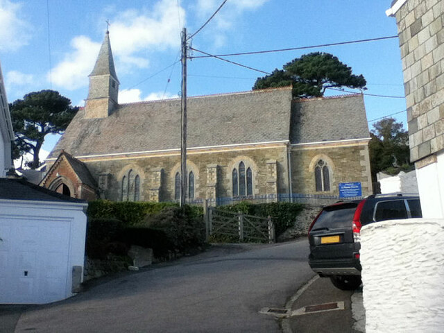
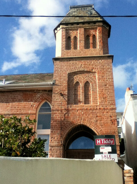
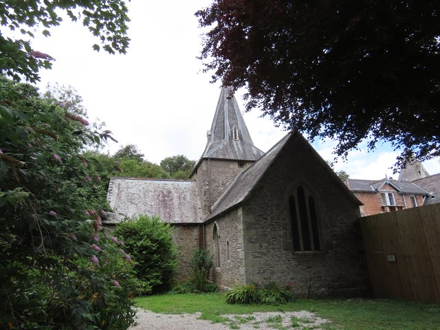
St Mawes' Church, St Mawes

St Mawes’ Church is a Grade II listed parish church in the Church of England Diocese of Truro in St Mawes, Cornwall, England, UK. == History == The name...
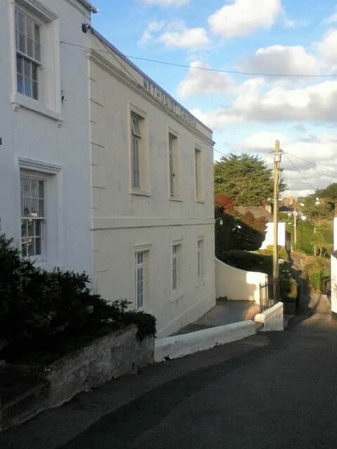
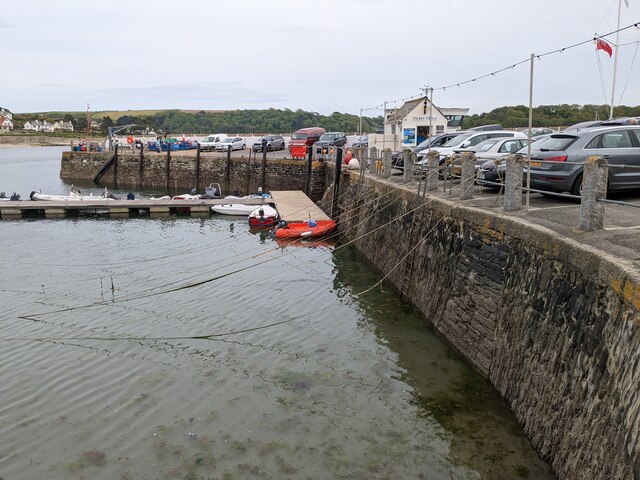
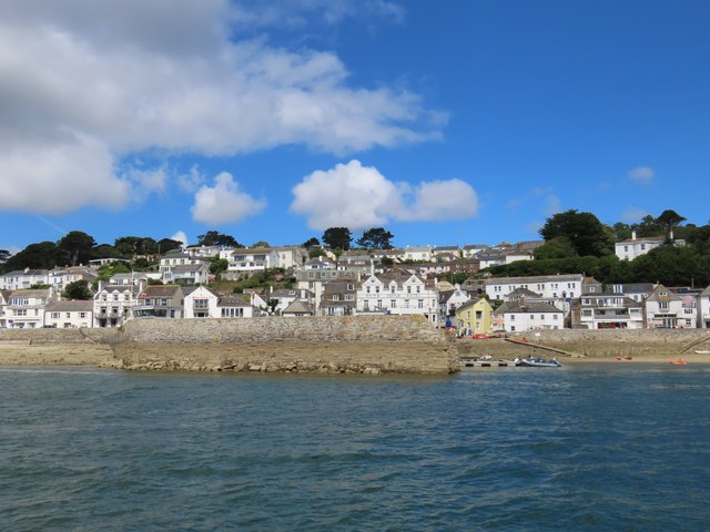
St Mawes

St Mawes' (Cornish: Lannvowsedh) is a village on the end of the Roseland Peninsula, in the eastern side of Falmouth harbour, on the south coast of Cornwall...

Percuil River

The Percuil River is an estuary and stream draining the southern part of the Roseland Peninsula of Cornwall, UK and is one of three major tidal creeks...
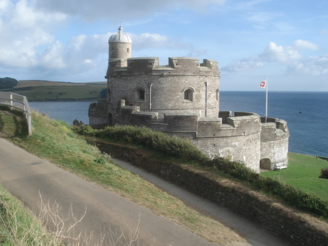
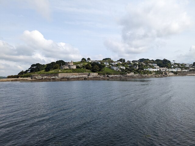
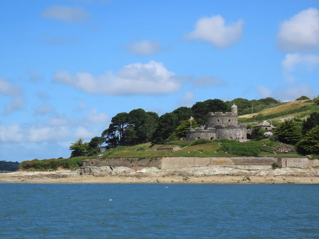
St Mawes Castle

St Mawes Castle (Cornish: Kastel Lannvowsedh) is an artillery fort constructed by Henry VIII near Falmouth, Cornwall, between 1540 and 1542. It formed...

Nearby Amenities

Located within 500m of 50.157932,-5.009833
Source: PGS
Lat/Long: 50.157773/-5.0156955
Source: PGS
Lat/Long: 50.1579471/-5.0153718
Source: PGS
Lat/Long: 50.1586648/-5.0144611
Source: PGS
Lat/Long: 50.1587486/-5.0143322
Source: PGS
Lat/Long: 50.1570162/-5.008323
Source: PGS
Lat/Long: 50.1566067/-5.0069633
Source: PGS
Lat/Long: 50.1565362/-5.0068986
Source: PGS
Lat/Long: 50.1565121/-5.0063897
Source: PGS
Lat/Long: 50.1565725/-5.0056535
Source: PGS
Lat/Long: 50.1569162/-5.0049903
Source: PGS
Lat/Long: 50.1584402/-5.0042564
Source: PGS
Lat/Long: 50.1585627/-5.0041972
Source: PGS
Lat/Long: 50.1593225/-5.004904
Source: PGS
Lat/Long: 50.1600005/-5.0049587
Source: PGS
Lat/Long: 50.16045/-5.0054175
Source: PGS
Lat/Long: 50.1611618/-5.0058911
St. Mawes
Is In: Cornwall, England, UK
Is In Country: England
Is In Country Code: GB
Is In County: Cornwall
Name Br: Lannvowsedh
Name Kw: Lannvowsedh
Place: village
Source: npe
Source Name Br: proper translation
Wikidata: Q993884
Wikipedia: en:St Mawes
Lat/Long: 50.1586134/-5.0148258
Parking
Access: yes
Fee: yes
Parking: surface
Lat/Long: 50.1596365/-5.0140905
Pub
The Rising Sun
Addr City: Truro
Addr Place: St Mawes
Addr Postcode: TR2 5DJ
Addr Street: The Square
Fhrs Id: 551154
Source Addr: FHRS Open Data
Lat/Long: 50.1594656/-5.0137042
Idle Rocks
Addr City: Truro
Addr Place: St Mawes
Addr Postcode: TR2 5AN
Addr Street: Tredenham Road
Fhrs Id: 580102
Source Addr: FHRS Open Data
Tourism: hotel
Lat/Long: 50.1590957/-5.0132461
Bus Stop
St Mawes Car Park
Bus: yes
Naptan AtcoCode: 0800COC30870
Naptan Bearing: S
Naptan CommonName: Car Park
Naptan Crossing: Hillhead
Naptan Indicator: S-bound
Naptan NaptanCode: cordagwa
Naptan Street: The Square
Naptan Verified: no
Public Transport: platform
Source: naptan_import
Lat/Long: 50.1597138/-5.0139172
Post Office
St Mawes Post Office
Addr City: Truro
Addr Country: GB
Addr County: Cornwall
Addr Housenumber: 2
Addr Postcode: TR2 5DG
Addr Street: The Quay
Addr Town: St Mawes
Brand: Post Office
Brand Wikidata: Q1783168
Collection Times: Mo-Fr 16:00; Sa 10:30
Contact Website: https://www.postoffice.co.uk/branch-finder/1835556/st-mawes
Opening Hours: Mo-Fr 09:00-17:30; Sa 09:00-12:30
Operator: Post Office Ltd
Ref Pol Id: 5562
Lat/Long: 50.1581979/-5.0152034
Telephone
Booth: K6
Covered: booth
Listed Status: Grade II
Lat/Long: 50.1582981/-5.0150636
Pub
The Victory Inn
Addr City: Truro
Addr Place: St Mawes
Addr Postcode: TR2 5DQ
Addr Street: Victory Hill
Fhrs Id: 1052609
Source Addr: FHRS Open Data
Website: http://www.victory-inn.co.uk/
Wikidata: Q26614274
Lat/Long: 50.1587309/-5.015167
Barrier: bollard
Lat/Long: 50.1585197/-5.0147234
Waste Basket
Lat/Long: 50.1587608/-5.0145461
Bench
Lat/Long: 50.1591888/-5.0137071
Waste Basket
Lat/Long: 50.1591657/-5.01371
Recycling
Lat/Long: 50.1599906/-5.0150015
Ferry Terminal
Ferry: yes
Public Transport: station
Lat/Long: 50.1581438/-5.0140588
Cafe
Cafe Chandlers
Addr City: Truro
Addr Country: GB
Addr County: Cornwall
Addr Housenumber: 1
Addr Postcode: TR2 5DG
Addr Street: The Quay
Addr Town: St Mawes
Fhrs Id: 510745
Opening Hours: Mo-Su 09:00-17:00
Outdoor Seating: yes
Source Addr: FHRS Open Data
Website: https://cafechandlers.co.uk/
Lat/Long: 50.1581498/-5.0152774
Restaurant
The Watch House
Cuisine: seafood
Takeaway: yes
Website: http://www.watchhousestmawes.co.uk/
Lat/Long: 50.1592004/-5.0139924
Cafe
Lat/Long: 50.1579761/-5.0151149
Post Box
Brand: Royal Mail
Brand Wikidata: Q638098
Collection Times: Mo-Fr 16:00; Sa 10:30; Su off
Operator: Royal Mail
Operator Wikidata: Q638098
Post Box Design: type_b
Post Box Mounting: building
Post Box Type: wall
Ref: TR2 220
Royal Cypher: GR
Royal Cypher Wikidata: Q33102273
Source: survey;aerial imagery
Survey Date: 2023-06-01
Lat/Long: 50.1581995/-5.0151659
Fast Food
Watch Out
Cuisine: fish_and_chips
Lat/Long: 50.1592606/-5.0139257
Co-op Food
Brand: Co-op Food
Brand Wikidata: Q3277439
Brand Wikipedia: en:Co-op Food
Operator: The Co-operative Group
Operator Wikidata: Q117202
Shop: supermarket
Lat/Long: 50.1587537/-5.0147975
Cafe
The View
Lat/Long: 50.1585176/-5.0149619
Saint Mawes Butchery
Shop: butcher
Lat/Long: 50.1581586/-5.0155605
Leisure: slipway
Lat/Long: 50.1611759/-5.0057755
Leisure: slipway
Lat/Long: 50.1588474/-5.004392
Leisure: slipway
Lat/Long: 50.1574249/-5.0044046
Give Way
Lat/Long: 50.1593013/-5.013744
Leisure: slipway
Lat/Long: 50.1591413/-5.013681
Bus Stop
Buckeys Lane
Bench: no
Bin: no
Bus: yes
Lit: yes
Name En: Buckeys Lane
Naptan AdministrativeAreaCode: 73
Naptan AtcoCode: 0800COA15877
Naptan Bearing: NW
Naptan BusStopType: CUS
Naptan CommonName: Buckeys Lane
Naptan Indicator: NW-bound
Naptan LocalityName: St Mawes
Naptan NaptanCode: corgmata
Naptan NptgLocalityCode: E0002956
Naptan RegionCode: corgmata
Naptan Verified: no
Public Transport: platform
Shelter: no
Source: bing;naptan
Tactile Paving: no
Lat/Long: 50.1586203/-5.0066009
Generator Method: photovoltaic
Generator Output Electricity: yes
Generator Source: solar
Generator Type: solar_photovoltaic_panel
Location: roof
Power: generator
Lat/Long: 50.161792/-5.0111217
Generator Method: photovoltaic
Generator Output Electricity: yes
Generator Source: solar
Generator Type: solar_photovoltaic_panel
Location: roof
Power: generator
Lat/Long: 50.1608057/-5.013179
Generator Method: photovoltaic
Generator Output Electricity: yes
Generator Source: solar
Generator Type: solar_photovoltaic_panel
Location: roof
Power: generator
Lat/Long: 50.1600617/-5.0125621
Mr Scorse Gourmet Deli & Wines
Addr City: St. Mawes, Truro
Addr Housename: 1 The Arcade
Addr Postcode: TR2 5DT
Opening Hours: Mo-Su 09:00-19:00
Payment Cards: yes
Payment Cash: yes
Payment Coins: yes
Payment Contactless: yes
Payment Credit Cards: yes
Payment Debit Cards: yes
Payment Mastercard: yes
Payment Notes: yes
Payment Visa: yes
Payment Visa Debit: yes
Payment Visa Electron: yes
Shop: deli
Lat/Long: 50.1593488/-5.0141019
Ferry: yes
Public Transport: stop_position
Lat/Long: 50.1583595/-5.0148795
Defibrillator
Defibrillator Location: Attached to outside of building under the information board
Emergency: defibrillator
Indoor: no
Ref GB The Circuit: 405498E8-B33D-49CB-AFB7-AE3B00E62BD6
Lat/Long: 50.157984/-5.0150355
Booth: K6
Covered: booth
Disused Amenity: telephone
Information: board
Man Made: telephone_box
Tourism: information
Lat/Long: 50.1595002/-5.0138979
Post Box
Collection Times: Mo-Fr 09:00; Sa 07:00; Su off
Operator: Royal Mail
Operator Wikidata: Q638098
Post Box Design: type_b
Post Box Mounting: stone_wall
Post Box Type: wall
Ref: TR2 222D
Royal Cypher: GR
Royal Cypher Wikidata: Q33102273
Source: survey;aerial imagery
Lat/Long: 50.1616138/-5.0116663
Telephone
Board Type: history
Booth: K6
Covered: booth
Information: board
Man Made: telephone_box
Tourism: information
Lat/Long: 50.1605948/-5.0097538
Bar
The Bohella Bar
Lat/Long: 50.1598603/-5.0138234
Pharmacy
St Mawes Pharmacy
Addr City: Truro
Addr Housenumber: 12
Addr Postcode: TR2 5DH
Addr Street: Kings Road
Addr Village: St Mawes
Healthcare: pharmacy
Lat/Long: 50.1590767/-5.0143495
Post Box
Collection Times: Mo-Fr 09:00; Sa 07:00; Su off
Operator: Royal Mail
Operator Wikidata: Q638098
Post Box Design: type_b
Post Box Mounting: stone_wall
Post Box Type: wall
Ref: TR2 221D
Royal Cypher: GR
Royal Cypher Wikidata: Q33102273
Source: survey;aerial imagery
Lat/Long: 50.1578823/-5.0090658
The Square Gallery
Shop: art
Lat/Long: 50.1594444/-5.0140188
Fudge & More
Shop: gift
Lat/Long: 50.1591255/-5.0142588
Dentist
St Mawes Dental
Healthcare: dentist
Lat/Long: 50.1592451/-5.0141152
Waterside Gallery
Shop: art
Lat/Long: 50.1576298/-5.0163251
Philip Martin
Office: estate_agent
Lat/Long: 50.1593843/-5.0140439
4 @ the arcade
Shop: gift
Lat/Long: 50.1594219/-5.0141009
Grace & Favour
Shop: clothes
Lat/Long: 50.1577127/-5.0161253
Da Bara Bakery
Shop: bakery
Lat/Long: 50.1584217/-5.0149442
Aspiga
Shop: clothes
Lat/Long: 50.1594822/-5.014075
St Mawes Gallery
Shop: art
Lat/Long: 50.1590328/-5.0144359
Fat Face
Brand: Fat Face
Brand Wikidata: Q5437186
Shop: clothes
Lat/Long: 50.1596002/-5.0142495
Roseland Visitor Centre
Information: office
Tourism: information
Lat/Long: 50.160064/-5.0141864
Board Type: notice
Information: board
Tourism: information
Lat/Long: 50.1593754/-5.0133128
Doctors
Roseland Surgeries
Healthcare: doctor
Lat/Long: 50.1599282/-5.01334
Bus Stop
Buckeys Lane
Bench: no
Bin: no
Bus: yes
Lit: yes
Naptan AdministrativeAreaCode: 73
Naptan AtcoCode: 0800COA15878
Naptan Bearing: SE
Naptan BusStopType: CUS
Naptan CommonName: Buckeys Lane
Naptan Indicator: SE-bound
Naptan LocalityName: St Mawes
Naptan NptgLocalityCode: E0002956
Naptan RegionCode: corgmatd
Naptan Verified: no
Public Transport: platform
Shelter: no
Tactile Paving: no
Lat/Long: 50.1586658/-5.0063167
Bus Stop
Freshwater Lane
Bus: yes
Naptan AdministrativeAreaCode: 73
Naptan AtcoCode: 0800COA15875
Naptan Bearing: SE
Naptan BusStopType: CUS
Naptan CommonName: Freshwater Lane
Naptan Indicator: SE-bound
Naptan LocalityName: St Mawes
Naptan NptgLocalityCode: E0002956
Naptan RegionCode: corgmapt
Naptan Verified: no
Public Transport: platform
Lat/Long: 50.159914/-5.0085212
Bus Stop
Freshwater Lane
Bus: yes
Naptan AdministrativeAreaCode: 73
Naptan AtcoCode: 0800COA15876
Naptan Bearing: NW
Naptan BusStopType: CUS
Naptan CommonName: Freshwater Lane
Naptan Indicator: NW-bound
Naptan LocalityName: St Mawes
Naptan NptgLocalityCode: E0002956
Naptan RegionCode: corgmapw
Naptan Verified: no
Public Transport: platform
Lat/Long: 50.1596943/-5.0084294
Bus Stop
Polvarth Estate
Bus: yes
Naptan AdministrativeAreaCode: 73
Naptan AtcoCode: 0800COC30869
Naptan Bearing: W
Naptan BusStopType: CUS
Naptan CommonName: Polvarth Estate
Naptan Indicator: opp
Naptan LocalityName: St Mawes
Naptan NptgLocalityCode: E0002956
Naptan RegionCode: cordajag
Naptan Street: Polvarth Road
Naptan Verified: no
Public Transport: platform
Lat/Long: 50.1617723/-5.0121066
Bus Stop
Polvarth Estate
Bus: yes
Naptan AdministrativeAreaCode: 73
Naptan AtcoCode: 0800COC30868
Naptan Bearing: SE
Naptan BusStopType: CUS
Naptan CommonName: Polvarth Estate
Naptan Indicator: SE-bound
Naptan LocalityName: St Mawes
Naptan NptgLocalityCode: E0002956
Naptan RegionCode: cordajaj
Naptan Verified: no
Public Transport: platform
Shelter: no
Lat/Long: 50.1617885/-5.0118582
Bench
Survey Date: 2024-02-24
Lat/Long: 50.1579931/-5.00939
Bench
Survey Date: 2024-02-24
Lat/Long: 50.1580342/-5.0094381
Bench
Survey Date: 2024-02-24
Lat/Long: 50.158069/-5.0094929
Bench
Survey Date: 2024-02-24
Lat/Long: 50.1581103/-5.0095332
Bench
Survey Date: 2024-02-24
Lat/Long: 50.1581534/-5.0095795
Bench
Survey Date: 2024-02-24
Lat/Long: 50.1581925/-5.0096308
Bench
Backrest: yes
Survey Date: 2024-02-24
Lat/Long: 50.158225/-5.0096635
Waste Basket
Survey Date: 2024-02-24
Lat/Long: 50.1583185/-5.009788
Life Ring
Emergency: life_ring
Survey Date: 2024-02-24
Lat/Long: 50.1583529/-5.0098638
Bench
Survey Date: 2024-02-24
Lat/Long: 50.1589516/-5.0113171
Waste Basket
Survey Date: 2024-02-24
Lat/Long: 50.1589747/-5.0113588
Bench
Survey Date: 2024-02-24
Lat/Long: 50.1589758/-5.0114026
Bench
Survey Date: 2024-02-24
Lat/Long: 50.1589969/-5.0114814
Waste Basket
Survey Date: 2024-02-24
Waste: dog_excrement
Lat/Long: 50.159082/-5.0122186
Waste Basket
Survey Date: 2024-02-24
Waste: dog_excrement
Lat/Long: 50.1590556/-5.0127586
Bench
Survey Date: 2024-02-24
Lat/Long: 50.1590376/-5.012666
Bench
Survey Date: 2024-02-24
Lat/Long: 50.159039/-5.0126474
Bench
Survey Date: 2024-02-24
Lat/Long: 50.1590356/-5.0126088
Bench
Survey Date: 2024-02-24
Lat/Long: 50.1590372/-5.0125667
Bench
Survey Date: 2024-02-24
Lat/Long: 50.159036/-5.0125247
Bench
Survey Date: 2024-02-24
Lat/Long: 50.1590172/-5.0124994
Recycling
Recycling Type: container
Survey Date: 2024-02-24
Lat/Long: 50.1587778/-5.0145266
Life Ring
Emergency: life_ring
Survey Date: 2024-02-24
Lat/Long: 50.1584899/-5.0147624
Fire Hydrant
Emergency: fire_hydrant
Survey Date: 2024-02-24
Lat/Long: 50.1584333/-5.0148269
Waste Basket
Survey Date: 2024-02-24
Lat/Long: 50.1582913/-5.01507
Life Ring
Emergency: life_ring
Survey Date: 2024-02-24
Lat/Long: 50.1580177/-5.0147164
Recycling
Recycling Type: container
Survey Date: 2024-02-24
Lat/Long: 50.1579897/-5.0153557
Waste Basket
Survey Date: 2024-02-24
Lat/Long: 50.157976/-5.0153799
Fire Hydrant
Emergency: fire_hydrant
Survey Date: 2024-02-24
Lat/Long: 50.1578113/-5.0157655
Waste Basket
Survey Date: 2024-02-24
Waste: dog_excrement
Lat/Long: 50.1588976/-5.004883
Fire Hydrant
Emergency: fire_hydrant
Fire Hydrant Diameter: 100
Fire Hydrant Position: lane
Fire Hydrant Type: underground
Survey Date: 2024-02-24
Waste: dog_excrement
Lat/Long: 50.1571739/-5.0066075
Bench
Survey Date: 2024-02-24
Lat/Long: 50.1574024/-5.0085614
Defibrillator
Defibrillator Location: On outside wall of The Rising Sun pub, at left-hand corning when facing the main entrance.
Emergency: defibrillator
Indoor: no
Mapillary: 2638828226286533
Survey Date: 2024-02-24
Lat/Long: 50.1594502/-5.0137593
Atm
Survey Date: 2024-02-24
Lat/Long: 50.1597224/-5.0138855
Bench
Survey Date: 2024-02-24
Lat/Long: 50.1597573/-5.0139525
Defibrillator
Emergency: defibrillator
Indoor: yes
Survey Date: 2024-02-24
Lat/Long: 50.1600427/-5.0142579
Bench
Survey Date: 2024-02-24
Lat/Long: 50.1579464/-5.0093472
Bench
Survey Date: 2024-02-24
Lat/Long: 50.1573332/-5.0085367
Bench
Survey Date: 2024-02-24
Lat/Long: 50.1573292/-5.0084627
Bench
Survey Date: 2024-02-24
Lat/Long: 50.1573067/-5.0086044
Bench
Survey Date: 2024-02-24
Lat/Long: 50.1573414/-5.0086156
Bench
Survey Date: 2024-02-24
Lat/Long: 50.1573812/-5.008645
Bench
Survey Date: 2024-02-24
Lat/Long: 50.1574235/-5.0087318
Bench
Survey Date: 2024-02-24
Lat/Long: 50.1574975/-5.0087398
Bench
Survey Date: 2024-02-24
Lat/Long: 50.1576118/-5.0088823
Bench
Survey Date: 2024-02-24
Lat/Long: 50.1575618/-5.0088242
The data included in this document is from www.openstreetmap.org. The data is made available under ODbL.

Have you been to Summers Beach?

Leave your review of Summers Beach below (or comments, questions and feedback).