Millgill Force

Waterfall in Yorkshire Richmondshire

England

Millgill Force

Footpath through wood below Brough Scar
Footpath through wood below Brough Scar Credit: Roger Templeman

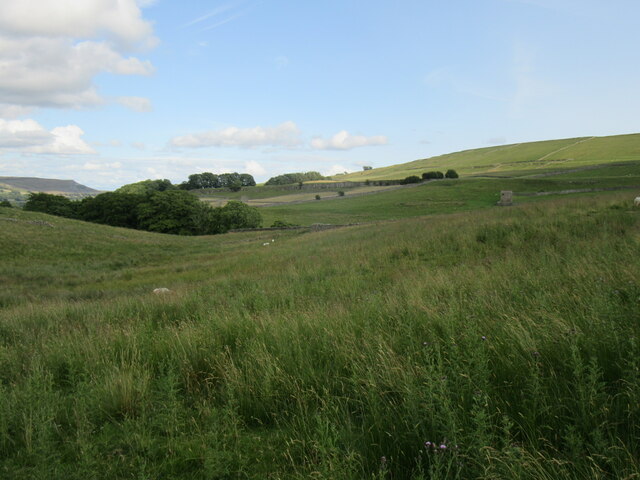
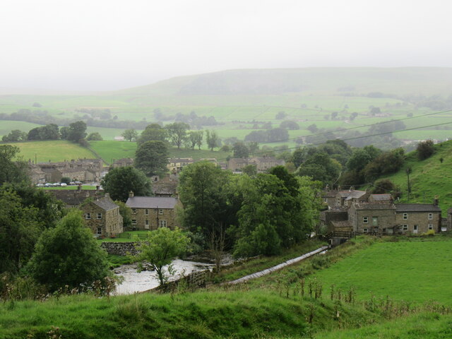
Millgill Force is a picturesque waterfall located in the Yorkshire Dales National Park, in the county of Yorkshire, England. It is situated near the village of Ingleton, approximately 4 miles southwest of the town of Hawes. The waterfall is a popular tourist attraction, drawing visitors from near and far.

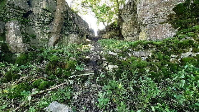
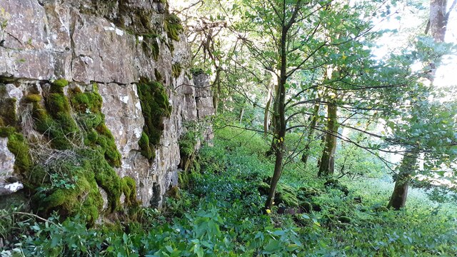
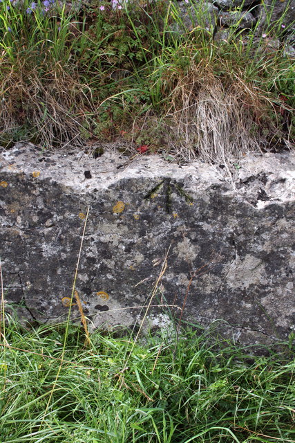
Millgill Force is formed by the River Doe as it cascades over a series of limestone steps, creating a dramatic and enchanting sight. The waterfall is surrounded by lush green vegetation and towering cliffs, adding to its natural beauty. The total drop of the waterfall is approximately 30 feet.

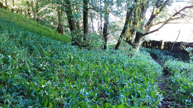
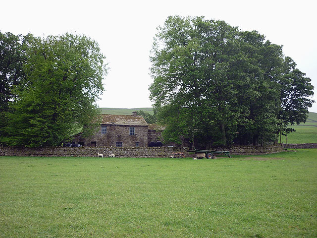
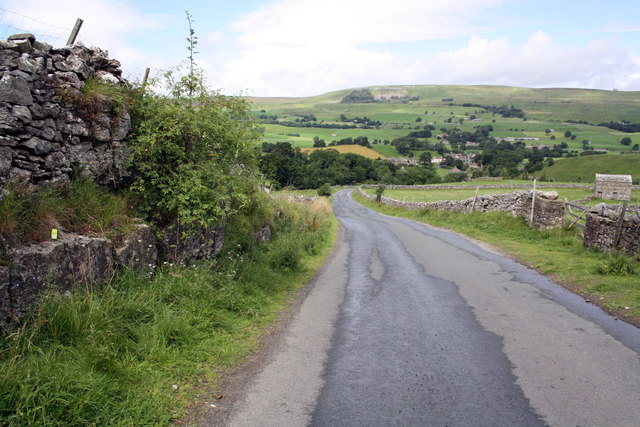
Visitors can access Millgill Force via a well-maintained footpath that winds its way through the picturesque countryside. Along the way, there are several viewpoints that offer stunning vistas of the waterfall and the surrounding landscape. The footpath also provides an opportunity for nature enthusiasts to observe the diverse flora and fauna found in the area.

During the spring and summer months, Millgill Force is particularly captivating, as the surrounding foliage bursts into vibrant colors. The waterfall is also known for its tranquility, providing a peaceful and calming atmosphere for visitors to enjoy.

In addition to its natural beauty, Millgill Force is also known for its accessibility. There is parking available nearby, and the footpath leading to the waterfall is relatively easy to navigate, making it suitable for individuals of all ages and physical abilities.

Overall, Millgill Force is a stunning waterfall that offers visitors a chance to experience the beauty of the Yorkshire Dales National Park firsthand.

If you have any feedback on the listing, please let us know in the comments section below.

Millgill Force Images

Images are sourced within 2km of 54.319082/-2.0958472 or Grid Reference SD9391. Thanks to Geograph Open Source API. All images are credited.

Footpath through wood below Brough Scar
Footpath passing through gap in Brough Scar
Looking west along Brough Scar
Near Bainbridge Looking east from Cam High Road.
Near Bainbridge
Looking east from Cam High Road.
Bainbridge Looking north to Bainbridge.
Bainbridge
Looking north to Bainbridge.
Scar Top The house does not seem to be occupied - slates are sliding off the roof.
Scar Top
The house does not seem to be occupied - slates are sliding off the roof.
Barn on Cam High Road near Bainbridge There is an OS benchmark <a href="https://www.geograph.org.uk/photo/2708746">SD9389 : Benchmark on barn on Cam High Road</a> on the barn.
Barn on Cam High Road near Bainbridge
There is an OS benchmark SD9389 : Benchmark on barn on Cam High Road on the barn.
Benchmark on barn on Cam High Road Ordnance Survey cut mark described on the Bench Mark Database at <span class="nowrap"><a title="http://www.bench-marks.org.uk/bm39074" rel="nofollow ugc noopener" href="http://www.bench-marks.org.uk/bm39074">Link</a><img style="margin-left:2px;" alt="External link" title="External link - shift click to open in new window" src="https://s1.geograph.org.uk/img/external.png" width="10" height="10"/></span>
Benchmark on barn on Cam High Road
Ordnance Survey cut mark described on the Bench Mark Database at LinkExternal link
Benchmark on stone of Carpley Green Road Ordnance Survey pivot benchmark described on the Bench Mark Database at <span class="nowrap"><a title="http://www.bench-marks.org.uk/bm39075" rel="nofollow ugc noopener" href="http://www.bench-marks.org.uk/bm39075">Link</a><img style="margin-left:2px;" alt="External link" title="External link - shift click to open in new window" src="https://s1.geograph.org.uk/img/external.png" width="10" height="10"/></span>
Benchmark on stone of Carpley Green Road
Ordnance Survey pivot benchmark described on the Bench Mark Database at LinkExternal link
Carpley Green Road south from Bainbridge There is an OS benchmark <a href="https://www.geograph.org.uk/photo/2719675">SD9389 : Benchmark on stone of Carpley Green Road</a> on the wall on the left side of the road
Carpley Green Road south from Bainbridge
There is an OS benchmark SD9389 : Benchmark on stone of Carpley Green Road on the wall on the left side of the road
Benchmark on gateway on Carpley Green Road Ordnance Survey cut mark benchmark described on the Bench Mark Database at <span class="nowrap"><a title="http://www.bench-marks.org.uk/bm39076" rel="nofollow ugc noopener" href="http://www.bench-marks.org.uk/bm39076">Link</a><img style="margin-left:2px;" alt="External link" title="External link - shift click to open in new window" src="https://s1.geograph.org.uk/img/external.png" width="10" height="10"/></span>
Benchmark on gateway on Carpley Green Road
Ordnance Survey cut mark benchmark described on the Bench Mark Database at LinkExternal link
Gateway to field from Carpley Green Road There is an OS benchmark <a href="https://www.geograph.org.uk/photo/2719755">SD9389 : Benchmark on gateway on Carpley Green Road</a> on the inside face of the wall end at the left hand side of the gateway.
Gateway to field from Carpley Green Road
There is an OS benchmark SD9389 : Benchmark on gateway on Carpley Green Road on the inside face of the wall end at the left hand side of the gateway.
Benchmark on outcrop by road near Out Brough Ordnance Survey pivot benchmark described on the Bench Mark Database at <span class="nowrap"><a title="http://www.bench-marks.org.uk/bm39077" rel="nofollow ugc noopener" href="http://www.bench-marks.org.uk/bm39077">Link</a><img style="margin-left:2px;" alt="External link" title="External link - shift click to open in new window" src="https://s1.geograph.org.uk/img/external.png" width="10" height="10"/></span>
Benchmark on outcrop by road near Out Brough
Ordnance Survey pivot benchmark described on the Bench Mark Database at LinkExternal link
Outcrop beside the road to Bainbridge There is an OS benchmark <a href="https://www.geograph.org.uk/photo/2720599">SD9389 : Benchmark on outcrop by road near Out Brough</a> on the outcrop ledge on the left side of the road, by the green GPS instrument.
Outcrop beside the road to Bainbridge
There is an OS benchmark SD9389 : Benchmark on outcrop by road near Out Brough on the outcrop ledge on the left side of the road, by the green GPS instrument.
Benchmark on A684 gatepost Ordnance Survey cut mark described on the Bench Mark Database at <span class="nowrap"><a title="http://www.bench-marks.org.uk/bm27871" rel="nofollow ugc noopener" href="http://www.bench-marks.org.uk/bm27871">Link</a><img style="margin-left:2px;" alt="External link" title="External link - shift click to open in new window" src="https://s1.geograph.org.uk/img/external.png" width="10" height="10"/></span>
Benchmark on A684 gatepost
Ordnance Survey cut mark described on the Bench Mark Database at LinkExternal link
Gateway beside A684 There is an OS benchmark <a href="https://www.geograph.org.uk/photo/2722279">SD9389 : Benchmark on A684 gatepost</a> at ground level on the right hand gatepost
Gateway beside A684
There is an OS benchmark SD9389 : Benchmark on A684 gatepost at ground level on the right hand gatepost
Chickens in the bath I think they were drinking rainwater which has collected in the bath.
Chickens in the bath
I think they were drinking rainwater which has collected in the bath.
Path along the top of Worton Scar Looking east.
Path along the top of Worton Scar
Looking east.
Show me another place!

Millgill Force is located at Grid Ref: SD9391 (Lat: 54.319082, Lng: -2.0958472)

Division: North Riding

Administrative County: North Yorkshire

District: Richmondshire

Police Authority: North Yorkshire

What 3 Words

///dunes.scripted.swatted. Near Leyburn, North Yorkshire

Related Wikis

Askrigg railway station

Askrigg railway station is a disused railway station in North Yorkshire, England and served the village of Askrigg. It was part of the Wensleydale Railway...

Fors Abbey

Fors Abbey was an abbey in Low Abbotside, Askrigg, North Yorkshire, England.It was built in 1145 for the Savigniac order and converted to the Cistercian...

River Bain, North Yorkshire

The River Bain is a river in North Yorkshire, England. As a tributary of the River Ure, it is one of the shortest, named rivers in England. The river...

St Oswald's Church, Askrigg

St Oswald's Church is a Grade I listed parish church in the Church of England in Askrigg, North Yorkshire. == History == The church dates largely from...

Askrigg

Askrigg is a small village and civil parish in Wensleydale in the Yorkshire Dales National Park. It was formerly a part of the Richmondshire district of...

Cringley House

Cringley House (also known as Skeldale House) is an historic building in the English village of Askrigg, North Yorkshire. Standing on the south side of...
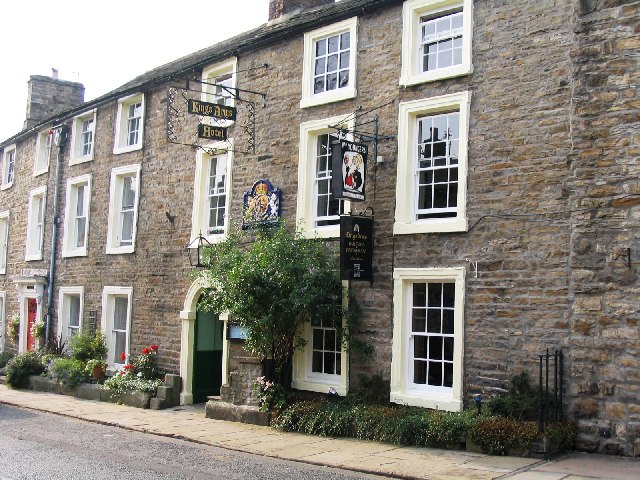
Kings Arms Hotel

The Kings Arms Hotel is a public house and inn in the English village of Askrigg, North Yorkshire. A Grade II listed building, standing on the northern...

Bainbridge, North Yorkshire

Bainbridge is a village and civil parish in North Yorkshire, England. The population of the civil parish at the 2011 census was 480. The village is situated...

Nearby Amenities

Located within 500m of 54.319082,-2.0958472
Barrier: stile
Material: stone
Source: survey;gps
Stile: squeezer
Lat/Long: 54.3164524/-2.0898438
Mill Gill Force
Image: https://www.geograph.org.uk/photo/1606553
Tourism: attraction
Waterway: waterfall
Lat/Long: 54.3189007/-2.0957332
Barrier: stile
Lat/Long: 54.3214366/-2.0988861
Source: OS_OpenData_Streetview
Waterway: weir
Lat/Long: 54.3175378/-2.0920952
Source: OS_OpenData_Streetview
Waterway: weir
Lat/Long: 54.3204926/-2.0966126
Barrier: stile
Material: stone
Source: survey;gps
Stile: squeezer
Lat/Long: 54.3176815/-2.1025209
Barrier: stile
Material: stone
Source: survey;gps
Stile: stepover
Lat/Long: 54.314784/-2.0969684
Barrier: stile
Material: stone
Source: survey;gps
Stile: squeezer
Lat/Long: 54.3150388/-2.0953601
Barrier: stile
Material: stone
Source: survey;gps
Stile: squeezer
Lat/Long: 54.3152269/-2.0937564
Barrier: stile
Material: stone
Source: survey;gps
Stile: squeezer
Lat/Long: 54.3155236/-2.0924345
Historic: lime_kiln
Lat/Long: 54.3182035/-2.0960096
Barrier: stile
Lat/Long: 54.3208991/-2.0979702
Historic: ruins
Note: former limekilns?
Lat/Long: 54.3182771/-2.0960203
Hiking: yes
Information: guidepost
Tourism: information
Lat/Long: 54.3183365/-2.0964119
Power: pole
Lat/Long: 54.3180596/-2.1028961
Power: pole
Lat/Long: 54.3203973/-2.0973855
Power: pole
Lat/Long: 54.3200809/-2.098223
Power: pole
Lat/Long: 54.319822/-2.0994897
Power: pole
Lat/Long: 54.3194105/-2.1006082
Power: pole
Lat/Long: 54.3190487/-2.1016395
Power: pole
Lat/Long: 54.3185352/-2.1022671
Power: pole
Lat/Long: 54.3166664/-2.1001764
Power: pole
Lat/Long: 54.3164219/-2.1007021
Power: pole
Lat/Long: 54.3161352/-2.1012452
The data included in this document is from www.openstreetmap.org. The data is made available under ODbL.

Have you been to Millgill Force?

Leave your review of Millgill Force below (or comments, questions and feedback).