Abbey Force

Waterfall in Yorkshire Richmondshire

England

Abbey Force

Junction of dry stone walls on NW side of A684 at Butter Hill Ordnance Survey records indicate that a benchmark was levelled at 228.910m above Newlyn Datum in 1971 on a bolt set in a concrete block buried at the wall junction
Junction of dry stone walls on NW side of A684 at Butter Hill Credit: Roger Templeman

Abbey Force is a picturesque waterfall located in Yorkshire, England. Situated in the heart of the Yorkshire Dales National Park, it is a popular tourist attraction known for its natural beauty and tranquil surroundings.

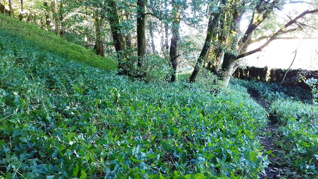
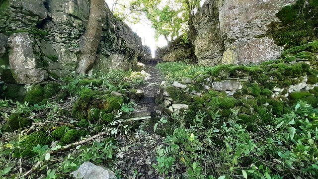
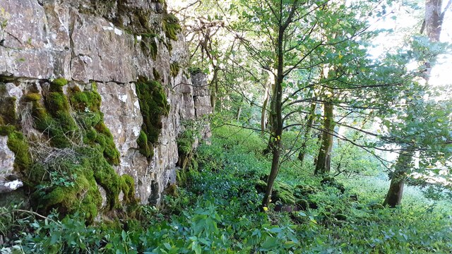
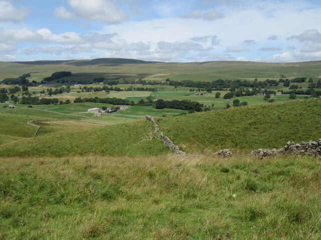
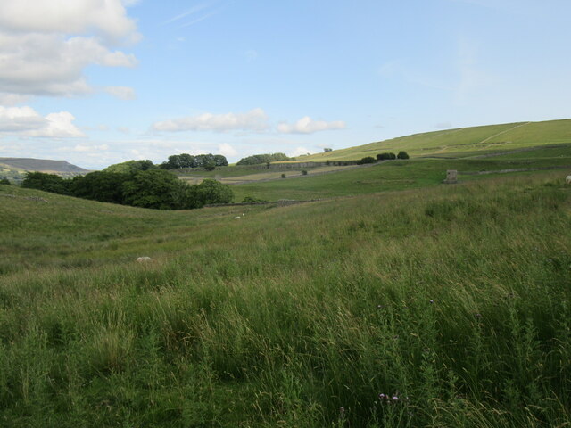
The waterfall is nestled within a secluded wooded area, adding to its charm and providing a sense of serenity. The cascading water flows down a series of rocky steps, creating a mesmerizing sight and a soothing sound that attracts visitors throughout the year.

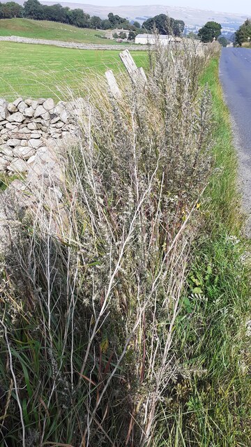
Abbey Force is surrounded by lush vegetation, including moss-covered rocks, ferns, and tall trees, which enhance the beauty of the waterfall and create a vibrant and verdant atmosphere. The area is also home to a diverse range of wildlife, making it a haven for nature lovers and wildlife enthusiasts.

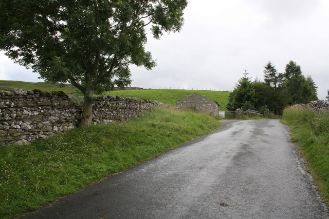
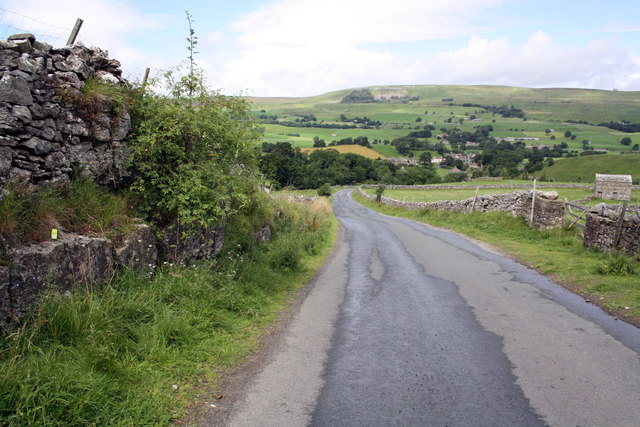
Visitors can access Abbey Force via a well-maintained footpath that leads from the nearby village. The path meanders through the scenic countryside and offers breathtaking views of the surrounding landscape. As visitors approach the waterfall, they will find a small viewing platform that provides an ideal spot to admire the cascades and take photographs.

The waterfall is particularly picturesque after a period of rainfall, when the water levels are high and the force of the water creates a dramatic spectacle. However, Abbey Force is equally enchanting during drier periods, when the waterfall's gentle flow adds to its tranquil ambiance.

Overall, Abbey Force is a natural gem in the heart of Yorkshire. Its stunning beauty, peaceful atmosphere, and accessibility make it a must-visit destination for nature enthusiasts and those seeking a peaceful retreat.

If you have any feedback on the listing, please let us know in the comments section below.

Abbey Force Images

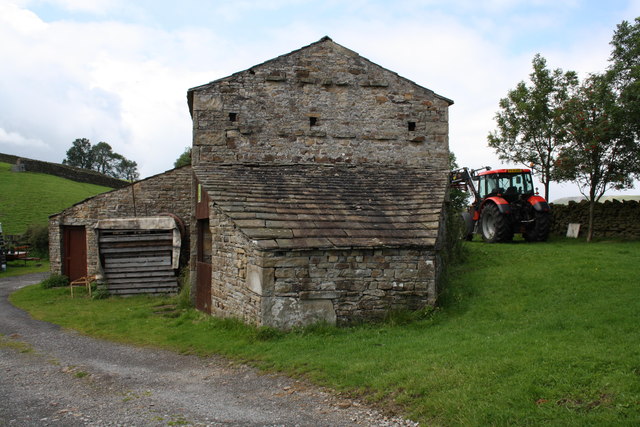
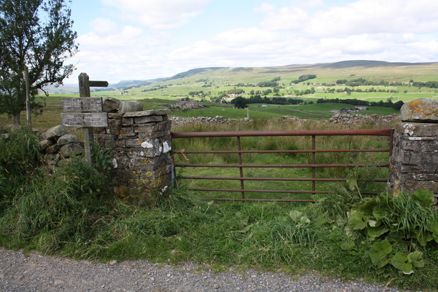
Images are sourced within 2km of 54.315805/-2.1029567 or Grid Reference SD9391. Thanks to Geograph Open Source API. All images are credited.

Junction of dry stone walls on NW side of A684 at Butter Hill Ordnance Survey records indicate that a benchmark was levelled at 228.910m above Newlyn Datum in 1971 on a bolt set in a concrete block buried at the wall junction
Junction of dry stone walls on NW side of A684 at Butter Hill
Ordnance Survey records indicate that a benchmark was levelled at 228.910m above Newlyn Datum in 1971 on a bolt set in a concrete block buried at the wall junction
Footpath through wood below Brough Scar
Footpath passing through gap in Brough Scar
Looking west along Brough Scar
Above Greensley Bank Greensley Bank is the farm ahead.
Above Greensley Bank
Greensley Bank is the farm ahead.
Near Bainbridge Looking east from Cam High Road.
Near Bainbridge
Looking east from Cam High Road.
Bainbridge Looking north to Bainbridge.
Bainbridge
Looking north to Bainbridge.
Scar Top The house does not seem to be occupied - slates are sliding off the roof.
Scar Top
The house does not seem to be occupied - slates are sliding off the roof.
Barn on Cam High Road near Bainbridge There is an OS benchmark <a href="https://www.geograph.org.uk/photo/2708746">SD9389 : Benchmark on barn on Cam High Road</a> on the barn.
Barn on Cam High Road near Bainbridge
There is an OS benchmark SD9389 : Benchmark on barn on Cam High Road on the barn.
Benchmark on gatepost above Greensley Bank Ordnance Survey cut mark benchmark described on the Bench Mark Database at <span class="nowrap"><a title="http://www.bench-marks.org.uk/bm39034" rel="nofollow ugc noopener" href="http://www.bench-marks.org.uk/bm39034">Link</a><img style="margin-left:2px;" alt="External link" title="External link - shift click to open in new window" src="https://s1.geograph.org.uk/img/external.png" width="10" height="10"/></span>
Benchmark on gatepost above Greensley Bank
Ordnance Survey cut mark benchmark described on the Bench Mark Database at LinkExternal link
Gateway across path to Greensley Bank The signs read:
Please keep dogs
under close control
preferably on a lead
and:
Meadowland
Winter food for stock
Please walk in single file.

On the left hand gatepost is an OS benchmark <a href="https://www.geograph.org.uk/photo/2697335">SD9289 : Benchmark on gatepost above Greensley Bank</a>
Gateway across path to Greensley Bank
The signs read: Please keep dogs under close control preferably on a lead and: Meadowland Winter food for stock Please walk in single file. On the left hand gatepost is an OS benchmark SD9289 : Benchmark on gatepost above Greensley Bank
Benchmark on barn on Cam High Road Ordnance Survey cut mark described on the Bench Mark Database at <span class="nowrap"><a title="http://www.bench-marks.org.uk/bm39074" rel="nofollow ugc noopener" href="http://www.bench-marks.org.uk/bm39074">Link</a><img style="margin-left:2px;" alt="External link" title="External link - shift click to open in new window" src="https://s1.geograph.org.uk/img/external.png" width="10" height="10"/></span>
Benchmark on barn on Cam High Road
Ordnance Survey cut mark described on the Bench Mark Database at LinkExternal link
Benchmark on stone of Carpley Green Road Ordnance Survey pivot benchmark described on the Bench Mark Database at <span class="nowrap"><a title="http://www.bench-marks.org.uk/bm39075" rel="nofollow ugc noopener" href="http://www.bench-marks.org.uk/bm39075">Link</a><img style="margin-left:2px;" alt="External link" title="External link - shift click to open in new window" src="https://s1.geograph.org.uk/img/external.png" width="10" height="10"/></span>
Benchmark on stone of Carpley Green Road
Ordnance Survey pivot benchmark described on the Bench Mark Database at LinkExternal link
Carpley Green Road south from Bainbridge There is an OS benchmark <a href="https://www.geograph.org.uk/photo/2719675">SD9389 : Benchmark on stone of Carpley Green Road</a> on the wall on the left side of the road
Carpley Green Road south from Bainbridge
There is an OS benchmark SD9389 : Benchmark on stone of Carpley Green Road on the wall on the left side of the road
Benchmark on gateway on Carpley Green Road Ordnance Survey cut mark benchmark described on the Bench Mark Database at <span class="nowrap"><a title="http://www.bench-marks.org.uk/bm39076" rel="nofollow ugc noopener" href="http://www.bench-marks.org.uk/bm39076">Link</a><img style="margin-left:2px;" alt="External link" title="External link - shift click to open in new window" src="https://s1.geograph.org.uk/img/external.png" width="10" height="10"/></span>
Benchmark on gateway on Carpley Green Road
Ordnance Survey cut mark benchmark described on the Bench Mark Database at LinkExternal link
Gateway to field from Carpley Green Road There is an OS benchmark <a href="https://www.geograph.org.uk/photo/2719755">SD9389 : Benchmark on gateway on Carpley Green Road</a> on the inside face of the wall end at the left hand side of the gateway.
Gateway to field from Carpley Green Road
There is an OS benchmark SD9389 : Benchmark on gateway on Carpley Green Road on the inside face of the wall end at the left hand side of the gateway.
Benchmark on outcrop by road near Out Brough Ordnance Survey pivot benchmark described on the Bench Mark Database at <span class="nowrap"><a title="http://www.bench-marks.org.uk/bm39077" rel="nofollow ugc noopener" href="http://www.bench-marks.org.uk/bm39077">Link</a><img style="margin-left:2px;" alt="External link" title="External link - shift click to open in new window" src="https://s1.geograph.org.uk/img/external.png" width="10" height="10"/></span>
Benchmark on outcrop by road near Out Brough
Ordnance Survey pivot benchmark described on the Bench Mark Database at LinkExternal link
Outcrop beside the road to Bainbridge There is an OS benchmark <a href="https://www.geograph.org.uk/photo/2720599">SD9389 : Benchmark on outcrop by road near Out Brough</a> on the outcrop ledge on the left side of the road, by the green GPS instrument.
Outcrop beside the road to Bainbridge
There is an OS benchmark SD9389 : Benchmark on outcrop by road near Out Brough on the outcrop ledge on the left side of the road, by the green GPS instrument.
Show me another place!

Abbey Force is located at Grid Ref: SD9391 (Lat: 54.315805, Lng: -2.1029567)

Division: North Riding

Administrative County: North Yorkshire

District: Richmondshire

Police Authority: North Yorkshire

What 3 Words

///distilled.hero.swatted. Near Leyburn, North Yorkshire

Related Wikis

Fors Abbey

Fors Abbey was an abbey in Low Abbotside, Askrigg, North Yorkshire, England.It was built in 1145 for the Savigniac order and converted to the Cistercian...

River Bain, North Yorkshire

The River Bain is a river in North Yorkshire, England. As a tributary of the River Ure, it is one of the shortest, named rivers in England. The river...

Bainbridge, North Yorkshire

Bainbridge is a village and civil parish in North Yorkshire, England. The population of the civil parish at the 2011 census was 480. The village is situated...

Askrigg railway station

Askrigg railway station is a disused railway station in North Yorkshire, England and served the village of Askrigg. It was part of the Wensleydale Railway...

River Bain Hydro

The River Bain Hydro is a hydroelectric generator on the River Bain in the village of Bainbridge, North Yorkshire, England. Its screw turbine powers most...

Virosidum

Virosidum was a Roman fort and settlement situated near to the modern town of Bainbridge, North Yorkshire, England. The site is a Scheduled monument....

St Oswald's Church, Askrigg

St Oswald's Church is a Grade I listed parish church in the Church of England in Askrigg, North Yorkshire. == History == The church dates largely from...

Askrigg

Askrigg is a small village and civil parish in Wensleydale in the Yorkshire Dales National Park. It was formerly a part of the Richmondshire district of...

Nearby Amenities

Located within 500m of 54.315805,-2.1029567
Post Box
Lat/Long: 54.3143894/-2.1017324
Source: OS_OpenData_Streetview
Waterway: weir
Lat/Long: 54.3136237/-2.1014629
Barrier: stile
Material: stone
Source: survey;gps
Stile: squeezer
Lat/Long: 54.3176815/-2.1025209
Helm Green Lime Kiln
Board Type: history
Information: board
Tourism: information
Lat/Long: 54.3186108/-2.1085839
Barrier: stile
Material: stone
Source: survey;gps
Stile: squeezer
Lat/Long: 54.3137182/-2.1088851
Barrier: stile
Material: stone
Source: survey;gps
Stile: squeezer
Lat/Long: 54.3178572/-2.1039602
Barrier: stile
Material: stone
Source: survey;gps
Stile: squeezer
Lat/Long: 54.3123521/-2.1039567
Barrier: kissing_gate
Source: survey;gps
Lat/Long: 54.3122233/-2.1064666
Barrier: stile
Material: stone
Source: survey;gps
Stile: squeezer
Lat/Long: 54.3123247/-2.1037991
Barrier: kissing_gate
Source: survey;gps
Lat/Long: 54.3125793/-2.1051524
Barrier: stile
Material: stone
Source: survey;gps
Stile: squeezer
Lat/Long: 54.3138675/-2.1007932
Barrier: stile
Material: stone
Source: survey;gps
Stile: squeezer
Lat/Long: 54.3143481/-2.0996364
Barrier: stile
Material: stone
Source: survey;gps
Stile: squeezer
Lat/Long: 54.3143816/-2.0985115
Barrier: stile
Material: stone
Source: survey;gps
Stile: stepover
Lat/Long: 54.314784/-2.0969684
Barrier: stile
Material: stone
Source: survey;gps
Stile: squeezer
Lat/Long: 54.3150388/-2.0953601
Helm
Image: https://www.geograph.org.uk/photo/376484
Place: hamlet
Lat/Long: 54.3198822/-2.1036029
Power: pole
Lat/Long: 54.3131421/-2.0975974
Power: pole
Lat/Long: 54.3129669/-2.0989117
Power: pole
Lat/Long: 54.3127854/-2.1002582
Power: pole
Lat/Long: 54.3125757/-2.1018541
Power: pole
Lat/Long: 54.3124325/-2.1029511
Power: pole
Lat/Long: 54.3123058/-2.1039543
Power: pole
Lat/Long: 54.311859/-2.1052712
Power: pole
Lat/Long: 54.3193683/-2.1057862
Power: pole
Lat/Long: 54.3177749/-2.1032837
Power: pole
Lat/Long: 54.3168002/-2.1046382
Power: pole
Lat/Long: 54.3180596/-2.1028961
Power: pole
Lat/Long: 54.3200887/-2.1034245
Power: pole
Lat/Long: 54.3198353/-2.1039824
Power: pole
Lat/Long: 54.319599/-2.1045068
Power: pole
Lat/Long: 54.3194582/-2.1053168
Power: pole
Lat/Long: 54.3185962/-2.1045551
Power: pole
Lat/Long: 54.3180002/-2.1040267
Power: pole
Lat/Long: 54.319822/-2.0994897
Power: pole
Lat/Long: 54.3194105/-2.1006082
Power: pole
Lat/Long: 54.3190487/-2.1016395
Power: pole
Lat/Long: 54.3185352/-2.1022671
Power: pole
Lat/Long: 54.3175378/-2.1036203
Power: pole
Lat/Long: 54.3162956/-2.1052592
Power: pole
Lat/Long: 54.3158403/-2.1058197
Power: pole
Lat/Long: 54.3152301/-2.1066512
Power: pole
Lat/Long: 54.3145503/-2.1046677
Power: pole
Lat/Long: 54.3142624/-2.1048038
Power: pole
Lat/Long: 54.3145714/-2.1045765
Power: pole
Lat/Long: 54.3146011/-2.1023396
Power: pole
Lat/Long: 54.3146223/-2.1017334
Power: pole
Lat/Long: 54.3146058/-2.1003755
Power: pole
Lat/Long: 54.3133502/-2.0993757
Power: pole
Lat/Long: 54.3166664/-2.1001764
Power: pole
Lat/Long: 54.3164219/-2.1007021
Power: pole
Lat/Long: 54.3161352/-2.1012452
Power: pole
Lat/Long: 54.3159311/-2.1016341
Power: pole
Lat/Long: 54.3154934/-2.1014437
Power: pole
Lat/Long: 54.3150643/-2.1012573
Power: pole
Lat/Long: 54.3146363/-2.1010816
Power: pole
Lat/Long: 54.3144799/-2.1010266
Power: pole
Lat/Long: 54.3142518/-2.1009381
Power: pole
Lat/Long: 54.3140121/-2.1009824
Power: pole
Lat/Long: 54.3138407/-2.100804
Power: pole
Lat/Long: 54.3139608/-2.1001147
Power: pole
Lat/Long: 54.3140922/-2.099365
Power: pole
Lat/Long: 54.3142569/-2.0984691
Power: pole
Lat/Long: 54.3196882/-2.1037732
Power: pole
Lat/Long: 54.3192197/-2.1038041
Power: pole
Lat/Long: 54.3188207/-2.1062462
Power: pole
Lat/Long: 54.3187182/-2.1053195
Power: pole
Lat/Long: 54.3186236/-2.1043244
Power: pole
Lat/Long: 54.3187699/-2.1037544
Give Way
Lat/Long: 54.3140518/-2.1045261
Power: pole
Lat/Long: 54.3145652/-2.1031335
Power: pole
Lat/Long: 54.3145683/-2.1040334
Power: pole
Lat/Long: 54.3146129/-2.1072011
Power: pole
Lat/Long: 54.3135082/-2.1081492
Power: pole
Lat/Long: 54.3120418/-2.1032253
Power: pole
Lat/Long: 54.3123667/-2.1034585
The data included in this document is from www.openstreetmap.org. The data is made available under ODbL.

Have you been to Abbey Force?

Leave your review of Abbey Force below (or comments, questions and feedback).