Helm

Settlement in Yorkshire Richmondshire

England

Helm

Footpath through wood below Brough Scar
Footpath through wood below Brough Scar Credit: Roger Templeman

Helm is a small village located in the county of Yorkshire, England. Situated in the picturesque countryside, it is part of the wider civil parish of East Riding of Yorkshire. Helm is about 7 miles northwest of the market town of Beverley and approximately 15 miles northeast of the city of Hull.

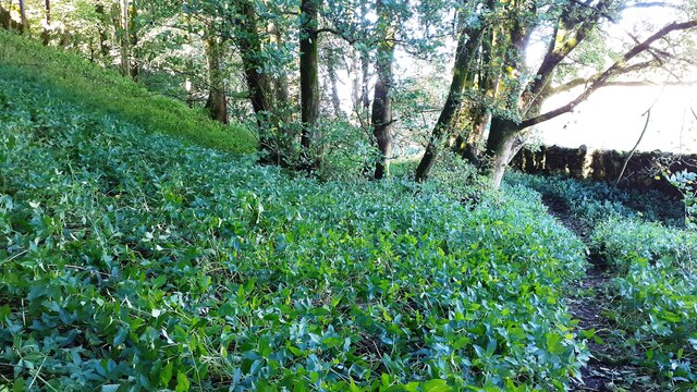
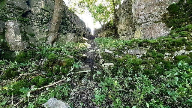
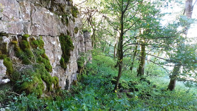
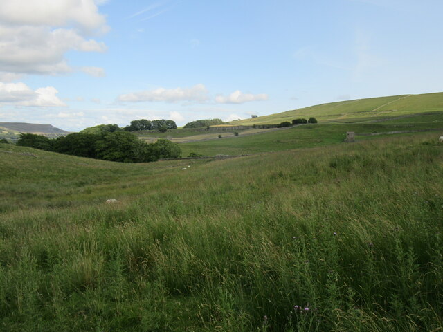
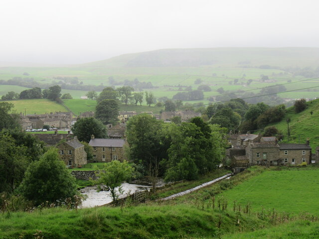
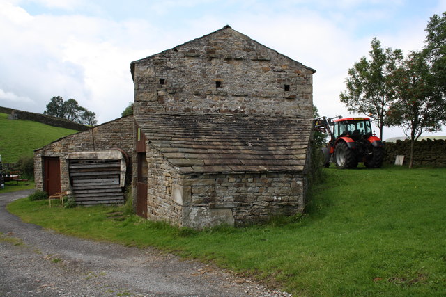
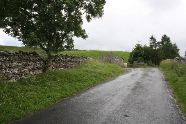
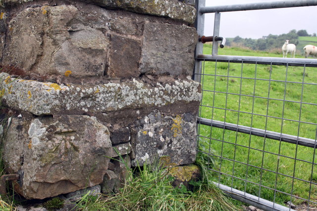
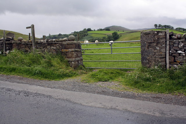
The village of Helm is known for its peaceful and rural atmosphere. It is surrounded by rolling hills, lush green fields, and scenic landscapes, offering residents and visitors a tranquil escape from the hustle and bustle of city life. The village is characterized by its charming cottages made of local stone, which add to the overall quaint and traditional ambiance.

Although Helm is a small village, it has a strong sense of community. The local residents actively participate in various community events and initiatives, fostering a friendly and welcoming atmosphere. The village also has a local pub, where locals and visitors can gather for a drink and socialize.

In terms of amenities, Helm offers limited facilities, with a few small shops catering to the basic needs of the residents. However, nearby towns such as Beverley provide access to a wider range of services, including schools, healthcare facilities, and shopping centers.

Overall, Helm is a serene and idyllic village that appeals to those seeking a peaceful rural lifestyle amidst the stunning Yorkshire countryside.

If you have any feedback on the listing, please let us know in the comments section below.

Helm Images

Images are sourced within 2km of 54.319949/-2.102508 or Grid Reference SD9391. Thanks to Geograph Open Source API. All images are credited.

Footpath through wood below Brough Scar
Footpath passing through gap in Brough Scar
Looking west along Brough Scar
Near Bainbridge Looking east from Cam High Road.
Near Bainbridge
Looking east from Cam High Road.
Bainbridge Looking north to Bainbridge.
Bainbridge
Looking north to Bainbridge.
Barn on Cam High Road near Bainbridge There is an OS benchmark <a href="https://www.geograph.org.uk/photo/2708746">SD9389 : Benchmark on barn on Cam High Road</a> on the barn.
Barn on Cam High Road near Bainbridge
There is an OS benchmark SD9389 : Benchmark on barn on Cam High Road on the barn.
Benchmark on barn on Cam High Road Ordnance Survey cut mark described on the Bench Mark Database at <span class="nowrap"><a title="http://www.bench-marks.org.uk/bm39074" rel="nofollow ugc noopener" href="http://www.bench-marks.org.uk/bm39074">Link</a><img style="margin-left:2px;" alt="External link" title="External link - shift click to open in new window" src="https://s1.geograph.org.uk/img/external.png" width="10" height="10"/></span>
Benchmark on barn on Cam High Road
Ordnance Survey cut mark described on the Bench Mark Database at LinkExternal link
Benchmark on stone of Carpley Green Road Ordnance Survey pivot benchmark described on the Bench Mark Database at <span class="nowrap"><a title="http://www.bench-marks.org.uk/bm39075" rel="nofollow ugc noopener" href="http://www.bench-marks.org.uk/bm39075">Link</a><img style="margin-left:2px;" alt="External link" title="External link - shift click to open in new window" src="https://s1.geograph.org.uk/img/external.png" width="10" height="10"/></span>
Benchmark on stone of Carpley Green Road
Ordnance Survey pivot benchmark described on the Bench Mark Database at LinkExternal link
Carpley Green Road south from Bainbridge There is an OS benchmark <a href="https://www.geograph.org.uk/photo/2719675">SD9389 : Benchmark on stone of Carpley Green Road</a> on the wall on the left side of the road
Carpley Green Road south from Bainbridge
There is an OS benchmark SD9389 : Benchmark on stone of Carpley Green Road on the wall on the left side of the road
Benchmark on gateway on Carpley Green Road Ordnance Survey cut mark benchmark described on the Bench Mark Database at <span class="nowrap"><a title="http://www.bench-marks.org.uk/bm39076" rel="nofollow ugc noopener" href="http://www.bench-marks.org.uk/bm39076">Link</a><img style="margin-left:2px;" alt="External link" title="External link - shift click to open in new window" src="https://s1.geograph.org.uk/img/external.png" width="10" height="10"/></span>
Benchmark on gateway on Carpley Green Road
Ordnance Survey cut mark benchmark described on the Bench Mark Database at LinkExternal link
Gateway to field from Carpley Green Road There is an OS benchmark <a href="https://www.geograph.org.uk/photo/2719755">SD9389 : Benchmark on gateway on Carpley Green Road</a> on the inside face of the wall end at the left hand side of the gateway.
Gateway to field from Carpley Green Road
There is an OS benchmark SD9389 : Benchmark on gateway on Carpley Green Road on the inside face of the wall end at the left hand side of the gateway.
Benchmark on A684 gatepost Ordnance Survey cut mark described on the Bench Mark Database at <span class="nowrap"><a title="http://www.bench-marks.org.uk/bm27871" rel="nofollow ugc noopener" href="http://www.bench-marks.org.uk/bm27871">Link</a><img style="margin-left:2px;" alt="External link" title="External link - shift click to open in new window" src="https://s1.geograph.org.uk/img/external.png" width="10" height="10"/></span>
Benchmark on A684 gatepost
Ordnance Survey cut mark described on the Bench Mark Database at LinkExternal link
Gateway beside A684 There is an OS benchmark <a href="https://www.geograph.org.uk/photo/2722279">SD9389 : Benchmark on A684 gatepost</a> at ground level on the right hand gatepost
Gateway beside A684
There is an OS benchmark SD9389 : Benchmark on A684 gatepost at ground level on the right hand gatepost
Chickens in the bath I think they were drinking rainwater which has collected in the bath.
Chickens in the bath
I think they were drinking rainwater which has collected in the bath.
Spring arrivals on Brough Scar
Bainbridge from Brough Scar Looking north-west from the scar.
Bainbridge from Brough Scar
Looking north-west from the scar.
Entering Bainbridge
Entering Bainbridge
Barn at School Intake above Bainbridge The age-old cycle of lambing is being played out in hundreds of fields just like this one above Wensleydale.
Barn at School Intake above Bainbridge
The age-old cycle of lambing is being played out in hundreds of fields just like this one above Wensleydale.
Show me another place!

Helm is located at Grid Ref: SD9391 (Lat: 54.319949, Lng: -2.102508)

Division: North Riding

Administrative County: North Yorkshire

District: Richmondshire

Police Authority: North Yorkshire

What 3 Words

///elects.vocally.custodian. Near Leyburn, North Yorkshire

Related Wikis

Fors Abbey

Fors Abbey was an abbey in Low Abbotside, Askrigg, North Yorkshire, England.It was built in 1145 for the Savigniac order and converted to the Cistercian...

River Bain, North Yorkshire

The River Bain is a river in North Yorkshire, England. As a tributary of the River Ure, it is one of the shortest, named rivers in England. The river...

Askrigg railway station

Askrigg railway station is a disused railway station in North Yorkshire, England and served the village of Askrigg. It was part of the Wensleydale Railway...

Bainbridge, North Yorkshire

Bainbridge is a village and civil parish in North Yorkshire, England. The population of the civil parish at the 2011 census was 480. The village is situated...

St Oswald's Church, Askrigg

St Oswald's Church is a Grade I listed parish church in the Church of England in Askrigg, North Yorkshire. == History == The church dates largely from...

Askrigg

Askrigg is a small village and civil parish in Wensleydale in the Yorkshire Dales National Park. It was formerly a part of the Richmondshire district of...

Cringley House

Cringley House (also known as Skeldale House) is an historic building in the English village of Askrigg, North Yorkshire. Standing on the south side of...
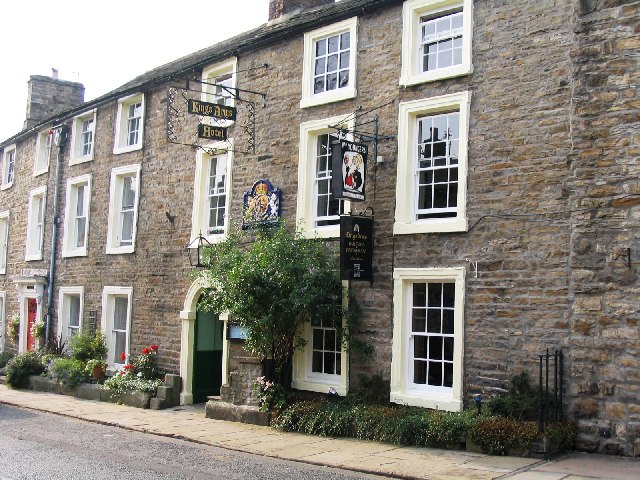
Kings Arms Hotel

The Kings Arms Hotel is a public house and inn in the English village of Askrigg, North Yorkshire. A Grade II listed building, standing on the northern...

Nearby Amenities

Located within 500m of 54.319949,-2.102508
Mill Gill Force
Image: https://www.geograph.org.uk/photo/1606553
Tourism: attraction
Waterway: waterfall
Lat/Long: 54.3189007/-2.0957332
Barrier: stile
Lat/Long: 54.3214366/-2.0988861
Whitfield Gill Lower Falls
Image: https://www.geograph.org.uk/photo/2217696
Waterway: waterfall
Lat/Long: 54.3227494/-2.100964
Source: OS_OpenData_Streetview
Waterway: weir
Lat/Long: 54.3204926/-2.0966126
Barrier: stile
Material: stone
Source: survey;gps
Stile: squeezer
Lat/Long: 54.3176815/-2.1025209
Helm Green Lime Kiln
Board Type: history
Information: board
Tourism: information
Lat/Long: 54.3186108/-2.1085839
Barrier: stile
Material: stone
Source: survey;gps
Stile: squeezer
Lat/Long: 54.3178572/-2.1039602
Historic: lime_kiln
Lat/Long: 54.3182035/-2.0960096
Barrier: stile
Lat/Long: 54.3208991/-2.0979702
Helm
Image: https://www.geograph.org.uk/photo/376484
Place: hamlet
Lat/Long: 54.3198822/-2.1036029
Historic: ruins
Note: former limekilns?
Lat/Long: 54.3182771/-2.0960203
Hiking: yes
Information: guidepost
Tourism: information
Lat/Long: 54.3183365/-2.0964119
Power: pole
Lat/Long: 54.3193683/-2.1057862
Power: pole
Lat/Long: 54.3177749/-2.1032837
Power: pole
Lat/Long: 54.3168002/-2.1046382
Power: pole
Lat/Long: 54.3180596/-2.1028961
Power: pole
Lat/Long: 54.3200887/-2.1034245
Power: pole
Lat/Long: 54.3198353/-2.1039824
Power: pole
Lat/Long: 54.319599/-2.1045068
Power: pole
Lat/Long: 54.3194582/-2.1053168
Power: pole
Lat/Long: 54.3185962/-2.1045551
Power: pole
Lat/Long: 54.3180002/-2.1040267
Power: pole
Lat/Long: 54.3203973/-2.0973855
Power: pole
Lat/Long: 54.3200809/-2.098223
Power: pole
Lat/Long: 54.319822/-2.0994897
Power: pole
Lat/Long: 54.3194105/-2.1006082
Power: pole
Lat/Long: 54.3190487/-2.1016395
Power: pole
Lat/Long: 54.3185352/-2.1022671
Power: pole
Lat/Long: 54.3175378/-2.1036203
Power: pole
Lat/Long: 54.3162956/-2.1052592
Power: pole
Lat/Long: 54.3166664/-2.1001764
Power: pole
Lat/Long: 54.3164219/-2.1007021
Power: pole
Lat/Long: 54.3161352/-2.1012452
Power: pole
Lat/Long: 54.3159311/-2.1016341
Power: pole
Lat/Long: 54.3154934/-2.1014437
Power: pole
Lat/Long: 54.3196882/-2.1037732
Power: pole
Lat/Long: 54.3192197/-2.1038041
Power: pole
Lat/Long: 54.3190327/-2.1095882
Power: pole
Lat/Long: 54.3189756/-2.1085328
Power: pole
Lat/Long: 54.3188207/-2.1062462
Power: pole
Lat/Long: 54.3187182/-2.1053195
Power: pole
Lat/Long: 54.3186236/-2.1043244
Power: pole
Lat/Long: 54.3187699/-2.1037544
The data included in this document is from www.openstreetmap.org. The data is made available under ODbL.

Have you been to Helm?

Leave your review of Helm below (or comments, questions and feedback).