Andrew's Gill

Valley in Sussex Horsham

England

Andrew's Gill

New bridleway off Bell Lane The footpath leading south-east off Bell Lane to the old Dorking Road (now sequestered by the A24 dual carriageway) has recently been upgraded to bridleway, no. 3647_1.
New bridleway off Bell Lane Credit: Hugh Craddock

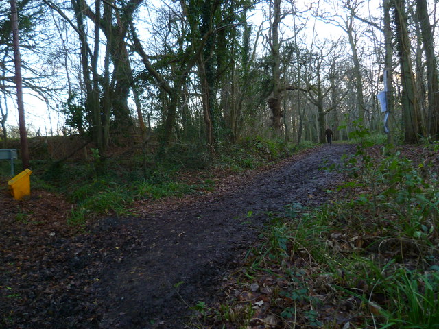
Andrew's Gill is a picturesque valley located in Sussex, England. Nestled amidst the rolling hills and lush greenery, it offers a serene and tranquil retreat for nature lovers and outdoor enthusiasts. The valley is named after Andrew, a local landowner who was historically associated with the area.

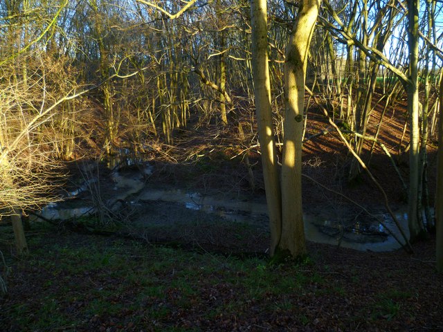
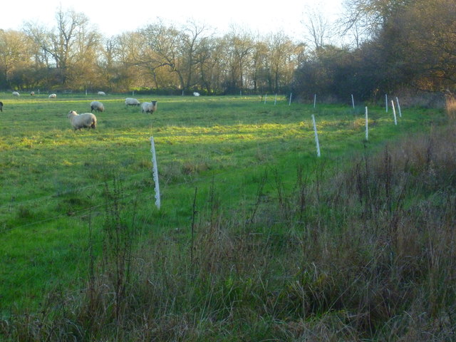
The landscape of Andrew's Gill is characterized by its sprawling meadows, dense woodlands, and a meandering stream that runs through it. The valley is blessed with a diverse range of flora and fauna, making it a haven for wildlife. Visitors can spot an array of bird species, including woodpeckers, owls, and various songbirds.

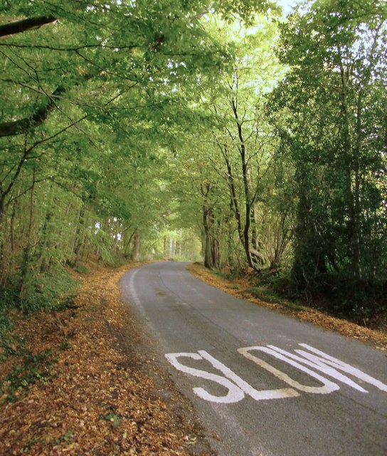
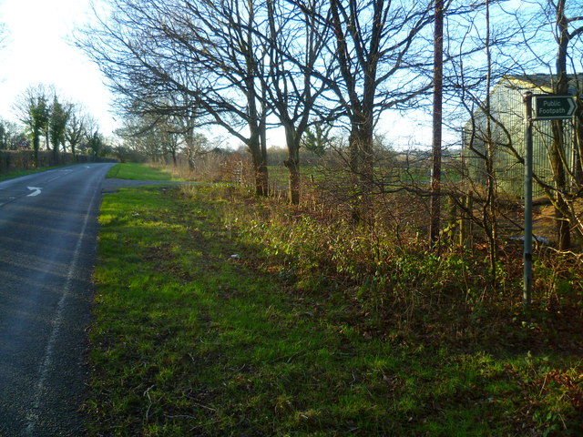
The valley is a popular destination for walking and hiking enthusiasts, with numerous trails crisscrossing the area. These trails offer breathtaking views of the surrounding countryside and provide an opportunity to explore the valley's natural beauty up close. The gentle slopes and well-maintained paths make it accessible for people of all ages and fitness levels.

In addition to its natural attractions, Andrew's Gill is also home to a small community of residents. There are a few quaint cottages and farmhouses scattered throughout the valley, adding to its idyllic charm. The local community takes great pride in preserving the valley's natural heritage and organizing events and activities that showcase the area's beauty.

Overall, Andrew's Gill is a hidden gem in Sussex, offering a peaceful escape from the hustle and bustle of city life. Whether it's for a leisurely stroll, birdwatching, or simply enjoying the tranquility of the countryside, this valley has something to offer for everyone.

If you have any feedback on the listing, please let us know in the comments section below.

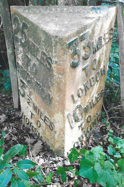
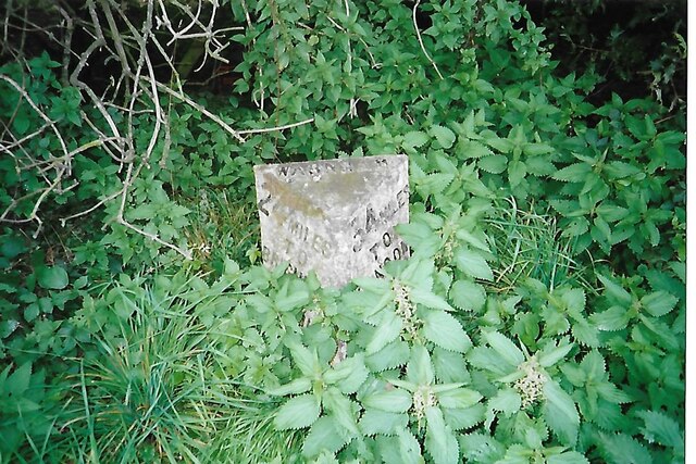
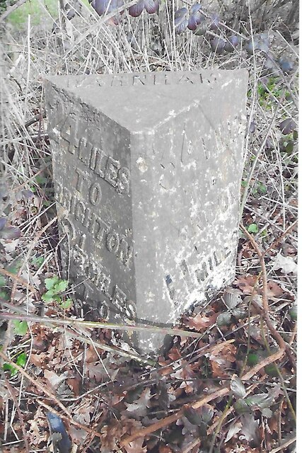
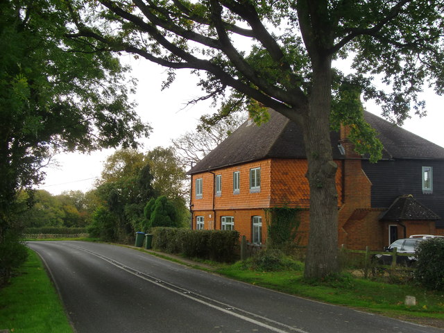
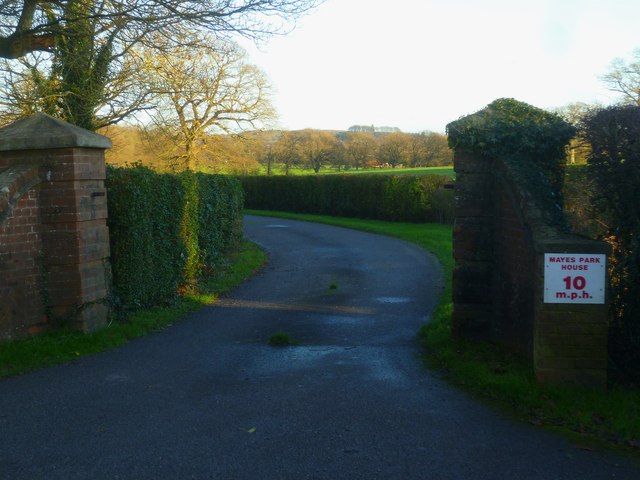
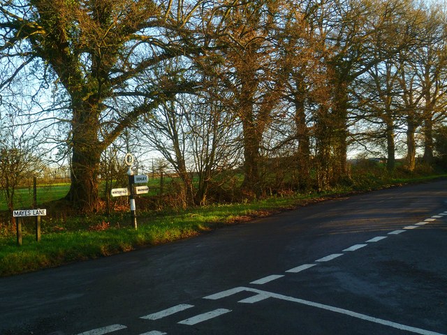
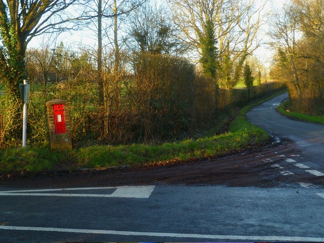
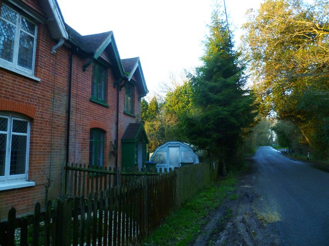
Andrew's Gill Images

Images are sourced within 2km of 51.096502/-0.3399028 or Grid Reference TQ1634. Thanks to Geograph Open Source API. All images are credited.

New bridleway off Bell Lane The footpath leading south-east off Bell Lane to the old Dorking Road (now sequestered by the A24 dual carriageway) has recently been upgraded to bridleway, no. 3647_1.
New bridleway off Bell Lane
The footpath leading south-east off Bell Lane to the old Dorking Road (now sequestered by the A24 dual carriageway) has recently been upgraded to bridleway, no. 3647_1.
Old Milepost by A24, Durfold, a mile North of Warnham The Milepost is located by fence at back of verge on the East of the road.  Parish of Warnham (Horsham District). Cast iron post, Horsham post design, erected by the Horsham & Dorking turnpike trust in the 19th Century. 

Inscription reads:-  
25 MILES / TO / BRIGHTON / 3½ / TO / HORSHAM : : 33 MILES / TO / LONDON / 10 / MILES TO / DORKING : : WARNHAM

Milestone Society National ID: SX_LA33
Old Milepost by A24, Durfold, a mile North of Warnham
The Milepost is located by fence at back of verge on the East of the road.  Parish of Warnham (Horsham District). Cast iron post, Horsham post design, erected by the Horsham & Dorking turnpike trust in the 19th Century.  Inscription reads:- 25 MILES / TO / BRIGHTON / 3½ / TO / HORSHAM : : 33 MILES / TO / LONDON / 10 / MILES TO / DORKING : : WARNHAM Milestone Society National ID: SX_LA33
Old Milestone by A24, Andrews Farm The Milestone is located by the road.  Parish of Warnham (Horsham District). Cast iron post, Horsham post design, erected by the Horsham & Dorking turnpike trust in the 19th Century. An earlier photograph can be found here: <a title="https://www.geograph.org.uk/photo/1596429" href="https://www.geograph.org.uk/photo/1596429">Link</a> 

Inscription reads:-  
24 MILES / TO / BRIGHTON / 2½ / TO / HORSHAM : : 34 MILES / TO / LONDON / 11 / MILES TO / DORKING : : WARNHAM  

Milestone Society National ID: SX_LA34
Old Milestone by A24, Andrews Farm
The Milestone is located by the road.  Parish of Warnham (Horsham District). Cast iron post, Horsham post design, erected by the Horsham & Dorking turnpike trust in the 19th Century. An earlier photograph can be found here: Link  Inscription reads:- 24 MILES / TO / BRIGHTON / 2½ / TO / HORSHAM : : 34 MILES / TO / LONDON / 11 / MILES TO / DORKING : : WARNHAM Milestone Society National ID: SX_LA34
Old Milestone by A24, Andrews Farm The Milestone is located by the road.  Parish of Warnham (Horsham District). Cast iron post, Horsham post design, erected by the Horsham & Dorking turnpike trust in the 19th Century. An earlier photograph can be found here: <a title="https://www.geograph.org.uk/photo/7429171" href="https://www.geograph.org.uk/photo/7429171">Link</a> 

Inscription reads:-  
24 MILES / TO / BRIGHTON / 2½ / TO / HORSHAM : : 34 MILES / TO / LONDON / 11 / MILES TO / DORKING : : WARNHAM  

Milestone Society National ID: SX_LA34
Old Milestone by A24, Andrews Farm
The Milestone is located by the road.  Parish of Warnham (Horsham District). Cast iron post, Horsham post design, erected by the Horsham & Dorking turnpike trust in the 19th Century. An earlier photograph can be found here: Link  Inscription reads:- 24 MILES / TO / BRIGHTON / 2½ / TO / HORSHAM : : 34 MILES / TO / LONDON / 11 / MILES TO / DORKING : : WARNHAM Milestone Society National ID: SX_LA34
School Hill, Warnham School Hill in the village of Warnham, in West Sussex
School Hill, Warnham
School Hill in the village of Warnham, in West Sussex
Timber-framed outbuilding at Bailing Hill Farm - with antler trophies Bailing Hill (on the Warnham Park estate) is currently run as a deer farm - hence the antler trophies.  Apart from the smallish trophies fixed to the first-floor frame, notice the huge pair of antlers on the ground at the far end of the building.   <span class="nowrap"><a title="http://www.warnhampark.com/" rel="nofollow ugc noopener" href="http://www.warnhampark.com/">Link</a><img style="margin-left:2px;" alt="External link" title="External link - shift click to open in new window" src="https://s1.geograph.org.uk/img/external.png" width="10" height="10"/></span>
Timber-framed outbuilding at Bailing Hill Farm - with antler trophies
Bailing Hill (on the Warnham Park estate) is currently run as a deer farm - hence the antler trophies. Apart from the smallish trophies fixed to the first-floor frame, notice the huge pair of antlers on the ground at the far end of the building. LinkExternal link
Former school, by Warnham village green A Victorian school building, overlooking the village green from the east.
Former school, by Warnham village green
A Victorian school building, overlooking the village green from the east.
Marches Farmhouse, Marches Road The date 1877 appears as a pattern of blue brickwork (so called 'diapering') between the middle and left-hand ground-floor windows.  No longer a working farm.
Marches Farmhouse, Marches Road
The date 1877 appears as a pattern of blue brickwork (so called 'diapering') between the middle and left-hand ground-floor windows. No longer a working farm.
Mayes Lane near Joanlands Farm Dave Spicer was here before me, but at a less colourful, leafless time of year : <a href="https://www.geograph.org.uk/photo/2845209">TQ1535 : Mayes Lane south to Warnham</a>
Mayes Lane near Joanlands Farm
Dave Spicer was here before me, but at a less colourful, leafless time of year : TQ1535 : Mayes Lane south to Warnham
Mid-18th century tombstone, Warnham churchyard The name is JOHN AGATE (if I've read it correctly) and the date July 1748.  The jawless skull is pretty typical of the rather heartless imagery to be found on 18th century tombstones.
Mid-18th century tombstone, Warnham churchyard
The name is JOHN AGATE (if I've read it correctly) and the date July 1748. The jawless skull is pretty typical of the rather heartless imagery to be found on 18th century tombstones.
Stonefarm Gill and tributary
Looking west along Marches Road at footpath junction
Field edge path at Winterfold
Entrance to Mayes Park House
Road junction at Pound Corner For another view see <a title="https://www.geograph.org.uk/photo/1852989" href="https://www.geograph.org.uk/photo/1852989">Link</a>.
Road junction at Pound Corner
For another view see Link.
Junction at Pound Corner with pillar box For a better view of the post box see <a title="https://www.geograph.org.uk/photo/1853267" href="https://www.geograph.org.uk/photo/1853267">Link</a>.
Junction at Pound Corner with pillar box
For a better view of the post box see Link.
Dwellings on Northlands Road
Bridleway goes south from Northlands Road through Benland Wood
Show me another place!

Andrew's Gill is located at Grid Ref: TQ1634 (Lat: 51.096502, Lng: -0.3399028)

Administrative County: West Sussex

District: Horsham

Police Authority: Sussex

What 3 Words

///drooling.start.stowing. Near Warnham, West Sussex

Related Wikis

Warnham & Rusper (electoral division)

Warnham & Rusper is an electoral division of West Sussex in the United Kingdom and returns one member to sit on West Sussex County Council. The current...

Warnham

Warnham is a village and civil parish in the Horsham district of West Sussex, England. The village is centred 2 miles (3.2 km) north-northwest of Horsham...

Warnham railway station

Warnham railway station serves the village of Warnham in West Sussex, England. It is 33 miles 46 chains (54.0 km) measured from London Waterloo (although...

E. Tredcroft's Ground

E. Tredcroft's Ground was a cricket ground at the Warnham Court estate, located at Horsham, Sussex. The first recorded match on the ground was in 1851...

Graylands

Graylands is a hamlet in the Horsham district of West Sussex, England. The largely rural hamlet is located north of Holbrook beyond the A264. It is bordered...

Old Holbrook

Old Holbrook (formerly known as Northlands) is a hamlet in the Horsham district of West Sussex, England. This rural hamlet is located north of the Horsham...

Warnham SSSI

Warnham SSSI is a 28.5-hectare (70-acre) geological Site of Special Scientific Interest north of Horsham in West Sussex. It is a Geological Conservation...

Warnham LNR

Warnham LNR is a 38.4-hectare (95-acre) Local Nature Reserve in Horsham in West Sussex. It is owned and managed by Horsham District Council.The principal...

Related Videos

Take an Epic 4K Drone Journey on a Beginners Hiking Adventure in the UK!

Distance: 16.5 km (10.3 miles) Grading: Easy Rating: 3 out of 10 Ascents: 314 m Hiking time: About 5.5 to 6.5 hours of actual ...

How to enjoy a nice walk at Warnham nature reserve

How to enjoy a walk at Warnham nature reserve.

walking with Stilts #painting #spraypaint #decoration #spraying #diy #stilts #construction #spraying

walking with Stilts, spraying high cealling #painting #spraypaint #spraying #diy #stilts #decorator #vevor.

Nearby Amenities

Located within 500m of 51.096502,-0.3399028
Geerings
Place: farm
Wikidata: Q26573742
Lat/Long: 51.1002612/-0.3429612
Cox Farm
Place: farm
Lat/Long: 51.0994934/-0.3350577
Andrew's Farm
Place: farm
Lat/Long: 51.0943205/-0.337748
Lower Chickens
Place: farm
Lat/Long: 51.097557/-0.3416167
Slaughter Bridge
Addr Housename: Slaughter Bridge
Addr Street: Little London Hill
Lat/Long: 51.0961217/-0.3414092
Power: pole
Lat/Long: 51.1000602/-0.3390973
The data included in this document is from www.openstreetmap.org. The data is made available under ODbL.

Have you been to Andrew's Gill?

Leave your review of Andrew's Gill below (or comments, questions and feedback).