Little London Hill

Hill, Mountain in Sussex Horsham

England

Little London Hill

New bridleway off Bell Lane The footpath leading south-east off Bell Lane to the old Dorking Road (now sequestered by the A24 dual carriageway) has recently been upgraded to bridleway, no. 3647_1.
New bridleway off Bell Lane Credit: Hugh Craddock

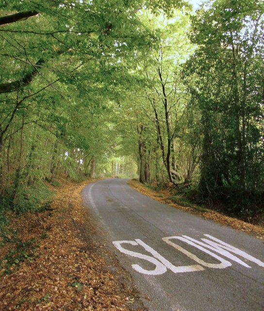
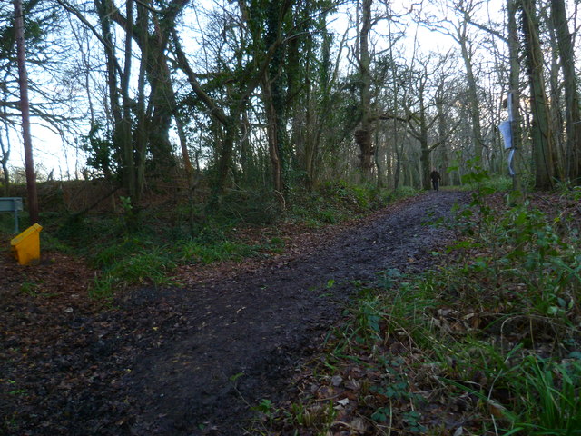
Little London Hill is a picturesque hill located in the county of Sussex, England. Situated in the South Downs National Park, it offers breathtaking views and is a popular destination for both locals and tourists alike. Despite its name, it is not a hill in the traditional sense, but rather a low-lying ridge that offers stunning panoramic vistas.

Standing at an elevation of around 200 meters (656 feet), Little London Hill is covered in lush greenery, with patches of wildflowers dotting its slopes during the spring and summer months. The hill is predominantly composed of chalk, which gives it a distinct white appearance and contributes to its unique charm.

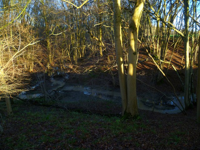
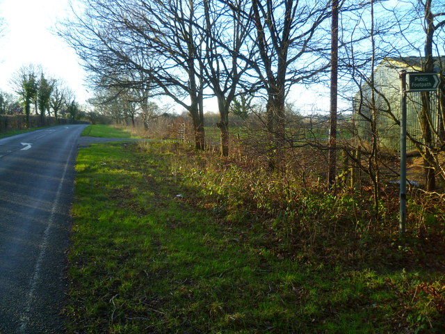
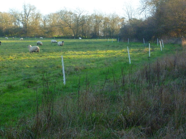
The hill is easily accessible, with well-maintained footpaths leading to the summit. Hikers and nature enthusiasts can enjoy walking along these paths, taking in the picturesque countryside and surrounding farmland. The summit itself provides a stunning view of the rolling hills, meandering rivers, and quaint villages that define the Sussex landscape.

Little London Hill is also home to a variety of wildlife, including rabbits, foxes, and numerous bird species. Nature lovers can often spot kestrels hovering above the hill, as well as skylarks singing their melodic tunes.

Overall, Little London Hill is a hidden gem in the Sussex countryside, offering visitors a tranquil escape from the hustle and bustle of city life. Whether it be for a leisurely walk or to admire the stunning views, this hill is a must-visit for anyone seeking a taste of the natural beauty that Sussex has to offer.

If you have any feedback on the listing, please let us know in the comments section below.

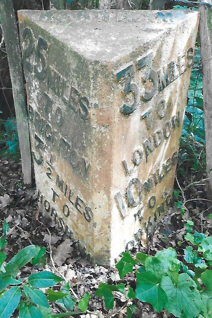
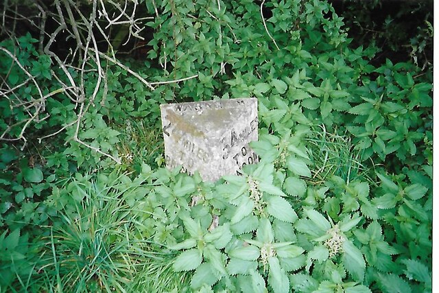
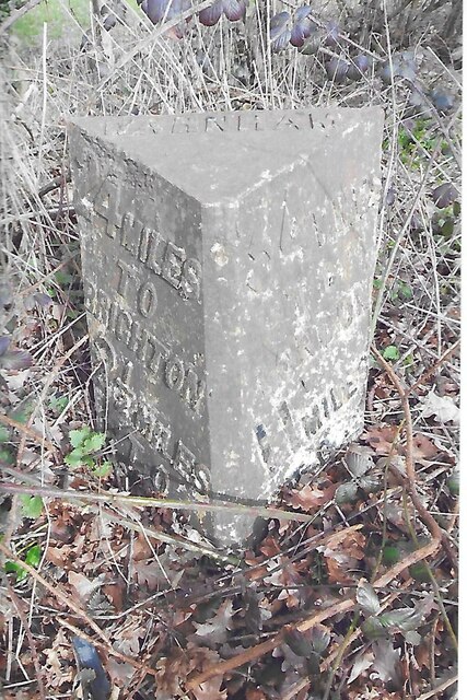
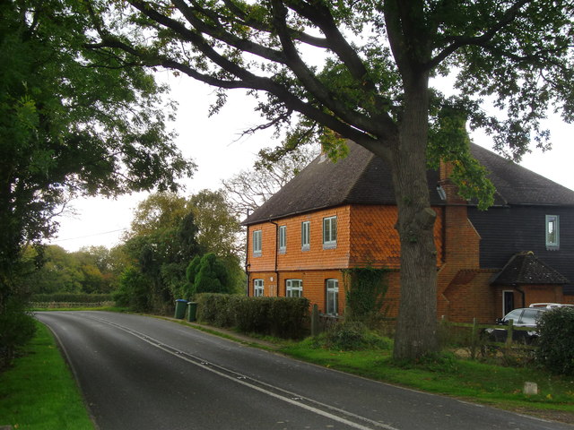
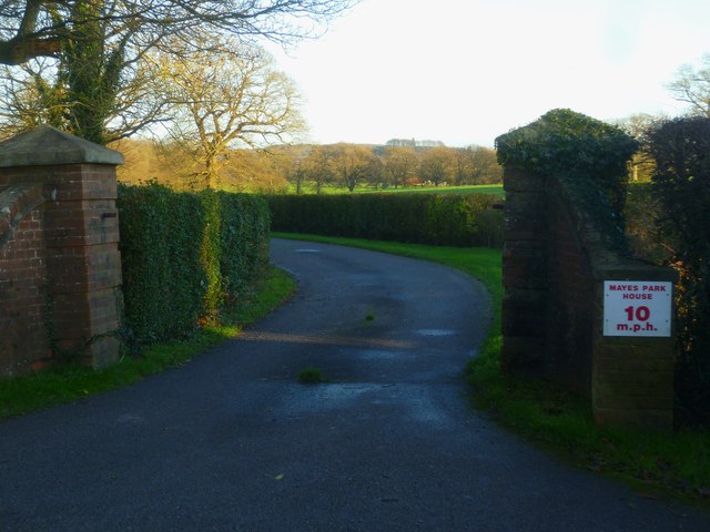
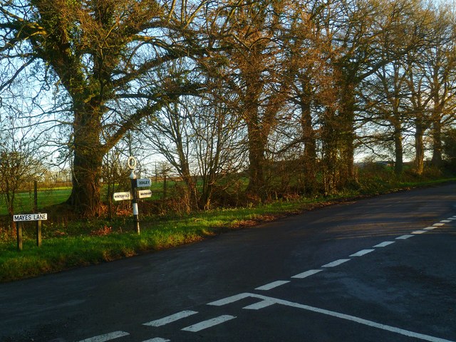
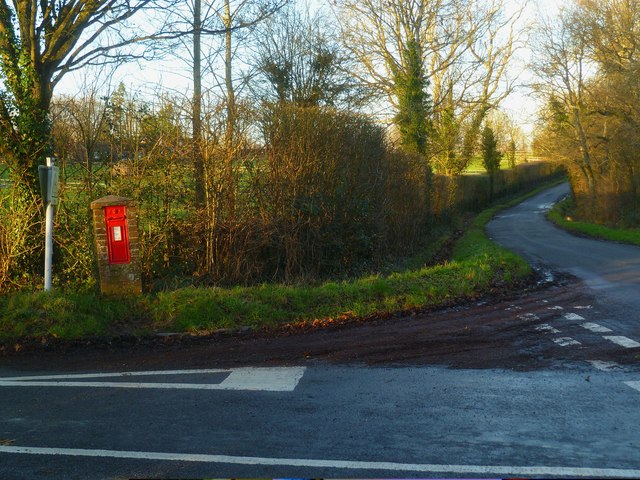
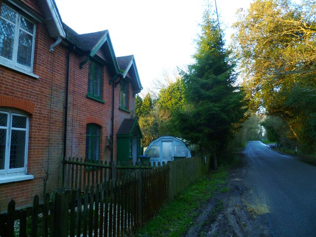
Little London Hill Images

Images are sourced within 2km of 51.099096/-0.34019552 or Grid Reference TQ1634. Thanks to Geograph Open Source API. All images are credited.

New bridleway off Bell Lane The footpath leading south-east off Bell Lane to the old Dorking Road (now sequestered by the A24 dual carriageway) has recently been upgraded to bridleway, no. 3647_1.
New bridleway off Bell Lane
The footpath leading south-east off Bell Lane to the old Dorking Road (now sequestered by the A24 dual carriageway) has recently been upgraded to bridleway, no. 3647_1.
Old Milepost by A24, Durfold, a mile North of Warnham The Milepost is located by fence at back of verge on the East of the road.  Parish of Warnham (Horsham District). Cast iron post, Horsham post design, erected by the Horsham & Dorking turnpike trust in the 19th Century. 

Inscription reads:-  
25 MILES / TO / BRIGHTON / 3½ / TO / HORSHAM : : 33 MILES / TO / LONDON / 10 / MILES TO / DORKING : : WARNHAM

Milestone Society National ID: SX_LA33
Old Milepost by A24, Durfold, a mile North of Warnham
The Milepost is located by fence at back of verge on the East of the road.  Parish of Warnham (Horsham District). Cast iron post, Horsham post design, erected by the Horsham & Dorking turnpike trust in the 19th Century.  Inscription reads:- 25 MILES / TO / BRIGHTON / 3½ / TO / HORSHAM : : 33 MILES / TO / LONDON / 10 / MILES TO / DORKING : : WARNHAM Milestone Society National ID: SX_LA33
Old Milestone by A24, Andrews Farm The Milestone is located by the road.  Parish of Warnham (Horsham District). Cast iron post, Horsham post design, erected by the Horsham & Dorking turnpike trust in the 19th Century. An earlier photograph can be found here: <a title="https://www.geograph.org.uk/photo/1596429" href="https://www.geograph.org.uk/photo/1596429">Link</a> 

Inscription reads:-  
24 MILES / TO / BRIGHTON / 2½ / TO / HORSHAM : : 34 MILES / TO / LONDON / 11 / MILES TO / DORKING : : WARNHAM  

Milestone Society National ID: SX_LA34
Old Milestone by A24, Andrews Farm
The Milestone is located by the road.  Parish of Warnham (Horsham District). Cast iron post, Horsham post design, erected by the Horsham & Dorking turnpike trust in the 19th Century. An earlier photograph can be found here: Link  Inscription reads:- 24 MILES / TO / BRIGHTON / 2½ / TO / HORSHAM : : 34 MILES / TO / LONDON / 11 / MILES TO / DORKING : : WARNHAM Milestone Society National ID: SX_LA34
Old Milestone by A24, Andrews Farm The Milestone is located by the road.  Parish of Warnham (Horsham District). Cast iron post, Horsham post design, erected by the Horsham & Dorking turnpike trust in the 19th Century. An earlier photograph can be found here: <a title="https://www.geograph.org.uk/photo/7429171" href="https://www.geograph.org.uk/photo/7429171">Link</a> 

Inscription reads:-  
24 MILES / TO / BRIGHTON / 2½ / TO / HORSHAM : : 34 MILES / TO / LONDON / 11 / MILES TO / DORKING : : WARNHAM  

Milestone Society National ID: SX_LA34
Old Milestone by A24, Andrews Farm
The Milestone is located by the road.  Parish of Warnham (Horsham District). Cast iron post, Horsham post design, erected by the Horsham & Dorking turnpike trust in the 19th Century. An earlier photograph can be found here: Link  Inscription reads:- 24 MILES / TO / BRIGHTON / 2½ / TO / HORSHAM : : 34 MILES / TO / LONDON / 11 / MILES TO / DORKING : : WARNHAM Milestone Society National ID: SX_LA34
School Hill, Warnham School Hill in the village of Warnham, in West Sussex
School Hill, Warnham
School Hill in the village of Warnham, in West Sussex
Former school, by Warnham village green A Victorian school building, overlooking the village green from the east.
Former school, by Warnham village green
A Victorian school building, overlooking the village green from the east.
Marches Farmhouse, Marches Road The date 1877 appears as a pattern of blue brickwork (so called 'diapering') between the middle and left-hand ground-floor windows.  No longer a working farm.
Marches Farmhouse, Marches Road
The date 1877 appears as a pattern of blue brickwork (so called 'diapering') between the middle and left-hand ground-floor windows. No longer a working farm.
Mayes Lane near Joanlands Farm Dave Spicer was here before me, but at a less colourful, leafless time of year : <a href="https://www.geograph.org.uk/photo/2845209">TQ1535 : Mayes Lane south to Warnham</a>
Mayes Lane near Joanlands Farm
Dave Spicer was here before me, but at a less colourful, leafless time of year : TQ1535 : Mayes Lane south to Warnham
Mid-18th century tombstone, Warnham churchyard The name is JOHN AGATE (if I've read it correctly) and the date July 1748.  The jawless skull is pretty typical of the rather heartless imagery to be found on 18th century tombstones.
Mid-18th century tombstone, Warnham churchyard
The name is JOHN AGATE (if I've read it correctly) and the date July 1748. The jawless skull is pretty typical of the rather heartless imagery to be found on 18th century tombstones.
Stonefarm Gill and tributary
Looking west along Marches Road at footpath junction
Field edge path at Winterfold
Entrance to Mayes Park House
Road junction at Pound Corner For another view see <a title="https://www.geograph.org.uk/photo/1852989" href="https://www.geograph.org.uk/photo/1852989">Link</a>.
Road junction at Pound Corner
For another view see Link.
Junction at Pound Corner with pillar box For a better view of the post box see <a title="https://www.geograph.org.uk/photo/1853267" href="https://www.geograph.org.uk/photo/1853267">Link</a>.
Junction at Pound Corner with pillar box
For a better view of the post box see Link.
Dwellings on Northlands Road
Bridleway goes south from Northlands Road through Benland Wood
Bend on Northlands Road with bridleway junction
Show me another place!

Little London Hill is located at Grid Ref: TQ1634 (Lat: 51.099096, Lng: -0.34019552)

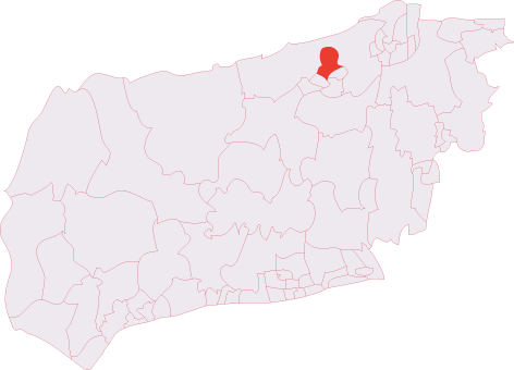
Administrative County: West Sussex

District: Horsham

Police Authority: Sussex

What 3 Words

///turkeys.simulator.headstone. Near Warnham, West Sussex

Related Wikis

Warnham & Rusper (electoral division)

Warnham & Rusper is an electoral division of West Sussex in the United Kingdom and returns one member to sit on West Sussex County Council. The current...

Warnham

Warnham is a village and civil parish in the Horsham district of West Sussex, England. The village is centred 2 miles (3.2 km) north-northwest of Horsham...

Warnham railway station

Warnham railway station serves the village of Warnham in West Sussex, England. It is 33 miles 46 chains (54.0 km) measured from London Waterloo (although...

E. Tredcroft's Ground

E. Tredcroft's Ground was a cricket ground at the Warnham Court estate, located at Horsham, Sussex. The first recorded match on the ground was in 1851...

Warnham SSSI

Warnham SSSI is a 28.5-hectare (70-acre) geological Site of Special Scientific Interest north of Horsham in West Sussex. It is a Geological Conservation...

Graylands

Graylands is a hamlet in the Horsham district of West Sussex, England. The largely rural hamlet is located north of Holbrook beyond the A264. It is bordered...

Old Holbrook

Old Holbrook (formerly known as Northlands) is a hamlet in the Horsham district of West Sussex, England. This rural hamlet is located north of the Horsham...

Holbrook (electoral division)

Holbrook is an electoral division of West Sussex in the United Kingdom and returns one member to sit on West Sussex County Council. The current County...

Nearby Amenities

Located within 500m of 51.099096,-0.34019552
Auctioneers
Denham's Auctioneers
Shop: yes
Lat/Long: 51.1025925/-0.3360315
Bus Stop
War Museum
Bus: yes
Naptan AtcoCode: 4400HR0036
Naptan Bearing: N
Naptan CommonName: War Museum
Naptan Indicator: opp Auction House
Naptan Landmark: Tylden House
Naptan NaptanCode: wsxatgjm
Naptan Street: Dorking Road
Naptan Verified: no
Public Transport: platform
Lat/Long: 51.1028892/-0.3376712
Bus Stop
War Museum
Bench: yes
Bus: yes
Naptan AtcoCode: 4400HR0037
Naptan Bearing: S
Naptan CommonName: War Museum
Naptan Indicator: o/s Auction House
Naptan Landmark: Tylden House
Naptan NaptanCode: wsxatgjp
Naptan Street: Dorking Road
Naptan Verified: no
Public Transport: platform
Shelter: yes
Source: naptan_import
Wheelchair: limited
Lat/Long: 51.1024957/-0.3377055
War Museum
Bus: yes
Public Transport: stop_position
Lat/Long: 51.1025175/-0.3378374
War Museum
Bus: yes
Public Transport: stop_position
Lat/Long: 51.1028779/-0.337622
Geerings
Place: farm
Wikidata: Q26573742
Lat/Long: 51.1002612/-0.3429612
Cox Farm
Place: farm
Lat/Long: 51.0994934/-0.3350577
Tylden House
Place: locality
Lat/Long: 51.10235/-0.3369873
Lower Chickens
Place: farm
Lat/Long: 51.097557/-0.3416167
Slaughter Bridge
Addr Housename: Slaughter Bridge
Addr Street: Little London Hill
Lat/Long: 51.0961217/-0.3414092
Power: pole
Lat/Long: 51.1010624/-0.3382234
Power: pole
Lat/Long: 51.1007417/-0.3368756
Power: pole
Lat/Long: 51.1003641/-0.3352987
Power: pole
Lat/Long: 51.100016/-0.333791
Power: pole
Lat/Long: 51.1017098/-0.3409022
Power: pole
Lat/Long: 51.1017224/-0.3420768
Power: pole
Lat/Long: 51.1015691/-0.3434067
Power: pole
Lat/Long: 51.1000602/-0.3390973
Power: pole
Lat/Long: 51.1016866/-0.3397612
Post Box
Source: Photo for Wheelmap survey 2023-03
Wheelchair: yes
Lat/Long: 51.102517/-0.3376993
The data included in this document is from www.openstreetmap.org. The data is made available under ODbL.

Have you been to Little London Hill?

Leave your review of Little London Hill below (or comments, questions and feedback).