High Holborn Hill

Hill, Mountain in Huntingdonshire Huntingdonshire

England

High Holborn Hill

Wheat field off Cook's Lane
Wheat field off Cook's Lane Credit: Jonathan Thacker

The requested URL returned error: 429 Too Many Requests

If you have any feedback on the listing, please let us know in the comments section below.

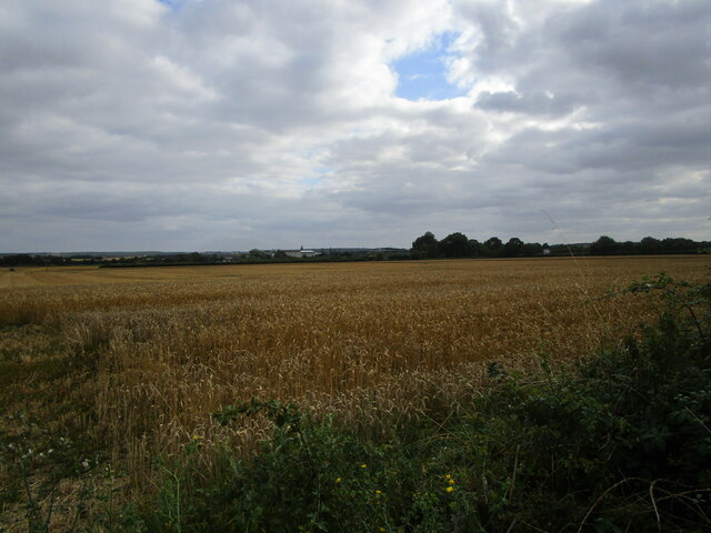
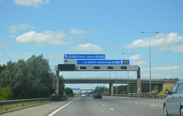
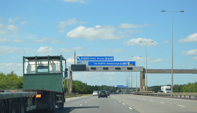
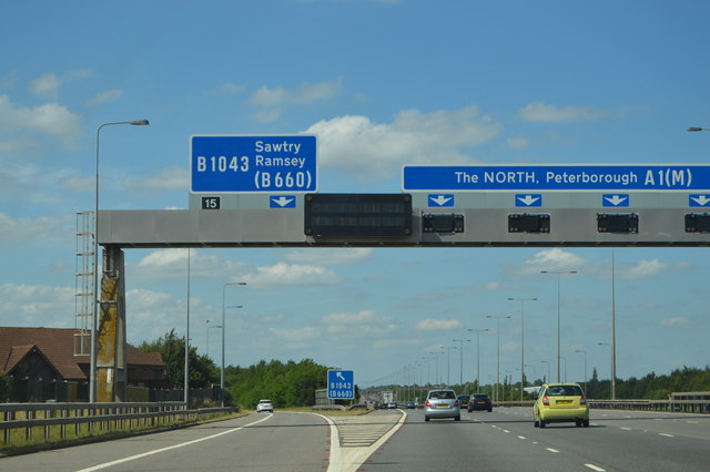
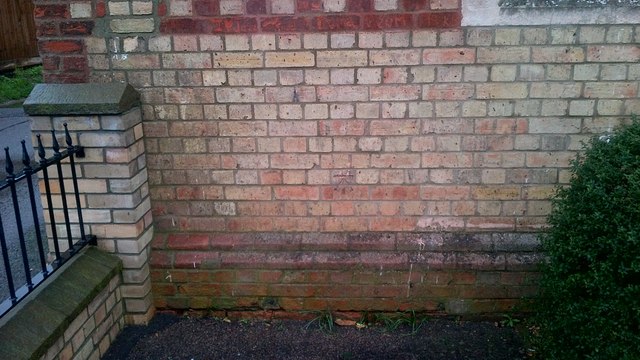
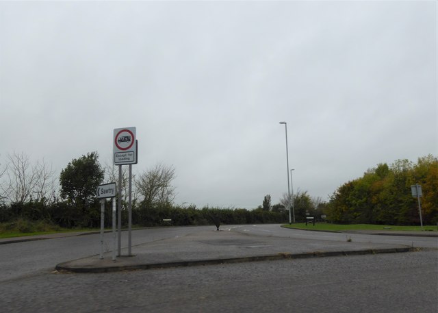
High Holborn Hill Images

Images are sourced within 2km of 52.429171/-0.2882133 or Grid Reference TL1682. Thanks to Geograph Open Source API. All images are credited.

Wheat field off Cook's Lane
A1(M) approaching J15 The A1 is the longest numbered road in the UK at 410 miles long. It connects London with Edinburgh, via the east of England. 
For much of its path it follows the Great North Road the old coaching route between London and Edinburgh. Several sections of the route are classified as motorway A1(M). The modern A1 bypasses the towns the Great North Road passed through and is dual carriageway for most of its route through England.
A1(M) approaching J15
The A1 is the longest numbered road in the UK at 410 miles long. It connects London with Edinburgh, via the east of England. For much of its path it follows the Great North Road the old coaching route between London and Edinburgh. Several sections of the route are classified as motorway A1(M). The modern A1 bypasses the towns the Great North Road passed through and is dual carriageway for most of its route through England.
Gantry, A1(M) The A1 is the longest numbered road in the UK at 410 miles long. It connects London with Edinburgh, via the east of England. 
For much of its path it follows the Great North Road the old coaching route between London and Edinburgh. Several sections of the route are classified as motorway A1(M). The modern A1 bypasses the towns the Great North Road passed through and is dual carriageway for most of its route through England.
Gantry, A1(M)
The A1 is the longest numbered road in the UK at 410 miles long. It connects London with Edinburgh, via the east of England. For much of its path it follows the Great North Road the old coaching route between London and Edinburgh. Several sections of the route are classified as motorway A1(M). The modern A1 bypasses the towns the Great North Road passed through and is dual carriageway for most of its route through England.
J15, A1(M) The A1 is the longest numbered road in the UK at 410 miles long. It connects London with Edinburgh, via the east of England. 
For much of its path it follows the Great North Road the old coaching route between London and Edinburgh. Several sections of the route are classified as motorway A1(M). The modern A1 bypasses the towns the Great North Road passed through and is dual carriageway for most of its route through England.
J15, A1(M)
The A1 is the longest numbered road in the UK at 410 miles long. It connects London with Edinburgh, via the east of England. For much of its path it follows the Great North Road the old coaching route between London and Edinburgh. Several sections of the route are classified as motorway A1(M). The modern A1 bypasses the towns the Great North Road passed through and is dual carriageway for most of its route through England.
A1(M), northbound The A1 is the longest numbered road in the UK at 410 miles long. It connects London with Edinburgh, via the east of England. 
For much of its path it follows the Great North Road the old coaching route between London and Edinburgh. Several sections of the route are classified as motorway A1(M). The modern A1 bypasses the towns the Great North Road passed through and is dual carriageway for most of its route through England.
A1(M), northbound
The A1 is the longest numbered road in the UK at 410 miles long. It connects London with Edinburgh, via the east of England. For much of its path it follows the Great North Road the old coaching route between London and Edinburgh. Several sections of the route are classified as motorway A1(M). The modern A1 bypasses the towns the Great North Road passed through and is dual carriageway for most of its route through England.
Ordnance Survey Benchmark - Sawtry, Gidding Rd. Ordnance Survey Benchmark (OSBM) used for levelling height above Ordnance Datum (OD).
Height: 11.8354m OD (Newlyn).  Mark verified by the Ordnance Survey in 1966.  Description: NBM BLDG NW SIDE RD JUNC E ANG NE FACE.  0.5m above ground.  3rd Order BM.
This new benchmark (NBM) replaced one on the pub opposite, after it was demolished.

Context: <a href="https://www.geograph.org.uk/photo/4797753">TL1683 : Ordnance Survey Benchmark - Sawtry, Gidding Rd.</a>
Ordnance Survey Benchmark - Sawtry, Gidding Rd.
Ordnance Survey Benchmark (OSBM) used for levelling height above Ordnance Datum (OD). Height: 11.8354m OD (Newlyn). Mark verified by the Ordnance Survey in 1966. Description: NBM BLDG NW SIDE RD JUNC E ANG NE FACE. 0.5m above ground. 3rd Order BM. This new benchmark (NBM) replaced one on the pub opposite, after it was demolished. Context: TL1683 : Ordnance Survey Benchmark - Sawtry, Gidding Rd.
Ordnance Survey Benchmark - Sawtry, Gidding Rd. Ordnance Survey Benchmark (OSBM) used for levelling height above Ordnance Datum (OD).
Height: 11.8354m OD (Newlyn). Mark verified by the Ordnance Survey in 1966. Description: NBM BLDG NW SIDE RD JUNC E ANG NE FACE. 0.5m above ground. 3rd Order BM.
This new benchmark (NBM) replaced one on the pub opposite, after it was demolished.

Close-up: <a href="https://www.geograph.org.uk/photo/4797743">TL1683 : Ordnance Survey Benchmark - Sawtry, Gidding Rd.</a>
Ordnance Survey Benchmark - Sawtry, Gidding Rd.
Ordnance Survey Benchmark (OSBM) used for levelling height above Ordnance Datum (OD). Height: 11.8354m OD (Newlyn). Mark verified by the Ordnance Survey in 1966. Description: NBM BLDG NW SIDE RD JUNC E ANG NE FACE. 0.5m above ground. 3rd Order BM. This new benchmark (NBM) replaced one on the pub opposite, after it was demolished. Close-up: TL1683 : Ordnance Survey Benchmark - Sawtry, Gidding Rd.
Ordnance Survey Benchmark - Sawtry, Old School Hall Ordnance Survey Benchmark (OSBM) used for levelling height above Ordnance Datum (OD).
Height (1966): 14.6213m OD (Newlyn). Mark verified by the Ordnance Survey in 1966. Description: OLD SCHOOL HALL SW FACE 1.2M W ANG. 0.7m above ground. 3rd Order BM.

Context: <a href="https://www.geograph.org.uk/photo/4797830">TL1683 : Ordnance Survey Benchmark - Sawtry, Old School Hall</a>
Ordnance Survey Benchmark - Sawtry, Old School Hall
Ordnance Survey Benchmark (OSBM) used for levelling height above Ordnance Datum (OD). Height (1966): 14.6213m OD (Newlyn). Mark verified by the Ordnance Survey in 1966. Description: OLD SCHOOL HALL SW FACE 1.2M W ANG. 0.7m above ground. 3rd Order BM. Context: TL1683 : Ordnance Survey Benchmark - Sawtry, Old School Hall
Ordnance Survey Benchmark - Sawtry, Old School Hall Ordnance Survey Benchmark (OSBM) used for levelling height above Ordnance Datum (OD).
Height (1966): 14.6213m OD (Newlyn). Mark verified by the Ordnance Survey in 1966. Description: OLD SCHOOL HALL SW FACE 1.2M W ANG. 0.7m above ground. 3rd Order BM.

Close-up: <a href="https://www.geograph.org.uk/photo/4797816">TL1683 : Ordnance Survey Benchmark - Sawtry, Old School Hall</a>
Ordnance Survey Benchmark - Sawtry, Old School Hall
Ordnance Survey Benchmark (OSBM) used for levelling height above Ordnance Datum (OD). Height (1966): 14.6213m OD (Newlyn). Mark verified by the Ordnance Survey in 1966. Description: OLD SCHOOL HALL SW FACE 1.2M W ANG. 0.7m above ground. 3rd Order BM. Close-up: TL1683 : Ordnance Survey Benchmark - Sawtry, Old School Hall
Ordnance Survey Benchmark - Sawtry, The Bell Inn Ordnance Survey Benchmark (OSBM) used for levelling height above Ordnance Datum (OD).
Height: 7.0013m OD (Newlyn). Mark verified by the Ordnance Survey in 1966. Description: THE BELL INN S ANG SW FACE. 0.4m above ground. 3rd Order BM.

Context: <a href="https://www.geograph.org.uk/photo/4797961">TL1783 : Ordnance Survey Benchmark - Sawtry, The Bell Inn</a>
Ordnance Survey Benchmark - Sawtry, The Bell Inn
Ordnance Survey Benchmark (OSBM) used for levelling height above Ordnance Datum (OD). Height: 7.0013m OD (Newlyn). Mark verified by the Ordnance Survey in 1966. Description: THE BELL INN S ANG SW FACE. 0.4m above ground. 3rd Order BM. Context: TL1783 : Ordnance Survey Benchmark - Sawtry, The Bell Inn
Ordnance Survey Benchmark - Sawtry, The Bell Inn Ordnance Survey Benchmark (OSBM) used for levelling height above Ordnance Datum (OD).
Height: 7.0013m OD (Newlyn). Mark verified by the Ordnance Survey in 1966. Description: THE BELL INN S ANG SW FACE. 0.4m above ground. 3rd Order BM.

Close-up: <a href="https://www.geograph.org.uk/photo/4797912">TL1783 : Ordnance Survey Benchmark - Sawtry, The Bell Inn</a>
Ordnance Survey Benchmark - Sawtry, The Bell Inn
Ordnance Survey Benchmark (OSBM) used for levelling height above Ordnance Datum (OD). Height: 7.0013m OD (Newlyn). Mark verified by the Ordnance Survey in 1966. Description: THE BELL INN S ANG SW FACE. 0.4m above ground. 3rd Order BM. Close-up: TL1783 : Ordnance Survey Benchmark - Sawtry, The Bell Inn
Ordnance Survey Benchmark - Sawtry, Manor House Farm Ordnance Survey Benchmark (OSBM) used for levelling height above Ordnance Datum (OD).
Height: 10.4089m OD (Newlyn). Mark verified by the Ordnance Survey in 1966. Description: NBM BLDG MANOR HOUSE FM C NE FACE. 0.7m above ground. 3rd Order BM.

Context: <a href="https://www.geograph.org.uk/photo/4798324">TL1782 : Ordnance Survey Benchmark - Sawtry, Manor House Farm</a>
Ordnance Survey Benchmark - Sawtry, Manor House Farm
Ordnance Survey Benchmark (OSBM) used for levelling height above Ordnance Datum (OD). Height: 10.4089m OD (Newlyn). Mark verified by the Ordnance Survey in 1966. Description: NBM BLDG MANOR HOUSE FM C NE FACE. 0.7m above ground. 3rd Order BM. Context: TL1782 : Ordnance Survey Benchmark - Sawtry, Manor House Farm
Ordnance Survey Benchmark - Sawtry, Manor House Farm Ordnance Survey Benchmark (OSBM) used for levelling height above Ordnance Datum (OD).
Height: 10.4089m OD (Newlyn). Mark verified by the Ordnance Survey in 1966. Description: NBM BLDG MANOR HOUSE FM C NE FACE. 0.7m above ground. 3rd Order BM.

Close-up: <a href="https://www.geograph.org.uk/photo/4798314">TL1782 : Ordnance Survey Benchmark - Sawtry, Manor House Farm</a>
Ordnance Survey Benchmark - Sawtry, Manor House Farm
Ordnance Survey Benchmark (OSBM) used for levelling height above Ordnance Datum (OD). Height: 10.4089m OD (Newlyn). Mark verified by the Ordnance Survey in 1966. Description: NBM BLDG MANOR HOUSE FM C NE FACE. 0.7m above ground. 3rd Order BM. Close-up: TL1782 : Ordnance Survey Benchmark - Sawtry, Manor House Farm
Farmland near Archer's Wood
Brookside Industrial Estate
Old North Road
Old North Road
Minor road near Whitehall Farm
Turning for Sawtry
Turning for Sawtry
Show me another place!

High Holborn Hill is located at Grid Ref: TL1682 (Lat: 52.429171, Lng: -0.2882133)

Administrative County: Cambridgeshire

District: Huntingdonshire

Police Authority: Cambridgeshire

What 3 Words

///checked.sprinkler.patio. Near Sawtry, Cambridgeshire

Nearby Locations

High Holborn Hill

Related Wikis

Aversley Wood

Aversley Wood is a 62.3 hectares (154 acres) biological Site of Special Scientific Interest south-west of Sawtry in Cambridgeshire. It is owned and managed...

Sawtry Village Academy

Sawtry Village Academy (formerly Sawtry Community College) is a mixed secondary school and sixth form located in the village of Sawtry, Cambridgeshire...

Sawtry

Sawtry () is a village and civil parish in Cambridgeshire, England. Sawtry lies approximately 8 miles (13 km) north of Huntingdon. Sawtry is situated within...

Church of All Saints, Sawtry

Church of All Saints is a Grade II listed building located in Sawtry, a village in Huntingdonshire, Cambridgeshire, England. It became a listed building...

Nearby Amenities

Located within 500m of 52.429171,-0.2882133
Bench
Lat/Long: 52.426494/-0.2885488
The data included in this document is from www.openstreetmap.org. The data is made available under ODbL.

Have you been to High Holborn Hill?

Leave your review of High Holborn Hill below (or comments, questions and feedback).