Farsley Beck Bottom

Valley in Yorkshire

England

Farsley Beck Bottom

Communications Mast at Rodley Nature Reserve Looking down the entrance road heading in to Rodley Nature Reserve towards the Yorkshire Water Works at the far end. This mast carries the EE and Three mobile networks. Photograph taken on 29/09/2021.
Communications Mast at Rodley Nature Reserve Credit: David Goodall

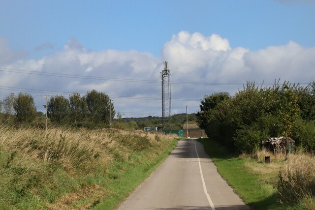
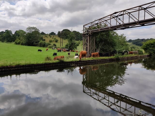
Farsley Beck Bottom is a scenic valley located in Yorkshire, England. Nestled between the towns of Farsley and Rodley, the valley is known for its natural beauty and tranquil atmosphere. The valley is formed by the Farsley Beck, a small stream that meanders through the lush green landscape, creating a picturesque setting.

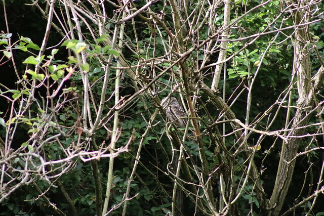
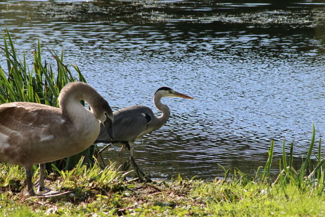
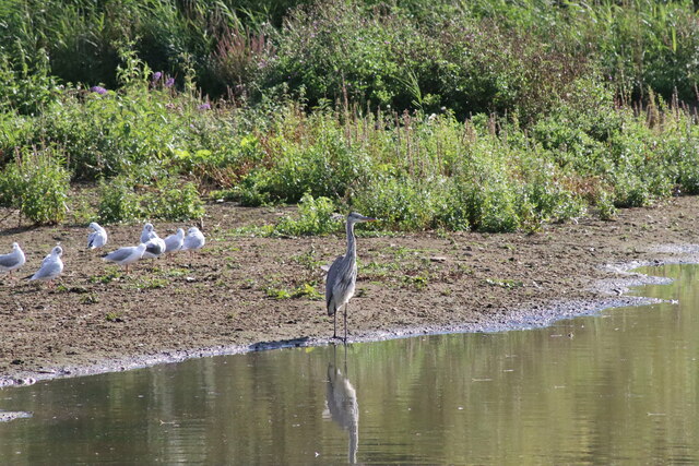
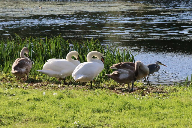
Surrounded by rolling hills and dense woodlands, Farsley Beck Bottom offers a peaceful retreat for nature lovers and outdoor enthusiasts. The valley is home to a variety of wildlife, including birds, small mammals, and amphibians, making it a popular spot for birdwatching and wildlife observation.

The valley is also a haven for hikers and walkers, with numerous trails and footpaths crisscrossing the area. These scenic routes allow visitors to explore the valley's diverse flora and fauna, as well as enjoy breathtaking views of the surrounding countryside.

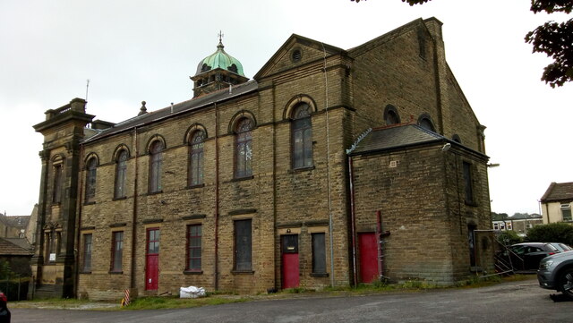
In addition to its natural attractions, Farsley Beck Bottom is rich in history and heritage. The valley has been inhabited since ancient times, and traces of its past can still be seen in the form of old mills and ruins scattered throughout the area. These remnants serve as a reminder of the valley's industrial past, as it was once a thriving hub for textile production.

Overall, Farsley Beck Bottom is a hidden gem in Yorkshire, offering a peaceful escape from the hustle and bustle of everyday life. With its stunning scenery, abundant wildlife, and rich history, it is a must-visit destination for anyone seeking tranquility and natural beauty.

If you have any feedback on the listing, please let us know in the comments section below.

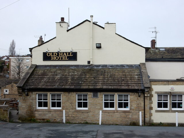
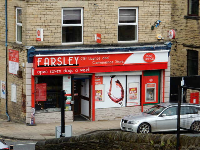
Farsley Beck Bottom Images

Images are sourced within 2km of 53.813906/-1.6626627 or Grid Reference SE2235. Thanks to Geograph Open Source API. All images are credited.

Communications Mast at Rodley Nature Reserve Looking down the entrance road heading in to Rodley Nature Reserve towards the Yorkshire Water Works at the far end. This mast carries the EE and Three mobile networks. Photograph taken on 29/09/2021.
Communications Mast at Rodley Nature Reserve
Looking down the entrance road heading in to Rodley Nature Reserve towards the Yorkshire Water Works at the far end. This mast carries the EE and Three mobile networks. Photograph taken on 29/09/2021.
Little Owl Hiding Amongst the Trees at Rodley Nature Reserve A Little Owl observed hiding amongst the trees near the Manager's Hide at Rodley Nature Reserve. Photograph taken on 29/09/2021.
Little Owl Hiding Amongst the Trees at Rodley Nature Reserve
A Little Owl observed hiding amongst the trees near the Manager's Hide at Rodley Nature Reserve. Photograph taken on 29/09/2021.
Heron and Swan Cygnet at Rodley Nature Reserve A Heron and a Swan Cygnet together at Rodley Nature Reserve. Photograph taken on 29/09/2021.
Heron and Swan Cygnet at Rodley Nature Reserve
A Heron and a Swan Cygnet together at Rodley Nature Reserve. Photograph taken on 29/09/2021.
Heron Looking Over the Water at Rodley Nature Reserve A Heron stands looking out over the lake at Rodley Nature Reserve. Photograph taken on 29/09/2021.
Heron Looking Over the Water at Rodley Nature Reserve
A Heron stands looking out over the lake at Rodley Nature Reserve. Photograph taken on 29/09/2021.
A Heron and Swans at Rodley Nature Reserve A Heron and some Swans at Rodley Nature Reserve. Photograph taken on 29/09/2021.
A Heron and Swans at Rodley Nature Reserve
A Heron and some Swans at Rodley Nature Reserve. Photograph taken on 29/09/2021.
Lloyds Banking Group Pudsey Office near Dawsons Corner, Farsley The outside of the Lloyds Banking Group office near Dawsons Corner, Farsley. Previously the building belonged to the Leeds Permanent Building Society and then the Halifax Building Society. The building is reported to be closing down later in 2021. Photograph taken on 26/09/2021.
Lloyds Banking Group Pudsey Office near Dawsons Corner, Farsley
The outside of the Lloyds Banking Group office near Dawsons Corner, Farsley. Previously the building belonged to the Leeds Permanent Building Society and then the Halifax Building Society. The building is reported to be closing down later in 2021. Photograph taken on 26/09/2021.
Cows Beside the Leeds and Liverpool Canal near Rodley Some Cows grazing in a field beside the Leeds and Liverpool Canal near Rodley, Leeds. Photograph taken on 25/07/2021.
Cows Beside the Leeds and Liverpool Canal near Rodley
Some Cows grazing in a field beside the Leeds and Liverpool Canal near Rodley, Leeds. Photograph taken on 25/07/2021.
Former Trinity Methodist Church, Pudsey A view of the east side and rear from Mount Pleasant Heights. Grade II Listed c1899.
Former Trinity Methodist Church, Pudsey
A view of the east side and rear from Mount Pleasant Heights. Grade II Listed c1899.
The A647 Leeds Ring Road / Stanningley Bypass at Pudsey Viewed from Richardshaw Lane bridge.
The A647 Leeds Ring Road / Stanningley Bypass at Pudsey
Viewed from Richardshaw Lane bridge.
Richmond House Care Home, Farsley A view taken from Richmond Road looking towards Richmond House Care Home in Farsley. Photograph taken on 04/02/2018.
Richmond House Care Home, Farsley
A view taken from Richmond Road looking towards Richmond House Care Home in Farsley. Photograph taken on 04/02/2018.
Richmond Road, Farsley A view taken next to Richmond Road Care Home looking down Richmond Road. Photograph taken on 04/02/2018.
Richmond Road, Farsley
A view taken next to Richmond Road Care Home looking down Richmond Road. Photograph taken on 04/02/2018.
Co-Op Academy Priesthorpe, Farsley A view of Co-Op Academy Priesthorpe (formerly known as Priesthorpe High School) taken from the foot bridge over the A6120 Ring Road. Photograph taken on 04/02/2018.
Co-Op Academy Priesthorpe, Farsley
A view of Co-Op Academy Priesthorpe (formerly known as Priesthorpe High School) taken from the foot bridge over the A6120 Ring Road. Photograph taken on 04/02/2018.
Co-Op Academy Priesthorpe, Farsley The front of the Co-Op Academy Priesthorpe buildings and car park area. Photograph taken on 04/02/2018.
Co-Op Academy Priesthorpe, Farsley
The front of the Co-Op Academy Priesthorpe buildings and car park area. Photograph taken on 04/02/2018.
Pudsey Civic Hall Car Park, Farsley A view looking across Pudsey Civic Hall Car Park. Richmond Road and the Lloyds Banking Group Pudsey office are visible in the distance. Photograph taken on 04/02/2018.
Pudsey Civic Hall Car Park, Farsley
A view looking across Pudsey Civic Hall Car Park. Richmond Road and the Lloyds Banking Group Pudsey office are visible in the distance. Photograph taken on 04/02/2018.
The Old Hall Hotel, Farsley The Old Hall Hotel, Farsley. Photograph taken on 08/04/2018.
The Old Hall Hotel, Farsley
The Old Hall Hotel, Farsley. Photograph taken on 08/04/2018.
The Old Hall Hotel, Farsley The Old Hall Hotel, Farsley. Photograph taken on 08/04/2018.
The Old Hall Hotel, Farsley
The Old Hall Hotel, Farsley. Photograph taken on 08/04/2018.
Farsley Post Office Photograph showing the front of Farsley Post Office and Convenience Store. Photograph taken on 08/04/2018.
Farsley Post Office
Photograph showing the front of Farsley Post Office and Convenience Store. Photograph taken on 08/04/2018.
Show me another place!

Farsley Beck Bottom is located at Grid Ref: SE2235 (Lat: 53.813906, Lng: -1.6626627)

Division: West Riding

Unitary Authority: Leeds

Police Authority: West Yorkshire

What 3 Words

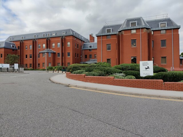
///pest.pinks.porch. Near Pudsey, West Yorkshire

Related Wikis

Bagley, West Yorkshire

Bagley is a village in the City of Leeds metropolitan borough, West Yorkshire, England, once in the township of Farsley. The remains of the village (or...

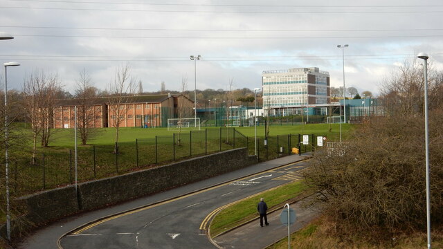
The Citadel (Farsley)

The Citadel, previously known as Throstle Nest, is a football ground situated in Farsley, in the Metropolitan District of the City of Leeds in England...

Sunny Bank Mills

Sunny Bank Mills is a former textile mill, which specialised in worsted cloth, set in 10 acres of land located on Town Street, Farsley, Leeds, England...
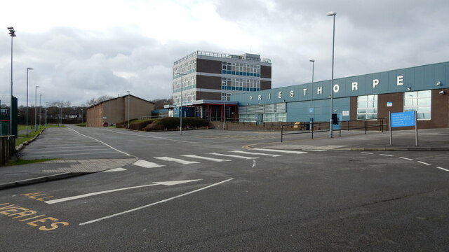
Leeds West Academy

Leeds West Academy is a secondary school with academy status in Rodley, Leeds, West Yorkshire, England. It is well known for specialising its area of education...

Farsley

Farsley is a town in the City of Leeds metropolitan borough, West Yorkshire, England, 6 miles (9.7 km) to the west of Leeds city centre, 4 miles (6.4 km...

Stanningley

Stanningley is a district of Pudsey, West Yorkshire, England. It is situated approximately 5 miles (8 km) west of Leeds city centre on the A647 road, the...

AW Hainsworth

AW Hainsworth & Sons, Ltd., formerly known as Abimelech Hainsworth are an English textile manufacturing company based in Pudsey, West Yorkshire. They are...

Rodley, West Yorkshire

Rodley is a suburb in the City of Leeds metropolitan borough, West Yorkshire, England. The village is situated within the Calverley and Farsley ward of...

Nearby Amenities

Located within 500m of 53.813906,-1.6626627
Farsley
Is In: Leeds, West Yorkshire, United Kingdom
Place: town
Wikidata: Q5436438
Wikipedia: en:Farsley
Lat/Long: 53.8143915/-1.6697743
Traffic Calming: table
Lat/Long: 53.8127166/-1.6684286
Traffic Calming: cushion
Lat/Long: 53.8127858/-1.6669017
Traffic Calming: table
Lat/Long: 53.8145132/-1.6645435
Post Box
Operator: Royal Mail
Post Box Type: pillar
Ref: LS13 974
Lat/Long: 53.8139836/-1.6592374
Bus Stop
Intake Lane Coal Hill Lane
Local Ref: 45012334
Naptan AtcoCode: 450012334
Naptan Bearing: SE
Naptan CommonName: Intake Lane Coal Hill Lane
Naptan Crossing: Coal Hill Lane
Naptan Indicator: Stop 45012334
Naptan PlusbusZoneRef: LEEDS
Naptan ShortCommonName: Coal Hill Lane
Naptan Street: Intake Lane
Naptan Verified: no
Source: naptan_import
Lat/Long: 53.815319/-1.6559046
Bus Stop
Intake Lane Coal Hill Lane
Local Ref: 45012336
Naptan AtcoCode: 450012336
Naptan Bearing: NW
Naptan CommonName: Intake Lane Coal Hill Lane
Naptan Crossing: Coal Hill Lane
Naptan Indicator: Stop 45012336
Naptan PlusbusZoneRef: LEEDS
Naptan ShortCommonName: Coal Hill Lane
Naptan Street: Intake Lane
Naptan Verified: no
Source: naptan_import
Lat/Long: 53.8153466/-1.6561322
Bus Stop
Bagley Lane Springbank Road
Bench: yes
Local Ref: 45012337
Naptan AtcoCode: 450012337
Naptan Bearing: W
Naptan CommonName: Bagley Lane Springbank Road
Naptan Crossing: Springbank Road
Naptan Indicator: Stop 45012337
Naptan PlusbusZoneRef: LEEDS
Naptan ShortCommonName: Springbank Road
Naptan Street: Bagley Lane
Naptan Verified: no
Shelter: yes
Source: naptan_import
Tactile Paving: no
Lat/Long: 53.8163797/-1.6654649
Bus Stop
Coal Hill Lane Intake Lane
Bench: yes
Local Ref: 45012390
Naptan AtcoCode: 450012390
Naptan Bearing: NE
Naptan CommonName: Coal Hill Lane Intake Lane
Naptan Crossing: Intake Lane
Naptan Indicator: Stop 45012390
Naptan PlusbusZoneRef: LEEDS
Naptan ShortCommonName: Intake Lane
Naptan Street: Coal Hill Lane
Naptan Verified: no
Shelter: yes
Source: naptan_import
Tactile Paving: no
Lat/Long: 53.8157145/-1.6559165
Bus Stop
Coal Hill Lane Bagley Lane
Bench: no
Local Ref: 45012391
Naptan AtcoCode: 450012391
Naptan Bearing: SE
Naptan CommonName: Coal Hill Lane Bagley Lane
Naptan Crossing: Bagley Lane
Naptan Indicator: Stop 45012391
Naptan PlusbusZoneRef: LEEDS
Naptan ShortCommonName: Bagley Lane
Naptan Street: Coal Hill Lane
Naptan Verified: no
Shelter: yes
Source: naptan_import
Tactile Paving: no
Lat/Long: 53.8154514/-1.6613562
Bus Stop
Coal Hill Lane Farsley
Local Ref: 45012392
Naptan AtcoCode: 450012392
Naptan Bearing: NW
Naptan CommonName: Coal Hill Lane Farsley
Naptan Crossing: Nr-At Bagley Lane
Naptan Indicator: Stop 45012392
Naptan PlusbusZoneRef: LEEDS
Naptan ShortCommonName: Broom Mills
Naptan Street: Coal Hill Lane
Naptan Verified: no
Source: naptan_import
Lat/Long: 53.8153438/-1.6614634
Bus Stop
Bagley Lane Springbank Road
Local Ref: 45012393
Naptan AtcoCode: 450012393
Naptan Bearing: E
Naptan CommonName: Bagley Lane Springbank Road
Naptan Crossing: Springbank Grove
Naptan Indicator: Stop 45012393
Naptan PlusbusZoneRef: LEEDS
Naptan ShortCommonName: Springbank Road
Naptan Street: Bagley Lane
Naptan Verified: no
Source: naptan_import
Lat/Long: 53.8164962/-1.6653273
Bus Stop
Bagley Lane
Bench: no
Bin: no
Local Ref: 45024099
Naptan AtcoCode: 450024099
Naptan Bearing: S
Naptan CommonName: Bagley Lane
Naptan Crossing: Mary Street
Naptan Indicator: Stop 45024099
Naptan PlusbusZoneRef: LEEDS
Naptan ShortCommonName: Mary Street
Naptan Street: Bagley Lane
Naptan Verified: no
Shelter: no
Source: naptan_import
Tactile Paving: no
Lat/Long: 53.8175075/-1.6637851
Bus Stop
Coal Hill Lane Intake Lane
Bench: no
Local Ref: 45025180
Naptan AtcoCode: 450025180
Naptan Bearing: SW
Naptan CommonName: Coal Hill Lane Intake Lane
Naptan Crossing: Intake Lane
Naptan Indicator: Stop 45025180
Naptan PlusbusZoneRef: LEEDS
Naptan ShortCommonName: Intake Lane
Naptan Street: Coal Hill Lane
Naptan Verified: no
Shelter: no
Source: naptan_import
Tactile Paving: no
Lat/Long: 53.8156602/-1.6557803
Power: substation
Lat/Long: 53.8151418/-1.6621586
Post Box
Collection Times: Mo-Fr 09:00, Sa 07:00
Operator: Royal Mail
Post Box Type: wall
Ref: LS28 721
Royal Cypher: EIIR
Royal Cypher Wikidata: Q33102113
Lat/Long: 53.8167576/-1.663815
Turning Circle
Lat/Long: 53.813125/-1.6569397
Turning Circle
Lat/Long: 53.810484/-1.6590169
Turning Circle
Lat/Long: 53.8102781/-1.6597879
Turning Circle
Lat/Long: 53.8110398/-1.6609911
Turning Circle
Lat/Long: 53.8163874/-1.6688199
Turning Circle
Lat/Long: 53.8173717/-1.6667471
Traffic Calming: cushion
Lat/Long: 53.8117916/-1.6680177
Traffic Calming: table
Lat/Long: 53.8111409/-1.6667633
Traffic Calming: table
Lat/Long: 53.814559/-1.6644696
Traffic Calming: cushion
Lat/Long: 53.8115793/-1.6638577
Traffic Calming: cushion
Lat/Long: 53.8121763/-1.6627855
Turning Circle
Lat/Long: 53.8135056/-1.6641452
Traffic Calming: cushion
Lat/Long: 53.8130328/-1.6623524
Traffic Calming: cushion
Lat/Long: 53.8111983/-1.6650502
Turning Circle
Lat/Long: 53.8102922/-1.6661263
Turning Circle
Burton Street
Lat/Long: 53.811169/-1.6686569
Kerb: raised
Lat/Long: 53.8114576/-1.667618
Noexit: yes
Lat/Long: 53.8106408/-1.6618949
Traffic Calming: cushion
Lat/Long: 53.8128956/-1.6655309
Traffic Calming: cushion
Lat/Long: 53.8133708/-1.6663882
Traffic Calming: cushion
Lat/Long: 53.8136051/-1.6653077
Traffic Calming: cushion
Lat/Long: 53.8138853/-1.6632848
Traffic Calming: cushion
Lat/Long: 53.8144394/-1.666504
Traffic Calming: cushion
Lat/Long: 53.8151097/-1.6665784
Traffic Calming: cushion
Lat/Long: 53.8154394/-1.6638438
Traffic Calming: cushion
Lat/Long: 53.8157007/-1.6665912
Traffic Calming: cushion
Lat/Long: 53.8160161/-1.6641856
Traffic Calming: cushion
Lat/Long: 53.8160315/-1.6652123
Arts Centre
The Rainbow Factory
Addr City: Pudsey
Addr Housename: Springfield Commercial Centre
Addr Postcode: LS28 5LY
Addr Street: Bagley Lane
Addr Suburb: Farsley
Addr Unit: 13c
Fhrs Id: 785915
Lat/Long: 53.8173697/-1.6660696
Cafe
The Loft Coffee Shop
Addr City: Pudsey
Addr Housename: Springfield Commercial Centre
Addr Postcode: LS28 5LY
Addr Street: Bagley Lane
Addr Suburb: Farsley
Addr Unit: 13A
Fhrs Id: 1034335
Website: https://theloftcoffeeshop.co.uk/
Lat/Long: 53.8174013/-1.6656619
Kindergarten
Childrens Corner Farsley
Addr City: Pudsey
Addr Postcode: LS28 5LE
Addr Street: Wesley Street
Addr Suburb: Farsley
Fhrs Id: 321453
Lat/Long: 53.8131167/-1.6692084
Kindergarten
Childrens Corner
Addr City: Leeds
Addr Housename: Valley View Community Primary School
Addr Postcode: LS13 1DD
Addr Street: Coal Hill Drive
Addr Suburb: Rodley
Fhrs Id: 974969
Lat/Long: 53.8162577/-1.6583508
Breakfast Club
Addr City: Leeds
Addr Housename: Valley View Community Primary School
Addr Postcode: LS13 1DD
Addr Street: Coal Hill Drive
Addr Suburb: Rodley
Craft: caterer
Fhrs Id: 559045
Lat/Long: 53.816226/-1.65856
Get Cooking CIC
Addr City: Pudsey
Addr Housename: Springfield Commercial Centre
Addr Postcode: LS28 5LY
Addr Street: Bagley Lane
Addr Suburb: Farsley
Addr Unit: 43a
Fhrs Id: 1073702
Lat/Long: 53.8171919/-1.6660112
Tarte And Berry
Addr City: Pudsey
Addr Housename: Springfield Commercial Centre
Addr Postcode: LS28 5LY
Addr Street: Bagley Lane
Addr Suburb: Farsley
Addr Unit: 23
Shop: pastry
Lat/Long: 53.8172173/-1.6656572
Waste Basket
Collection Times: Tu; Th
Condition: GOOD
Ref UK Leedscc Bin: 5796
Waste Basket Model: METAL SQUARE
Lat/Long: 53.815854/-1.657276
Waste Basket
Collection Times: Tu; Th
Condition: FAIR
Ref UK Leedscc Bin: 5030
Waste Basket Model: METAL TWIN
Lat/Long: 53.815328/-1.655672
Waste Basket
Collection Times: Su
Ref UK Leedscc Bin: 154
Lat/Long: 53.816591/-1.664931
Waste Basket
Collection Times: Su
Ref UK Leedscc Bin: 155
Lat/Long: 53.816382/-1.665268
Crossing
Crossing: uncontrolled
Crossing Island: no
Crossing Ref: zebra
Kerb: lowered
Supervised: no
Tactile Paving: yes
Lat/Long: 53.8154184/-1.657062
Generator Method: photovoltaic
Generator Output Electricity: small_installation
Generator Source: solar
Generator Type: solar_photovoltaic_panel
Location: roof
Power: generator
Lat/Long: 53.8126241/-1.6640787
Generator Method: photovoltaic
Generator Output Electricity: small_installation
Generator Source: solar
Generator Type: solar_photovoltaic_panel
Location: roof
Power: generator
Lat/Long: 53.8114942/-1.663042
Generator Method: photovoltaic
Generator Output Electricity: small_installation
Generator Source: solar
Generator Type: solar_photovoltaic_panel
Location: roof
Power: generator
Lat/Long: 53.810641/-1.6662218
Generator Method: photovoltaic
Generator Output Electricity: small_installation
Generator Source: solar
Generator Type: solar_photovoltaic_panel
Location: roof
Power: generator
Lat/Long: 53.8104109/-1.6667428
The data included in this document is from www.openstreetmap.org. The data is made available under ODbL.

Have you been to Farsley Beck Bottom?

Leave your review of Farsley Beck Bottom below (or comments, questions and feedback).