Pears House Clough

Valley in Yorkshire

England

Pears House Clough

Approaching "Strines Inn"
Approaching "Strines Inn" Credit: Neil Theasby

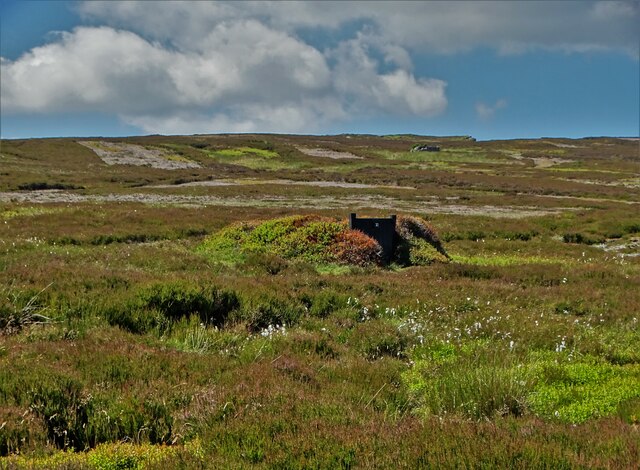
Pears House Clough is a picturesque valley located in Yorkshire, England. Situated amidst the stunning landscape of the Yorkshire Dales, this idyllic spot offers visitors a tranquil and serene escape from the hustle and bustle of city life.

The valley is characterized by its rolling hills, lush green fields, and meandering streams. Pears House Clough is named after the charming stone house that stands at the heart of the valley. The house, which dates back to the 18th century, serves as a reminder of the area's rich history and heritage.

Surrounded by breathtaking natural beauty, Pears House Clough offers a range of outdoor activities for nature enthusiasts. Hiking trails wind their way through the valley, providing visitors with opportunities to explore the diverse flora and fauna that call this place home. The valley is also a popular spot for birdwatching, with many species of birds making their nests in the surrounding trees.

For those seeking a more leisurely experience, Pears House Clough offers numerous picnic spots where visitors can relax and enjoy a meal amidst the stunning scenery. The valley is also home to a variety of wildlife, including rabbits, squirrels, and deer, making it a haven for animal lovers and wildlife photographers.

Pears House Clough truly embodies the beauty and tranquility of the Yorkshire countryside. Whether you're seeking adventure or simply looking to unwind in nature's embrace, this charming valley promises an unforgettable experience for all who visit.

If you have any feedback on the listing, please let us know in the comments section below.

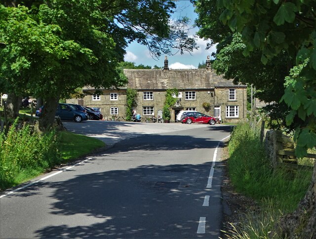
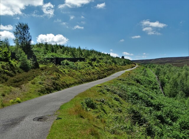
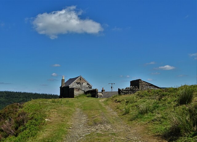
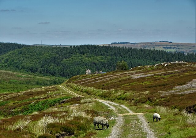
Pears House Clough Images

Images are sourced within 2km of 53.404766/-1.6651532 or Grid Reference SK2289. Thanks to Geograph Open Source API. All images are credited.

Approaching "Strines Inn"
Foulstone Road It leads to Foulstone Delf and Derwent Moors. The area is under the control of Fitzwilliam Wentworth Estates - mostly for the purposes of grouse shooting.
Foulstone Road
It leads to Foulstone Delf and Derwent Moors. The area is under the control of Fitzwilliam Wentworth Estates - mostly for the purposes of grouse shooting.
Summer cloud over Foulstone Delf This moorland property is part of the Fitzwilliam-Wentworth Estates and is almost certainly connected with grouse shooting and rearing of game birds.
Summer cloud over Foulstone Delf
This moorland property is part of the Fitzwilliam-Wentworth Estates and is almost certainly connected with grouse shooting and rearing of game birds.
Looking back along Foulstone Road To Foulstone Delf - the property to the right of the track
Looking back along Foulstone Road
To Foulstone Delf - the property to the right of the track
Grouse butt No.10 on Foulstone Moor From here, during the shooting season, men with shotguns blast grouse out of the sky. They call it sport.
Grouse butt No.10 on Foulstone Moor
From here, during the shooting season, men with shotguns blast grouse out of the sky. They call it sport.
Entrance to "The Strines Inn" "The building that now houses The Strines Inn was originally a manor house built in 1275. Over the years it was extended and eventually converted into an inn in 1771." - copied from the pub's website.
Entrance to "The Strines Inn"
"The building that now houses The Strines Inn was originally a manor house built in 1275. Over the years it was extended and eventually converted into an inn in 1771." - copied from the pub's website.
View to Dale Dike Reservoir from West Shaw Lane
Sheffield Country Walk Heading up the dale through land which used to be farmed.
Sheffield Country Walk
Heading up the dale through land which used to be farmed.
Andrew Wood A strip of woodland up the southern side of Bradfield Dale, but it is not very dense.
Andrew Wood
A strip of woodland up the southern side of Bradfield Dale, but it is not very dense.
Dale Dike Reservoir The water level is very low, leaving a lot of the upper reaches bone dry.
Dale Dike Reservoir
The water level is very low, leaving a lot of the upper reaches bone dry.
Path by Dale Dike Reservoir Following the northern side of the reservoir. The water level is very low.
Path by Dale Dike Reservoir
Following the northern side of the reservoir. The water level is very low.
Dale Dike Reservoir The water is at a very low level.
Dale Dike Reservoir
The water is at a very low level.
Horse stone The Mortimer Road Turnpike first enacted in 1771, renewed 1792, failed by 1813.   Named after Hans Winthrop Mortimer, Lord of the Manor of Bamford.   It failed because it didn't make any money and didn't become an important route.   But it was very hilly!   Extra horses were needed and had to be paid for to help carts and carriages up very steep hills, so a stone such as this 'Take off' was placed at the top.   This one is about 30m north of the 16thC Strines Inn which is 1015ft above sea level.  
The stone is Grade II listed 1203771.
Horse stone
The Mortimer Road Turnpike first enacted in 1771, renewed 1792, failed by 1813. Named after Hans Winthrop Mortimer, Lord of the Manor of Bamford. It failed because it didn't make any money and didn't become an important route. But it was very hilly! Extra horses were needed and had to be paid for to help carts and carriages up very steep hills, so a stone such as this 'Take off' was placed at the top. This one is about 30m north of the 16thC Strines Inn which is 1015ft above sea level. The stone is Grade II listed 1203771.
Horse stone Standing away from the 'Take off' stone near The Strines Inn, its position near a telegraph pole on the east side of Mortimer Road can be seen.  The story of this road can be read in 'The Mortimer Road' by Howard Smith. ISBN 978-1-5272-3446-8.
Horse stone
Standing away from the 'Take off' stone near The Strines Inn, its position near a telegraph pole on the east side of Mortimer Road can be seen. The story of this road can be read in 'The Mortimer Road' by Howard Smith. ISBN 978-1-5272-3446-8.
Grouse butt Number 1, Holling Dale Plantation When I first saw this land there was a large conifer plantation but now the trees have gone it's a  bit of a wasteland fit only for grouse shooters.
Grouse butt Number 1, Holling Dale Plantation
When I first saw this land there was a large conifer plantation but now the trees have gone it's a bit of a wasteland fit only for grouse shooters.
The Strines Inn Pictured on a superb midweek afternoon in mid April.
The Strines Inn
Pictured on a superb midweek afternoon in mid April.
Brogging (disused)
Brogging (disused)
Strines Reservoir Strines Reservoir with the valley of the stream,  Dales Dike beyond as seen from the minor road crossing Strines Moor.
Strines Reservoir
Strines Reservoir with the valley of the stream, Dales Dike beyond as seen from the minor road crossing Strines Moor.
Show me another place!

Pears House Clough is located at Grid Ref: SK2289 (Lat: 53.404766, Lng: -1.6651532)

Division: West Riding

Unitary Authority: Sheffield

Police Authority: South Yorkshire

What 3 Words

///strict.slim.phones. Near Bradfield, South Yorkshire

Nearby Locations

Pears House Clough

Related Wikis

Strines Reservoir

Strines Reservoir is a water storage reservoir situated at 53.4099°N 1.6557°W / 53.4099; -1.6557 (Strines_Reservoir), 8 miles (13 km) west of the centre...

Sugworth Hall

Sugworth Hall is an English country house on Sugworth Road in Bradfield Dale, near Sheffield, England. It is situated approximately 8 miles (13 km) west...

Moscar Cross

Moscar Cross is the name of a standing stone (or "guide stoop") and surrounding area in the Peak District on the border between Derbyshire and Sheffield...

Hallfield House

Hallfield House is a Grade II listed building situated in Bradfield Dale, 1.7 miles (2.74 km) west of the village of Low Bradfield, near Sheffield in England...

Nearby Amenities

Located within 500m of 53.404766,-1.6651532
Bents House
Place: isolated_dwelling
Lat/Long: 53.4020139/-1.6596663
Broad Carr
Place: locality
Lat/Long: 53.4072211/-1.6627613
Pears House Clough
Place: locality
Lat/Long: 53.405382/-1.6627257
Pears House
Historic Place: isolated_dwelling
Lat/Long: 53.4061868/-1.6651395
Parking
Lat/Long: 53.4021196/-1.6695837
Power: pole
Lat/Long: 53.4053928/-1.6588924
Power: pole
Lat/Long: 53.4039363/-1.6618329
Power: pole
Lat/Long: 53.4027854/-1.6621744
Power: pole
Lat/Long: 53.4016601/-1.6624931
Power: pole
Lat/Long: 53.4008075/-1.6624872
Power: pole
Lat/Long: 53.4015625/-1.6622922
Power: pole
Lat/Long: 53.4023125/-1.6620774
Power: pole
Lat/Long: 53.4027199/-1.6601744
Power: pole
Lat/Long: 53.4045974/-1.6604982
The data included in this document is from www.openstreetmap.org. The data is made available under ODbL.

Have you been to Pears House Clough?

Leave your review of Pears House Clough below (or comments, questions and feedback).