Intake

Settlement in Yorkshire

England

Intake

Brick effect box, Landseer Road A recent addition to the Bramley Tate outdoor gallery.
Brick effect box, Landseer Road Credit: Stephen Craven

Intake is a small village located in the metropolitan borough of Doncaster, South Yorkshire, England. Situated approximately 6 miles northeast of the town center, it is a predominantly residential area with a population of around 6,000 people.

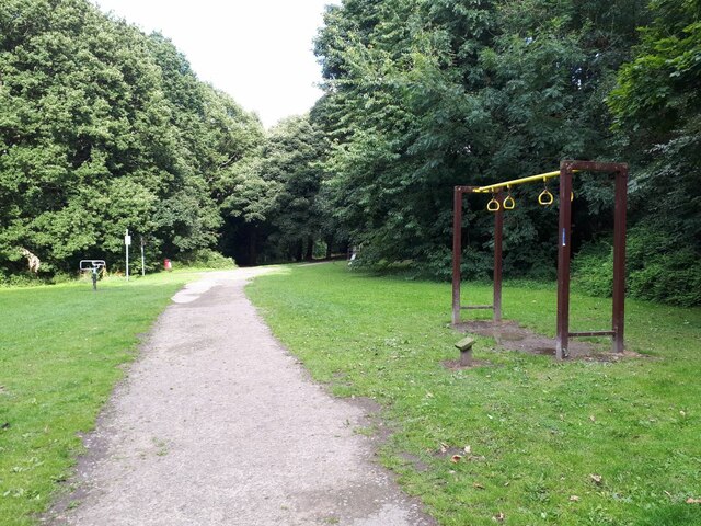
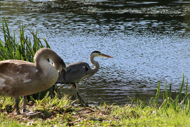
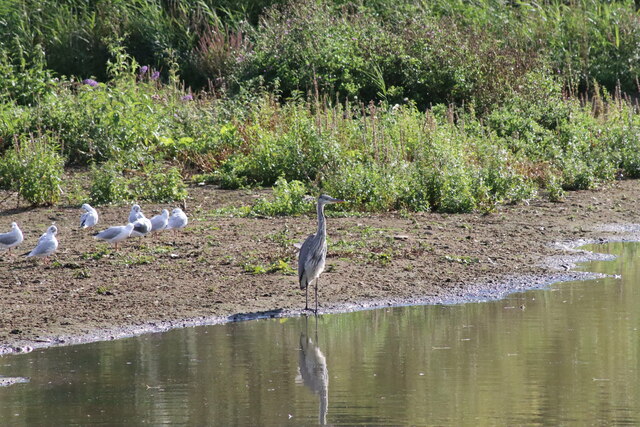
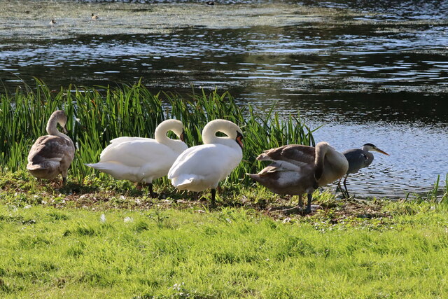
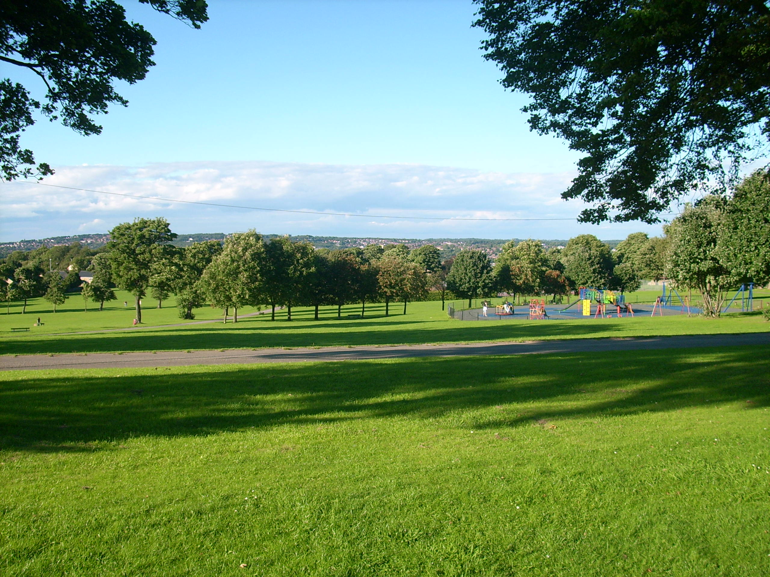
The village is known for its peaceful and close-knit community, offering residents a quiet and picturesque setting. Intake is surrounded by beautiful countryside, providing ample opportunities for outdoor activities such as hiking and cycling. The nearby Intake Quarry Nature Reserve offers a tranquil escape for nature lovers, with its diverse flora and fauna.

In terms of amenities, Intake provides various facilities to cater to the needs of its residents. There are several local shops and convenience stores, ensuring easy access to everyday essentials. The village also has a primary school, making it an attractive location for families with young children.

Transportation in Intake is well-connected, with regular bus services linking the village to nearby towns and cities. The A630 road runs through the area, providing easy access to the wider road network.

Overall, Intake offers a peaceful and scenic setting, ideal for those seeking a quiet village lifestyle. Its close proximity to Doncaster ensures residents can easily access the amenities and opportunities of a larger town while enjoying the tranquility of rural living.

If you have any feedback on the listing, please let us know in the comments section below.
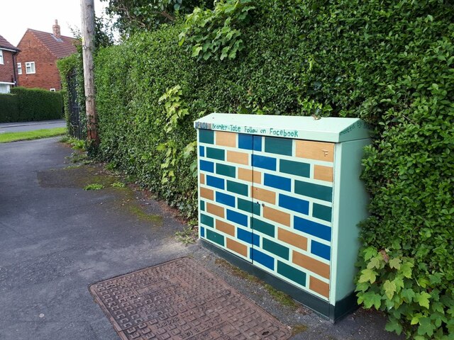
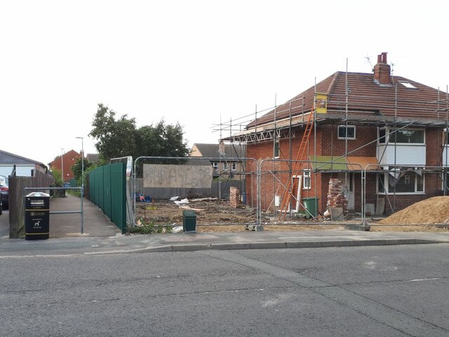
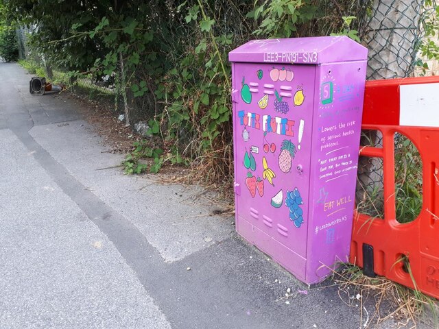
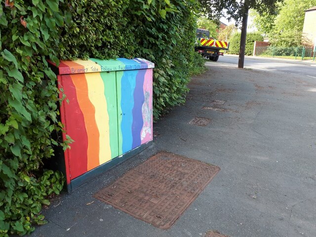
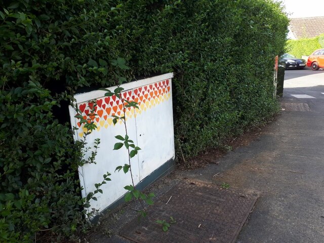
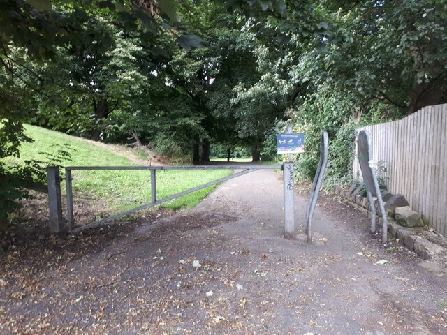
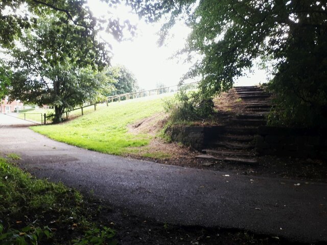
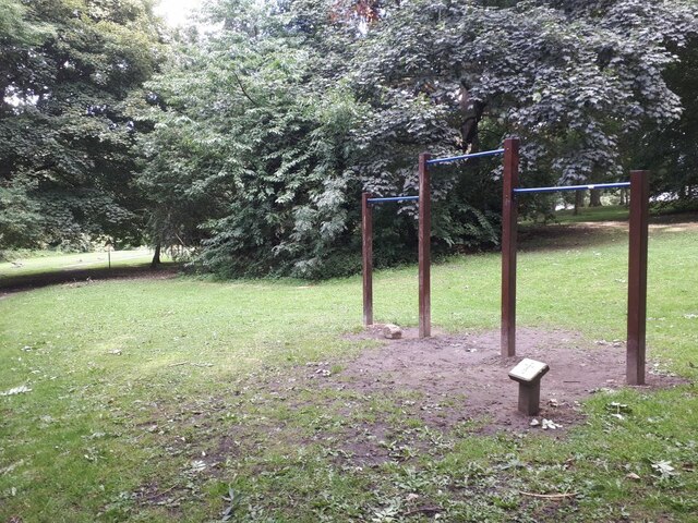
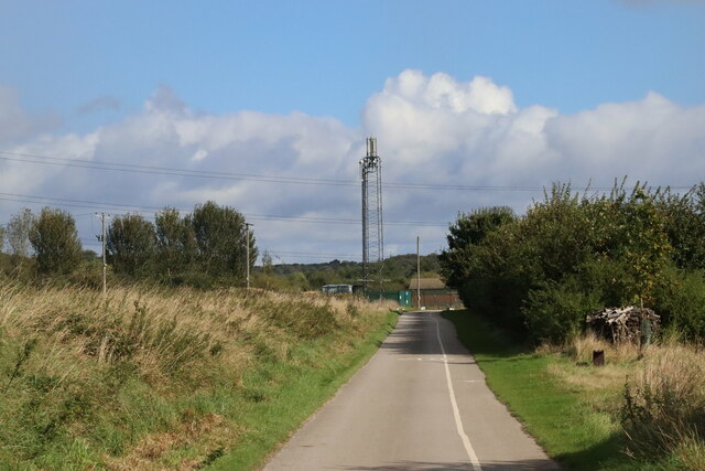
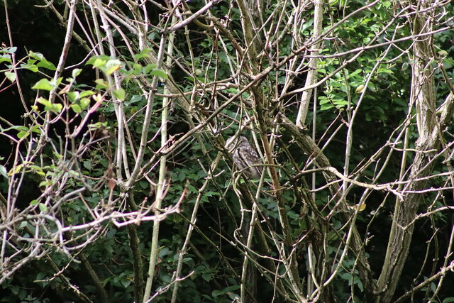
Intake Images

Images are sourced within 2km of 53.815279/-1.653368 or Grid Reference SE2235. Thanks to Geograph Open Source API. All images are credited.

Brick effect box, Landseer Road A recent addition to the Bramley Tate outdoor gallery.
Brick effect box, Landseer Road
A recent addition to the Bramley Tate outdoor gallery.
Sold: one garage The householder on Waterloo Lane is having an extension built, and there was a sign on the fence saying "Garage for sale". Obviously they found a buyer, as only the garage door and concrete floor slab panels remained, stacked against the side fence.

To the left is a path cutting through to Wellington Gardens <a href="https://www.geograph.org.uk/photo/4775123">SE2435 : Footpath from Waterloo Lane to Wellington Gardens</a>.
Sold: one garage
The householder on Waterloo Lane is having an extension built, and there was a sign on the fence saying "Garage for sale". Obviously they found a buyer, as only the garage door and concrete floor slab panels remained, stacked against the side fence. To the left is a path cutting through to Wellington Gardens SE2435 : Footpath from Waterloo Lane to Wellington Gardens.
Tutti Frutti A recent addition, I think, to the painted boxes in this area.  I've included it in the shared description for Bramley Tate but this one is credited to "Leeds West Rocks" which may be a different group of people. The artwork is to encourage healthy eating.
Tutti Frutti
A recent addition, I think, to the painted boxes in this area. I've included it in the shared description for Bramley Tate but this one is credited to "Leeds West Rocks" which may be a different group of people. The artwork is to encourage healthy eating.
Rainbow box A recent addition, I think, to the painted boxes in this area by Bramley Tate. This one is on the corner of Ganners Hill and Wellington Grove.
Rainbow box
A recent addition, I think, to the painted boxes in this area by Bramley Tate. This one is on the corner of Ganners Hill and Wellington Grove.
Box with coloured hearts A recent addition, I think, to the painted boxes in this area by Bramley Tate. This one is on the corner of Ganners Hill and Ganners Road.
Box with coloured hearts
A recent addition, I think, to the painted boxes in this area by Bramley Tate. This one is on the corner of Ganners Hill and Ganners Road.
Entrance to Bramley Fall woods  This entrance is off Leeds and Bradford Road, just east of the football pitches.
Entrance to Bramley Fall woods
This entrance is off Leeds and Bradford Road, just east of the football pitches.
Steps out of Bramley Fall woods  There was a deep contrast between the sunlit playing fields to the left, and the shade of the woods.  The steps are also seen in <a href="https://www.geograph.org.uk/photo/3477659">SE2436 : Steps - Bramley Fall Park</a>.
Steps out of Bramley Fall woods
There was a deep contrast between the sunlit playing fields to the left, and the shade of the woods. The steps are also seen in SE2436 : Steps - Bramley Fall Park.
Bramley Fall exercise trail: horizontal bars  One of several fitness stations around a trail through the wood. I presume these are for swinging by the arms.
Bramley Fall exercise trail: horizontal bars
One of several fitness stations around a trail through the wood. I presume these are for swinging by the arms.
Bramley Fall exercise trail: strap hangers One of several fitness stations around a trail through the wood. These look like essential training equipment for would-be London commuters.
Bramley Fall exercise trail: strap hangers
One of several fitness stations around a trail through the wood. These look like essential training equipment for would-be London commuters.
Rugby pitches at Bramley Fall
Collapsed weir on the River Aire at Newlay Newlay Weir collapsed in early February 2021, during a period of very high river levels caused by recent heavy rain and snow.
The first pictures appeared locally on social media on 4th February, where you could see that water was lower in the centre of the weir. By 9th February, a large section had collapsed, leaving the river level at least a metre below the top of the weir. The water was flowing through a gap between 5 and 10 metres wide. The altered flow has washed away some of the bank just downstream, causing a large tree to fall into the water. It was also reported that contractors working on construction of the fish pass lost some equipment into the river.
The river under Newlay Bridge is now a metre lower than normal summer levels, leaving parts of the banks exposed which are normally under water.
The weir is a Grade II Listed structure (see English Heritage <span class="nowrap"><a title="https://historicengland.org.uk/listing/the-list/list-entry/1375482" rel="nofollow ugc noopener" href="https://historicengland.org.uk/listing/the-list/list-entry/1375482">Link</a><img style="margin-left:2px;" alt="External link" title="External link - shift click to open in new window" src="https://s1.geograph.org.uk/img/external.png" width="10" height="10"/></span> ). There are various reports of its age - the first weir may have been built by monks from Kirkstall Abbey. It is clear that a weir existed by the late 17th century, and the present weir dates from the 19th century. The purpose of the weir was to divert water along a goit (channel) towards Kirkstall Forge (which certainly has its origins as a corn mill built by the monks). By the late 18th century Beecroft and Butler were using the forge to make wrought iron. The goit fed into a dam from where it drove 3 waterwheels which operated drop hammers in the forge. (See <a href="https://www.geograph.org.uk/photo/6088288">SE2536 : Remains of the Kirkstall Forge </a>). 2 of the water wheels and parts of the original building still exist and are Grade II listed.
Collapsed weir on the River Aire at Newlay
Newlay Weir collapsed in early February 2021, during a period of very high river levels caused by recent heavy rain and snow. The first pictures appeared locally on social media on 4th February, where you could see that water was lower in the centre of the weir. By 9th February, a large section had collapsed, leaving the river level at least a metre below the top of the weir. The water was flowing through a gap between 5 and 10 metres wide. The altered flow has washed away some of the bank just downstream, causing a large tree to fall into the water. It was also reported that contractors working on construction of the fish pass lost some equipment into the river. The river under Newlay Bridge is now a metre lower than normal summer levels, leaving parts of the banks exposed which are normally under water. The weir is a Grade II Listed structure (see English Heritage LinkExternal link ). There are various reports of its age - the first weir may have been built by monks from Kirkstall Abbey. It is clear that a weir existed by the late 17th century, and the present weir dates from the 19th century. The purpose of the weir was to divert water along a goit (channel) towards Kirkstall Forge (which certainly has its origins as a corn mill built by the monks). By the late 18th century Beecroft and Butler were using the forge to make wrought iron. The goit fed into a dam from where it drove 3 waterwheels which operated drop hammers in the forge. (See SE2536 : Remains of the Kirkstall Forge ). 2 of the water wheels and parts of the original building still exist and are Grade II listed.
Newlay Bridge Bridge across the River Aire.
Newlay Bridge
Bridge across the River Aire.
The top section of Newlay Lane A steep residential street rising from Newlay Bridge across the River Aire.
The top section of Newlay Lane
A steep residential street rising from Newlay Bridge across the River Aire.
Communications Mast at Rodley Nature Reserve Looking down the entrance road heading in to Rodley Nature Reserve towards the Yorkshire Water Works at the far end. This mast carries the EE and Three mobile networks. Photograph taken on 29/09/2021.
Communications Mast at Rodley Nature Reserve
Looking down the entrance road heading in to Rodley Nature Reserve towards the Yorkshire Water Works at the far end. This mast carries the EE and Three mobile networks. Photograph taken on 29/09/2021.
Little Owl Hiding Amongst the Trees at Rodley Nature Reserve A Little Owl observed hiding amongst the trees near the Manager's Hide at Rodley Nature Reserve. Photograph taken on 29/09/2021.
Little Owl Hiding Amongst the Trees at Rodley Nature Reserve
A Little Owl observed hiding amongst the trees near the Manager's Hide at Rodley Nature Reserve. Photograph taken on 29/09/2021.
Heron and Swan Cygnet at Rodley Nature Reserve A Heron and a Swan Cygnet together at Rodley Nature Reserve. Photograph taken on 29/09/2021.
Heron and Swan Cygnet at Rodley Nature Reserve
A Heron and a Swan Cygnet together at Rodley Nature Reserve. Photograph taken on 29/09/2021.
Heron Looking Over the Water at Rodley Nature Reserve A Heron stands looking out over the lake at Rodley Nature Reserve. Photograph taken on 29/09/2021.
Heron Looking Over the Water at Rodley Nature Reserve
A Heron stands looking out over the lake at Rodley Nature Reserve. Photograph taken on 29/09/2021.
A Heron and Swans at Rodley Nature Reserve A Heron and some Swans at Rodley Nature Reserve. Photograph taken on 29/09/2021.
A Heron and Swans at Rodley Nature Reserve
A Heron and some Swans at Rodley Nature Reserve. Photograph taken on 29/09/2021.
Show me another place!

Intake is located at Grid Ref: SE2235 (Lat: 53.815279, Lng: -1.653368)

Division: West Riding

Unitary Authority: Leeds

Police Authority: West Yorkshire

What 3 Words

///rental.gives.ladder. Near Pudsey, West Yorkshire

Related Wikis

Leeds West Academy

Leeds West Academy is a secondary school with academy status in Rodley, Leeds, West Yorkshire, England. It is well known for specialising its area of education...

Bagley, West Yorkshire

Bagley is a village in the City of Leeds metropolitan borough, West Yorkshire, England, once in the township of Farsley. The remains of the village (or...

Rodley, West Yorkshire

Rodley is a suburb in the City of Leeds metropolitan borough, West Yorkshire, England. The village is situated within the Calverley and Farsley ward of...

Rodley Nature Reserve

The Rodley Nature Reserve is a wetland reserve created in 1999 on the site of a former sewage works on the outskirts of Rodley, West Yorkshire, United...

The Citadel (Farsley)

The Citadel, previously known as Throstle Nest, is a football ground situated in Farsley, in the Metropolitan District of the City of Leeds in England...

Bramley Park, Leeds

Bramley Park is a community park situated near the centre of Bramley, four miles west of Leeds city centre, West Yorkshire, England. The park contains...

Sunny Bank Mills

Sunny Bank Mills is a former textile mill, which specialised in worsted cloth, set in 10 acres of land located on Town Street, Farsley, Leeds, England...

Farsley

Farsley is a town in the City of Leeds metropolitan borough, West Yorkshire, England, 6 miles (9.7 km) to the west of Leeds city centre, 4 miles (6.4 km...

Nearby Amenities

Located within 500m of 53.815279,-1.653368
Turning Circle
Lat/Long: 53.8130947/-1.6510439
Fast Food
Rahman Pizzas
Addr City: Leeds
Addr Housenumber: 41
Addr Postcode: LS13 1AJ
Addr Street: Summerfield Drive
Fhrs Id: 322644
Lat/Long: 53.8139604/-1.6491751
Post Office
Bramstan Post Office
Addr City: Leeds
Addr Housenumber: 51
Addr Postcode: LS13 1AJ
Addr Street: Summerfield Drive
Brand: Post Office
Brand Wikidata: Q1783168
Opening Hours: Mo-Fr 08:45-18:30; Sa 08:45-13:00,14:00-17:30; Su 10:00-13:00
Ref Pol Id: 4818
Website: https://www.postoffice.co.uk/branch-finder/1743236/bramstan
Lat/Long: 53.8137223/-1.6495105
Post Box
Operator: Royal Mail
Postal Code: LS13
Ref: LS13 697
Lat/Long: 53.8137844/-1.649673
Addr City: Leeds
Addr Housenumber: 51-53
Addr Postcode: LS13 1AJ
Addr Street: Summerfield Drive
Addr Suburb: Bramley
Fhrs Id: 1018430
Shop: convenience
Lat/Long: 53.8136347/-1.6496927
Bus Stop
Intake Lane The Rowans
Bus: yes
Local Ref: 45012504
Naptan AtcoCode: 450012504
Naptan Bearing: SE
Naptan CommonName: Intake Lane The Rowans
Naptan Crossing: The Rowans
Naptan Indicator: Stop 45012504
Naptan PlusbusZoneRef: LEEDS
Naptan ShortCommonName: The Rowans
Naptan Street: Intake Lane
Naptan Verified: yes
Public Transport: platform
Ref: 45012504
Source: naptan_import
Lat/Long: 53.8123552/-1.6530658
Turning Circle
Lat/Long: 53.8138476/-1.6464663
Turning Circle
Lat/Long: 53.8148222/-1.6471003
Post Box
Operator: Royal Mail
Post Box Type: pillar
Postal Code: LS13
Ref: LS13 957
Royal Cypher: EIIR
Royal Cypher Wikidata: Q33102113
Lat/Long: 53.8162075/-1.6482837
Post Box
Operator: Royal Mail
Post Box Type: pillar
Postal Code: LS13
Ref: LS13 973
Lat/Long: 53.8132222/-1.654076
Bus Stop
Coal Hill Lane Town Street
Bench: no
Local Ref: 45012341
Naptan AtcoCode: 450012341
Naptan Bearing: S
Naptan CommonName: Coal Hill Lane Town Street
Naptan Crossing: Town Street
Naptan Indicator: Stop 45012341
Naptan PlusbusZoneRef: LEEDS
Naptan ShortCommonName: Town Street
Naptan Street: Coal Hill Lane
Naptan Verified: yes
Ref: 45012341
Shelter: no
Source: naptan_import
Tactile Paving: no
Lat/Long: 53.8185335/-1.6517415
Post Box
Check Date: 2021-01-30
Collection Times: Mo-Fr 09:00, Sa 07:00
Operator: Royal Mail
Ref: LS13 1026
Lat/Long: 53.8171025/-1.6528045
Turning Circle
Lat/Long: 53.8173764/-1.6497251
Turning Circle
Lat/Long: 53.8167778/-1.6518333
Post Box
Operator: Royal Mail
Post Box Type: pillar
Ref: LS13 974
Lat/Long: 53.8139836/-1.6592374
Bus Stop
Intake Lane Coal Hill Lane
Local Ref: 45012334
Naptan AtcoCode: 450012334
Naptan Bearing: SE
Naptan CommonName: Intake Lane Coal Hill Lane
Naptan Crossing: Coal Hill Lane
Naptan Indicator: Stop 45012334
Naptan PlusbusZoneRef: LEEDS
Naptan ShortCommonName: Coal Hill Lane
Naptan Street: Intake Lane
Naptan Verified: no
Source: naptan_import
Lat/Long: 53.815319/-1.6559046
Bus Stop
Intake Lane Fernbank Avenue
Local Ref: 45012335
Naptan AtcoCode: 450012335
Naptan Bearing: NW
Naptan CommonName: Intake Lane Fernbank Avenue
Naptan Crossing: Fernbank Avenue
Naptan Indicator: Stop 45012335
Naptan PlusbusZoneRef: LEEDS
Naptan ShortCommonName: Fernbank Avenue
Naptan Street: Intake Lane
Naptan Verified: no
Source: naptan_import
Lat/Long: 53.8127328/-1.6536021
Bus Stop
Intake Lane Coal Hill Lane
Local Ref: 45012336
Naptan AtcoCode: 450012336
Naptan Bearing: NW
Naptan CommonName: Intake Lane Coal Hill Lane
Naptan Crossing: Coal Hill Lane
Naptan Indicator: Stop 45012336
Naptan PlusbusZoneRef: LEEDS
Naptan ShortCommonName: Coal Hill Lane
Naptan Street: Intake Lane
Naptan Verified: no
Source: naptan_import
Lat/Long: 53.8153466/-1.6561322
Bus Stop
Coal Hill Lane Town Street
Bench: no
Local Ref: 45012340
Naptan AtcoCode: 450012340
Naptan Bearing: N
Naptan CommonName: Coal Hill Lane Town Street
Naptan Crossing: Town Street
Naptan Indicator: Stop 45012340
Naptan PlusbusZoneRef: LEEDS
Naptan ShortCommonName: Town Street
Naptan Street: Coal Hill Lane
Naptan Verified: no
Shelter: no
Source: naptan_import
Tactile Paving: no
Lat/Long: 53.8186329/-1.651837
Bus Stop
Coal Hill Lane Calverley Lane
Bench: no
Local Ref: 45012342
Naptan AtcoCode: 450012342
Naptan Bearing: SW
Naptan CommonName: Coal Hill Lane Calverley Lane
Naptan Crossing: Calverley Lane
Naptan Indicator: Stop 45012342
Naptan PlusbusZoneRef: LEEDS
Naptan ShortCommonName: Calverley Lane
Naptan Street: Coal Hill Lane
Naptan Verified: no
Shelter: no
Source: naptan_import
Tactile Paving: no
Lat/Long: 53.8164984/-1.6534495
Bus Stop
Coal Hill Lane Calverley Lane
Bench: no
Local Ref: 45012343
Naptan AtcoCode: 450012343
Naptan Bearing: NE
Naptan CommonName: Coal Hill Lane Calverley Lane
Naptan Crossing: Calverley Lane
Naptan Indicator: Stop 45012343
Naptan PlusbusZoneRef: LEEDS
Naptan ShortCommonName: Calverley Lane
Naptan Street: Coal Hill Lane
Naptan Verified: no
Shelter: no
Source: naptan_import
Tactile Paving: no
Lat/Long: 53.81649/-1.653647
Bus Stop
Coal Hill Lane Intake Lane
Bench: yes
Local Ref: 45012390
Naptan AtcoCode: 450012390
Naptan Bearing: NE
Naptan CommonName: Coal Hill Lane Intake Lane
Naptan Crossing: Intake Lane
Naptan Indicator: Stop 45012390
Naptan PlusbusZoneRef: LEEDS
Naptan ShortCommonName: Intake Lane
Naptan Street: Coal Hill Lane
Naptan Verified: no
Shelter: yes
Source: naptan_import
Tactile Paving: no
Lat/Long: 53.8157145/-1.6559165
Bus Stop
Rodley Lane Langley Place
Bench: no
Bin: yes
Lit: no
Local Ref: 45012549
Naptan AtcoCode: 450012549
Naptan Bearing: W
Naptan CommonName: Rodley Lane Langley Place
Naptan Crossing: Langley Place
Naptan Indicator: Stop 45012549
Naptan PlusbusZoneRef: LEEDS
Naptan ShortCommonName: Langley Place
Naptan Street: Rodley Lane
Naptan Verified: no
Shelter: no
Source: naptan_import
Tactile Paving: no
Lat/Long: 53.8176691/-1.6480476
Bus Stop
Rodley Lane Langley Place
Local Ref: 45012550
Naptan AtcoCode: 450012550
Naptan Bearing: E
Naptan CommonName: Rodley Lane Langley Place
Naptan Crossing: Langley Place
Naptan Indicator: Stop 45012550
Naptan PlusbusZoneRef: LEEDS
Naptan ShortCommonName: Langley Place
Naptan Street: Rodley Lane
Naptan Verified: no
Source: naptan_import
Lat/Long: 53.817676/-1.6473185
Bus Stop
Town Street Airedale Wharf
Bench: no
Local Ref: 45012597
Naptan AtcoCode: 450012597
Naptan Bearing: NW
Naptan CommonName: Town Street Airedale Wharf
Naptan Crossing: Airedale Wharf
Naptan Indicator: Stop 45012597
Naptan Landmark: Park
Naptan PlusbusZoneRef: LEEDS
Naptan ShortCommonName: Airedale Wharf
Naptan Street: Town Street
Naptan Verified: no
Shelter: yes
Source: naptan_import
Tactile Paving: no
Lat/Long: 53.8197523/-1.6534986
Bus Stop
Calverley Lane Langley Avenue
Local Ref: 45024291
Naptan AtcoCode: 450024291
Naptan Bearing: W
Naptan CommonName: Calverley Lane Langley Avenue
Naptan Crossing: Langley Avenue
Naptan Indicator: Stop 45024291
Naptan Landmark: School
Naptan PlusbusZoneRef: LEEDS
Naptan ShortCommonName: Langley Avenue
Naptan Street: Calverley Lane
Naptan Verified: no
Source: naptan_import
Lat/Long: 53.8160978/-1.6486076
Bus Stop
Calverley Lane Calverley Gardens
Local Ref: 45024292
Naptan AtcoCode: 450024292
Naptan Bearing: E
Naptan CommonName: Calverley Lane Calverley Gardens
Naptan Crossing: Calverley Gardens
Naptan Indicator: Stop 45024292
Naptan Landmark: High School
Naptan PlusbusZoneRef: LEEDS
Naptan ShortCommonName: Calverley Gardens
Naptan Street: Calverley Lane
Naptan Verified: no
Source: naptan_import
Lat/Long: 53.8161574/-1.6474831
Bus Stop
Coal Hill Lane Intake Lane
Bench: no
Local Ref: 45025180
Naptan AtcoCode: 450025180
Naptan Bearing: SW
Naptan CommonName: Coal Hill Lane Intake Lane
Naptan Crossing: Intake Lane
Naptan Indicator: Stop 45025180
Naptan PlusbusZoneRef: LEEDS
Naptan ShortCommonName: Intake Lane
Naptan Street: Coal Hill Lane
Naptan Verified: no
Shelter: no
Source: naptan_import
Tactile Paving: no
Lat/Long: 53.8156602/-1.6557803
Turning Circle
Lat/Long: 53.813125/-1.6569397
Turning Circle
Lat/Long: 53.8166833/-1.6465891
Turning Circle
Lat/Long: 53.8175771/-1.6490043
Turning Circle
Lat/Long: 53.8171887/-1.6490681
Turning Circle
Lat/Long: 53.8167291/-1.6498196
Turning Loop
Lat/Long: 53.8168103/-1.6559193
New Rodley Motors
Shop: car
Lat/Long: 53.818332/-1.6506422
Woodworks Timber
Shop: trade
Trade: timber
Website: https://www.woodworkstimber.co.uk/
Lat/Long: 53.8183653/-1.6512001
Turning Circle
Lat/Long: 53.8142592/-1.6545716
Traffic Calming: cushion
Lat/Long: 53.8137553/-1.6545178
Cafe
Websters Cafe And Cakes
Addr City: Leeds
Addr Housenumber: 49
Addr Postcode: LS13 1AJ
Addr Street: Summerfield Drive
Addr Suburb: Bramley
Lat/Long: 53.8137667/-1.6494378
Cafe
Breakfast Club
Addr City: Leeds
Addr Housename: Summerfield Primary School
Addr Postcode: LS13 1DQ
Addr Street: Intake Lane
Addr Suburb: Rodley
Fhrs Id: 321596
Lat/Long: 53.8134152/-1.6534612
Kindergarten
Childrens Corner
Addr City: Leeds
Addr Housename: Valley View Community Primary School
Addr Postcode: LS13 1DD
Addr Street: Coal Hill Drive
Addr Suburb: Rodley
Fhrs Id: 974969
Lat/Long: 53.8162577/-1.6583508
Breakfast Club
Addr City: Leeds
Addr Housename: Valley View Community Primary School
Addr Postcode: LS13 1DD
Addr Street: Coal Hill Drive
Addr Suburb: Rodley
Craft: caterer
Fhrs Id: 559045
Lat/Long: 53.816226/-1.65856
Waste Basket
Collection Times: Tu; Th
Condition: GOOD
Ref UK Leedscc Bin: 5797
Waste Basket Model: METAL SQUARE
Lat/Long: 53.819603/-1.653448
Waste Basket
Collection Times: Tu; Th
Condition: GOOD
Ref UK Leedscc Bin: 5032
Waste Basket Model: METAL SQUARE
Lat/Long: 53.816572/-1.65378
Waste Basket
Collection Times: Tu; Th
Condition: GOOD
Ref UK Leedscc Bin: 5796
Waste Basket Model: METAL SQUARE
Lat/Long: 53.815854/-1.657276
Waste Basket
Collection Times: Tu; Th
Condition: FAIR
Ref UK Leedscc Bin: 5030
Waste Basket Model: METAL TWIN
Lat/Long: 53.815328/-1.655672
Waste Basket
Collection Times: Tu; Th
Condition: FAIR
Ref UK Leedscc Bin: 5033
Waste Basket Model: METAL TWIN
Lat/Long: 53.81598/-1.64824
Waste Basket
Collection Times: Tu; Th
Condition: FAIR
Ref UK Leedscc Bin: 5799
Waste Basket Model: METAL TWIN
Lat/Long: 53.81457/-1.655003
Waste Basket
Collection Times: Tu; Th
Condition: FAIR
Ref UK Leedscc Bin: 3134
Waste Basket Model: METAL TWIN
Lat/Long: 53.814006/-1.649199
Waste Basket
Collection Times: Tu; Th
Condition: FAIR
Ref UK Leedscc Bin: 3135
Waste Basket Model: METAL TWIN
Lat/Long: 53.813781/-1.649559
Waste Basket
Collection Times: Tu; Th
Condition: FAIR
Ref UK Leedscc Bin: 5029
Waste Basket Model: METAL TWIN
Lat/Long: 53.813167/-1.653675
Waste Basket
Collection Times: Tu; Th
Condition: GOOD
Ref UK Leedscc Bin: 5028
Waste Basket Model: METAL SQUARE
Lat/Long: 53.812639/-1.653717
Waste Basket
Collection Times: Tu; Th
Condition: GOOD
Ref UK Leedscc Bin: 5027
Waste Basket Model: METAL SQUARE
Lat/Long: 53.812494/-1.652922
Crossing
Crossing: uncontrolled
Crossing Island: no
Crossing Ref: zebra
Kerb: lowered
Supervised: no
Tactile Paving: yes
Lat/Long: 53.8154184/-1.657062
The data included in this document is from www.openstreetmap.org. The data is made available under ODbL.

Have you been to Intake?

Leave your review of Intake below (or comments, questions and feedback).