Coal Hill

Hill, Mountain in Yorkshire

England

Coal Hill

Rugby pitches at Bramley Fall
Rugby pitches at Bramley Fall Credit: David Martin

Coal Hill, also known as Coal Hill Mountain, is a prominent landmark situated in the county of Yorkshire, England. Located in the South Pennines, it forms part of the Pennine range and stands at an elevation of approximately 1,354 feet (413 meters) above sea level. The hill is nestled between the villages of Haworth and Oxenhope, offering breathtaking panoramic views of the surrounding countryside.

Coal Hill derives its name from the rich coal seams that were historically found in the area, which played a significant role in the region's industrial past. The hill was extensively mined during the 19th and early 20th centuries, contributing to the growth of the local economy. Today, the remnants of these mining activities can still be seen in the form of abandoned mine shafts and spoil heaps scattered across the landscape.

The hill is a popular destination for outdoor enthusiasts and nature lovers, attracting hikers, walkers, and cyclists who are drawn to the challenging terrain and scenic beauty. Several well-marked footpaths and trails crisscross the hill, offering opportunities for exploration and adventure. The area is also home to a diverse range of flora and fauna, including heather, bilberry, and various bird species, making it an ideal spot for wildlife observation.

Coal Hill boasts a rich cultural heritage, as it is closely associated with the Brontë sisters. The hill and its surroundings served as a source of inspiration for their renowned literary works, with the rugged landscapes often depicted in their novels. Visitors can follow in the footsteps of the Brontës and visit the nearby village of Haworth, which houses the Brontë Parsonage Museum, providing insight into the lives and works of these literary icons.

In summary, Coal Hill, Yorkshire, is a captivating natural landmark, steeped in history and offering a unique blend of outdoor adventure and cultural significance.

If you have any feedback on the listing, please let us know in the comments section below.
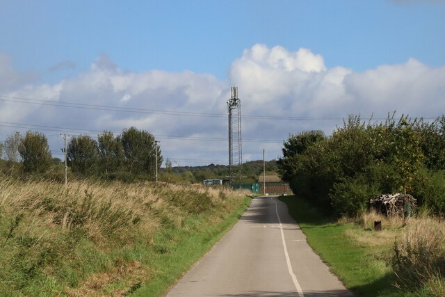
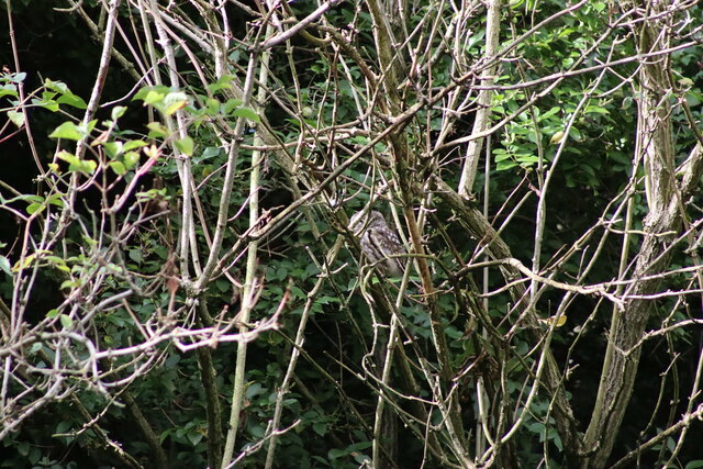
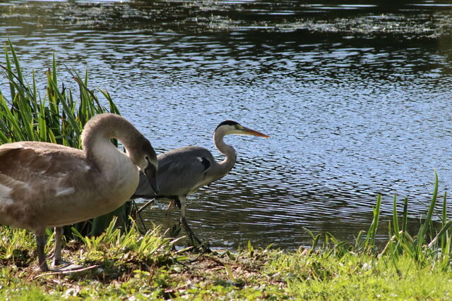
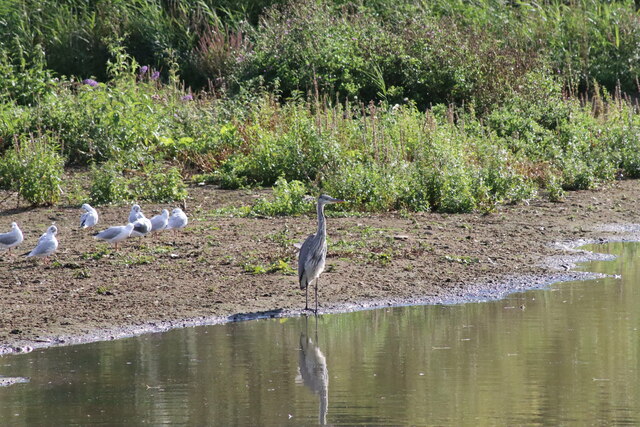
Coal Hill Images

Images are sourced within 2km of 53.815953/-1.6587733 or Grid Reference SE2235. Thanks to Geograph Open Source API. All images are credited.

Rugby pitches at Bramley Fall
Collapsed weir on the River Aire at Newlay Newlay Weir collapsed in early February 2021, during a period of very high river levels caused by recent heavy rain and snow.
The first pictures appeared locally on social media on 4th February, where you could see that water was lower in the centre of the weir. By 9th February, a large section had collapsed, leaving the river level at least a metre below the top of the weir. The water was flowing through a gap between 5 and 10 metres wide. The altered flow has washed away some of the bank just downstream, causing a large tree to fall into the water. It was also reported that contractors working on construction of the fish pass lost some equipment into the river.
The river under Newlay Bridge is now a metre lower than normal summer levels, leaving parts of the banks exposed which are normally under water.
The weir is a Grade II Listed structure (see English Heritage <span class="nowrap"><a title="https://historicengland.org.uk/listing/the-list/list-entry/1375482" rel="nofollow ugc noopener" href="https://historicengland.org.uk/listing/the-list/list-entry/1375482">Link</a><img style="margin-left:2px;" alt="External link" title="External link - shift click to open in new window" src="https://s1.geograph.org.uk/img/external.png" width="10" height="10"/></span> ). There are various reports of its age - the first weir may have been built by monks from Kirkstall Abbey. It is clear that a weir existed by the late 17th century, and the present weir dates from the 19th century. The purpose of the weir was to divert water along a goit (channel) towards Kirkstall Forge (which certainly has its origins as a corn mill built by the monks). By the late 18th century Beecroft and Butler were using the forge to make wrought iron. The goit fed into a dam from where it drove 3 waterwheels which operated drop hammers in the forge. (See <a href="https://www.geograph.org.uk/photo/6088288">SE2536 : Remains of the Kirkstall Forge </a>). 2 of the water wheels and parts of the original building still exist and are Grade II listed.
Collapsed weir on the River Aire at Newlay
Newlay Weir collapsed in early February 2021, during a period of very high river levels caused by recent heavy rain and snow. The first pictures appeared locally on social media on 4th February, where you could see that water was lower in the centre of the weir. By 9th February, a large section had collapsed, leaving the river level at least a metre below the top of the weir. The water was flowing through a gap between 5 and 10 metres wide. The altered flow has washed away some of the bank just downstream, causing a large tree to fall into the water. It was also reported that contractors working on construction of the fish pass lost some equipment into the river. The river under Newlay Bridge is now a metre lower than normal summer levels, leaving parts of the banks exposed which are normally under water. The weir is a Grade II Listed structure (see English Heritage LinkExternal link ). There are various reports of its age - the first weir may have been built by monks from Kirkstall Abbey. It is clear that a weir existed by the late 17th century, and the present weir dates from the 19th century. The purpose of the weir was to divert water along a goit (channel) towards Kirkstall Forge (which certainly has its origins as a corn mill built by the monks). By the late 18th century Beecroft and Butler were using the forge to make wrought iron. The goit fed into a dam from where it drove 3 waterwheels which operated drop hammers in the forge. (See SE2536 : Remains of the Kirkstall Forge ). 2 of the water wheels and parts of the original building still exist and are Grade II listed.
Newlay Bridge Bridge across the River Aire.
Newlay Bridge
Bridge across the River Aire.
The top section of Newlay Lane A steep residential street rising from Newlay Bridge across the River Aire.
The top section of Newlay Lane
A steep residential street rising from Newlay Bridge across the River Aire.
Communications Mast at Rodley Nature Reserve Looking down the entrance road heading in to Rodley Nature Reserve towards the Yorkshire Water Works at the far end. This mast carries the EE and Three mobile networks. Photograph taken on 29/09/2021.
Communications Mast at Rodley Nature Reserve
Looking down the entrance road heading in to Rodley Nature Reserve towards the Yorkshire Water Works at the far end. This mast carries the EE and Three mobile networks. Photograph taken on 29/09/2021.
Little Owl Hiding Amongst the Trees at Rodley Nature Reserve A Little Owl observed hiding amongst the trees near the Manager's Hide at Rodley Nature Reserve. Photograph taken on 29/09/2021.
Little Owl Hiding Amongst the Trees at Rodley Nature Reserve
A Little Owl observed hiding amongst the trees near the Manager's Hide at Rodley Nature Reserve. Photograph taken on 29/09/2021.
Heron and Swan Cygnet at Rodley Nature Reserve A Heron and a Swan Cygnet together at Rodley Nature Reserve. Photograph taken on 29/09/2021.
Heron and Swan Cygnet at Rodley Nature Reserve
A Heron and a Swan Cygnet together at Rodley Nature Reserve. Photograph taken on 29/09/2021.
Heron Looking Over the Water at Rodley Nature Reserve A Heron stands looking out over the lake at Rodley Nature Reserve. Photograph taken on 29/09/2021.
Heron Looking Over the Water at Rodley Nature Reserve
A Heron stands looking out over the lake at Rodley Nature Reserve. Photograph taken on 29/09/2021.
A Heron and Swans at Rodley Nature Reserve A Heron and some Swans at Rodley Nature Reserve. Photograph taken on 29/09/2021.
A Heron and Swans at Rodley Nature Reserve
A Heron and some Swans at Rodley Nature Reserve. Photograph taken on 29/09/2021.
Lloyds Banking Group Pudsey Office near Dawsons Corner, Farsley The outside of the Lloyds Banking Group office near Dawsons Corner, Farsley. Previously the building belonged to the Leeds Permanent Building Society and then the Halifax Building Society. The building is reported to be closing down later in 2021. Photograph taken on 26/09/2021.
Lloyds Banking Group Pudsey Office near Dawsons Corner, Farsley
The outside of the Lloyds Banking Group office near Dawsons Corner, Farsley. Previously the building belonged to the Leeds Permanent Building Society and then the Halifax Building Society. The building is reported to be closing down later in 2021. Photograph taken on 26/09/2021.
Cows Beside the Leeds and Liverpool Canal near Rodley Some Cows grazing in a field beside the Leeds and Liverpool Canal near Rodley, Leeds. Photograph taken on 25/07/2021.
Cows Beside the Leeds and Liverpool Canal near Rodley
Some Cows grazing in a field beside the Leeds and Liverpool Canal near Rodley, Leeds. Photograph taken on 25/07/2021.
The A647 Leeds Ring Road / Stanningley Bypass at Pudsey Viewed from Richardshaw Lane bridge.
The A647 Leeds Ring Road / Stanningley Bypass at Pudsey
Viewed from Richardshaw Lane bridge.
Richmond House Care Home, Farsley A view taken from Richmond Road looking towards Richmond House Care Home in Farsley. Photograph taken on 04/02/2018.
Richmond House Care Home, Farsley
A view taken from Richmond Road looking towards Richmond House Care Home in Farsley. Photograph taken on 04/02/2018.
Richmond Road, Farsley A view taken next to Richmond Road Care Home looking down Richmond Road. Photograph taken on 04/02/2018.
Richmond Road, Farsley
A view taken next to Richmond Road Care Home looking down Richmond Road. Photograph taken on 04/02/2018.
Pudsey Civic Hall Car Park, Farsley A view looking across Pudsey Civic Hall Car Park. Richmond Road and the Lloyds Banking Group Pudsey office are visible in the distance. Photograph taken on 04/02/2018.
Pudsey Civic Hall Car Park, Farsley
A view looking across Pudsey Civic Hall Car Park. Richmond Road and the Lloyds Banking Group Pudsey office are visible in the distance. Photograph taken on 04/02/2018.
The Old Hall Hotel, Farsley The Old Hall Hotel, Farsley. Photograph taken on 08/04/2018.
The Old Hall Hotel, Farsley
The Old Hall Hotel, Farsley. Photograph taken on 08/04/2018.
The Old Hall Hotel, Farsley The Old Hall Hotel, Farsley. Photograph taken on 08/04/2018.
The Old Hall Hotel, Farsley
The Old Hall Hotel, Farsley. Photograph taken on 08/04/2018.
Show me another place!

Coal Hill is located at Grid Ref: SE2235 (Lat: 53.815953, Lng: -1.6587733)

Division: West Riding

Unitary Authority: Leeds

Police Authority: West Yorkshire

What 3 Words

///hobby.proof.broke. Near Pudsey, West Yorkshire

Related Wikis

Bagley, West Yorkshire

Bagley is a village in the City of Leeds metropolitan borough, West Yorkshire, England, once in the township of Farsley. The remains of the village (or...

Leeds West Academy

Leeds West Academy is a secondary school with academy status in Rodley, Leeds, West Yorkshire, England. It is well known for specialising its area of education...

Rodley, West Yorkshire

Rodley is a suburb in the City of Leeds metropolitan borough, West Yorkshire, England. The village is situated within the Calverley and Farsley ward of...

Sunny Bank Mills

Sunny Bank Mills is a former textile mill, which specialised in worsted cloth, set in 10 acres of land located on Town Street, Farsley, Leeds, England...

Nearby Amenities

Located within 500m of 53.815953,-1.6587733
Power: tower
Lat/Long: 53.8187834/-1.6592624
Post Box
Operator: Royal Mail
Post Box Type: pillar
Postal Code: LS13
Ref: LS13 973
Lat/Long: 53.8132222/-1.654076
Traffic Calming: table
Lat/Long: 53.8145132/-1.6645435
Post Box
Check Date: 2021-01-30
Collection Times: Mo-Fr 09:00, Sa 07:00
Operator: Royal Mail
Ref: LS13 1026
Lat/Long: 53.8171025/-1.6528045
Turning Circle
Lat/Long: 53.8167778/-1.6518333
Post Box
Operator: Royal Mail
Post Box Type: pillar
Ref: LS13 974
Lat/Long: 53.8139836/-1.6592374
Bus Stop
Intake Lane Coal Hill Lane
Local Ref: 45012334
Naptan AtcoCode: 450012334
Naptan Bearing: SE
Naptan CommonName: Intake Lane Coal Hill Lane
Naptan Crossing: Coal Hill Lane
Naptan Indicator: Stop 45012334
Naptan PlusbusZoneRef: LEEDS
Naptan ShortCommonName: Coal Hill Lane
Naptan Street: Intake Lane
Naptan Verified: no
Source: naptan_import
Lat/Long: 53.815319/-1.6559046
Bus Stop
Intake Lane Fernbank Avenue
Local Ref: 45012335
Naptan AtcoCode: 450012335
Naptan Bearing: NW
Naptan CommonName: Intake Lane Fernbank Avenue
Naptan Crossing: Fernbank Avenue
Naptan Indicator: Stop 45012335
Naptan PlusbusZoneRef: LEEDS
Naptan ShortCommonName: Fernbank Avenue
Naptan Street: Intake Lane
Naptan Verified: no
Source: naptan_import
Lat/Long: 53.8127328/-1.6536021
Bus Stop
Intake Lane Coal Hill Lane
Local Ref: 45012336
Naptan AtcoCode: 450012336
Naptan Bearing: NW
Naptan CommonName: Intake Lane Coal Hill Lane
Naptan Crossing: Coal Hill Lane
Naptan Indicator: Stop 45012336
Naptan PlusbusZoneRef: LEEDS
Naptan ShortCommonName: Coal Hill Lane
Naptan Street: Intake Lane
Naptan Verified: no
Source: naptan_import
Lat/Long: 53.8153466/-1.6561322
Bus Stop
Bagley Lane Springbank Road
Bench: yes
Local Ref: 45012337
Naptan AtcoCode: 450012337
Naptan Bearing: W
Naptan CommonName: Bagley Lane Springbank Road
Naptan Crossing: Springbank Road
Naptan Indicator: Stop 45012337
Naptan PlusbusZoneRef: LEEDS
Naptan ShortCommonName: Springbank Road
Naptan Street: Bagley Lane
Naptan Verified: no
Shelter: yes
Source: naptan_import
Tactile Paving: no
Lat/Long: 53.8163797/-1.6654649
Bus Stop
Coal Hill Lane Calverley Lane
Bench: no
Local Ref: 45012342
Naptan AtcoCode: 450012342
Naptan Bearing: SW
Naptan CommonName: Coal Hill Lane Calverley Lane
Naptan Crossing: Calverley Lane
Naptan Indicator: Stop 45012342
Naptan PlusbusZoneRef: LEEDS
Naptan ShortCommonName: Calverley Lane
Naptan Street: Coal Hill Lane
Naptan Verified: no
Shelter: no
Source: naptan_import
Tactile Paving: no
Lat/Long: 53.8164984/-1.6534495
Bus Stop
Coal Hill Lane Calverley Lane
Bench: no
Local Ref: 45012343
Naptan AtcoCode: 450012343
Naptan Bearing: NE
Naptan CommonName: Coal Hill Lane Calverley Lane
Naptan Crossing: Calverley Lane
Naptan Indicator: Stop 45012343
Naptan PlusbusZoneRef: LEEDS
Naptan ShortCommonName: Calverley Lane
Naptan Street: Coal Hill Lane
Naptan Verified: no
Shelter: no
Source: naptan_import
Tactile Paving: no
Lat/Long: 53.81649/-1.653647
Bus Stop
Coal Hill Lane Intake Lane
Bench: yes
Local Ref: 45012390
Naptan AtcoCode: 450012390
Naptan Bearing: NE
Naptan CommonName: Coal Hill Lane Intake Lane
Naptan Crossing: Intake Lane
Naptan Indicator: Stop 45012390
Naptan PlusbusZoneRef: LEEDS
Naptan ShortCommonName: Intake Lane
Naptan Street: Coal Hill Lane
Naptan Verified: no
Shelter: yes
Source: naptan_import
Tactile Paving: no
Lat/Long: 53.8157145/-1.6559165
Bus Stop
Coal Hill Lane Bagley Lane
Bench: no
Local Ref: 45012391
Naptan AtcoCode: 450012391
Naptan Bearing: SE
Naptan CommonName: Coal Hill Lane Bagley Lane
Naptan Crossing: Bagley Lane
Naptan Indicator: Stop 45012391
Naptan PlusbusZoneRef: LEEDS
Naptan ShortCommonName: Bagley Lane
Naptan Street: Coal Hill Lane
Naptan Verified: no
Shelter: yes
Source: naptan_import
Tactile Paving: no
Lat/Long: 53.8154514/-1.6613562
Bus Stop
Coal Hill Lane Farsley
Local Ref: 45012392
Naptan AtcoCode: 450012392
Naptan Bearing: NW
Naptan CommonName: Coal Hill Lane Farsley
Naptan Crossing: Nr-At Bagley Lane
Naptan Indicator: Stop 45012392
Naptan PlusbusZoneRef: LEEDS
Naptan ShortCommonName: Broom Mills
Naptan Street: Coal Hill Lane
Naptan Verified: no
Source: naptan_import
Lat/Long: 53.8153438/-1.6614634
Bus Stop
Bagley Lane Springbank Road
Local Ref: 45012393
Naptan AtcoCode: 450012393
Naptan Bearing: E
Naptan CommonName: Bagley Lane Springbank Road
Naptan Crossing: Springbank Grove
Naptan Indicator: Stop 45012393
Naptan PlusbusZoneRef: LEEDS
Naptan ShortCommonName: Springbank Road
Naptan Street: Bagley Lane
Naptan Verified: no
Source: naptan_import
Lat/Long: 53.8164962/-1.6653273
Bus Stop
Bagley Lane
Bench: no
Bin: no
Local Ref: 45024099
Naptan AtcoCode: 450024099
Naptan Bearing: S
Naptan CommonName: Bagley Lane
Naptan Crossing: Mary Street
Naptan Indicator: Stop 45024099
Naptan PlusbusZoneRef: LEEDS
Naptan ShortCommonName: Mary Street
Naptan Street: Bagley Lane
Naptan Verified: no
Shelter: no
Source: naptan_import
Tactile Paving: no
Lat/Long: 53.8175075/-1.6637851
Bus Stop
Coal Hill Lane Intake Lane
Bench: no
Local Ref: 45025180
Naptan AtcoCode: 450025180
Naptan Bearing: SW
Naptan CommonName: Coal Hill Lane Intake Lane
Naptan Crossing: Intake Lane
Naptan Indicator: Stop 45025180
Naptan PlusbusZoneRef: LEEDS
Naptan ShortCommonName: Intake Lane
Naptan Street: Coal Hill Lane
Naptan Verified: no
Shelter: no
Source: naptan_import
Tactile Paving: no
Lat/Long: 53.8156602/-1.6557803
Power: substation
Lat/Long: 53.8151418/-1.6621586
Post Box
Collection Times: Mo-Fr 09:00, Sa 07:00
Operator: Royal Mail
Post Box Type: wall
Ref: LS28 721
Royal Cypher: EIIR
Royal Cypher Wikidata: Q33102113
Lat/Long: 53.8167576/-1.663815
Turning Circle
Lat/Long: 53.813125/-1.6569397
Traffic Calming: table
Lat/Long: 53.814559/-1.6644696
Traffic Calming: cushion
Lat/Long: 53.8121763/-1.6627855
Turning Circle
Lat/Long: 53.8135056/-1.6641452
Traffic Calming: cushion
Lat/Long: 53.8130328/-1.6623524
Turning Loop
Lat/Long: 53.8168103/-1.6559193
Traffic Calming: cushion
Lat/Long: 53.8138853/-1.6632848
Traffic Calming: cushion
Lat/Long: 53.8154394/-1.6638438
Traffic Calming: cushion
Lat/Long: 53.8160161/-1.6641856
Traffic Calming: cushion
Lat/Long: 53.8160315/-1.6652123
Cafe
The Loft Coffee Shop
Addr City: Pudsey
Addr Housename: Springfield Commercial Centre
Addr Postcode: LS28 5LY
Addr Street: Bagley Lane
Addr Suburb: Farsley
Addr Unit: 13A
Fhrs Id: 1034335
Website: https://theloftcoffeeshop.co.uk/
Lat/Long: 53.8174013/-1.6656619
Turning Circle
Lat/Long: 53.8142592/-1.6545716
Traffic Calming: cushion
Lat/Long: 53.8137553/-1.6545178
Cafe
Breakfast Club
Addr City: Leeds
Addr Housename: Summerfield Primary School
Addr Postcode: LS13 1DQ
Addr Street: Intake Lane
Addr Suburb: Rodley
Fhrs Id: 321596
Lat/Long: 53.8134152/-1.6534612
Kindergarten
Childrens Corner
Addr City: Leeds
Addr Housename: Valley View Community Primary School
Addr Postcode: LS13 1DD
Addr Street: Coal Hill Drive
Addr Suburb: Rodley
Fhrs Id: 974969
Lat/Long: 53.8162577/-1.6583508
Breakfast Club
Addr City: Leeds
Addr Housename: Valley View Community Primary School
Addr Postcode: LS13 1DD
Addr Street: Coal Hill Drive
Addr Suburb: Rodley
Craft: caterer
Fhrs Id: 559045
Lat/Long: 53.816226/-1.65856
Get Cooking CIC
Addr City: Pudsey
Addr Housename: Springfield Commercial Centre
Addr Postcode: LS28 5LY
Addr Street: Bagley Lane
Addr Suburb: Farsley
Addr Unit: 43a
Fhrs Id: 1073702
Lat/Long: 53.8171919/-1.6660112
Tarte And Berry
Addr City: Pudsey
Addr Housename: Springfield Commercial Centre
Addr Postcode: LS28 5LY
Addr Street: Bagley Lane
Addr Suburb: Farsley
Addr Unit: 23
Shop: pastry
Lat/Long: 53.8172173/-1.6656572
Waste Basket
Collection Times: Tu; Th
Condition: GOOD
Ref UK Leedscc Bin: 5032
Waste Basket Model: METAL SQUARE
Lat/Long: 53.816572/-1.65378
Waste Basket
Collection Times: Tu; Th
Condition: GOOD
Ref UK Leedscc Bin: 5796
Waste Basket Model: METAL SQUARE
Lat/Long: 53.815854/-1.657276
Waste Basket
Collection Times: Tu; Th
Condition: FAIR
Ref UK Leedscc Bin: 5030
Waste Basket Model: METAL TWIN
Lat/Long: 53.815328/-1.655672
Waste Basket
Collection Times: Su
Ref UK Leedscc Bin: 154
Lat/Long: 53.816591/-1.664931
Waste Basket
Collection Times: Tu; Th
Condition: FAIR
Ref UK Leedscc Bin: 5799
Waste Basket Model: METAL TWIN
Lat/Long: 53.81457/-1.655003
Waste Basket
Collection Times: Su
Ref UK Leedscc Bin: 155
Lat/Long: 53.816382/-1.665268
Waste Basket
Collection Times: Tu; Th
Condition: FAIR
Ref UK Leedscc Bin: 5029
Waste Basket Model: METAL TWIN
Lat/Long: 53.813167/-1.653675
Waste Basket
Collection Times: Tu; Th
Condition: GOOD
Ref UK Leedscc Bin: 5028
Waste Basket Model: METAL SQUARE
Lat/Long: 53.812639/-1.653717
Crossing
Crossing: uncontrolled
Crossing Island: no
Crossing Ref: zebra
Kerb: lowered
Supervised: no
Tactile Paving: yes
Lat/Long: 53.8154184/-1.657062
The data included in this document is from www.openstreetmap.org. The data is made available under ODbL.

Have you been to Coal Hill?

Leave your review of Coal Hill below (or comments, questions and feedback).