Deep Dale

Valley in Yorkshire Richmondshire

England

Deep Dale

West Applegarth Farm, Swaledale The crags at left guard the entrance to Deep Dale and Whitcliffe Scar lies half-hidden above the trees further to the right.
West Applegarth Farm, Swaledale Credit: Greg Fitchett

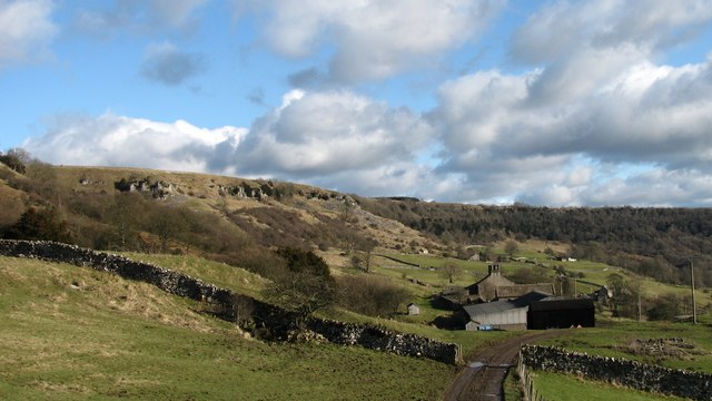
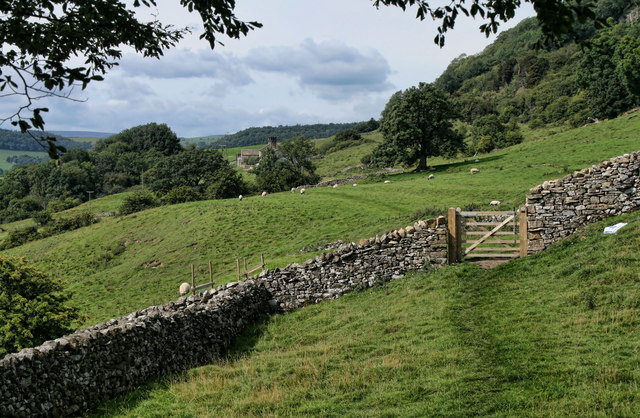
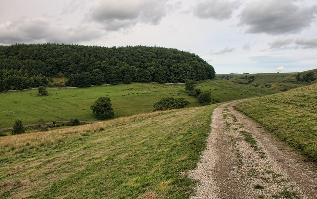
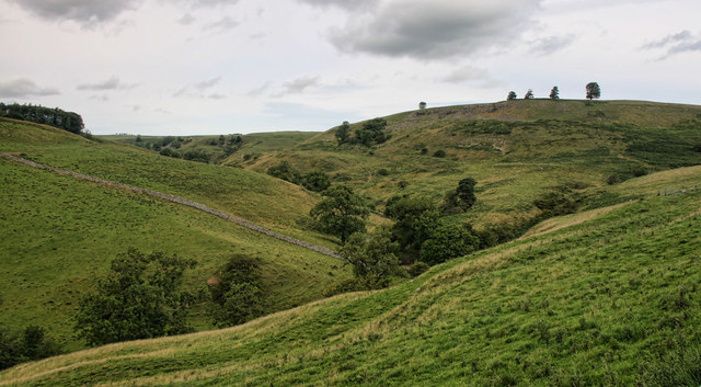
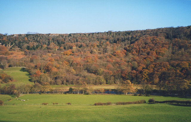
Deep Dale is a picturesque valley located in the Yorkshire Dales National Park in North Yorkshire, England. It is situated near the village of Dent, approximately 10 miles northwest of the town of Skipton. The valley is renowned for its stunning natural beauty, with its steep sides covered in lush greenery and dotted with ancient woodlands.

At the heart of Deep Dale flows the River Dee, which meanders through the valley, adding to its charm and tranquility. The river is famous for its crystal-clear waters, which are home to a variety of freshwater fish species.

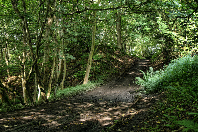
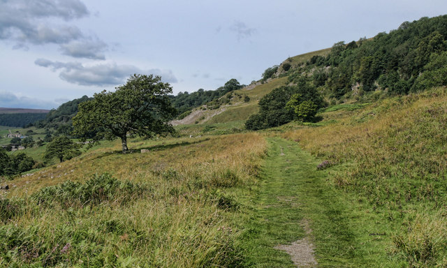
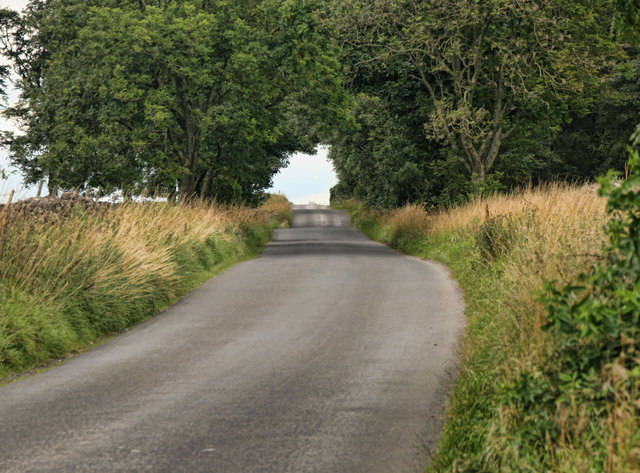
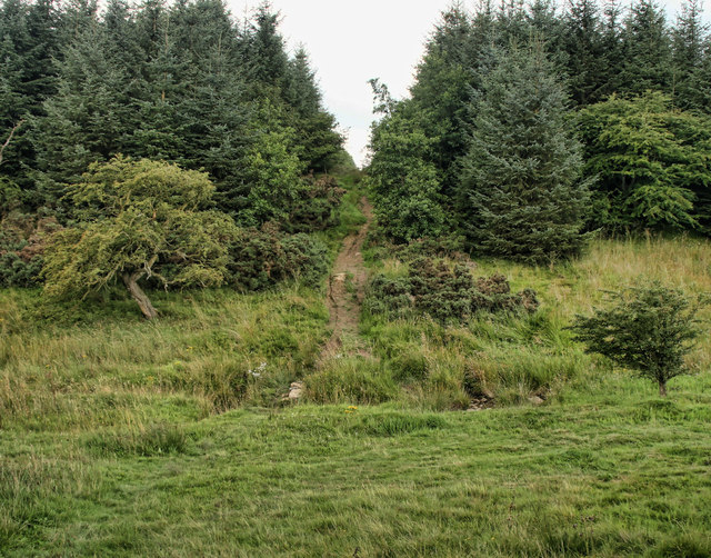
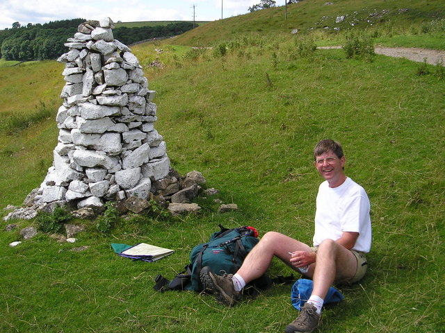
The valley is a haven for nature enthusiasts and hikers, offering a plethora of walking trails that cater to all abilities. The paths wind through fields, woodlands, and moorland, providing breathtaking views of the surrounding countryside. Due to its remote location, Deep Dale remains relatively unspoiled and offers a peaceful retreat for those seeking solitude and relaxation.

Deep Dale is also rich in history and heritage, with several ancient monuments and landmarks scattered throughout the area. The remains of old packhorse bridges and stone farmhouses serve as reminders of the valley's agricultural past.

Visitors to Deep Dale can expect to encounter an abundance of wildlife, including birds, deer, and foxes. The valley is particularly renowned for its bird population, with species such as red grouse, curlews, and peregrine falcons frequently spotted.

In conclusion, Deep Dale is a hidden gem within the Yorkshire Dales National Park, offering a combination of natural beauty, tranquility, and historical significance. It is a must-visit destination for nature lovers and hikers seeking an escape from the hustle and bustle of everyday life.

If you have any feedback on the listing, please let us know in the comments section below.

Deep Dale Images

Images are sourced within 2km of 54.412265/-1.803609 or Grid Reference NZ1201. Thanks to Geograph Open Source API. All images are credited.

West Applegarth Farm, Swaledale The crags at left guard the entrance to Deep Dale and Whitcliffe Scar lies half-hidden above the trees further to the right.
West Applegarth Farm, Swaledale
The crags at left guard the entrance to Deep Dale and Whitcliffe Scar lies half-hidden above the trees further to the right.
Whitcliffe Wood Track through Whitcliffe Wood.
Whitcliffe Wood
Track through Whitcliffe Wood.
Low Applegarth Looking along the bridleway towards West Applegarth.
Low Applegarth
Looking along the bridleway towards West Applegarth.
Whitcliffe Scar Bridleway beneath Whitcliffe Scar.
Whitcliffe Scar
Bridleway beneath Whitcliffe Scar.
Clapgate Gill View looking across Clapgate Gill.
Clapgate Gill
View looking across Clapgate Gill.
Clapgate Gill View looking up Clapgate Gill.
Clapgate Gill
View looking up Clapgate Gill.
Richmond Out Moor North Yorkshire Police communications masts at Richmond Out Moor.
Richmond Out Moor
North Yorkshire Police communications masts at Richmond Out Moor.
Hurgill Road Hurgill Road beneath Beacon Hill.
Hurgill Road
Hurgill Road beneath Beacon Hill.
Richmond Out Moor Track crossing Aske beck in the plantation on Richmond Out Moor.
Richmond Out Moor
Track crossing Aske beck in the plantation on Richmond Out Moor.
Trainee soldiers The rather startling sight of armed soldiers on Feldom Ranges.
Trainee soldiers
The rather startling sight of armed soldiers on Feldom Ranges.
Military Exercises By the road, Feldom Ranges.
Military Exercises
By the road, Feldom Ranges.
Leaving Hudswell Vicar's Green Farm on the centre right.
Leaving Hudswell
Vicar's Green Farm on the centre right.
Swaledale above Richmond A view from the main road down to the river and across to Whitcliffe Wood.
Swaledale above Richmond
A view from the main road down to the river and across to Whitcliffe Wood.
Sharp bends at Hag Wood
White Cairn on Applegarth Scar This cairn is on the route of the Dales Walk not far from Richmond.
White Cairn on Applegarth Scar
This cairn is on the route of the Dales Walk not far from Richmond.
Very muddy footpath in the woods, Richmond Out Moor The definitive rights-of-way map shows a bridleway some way west of this path, while this muddy horror show is also shown on OS maps with the old black dotted line symbol. However, in reality, only this route exists on (or should I say rapidly sinking into) the ground. At least it is easy enough to follow in the fog !
Very muddy footpath in the woods, Richmond Out Moor
The definitive rights-of-way map shows a bridleway some way west of this path, while this muddy horror show is also shown on OS maps with the old black dotted line symbol. However, in reality, only this route exists on (or should I say rapidly sinking into) the ground. At least it is easy enough to follow in the fog !
Mossy wall in the forest, Richmond Out Moor The weather on the day of this photograph does much to explain the amount of moss on the old wall as the humidity was high enough to keep it all very moist, even where not being dripped on by the overhanging trees. The forest will also protect it from all but late evening sun, too, in the summer when weather is less favourable (for aquatic life).
Mossy wall in the forest, Richmond Out Moor
The weather on the day of this photograph does much to explain the amount of moss on the old wall as the humidity was high enough to keep it all very moist, even where not being dripped on by the overhanging trees. The forest will also protect it from all but late evening sun, too, in the summer when weather is less favourable (for aquatic life).
Tarn and tree in the fog above Whitcliffe Scar Various boggy patches, pools and ponds dot the landscape above Whitcliffe Scar. This one had a tree growing in the wall-line behind it to add something to reflect.
Tarn and tree in the fog above Whitcliffe Scar
Various boggy patches, pools and ponds dot the landscape above Whitcliffe Scar. This one had a tree growing in the wall-line behind it to add something to reflect.
Show me another place!

Deep Dale is located at Grid Ref: NZ1201 (Lat: 54.412265, Lng: -1.803609)

Division: North Riding

Administrative County: North Yorkshire

District: Richmondshire

Police Authority: North Yorkshire

What 3 Words

///hardly.gentlemen.violin. Near Richmond, North Yorkshire

Related Wikis

Applegarth, North Yorkshire

Applegarth is a historic settlement located north of the River Swale in Yorkshire, England. It lies about three-quarters of a mile north-east of the village...

Scott Trial

The Scott Trial is a British motorcycle trials competition dating from 1914 run over an off-road course of approximately 70 miles. One of the most challenging...

Hudswell, North Yorkshire

Hudswell is a village and civil parish on the border of the Yorkshire Dales, in North Yorkshire, England. The population at the ONS Census 2011 was 353...

Marske, Richmondshire

Marske is a village and civil parish in the Richmondshire district of North Yorkshire, England, situated in lower Swaledale on the boundary of the Yorkshire...

Skelton, west North Yorkshire

Skelton is a small hamlet in the Richmondshire district of North Yorkshire, England. It is within the Yorkshire Dales National Park near the larger village...

Richmond Racecourse

Richmond Racecourse was a British horse racing track situated at Richmond, North Yorkshire at first High Moor, then Low Moor, from 1765 to 1776. It was...

St Joseph and St Francis Xavier Church

St Joseph and St Francis Xavier Church is a Roman Catholic Parish church in Richmond, North Yorkshire. It is situated between Newbiggin and Victoria Road...

Friary Community Hospital

The Friary Community Hospital is a health facility in Queen's Road, Richmond, North Yorkshire, England. It is managed by South Tees Hospitals NHS Foundation...

Nearby Amenities

Located within 500m of 54.412265,-1.803609
Barrier: stile
Ele: 188
Foot: designated
Lat/Long: 54.4096272/-1.8073501
Barrier: stile
Foot: designated
Lat/Long: 54.4098613/-1.8053466
Barrier: cattle_grid
Lat/Long: 54.4108251/-1.8024656
High Applegarth
Place: farm
Lat/Long: 54.4112364/-1.8001466
Low Applegarth
Place: farm
Lat/Long: 54.4097282/-1.8018929
West Applegarth
Place: farm
Lat/Long: 54.409103/-1.8090208
Power: pole
Lat/Long: 54.4156739/-1.8085753
The data included in this document is from www.openstreetmap.org. The data is made available under ODbL.

Have you been to Deep Dale?

Leave your review of Deep Dale below (or comments, questions and feedback).