Collier Hag Wood

Wood, Forest in Yorkshire Richmondshire

England

Collier Hag Wood

Cattle Grid and Tank Crossing, Downholme Moor This is a view of the same location as the only other current picture for this grid square. Little has changed in nine years, but the tank warning sign has gone AWOL and the cattle grid sign seems to have been used for target practice.
Cattle Grid and Tank Crossing, Downholme Moor Credit: Tony Simms

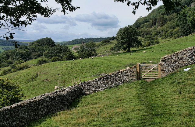
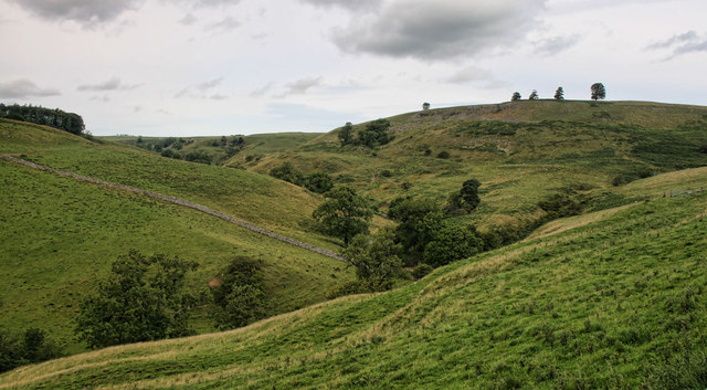
Collier Hag Wood is a picturesque woodland located in Yorkshire, England. Spanning over a vast area, it is a prominent natural attraction in the region. Known for its diverse flora and fauna, the wood offers a tranquil escape into nature for visitors and locals alike.

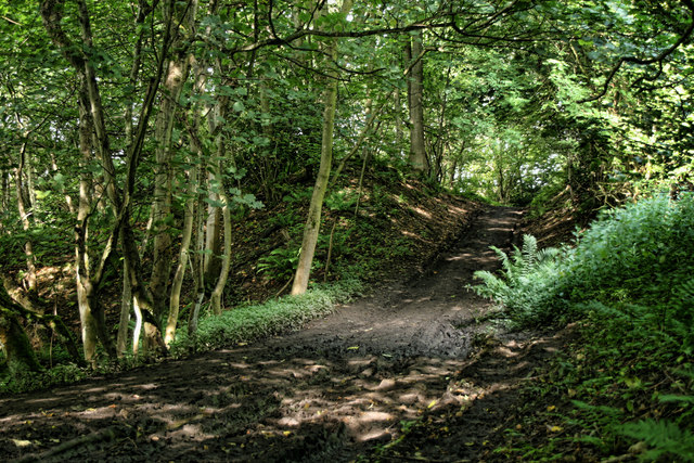
The woodland is home to a variety of tree species, including oak, birch, and beech. The towering trees create a dense canopy, allowing only speckles of sunlight to filter through, creating a magical ambiance within the wood. Bluebells carpet the forest floor during the spring season, painting the landscape with vibrant hues of blue.

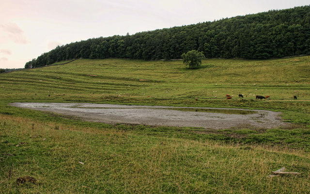
The wood not only offers a serene environment but also provides a habitat for a range of wildlife. Birdwatchers can spot various species, including woodpeckers, owls, and songbirds. The wood is also home to small mammals like foxes, badgers, and rabbits, adding to the biodiversity of the area.

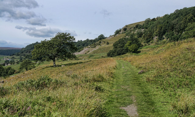
Collier Hag Wood is a popular destination for nature enthusiasts and hikers. The wood features well-maintained trails that wind through the trees, offering breathtaking views at every turn. Visitors can enjoy leisurely walks, picnics, and photography opportunities.

Managed by a local conservation organization, the wood is protected to ensure its preservation for future generations. The organization conducts regular maintenance and conservation activities to maintain the natural beauty of the wood.

Overall, Collier Hag Wood is a haven for nature lovers seeking solace amidst the beauty of Yorkshire's landscapes. Its tranquil atmosphere, diverse flora and fauna, and well-maintained trails make it a must-visit destination for those looking to immerse themselves in the wonders of nature.

If you have any feedback on the listing, please let us know in the comments section below.

Collier Hag Wood Images

Images are sourced within 2km of 54.406685/-1.8039745 or Grid Reference NZ1201. Thanks to Geograph Open Source API. All images are credited.
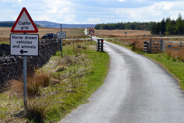
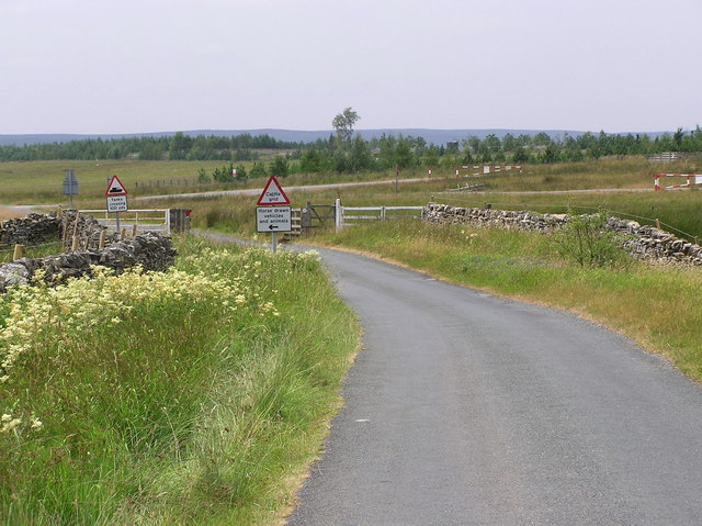
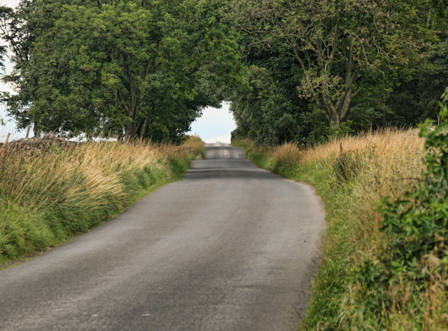
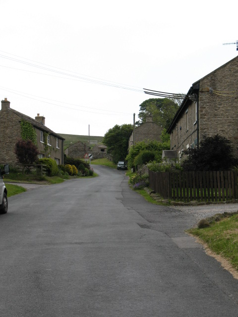
Cattle Grid and Tank Crossing, Downholme Moor This is a view of the same location as the only other current picture for this grid square. Little has changed in nine years, but the tank warning sign has gone AWOL and the cattle grid sign seems to have been used for target practice.
Cattle Grid and Tank Crossing, Downholme Moor
This is a view of the same location as the only other current picture for this grid square. Little has changed in nine years, but the tank warning sign has gone AWOL and the cattle grid sign seems to have been used for target practice.
Road across the moor This minor road sees little traffic these days, but at one time it was one of the main routes from Richmond into Swaledale, crossing the Swale at Richmond Bridge and passing through Hudswell before reaching this point on the way to Downholme and then via Stop Bridge Lane [now an unsurfaced byway] before dropping into the dale to join what is now the B6270. The current main route up the dale from Richmond is an early 19thC turnpike road.
Road across the moor
This minor road sees little traffic these days, but at one time it was one of the main routes from Richmond into Swaledale, crossing the Swale at Richmond Bridge and passing through Hudswell before reaching this point on the way to Downholme and then via Stop Bridge Lane [now an unsurfaced byway] before dropping into the dale to join what is now the B6270. The current main route up the dale from Richmond is an early 19thC turnpike road.
Range track on Downholme Moor Looking SE along one of the range tracks near the edge of the Catterick military ranges.
Range track on Downholme Moor
Looking SE along one of the range tracks near the edge of the Catterick military ranges.
Green Lane A narrow and little used back lane near Hudswell.
Green Lane
A narrow and little used back lane near Hudswell.
Estate Boundary Marker on the road between Downholme and Hudswell Estate Boundary Marker set against the west side of a drystone wall beside a metal gate and cattle grid on the road between Downholme and Hudswell. On the boundary of Downholme and Hudswell parishes. The National Park Authority have it recorded as one of a series of boundary stones across Stainton and Ellerton Moors to mark the boundary of the Scropes' land with that of Earl Drax.

Milestone Society National ID: YN_DOWHUD01em
Estate Boundary Marker on the road between Downholme and Hudswell
Estate Boundary Marker set against the west side of a drystone wall beside a metal gate and cattle grid on the road between Downholme and Hudswell. On the boundary of Downholme and Hudswell parishes. The National Park Authority have it recorded as one of a series of boundary stones across Stainton and Ellerton Moors to mark the boundary of the Scropes' land with that of Earl Drax. Milestone Society National ID: YN_DOWHUD01em
Downholme Farm : Reeth  Road
Downholme Farm : Reeth Road
Cattle Grid : Downholme Moor Looking east, Military Training Area. Downholme Moor
Cattle Grid : Downholme Moor
Looking east, Military Training Area. Downholme Moor
Downholme Park The A6108 and River Swale run in front of Downholme Park. The camera position is on Cat Bank in square NZ1000.
Downholme Park
The A6108 and River Swale run in front of Downholme Park. The camera position is on Cat Bank in square NZ1000.
West Applegarth Farm, Swaledale The crags at left guard the entrance to Deep Dale and Whitcliffe Scar lies half-hidden above the trees further to the right.
West Applegarth Farm, Swaledale
The crags at left guard the entrance to Deep Dale and Whitcliffe Scar lies half-hidden above the trees further to the right.
Winding road towards Marske
Whitcliffe Wood Track through Whitcliffe Wood.
Whitcliffe Wood
Track through Whitcliffe Wood.
Low Applegarth Looking along the bridleway towards West Applegarth.
Low Applegarth
Looking along the bridleway towards West Applegarth.
Whitcliffe Scar Bridleway beneath Whitcliffe Scar.
Whitcliffe Scar
Bridleway beneath Whitcliffe Scar.
Clapgate Gill View looking across Clapgate Gill.
Clapgate Gill
View looking across Clapgate Gill.
Clapgate Gill View looking up Clapgate Gill.
Clapgate Gill
View looking up Clapgate Gill.
Nanny Miller Spring Pond near Nanny Miller Spring.
Nanny Miller Spring
Pond near Nanny Miller Spring.
Richmond Out Moor North Yorkshire Police communications masts at Richmond Out Moor.
Richmond Out Moor
North Yorkshire Police communications masts at Richmond Out Moor.
Hurgill Road Hurgill Road beneath Beacon Hill.
Hurgill Road
Hurgill Road beneath Beacon Hill.
Show me another place!

Collier Hag Wood is located at Grid Ref: NZ1201 (Lat: 54.406685, Lng: -1.8039745)

Division: North Riding

Administrative County: North Yorkshire

District: Richmondshire

Police Authority: North Yorkshire

What 3 Words

///soccer.buckling.full. Near Richmond, North Yorkshire

Related Wikis

Applegarth, North Yorkshire

Applegarth is a historic settlement located north of the River Swale in Yorkshire, England. It lies about three-quarters of a mile north-east of the village...

Scott Trial

The Scott Trial is a British motorcycle trials competition dating from 1914 run over an off-road course of approximately 70 miles. One of the most challenging...

Hudswell, North Yorkshire

Hudswell is a village and civil parish on the border of the Yorkshire Dales, in North Yorkshire, England. The population at the ONS Census 2011 was 353...

Marske, Richmondshire

Marske is a village and civil parish in the Richmondshire district of North Yorkshire, England, situated in lower Swaledale on the boundary of the Yorkshire...

Skelton, west North Yorkshire

Skelton is a small hamlet in the Richmondshire district of North Yorkshire, England. It is within the Yorkshire Dales National Park near the larger village...

Richmond Racecourse

Richmond Racecourse was a British horse racing track situated at Richmond, North Yorkshire at first High Moor, then Low Moor, from 1765 to 1776. It was...

Downholme

Downholme is a village and civil parish in North Yorkshire, England. It is situated approximately 4 miles (6 km) west from the market town of Richmond...

St Joseph and St Francis Xavier Church

St Joseph and St Francis Xavier Church is a Roman Catholic Parish church in Richmond, North Yorkshire. It is situated between Newbiggin and Victoria Road...

Nearby Amenities

Located within 500m of 54.406685,-1.8039745
Barrier: stile
Ele: 188
Foot: designated
Lat/Long: 54.4096272/-1.8073501
Barrier: stile
Foot: designated
Lat/Long: 54.4098613/-1.8053466
Barrier: cattle_grid
Lat/Long: 54.4108251/-1.8024656
Low Applegarth
Place: farm
Lat/Long: 54.4097282/-1.8018929
West Applegarth
Place: farm
Lat/Long: 54.409103/-1.8090208
Swaleview Caravan Park
Bench: no
Bin: no
Public Transport: platform
Route Ref: 831
Shelter: no
Tactile Paving: no
Lat/Long: 54.4057036/-1.7978136
Bus: yes
Public Transport: stop_position
Lat/Long: 54.4056783/-1.797815
Swaleview Caravan Park
Bench: yes
Bin: yes
Public Transport: platform
Shelter: yes
Tactile Paving: no
Lat/Long: 54.4056271/-1.7978217
The data included in this document is from www.openstreetmap.org. The data is made available under ODbL.

Have you been to Collier Hag Wood?

Leave your review of Collier Hag Wood below (or comments, questions and feedback).