Stanhope Dene

Valley in Durham

England

Stanhope Dene

Stanhope Tree A preserved Sigillaria tree from the mid Carboniferous coal swamps. Instead of joining its coal friends it rotted away but was covered in sand which left a cast. <span class="nowrap"><a title="http://arthuride.files.wordpress.com/2010/12/sigillaria-tree1.jpg" rel="nofollow ugc noopener" href="http://arthuride.files.wordpress.com/2010/12/sigillaria-tree1.jpg">Link</a><img style="margin-left:2px;" alt="External link" title="External link - shift click to open in new window" src="https://s1.geograph.org.uk/img/external.png" width="10" height="10"/></span>

Preserved at a sand quarry it was brought here and erected in front of the church. The bark and root impressions are very good.
Stanhope Tree Credit: Ashley Dace

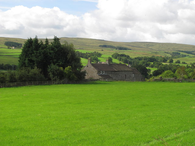
Stanhope Dene, also known as Stanhope Valley, is a picturesque area located in County Durham, England. This valley is situated in the North Pennines Area of Outstanding Natural Beauty, which attracts visitors from far and wide due to its stunning natural scenery and rich history.

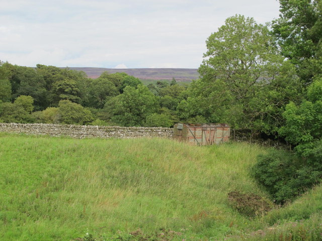
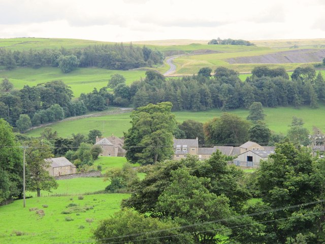
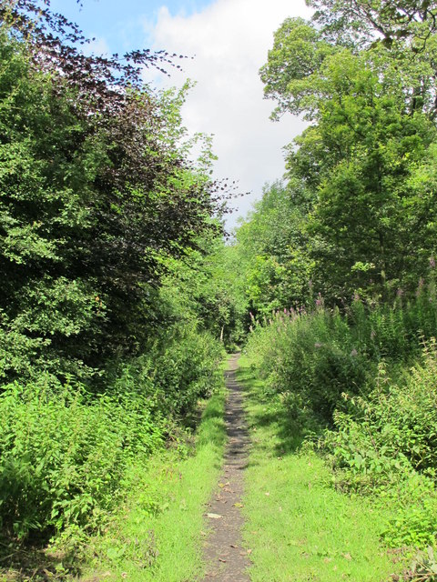
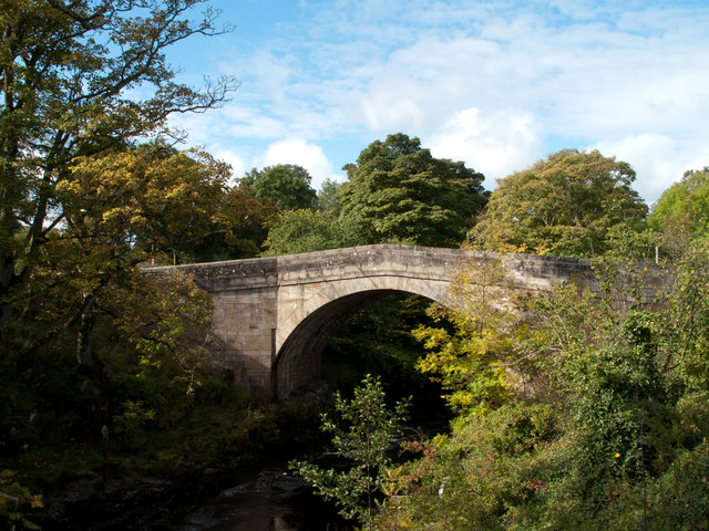
The dene stretches for approximately 12 miles and is carved by the River Wear, which meanders through the landscape, creating a beautiful and tranquil environment. The valley is surrounded by rolling hills and dense woodland, providing a sense of seclusion and serenity to those who venture into it.

Stanhope Dene is home to a wide variety of flora and fauna, making it an ideal destination for nature enthusiasts. The wooded areas are filled with ancient oak and ash trees, while the riverbanks support an array of wildflowers and plants, including bluebells and primroses in the springtime.

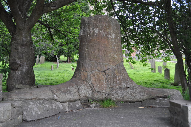
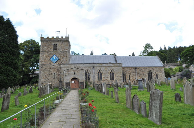
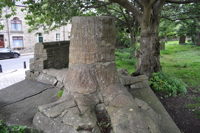
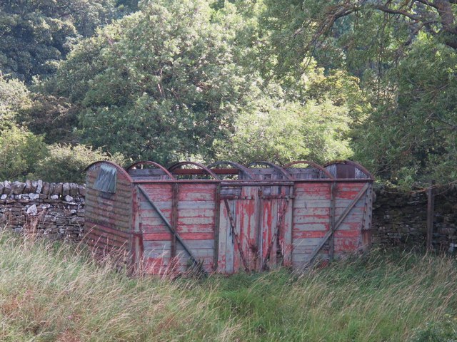
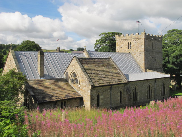
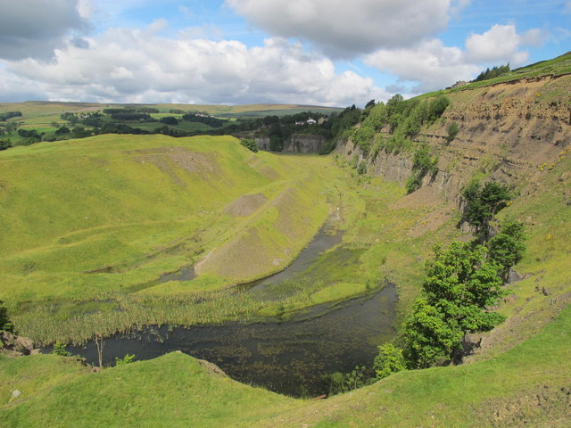
In addition to its natural beauty, Stanhope Dene boasts a rich cultural heritage. The valley is dotted with remnants of its industrial past, including old lead mines and quarries, which provide a glimpse into the region's history. There are also several charming villages and hamlets nestled within the dene, such as Stanhope and Frosterley, where visitors can explore traditional stone-built houses and enjoy a taste of rural life.

Overall, Stanhope Dene offers a captivating blend of natural beauty and historical significance, making it a must-visit destination for those seeking tranquility and a connection to the past.

If you have any feedback on the listing, please let us know in the comments section below.

Stanhope Dene Images

Images are sourced within 2km of 54.754774/-2.0195923 or Grid Reference NY9839. Thanks to Geograph Open Source API. All images are credited.

Stanhope Tree A preserved Sigillaria tree from the mid Carboniferous coal swamps. Instead of joining its coal friends it rotted away but was covered in sand which left a cast. <span class="nowrap"><a title="http://arthuride.files.wordpress.com/2010/12/sigillaria-tree1.jpg" rel="nofollow ugc noopener" href="http://arthuride.files.wordpress.com/2010/12/sigillaria-tree1.jpg">Link</a><img style="margin-left:2px;" alt="External link" title="External link - shift click to open in new window" src="https://s1.geograph.org.uk/img/external.png" width="10" height="10"/></span>

Preserved at a sand quarry it was brought here and erected in front of the church. The bark and root impressions are very good.
Stanhope Tree
A preserved Sigillaria tree from the mid Carboniferous coal swamps. Instead of joining its coal friends it rotted away but was covered in sand which left a cast. LinkExternal link Preserved at a sand quarry it was brought here and erected in front of the church. The bark and root impressions are very good.
St Thomas the Apostle Church, Stanhope The Church is an ancient structure, standing on the north side of the town. It is mainly of the Norman period, with its oldest portion being the lower stages of the tower. It consists of nave, aisles, chancel, south porch, and western tower. The chantry chapel at the east end of the south aisle, and dedicated to St. Mary, was probably added about 1225. (Carol Bleasdale)
St Thomas the Apostle Church, Stanhope
The Church is an ancient structure, standing on the north side of the town. It is mainly of the Norman period, with its oldest portion being the lower stages of the tower. It consists of nave, aisles, chancel, south porch, and western tower. The chantry chapel at the east end of the south aisle, and dedicated to St. Mary, was probably added about 1225. (Carol Bleasdale)
Stanhope Tree A preserved Sigillaria tree from the mid Carboniferous coal swamps. Instead of joining its coal friends it rotted away but was covered in sand which left a cast. <span class="nowrap"><a title="http://arthuride.files.wordpress.com/2010/12/sigillaria-tree1.jpg" rel="nofollow ugc noopener" href="http://arthuride.files.wordpress.com/2010/12/sigillaria-tree1.jpg">Link</a><img style="margin-left:2px;" alt="External link" title="External link - shift click to open in new window" src="https://s1.geograph.org.uk/img/external.png" width="10" height="10"/></span>

Preserved at a sand quarry it was brought here and erected in front of the church. The bark and root impressions are very good.
Stanhope Tree
A preserved Sigillaria tree from the mid Carboniferous coal swamps. Instead of joining its coal friends it rotted away but was covered in sand which left a cast. LinkExternal link Preserved at a sand quarry it was brought here and erected in front of the church. The bark and root impressions are very good.
Stanhope Railway Station Steam was due to be running but problems meant no service today. The station was restored in 2004 with reconstruction of the canopy. The Edwardian traveller would notice little difference apart from the footbridge, signal box and signage.
Stanhope Railway Station
Steam was due to be running but problems meant no service today. The station was restored in 2004 with reconstruction of the canopy. The Edwardian traveller would notice little difference apart from the footbridge, signal box and signage.
Stanhope Railway Station A view of the footbridge which hasn't changed in many years.
Stanhope Railway Station
A view of the footbridge which hasn't changed in many years.
Stanhope Railway Station The preserved railway station on the Weardale railway, a line offering a service to Bishops Auckland. Steam runs to Wolsingham and return. Since 2004 the canopy has been restored and facilities improved. <span class="nowrap"><a title="http://www.weardale-railway.org.uk/" rel="nofollow ugc noopener" href="http://www.weardale-railway.org.uk/">Link</a><img style="margin-left:2px;" alt="External link" title="External link - shift click to open in new window" src="https://s1.geograph.org.uk/img/external.png" width="10" height="10"/></span>
Stanhope Railway Station
The preserved railway station on the Weardale railway, a line offering a service to Bishops Auckland. Steam runs to Wolsingham and return. Since 2004 the canopy has been restored and facilities improved. LinkExternal link
Former Weardale Railway The line to Eastgate is now disused but ready for restoration.
Former Weardale Railway
The line to Eastgate is now disused but ready for restoration.
Old railway goods van near Greenhead Farm The location of this old railway goods van is shown in <a href="https://www.geograph.org.uk/photo/2559305">NY9739 : The valley of Allerton Burn near Greenhead Farm</a>.
Old railway goods van near Greenhead Farm
The location of this old railway goods van is shown in NY9739 : The valley of Allerton Burn near Greenhead Farm.
The valley of Allerton Burn near Greenhead Farm Shows the location of <a href="https://www.geograph.org.uk/photo/2559299">NY9739 : Old railway goods van near Greenhead Farm</a>.
The valley of Allerton Burn near Greenhead Farm
Weardale near Greenfoot
The Church of St. Thomas, Stanhope Viewed from Church Lane.
The Church of St. Thomas, Stanhope
Viewed from Church Lane.
Ashes Quarry (2) The quarry was a mile long and was worked for over 70 years. The North Pennines AONB has produced a leaflet about the quarry that includes a 2 mile walk around the area <span class="nowrap"><a title="http://www.northpennines.org.uk/getmedia.cfm?mediaid=13093" rel="nofollow ugc noopener" href="http://www.northpennines.org.uk/getmedia.cfm?mediaid=13093">Link</a><img style="margin-left:2px;" alt="External link" title="External link - shift click to open in new window" src="https://s1.geograph.org.uk/img/external.png" width="10" height="10"/></span>.
Ashes Quarry (2)
The quarry was a mile long and was worked for over 70 years. The North Pennines AONB has produced a leaflet about the quarry that includes a 2 mile walk around the area LinkExternal link.
Ashes Quarry The quarry was a mile long and was worked for over 70 years. The North Pennines AONB has produced a leaflet about the quarry that includes a 2 mile walk around the area <span class="nowrap"><a title="http://www.northpennines.org.uk/getmedia.cfm?mediaid=13093" rel="nofollow ugc noopener" href="http://www.northpennines.org.uk/getmedia.cfm?mediaid=13093">Link</a><img style="margin-left:2px;" alt="External link" title="External link - shift click to open in new window" src="https://s1.geograph.org.uk/img/external.png" width="10" height="10"/></span>. See also <a href="https://www.geograph.org.uk/photo/2559354">NY9939 : Ashes Quarry (2)</a>.
Ashes Quarry
The quarry was a mile long and was worked for over 70 years. The North Pennines AONB has produced a leaflet about the quarry that includes a 2 mile walk around the area LinkExternal link. See also NY9939 : Ashes Quarry (2).
Weardale around Allerton bridge west of Stanhope Looking south across the valley towards <a href="https://www.geograph.org.uk/photo/1226084">NY9838 : Newlandside Quarry</a> photographed by Peter McDermott.
Weardale around Allerton bridge west of Stanhope
Looking south across the valley towards NY9838 : Newlandside Quarry photographed by Peter McDermott.
Trackbed of the former mineral railway between Ashes Quarry and Crawleyside See <a href="https://www.geograph.org.uk/photo/2559354">NY9939 : Ashes Quarry (2)</a>.
Trackbed of the former mineral railway between Ashes Quarry and Crawleyside
Wooden sleepers in the trackbed of the former mineral railway between Ashes Quarry and Crawleyside See <a href="https://www.geograph.org.uk/photo/2562753">NY9939 : Trackbed of the former mineral railway between Ashes Quarry and Crawleyside</a>.
Wooden sleepers in the trackbed of the former mineral railway between Ashes Quarry and Crawleyside
Stanhope Bridge Stanhope Bridge is a grade II* listed building: 'Medieval and early C19 with C20 restoration' as the website British Listed Buildings tells - <span class="nowrap"><a title="http://britishlistedbuildings.co.uk/en-407548-stanhope-bridge-over-river-wear-stanhope" rel="nofollow ugc noopener" href="http://britishlistedbuildings.co.uk/en-407548-stanhope-bridge-over-river-wear-stanhope">Link</a><img style="margin-left:2px;" alt="External link" title="External link - shift click to open in new window" src="https://s1.geograph.org.uk/img/external.png" width="10" height="10"/></span> . The bridge provides a crossing of the River Wear just west of the town of Stanhope.
Stanhope Bridge
Stanhope Bridge is a grade II* listed building: 'Medieval and early C19 with C20 restoration' as the website British Listed Buildings tells - LinkExternal link . The bridge provides a crossing of the River Wear just west of the town of Stanhope.
Aller Gill House Aller Gill House lies on the south side of the River Wear and north of the minor road there.
Aller Gill House
Aller Gill House lies on the south side of the River Wear and north of the minor road there.
Show me another place!

Stanhope Dene is located at Grid Ref: NY9839 (Lat: 54.754774, Lng: -2.0195923)

Unitary Authority: County Durham

Police Authority: Durham

What 3 Words

///unrealistic.twig.broached. Near Stanhope, Co. Durham

Related Wikis

Crawley railway station (Durham)

Crawley railway station served the village of Crawleyside, County Durham, England, from 1845 to 1846 on the Stanhope and Tyne Railway. == History == The...

Crawleyside

Crawleyside is a village in the civil parish of Stanhope, in County Durham, England. It is situated to the north of Stanhope, in Weardale. In the 2001...

Greenfoot Quarry

Greenfoot Quarry is a Site of Special Scientific Interest in the Wear Valley district of west County Durham, England. It is a disused quarry, situated...

Heathery Burn Cave

Heathery Burn Cave is a cave near Stanhope, County Durham, England, in which a large collection of Late Bronze Age weapons and tools was discovered and...

Nearby Amenities

Located within 500m of 54.754774,-2.0195923
Bus Stop
Crawleyside Bank (Ashers Ho.)
Naptan AtcoCode: 13004501A
Naptan Bearing: N
Naptan CommonName: Crawleyside Bank (Ashers Ho.)
Naptan Indicator: north bound
Naptan Landmark: Landmark not known
Naptan NaptanCode: durdapgt
Naptan Notes: Opposite ashes house crawleyside- stanhope
Naptan Street: B6278
Naptan Verified: no
Source: naptan_import
Lat/Long: 54.7533676/-2.0150558
Bus Stop
Crawleyside Bank (Ashers Ho.)
Naptan AtcoCode: 13004501E
Naptan Bearing: S
Naptan CommonName: Crawleyside Bank (Ashers Ho.)
Naptan Indicator: south bound
Naptan Landmark: Landmark not known
Naptan NaptanCode: durdapgw
Naptan Notes: Ashes House- Crawleyside- Stanhope
Naptan Street: B6278
Naptan Verified: no
Source: naptan_import
Lat/Long: 54.7533676/-2.014916
Turning Circle
Lat/Long: 54.7521346/-2.0136651
Barrier: entrance
Lat/Long: 54.7590706/-2.0182775
Historic: mine
Lat/Long: 54.7564425/-2.0257216
Barrier: entrance
Lat/Long: 54.7517771/-2.0202488
Power: pole
Lat/Long: 54.752799/-2.0178889
Power: pole
Lat/Long: 54.752597/-2.0258845
Power: pole
Lat/Long: 54.7525188/-2.0246199
Power: pole
Lat/Long: 54.7524461/-2.0234022
Power: pole
Lat/Long: 54.7523694/-2.0221362
Power: pole
Lat/Long: 54.7522913/-2.0208809
Power: pole
Lat/Long: 54.7522185/-2.0196766
Power: pole
Lat/Long: 54.7521465/-2.0184508
Power: pole
Lat/Long: 54.7520777/-2.0171808
Power: pole
Lat/Long: 54.7519886/-2.015892
Power: pole
Lat/Long: 54.7519252/-2.0148419
Power: pole
Lat/Long: 54.7519739/-2.0254675
Power: pole
Lat/Long: 54.7572536/-2.0260388
Power: pole
Lat/Long: 54.7569248/-2.0138039
Power: pole
Lat/Long: 54.7568652/-2.0152456
Barrier: entrance
Lat/Long: 54.759042/-2.0184132
Lane Head
Place: farm
Source Name: OS_OpenData_StreetView
Lat/Long: 54.7557956/-2.0159912
Power: pole
Transformer: distribution
Lat/Long: 54.7545891/-2.0176207
Power: pole
Lat/Long: 54.7545744/-2.0177105
Power: pole
Lat/Long: 54.7552052/-2.0180485
Power: pole
Lat/Long: 54.7554752/-2.0182
Fixme: continue (longer than this)
Lat/Long: 54.7571487/-2.0137484
Direction: NNW
Guidepost: hiking
Information: guidepost
Tourism: information
Lat/Long: 54.7549662/-2.0159169
The data included in this document is from www.openstreetmap.org. The data is made available under ODbL.

Have you been to Stanhope Dene?

Leave your review of Stanhope Dene below (or comments, questions and feedback).