Adjustment Bottom

Valley in Yorkshire Richmondshire

England

Adjustment Bottom

Beck Crooks Ford This ford is found on Beck Crooks.
Beck Crooks Ford Credit: John Walton

Adjustment Bottom is a small valley located in the county of Yorkshire, England. Nestled in the picturesque countryside, it is part of the larger Yorkshire Dales National Park, renowned for its natural beauty and diverse wildlife. The valley is situated in the southern region of the park, near the village of Austwick.

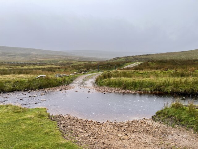
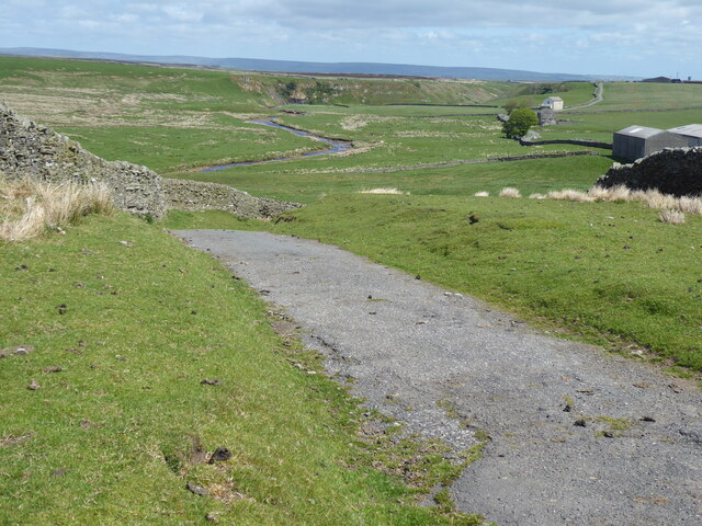
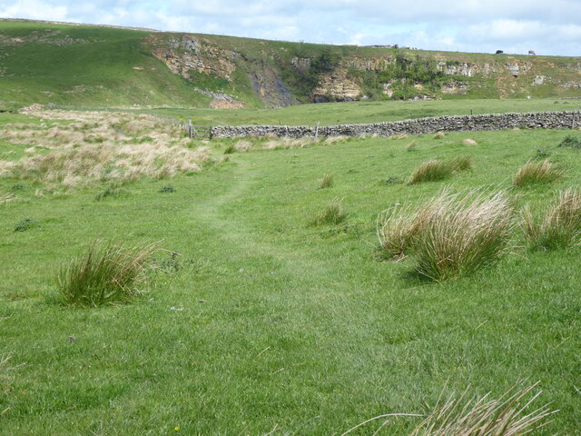
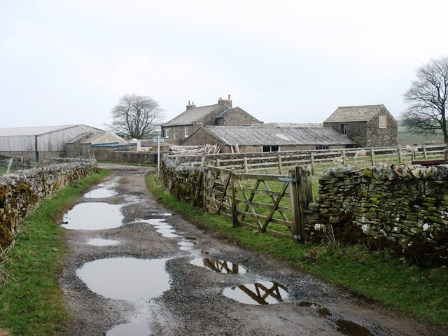
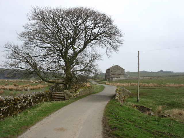
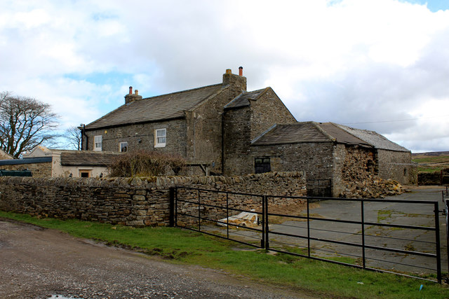
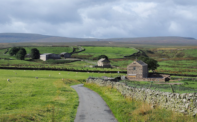
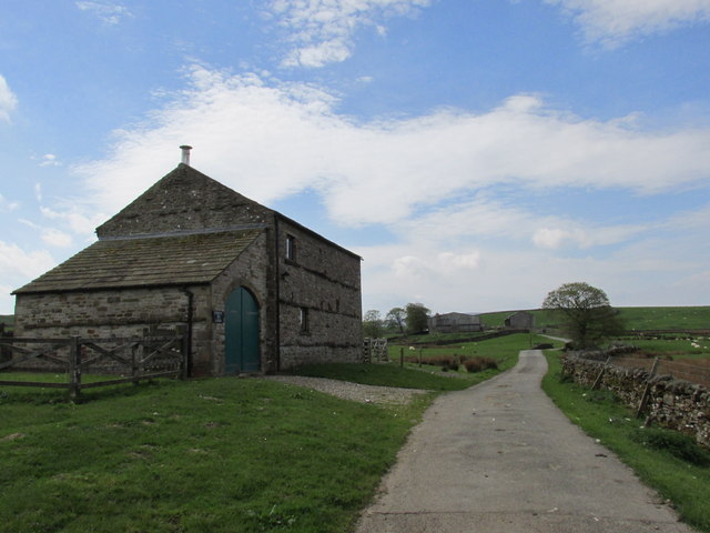
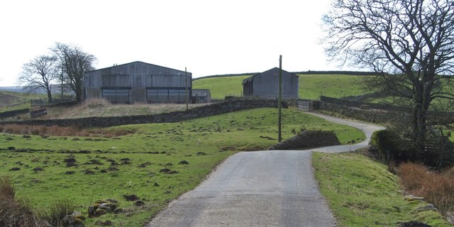
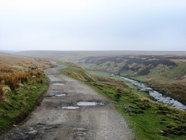
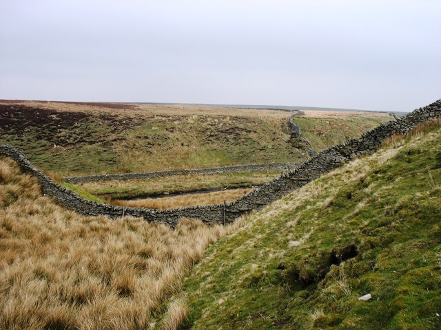
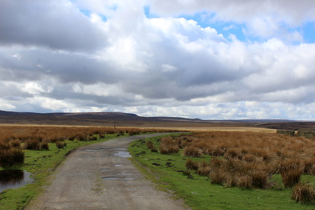
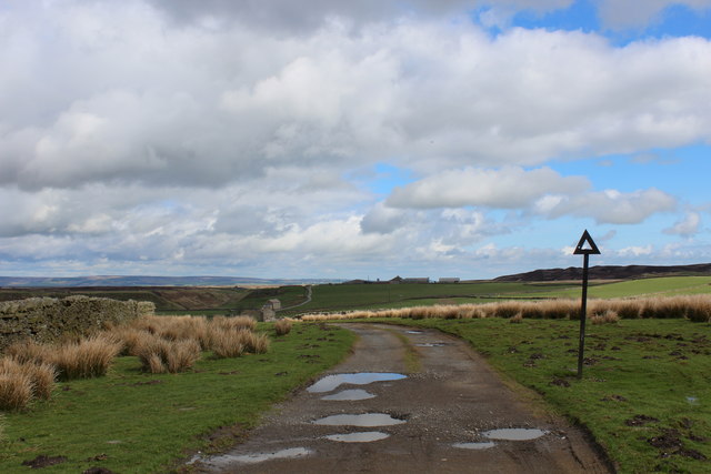
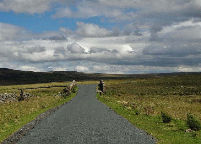
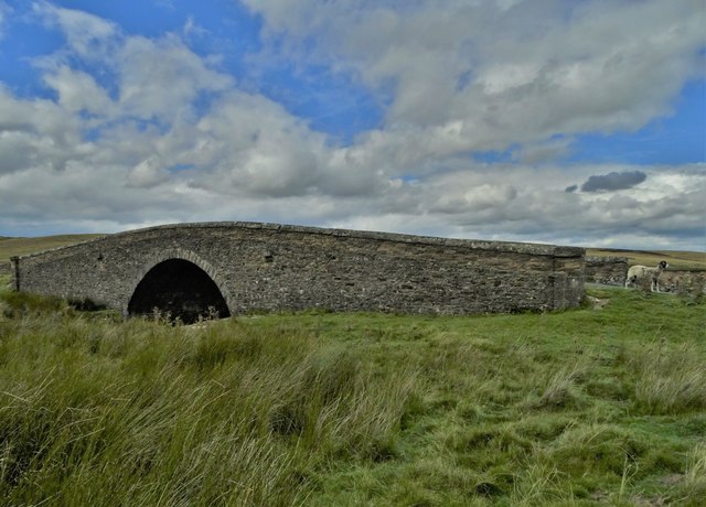
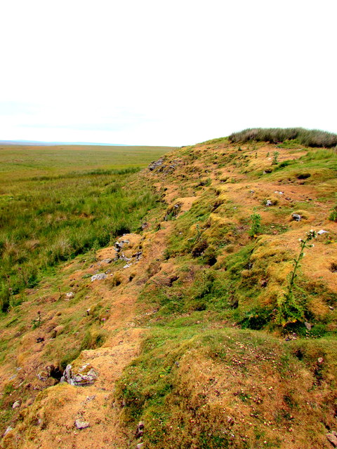
Characterized by its rolling hills, lush green meadows, and winding streams, Adjustment Bottom offers a tranquil and idyllic setting for visitors and locals alike. The valley is lined with dry stone walls, which not only add to its charm but also serve as a testament to the area's rich agricultural heritage.

The landscape of Adjustment Bottom is dominated by expansive pastures, where sheep and cattle graze peacefully. In spring and summer, the valley is transformed into a kaleidoscope of vibrant colors, as wildflowers bloom in abundance. The surrounding woodland, predominantly consisting of native species such as oak and ash, provides a habitat for a variety of bird species, making it a haven for birdwatchers and nature enthusiasts.

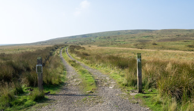
A network of footpaths and bridleways crisscrosses the valley, allowing visitors to explore the area on foot or by bike. These paths lead to panoramic viewpoints, revealing breathtaking vistas of the surrounding countryside. The valley is also intersected by a picturesque stream, which meanders through the landscape, offering opportunities for paddling and picnicking along its banks.

Overall, Adjustment Bottom is a hidden gem within the Yorkshire Dales National Park, offering visitors a peaceful retreat in the heart of nature. Its unspoiled beauty and tranquil atmosphere make it a must-visit destination for those seeking solace in the Yorkshire countryside.

If you have any feedback on the listing, please let us know in the comments section below.

Adjustment Bottom Images

Images are sourced within 2km of 54.471188/-2.0700959 or Grid Reference NY9508. Thanks to Geograph Open Source API. All images are credited.

Beck Crooks Ford This ford is found on Beck Crooks.
Beck Crooks Ford
This ford is found on Beck Crooks.
The Pennine Way on Sleightholme Moor Road
The Pennine Way near Sleightholme Farm
The Pennine Way near Jack Shields Bridge
Sleightholme Farm The Pennine Way passes along this track.
Sleightholme Farm
The Pennine Way passes along this track.
Kingdom Lodge, Sleightholme Bar Gap Farm is on the horizon to the right. The lane runs to Gilmonby and Bowes.
Kingdom Lodge, Sleightholme
Bar Gap Farm is on the horizon to the right. The lane runs to Gilmonby and Bowes.
Sleightholme Farm For northbound Pennine Way walkers this comes as a welcome relief - being the first sign of civilisation since the long trek from Tan Hill Inn.
Sleightholme Farm
For northbound Pennine Way walkers this comes as a welcome relief - being the first sign of civilisation since the long trek from Tan Hill Inn.
Buildings at Sleightholme The most distant is Sleightholme Farm, the two nearer buildings are both barn conversions; the middle one is Kingdom Lodge, the nearer barn is a recent development.
Buildings at Sleightholme
The most distant is Sleightholme Farm, the two nearer buildings are both barn conversions; the middle one is Kingdom Lodge, the nearer barn is a recent development.
Kingdom Lodge. On the road to Sleightholme Farm.
Kingdom Lodge.
On the road to Sleightholme Farm.
Sleightholme Farm The farm marks the end of the narrow road which crosses the moor from Bowes, although there is a track continuing towards the Tan Hill road. This is considered to be unsuitable for motor vehicles, but a certain geograph contributor did drive it many years ago in a VW Beetle.
Sleightholme Farm
The farm marks the end of the narrow road which crosses the moor from Bowes, although there is a track continuing towards the Tan Hill road. This is considered to be unsuitable for motor vehicles, but a certain geograph contributor did drive it many years ago in a VW Beetle.
The track beside Sleightholme Beck The Pennine Way follows this track for about 2 kilometres.
The track beside Sleightholme Beck
The Pennine Way follows this track for about 2 kilometres.
Sleightholme Beck Seen from the Pennine Way.
Sleightholme Beck
Seen from the Pennine Way.
Estate road rising towards Leading Stead Leading Stead is an ill-defined upland location named on OS maps as part of Arkengarthdale Moor - another of them! The estate road climbs only a short way up the slope which is on the south side of Arkengarthdale.
Estate road rising towards Leading Stead
Leading Stead is an ill-defined upland location named on OS maps as part of Arkengarthdale Moor - another of them! The estate road climbs only a short way up the slope which is on the south side of Arkengarthdale.
Pennine Way leading away from Sleightholme Farm For southbound Pennine Way walkers the prospect of a long tramp of gradual ascent over Sleightholme Moor lies ahead.
Reward is bestowed when Tan Hill Inn is finally reached.
Pennine Way leading away from Sleightholme Farm
For southbound Pennine Way walkers the prospect of a long tramp of gradual ascent over Sleightholme Moor lies ahead. Reward is bestowed when Tan Hill Inn is finally reached.
Pennine Way heading North East to Sleightholme Farm The farm is just out of sight at the bottom of this incline.
The ancient and redundant road sign indicates this track was once open for vehicular access - and still navigable with a robust 4x4.
Pennine Way heading North East to Sleightholme Farm
The farm is just out of sight at the bottom of this incline. The ancient and redundant road sign indicates this track was once open for vehicular access - and still navigable with a robust 4x4.
Beck Crooks Bridge over Arkle Beck
Beck Crooks Bridge
Beck Crooks Bridge
The rabbit infested Limestone Hill An outcrop of Great Limestone, formed in the Carboniferous Period 322 to 326 million years ago.
The rabbit infested Limestone Hill
An outcrop of Great Limestone, formed in the Carboniferous Period 322 to 326 million years ago.
Show me another place!

Adjustment Bottom is located at Grid Ref: NY9508 (Lat: 54.471188, Lng: -2.0700959)

Division: North Riding

Administrative County: North Yorkshire

District: Richmondshire

Police Authority: North Yorkshire

What 3 Words

///eyeliner.positions.piston. Near Bowes, Co. Durham

Related Wikis

Sleightholme

Sleightholme is a secluded hamlet on a dead end road in County Durham, England. It lies beside Sleightholme Beck, a tributary of the River Greta. The...

Walney to Wear and Whitby Cycle Route

The Walney to Wear and Whitby Cycle Route (or W2W) is the name of a cross-country cycle route in Northern England. It runs from Walney Island in Cumbria...

National Cycle Route 70

National Cycle Network (NCN) Route 70 is a Sustrans National Route that runs from Walney Island in Cumbria to Sunderland. The route is fully open and signed...

Arkengarthdale

Arkengarthdale is a dale, or valley, on the east side of the Pennines in North Yorkshire, England. Running roughly north-west to south-east, it is the...

Sleightholme Beck Gorge – The Troughs

Sleightholme Beck Gorge – The Troughs is a Site of Special Scientific Interest in the County Durham district of south-west County Durham, England. The...

Bowes Moor

Bowes Moor is a Site of Special Scientific Interest in the County Durham district in south-west County Durham, England. It is an extensive area of moorland...
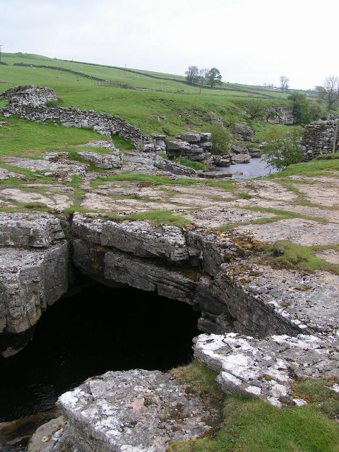
God's Bridge

God's Bridge is a Site of Special Scientific Interest in the County Durham district of south-west County Durham, England. It is a natural limestone bridge...

Whaw

Whaw is a hamlet in Arkengarthdale in North Yorkshire, England. It is one of few settlements in the dale and is one of the smallest. Its name derives from...

Nearby Amenities

Located within 500m of 54.471188,-2.0700959
Rushy Moor
Place: locality
Lat/Long: 54.4727562/-2.0751254
West Moor
Place: locality
Lat/Long: 54.469087/-2.0697279
Adjustment Bottom
Place: locality
Lat/Long: 54.4710996/-2.0708861
Scabba Wath
Place: locality
Lat/Long: 54.4704048/-2.0649272
The data included in this document is from www.openstreetmap.org. The data is made available under ODbL.

Have you been to Adjustment Bottom?

Leave your review of Adjustment Bottom below (or comments, questions and feedback).