Rushy Moor Bottom

Valley in Yorkshire

England

Rushy Moor Bottom

Beck Crooks Ford This ford is found on Beck Crooks.
Beck Crooks Ford Credit: John Walton

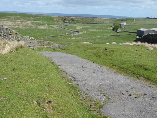
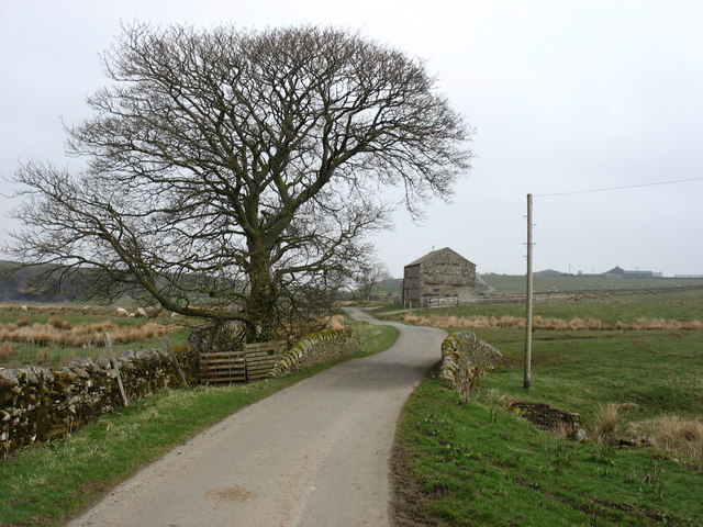
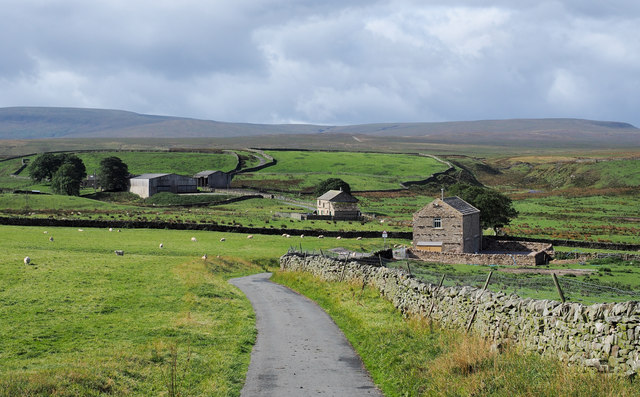
Rushy Moor Bottom is a picturesque valley located in the county of Yorkshire, England. Nestled within the stunning Yorkshire Dales National Park, this tranquil valley offers breathtaking views and a serene atmosphere.

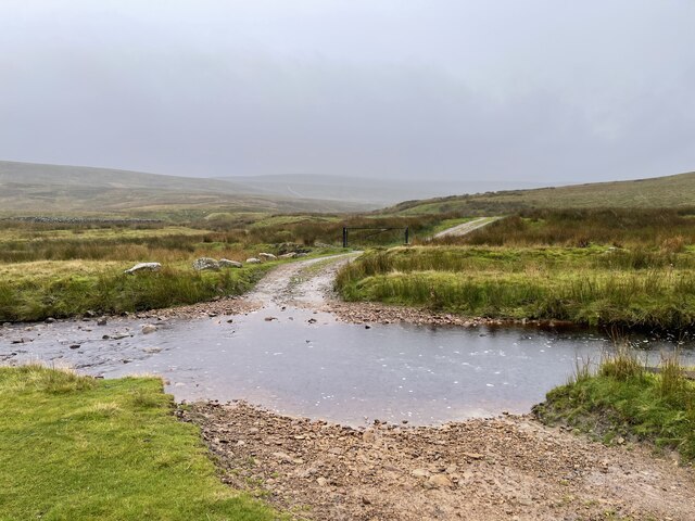
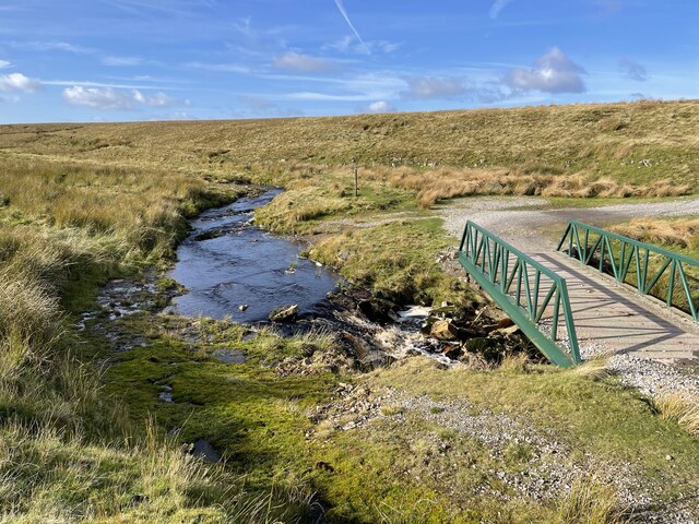
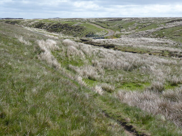
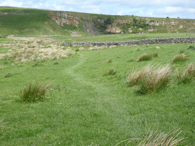
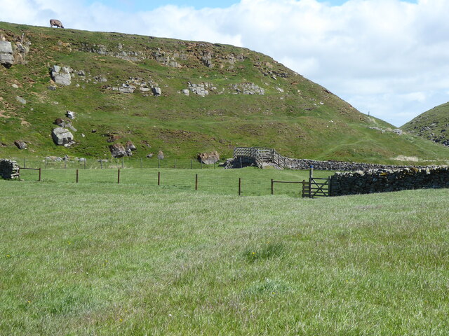
Rushy Moor Bottom is renowned for its untouched natural beauty, characterized by rolling hills, lush green meadows, and vibrant wildflowers. The valley's landscape is dotted with meandering streams and charming wooden bridges, adding to its idyllic charm. The area is home to an abundance of wildlife, including various bird species, foxes, and rabbits, making it a popular spot for nature lovers and birdwatchers.

The valley is also rich in history, with evidence of human habitation dating back to ancient times. Archaeological discoveries in the area have revealed remnants of Iron Age settlements, including stone tools and pottery fragments. The valley's historical significance further adds to its appeal.

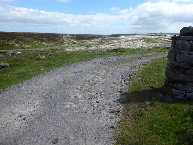
Visitors to Rushy Moor Bottom can indulge in a range of outdoor activities. The valley offers excellent hiking trails, allowing visitors to explore the surrounding countryside and enjoy panoramic vistas. The area is also popular for cycling, with designated routes catering to all skill levels.

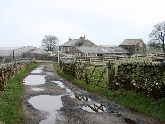
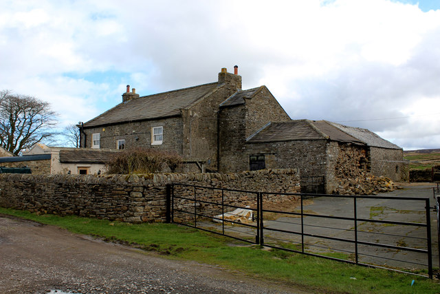
For those seeking a peaceful retreat, Rushy Moor Bottom offers a variety of accommodation options, ranging from cozy bed and breakfasts to charming cottages. Local amenities, such as quaint pubs and tea rooms, provide visitors with the opportunity to experience traditional Yorkshire hospitality and cuisine.

In conclusion, Rushy Moor Bottom is a captivating valley in Yorkshire, offering a harmonious blend of natural beauty, historical significance, and outdoor activities. It is a haven for those seeking a peaceful escape in the heart of the stunning Yorkshire Dales.

If you have any feedback on the listing, please let us know in the comments section below.

Rushy Moor Bottom Images

Images are sourced within 2km of 54.475004/-2.0760744 or Grid Reference NY9508. Thanks to Geograph Open Source API. All images are credited.

Beck Crooks Ford This ford is found on Beck Crooks.
Beck Crooks Ford
This ford is found on Beck Crooks.
Frumming Beck Ford This ford on the Frumming Beck is found at the point where the Pennine Way leaves the estate road. The other three fords shown on the OS map at Dry Gill have now been replaced by identical bridges to the one shown in this image.
Frumming Beck Ford
This ford on the Frumming Beck is found at the point where the Pennine Way leaves the estate road. The other three fords shown on the OS map at Dry Gill have now been replaced by identical bridges to the one shown in this image.
The Pennine Way near Cocker Hag
The Pennine Way near Sleightholme Moor Road
The Pennine Way on Sleightholme Moor Road
The Pennine Way near Sleightholme Farm
The Pennine Way near Jack Shields Bridge
The Pennine Way near Intake Bridge
Sleightholme Farm The Pennine Way passes along this track.
Sleightholme Farm
The Pennine Way passes along this track.
Kingdom Lodge, Sleightholme Bar Gap Farm is on the horizon to the right. The lane runs to Gilmonby and Bowes.
Kingdom Lodge, Sleightholme
Bar Gap Farm is on the horizon to the right. The lane runs to Gilmonby and Bowes.
Intake Bridge Footbridge that carries the Pennine Way over Sleightholme Beck, below the exposed sandstone of Bog Scar
Intake Bridge
Footbridge that carries the Pennine Way over Sleightholme Beck, below the exposed sandstone of Bog Scar
Bog Scar As seen from the Pennine Way on Intake Bridge - heavy exposure of sandstone above Sleighthome Beck
Bog Scar
As seen from the Pennine Way on Intake Bridge - heavy exposure of sandstone above Sleighthome Beck
Sleightholme Farm For northbound Pennine Way walkers this comes as a welcome relief - being the first sign of civilisation since the long trek from Tan Hill Inn.
Sleightholme Farm
For northbound Pennine Way walkers this comes as a welcome relief - being the first sign of civilisation since the long trek from Tan Hill Inn.
Buildings at Sleightholme The most distant is Sleightholme Farm, the two nearer buildings are both barn conversions; the middle one is Kingdom Lodge, the nearer barn is a recent development.
Buildings at Sleightholme
The most distant is Sleightholme Farm, the two nearer buildings are both barn conversions; the middle one is Kingdom Lodge, the nearer barn is a recent development.
Bog Scar Bog Scar is on the north side of Sleightholme Beck; it's seen here from a footbridge over that river which carries a public footpath, also the route of the Pennine Way.
Bog Scar
Bog Scar is on the north side of Sleightholme Beck; it's seen here from a footbridge over that river which carries a public footpath, also the route of the Pennine Way.
Bog Scar Viewed from Intake Bridge.
Bog Scar
Viewed from Intake Bridge.
Bog Tarn Bog Tarn: so unattractively yet so appositely named! The pool is on an almost flat tract of moorland and there the water table simply reaches the land surface and so the tarn... and so also the surrounding bog and rushes.
In the distance, to the right, rises the shallow cone of Citron Seat with, to the left, can you believe it, the feature named on maps as 'Seven Hills'.
Bog Tarn
Bog Tarn: so unattractively yet so appositely named! The pool is on an almost flat tract of moorland and there the water table simply reaches the land surface and so the tarn... and so also the surrounding bog and rushes. In the distance, to the right, rises the shallow cone of Citron Seat with, to the left, can you believe it, the feature named on maps as 'Seven Hills'.
Farm buildings at Bar Gap The name Bar Gap has almost a 'Western' ring to it! These buildings however are not in Arizona but at the farm of that name, west of Sleightholme Beck, a tributary of the River Greta. The view is from the minor road close to the farm, at a cattle grid.
Farm buildings at Bar Gap
The name Bar Gap has almost a 'Western' ring to it! These buildings however are not in Arizona but at the farm of that name, west of Sleightholme Beck, a tributary of the River Greta. The view is from the minor road close to the farm, at a cattle grid.
Show me another place!

Rushy Moor Bottom is located at Grid Ref: NY9508 (Lat: 54.475004, Lng: -2.0760744)

Division: North Riding

Unitary Authority: County Durham

Police Authority: Durham

What 3 Words

///middle.zoomed.distanced. Near Bowes, Co. Durham

Related Wikis

Sleightholme

Sleightholme is a secluded hamlet on a dead end road in County Durham, England. It lies beside Sleightholme Beck, a tributary of the River Greta. The...

Walney to Wear and Whitby Cycle Route

The Walney to Wear and Whitby Cycle Route (or W2W) is the name of a cross-country cycle route in Northern England. It runs from Walney Island in Cumbria...

National Cycle Route 70

National Cycle Network (NCN) Route 70 is a Sustrans National Route that runs from Walney Island in Cumbria to Sunderland. The route is fully open and signed...

Bowes Moor

Bowes Moor is a Site of Special Scientific Interest in the County Durham district in south-west County Durham, England. It is an extensive area of moorland...

Sleightholme Beck Gorge – The Troughs

Sleightholme Beck Gorge – The Troughs is a Site of Special Scientific Interest in the County Durham district of south-west County Durham, England. The...
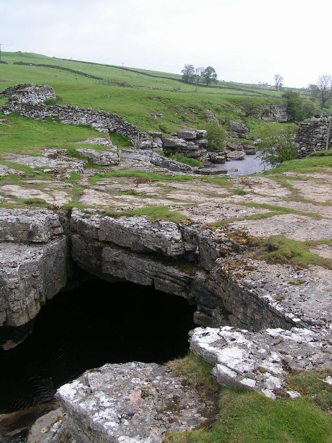
God's Bridge

God's Bridge is a Site of Special Scientific Interest in the County Durham district of south-west County Durham, England. It is a natural limestone bridge...

Arkengarthdale

Arkengarthdale is a dale, or valley, on the east side of the Pennines in North Yorkshire, England. Running roughly north-west to south-east, it is the...

Whaw

Whaw is a hamlet in Arkengarthdale in North Yorkshire, England. It is one of few settlements in the dale and is one of the smallest. Its name derives from...

Nearby Amenities

Located within 500m of 54.475004,-2.0760744
Coney Seat Hill
Is In County: North Yorkshire
Is In Historic County: Yorkshire
Natural: peak
Source: NPE
Lat/Long: 54.4757496/-2.0700639
Rushy Moor Bottom
Place: locality
Lat/Long: 54.4758733/-2.0807474
Rushy Moor End
Place: locality
Lat/Long: 54.4717961/-2.0801036
Rushy Moor
Place: locality
Lat/Long: 54.4727562/-2.0751254
Malice End
Place: locality
Lat/Long: 54.4786536/-2.0776574
The data included in this document is from www.openstreetmap.org. The data is made available under ODbL.

Have you been to Rushy Moor Bottom?

Leave your review of Rushy Moor Bottom below (or comments, questions and feedback).