Harcombe Bottom

Valley in Gloucestershire Cotswold

England

Harcombe Bottom

Brimsfield Park Farm
Brimsfield Park Farm Credit: P Gaskell

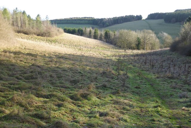
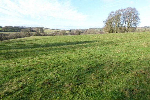
Harcombe Bottom is a picturesque valley located in the county of Gloucestershire, England. Nestled amidst the rolling hills of the Cotswolds, this tranquil valley offers breathtaking natural beauty and a peaceful escape from the bustling city life.

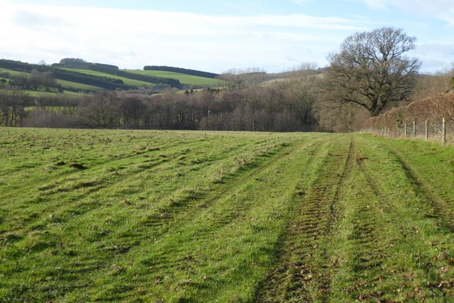
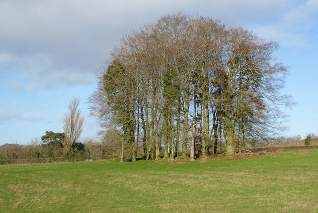
The valley is characterized by its lush green meadows, dense woodlands, and a sparkling stream that meanders through its heart, adding to its idyllic charm. The surrounding hills provide a stunning backdrop, adorned with vibrant wildflowers during the spring and summer months. The valley is home to a diverse range of flora and fauna, making it a haven for nature lovers and wildlife enthusiasts.

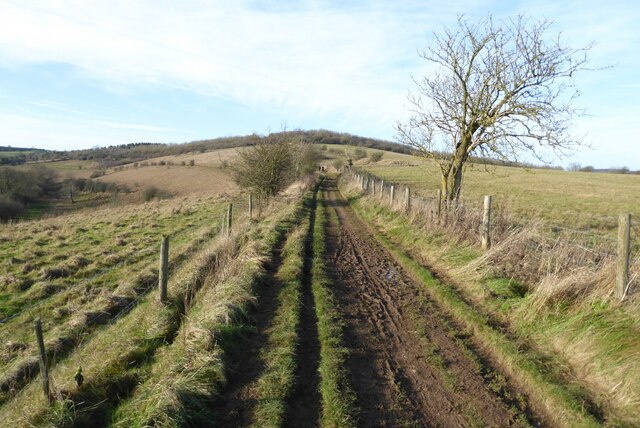
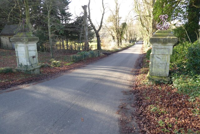
Harcombe Bottom is a popular destination for outdoor activities, offering a plethora of walking trails and hiking routes that cater to all levels of fitness. The valley is also a haven for cyclists, with its scenic country lanes and challenging terrains providing an exciting adventure for biking enthusiasts.

In addition to its natural beauty, Harcombe Bottom boasts a rich history. The valley is dotted with ancient archaeological sites, including Neolithic burial mounds and Iron Age settlements, showcasing the area's significance throughout the ages.

Visitors to Harcombe Bottom can enjoy a peaceful picnic by the stream or simply immerse themselves in the serenity of the surroundings. The valley's unspoiled beauty and tranquil ambiance make it a perfect retreat for those seeking an escape from the hustle and bustle of everyday life.

If you have any feedback on the listing, please let us know in the comments section below.

Harcombe Bottom Images

Images are sourced within 2km of 51.824153/-2.0652884 or Grid Reference SO9513. Thanks to Geograph Open Source API. All images are credited.

Brimsfield Park Farm
Watercombe Farm
Watercombe Farm
Manx Loaghtan sheep Manx Loaghtan sheep in a field at Coberley.
Manx Loaghtan sheep
Manx Loaghtan sheep in a field at Coberley.
Manx Loaghtan sheep Manx Loaghtan sheep in a field at Coberley.
Manx Loaghtan sheep
Manx Loaghtan sheep in a field at Coberley.
Manx Loaghtan sheep Manx Loaghtan sheep in a field at Coberley.
Manx Loaghtan sheep
Manx Loaghtan sheep in a field at Coberley.
The Gloucestershire Way The Gloucestershire Way crossing a field between forestry and entering the valley above Coberley known as Coldwell Bottom.
The Gloucestershire Way
The Gloucestershire Way crossing a field between forestry and entering the valley above Coberley known as Coldwell Bottom.
Coldwell Bottom The Gloucestershire Way long distance footpath follows this path above the valley on the right which is called Coldwell Bottom.
Coldwell Bottom
The Gloucestershire Way long distance footpath follows this path above the valley on the right which is called Coldwell Bottom.
Path and gate above Coldwell Bottom The Gloucestershire Way follows this right of way above Coldwell Bottom.
Path and gate above Coldwell Bottom
The Gloucestershire Way follows this right of way above Coldwell Bottom.
Coldwell Bottom View across Coldwell Bottom to the Churn valley beyond, from the Gloucestershire Way.
Coldwell Bottom
View across Coldwell Bottom to the Churn valley beyond, from the Gloucestershire Way.
Gloucestershire Way Gloucestershire Way with Coldwell Bottom below on the left.
Gloucestershire Way
Gloucestershire Way with Coldwell Bottom below on the left.
A junction of paths The right of way on the left passing through the gate is the route of the Gloucestershire Way, alternatively there is a right of way on the right which eventually rejoins the Gloucestershire Way.
A junction of paths
The right of way on the left passing through the gate is the route of the Gloucestershire Way, alternatively there is a right of way on the right which eventually rejoins the Gloucestershire Way.
A junction of rights of way Continuing along this right of way passes Cuckoopen Barn Farm.  The path on the left, out of view is the route of the Gloucestershire Way.  This is almost exactly the same view as when I was last here almost fourteen years ago to the day <a href="https://www.geograph.org.uk/photo/653006">SO9515 : Footpath junction near Coberley</a>.
A junction of rights of way
Continuing along this right of way passes Cuckoopen Barn Farm. The path on the left, out of view is the route of the Gloucestershire Way. This is almost exactly the same view as when I was last here almost fourteen years ago to the day SO9515 : Footpath junction near Coberley.
The Gloucestershire Way The Gloucestershire Way to the west of Coberley and above Coldwell Bottom which is out of view on the left.
The Gloucestershire Way
The Gloucestershire Way to the west of Coberley and above Coldwell Bottom which is out of view on the left.
Farmland Coberley View to the west across farmland between Coberley and Cowley.
Farmland Coberley
View to the west across farmland between Coberley and Cowley.
Clump of trees Clump of trees beside a footpath between Cowley and Coberley.
Clump of trees
Clump of trees beside a footpath between Cowley and Coberley.
Field at Cowley in the Churn valley This field between Cowley and Coberley was the site of a Channel 4 'Time Team' dig.  The programme was entitled "Mysteries of the Mosaic" in which they unearthed mosaics and a Roman villa.  The site is a scheduled monument, see: <span class="nowrap"><a title="https://historicengland.org.uk/listing/the-list/list-entry/1405896" rel="nofollow ugc noopener" href="https://historicengland.org.uk/listing/the-list/list-entry/1405896">Link</a><img style="margin-left:2px;" alt="External link" title="External link - shift click to open in new window" src="https://s1.geograph.org.uk/img/external.png" width="10" height="10"/></span>
Field at Cowley in the Churn valley
This field between Cowley and Coberley was the site of a Channel 4 'Time Team' dig. The programme was entitled "Mysteries of the Mosaic" in which they unearthed mosaics and a Roman villa. The site is a scheduled monument, see: LinkExternal link
Gate pillars on the road to Cowley This pair of gate pillars flank this road at its junction with the A435.  The road leads to Cowley and originally this was a private drive to a manor.  There used to be a lodge to the left but it was demolished in the 1960s.
Gate pillars on the road to Cowley
This pair of gate pillars flank this road at its junction with the A435. The road leads to Cowley and originally this was a private drive to a manor. There used to be a lodge to the left but it was demolished in the 1960s.
Grave of Sir James Horlick, 1st Baronet Grave of Sir James Horlick, 1st Baronet in Cowley churchyard.  He lived in Cowley Manor which is next to the church and now a luxury hotel.  James and his brother William were born in Ruardean in the Forest of Dean and went off to the United States where they developed the Horlicks brand.
Grave of Sir James Horlick, 1st Baronet
Grave of Sir James Horlick, 1st Baronet in Cowley churchyard. He lived in Cowley Manor which is next to the church and now a luxury hotel. James and his brother William were born in Ruardean in the Forest of Dean and went off to the United States where they developed the Horlicks brand.
Show me another place!

Harcombe Bottom is located at Grid Ref: SO9513 (Lat: 51.824153, Lng: -2.0652884)

Administrative County: Gloucestershire

District: Cotswold

Police Authority: Gloucestershire

What 3 Words

///recapture.river.clear. Near Shurdington, Gloucestershire

Related Wikis

Cowley, Gloucestershire

Cowley is a village and civil parish in the Cotswold District of Gloucestershire, England. It lies between the A417 and A435 roads between Cheltenham...

Bushley Muzzard, Brimpsfield

Bushley Muzzard, Brimpsfield (grid reference SO944133) is a 1.13-hectare (2.8-acre) biological Site of Special Scientific Interest in Gloucestershire,...

Church of St Michael, Brimpsfield

The Anglican Church of St Michael at Brimpsfield in the Cotswold District of Gloucestershire, England was built in 12th century. It is a grade I listed...

Brimpsfield Priory

Brimpsfield Priory was a Benedictine monastic foundation in Brimpsfield, Gloucestershire, England, a cell or grange of the Abbey of Saint-Wandrille in...

Church of St John the Evangelist, Elkstone

The Anglican Church of St John the Evangelist at Elkstone in the Cotswold District of Gloucestershire, England was built in the 12th century. It is a grade...

Elkstone

Elkstone is a village and civil parish in the English county of Gloucestershire. In the 2001 United Kingdom census, the parish had a population of 203...

Coberley

Coberley is a village and civil parish in the Cotswold District of Gloucestershire in England, 4 miles (6.4 km) south of Cheltenham. It lies at the confluence...

Cockleford Marsh

Cockleford Marsh (grid reference SO977133) is a 3.2-hectare (7.9-acre) biological Site of Special Scientific Interest in Gloucestershire, notified in 1991...

Nearby Amenities

Located within 500m of 51.824153,-2.0652884
Barrier: kissing_gate
Lat/Long: 51.8245868/-2.0588019
Passing Place
Lat/Long: 51.8232142/-2.0637059
Addr Housename: Keepers Cottage
Lat/Long: 51.8215749/-2.0665475
Harcombe Bottom
Place: locality
Source Name: OS_OpenMap_Local
Lat/Long: 51.8238163/-2.0642066
Keepers Cottage
Power: pole
Transformer: distribution
Voltage Primary: 11000
Lat/Long: 51.8217804/-2.0668995
Harding's Barn
Location Transition: yes
Power: pole
Transformer: distribution
Voltage Primary: 11000
Lat/Long: 51.8241544/-2.068816
Power: pole
Lat/Long: 51.8250646/-2.0681307
Power: pole
Lat/Long: 51.8258686/-2.0686899
Power: pole
Lat/Long: 51.8268359/-2.068069
Power: pole
Lat/Long: 51.8277451/-2.067491
Power: pole
Lat/Long: 51.8284844/-2.0672295
The data included in this document is from www.openstreetmap.org. The data is made available under ODbL.

Have you been to Harcombe Bottom?

Leave your review of Harcombe Bottom below (or comments, questions and feedback).