Lead Mine Clough

Valley in Yorkshire

England

Lead Mine Clough

Dam on Red Carr Clough The dam and weir seem to create a settlement pond for water draining into the catchment drain for Gorple Upper Reservoir
Dam on Red Carr Clough Credit: Kevin Waterhouse

Lead Mine Clough is a picturesque valley located in Yorkshire, England. Nestled within the beautiful landscape of the Pennines, this valley is renowned for its rich history and stunning natural beauty.

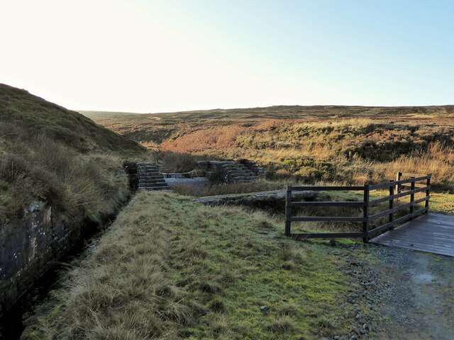
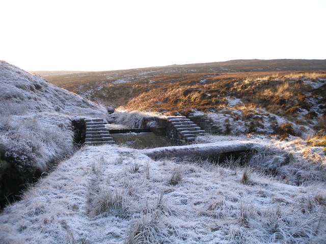
The name "Lead Mine Clough" originates from its historical significance as a lead mining site during the 18th and 19th centuries. The valley was once home to several lead mines, which played a crucial role in the local economy. Today, remnants of the mining industry can still be seen, including the remains of old mining structures and spoil heaps.

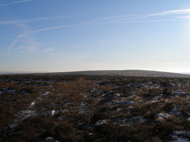
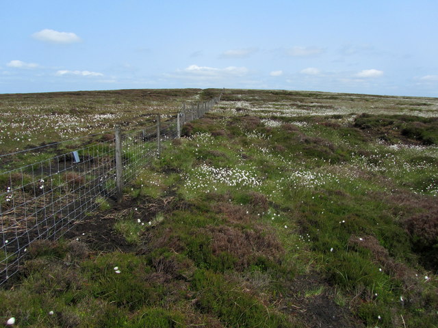
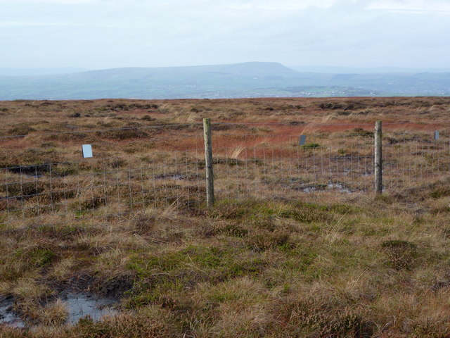
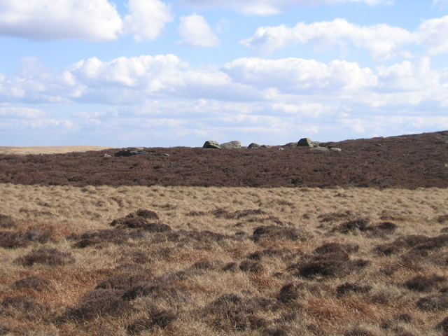
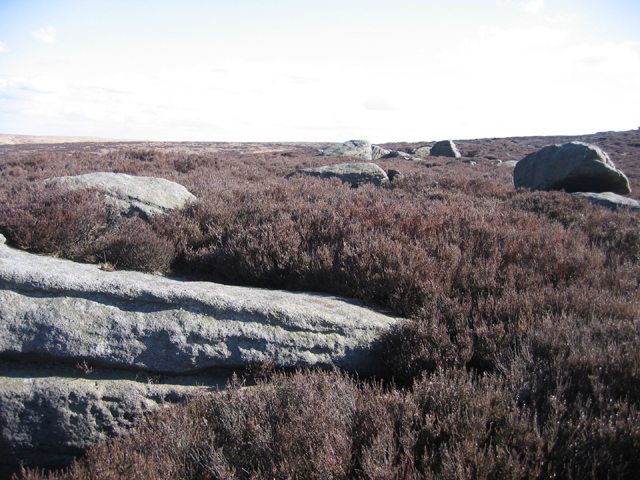
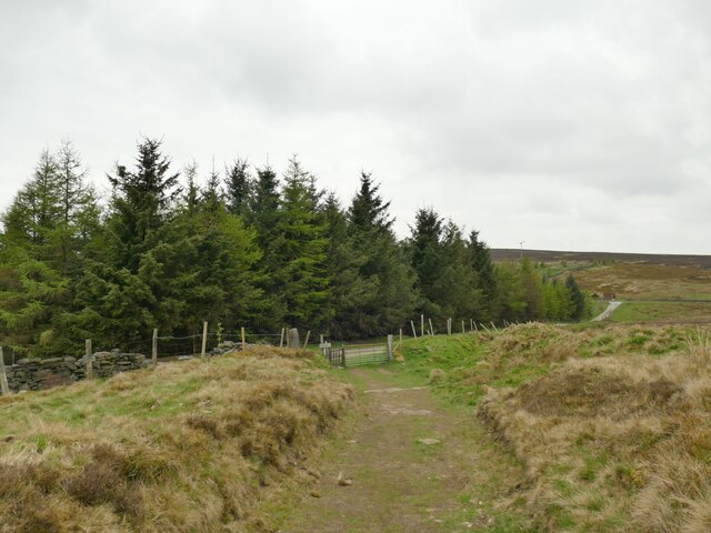
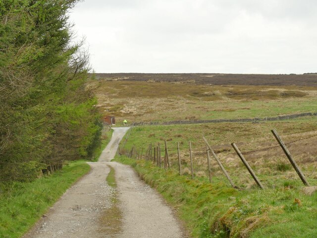
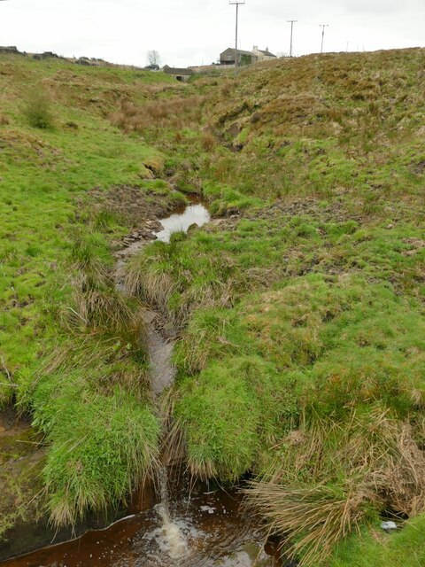
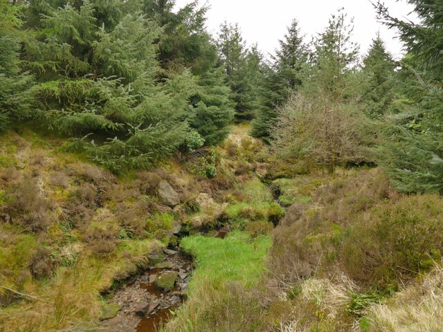
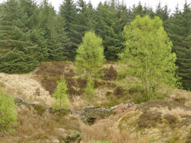
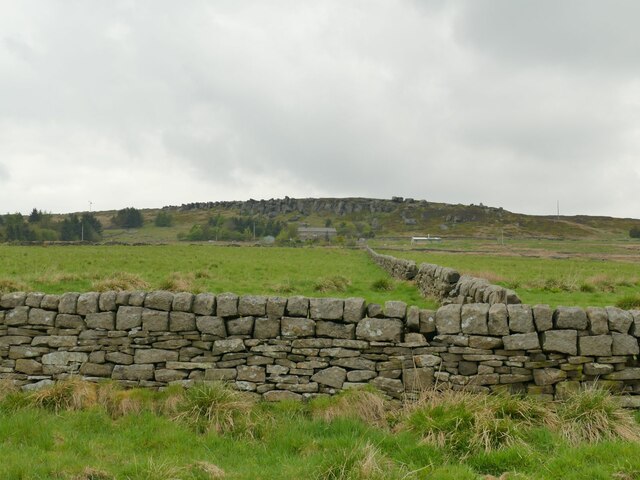
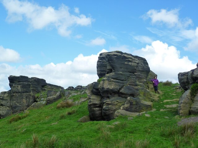
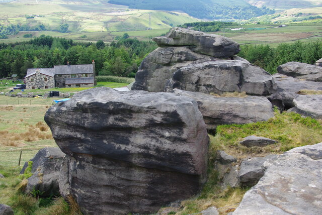
The valley itself is characterized by its steep slopes, dense woodlands, and meandering streams. The rugged terrain creates a sense of tranquility and seclusion, making it a popular destination for nature enthusiasts and hikers. The abundance of wildlife, including deer, birds, and various plant species, further enhances the valley's natural charm.

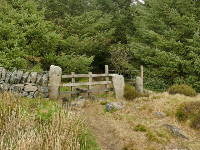
Visitors to Lead Mine Clough can explore the many walking trails that wind through the valley. These paths offer stunning panoramic views, particularly from the higher elevations, where one can marvel at the surrounding countryside. Additionally, the valley is intersected by a peaceful stream, providing opportunities for peaceful picnics and leisurely walks along its banks.

Lead Mine Clough is not only a haven for nature lovers but also a place of historical significance. It encapsulates the rich heritage of Yorkshire, offering a unique blend of natural beauty and industrial history. Whether it's exploring the remnants of the lead mining industry or simply immersing oneself in the serenity of the surroundings, Lead Mine Clough is a destination that captivates visitors with its timeless charm.

If you have any feedback on the listing, please let us know in the comments section below.

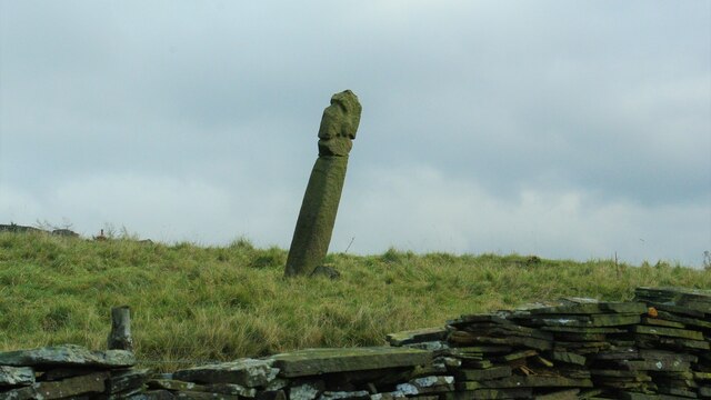
Lead Mine Clough Images

Images are sourced within 2km of 53.755405/-2.1181851 or Grid Reference SD9228. Thanks to Geograph Open Source API. All images are credited.

Dam on Red Carr Clough The dam and weir seem to create a settlement pond for water draining into the catchment drain for Gorple Upper Reservoir
Dam on Red Carr Clough
The dam and weir seem to create a settlement pond for water draining into the catchment drain for Gorple Upper Reservoir
Black Hameldon towards Hoof Stones Height
Dam (disused?) on the Gorple Upper conduit
On the Black Hameldon Ridge The fence indicates the position of the county border between West Yorkshire and Lancashire - and also a helpful guide across this lonely stretch of moorland.
On the Black Hameldon Ridge
The fence indicates the position of the county border between West Yorkshire and Lancashire - and also a helpful guide across this lonely stretch of moorland.
Lancashire - Yorkshire county boundary fence on Black Hameldon Pendle on the horizon.
Lancashire - Yorkshire county boundary fence on Black Hameldon
Pendle on the horizon.
Whinberry Stones, Heptonstall Moor, W Yorks view from Whinberry Flat of the northern end of the rock outcrop.
Whinberry Stones, Heptonstall Moor, W Yorks
view from Whinberry Flat of the northern end of the rock outcrop.
Whinberry Stones, Heptonstall Moor, W Yorks close-up view of the northern end of the boulder outcrop.
Whinberry Stones, Heptonstall Moor, W Yorks
close-up view of the northern end of the boulder outcrop.
Approaching Eleanor's Wood A conifer wood above Todmorden.
Approaching Eleanor's Wood
A conifer wood above Todmorden.
Track above Eleanor's Wood The track is a public footpath and in the other direction gives access to Hudson Clough Farm.
Track above Eleanor's Wood
The track is a public footpath and in the other direction gives access to Hudson Clough Farm.
Redmires Water above Eleanor's Wood Only a very small beck at this point.
Redmires Water above Eleanor's Wood
Only a very small beck at this point.
Redmires Water through  Eleanor's Wood The conifer wood has been planted either side of the beck.
Redmires Water through Eleanor's Wood
The conifer wood has been planted either side of the beck.
Path into Eleanor's Wood The public footpath predates the planting of the wood, and an old gate has been replaced with a wooden stile.
Path into Eleanor's Wood
The public footpath predates the planting of the wood, and an old gate has been replaced with a wooden stile.
Wall over Redmires Water What looks like a footbridge is in fact just an arch within an old field boundary wall.
Wall over Redmires Water
What looks like a footbridge is in fact just an arch within an old field boundary wall.
View towards the Hawks Stones One of many gritstone outcrops in this area, seen from Stony Lane.
View towards the Hawks Stones
One of many gritstone outcrops in this area, seen from Stony Lane.
Bride Stones Moor Escarpment Marked on the map as Fast End
Bride Stones Moor Escarpment
Marked on the map as Fast End
Pole Hill Navigational Aid For Manchester Airport
Pole Hill Navigational Aid
For Manchester Airport
Mount Cross A wayside cross for what has become the Long Causeway route
Mount Cross
A wayside cross for what has become the Long Causeway route
Bridestones at Fast End With Orchan House Farm below
Bridestones at Fast End
With Orchan House Farm below
Show me another place!

Lead Mine Clough is located at Grid Ref: SD9228 (Lat: 53.755405, Lng: -2.1181851)

Division: West Riding

Unitary Authority: Calderdale

Police Authority: West Yorkshire

What 3 Words

///remotest.classed.sentences. Near Cornholme, West Yorkshire

Related Wikis

Coal Clough Wind Farm

Coal Clough Wind Farm is one of the oldest onshore wind farms in England. The wind farm, which was built for Scottish Power, produced electricity from...

Blackshaw

Blackshaw is a civil parish in the Calderdale metropolitan borough of West Yorkshire, England. It contains the village of Blackshaw Head. According to...

Pudsey, Calderdale

Pudsey is a neighbourhood in the village of Cornholme, Calderdale, West Yorkshire, England. It is near the town of Todmorden and the A646 Burnley Road...

Cornholme railway station

Cornholme railway station served the village of Cornholme in West Yorkshire, England on the Copy Pit line. The station was opened by the Lancashire and...

Have you been to Lead Mine Clough?

Leave your review of Lead Mine Clough below (or comments, questions and feedback).