Ibber Clough

Valley in Yorkshire Pendle

England

Ibber Clough

Skipton Old Road at Black Lane Ends Looking south-westward.
Skipton Old Road at Black Lane Ends Credit: Peter Wood

Ibber Clough is a picturesque valley located in West Yorkshire, England. Nestled within the stunning landscapes of the Yorkshire Dales National Park, this idyllic valley offers visitors a tranquil and serene retreat from the hustle and bustle of city life.

Characterized by its rolling hills, lush meadows, and sparkling streams, Ibber Clough showcases the natural beauty that Yorkshire is renowned for. The valley is flanked by towering cliffs and wooded areas, creating a breathtaking backdrop for outdoor enthusiasts and nature lovers.

The area is home to a diverse range of flora and fauna, with native species such as wildflowers, oak trees, and various bird species found throughout the valley. Ibber Clough is particularly famous for its bluebells, which create a stunning carpet of vibrant colors during the spring months.

Outdoor activities abound in Ibber Clough, with numerous walking trails and hiking routes available for all skill levels. Visitors can explore the valley on foot, taking in the breathtaking views and discovering hidden waterfalls and caves along the way. The valley also offers opportunities for cycling, horseback riding, and wildlife watching.

For those seeking a peaceful retreat, Ibber Clough is also home to a number of charming holiday cottages and bed and breakfast establishments. These accommodations provide a cozy and comfortable base for exploring the valley and immersing oneself in the tranquility of the Yorkshire countryside.

In conclusion, Ibber Clough is a stunning valley in Yorkshire, offering visitors a chance to escape the noise of everyday life and immerse themselves in the beauty of nature. With its scenic landscapes, diverse wildlife, and range of outdoor activities, it is the perfect destination for those seeking a peaceful and rejuvenating getaway.

If you have any feedback on the listing, please let us know in the comments section below.
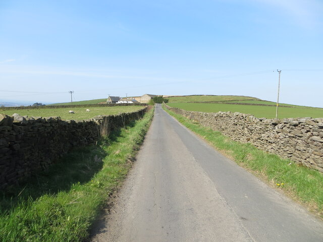
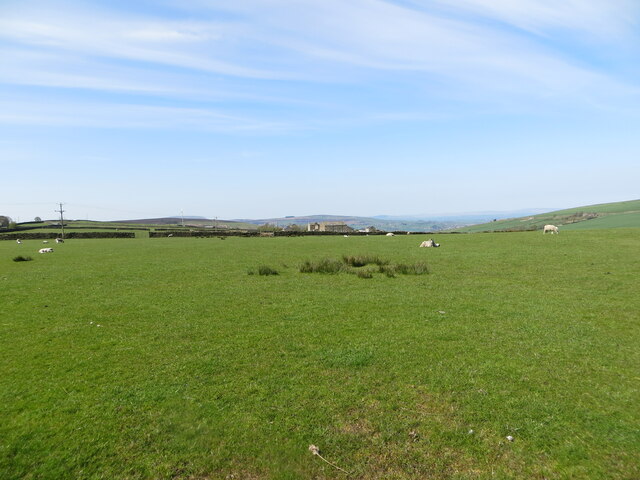
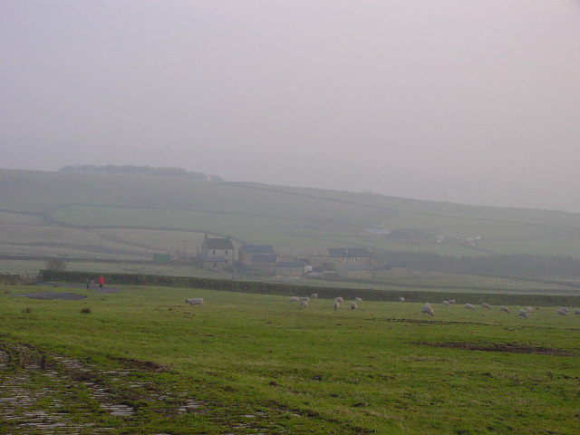
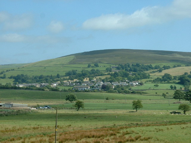
Ibber Clough Images

Images are sourced within 2km of 53.888102/-2.1188185 or Grid Reference SD9243. Thanks to Geograph Open Source API. All images are credited.

Skipton Old Road at Black Lane Ends Looking south-westward.
Skipton Old Road at Black Lane Ends
Looking south-westward.
A wall enclosed Warley Wise Lane approaching Black Lane Ends Looking south-westward.
A wall enclosed Warley Wise Lane approaching Black Lane Ends
Looking south-westward.
Bleara Road at its junction with West Road Looking north-eastward.
Bleara Road at its junction with West Road
Looking north-eastward.
A wall enclosed Bleara Road approaching Bleara Side Looking south-westward.
A wall enclosed Bleara Road approaching Bleara Side
Looking south-westward.
Pastureland hosting a crop of sheep and lambs Looking south-westward from Centre Road near to East Hainslack.
Pastureland hosting a crop of sheep and lambs
Looking south-westward from Centre Road near to East Hainslack.
Ordnance Survey Cut Mark This mark can be found on a stone gatepost beside Centre Road, Lothersdale.
The recorded details give a height of 331.6499 metres above sea level.
For more detail see : <span class="nowrap"><a title="https://www.bench-marks.org.uk/bm118329" rel="nofollow ugc noopener" href="https://www.bench-marks.org.uk/bm118329">Link</a><img style="margin-left:2px;" alt="External link" title="External link - shift click to open in new window" src="https://s1.geograph.org.uk/img/external.png" width="10" height="10"/></span>
Ordnance Survey Cut Mark
This mark can be found on a stone gatepost beside Centre Road, Lothersdale. The recorded details give a height of 331.6499 metres above sea level. For more detail see : LinkExternal link
Pennine bridleway / Pendle way above Kelbrook Pennine bridleway / Pendle way above and East of Kelbrook
Pennine bridleway / Pendle way above Kelbrook
Pennine bridleway / Pendle way above and East of Kelbrook
Bridleway gate at field boundary Bridleway gate at field boundary on the Pennine bridleway / Pendle way above Kelbrook
Bridleway gate at field boundary
Bridleway gate at field boundary on the Pennine bridleway / Pendle way above Kelbrook
Pennine bridleway / Pendle way above Kelbrook Bridleway to the South West of Harden Old Barn
Pennine bridleway / Pendle way above Kelbrook
Bridleway to the South West of Harden Old Barn
Higher Burnt Hill Taken from Bleara Side Farm looking south across the valley
Higher Burnt Hill
Taken from Bleara Side Farm looking south across the valley
Pennine  view near Kelbrook This is the old road between Colne and Skipton, looking across in the far distance to Ingleborough.
Pennine view near Kelbrook
This is the old road between Colne and Skipton, looking across in the far distance to Ingleborough.
Low Laithe
Low Laithe
Hawshaw Lodge Farm Buildings in the process of being converted into housing
Hawshaw Lodge
Farm Buildings in the process of being converted into housing
Pasture Pasture The farm itself is called Pasture; the land itself is pasture.
Pasture Pasture
The farm itself is called Pasture; the land itself is pasture.
Flass Bent Farm
Flass Bent Farm
Bog Hole Appears to be a spring...
Bog Hole
Appears to be a spring...
Kelbrook Lodge Built as a shooting lodge in 1908, this is still in use as part of Kelbrook Shooting School with clay pigeon shooting etc. in the grounds.
Kelbrook Lodge
Built as a shooting lodge in 1908, this is still in use as part of Kelbrook Shooting School with clay pigeon shooting etc. in the grounds.
Show me another place!

Ibber Clough is located at Grid Ref: SD9243 (Lat: 53.888102, Lng: -2.1188185)

Division: West Riding

Administrative County: Lancashire

District: Pendle

Police Authority: Lancashire

What 3 Words

///rhino.pink.defenders. Near Foulridge, Lancashire

Related Wikis

Kelbrook

Kelbrook is a village in the civil parish of Kelbrook and Sough, Borough of Pendle, in Lancashire, England. It lies on the A56 road between Colne and Earby...

Noyna Hill

Noyna Hill (sometimes called Noyna or Noyna Rock/s) is a hill in the Pennine range in Pendle, Lancashire, England. It is a mile east of Foulridge and it...

Kelbrook and Sough

Kelbrook and Sough is a civil parish in the Pendle district of Lancashire, England. It has a population of 1,008, and contains the village of Kelbrook...

Sough, Lancashire

Sough is a hamlet, in Lancashire, England. Sough is located east of the main A56 road between Earby and Kelbrook; it is in the area known as West Craven...

Nearby Amenities

Located within 500m of 53.888102,-2.1188185
Barrier: stile
Stile: stepover
Lat/Long: 53.8886761/-2.1172291
Barrier: stile
Material: stone
Note: with small wooden hand-gate
Stile: squeezer
Lat/Long: 53.8859035/-2.1136081
Barrier: stile
Material: stone
Stile: squeezer
Lat/Long: 53.8875572/-2.1144871
The data included in this document is from www.openstreetmap.org. The data is made available under ODbL.

Have you been to Ibber Clough?

Leave your review of Ibber Clough below (or comments, questions and feedback).