Moss Crop Hill

Hill, Mountain in Yorkshire

England

Moss Crop Hill

Black Hameldon towards Hoof Stones Height
Black Hameldon towards Hoof Stones Height Credit: John Slater

Moss Crop Hill is a prominent hill located in the picturesque region of Yorkshire, England. Situated in the North York Moors National Park, it offers breathtaking views and is a popular destination for hikers and nature enthusiasts alike.

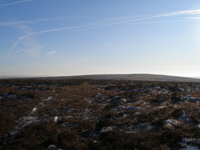
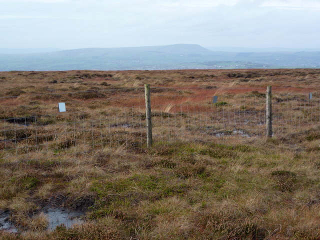
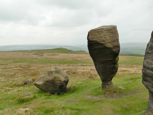
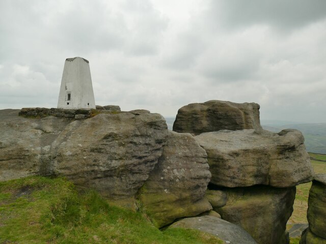
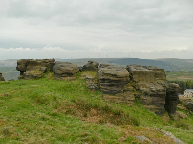
Rising to an elevation of approximately 342 meters (1,122 feet), Moss Crop Hill is characterized by its rolling green slopes and dense heather moorland. The hill is known for its rugged terrain, which presents a challenging yet rewarding experience for outdoor adventurers.

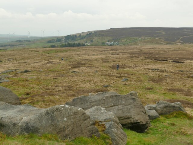
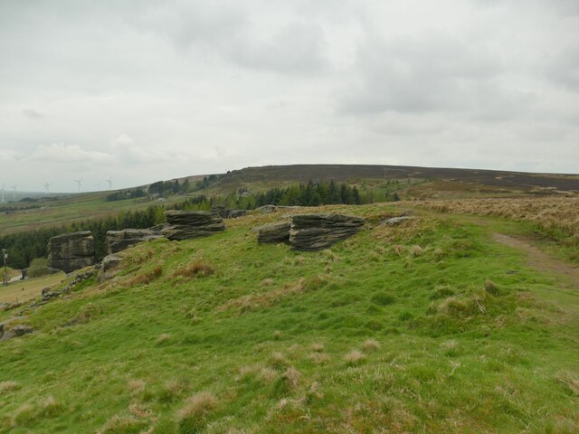
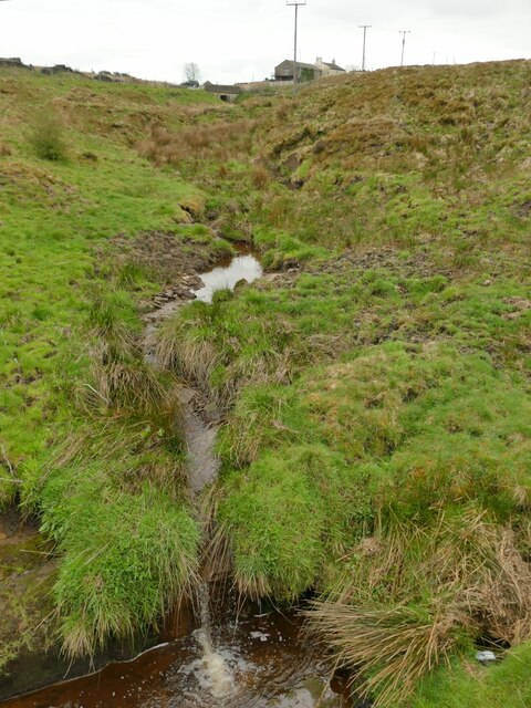
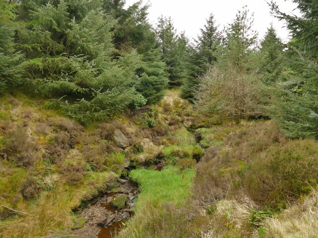
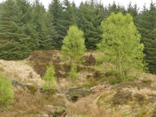
Covering an area of around 50 hectares, Moss Crop Hill is home to a diverse range of flora and fauna. The hill's vegetation is primarily composed of heather, bracken, and grasses, creating a vibrant landscape throughout the year. The area is also abundant in wildlife, including various bird species, such as curlews and meadow pipits.

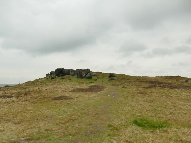
The summit of Moss Crop Hill offers breathtaking panoramic views of the surrounding countryside, including the neighboring hills and valleys. On clear days, it is possible to see as far as the North Sea coast, providing visitors with a truly awe-inspiring sight.

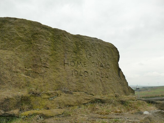
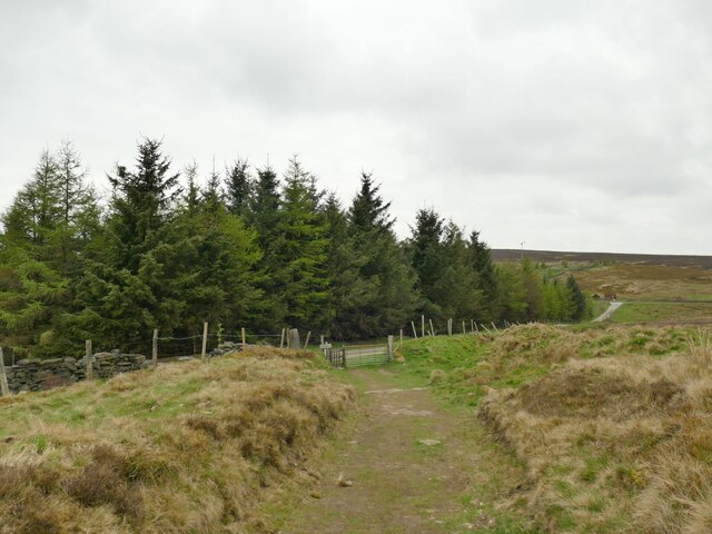
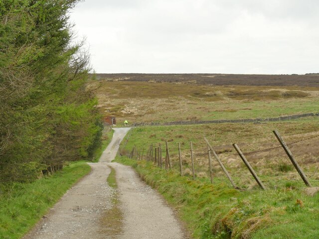
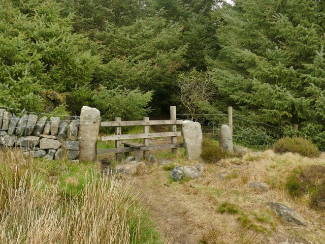
Access to Moss Crop Hill is available via a network of footpaths and trails, making it easily accessible for hikers of all abilities. The hill's remote location and peaceful atmosphere make it an ideal spot for those seeking tranquility and a connection with nature.

Overall, Moss Crop Hill is a captivating destination for outdoor enthusiasts, offering stunning natural beauty, diverse wildlife, and a sense of serenity amidst the rolling hills of Yorkshire.

If you have any feedback on the listing, please let us know in the comments section below.

Moss Crop Hill Images

Images are sourced within 2km of 53.751936/-2.1179478 or Grid Reference SD9228. Thanks to Geograph Open Source API. All images are credited.

Black Hameldon towards Hoof Stones Height
Lancashire - Yorkshire county boundary fence on Black Hameldon Pendle on the horizon.
Lancashire - Yorkshire county boundary fence on Black Hameldon
Pendle on the horizon.
OS Bench Mark OS cut bench mark from the first, 19th century, levelling, on flat rock close to the trig point. There is no sign of a pivot or rivet. The BM is shown on the 1853 6" OS map but not on subsequent editions, nor on any 25" maps. Marked as 1434.7 feet above old datum
OS Bench Mark
OS cut bench mark from the first, 19th century, levelling, on flat rock close to the trig point. There is no sign of a pivot or rivet. The BM is shown on the 1853 6" OS map but not on subsequent editions, nor on any 25" maps. Marked as 1434.7 feet above old datum
Approaching the Bridestones The moor contains several gritstone outcrops generically known as the Bridestones, some of them having individual names. This is the first significant outcrop approaching from the east.
Approaching the Bridestones
The moor contains several gritstone outcrops generically known as the Bridestones, some of them having individual names. This is the first significant outcrop approaching from the east.
The Bottleneck on Bridestones Moor The moor contains several gritstone outcrops generically known as the Bridestones, some of them having individual names. This is perhaps the most distinctive individual rock. <a href="https://www.geograph.org.uk/photo/5350930">SD9326 : The Bride Stone, Todmorden</a> shows the other side and another contributor gives us the geological detail at <a href="https://www.geograph.org.uk/photo/4105934">SD9326 : The Bride Stone</a>.
The Bottleneck on Bridestones Moor
The moor contains several gritstone outcrops generically known as the Bridestones, some of them having individual names. This is perhaps the most distinctive individual rock. SD9326 : The Bride Stone, Todmorden shows the other side and another contributor gives us the geological detail at SD9326 : The Bride Stone.
Bridestones triangulation pillar Given a height of 437 or 438 metres on modern maps, though these trig points were more important for their location on plan than the precise elevation.  The 1907 1:2500 map shows it 20 metres further west, a big enough  discrepancy at that scale to suggest it was in fact relocated at some time.
Bridestones triangulation pillar
Given a height of 437 or 438 metres on modern maps, though these trig points were more important for their location on plan than the precise elevation. The 1907 1:2500 map shows it 20 metres further west, a big enough discrepancy at that scale to suggest it was in fact relocated at some time.
West from the Great Bridestones
Outcrop above Bridestones Farm The moor contains several gritstone outcrops generically known as the Bridestones, some of them having individual names. This one doesn't seem to have a name, but the farm below has taken the name of the wider group.
Outcrop above Bridestones Farm
The moor contains several gritstone outcrops generically known as the Bridestones, some of them having individual names. This one doesn't seem to have a name, but the farm below has taken the name of the wider group.
Rock outcrop above Bridestones Farm The moor contains several gritstone outcrops generically known as the Bridestones, some of them having individual names. This one doesn't seem to have a name, but the farm below (right of photo) has taken the name of the wider group.
Rock outcrop above Bridestones Farm
The moor contains several gritstone outcrops generically known as the Bridestones, some of them having individual names. This one doesn't seem to have a name, but the farm below (right of photo) has taken the name of the wider group.
Graffito on rock outcrop above Bridestones Farm The text is "A Coy 21st WY Br Home Guard 1940-1944".  The lettering looks surprisingly sharp for an 80-year-old carving in an exposed location.  Maybe the gritstone is hard enough, or perhaps it's been re-cut more recently?

For context, it is on one of the rocks to the right of the group in <a href="https://www.geograph.org.uk/photo/7170447">SD9226 : Rock outcrop above Bridestones Farm</a>.
Graffito on rock outcrop above Bridestones Farm
The text is "A Coy 21st WY Br Home Guard 1940-1944". The lettering looks surprisingly sharp for an 80-year-old carving in an exposed location. Maybe the gritstone is hard enough, or perhaps it's been re-cut more recently? For context, it is on one of the rocks to the right of the group in SD9226 : Rock outcrop above Bridestones Farm.
Approaching Eleanor's Wood A conifer wood above Todmorden.
Approaching Eleanor's Wood
A conifer wood above Todmorden.
Track above Eleanor's Wood The track is a public footpath and in the other direction gives access to Hudson Clough Farm.
Track above Eleanor's Wood
The track is a public footpath and in the other direction gives access to Hudson Clough Farm.
Redmires Water above Eleanor's Wood Only a very small beck at this point.
Redmires Water above Eleanor's Wood
Only a very small beck at this point.
Redmires Water through  Eleanor's Wood The conifer wood has been planted either side of the beck.
Redmires Water through Eleanor's Wood
The conifer wood has been planted either side of the beck.
Path into Eleanor's Wood The public footpath predates the planting of the wood, and an old gate has been replaced with a wooden stile.
Path into Eleanor's Wood
The public footpath predates the planting of the wood, and an old gate has been replaced with a wooden stile.
Wall over Redmires Water What looks like a footbridge is in fact just an arch within an old field boundary wall.
Wall over Redmires Water
What looks like a footbridge is in fact just an arch within an old field boundary wall.
Track over Redmires Water A small stone arch bridge carries a bridleway called Stoney Lane over the beck.
Track over Redmires Water
A small stone arch bridge carries a bridleway called Stoney Lane over the beck.
Stony Lane beyond Redmires Water
Show me another place!

Moss Crop Hill is located at Grid Ref: SD9228 (Lat: 53.751936, Lng: -2.1179478)

Division: West Riding

Unitary Authority: Calderdale

Police Authority: West Yorkshire

What 3 Words

///hound.cones.forks. Near Cornholme, West Yorkshire

Related Wikis

Coal Clough Wind Farm

Coal Clough Wind Farm is one of the oldest onshore wind farms in England. The wind farm, which was built for Scottish Power, produced electricity from...

Pudsey, Calderdale

Pudsey is a neighbourhood in the village of Cornholme, Calderdale, West Yorkshire, England. It is near the town of Todmorden and the A646 Burnley Road...

Cornholme railway station

Cornholme railway station served the village of Cornholme in West Yorkshire, England on the Copy Pit line. The station was opened by the Lancashire and...

Blackshaw

Blackshaw is a civil parish in the Calderdale metropolitan borough of West Yorkshire, England. It contains the village of Blackshaw Head. According to...

Nearby Amenities

Located within 500m of 53.751936,-2.1179478
Stansfield Moor
Place: locality
Lat/Long: 53.7483079/-2.1180223
The data included in this document is from www.openstreetmap.org. The data is made available under ODbL.

Have you been to Moss Crop Hill?

Leave your review of Moss Crop Hill below (or comments, questions and feedback).