Noon Hill

Hill, Mountain in Yorkshire

England

Noon Hill

Dam on Red Carr Clough The dam and weir seem to create a settlement pond for water draining into the catchment drain for Gorple Upper Reservoir
Dam on Red Carr Clough Credit: Kevin Waterhouse

Noon Hill is a prominent hill located in the county of Yorkshire, England. Situated in the North York Moors National Park, it forms part of the stunning landscape of the region. Standing at an elevation of approximately 1,440 feet (439 meters), it is considered a notable landmark in the area.

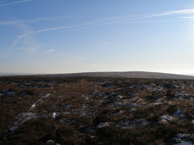
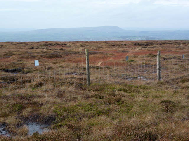
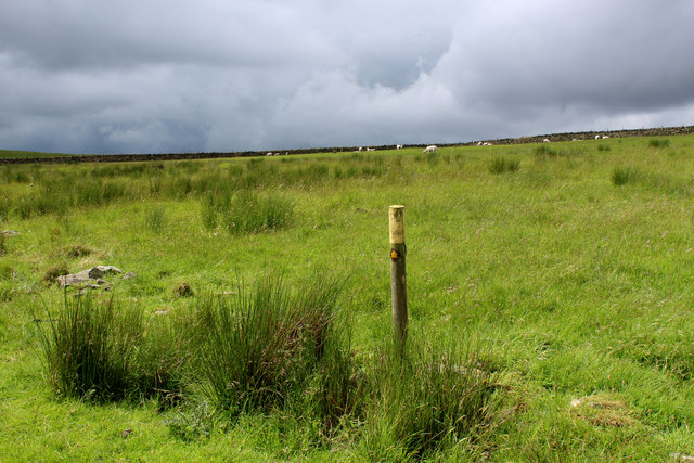
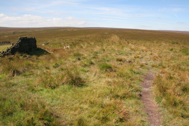
The hill offers breathtaking panoramic views, making it a popular destination for both locals and tourists. From its summit, visitors can enjoy sweeping vistas of the surrounding countryside, including rolling hills, lush green valleys, and picturesque villages dotted throughout the landscape.

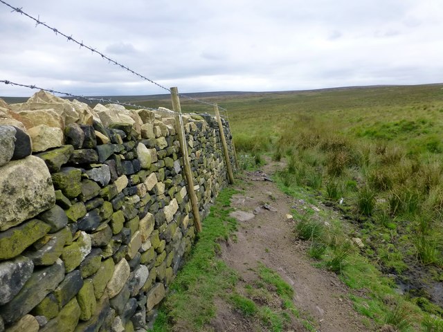
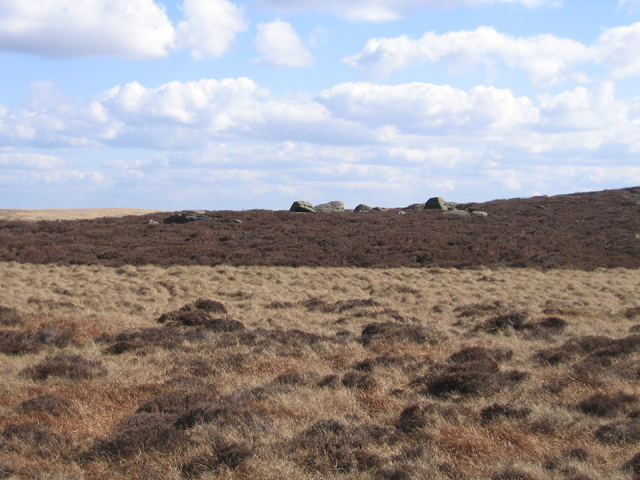
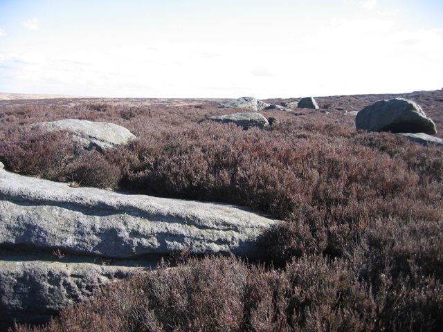
Noon Hill boasts a diverse range of flora and fauna, adding to its natural beauty. The hill is covered in heather and various species of wildflowers during the summer months, creating a colorful spectacle. It is also home to a variety of bird species, including the iconic red grouse, which can often be spotted in the heather moorland.

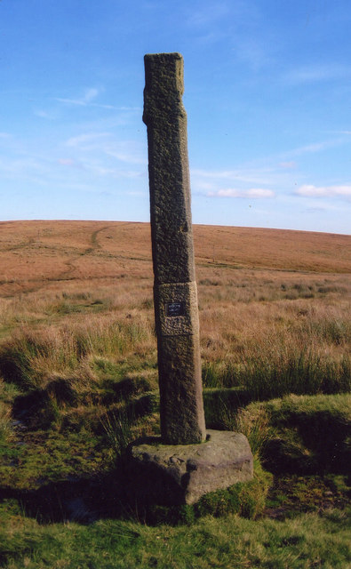
For outdoor enthusiasts, Noon Hill provides ample opportunities for walking, hiking, and exploring the countryside. Several well-marked trails and footpaths wind their way up the hill, allowing visitors to immerse themselves in the tranquil surroundings and experience the charm of rural Yorkshire.

Overall, Noon Hill is a must-visit destination for nature lovers and those seeking a peaceful retreat in the heart of Yorkshire. With its stunning vistas, diverse wildlife, and numerous recreational activities, it offers a truly enriching experience for all who venture to its summit.

If you have any feedback on the listing, please let us know in the comments section below.
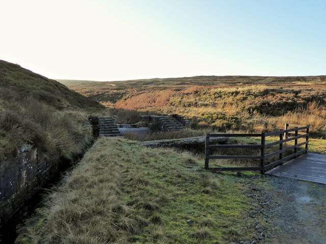
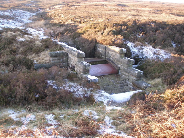
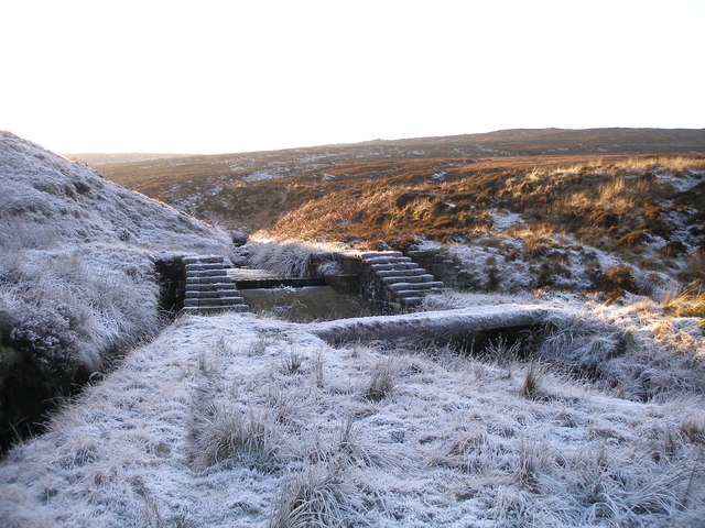
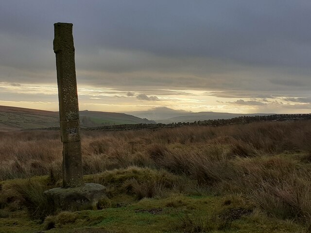
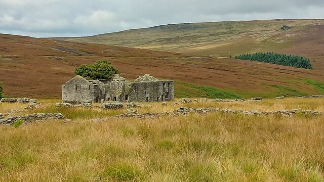
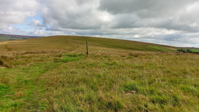
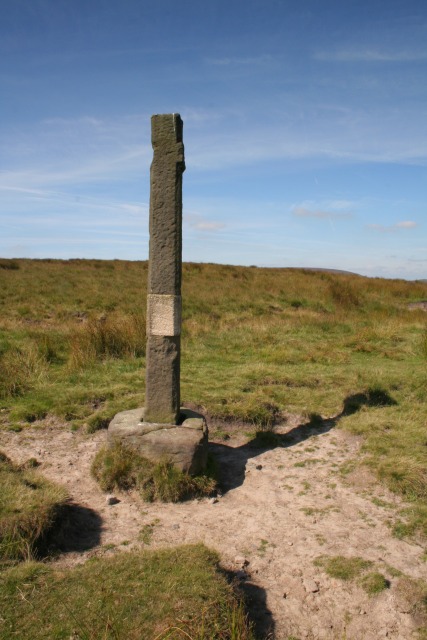
Noon Hill Images

Images are sourced within 2km of 53.755954/-2.1081615 or Grid Reference SD9228. Thanks to Geograph Open Source API. All images are credited.

Dam on Red Carr Clough The dam and weir seem to create a settlement pond for water draining into the catchment drain for Gorple Upper Reservoir
Dam on Red Carr Clough
The dam and weir seem to create a settlement pond for water draining into the catchment drain for Gorple Upper Reservoir
Black Hameldon towards Hoof Stones Height
Disused sluice on the Gorple Upper conduit
Dam (disused?) on the Gorple Upper conduit
Reaps Edge A recently repaired dry stone wall and fence at Reaps Edge.
Reaps Edge
A recently repaired dry stone wall and fence at Reaps Edge.
Lancashire - Yorkshire county boundary fence on Black Hameldon Pendle on the horizon.
Lancashire - Yorkshire county boundary fence on Black Hameldon
Pendle on the horizon.
Looking up Red Carr Clough Lonely section of Heptonstall Moor.
Looking up Red Carr Clough
Lonely section of Heptonstall Moor.
Looking down Red Carr Clough Beside an abandoned dry stone wall on Heptonstall Moor
Looking down Red Carr Clough
Beside an abandoned dry stone wall on Heptonstall Moor
Public Footpath on Rough Pasture, Heptonstall Moor Not evident on the ground, but posts lead the way for the footpath between the ruins of Rough Hey to the ruins of Raistrick Greave.
Public Footpath on Rough Pasture, Heptonstall Moor
Not evident on the ground, but posts lead the way for the footpath between the ruins of Rough Hey to the ruins of Raistrick Greave.
Old Wayside Cross on Reaps Edge, Heptonstall Moor, Heptonstall Parish Reaps Cross, old head, shaft and base, by the wayside, in parish of Heptonstall (Calderdale District), Hepstonstall Moor; Reaps Edge, on moorland overlooking Gorple Lower Reservoir, at junction of paths, re-erected 2002.

Grade II Listed. List Entry Number: 1226173
<span class="nowrap"><a title="https://historicengland.org.uk/listing/the-list/list-entry/1226173" rel="nofollow ugc noopener" href="https://historicengland.org.uk/listing/the-list/list-entry/1226173">Link</a><img style="margin-left:2px;" alt="External link" title="External link - shift click to open in new window" src="https://s1.geograph.org.uk/img/external.png" width="10" height="10"/></span>
Scheduled Monument. List Entry Number: 1013830
<span class="nowrap"><a title="https://historicengland.org.uk/listing/the-list/list-entry/1013830" rel="nofollow ugc noopener" href="https://historicengland.org.uk/listing/the-list/list-entry/1013830">Link</a><img style="margin-left:2px;" alt="External link" title="External link - shift click to open in new window" src="https://s1.geograph.org.uk/img/external.png" width="10" height="10"/></span>

To be surveyed

Milestone Society National ID: YWCA_HEP01
Old Wayside Cross on Reaps Edge, Heptonstall Moor, Heptonstall Parish
Reaps Cross, old head, shaft and base, by the wayside, in parish of Heptonstall (Calderdale District), Hepstonstall Moor; Reaps Edge, on moorland overlooking Gorple Lower Reservoir, at junction of paths, re-erected 2002. Grade II Listed. List Entry Number: 1226173 LinkExternal link Scheduled Monument. List Entry Number: 1013830 LinkExternal link To be surveyed Milestone Society National ID: YWCA_HEP01
Old cross The remains of Reaps Cross on Heptonstall Moor.  To the north is Gorple Lower Reservoir.   The small plaque says it was reerected in 2002.
Old cross
The remains of Reaps Cross on Heptonstall Moor. To the north is Gorple Lower Reservoir. The small plaque says it was reerected in 2002.
Raistrick Greave Farmhouse ruin dating back to the 17th century.
Raistrick Greave
Farmhouse ruin dating back to the 17th century.
Reaps Cross The cross has been vandalized in the past but still has a presence on Reaps Edge high on  Heptonstall Moor.
Reaps Cross
The cross has been vandalized in the past but still has a presence on Reaps Edge high on Heptonstall Moor.
Reap Cross, Heptonstall Moor Looking W at the remains of Reap Cross.
Reap Cross, Heptonstall Moor
Looking W at the remains of Reap Cross.
Footpath, Heptonstall Moor Looking SW along the footpath at the corner of the wall SD 938 302. Raistrick Greave Hill is directly ahead.
Footpath, Heptonstall Moor
Looking SW along the footpath at the corner of the wall SD 938 302. Raistrick Greave Hill is directly ahead.
Whinberry Stones, Heptonstall Moor, W Yorks view from Whinberry Flat of the northern end of the rock outcrop.
Whinberry Stones, Heptonstall Moor, W Yorks
view from Whinberry Flat of the northern end of the rock outcrop.
Whinberry Stones, Heptonstall Moor, W Yorks close-up view of the northern end of the boulder outcrop.
Whinberry Stones, Heptonstall Moor, W Yorks
close-up view of the northern end of the boulder outcrop.
Ruined farmhouse, Raistrick Greave Looking NW from the footpath.
Ruined farmhouse, Raistrick Greave
Looking NW from the footpath.
Show me another place!

Noon Hill is located at Grid Ref: SD9228 (Lat: 53.755954, Lng: -2.1081615)

Division: West Riding

Unitary Authority: Calderdale

Police Authority: West Yorkshire

What 3 Words

///seasick.relax.intensely. Near Cornholme, West Yorkshire

Related Wikis

Blackshaw

Blackshaw is a civil parish in the Calderdale metropolitan borough of West Yorkshire, England. It contains the village of Blackshaw Head. According to...

Coal Clough Wind Farm

Coal Clough Wind Farm is one of the oldest onshore wind farms in England. The wind farm, which was built for ScottishPower, produced electricity from originally...

Cornholme railway station

Cornholme railway station served the village of Cornholme in West Yorkshire, England on the Copy Pit line. The station was opened by the Lancashire and...

Pudsey, Calderdale

Pudsey is a neighbourhood in the village of Cornholme, Calderdale, West Yorkshire, England. It is near the town of Todmorden and the A646 Burnley Road...

Have you been to Noon Hill?

Leave your review of Noon Hill below (or comments, questions and feedback).