Sedgley Beacon

Hill, Mountain in Staffordshire

England

Sedgley Beacon

Northway Traffic Lights The view on the Sedgley estate, Dudley.
Northway Traffic Lights Credit: Gordon Griffiths

Sedgley Beacon is a prominent landmark located in Staffordshire, England. As the name suggests, it is situated in Sedgley, a small town in the southern part of the county. Despite its name, Sedgley Beacon is not a hill or a mountain, but rather a hilltop within the rolling landscape of the West Midlands region.

Rising to an elevation of approximately 240 meters (790 feet) above sea level, Sedgley Beacon offers breathtaking panoramic views of the surrounding countryside. On clear days, visitors can see as far as the neighboring counties of Worcestershire and Shropshire, as well as the city of Birmingham in the distance.

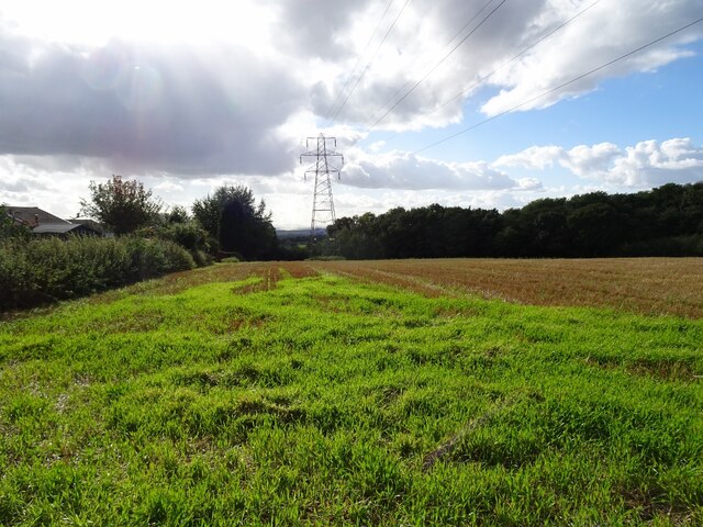
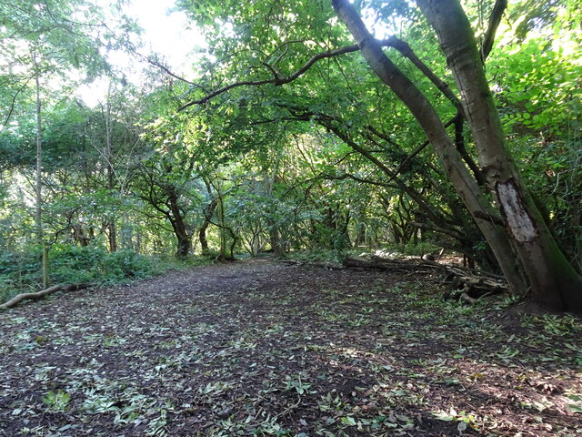
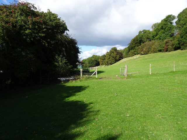
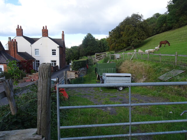
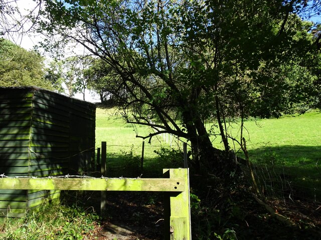
The hilltop itself is characterized by a grassy terrain dotted with scattered trees, making it a popular spot for picnics, leisurely walks, and family outings. It is also home to a small stone pillar that marks the highest point on the Beacon.

Sedgley Beacon holds historical significance as well, with evidence of prehistoric activity found in the area, including ancient burial mounds. Additionally, during the English Civil War in the 17th century, Sedgley Beacon was used as a beacon site to alert nearby towns of potential threats.

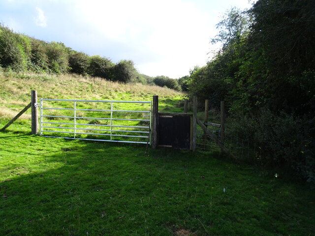
Access to Sedgley Beacon is relatively easy, with several footpaths and trails leading to its summit from nearby roads and villages. It is a cherished destination for locals and tourists alike who seek to enjoy the natural beauty and tranquility offered by this elevated vantage point in Staffordshire.

If you have any feedback on the listing, please let us know in the comments section below.

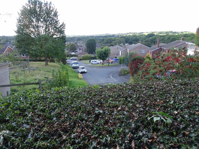
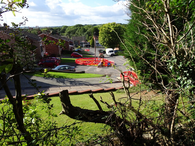
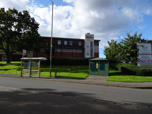
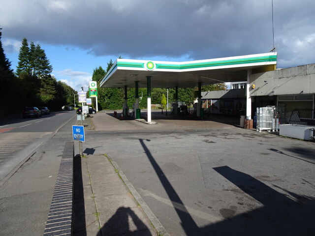
Sedgley Beacon Images

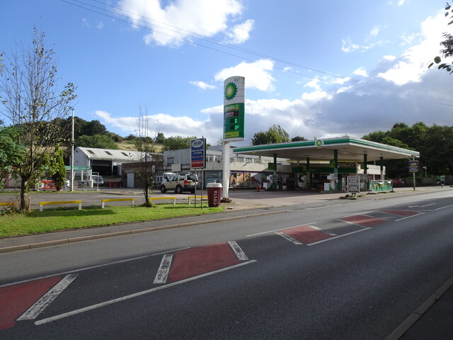
Images are sourced within 2km of 52.546575/-2.1148455 or Grid Reference SO9294. Thanks to Geograph Open Source API. All images are credited.

Northway Traffic Lights The view on the Sedgley estate, Dudley.
Northway Traffic Lights
The view on the Sedgley estate, Dudley.
New Bike Racks The view in the Northway Sedgley.
New Bike Racks
The view in the Northway Sedgley.
Alderdale Avenue View The view on the Northway Estate, Sedgley.
Alderdale Avenue View
The view on the Northway Estate, Sedgley.
Swallowfields  Road The view on the Northway Estate, Sedgley.
Swallowfields Road
The view on the Northway Estate, Sedgley.
Kineton Rise The view on the Northway Estate, Sedgley.
Kineton Rise
The view on the Northway Estate, Sedgley.
Alder Coppice Trees The view of the Weeping Willows on the Northway Estate, Sedgley.
Alder Coppice Trees
The view of the Weeping Willows on the Northway Estate, Sedgley.
Autumn Scene The view on the first day of autumn in Sedgley Hall Farm Park.
Autumn Scene
The view on the first day of autumn in Sedgley Hall Farm Park.
Edge Hill Drive  View from Sedgley Hall Farm Path, over the Northway Estate.
Edge Hill Drive
View from Sedgley Hall Farm Path, over the Northway Estate.
Kineton Rise View The view of the Close off the Northway in Sedgley.
Kineton Rise View
The view of the Close off the Northway in Sedgley.
Beacon Centre The view of the Beacon Centre for the blind on the Wolverhampton Sedgley border.
The view of the old building in November 2006 <a href="https://www.geograph.org.uk/photo/272346">SO9195 : The Beacon Centre for the Blind</a>.
Beacon Centre
The view of the Beacon Centre for the blind on the Wolverhampton Sedgley border. The view of the old building in November 2006 SO9195 : The Beacon Centre for the Blind.
No Petrol The view of the BP Petrol station on the Wolverhampton Road, Sedgley.
The shortage of petrol due to panic buying and a shortage of HGV drivers.
No Petrol
The view of the BP Petrol station on the Wolverhampton Road, Sedgley. The shortage of petrol due to panic buying and a shortage of HGV drivers.
Hopeful Price The view of the £0 price at the BP Petrol station on the Wolverhampton Road, Sedgley.
The shortage of petrol due to panic buying and a shortage of HGV drivers.
Hopeful Price
The view of the £0 price at the BP Petrol station on the Wolverhampton Road, Sedgley. The shortage of petrol due to panic buying and a shortage of HGV drivers.
Pylon View The view over the fields alongside the Northway Estate in Sedgley.
Pylon View
The view over the fields alongside the Northway Estate in Sedgley.
Woodland Scene The view in Alder Coppice Ancient Woodland on the Northway Estate, Sedgley.
Woodland Scene
The view in Alder Coppice Ancient Woodland on the Northway Estate, Sedgley.
Northway Stile The view of the path near Hickmerelands Lane, Sedgley.
Northway Stile
The view of the path near Hickmerelands Lane, Sedgley.
Northway Field The view of the path near Hickmerelands Lane, Sedgley.
Northway Field
The view of the path near Hickmerelands Lane, Sedgley.
Northway Farm The view of the Old Farm on Hickmerelands Lane Sedgley.
Northway Farm
The view of the Old Farm on Hickmerelands Lane Sedgley.
Field View The view from the Hickmerelands Lane footpath, Sedgley.
Field View
The view from the Hickmerelands Lane footpath, Sedgley.
Show me another place!

Sedgley Beacon is located at Grid Ref: SO9294 (Lat: 52.546575, Lng: -2.1148455)

Unitary Authority: Dudley

Police Authority: West Midlands

What 3 Words

///spray.sparks.risen. Near Bilston, West Midlands

Related Wikis

Beacon Hill, Sedgley

Beacon Hill in Sedgley, England, is one of the highest points in the West Midlands, at 237 metres (778 ft) above sea level. From the summit, Wolverhampton...

Sarah Hughes Brewery

Sarah Hughes Brewery in Sedgley, in the Black Country of England, dates from the Victorian era. It was bought by Sarah Hughes in 1921 and brewed until...

Woodcross

Woodcross is a residential area of Coseley, West Midlands, England. It is set within the City of Wolverhampton, though the area traditionally existed within...

Sedgley Urban District

Sedgley urban district was a local government district within Staffordshire, which was created in 1894 from the western half of the manor of Sedgley (the...

Nearby Amenities

Located within 500m of 52.546575,-2.1148455
Turning Circle
Source: bing
Lat/Long: 52.5498928/-2.1142156
Post Box
Operator: Royal Mail
Operator Wikidata: Q638098
Lat/Long: 52.5494115/-2.1106734
Bus Stop
Dovedale Rd / Camberley Crescent
NaPTANAreaCode: 43000727301
Bus: yes
Naptan AtcoCode: 43000727301
Naptan Bearing: NW
Naptan BusStopType: MKD
Naptan CommonName: Camberley Crescent
Naptan Indicator: adj
Naptan NaptanCode: nwmjgpaj
Naptan PlusbusZoneRef: BHAMNWS
Naptan Status: ACT
Naptan StopType: BCT
Naptan Street: DOVEDALE RD
Naptan Towards: Bilston, Wolverhampton
Naptan Verified: no
Public Transport: platform
Route Ref: 81;224
Shelter: yes
Shelter Ref: 104205
Source: WMCA
Lat/Long: 52.5496755/-2.1110511
Bus Stop
Dovedale Rd / Camberley Crescent
Bus: yes
Naptan AtcoCode: 43000727302
Naptan Bearing: SE
Naptan BusStopType: MKD
Naptan CommonName: Camberley Crescent
Naptan Indicator: after
Naptan NaptanCode: nwmtwtjw
Naptan PlusbusZoneRef: BHAMNWS
Naptan Status: ACT
Naptan StopType: BCT
Naptan Street: DOVEDALE RD
Naptan Towards: Coseley
Naptan Verified: no
Public Transport: platform
Route Ref: 81;224
Source: WMCA
Lat/Long: 52.550053/-2.1112143
Bus Stop
Woodcross St / Wathan Avenue
Bus: yes
Naptan AtcoCode: 43000727801
Naptan Bearing: NE
Naptan BusStopType: MKD
Naptan CommonName: Wathan Avenue
Naptan Indicator: opp
Naptan NaptanCode: nwmjgpdp
Naptan PlusbusZoneRef: BHAMNWS
Naptan Status: ACT
Naptan StopType: BCT
Naptan Street: WOODCROSS ST
Naptan Towards: Wolverhampton
Naptan Verified: no
Public Transport: platform
Route Ref: 81;223
Source: WMCA
Lat/Long: 52.548509/-2.1086591
Bus Stop
Woodcross St / Wathan Avenue
Bus: yes
Naptan AtcoCode: 43000727802
Naptan Bearing: SW
Naptan BusStopType: MKD
Naptan CommonName: Wathan Avenue
Naptan Indicator: adj
Naptan NaptanCode: nwmjgpdt
Naptan PlusbusZoneRef: BHAMNWS
Naptan Status: ACT
Naptan StopType: BCT
Naptan Street: WOODCROSS ST
Naptan Towards: Coseley
Naptan Verified: no
Public Transport: platform
Route Ref: 81;223
Source: WMCA
Lat/Long: 52.5484186/-2.1086441
Bus Stop
Dovedale Rd / Falcon Crescent
Bus: yes
Naptan AtcoCode: 43000727902
Naptan Bearing: SE
Naptan BusStopType: MKD
Naptan CommonName: Falcon Crescent
Naptan Indicator: before
Naptan NaptanCode: nwmtawtg
Naptan PlusbusZoneRef: BHAMNWS
Naptan Status: ACT
Naptan StopType: BCT
Naptan Street: DOVEDALE RD
Naptan Towards: Sedgley
Naptan Verified: no
Public Transport: platform
Route Ref: 223;224
Source: WMCA
Lat/Long: 52.5492176/-2.1104158
Bus Stop
Hall Lane / Robert Wynd
Bus: yes
Naptan AtcoCode: 43000728101
Naptan Bearing: NW
Naptan BusStopType: MKD
Naptan CommonName: Robert Wynd
Naptan Indicator: opp
Naptan NaptanCode: nwmjgpgd
Naptan PlusbusZoneRef: BHAMNWS
Naptan Status: ACT
Naptan StopType: BCT
Naptan Street: HALL LANE
Naptan Towards: Wolverhampton
Naptan Verified: no
Public Transport: platform
Route Ref: 81;224
Source: WMCA
Lat/Long: 52.5472508/-2.1082873
Bus Stop
Hall Lane / Robert Wynd
NaPTANAreaCode: 43000728102
Bus: yes
Naptan AtcoCode: 43000728102
Naptan Bearing: SE
Naptan BusStopType: MKD
Naptan CommonName: Robert Wynd
Naptan Indicator: after
Naptan NaptanCode: nwmtwmtw
Naptan PlusbusZoneRef: BHAMNWS
Naptan Status: ACT
Naptan StopType: BCT
Naptan Street: HALL LANE
Naptan Towards: Coseley
Naptan Verified: no
Public Transport: platform
Route Ref: 81;223;224
Shelter: yes
Shelter Ref: 104223
Source: WMCA
Lat/Long: 52.5470445/-2.1076822
Bus Stop
Roberts Wynd / Hall Lane
Bus: yes
Naptan AtcoCode: 43007281001
Naptan Bearing: NE
Naptan BusStopType: MKD
Naptan CommonName: Hall Lane
Naptan Indicator: after
Naptan Landmark: The Horse and Jockey
Naptan NaptanCode: nwmtwtpd
Naptan PlusbusZoneRef: BHAMNWS
Naptan Status: ACT
Naptan StopType: BCT
Naptan Street: ROBERTS WYND
Naptan Towards: Bilston
Naptan Verified: no
Public Transport: platform
Route Ref: 223
Source: WMCA
Lat/Long: 52.5474038/-2.1080222
Bus Stop
Mount Rd / Dovedale Rd
Bus: yes
Naptan AtcoCode: 43007753001
Naptan Bearing: NE
Naptan BusStopType: MKD
Naptan CommonName: Dovedale Rd
Naptan Indicator: after
Naptan NaptanCode: nwmpmjdg
Naptan PlusbusZoneRef: BHAMNWS
Naptan Status: ACT
Naptan StopType: BCT
Naptan Street: MOUNT RD
Naptan Towards: Bilston
Naptan Verified: no
Public Transport: platform
Route Ref: 223
Source: WMCA
Lat/Long: 52.54964/-2.1105938
Bus Stop
Gorge Rd / Rowan Rd
Bus: yes
Naptan AtcoCode: 43000852101
Naptan Bearing: E
Naptan BusStopType: MKD
Naptan CommonName: Rowan Rd
Naptan Indicator: adj
Naptan NaptanCode: nwmjwjmj
Naptan PlusbusZoneRef: BHAMNWS
Naptan Status: ACT
Naptan StopType: BCT
Naptan Street: GORGE RD
Naptan Towards: Bilston
Public Transport: platform
Route Ref: 223;224;229
Shelter: no
Source: WMCA
Towards: Bilston
Lat/Long: 52.5438872/-2.1096357
Bus Stop
Gorge Rd / Rowan Rd
NaPTANAreaCode: 43000852102
Asset Ref: 404230
Bus: yes
Naptan AtcoCode: 43000852102
Naptan Bearing: W
Naptan BusStopType: MKD
Naptan CommonName: Rowan Rd
Naptan Indicator: opp
Naptan NaptanCode: nwmjwjmp
Naptan PlusbusZoneRef: BHAMNWS
Naptan Status: ACT
Naptan StopType: BCT
Naptan Street: GORGE RD
Naptan Towards: Sedgley
Public Transport: platform
Route Ref: 223;224;229
Shelter: yes
Shelter Ref: 404230
Source: WMCA
Towards: Sedgley
Lat/Long: 52.5436882/-2.1103604
Bus Stop
Bilston St / Queens Rd
NaPTANAreaCode: 43000852201
Asset Ref: 404233
Bus: yes
Naptan AtcoCode: 43000852201
Naptan Bearing: W
Naptan BusStopType: MKD
Naptan CommonName: Queens Rd
Naptan Indicator: adj
Naptan NaptanCode: nwmjwjmt
Naptan PlusbusZoneRef: BHAMNWS
Naptan Status: ACT
Naptan StopType: BCT
Naptan Street: BILSTON ST
Naptan Towards: Sedgley
Public Transport: platform
Route Ref: 224;229
Shelter: yes
Shelter Ref: 404233
Source: WMCA
Towards: Sedgley
Lat/Long: 52.5432582/-2.1157468
Bus Stop
Bilston St / Queens Rd
Bus: yes
Naptan AtcoCode: 43000852202
Naptan Bearing: E
Naptan BusStopType: MKD
Naptan CommonName: Queens Rd
Naptan Indicator: opp
Naptan NaptanCode: nwmjwjmw
Naptan PlusbusZoneRef: BHAMNWS
Naptan Status: ACT
Naptan StopType: BCT
Naptan Street: BILSTON ST
Naptan Towards: Bilston
Public Transport: platform
Route Ref: 224;229
Shelter: no
Source: WMCA
Towards: Bilston
Lat/Long: 52.5435119/-2.1146809
Addr Street: Claremont Cottages
Lat/Long: 52.5429122/-2.1161618
Addr Street: Claremont Cottages
Lat/Long: 52.5430795/-2.1162281
Post Box
Operator: Royal Mail
Operator Wikidata: Q638098
Post Box Type: lamp
Ref: DY3 128
Royal Cypher: EIIR
Royal Cypher Wikidata: Q33102113
Lat/Long: 52.5434078/-2.1149797
JP's
Addr Housename: 124
Addr Street: Bilston Street
Shop: hairdresser
Lat/Long: 52.5434063/-2.1145268
Spar
Brand: Spar
Brand Wikidata: Q610492
Brand Wikipedia: en:SPAR (retailer)
Shop: supermarket
Lat/Long: 52.5434231/-2.114374
Telephone
Booth: KX100
Covered: booth
Lat/Long: 52.5436014/-2.1141975
Fast Food
Blue Ocean
Addr Housenumber: 128
Addr Postcode: DY3 1JF
Addr Street: Bilston Street
Cuisine: fish_and_chips
Fhrs Id: 688827
Source Addr: FHRS Open Data
Lat/Long: 52.5434455/-2.1141723
Bluecore Solutions LTD
Shop: computer
Lat/Long: 52.54343/-2.1142834
Turning Circle
Lat/Long: 52.5448906/-2.1091122
Addr Housenumber: 18
Addr Street: Beacon Passage
Lat/Long: 52.5443996/-2.1210575
Addr Housenumber: 25
Addr Street: Beacon Passage
Lat/Long: 52.5444399/-2.120728
Barrier: cycle_barrier
Lat/Long: 52.5441772/-2.1202701
Bench
Lat/Long: 52.5433209/-2.1161737
Bench
Lat/Long: 52.5433558/-2.1163203
Post Box
Operator: Royal Mail
Operator Wikidata: Q638098
Post Box Type: pillar
Ref: DY3 130
Lat/Long: 52.5458212/-2.1179241
Addr Housenumber: 1
Addr Street: Springfield Green
Lat/Long: 52.5463674/-2.1191004
Addr Housenumber: 10
Addr Street: Springfield Green
Lat/Long: 52.5463335/-2.1193922
Turning Circle
Lat/Long: 52.5474012/-2.1201308
Turning Circle
Lat/Long: 52.5454066/-2.1159751
Post Box
Note: no collection plate on this box today(01/09/2020).
Operator: Royal Mail
Operator Wikidata: Q638098
Post Box Mounting: brick_pillar
Post Box Type: wall
Ref: DY3 9
Royal Cypher: EIIR
Royal Cypher Wikidata: Q33102113
Source: survey
Lat/Long: 52.5459945/-2.1121469
Shop: convenience
Lat/Long: 52.5461481/-2.1121359
Barrier: cycle_barrier
Lat/Long: 52.54634/-2.1136389
Barrier: bollard
Lat/Long: 52.5463741/-2.1131411
Barrier: cycle_barrier
Lat/Long: 52.5464979/-2.1128266
Barrier: cycle_barrier
Bicycle: yes
Foot: yes
Motor Vehicle: no
Lat/Long: 52.5468912/-2.1149333
Man Made: tower
Tower Type: communication
Lat/Long: 52.5471809/-2.1148888
Barrier: cycle_barrier
Lat/Long: 52.5476614/-2.1155832
Man Made: tower
Tower Type: communication
Lat/Long: 52.5478384/-2.1154035
Tourism: picnic_site
Lat/Long: 52.5480231/-2.1159381
Power: substation
Lat/Long: 52.5465182/-2.1126089
Grit Bin
Lat/Long: 52.5472301/-2.1120384
Crossing
Crossing: traffic_signals
Crossing Ref: pelican
Lat/Long: 52.5433491/-2.1154682
Cinder Hill
Place: locality
Source: OS_OpenData_StreetView
Lat/Long: 52.5467231/-2.1089419
Speed Camera
Lat/Long: 52.5437367/-2.1097438
Sedgley Beacon
Ele: 235
Natural: peak
Lat/Long: 52.5473439/-2.1144677
Beacon Hill
Natural: peak
Wikidata: Q4875944
Lat/Long: 52.548465/-2.1175222
Man Made: street_cabinet
Source: survey
Street Cabinet: communications
Lat/Long: 52.5435956/-2.1142316
Man Made: street_cabinet
Source: survey
Street Cabinet: communications
Lat/Long: 52.5436046/-2.1141646
Bus: yes
Public Transport: stop_position
Lat/Long: 52.5473721/-2.1079591
Dovedale Rd / Falcon Crescent
Naptan AtcoCode: 43000727901
Naptan Bearing: NW
Naptan BusStopType: CUS
Naptan CommonName: Falcon Crescent
Naptan Indicator: after
Naptan NaptanCode: nwmtawtd
Naptan Status: ACT
Naptan StopType: BCT
Naptan Street: DOVEDALE RD
Naptan Towards: Bilston
Public Transport: platform
Route Ref: 223;224
Source: WMCA
Lat/Long: 52.5486493/-2.1100876
Generator Method: photovoltaic
Generator Output Electricity: yes
Generator Source: solar
Generator Type: solar_photovoltaic_panel
Location: roof
Power: generator
Lat/Long: 52.5428458/-2.1189411
The data included in this document is from www.openstreetmap.org. The data is made available under ODbL.

Have you been to Sedgley Beacon?

Leave your review of Sedgley Beacon below (or comments, questions and feedback).